Canal Locks
Cee’s Fun Foto Challenge was is a weekly themed challenge where Cee asks everyone to search through their photos and post photos they feel meet the criteria of the week’s current theme. This week Cee is challenging everyone to post photos of Locks, Keys, Knobs, and Handles.
My interpretation of this week’s challenge I know is different from what you might expect, but then again it is my insight for this challenge regarding Locks, Keys, Knobs, and Handles where I am focusing on Locks.

Landsford Canal State Park
The land along the Catawba River, now apart of Landsford Canal State Park, played a vital integral role in the lives of the surrounding inhabitants for over a thousand years. It was used by the native people like the Catawba as a ford to cross the river, a long long time prior to Tomas Land acquiring the land in 1754.
The Ford’s importance as a river crossing was extremely significant during the American Revolution when it was used as a staging ground by Patriot general Thomas Sumter before the battle of Hanging Rock. The British Army under Lord Charles Cornwallis also used the ford as they withdrew from Charlotte after the Battle of Kings Mountain.

Landsford Canal State Park
After the War of 1812, the Port of Charleston lost its significant importance to the Port of New Orleans. In an attempt to revitalize the port, projects were undertaken around the state to improve the ability of moving freight to and from the port and within the State of South Carolina.
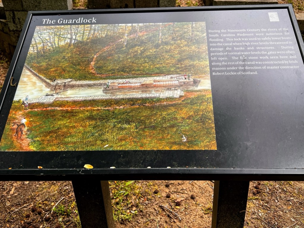
One of those projects included constructing a series of four canal. The Landsford Canal construction was the last and northern most in the canal system. It was built under the supervision of Scotsman Robert Leckie by both Irish Masons and the local enslaved population. The Canal ran approximately two (2) miles along the Catawba River at its most treacherous point.
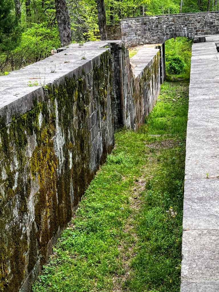
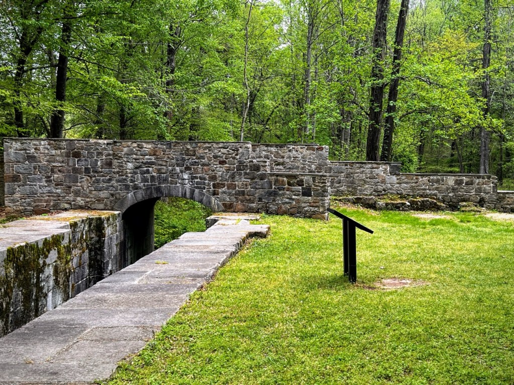
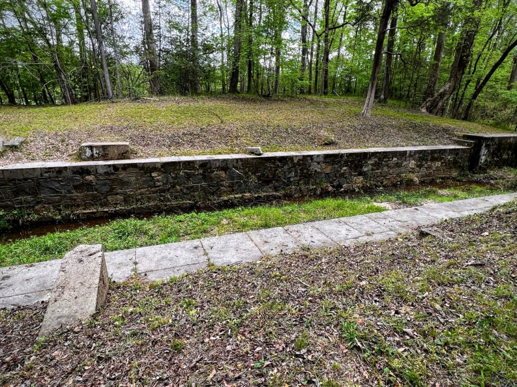
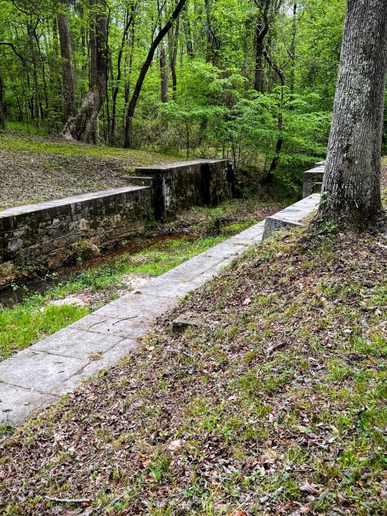
The Canal required a total of four lifting locks and a dread lock for the thirty-two feet of descent along its length. It was completed in 1823, was twelve feet wide, ten feet deep, and two miles long. Five locks raised and lowered barges through the thirty-two-foot fall of the river. Three bridges crossed the canal, and six storm culverts carried streams underneath it.
Today, Landsford Canal is the last of the Catawba River Canals and still accessible as well as one of the last in the entire state. The remains of the Canal still visible are the earthen walls of its upper side, four lifting locks and a dread lock. None of the bridges still remain, but the stone foundations are still intact. Ruins of stone culverts and retaining walls still stand in their original locations. The Canal Trail runs along the ruins of the old canal. Hiking the 1.5 mile length you can see the diversion dam in the Catawba River, The dead Lock upstream that let water into the canal, and the Lifting Locks near the south entrance. Along the way you can also see the ruins of much of the stone work and retaining walls. Interpretive signage points out major points of interest.
In Early May hundreds of visitors flock to Landsford Canal State Park. The majority of them are more interested in seeing the Rocky Shoals Spider Lilies. I have hiked the entire length of the nature trail and found the historical signage interesting and informative.

Cee’s Fun Foto Challenge – Locks, Keys, Knobs, and Handles
Photo Credit: ©️2022 Deb L. Waters … All Rights Reserved.
Camera: iPhone 13 Pro
Location: Nature Trail; Landsford Canal State Park; 2051 Park Dr, Catawba, South Carolina, USA
God Bless. Thank you for visiting and sharing your time and thoughts with me. I appreciate y’all very much.
