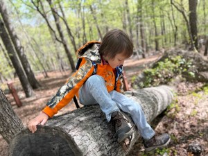
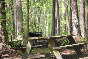
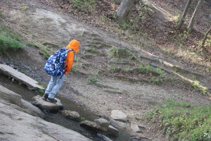
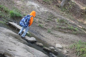
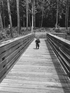
This week’s Ragtag Daily Prompt of Trail fits perfectly into the activities which Coleman and I enjoy the most. This Trail is one we haven’t hiked in a while, but always enjoyed.
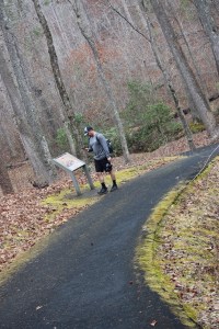
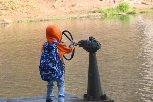
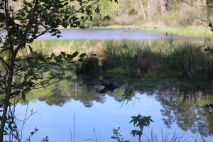
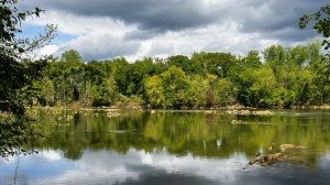
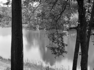
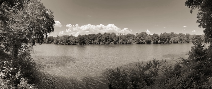
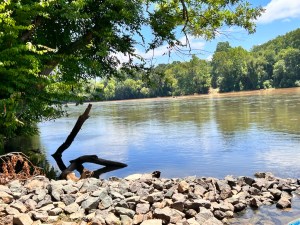
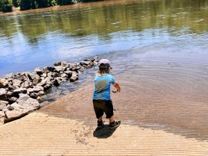
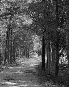
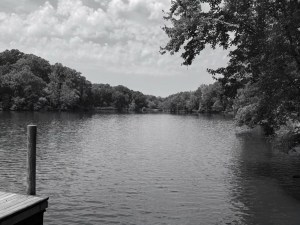
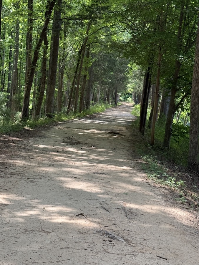
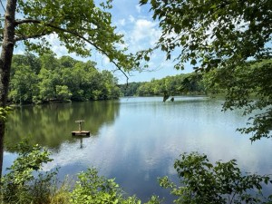
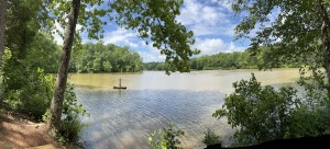
The Piedmont Medical Center Trail (a part of the Carolina Thread Trail system) runs adjacent to the Catawba River in Rock Hill/Fort Mill, South Carolina. The header image is of the Catawba River as seen from the Trail on the Rock Hill side.
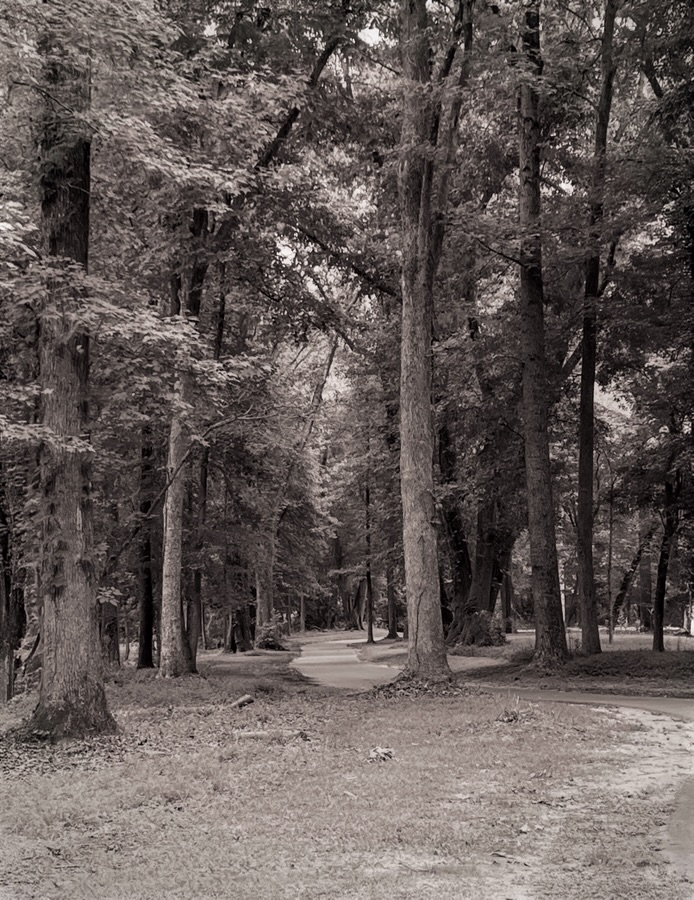
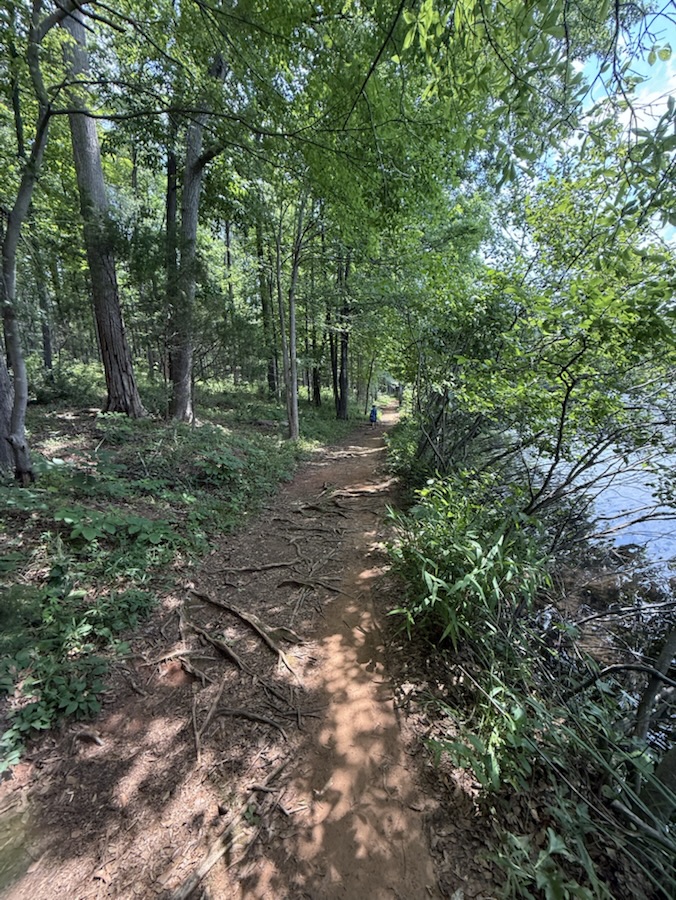
The Trail on the Rock Hill side of the Catawba River is predominantly a smooth paved surface trail. The Trail on the Fort Mill side of the Catawba River is a natural surface trail. Coleman and I have hiked the Trails on both sides of the Catawba River. Coleman loves to be near the river, as well as in the river, whenever and wherever possible.
Location: Piedmont Medical Center Trail; Carolina Thread Trail; Rock Hill, South Carolina, USA
God Bless. Get Outdoors. Take a Hike/Walk along a Trail. Enjoy Nature’s Beauty. Thank you for visiting and sharing your time and thoughts with us. I appreciate y’all very much.
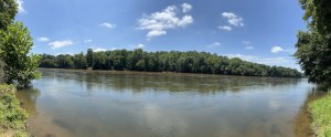
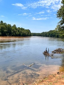
Location: Catawba River; Catawba Indian Reservation; Rock Hill, South Carolina, USA
God Bless. Have a wonderful week. Enjoy your Lovely surroundings. Thank you for visiting and sharing your time and thoughts with us. I appreciate y’all very much.
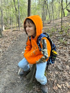
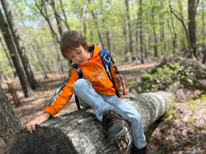
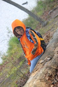
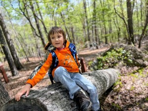
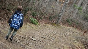
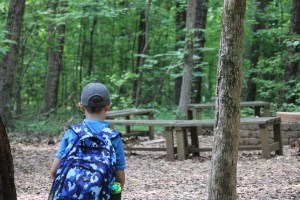
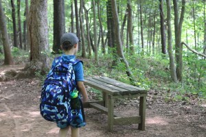
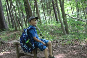
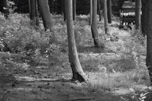
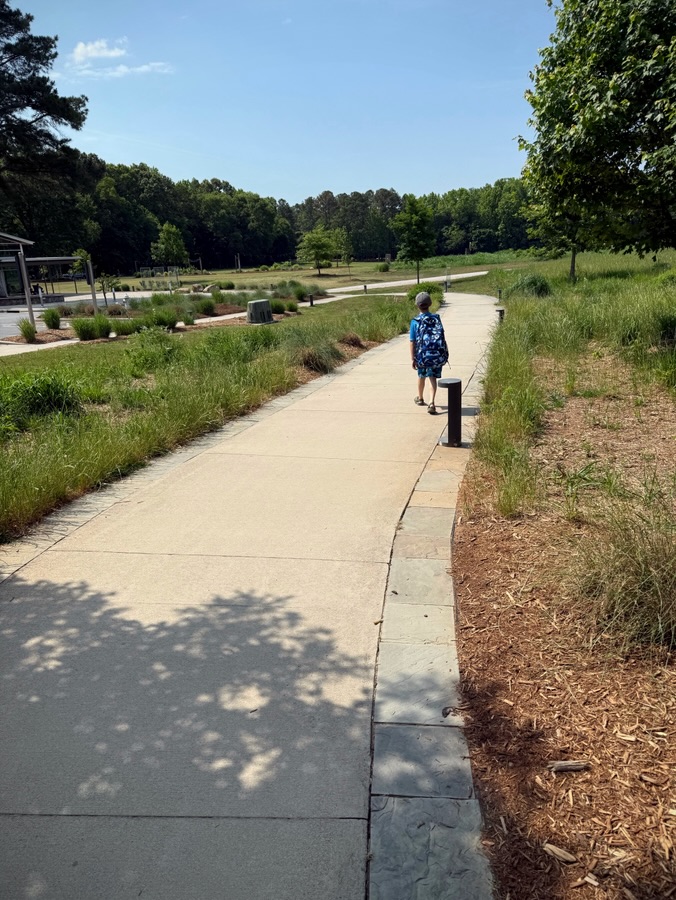
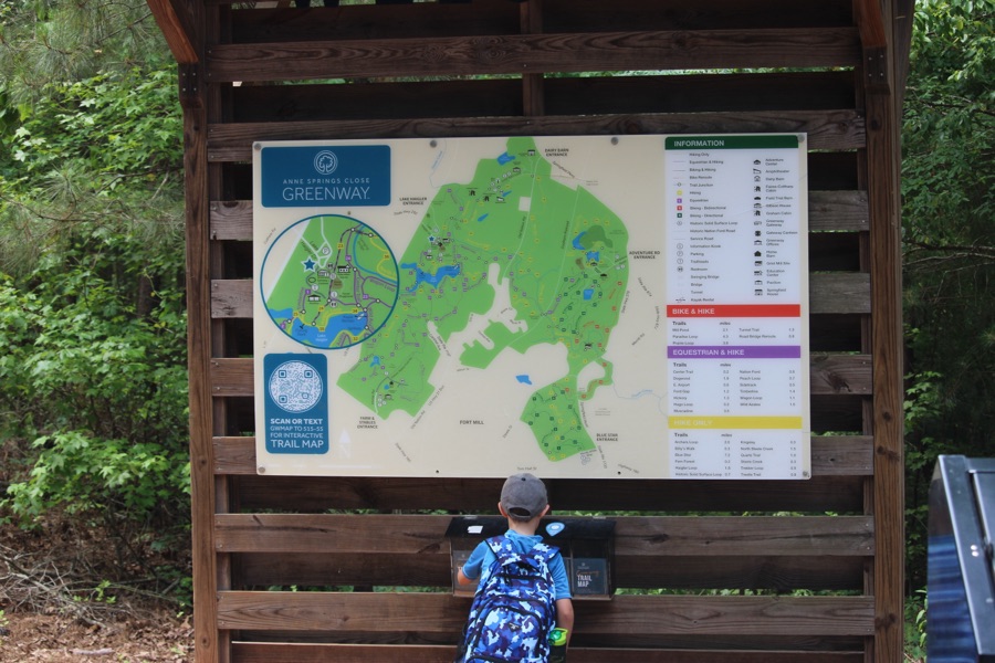
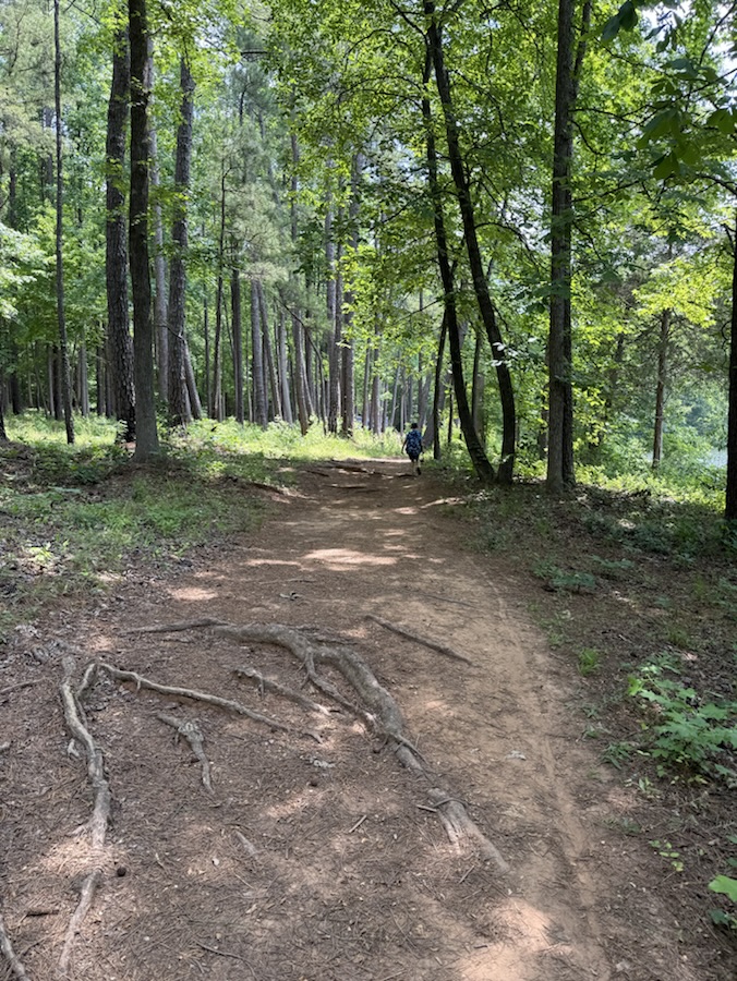
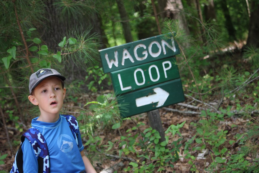
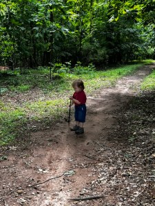
Coleman and I hiked along Wagon Loop a couple of weeks ago. Wagon Loop is one of 25 unique trails in Anne Springs Close Greenway in Fort Mill, South Carolina.
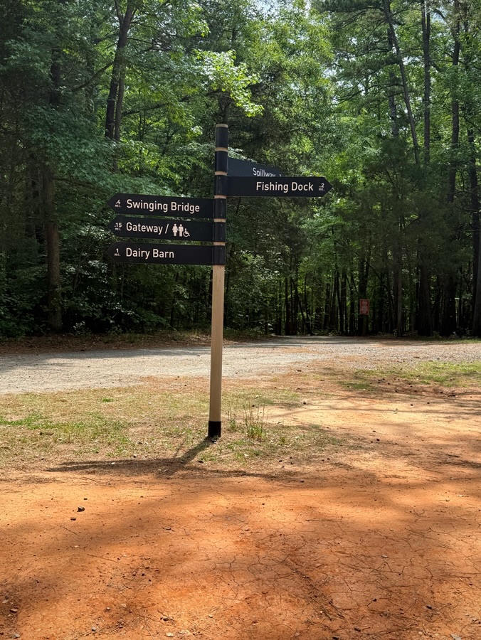
This trail follows part of Steele Creek and connects to Haigler Loop, Blue Star, Steele Creek, North Steele Creek, Ford Gap, Muscadine and Wild Azalea trails. You can access the trail behind the Williams Education Center or off Haigler Loop.
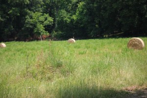
Can you spot all three?
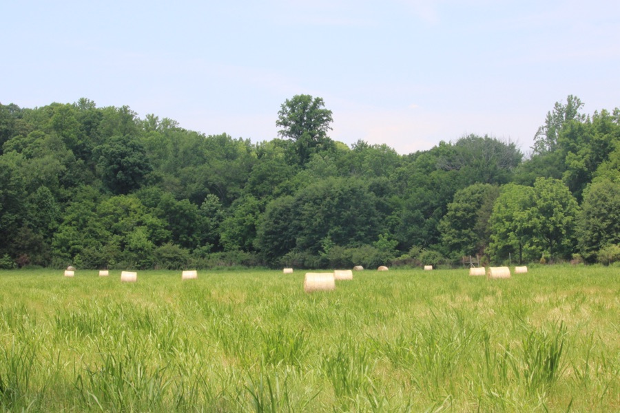
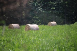
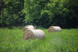
The distance for the complete Wagon Loop trail is 1.4 miles in length.It meanders through forested landscapes, creeks, and open fields (like this field of cut and rolled hay bales). It is often combined with Muscadine, Billy’s Walk, and the Lake Haigler Loop trail for a longer hiking experience.
Three Hay Bales in a Field
As you meander along the Wagon Loop trail you’ll pass by several points of historical significance such as the Nation Ford Trail. The trails are well maintained, however, I would recommend you wear a good pair of hiking shoes. There are exposed tree roots and when the rains occur so does the mud along the trails.
A Trio of Hay Bales (Oops, plus one)
There is a few to enter Anne Springs Close Greenway of $17 per adult, youth (ages 3-12) $8 (kids under 3 are free). The Greenway does offer memberships which I recommend if you live near the Fort Mill, South Carolina area. To find out more about the Greenway’s memberships click here.
Camera: Canon EOS Rebel T7 (2000D) with Canon EF-S55-250mm lens and Altura UV Filter attachment.
Location: Wagon Loop; Lake Haigler Entrance; Anne Springs Close Greenway; Fort Mill, South Carolina, USA
God Bless. Get Outdoors. Take a Walk/Hike. Enjoy Nature’s Beauty. Thank you for visiting and sharing your time and thoughts with us. I appreciate y’all very much.
Camera: Canon EOS Rebel T7 (2000D) with Canon EF-S55-250mm lens and Altura UV Filter attachment.
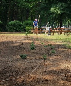
Location: Pollinator Garden; Lake Haigler Entrance; Anne Springs Close Greenway; Fort Mill, South Carolina, USA
God Bless. Get Outdoors. Enjoy Nature’s beautiful creations. Thank you for visiting and sharing your time and thoughts with us. I appreciate y’all very much.
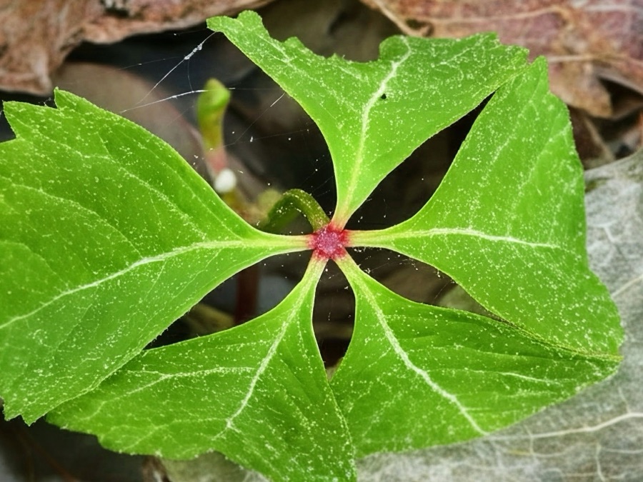
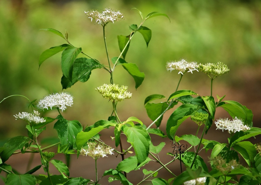
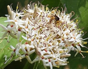
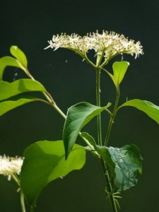
Xylocopa micans, Aka Southern Carpenter Bee feasting on a Cornus foemina, Aka SwampDogwood or stiff dogwood
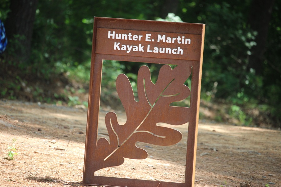
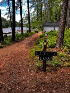
These Swamp Dogwood Flowers are located on the banks of Lake Haigler by the Hunter E. Martin Kayak Launch on Haigler Loop at Anne Springs Close Greenway in Fort Mill, South Carolina.
Cornus foemina, aka Swamp Dogwood or Stiff Dogwood
Camera: Canon EOS Rebel T7 (2000D) with Canon EF-S55-250mm lens and Altura UV Filter attachment.
Location: Lake Haigler Entrance; Anne Springs Close Greenway; Fort Mill, South Carolina, USA
God Bless. May you have a lovely week filled with love, joy, and laughter. Thank you for visiting and sharing your time and thoughts with us. I appreciate y’all very much.
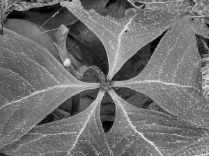
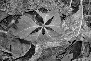
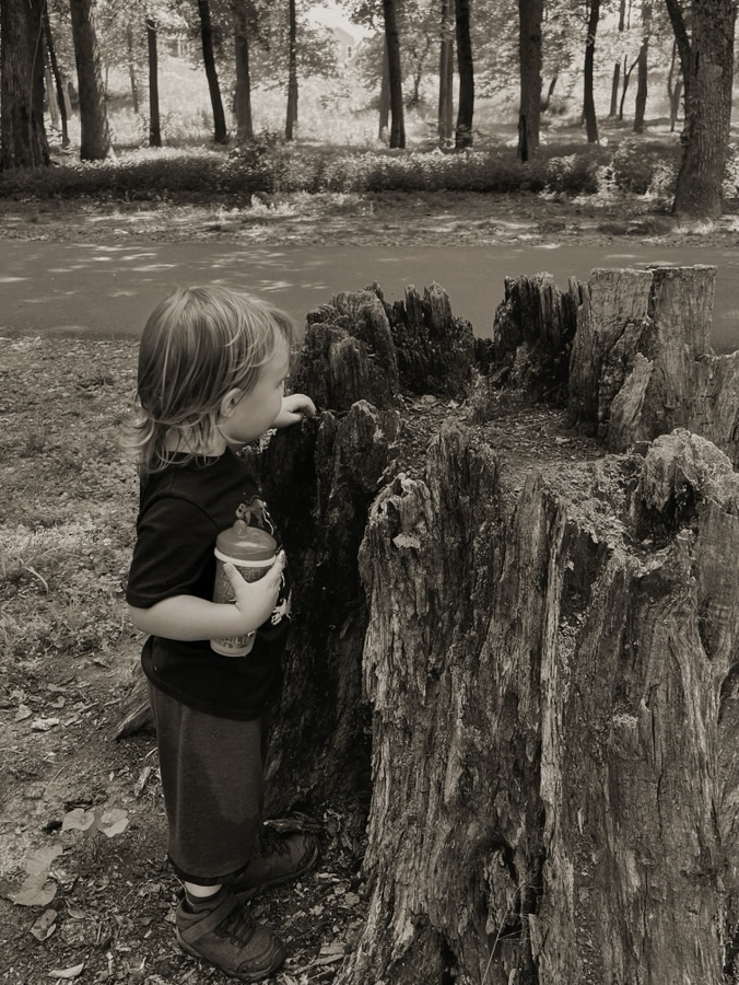
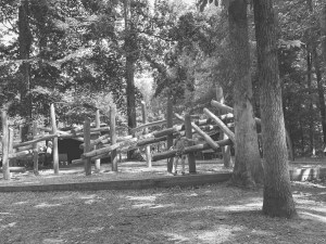
Visiting the Anne Springs Close Greenway, sometimes it’s nice to shoot in black and white instead of always in colour. The effects can be just as striking if not more dramatic and impressive.
These first images were taking while hiking along the trail towards and at Lake Haigler.
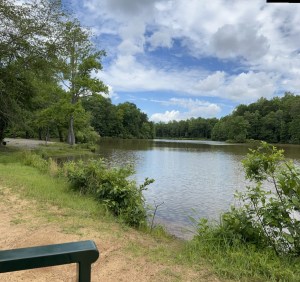
Lake Haigler Lake Haigler Loop Anne Springs Close Greenway
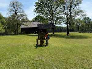
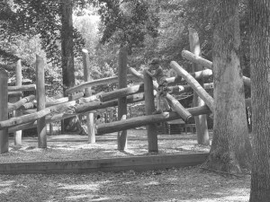
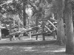
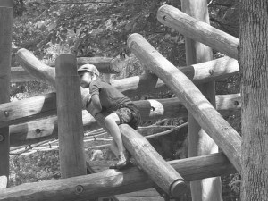
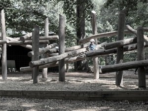
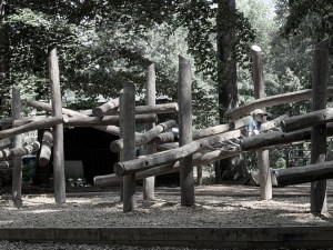
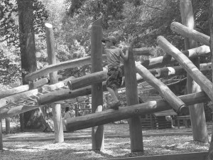
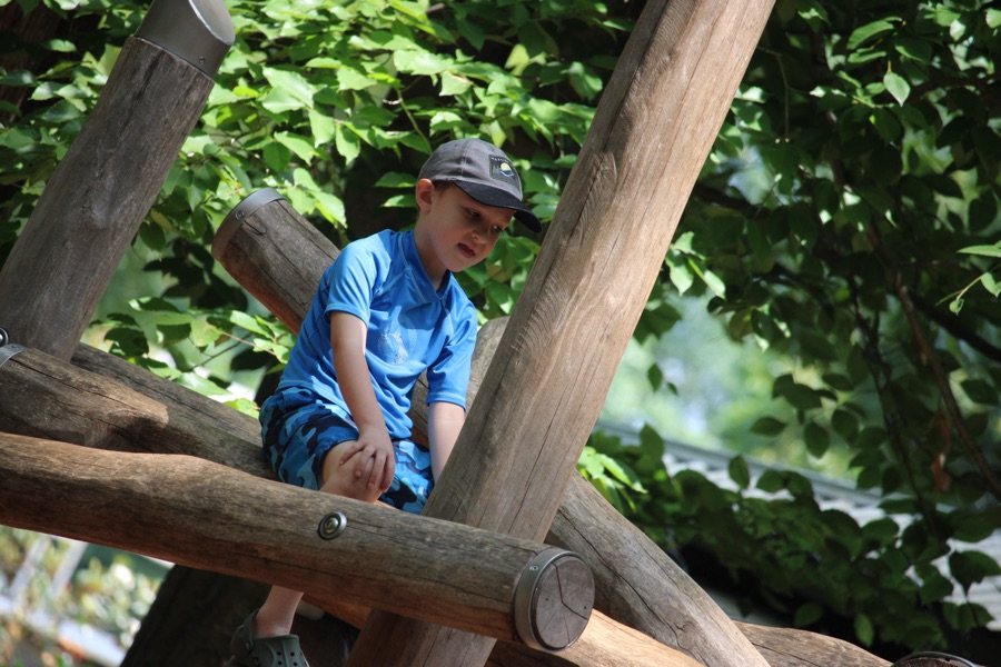
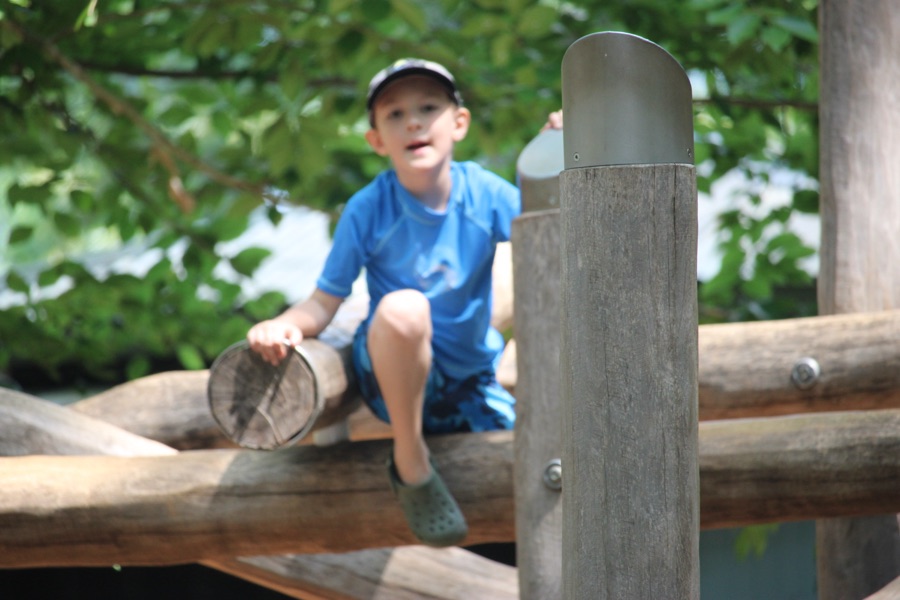
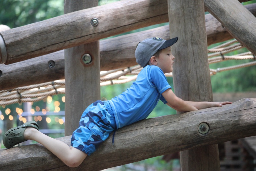
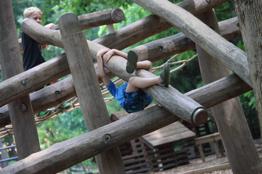
The next set of images were taken while Coleman was playing on the climbing structure in the Schroering Forest Playground.
Schroering Forest Playground Lake Haigler Entrance Anne Springs Close Greenway Fort Mill, South Carolina
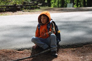
Coleman sitting on the Climbing Structure Repositioning Resting before #PullingUpaSeatDoes Laying on the Structure count? Not exactly Sitting, Oh well. Never know How or When Coleman will choose to Pull Up a SeatColeman #Pulling Up a Seat on the Central Climbing Structure
Camera: Canon EOS Rebel T7 (2000D) with Canon EF-S55-250mm lens and Altura UV Filter attachment.
Location: Schroering Forest Playground; Lake Haigler Entrance; Anne Springs Close Greenway; Fort Mill, South Carolina, USA
God Bless. May you have a lovely week filled with love, joy, and laughter. Thank you for visiting and sharing your time and thoughts with us. I appreciate y’all very much.
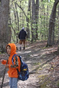
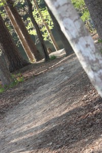
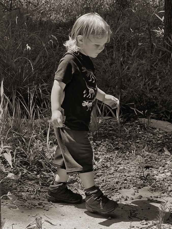
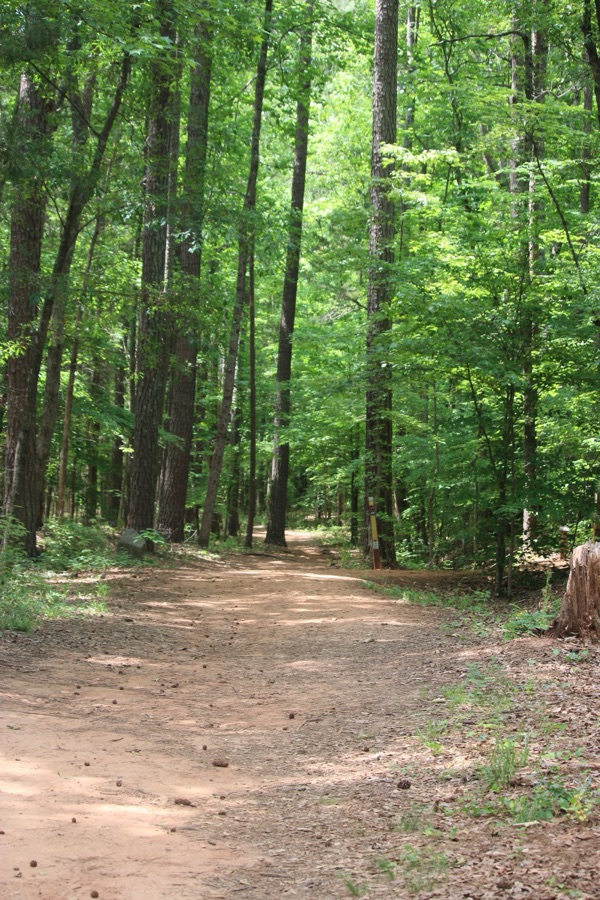
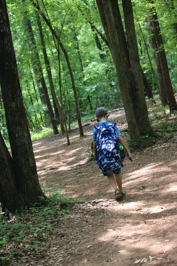
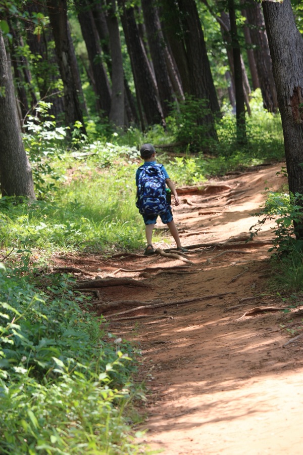
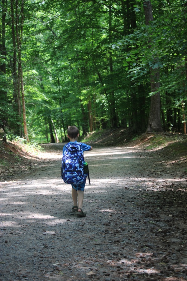
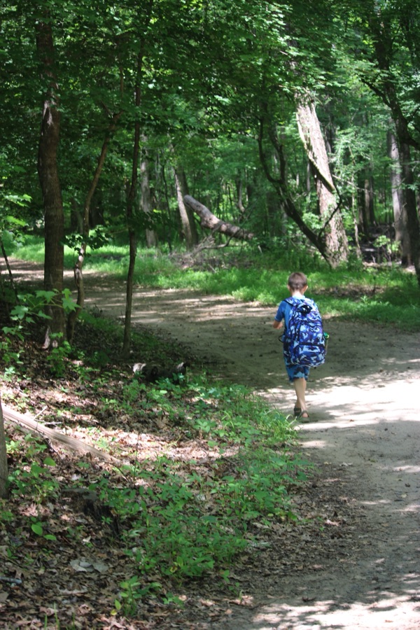
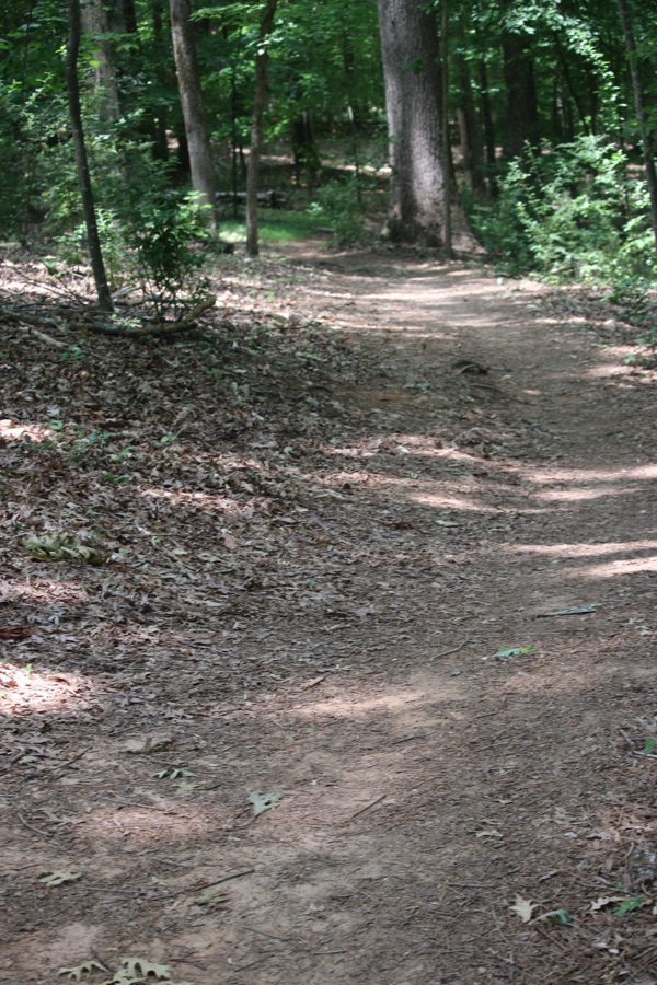
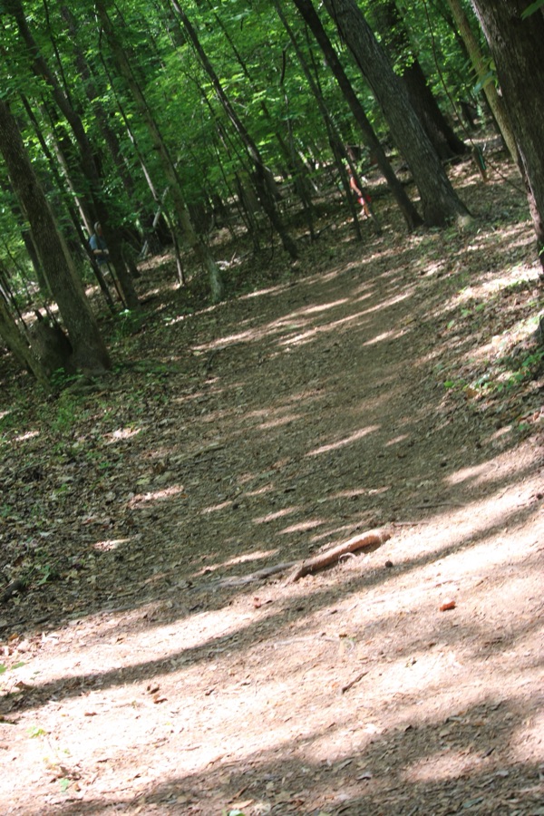
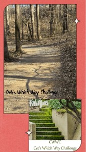
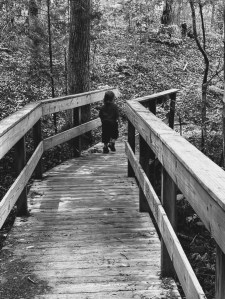
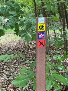
Welcome back to another Which Way Challenge (CWWC). I trust everyone has had a good week and able to spend some time to take a walk or hike in the vast outdoors. This week’s theme for the Which Way Challenge is CWWC: Any Which Way Along a Nature Trail (Paved, Unpaved, or Natural surface). The Which Way can be any trail found in nature as long as the Which Way is clearly discernible. As always signs are always welcome.
For further information regarding the Which Way Challenge (CWWC) feel free to check out the home page here.
A Nature Trail can be found in Greenways, state or national parks, and even in some city parks. They can be paved or unpaved natural surfaces or even graveled. Wherever you find to walk or hike amongst nature are fantastic places to show your Which Ways this week. Coleman and I love getting outdoors hiking in nature amongst the trees, rivers, and lakes.
Here is our latest adventure hiking along Nature Trails …
Click on each image to enlarge.
Thank you to those who have participated and supported the Which Ways Challenge. I appreciate y’all sharing your Which Ways with us.
For an idea of other’s Which Ways from this past week’s challenge, be sure to click on the following links below.
God Bless. Get Outdoors. Take a Walk/Hike. Enjoy Nature’s Beauty. Thank you for visiting and sharing your time and thoughts with us. I appreciate y’all very much.
*** Note Next Week’s theme: CWWC: Any Which Way on an Interstate, Highway, or Paved Road [06.05.2026]
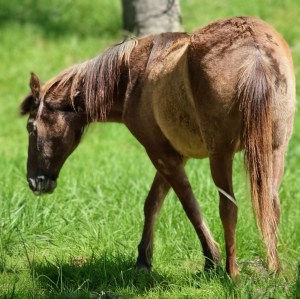
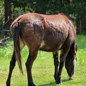
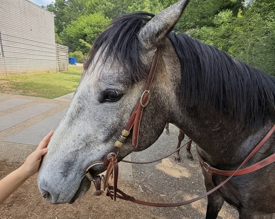
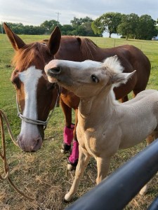
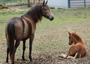
It’s been amazing to visit Baby Horses born at Anne Springs Close Greenway over the years. I was lucky to have captured Murphy and Forest with their mothers.
Fern and baby Forest (Born in 2022)
Baby Alpacas …
Greenway Baby Alpacas
My Grand-babies …
Coleman (6 almost 7) and Sophia Ruthann (5 months)
God Bless. Treasure your “babies” always. Capture the memories. Love to y’all. Thank you for visiting and sharing your time and thoughts with us. I appreciate y’all very much.
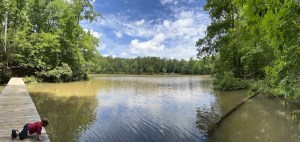
Egidio is this week’s host for the Lens-Artist Photo Challenge. She has asked us to limit our movement to within 10-15 steps in any direction from our focal point. Capture what we see from various angles and perspectives as we are Stuck in Place.
My images are all taken from within a few steps from Lake Haigler on the Haigler Loop Trail while hiking with Coleman.
I began taking pictures while Coleman sat on a bench looking out upon Lake Haigler.
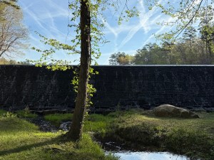
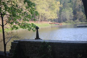
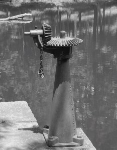
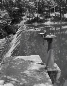
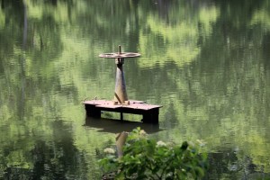
The Spillway lock at Lake Haigler
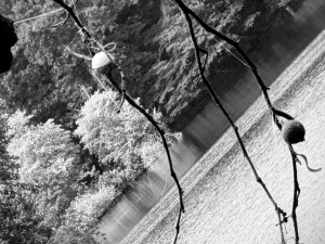
Looking up from the same spot to capture what was hanging from the trees above the lake.
Fishing Bobbers stuck in the tree.
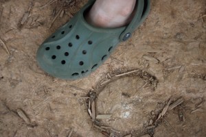
Then I turned around and saw interesting shoe prints on the trail. Here’s a comparison of the shoe print with Coleman’s shoe.
Coleman’s shoe next to a Horseshoe imprinted in the trail
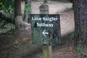
Turning to the left and to the left we acquired these interesting views …
To the left …
A sign indicating the direction to the Lake Haigler Spillway
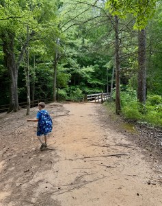
And to the right …
Where is Coleman going? Not to the bridge, but where?
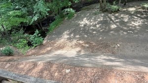
Still to the right …
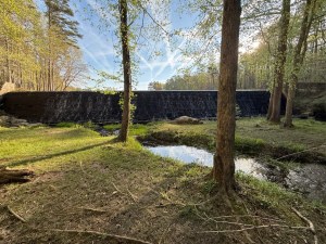
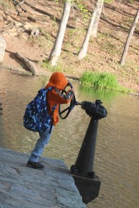
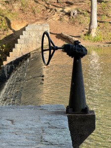
The Lake Haigler Spillway Where’s the water? The Spillway is so dry. Insufficient rain, no water is flowing from the Spillway.
Cameras: Apple iPhone 16 Pro Max; and Canon EOS Rebel T7 (2000D) with Canon EF-S55-250 mm lens & Altura UV Filter attachment.
Location: Haigler Loop Trail; Lake Haigler Entrance; Anne Springs Close Greenway; Fort Mill, South Carolina, USA
God Bless. Get Outdoors. Take a Hike/Walk. Enjoy Nature’s Beauty. Thank you for visiting and sharing your time and thoughts with us. I appreciate y’all very much.
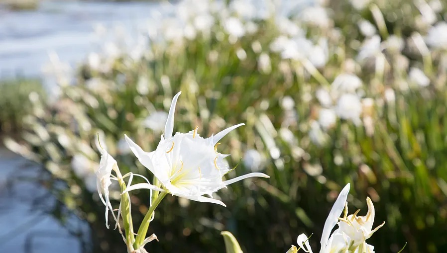
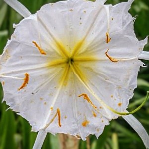
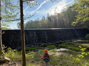
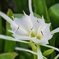
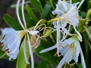
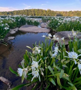
The Spider-Lilies are in full bloom in the Catawba River at Landsford Canal State Park. They are such a beautiful sight to see and admire. This is the best time to come on down to Landsford Canal State Park and enjoy the Shoals Spider-Lilies. You’ll be amazed at their beauty regardless of whether you walk along to shore to the viewing point or kayak down the Catawba River to get an up close view.
Location: Catawba River; Landsford Canal State Park; Catawba, South Carolina, USA
God Bless. Admire the Flowers and the beauty found in nature. Have a fantastic week. Thank you for visiting and sharing your time and thoughts with us. I appreciate y’all very much.
Camera: Canon EOS Rebel T7 (2000D) with Canon EF-S55-250mm lens
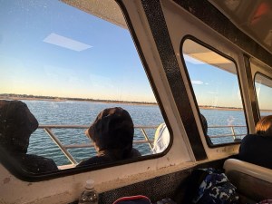
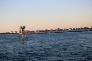
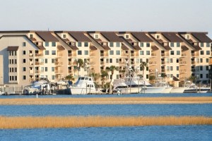
Location: 1508 S Waccamaw Dr.; Marlin Quay Marina, Murrells Inlet, South Carolina, USA
God Bless. Have an adventurous week filled with love and happiness. Thank you for visiting and sharing your time and thoughts with us. I appreciate y’all very much.
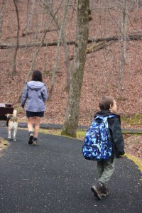
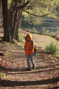
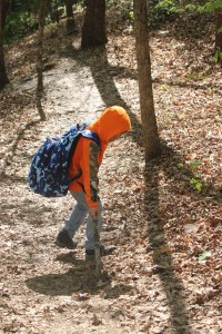
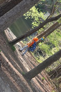
Welcome back to another Which Way Challenge (CWWC). I trust everyone has had a good week and able to spend some time to take a walk or hike in the vast outdoors. This week’s theme is CWWC: Any Which Way (Your Choice). The Which Way can be any path, sidewalk, trail, or road as long as the Which Way is clearly discernible. As always signs are always welcome.
For further information regarding the Which Way Challenge (CWWC) feel free to check out the home page here.
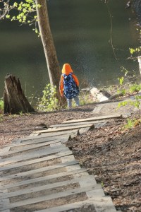
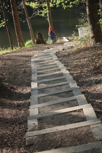
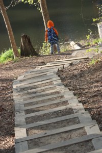
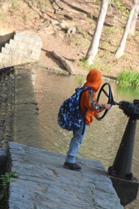
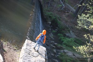
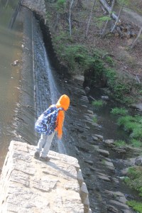
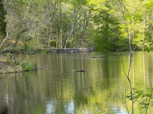
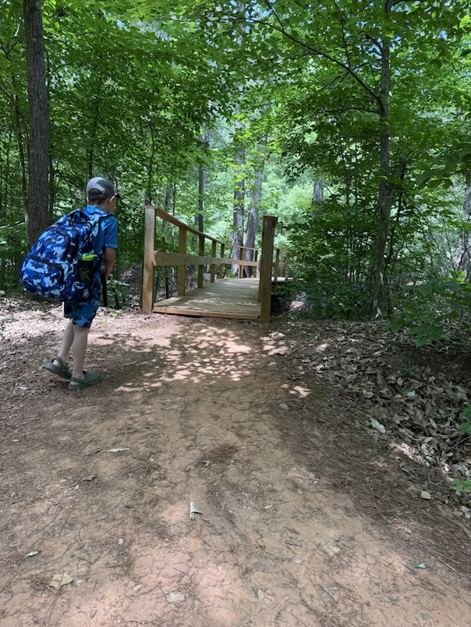
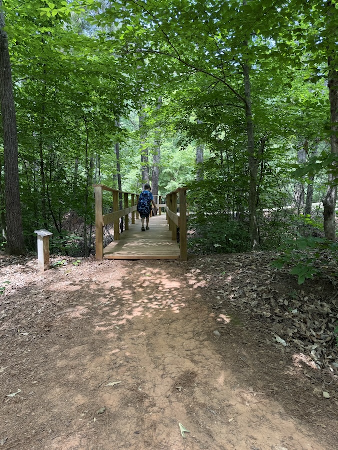
Coleman on a wooden path crossing Lake Haigler
For this week’s Which Way Challenge I have chosen to share a Which Way Coleman and I hiked back in 2022 when he was three years old. The hike along Lake Haigler Loop Trail at Anne Springs Close Greenway came up in my photo memories, so I thought y’all might enjoy seeing it as well.
Here are my entries …
Cee’s Which Way Challenge (Your Choice) Coleman on Lake Haigler Loop Trail Anne Springs Close Greenway
Click on each image to enlarge.
Thank you to those who have participated and supported the Which Ways Challenge. I appreciate y’all sharing your Which Ways with us.
For an idea of other’s Which Ways from this past week’s challenge, be sure to click on the following links below.
Location: Lake Haigler Loop Trail; Lake Haigler Entrance; Anne Springs Close Greenway; Fort Mill, South Carolina, USA
God Bless. Get Outdoors. Take a Walk/Hike. Enjoy Nature’s Beauty. Thank you for visiting and sharing your time and thoughts with us. I appreciate y’all very much.
*** Note: Next Week we will be exploring and sharing the theme of CWWC: Any Which Way with Signs [05.15.2026]. This will also tie in with Dan’s Fun Foto Challenge (CFFC) – Informational Signs. Feel free to link to his post as well next week. ***
Location: The Cultural Center Trail; Catawba Nation Greenway Trail; Carolina Thread Trail; Catawba Indian Nation; Catawba Reservation; Rock Hill, South Carolina, USA
God Bless Enjoy Nature. Hug a Tree. Peace be with you. Thank you for visiting and sharing your time and thoughts with us. I appreciate y’all very much.
Camera: Canon EOS Rebel T7 (2000D) with Canon EF-S55-25mm lens and Altura UV Filter attachment
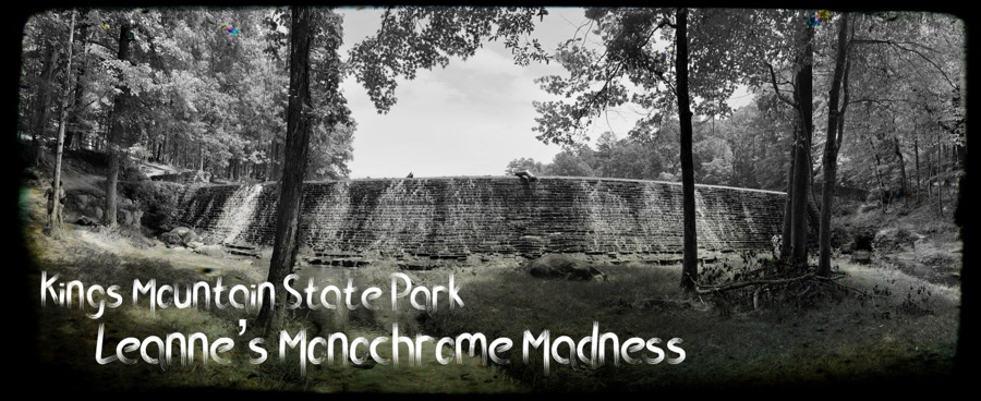
Location: Lake Crawford Trail; Kings Mountain State Park; Blacksburg, South Carolina, USA
God Bless. Get Outdoors. Take a Walk/Hike. Enjoy Nature. Thank you for visiting and sharing your time and thoughts with us. I appreciate y’all very much.
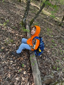
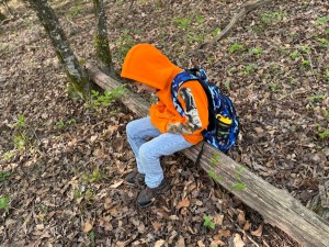
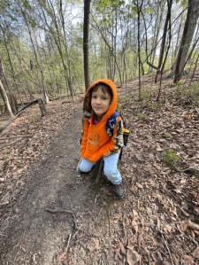
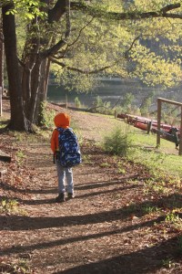
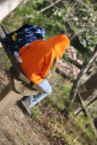
Welcome back to another Which Way Challenge (CWWC). I trust everyone has had a good week and able to spend some time to take a walk or hike in the vast outdoors. This week’s theme is CWWC: Any Which Way Capturing People Unaware. The Which Way can be any path, sidewalk, trail, or road as long as the Which Way is clearly discernible. As always signs are always welcome.
For further information regarding the Which Way Challenge (CWWC) feel free to check out the home page here.
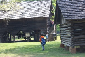
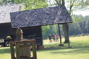
I hope y’all have had some lovely weather for getting out and about enjoying nature and capturing its amazing beauty. This week’s focus is on Capturing People Unaware in our pathways, the trails we explore, or wherever you may encounter them while you walk or hike in the vast outdoors. My Capturing People Unaware are on the trails Coleman and I hiked in Kings Mountain State Park and in Kings Mountain National Military Park. Enjoy.
Kings Mountain State Park Kings Mountain National Military ParkKings Mountain National Military ParkKings Mountain State ParkKings Mountain State ParkKings Mountain National Military ParkKings Mountain National Military ParkKings Mountain National Military ParkKings Mountain National Military Park Kings Mountain State ParkCee’s Which Way Challenge (CWWC) Any Which Way Capturing People Unaware
Click on each image to enlarge.
Thank you to those who have participated and supported the Which Ways Challenge. I appreciate y’all sharing your Which Ways with us.
For an idea of other’s Which Ways from this past week’s challenge, be sure to click on the following links below.
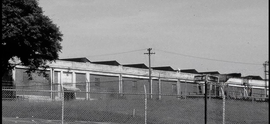
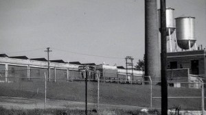
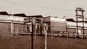
The Republic Textile Mills Company was founded in Great Falls, South Carolina around 1905-1910 by the Southern Power Company (later became known as Duke Power Company). It was founded to capitalize on Catawba River water power. The Republic Textile Mills Company expanded to three mills by 1923.
Republic Textile Mill #3
[My paternal grandfather worked in the #3 Mill located on Argonne Avenue kitty-corner from Walnut Street where my paternal grandparents lived. When he worked there the Mills were owned by J. P. Stevens and Company.]
J.P. Stevens Mill #3 (previously known as Republic Textile Mills Company)
The Republic Textile Mills Company operated as a major textile producer in the region, complete with a company town, before being sold to J. P. Stevens and Company in 1946. The #3 Mill opened in 1923. The company town included a company store, where workers could charge goods against their wages.
Republic Textile Mill #3 (Aka JP Stevens Mill #3)
The Mills ceased all operations due to the broader decline of the textile industry. The last of the Mills closed its doors around 1985.
These images are from last year. This year’s Rocky Shoals Spider Lilies are not in full bloom yet. The Rocky Shoals Spider Lilies bloom each year along the Catawba River and can be viewed from Landsford Canal State Park. The best time of year to view the Rocky Shoals Spider Lilies is from May through mid-June. To view them from land, you may choose to hike the 1.5 mile, round-trip down either the Nature Trail or the Canal Trail to the overlook. There is another option to view the Rocky Shoals Spider Lilies, that option would be to kayak the Catawba River and wind your way through the Rocky Shoals Spider Lilies where you’ll have an upclose view.
Aka Cahaba lily, Shoal lily, or Shoals Spider-lily
The latest report on the Lily Watchis that the green leaves are reaching full growth and the Rocky Shoals in the river are looking lush. There are a view early bloomers out in the Catawba River with more flowers coming into full bloom soon. This year the rainfall has been insufficient, however, the plants still are looking healthy and are expected to reach peak bloom around the middle or end of May.
Location: Landsford Canal State Park; Catawba, South Carolina, USA
God Bless. Admire the Flowers and the beauty found in nature. Have a fantastic week. Thank you for visiting and sharing your time and thoughts with us. I appreciate y’all very much.
Camera: Canon EOS Rebel T7 (2000D) with Canon EF-S55-250mm lens and Altura UV Filter attachment.
Location: The Living History Farm; Kings Mountain State Park; Blacksburg, South Carolina, USA
God Bless. Enjoy the beautiful outdoors. Hope it’s not too hot for all y’all. Thank you for sharing your time and thoughts with me. I appreciate y’all very much.
Camera: Canon EOS Rebel T7 (2000D) with Canon EF-S55-25mm lens and Altura UV Filter attachment; Apple iPhone 16 Pro Max
Location: By Lake Crawford & Lake Crawford Trail; Kings Mountain State Park; Blacksburg, South Carolina, USA
God Bless. Get Outdoors. Take a Walk/Hike. Enjoy Nature. Thank you for visiting and sharing your time and thoughts with us. I appreciate y’all very much.
Welcome back to another Which Way Challenge (CWWC). I trust everyone has had a good week and able to spend some time to take a walk or hike in the vast outdoors. This week’s theme is CWWC: Any Which Way with Shadows . The Which Way can be any path, sidewalk, trail, or road as long as the Which Way is clearly discernible. As always signs are always welcome.
For further information regarding the Which Way Challenge (CWWC) feel free to check out the home page here.
I hope y’all have had some lovely weather for getting out and about enjoying nature and capturing its amazing beauty. This week’s focus is on shadows in our pathways, the trails we explore, or wherever you may encounter them while you walk or hike in the vast outdoors. My shadows are on the trails Coleman and I hiked in Kings Mountain State Park. Enjoy.
Here are my entries …
Hiking Trails with Shadows Kings Mountain State Park
Click on each image to enlarge.
Thank you to those who have participated and supported the Which Ways Challenge. I appreciate y’all sharing your Which Ways with us.
For an idea of other’s Which Ways from this past week’s challenge, be sure to click on the following links below.
Camera: Canon EOS Rebel T3i with Canon EF-S55-250mm lens
Location: The Farm; The Schiele Museum of Natural History; Gastonia, North Carolina, USA
God Bless. Have a funtastic weekend. Enjoy the Spring Florals. Thank you for visiting and sharing your time and thoughts with us. I appreciate y’all very much.
Camera: Canon EOS Rebel T7 (2000D) with Canon EF-S55-250mm lens and Altura UV Filter attachment.
Location: The Living History Farm; Kings Mountain State Park; Blacksburg, South Carolina, USA
God Bless. Enjoy the beautiful outdoors. Hope it’s not too hot for all y’all. Thank you for sharing your time and thoughts with me. I appreciate y’all very much.
Camera: Canon EOS Rebel T7 (2000D) with Canon EF-S55-25mm lens and Altura UV Filter attachment
Location: By Lake Crawford & At The Living History Farm; Kings Mountain State Park; Blacksburg, South Carolina, USA
God Bless. Get Outdoors. Take a Walk/Hike. Enjoy Nature. Thank you for visiting and sharing your time and thoughts with us. I appreciate y’all very much.
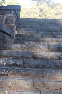
Welcome back to another Which Way Challenge (CWWC). I trust everyone has had a good week and able to spend some time to take a walk or hike in the vast outdoors. This week’s theme is CWWC: Any Which Way with Outdoor Steps or Stairs. The Which Way can be any path, sidewalk, trail, or road as long as the Which Way is clearly discernible. As always signs are always welcome.
For further information regarding the Which Way Challenge (CWWC) feel free to check out the home page here.
This week I am continuing to show aspects of mine and Coleman’s hike in Kings Mountain State Park, beginning with the Steps to the Bathhouse and continuing along the Lake Crawford Trail and beyond.
Here are my entries …
Bathhouse Steps Steps to Lake Crawford Steps to Lake CrawfordStepping StonesStairsBathhouse StepsStepping Stones Bathhouse StepsSteps to Lake CrawfordSteps to Lake CrawfordCWWC 2026 Any Which Way with Outdoor Steps or Stairs Kings Mountain State Park
Click on each image to enlarge.
Thank you to those who have participated and supported the Which Ways Challenge. I appreciate y’all sharing your Which Ways with us.
For an idea of other’s Which Ways from this past week’s challenge, be sure to click on the following links below.
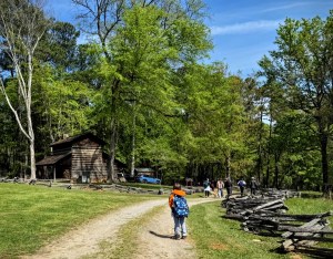
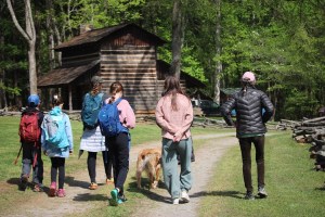
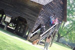
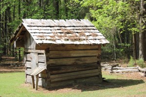
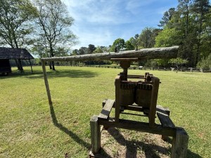
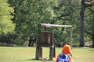
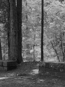
When Coleman and I went hiking the other week, we hiked from the Bathhouse to The Living History Farm (from one end to the other end) in Kings Mountain State Park.The Living History Farm at Kings Mountain State Park is a replica of a mid-nineteenth (19th) century South Carolina yeomen farm.
Yeomen Farms were run by small-scale independent landowners who worked their own land primarily using family labour. [Much in the same way the Amish farmers work, or farmers in the time period of ‘Little House on the Prairie’.] Yeomen farmers focused on subsistence farming, livestock, and self-reliance.
Enough of the side jaunt about the farmers, now back to The Living History Farm. It is an opportunity for visitors to explore an immersive look into the self-sufficiency lifestyle of the post-Revolutionary War era. It shows the period-appropriate buildings, heirloom gardens, and holds live demonstrations to illustrate how the farmers and their families lived and worked together during the post-Revolutionary War era.
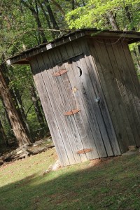
These here are a fraction of the authentic replicas at The Living History Farm.
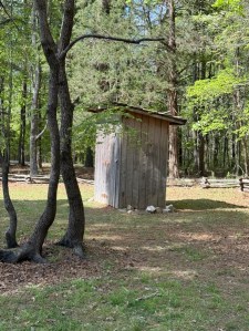
Anyone ever use one of these?
Outhouse
A Visiting Dog (not apart of the historical replica)
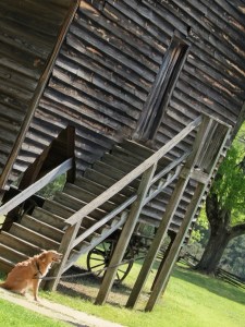
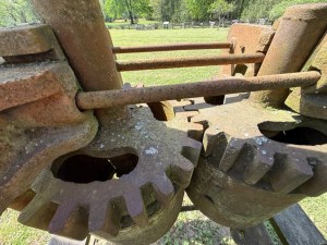
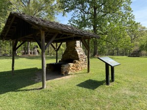
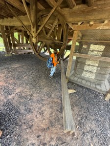
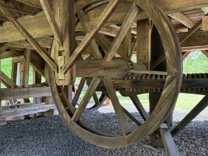
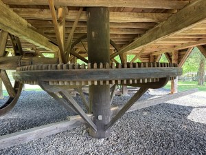
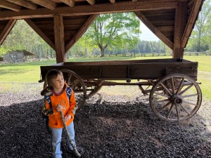
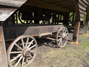
Under this building is a wagon and other equipment used on a yeomen farm.
Camera: Canon EOS Rebel T7 (2000D) with Canon EF-S55-250mm lens and Altura UV filter attachment.
Location: The Living History Farm; Kings Mountain State Park; Blacksburg, South Carolina, USA
God Bless. Have a wonderful week and weekend. Thank you for visiting and sharing your time and thoughts with us. I appreciate y’all very much.
Note: This Friday’s CWWC theme will be Any Which Way with Outdoor Steps or Stairs. The Steps or Stairs maybe on any pathway, nature trail, or any other walkway or footpath. Be sure your Which Ways are clearly visible. Thank you for your participation.
Location: Lake Crawford; Kings Mountain State Park; Blacksburg, South Carolina, USA
God Bless. Have a wonderful week. Love & Peace to y’all. Thank you for visiting and sharing your time and thoughts with us. I appreciate y’all very much.
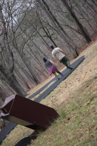
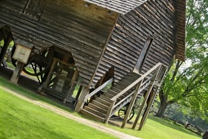
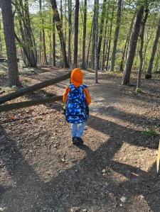
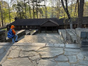
The Historic Civilian Conservation Corps (CCC) Bathhouse sits on the shores of Lake Crawford in Kings Mountain State Park. The Bathhouse was the location where Coleman and I began our hike. The height of usage for the Bathhouse was between 1930’s until the 1990’s. In its heyday it was an essential hub for park activities.
Side of Bathhouse
Currently, the Bathhouse is abandoned and in a sad state of disrepair. The exterior ofthe Bathhouse is available for viewing via the Farm Trail (or in our case, we parked in the parking area where the Bathhouse is located.
From the Backside
The Historic CCC Bathhouse is primary historical landmark within Kings Mountain State Park. It is known for its intricate craftsmanship.
Rear-side of Bathhouse
When you approach the main doors (currently locked) there is a QR code you may scan that will give you information about how to donate to the ongoing Bathhouse Donation Project to help aide in the Revitalization Efforts for the renovation of the Bathhouse.
The Bathhouse Backside
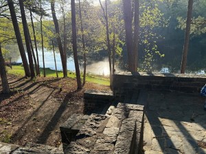
Once the Bathhouse is restored, it is intended to serve as a central visitor information hub. It will also allow the Lake Crawford swimming area to be reopen. Swimming has not been allowed in Lake Crawford since 2002. For over 20 years swimming in Lake Crawford and Lake York have been prohibited. Even though swimming is not allowed (hopefully it will be when the Bathhouse is renovated and reopened); there are other recreational activities which may be enjoyed … such as fishing, boating, and sightseeing.
XingfuMama hosts the weekly challenge Whatsoever Is Lovely. The challenge is simple. Just reflect back over your week and see what is lovely, whether a thing or a moment, share in a post what is precious and lovely to you.
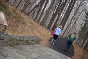
Last Thursday, Coleman and I had an early morning adventure (dropped off at 8am) hiking in Kings Mountain State Park. Coleman loves the being out in the great outdoors surrounded by nature’s beauty.
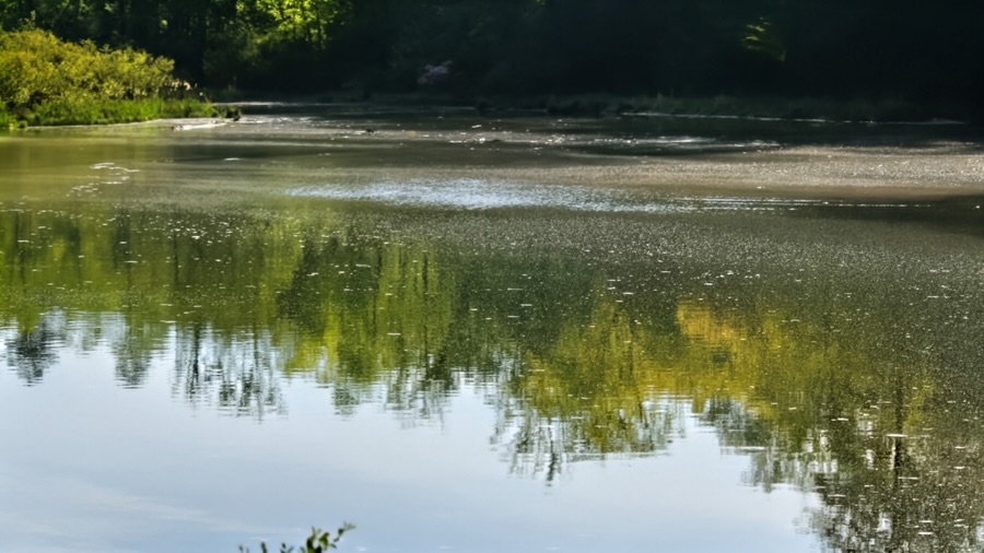
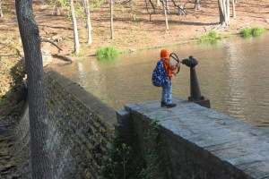
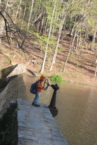
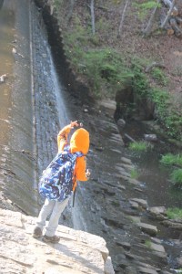
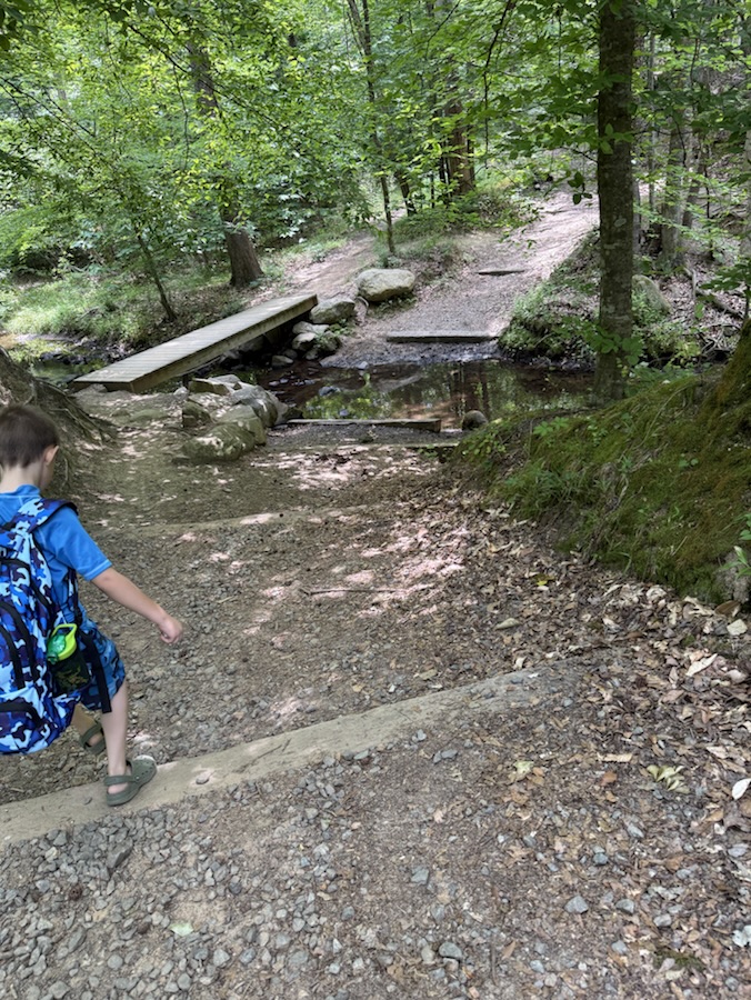
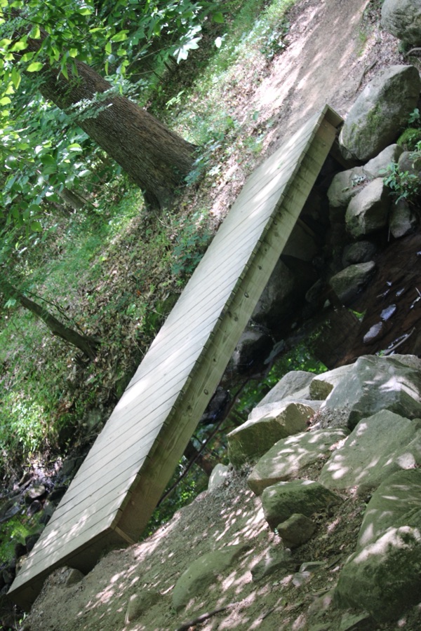
We were dropped off near Lake Crawford and proceeded to hike down to the lake. We hiked along the Lake Crawford Trail and stopped for a short break to observe the Spillway. Watching the water flow from one side to the other is fascinating and captivated Coleman’s interest.
He hopped from rock to rock to cross the water slowly flowing from the Spillway. I, on the hand, crossed over via the bridge.
Here are the views Coleman and I thought were lovely and the memories we made are extremely precious.
The Spillway at Kings Mountain State Park Whatsoever Is Lovely Challenge 2026 – Week 15
Cameras: Apple iPhone 16 Pro Max and Canon EOS Rebel T7 (2000D) with Canon EF-S55-250mm lens & Altura UV Filter attachment
Location: The Spillway; Lake Crawford; Kings Mountain State Park; Blacksburg, South Carolina, USA
God Bless. Isn’t it lovely to Enjoy Nature. Admire Nature’s beauty. Thank you for visiting and sharing your time and thoughts with us. I appreciate y’all very much.
Camera: Apple iPhone 16 Pro Max and Canon EOS Rebel T7 (2000D) with Canon EF-S55-250mm lens & Altura UV Filter attachment.
Location: The Living History Farm; Kings Mountain State Park; Blacksburg, South Carolina, USA
God Bless. Enjoy Nature. Get Outdoors. Have a fabulous week. Thank you for visiting and sharing your time and thoughts with us. I appreciate y’all very much.
Location: The Spillway; Kings Mountain State Park; Blacksburg, South Carolina, USA
God Bless. Have a wonderful week. Get Outdoors. Enjoy Nature. Thank you for visiting and sharing your time and thoughts with us. I appreciate y’all very much.
Camera: Canon EOS Rebel 2000D with Canon EF-S55-250mm lens and Altura UV Filter attachment.
Location: Lake Crawford; Kings Mountain State Park; Blacksburg, South Carolina, USA
God Bless. Get Outdoors. Enjoy Nature. Capture the beauty all around you. Have a wonderful week. Thank you for visiting and sharing your time and thoughts with us. I appreciate y’all very much.
This week I’m starting a new series for XingfuMama’s Pull Up a Seatthat will last approximately eight (8) weeks more or less. As you can see from the title it will be on Coleman’s Style (of Pulling Up a Seat) in a State Park. This series will all be Coleman’s Style at Kings Mountain State Park.
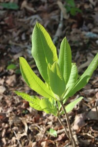
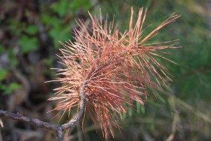
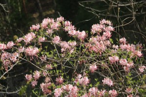
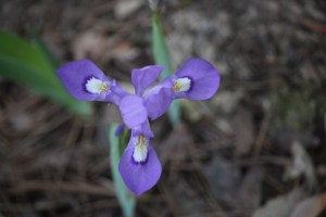
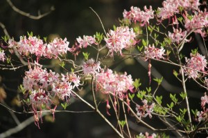
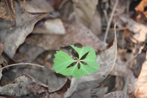
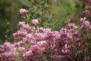
This is an excellent week for combining The Flower Hour, Spring Festival 2026 Week 4, while remembering Bren’s Floral Friday and Cee’s Flower of the Day challenges. As stated in my CWWC/CFFCpost Coleman and I hiked the Lake Crawford Trail at Kings Mountain State Park. The trail was displaying an impressive array showing colourful signs of Spring.
Here are a few pics of Spring signs we saw on our Hike …
Terri’s The Flower Hour Dawn’s Spring Festival 2026 Week 4 Bren’s Floral Friday Cee’s Flower of the Day (FOTD)
Camera: Canon EOS Rebel T7 (2000D) with Canon EF-S55-250mm lens and Altura UV Filter attachment.
Location: Lake Crawford Trail; Kings Mountain State Park; Blacksburg, South Carolina, USA
God Bless. Have a funtastic weekend. Enjoy the Spring Florals. Thank you for visiting and sharing your time and thoughts with us. I appreciate y’all very much.
Welcome back to another Which Way Challenge (CWWC). Let me first apologize for being a bit late in posting this week’s Which Way Challenge. Our internet was being wacky going in and out not staying connected for the longest time. Hopefully our WiFi will stay connected so I can complete and publish.
This week I have chosen (CWWC)/CFFC 2026: Any Which Way with Views from a walk or hike for this week’s theme. This week’s CWWC I’m combining with Dan’s Fun Foto Challenge (CFFC). Let’s see what we are looking at as we take our walks or hikes. The Which Way can be any path, sidewalk, trail, or road as long as the Which Way is clearly discernible. As always signs are always welcome.
For further information regarding the Which Way Challenge (CWWC) feel free to check out the home page here.
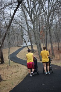
This week Coleman and I took an early morning brisk hike at Kings Mountain State Park (not to be confused with the Kings Mountain National Military Park). We began our hike along the Lake Crawford Trail (Purple Trail Signs) then ventured onto the Historic Farm Trail (Yellow Trail Signs). Our starting point for the Lake Crawford Trail began at the Historic Bathhouse which was built in 1939 by the Civilian Conservation Corps (CCC). This Historic Bathhouse is considered to be among the finest examples of CCC rock wall and step construction in the Southeast.
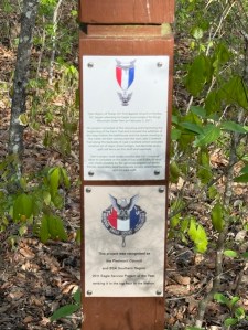
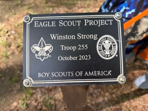
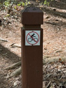
Coleman walking towards the Bathhouse The Rock Steps and the Bathhouse Lake Crawford The Spillway The Water flowing down the Spillway Lake Crawford Coleman following the Purple Trail Signs attached to TreesNotice of Eagle Scout Project completed at Kings Mountain State Park Eagle Scout Project performed by Winston Strong October 2023No Biking Allowed Lake Crawford Trail Kings Mountain State Park
As we continued our Hike, we ventured onto the Historic Farm Trail in order to investigate the Living History Farm. In this next gallery will began on the Historic Farm Trail and end at the Living History Farm.
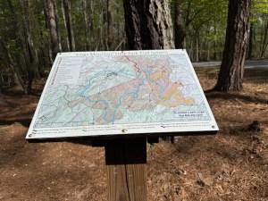
Coleman following the Yellow Trail Signs At this point we cross the road towards the FarmTrail MapKings Mountain State Park Living History Farm & Parking Who do I see? An Outhouse The chimney & Fireplace which once boiled sorghum stalks Coleman and a wagon Reminds my of the “Little House on the Prairie” wagonsHistoric Farm Trail Kings Mountain State Park
Click on each image to enlarge.
Thank you to those who have participated and supported the Which Ways Challenge. I appreciate y’all sharing your Which Ways with us.
For an idea of other’s Which Ways from this past week’s challenge, be sure to click on the following links below.
Location: Catawba River; Landsford Canal State Park; Catawba, South Carolina, USA
God Bless. Have a wonderful week. Love & Peace to y’all. Thank you for visiting and sharing your time and thoughts with us. I appreciate y’all very much.
God Bless. Enjoy Nature. Get Outdoors. Have a fabulous week. Thank you for visiting and sharing your time and thoughts with us. I appreciate y’all very much.
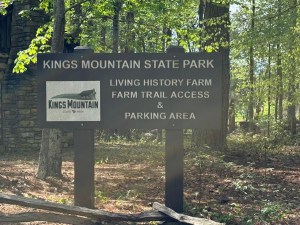
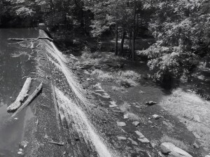
This week being a free week I thought I’d take you on a virtual journey through Kings Mountain State Park not to be confused with Kings Mountain National Military Park both of which are located in Blacksburg, South Carolina. The two are located right next to each other. The State Park is different and offers many more opportunities for outdoor activities like hiking, camping, canoeing, kayaking, horseback riding, fishing, and picnicking.
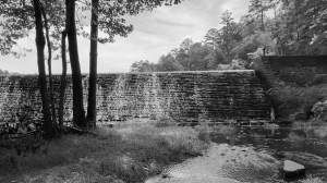
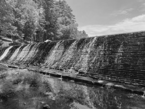
These are from a hike Coleman and I undertook back in 2020 when he was 11 months old. He is a trooper, for sure and for certain. We hiked down to the Waterfall at Lake Crawford.
Lake Crawford Kings Mountain State Park Blacksburg, SC
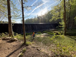
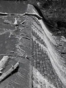
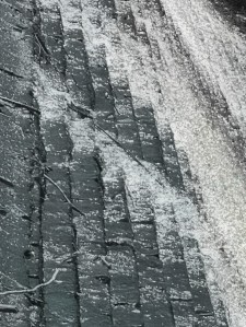
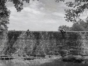
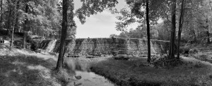
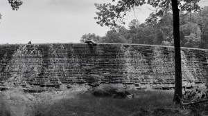
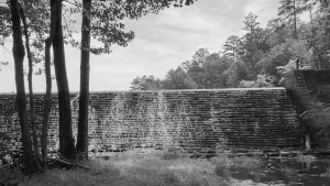
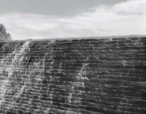
The Waterfall is an enormous staircase waterfall which is the overflow spillway for Lake Crawford. Lake Crawford is just one of two lakes within Kings Mountain State Park. The other lake is named Lake York which we have not hiked around as of yet.
The Staircase Waterfall & Spillway Kings Mountain State Park Blacksburg, South Carolina
The State Park offers more than twenty (20) of hiking trails and an additional thirty (30) miles of equestrian only trails. It also has one hundred fifteen (115) campsites equipped with water and electricity plus fifteen (15) equestrian campsites.
Kings Mountain State Park and Spillway were built in the 1930’s by the Civilian Conservation Corps (CCC). It contains approximately nearly seven thousand (7,000) acres for the enjoyment of all who wish to visit.
The Otherside of the Waterfall & Spillway Kings Mountain State Park Blacksburg, SC
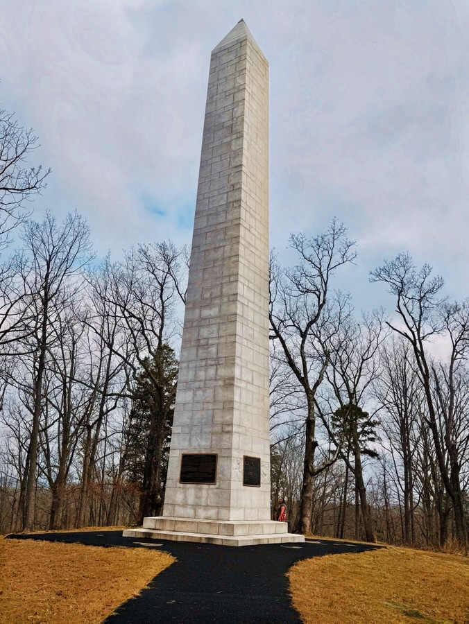
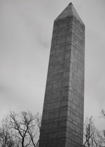
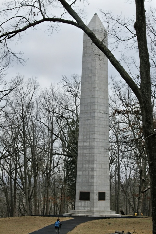
U.S. Monument Kings Mountain National Military Park Blacksburg, South Carolina
The U.S. Monument in Kings Mountain National Military Park stands on the highest point in the park. It resides on Battleground Ridge in the northeastern part of the park’s and its highest point. It stands in line with the Centennial Monument (which you can learn more about by clicking here.
The U.S. Monument was constructed of white granite from the Mount Airy quarry in North Carolina. It towers eighty-three (83) feet high above Battleground Ridge and rests on a two-stepped marble base (16’ x 3” squared).
The obelisk’s interior is hollow and the white marble bricks are contrasted against black mortar. The diagonals of the obelisk approximately correspond to the four (4) cardinals of the compass. On each side of the Monument are bronze tablets that dedicate the Monument to the patriot victory at Kings Mountain. The bronzetablets discuss the significance of the battle, list the American and British commanders, and list the Americans killed in battle.
The U.S. Monument in Kings Mountain National Military Park was dedicated in 1909. Interestingly, the decision to erect an obelisk at Kings Mountain National Military Park reflects the cultural fascination with Ancient Egypt during the nineteenth century. Since the time of Ancient Egypt, the obelisk has been seen as a symbol of reverence, dominance, and patriarchy.
Each year on October 7th, the Park honours those who fought at Kings Mountain by holding a wreath laying ceremony at the U.S. Monument with a program held in the amphitheater at 3:00 pm, the time in which the battle began.
Click on image to enlarge. The featured photo shows the full length of the U.S. Monument in Kings Mountain National Military Park.
Cameras: Main image-Canon EOS Rebel T7 (2000D) with Canon EF-S55-250mm lens and Altura UV Filter attachment; Featured image-Apple iPhone 16 Pro Max
Location: U.S. Monument; Battleground Ridge; Kings Mountain National Military Park; Blacksburg, South Carolina, USA
God Bless. Get Outdoors. Enjoy Nature. Capture the beauty all around you. Have a wonderful week. Thank you for visiting and sharing your time and thoughts with us. I appreciate y’all very much.
Judy from Life Lessons blog hosts a weekly photo challenge called The Numbers Game.This week’s number is 239. Her instructions for playing along are listed below …
To play along, go to your photos file and type that number into the search bar. Then post a selection of the photos you find under that number and include a link to your blog in Judy’s Numbers Game blog of the day. If instead of numbers, you have changed the identifiers of all your photos into words, pick a word or words to use instead, and show us a variety of photos that contain that word in the title.
Here are my contributions …
Please click on photos to enlarge.
From the Crazy Sister Murrells Inlet, South Carolina
God Bless. Have a wonderful week. Live life to the fullest. Make lasting memories. Take Care. Thank you for visiting and sharing your time and thoughts with us. I appreciate y’all very much.
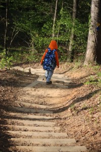
Welcome back to another Which Way Challenge (CWWC). This week I have chosen for the Which Way Challenge (CWWC) 2026: Any Which Way on a Nature Trail (Dirt or Paved) for this week’s theme. The Which Way can be any dirt or paved path, sidewalk, trail, or road as long as the Which Way is clearly discernible. As always signs are always welcome. For further information regarding the Which Way Challenge (CWWC) feel free to check out the home page here.
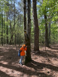
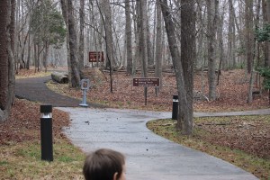
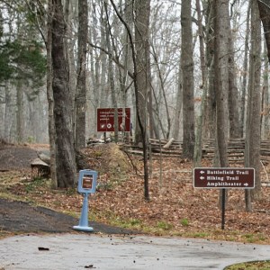
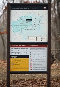
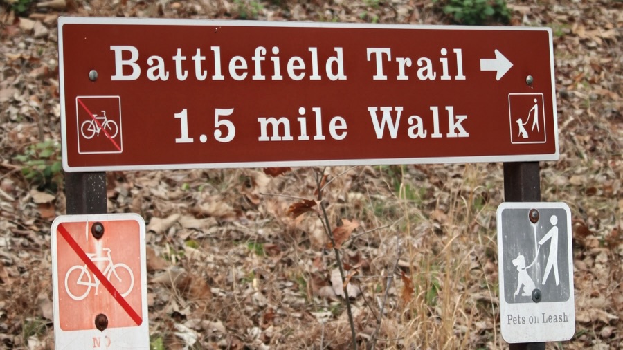
Coleman and I haven’t journeyed very far like some of y’all have, however, we do enjoy our adventurous journeys to Greenways, State Parks, and nearby National Parks. This past weekend we journeyed to Kings Mountain National Military Park for the sole purpose of hiking the Battlefield Trail.
The Battlefield Trail is a mere 1.5 miles long, but it seems a lot further when you’re hiking up hill on the trail, winding around the mountain, back and forth twisting this way and that way through the woods, hiking up and down continuously seems like you’re hiking forever.
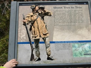
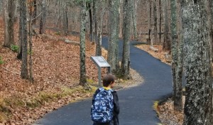
The Battlefield Trail contains several story boards telling about the impact the Revolutionary War had on the Kings Mountain area and the Carolinas. It has monuments in various locations along the trail which have significant historical relevance to the Revolutionary War and the Soldiers who fought against the British. It is a semi-paved trail in natural surroundings.
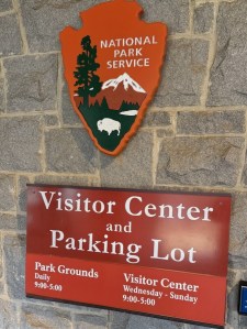
After arriving at Kings Mountain National Military Park, Coleman and I checked out the museum prior to hitting the trail for our adventurous journey. Once we left the Museum/Visitor Center, we had to decide which way we wanted to go to begin our hike.
Do we go to the left or right?
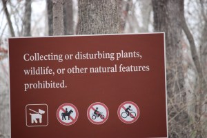
We read the sign which indicated which way the Battlefield Trail was located. Therefore, we followed the signs directions and began hiking to the left. We ran across various signs along the way … some that instructed us on what not to do, some that told about a specific area, and a few that informed about park regulations or gave us hiking suggestions.
Battlefield Trail
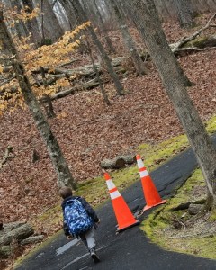
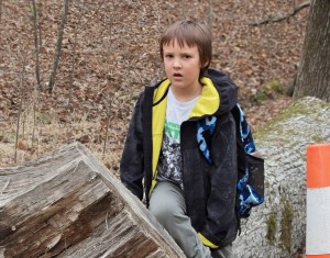
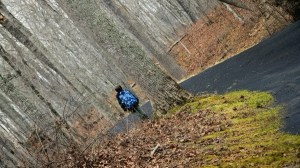
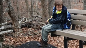
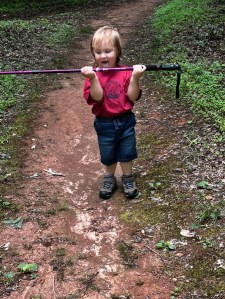
Hiking along we see stone monuments dedicated to fallen soldiers, orange cones alerting us to dangerous areas, and Coleman discovers interesting places to Pull Up a Seat.
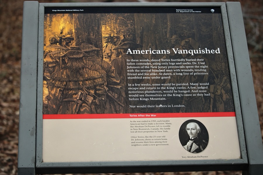
Sacred to the memoryof … Coleman Pulls Up a Seat on a logShoot Tree to TreeColeman Pulls Up a Seat on a Bench One of many Story BoardsBattlefield Trail
Hiking further up (and I mean uphill)along the trail we spot more monuments with information indicating their significance in history.
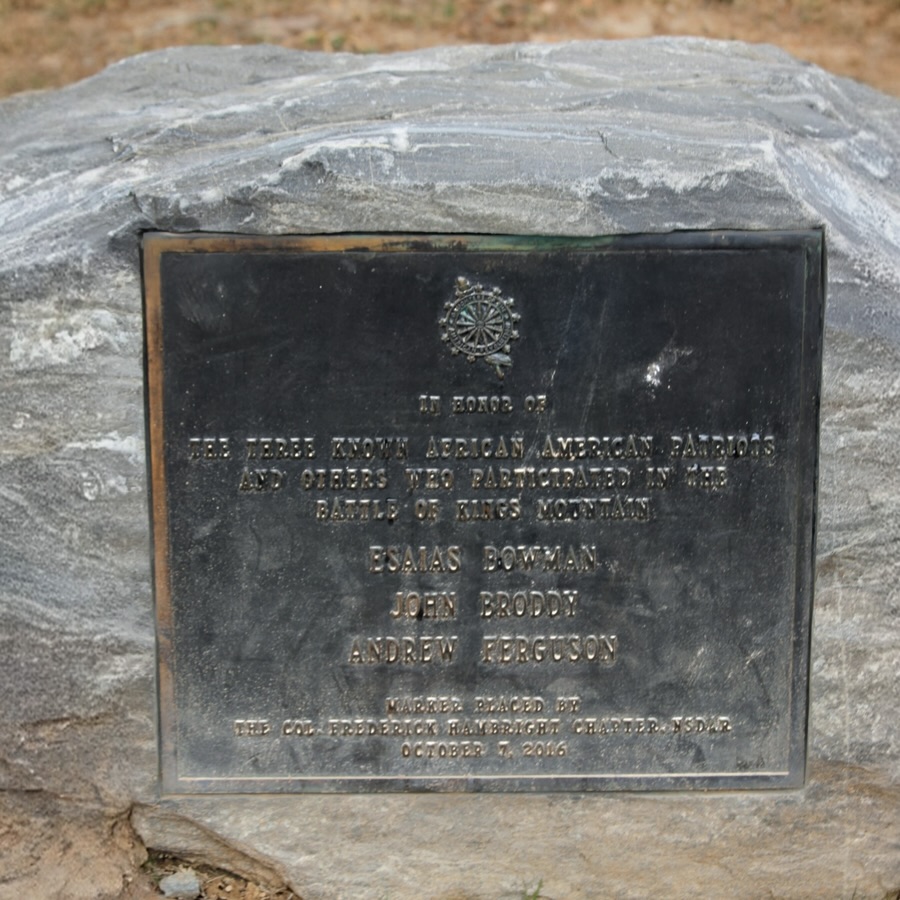
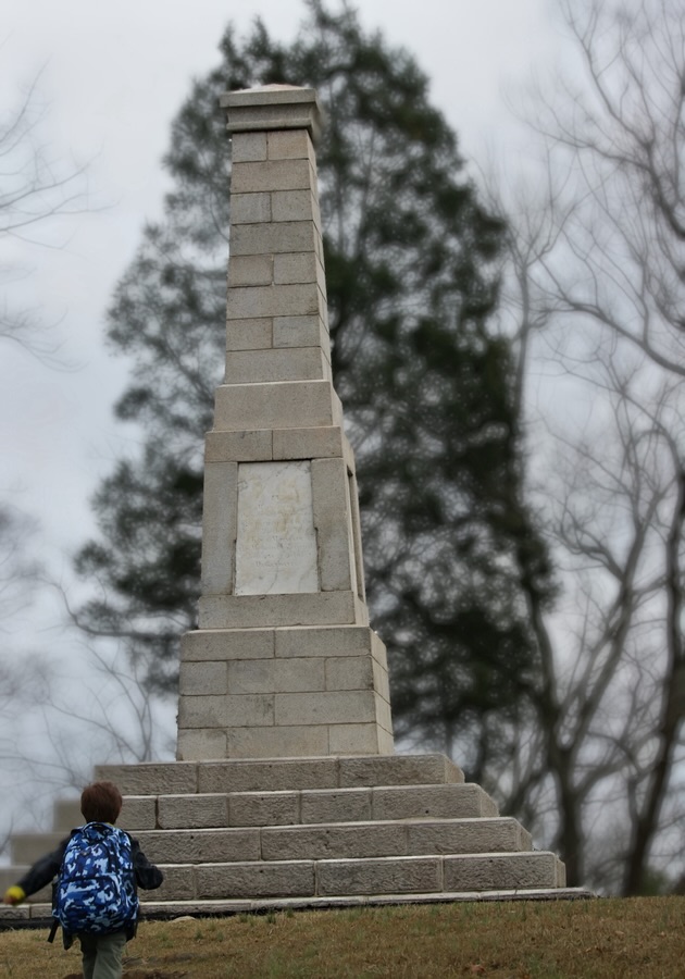
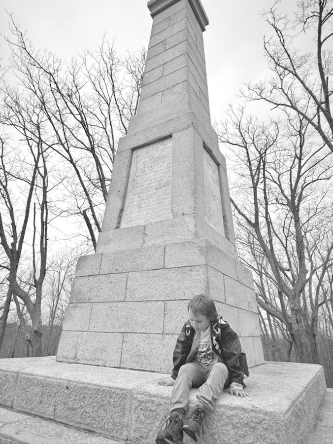
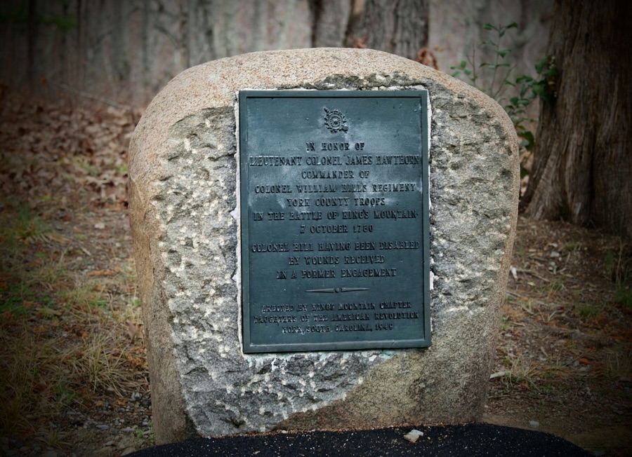
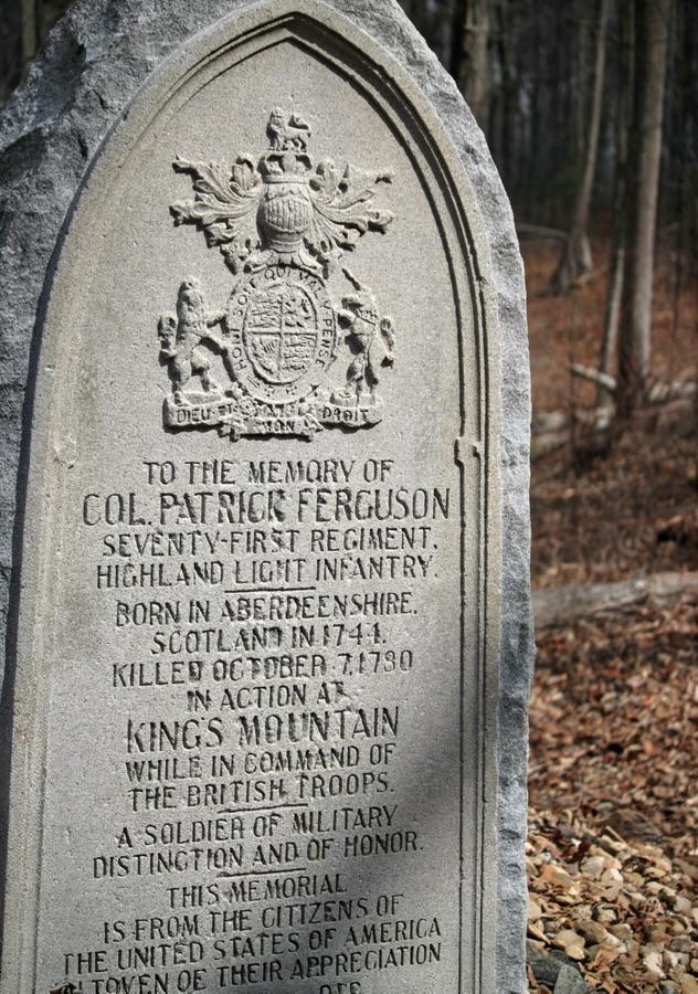
In Honor of the Three Known African-American Patriots…Coleman approaches the largest and tallest monument Coleman Pulls Up a Seat on a Monument This is a different monument Coleman is investigating In Honor of Lieutenant Colonel James Hawthorne …Coleman takes a break Pulling up a Seat on the TrailTo the Memory of Col. Patrick Ferguson …American Vanquished Battlefield Trail Directional SignThe end
Thank you to those who have participated and supported the Which Ways Challenge. I appreciate y’all sharing your Which Ways with us.
For an idea of other’s Which Ways from this past week’s challenge, be sure to click on the following links below.
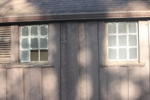
Coleman and I had the opportunity to hike Battlefield Trail (more on that later) on Saturday, March 7th. The day started out gloomy and overcast with the possibility of rain. Luckily the rain held off until we were back home. It ended up being around 76°F and humid. Not too bad for hiking weather except my glasses kept fogging up making it hard to see.
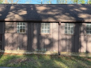
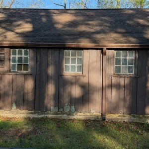
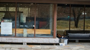
Below are the windows we saw as we were approaching the backside of the VisitorCenter upon completing the 1.5 mile Battlefield Trail.
Windows on the Backside of the Visitor Center
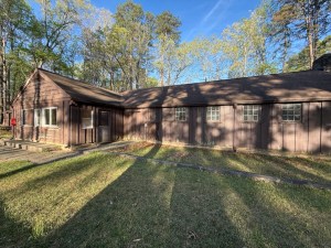
Kings Mountain National Military Park Visitor Center and Museum
National Park Service Visitor Center Kings Mountain National Military Park & Museum
Camera: 1-2) Canon EOS Rebel T7 (2000D) with Canon EF-S55-250mm lens and Altura UV Filter attachment; 3) Apple iPhone 16 Pro Max
Location: Kings Mountain National Military Park; Blacksburg, South Carolina, USA
God Bless. Have a fantastic week. Get Outdoors. Enjoy Nature’s Beauty. Thank you for visiting and sharing your time and thoughts with us. I appreciate y’all very much.
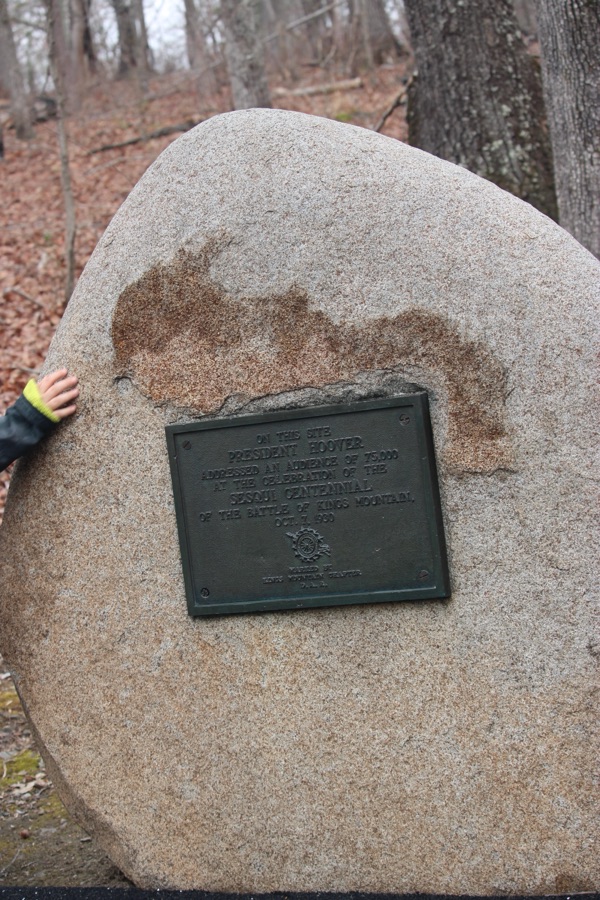
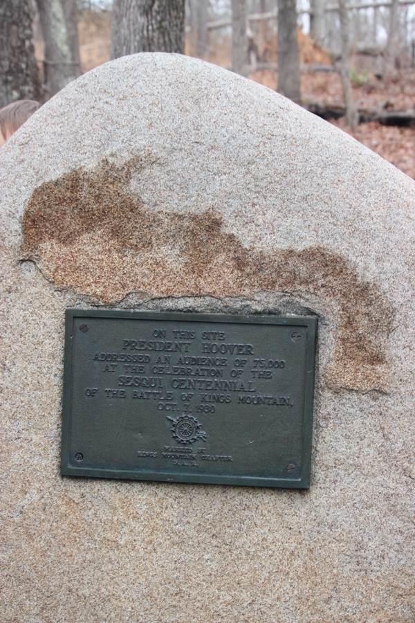
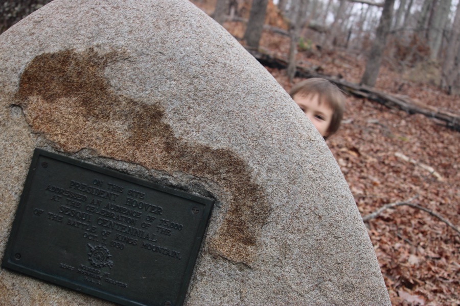
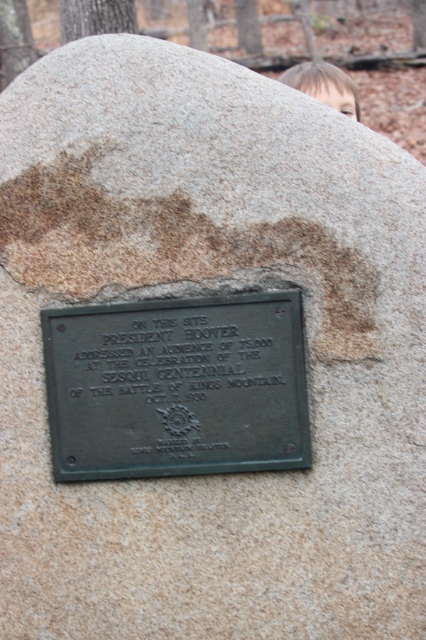
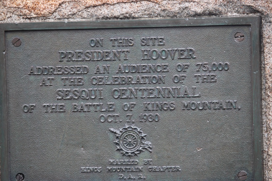
Coleman playing Hide-N-Seek … Behind the Monument Peek-a-Boo Coleman On This Site President Hoover Addressed An Audience of 75,000 At The Celebration Of The Sesqui Centennial Of The Battle Of Kings Mountain October 7, 1930
Camera: Canon EOS Rebel T7 (2000D) with Canon EF-S55-250mm lens and Altura UV Filter attachment.
Location: The Battlefield Trail; Kings Mountain National Military Park; Blacksburg, South Carolina, USA
God Bless. Have a funtastic week. Take a hike and enjoy nature. Thank you for visiting and sharing your time and thoughts with us. I appreciate y’all very much.


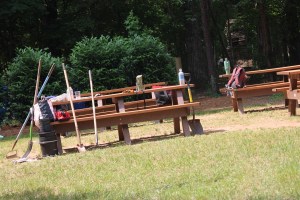


![Which Way Challenge 2026 (CWWC): Any Which Way Along a Nature Trail (Paved, Unpaved, or Natural surface) [05.29.2026]](https://gfpacificbeeintrospection.com/wp-content/uploads/2025/06/image-1-1.jpg?w=489)


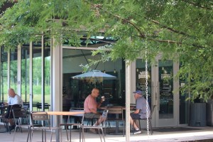
![Which Way Challenge 2026 (CWWC): Any Which Way (Your Choice) [05.08.2026]](https://gfpacificbeeintrospection.com/wp-content/uploads/2026/05/img_4638.jpg?w=900)


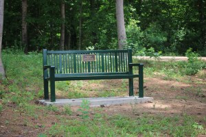
![Which Way Challenge 2026 (CWWC): Any Which Way Capturing People Unaware. [05.01.2026]](https://gfpacificbeeintrospection.com/wp-content/uploads/2025/04/img_1225-1.png?w=506)