2024 CWWC: Traveling Around Disneyland in 1965

Traveling back in time to December 1965, to a family day trip. Packed and loaded in our 1962 Ford Galaxie 500 with a cooler of drinks, snacks, and sandwiches; we began our approximately hour and fifty-one (1hr 51min) drive north moving forward through the city streets until turning onto CA-94 and eventually onto the recently constructed I-5.

Upon arriving at the Disneyland entrance, my parents purchased our admission and ride tickets. General Admission prices for adults at that time was $2.60 per adult and included a ticket for the Monorail. Junior prices were $1.80 and Children’s admission prices were $1.10. Tickets for the rides cost extra. A book of 10 tickets ranged from $3.00 to $5.00.

1965 Disneyland Ride Tickets A-E
Selection of E Ticket Rides

In 1965, the cost of admission was considered a lot of money. However, people considered visiting Disneyland was a worthwhile family adventure.

After our tickets were purchased and we entered the park, we selected what rides we wanted to ride. We went to each ride or attraction as a family unit, not venturing off individually. Our first ride of choice was the Monorail.

Disneyland Monorail

The Monorail was considered as a mid-century marvel and captured the hearts and imaginations of the theme park and Disney fans. The Monorail was a Highway in the Sky which allowed for a unique experience viewing the park from above.

Our next selection was to ride the submarine adventure. The attraction features vehicles that were designed to look like submarines. It required the E ticket was in the Tomorrowland area of the park.

Early Disneyland Submarine

The submarines took us on an adventure under the sea simulating fish and other sea creatures allowing us to imagine we were really being submerged and viewing the undersea life of a tropical lagoon.

Next up was the Autopia adventure. This was where we could get in cars and race around an enclosed track. We could imagine we were actually racing the other drivers.

My mom getting out
of the Race Car.

After a full day of adventures Moving Forward around the park, we selected a spot on the side of Disneyland’s Main Street to watch the Parade. The waiting was a time of excitement as we looked forward to the parade starting.

Mickey Mouse riding
in a Vintage Car
with Goofy
1965 Disneyland
Santa Claus Float

Well folks, that’s all for today. We had fun, but now it’s time to head home.

Cee’s Which Way Challenge-AnyWay

Throwback Thursday

Becky’s #Square Renew/Reconstruct/Moving Forward

Photo Credit:©️1965 Nornal H. Waters (my dad) … All Rights Reserved.

Location: Disneyland; Anaheim, California, USA

Photos were reconstructed from my dad’s slides using a Wolverine digital converter.

God Bless. Thank you for visiting Vintage Disneyland with us. Thank you for sharing your time and thoughts with me. I appreciate y’all very much.

2024 CWWC: May — Squared Lancaster’s Way

Moving Forward at

Lindsay Pettus Greenway

The forward thinking of concerned citizens, volunteers, business partners, and in partnership with the Katawba Valley Land Trust; the ideas, planning, and reconstruction of certain areas into a Greenway of trails in Lancaster began to develop beginning in 2014. The Greenway includes numerous pedestrian connections with linkages to residential, commercial, and local school properties, trail heads, and nature centers, bridge crossings, and sidewalk improvements.

Comporium Communications Trail Access is the starting point for Coleman’s and my hike along the first phase of the Greenway’s Master Plan. The first phase of the Reconstruction of Land in Lancaster was completed in 2019. Our hike took place in February of 2022.

As we moved forward in our adventure, we encountered several informational signs which were a tremendous help in guiding us as we moved forward along the Greenway.

Coleman and I decided to move forward together along the nature trail towards creek overlook and eventually the Wetlands Overlook.

Here Coleman takes a minute to look out over the bridge at the creek below.

Coleman can’t resist climbing on the bridges railing at this next point or interest.

Informational Signs are located strategically throughout the Greenway. This particular one gives information about out the Lindsay Pettus Greenway and Lindsay Pettus himself.

The forward thinking of Mr. Lindsay Pettus and the many volunteers ensured the Greenway is and will continually be accessible to everyone regardless of their mobility needs.

Cee’s Which Way Challenge-Any Which Way

Becky’s Square’s-Moving Forward

Photo Credit: ©️2024 Deb L. Waters … All Rights Reserved.

Camera: iPhone 13 Pro

Location: Lindsay Pettus Greenway; Lancaster, South Carolina, USA

God Bless. Thank you for visiting and sharing your time and thoughts with us. I appreciate y’all very much.

2024 CMMC/CWWC: Any Latte Way

We managed to have a beautiful clear day yesterday (almost), so Coleman and I rode the bus to the Y for some fresh air and a bit of hiking.

All aboard, we’re on our way.

Before we begin our hike, it’s Coleman swing time. If we waited till later the school kids would have taken over and he couldn’t have been able to play.

Next, Coleman cools down with a snack as I gaze out over the lake.

Now for our hiking, Coleman leads the Way. I constantly have to instruct him to slow down. He hikes much faster than I’m able to hike.

Through the woods along the bank of the lake we traverse. Across the dam and deeper into the woods. Upward, downward, and around and around we go.

Coleman spots the Fitness Challenge area off the Yellow Trail and climbs aboard for some fun before continuing our hike and back up to the Y.

Tired from our hike we’re gonna Leaf it all behind, and venture to the bus stop and head home.

Cee’s Midweek Madness Challenge-April Latte Color

Cee’s Which Way Challenge-Any Way

Photo Credit: ©️2024 Deb L. Waters … All Rights Reserved.

Cameras: iPhone 14 Pro Max and Canon EOS Rebel T3i with Canon EF-S18-55mm lens with Altura UV & NP filter and also Altura Wide-Angle Fisheye attachments.

Location: Gaston County Warlick Family YMCA; Gastonia, North Carolina, USA

God Bless. Get Outdoors and Enjoy Our Beautiful Earth. Thank you for traversing the trail with us. Thank you for sharing your time and thoughts with us. I appreciate y’all very much.

2024 CWWC: Any Type of Road, Path, Step, Bridge or Sign.

Following Cee’s lead on

Narrow Walkways

Mine are Along the

Blue Star Trail

On this hiking adventure I parked at the Dairy Barn Entrance to the Anne Springs Close Greenway. After exiting the car we proceeded to hike along the fencing before hitting the trails. Following the fence line we were able to view the horses, some of which trotted over to our location. [More on horses later].

Our first stop along the Blue Star Trail was to take a look at the Faires/Coltharp Cabin. To our surprise and delight it was open to the public (first time we’d seen it open). So naturally, Coleman with me following went inside to see what was inside.

A Look
inside the
Faires/Coltharp Cabin

After leaving the cabin, we hiked further along the Blue Star Trail towards the Swinging Bridge and the Schroering Forest Playground located on the other side of the Spillway.

Blue Star Trail

When the Spillway is up and streaming with a steady flow of water, the only way to cross it is to walk across the Greenway’s Swinging Bridge. Since our destination was on the far side of the Swinging Bridge we/I slowly walked across. Coleman used to walk across it when he was younger, but now if no one else is on it he’ll run across.

Coleman
crossing the
Swinging Bridge

We made it safely across the Swinging Bridge, walked around the Artisan Market, ordered lunch from the Greenway’s Canteen and rested a bit before heading to the Schroering Forest Playground. We had a clear view of the Playground from where we chose to sit. This was the first official day the Playground was open. They had been working on it all fall and winter. Being its opening day, the playground was crowded with children from all age groups.

Coleman
hiking the
Blue Star Trail

Upon completion of our lunch we noticed there were still a lot of children on the playground. I decided to have Coleman wait to play in it until it wasn’t nearly so crowded. Therefore, we continued on with our hiking and headed down to Lake Haigler.

Blue Star Trail
Almost down to
Lake Haigler

We hiked along the narrow side pathway towards the lake. The straight pathway is wider and more widely traveled by the majority of visitors to the Greenway.

We hiked a short loop with great views of Lake Haigler and then hiked back up to the Playground. Coleman climbed up on the Climbing structure and wasn’t sure about what to do after climbing up a short ways and just sat down for a few minutes. [The all natural wood climbing structure seemed to puzzle Coleman. He’ll probably climb more next time we visit.]

Steele Creek Trail

After a full afternoon of hiking and Coleman playing I decided it was time to head home. Hence, we proceeded to hike back up to the car. Instead of hiking the exact same trail we hiked down, we started out hiking on the Steele Creek Trail. The Steele Creek Trail is a narrow trail that leads up towards the Graham Historical Cabin.

From the cabin we traverse back onto the Blue Star Trail. After short distance from the cabin, Coleman starts searching for the cows. Sometimes they are up close to the fence line, but on this day we really had to look for them. Searching the pasture as we hiked up the trail, two of the cows came walking towards our direction from the far end of the pasture. That made a Coleman’s day. He was then ready to go home.

Cee’s Which Way Challenge- Any Type of Road, Path, Sign, Step, or Bridge 

Photo Credit:©️2024 Deb L. Waters … All Rights Reserved. 

Cameras: iPhone 14 Pro Max and Canon EOS Rebel T3i with Canon EF 75-300mm lens and Altura CPL Filter attachment.

Location: Dairy Barn Entrance; Blue Star Trail; Anne Springs Close Greenway; Fort Mill, South Carolina, USA.

God Bless. Thank you for hiking along the Blue Star Trail with us. Thank you for sharing your time and thoughts with us. I appreciate y’all very much.

2024 CWWC: 03.14 — Any Which Way

Coleman’s Way

Along Avon and Catawba

Creeks Greenway

Coleman Hiking & Playing
Along the Avon and
Catawba Creeks Greenway

The hiking adventures with Coleman are always fun and interesting. He doesn’t always stick to actual pathways or trails, however, he always gets to where he wants to go and has a fantastic time along the way.

Cee’s Which Way Challenge-Any Which Way

Photo Credit:©️2024 Deb L. Waters … All Rights Reserved.

Cameras: Canon EOS Rebel T3i with Canon EF-S55-250mm lens with an Altura CPL filter attachment and iPhone 14 Pro Max.

Locations: Lineberger Park; Avon Creek Trail, Avon and Catawba Creeks Greenway; Warlick YMCA; Gastonia, North Carolina, USA

God Bless. Thank you for visiting with Coleman’s adventures and for sharing your time and thoughts with us. I appreciate y’all very much.

2023 CWWC: Hiking the Greenway in Black & White

Our first stop, always, when we arrive at the Greenway is to make a track to the restrooms. When we get hiking it could be an hour or more before we reach one again, therefore we want to be prepared.
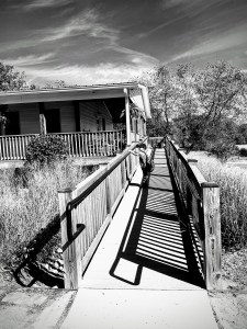
The Ramp to the
Gibson House porch
and restrooms.

Next we gaze out upon the pond to the right of the Gibson House. Horses are often in view as are various birds at times. The beauty of the reflections in the lake are always amazing to see. The walkway around the pond is new and still under construction.

The Pond
Horse Road Entrance
Anne Springs Close Greenway

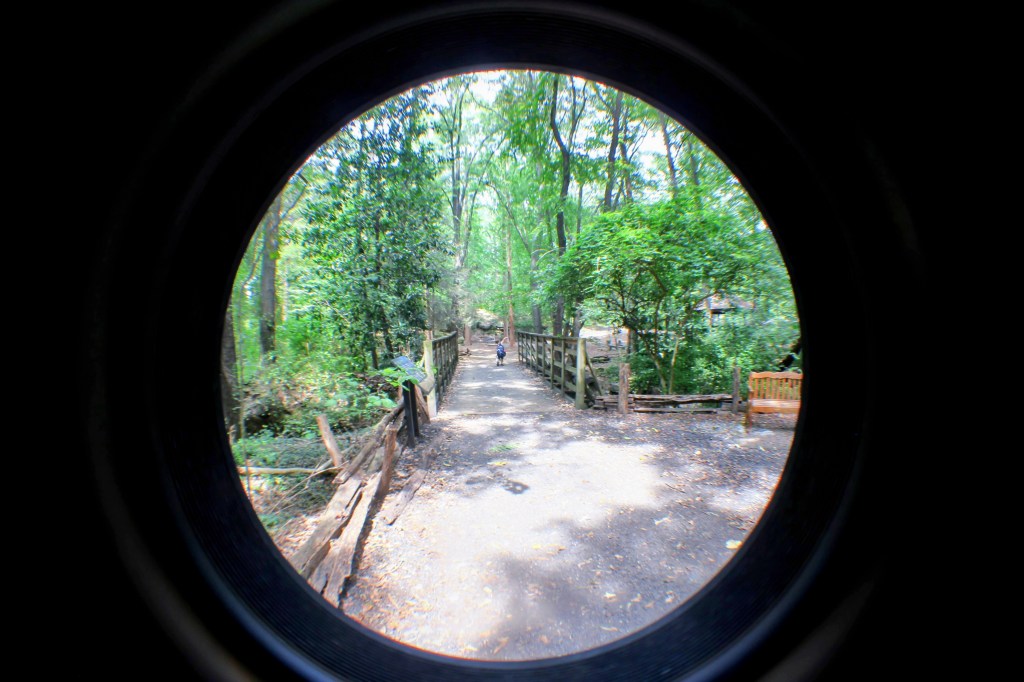
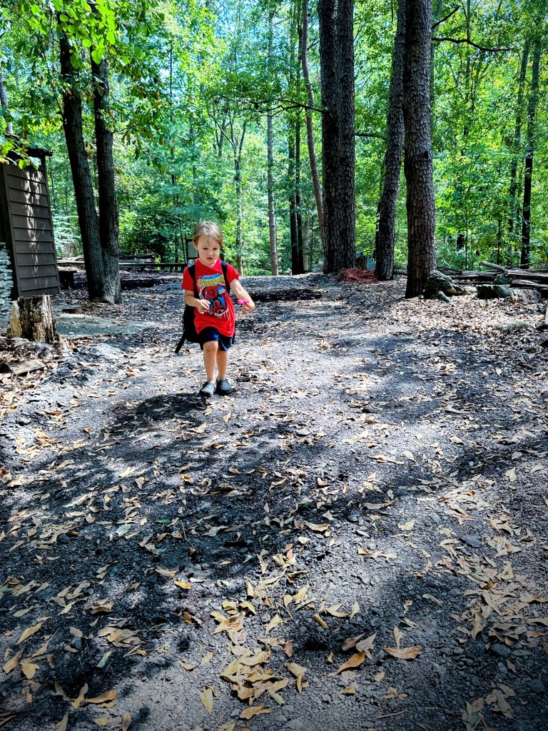
After that short period, we venture towards one of several hiking trails. On this particular day we chose to hike the Dogwood Trail. Coleman is leading the way. In case you were wondering, he usually always leads the way as we hike along the trails.

Coleman leading the way
to the Dogwood Trail

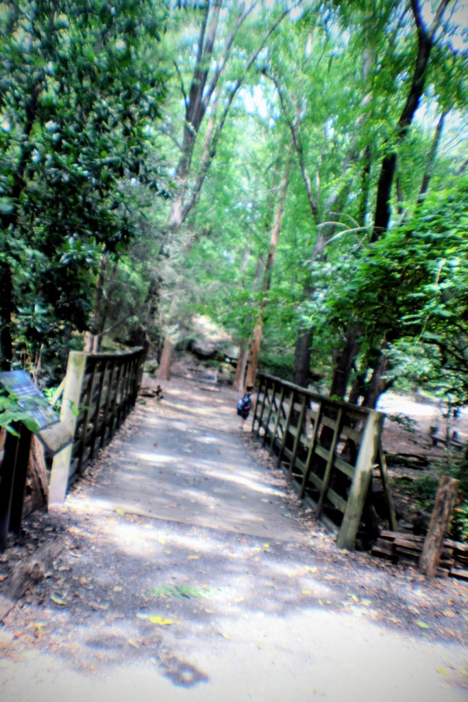
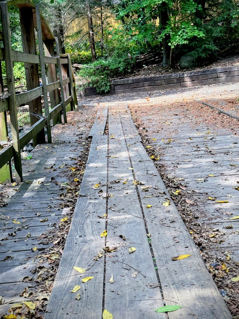
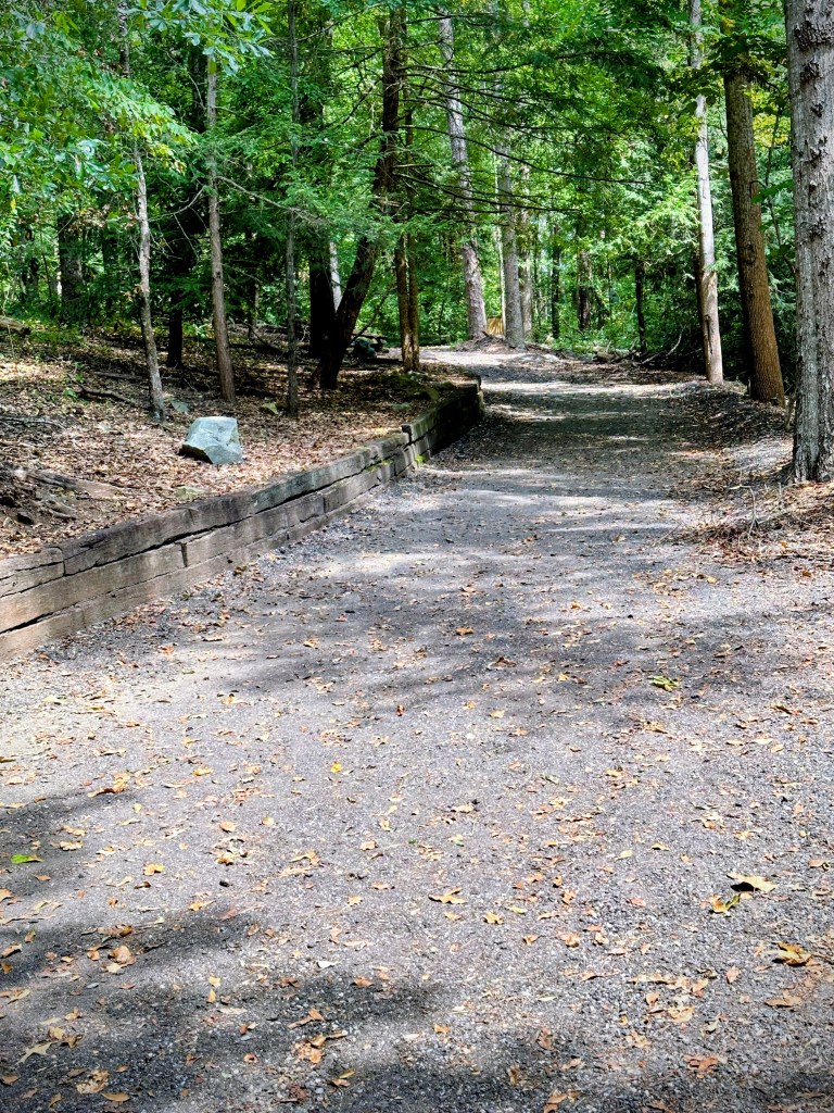
On this day and almost any day in the Fall, the trails are covered with leaves 🍁 🍃 🍁 of varying shades. Coleman pauses to wait for me to catch up. He goes a but fast for my pace.

Coleman standing
on Dogwood Trail

Hiking Trail signs are posted at regular intervals along the Trail. This is one of the many signs hikers will encounter as they hike along the trail. It designates directions for you to decide which way you’d prefer to hike. It informs you of which trail you are hiking so you do not get lost or sidetracked from your desired route. If you scan the QR code, it will bring up an online map and other pertinent information about the trail.

Coleman standing behind
the Dogwood Trail signs.

Cee’s Which Way Challenge-Black and White

Leanne’s Monochrome Madness

Photo Credit: ©️2023 Deb L. Waters … All Rights Reserved.

Camera: 1, 3-5) iPhone 14 Pro Max; 2) Canon EOS Rebel T3i with Canon EF 55-250 mm lens.

Location: Horse Road Entrance; Dogwood Trail; Anne Springs Close Greenway; Fort Mill, South Carolina, USA.

God Bless. Thank you for trekking along the Dogwood Trail with us. Thank you for sharing your time and thoughts. I appreciate y’all very much.

CWWC (Cee’s Which Way Challenge): Any type of Road

Welcome Cee and thanks for taking on the Which Way Challenge. I appreciate you and am looking forward to all you have to bring to challenge us on our Which Way Challenge adventures.

I’ve held off posting a which way challenge knowing you were taking over. Most of my “roads” are trails Coleman and I hike. I hope you’ll enjoy coming along on our Which Way hiking adventures.

I know only the first photo has an actual road in it, however, Coleman and I mostly travel on dirt pathways. We walk most everywhere, sometimes riding the bus to get to a location where we plan to hike. Hopefully next time I’ll be able to be more in tune with the theme.

Cee’s Which Way Challenge – Any Type of Road

Photo Credit: (c) 2023 Deb L. Waters … All Rights Reserved.

Cameras: iPhone 14 Pro Max and Canon EOS Rebel T3i with Canon EF-S18-55mm lens

Location: The Schiele Museum of Natural History; Gastonia, North Carolina

God Bless. Thank you for sharing your time and thoughts. I appreciate y’all.