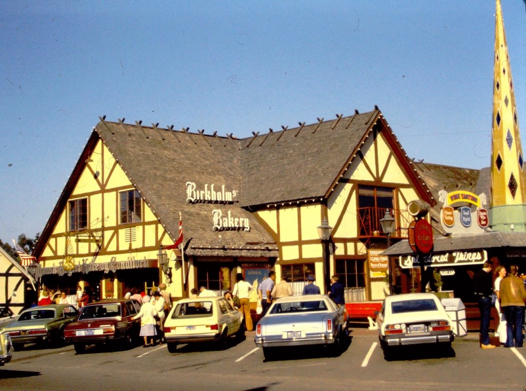
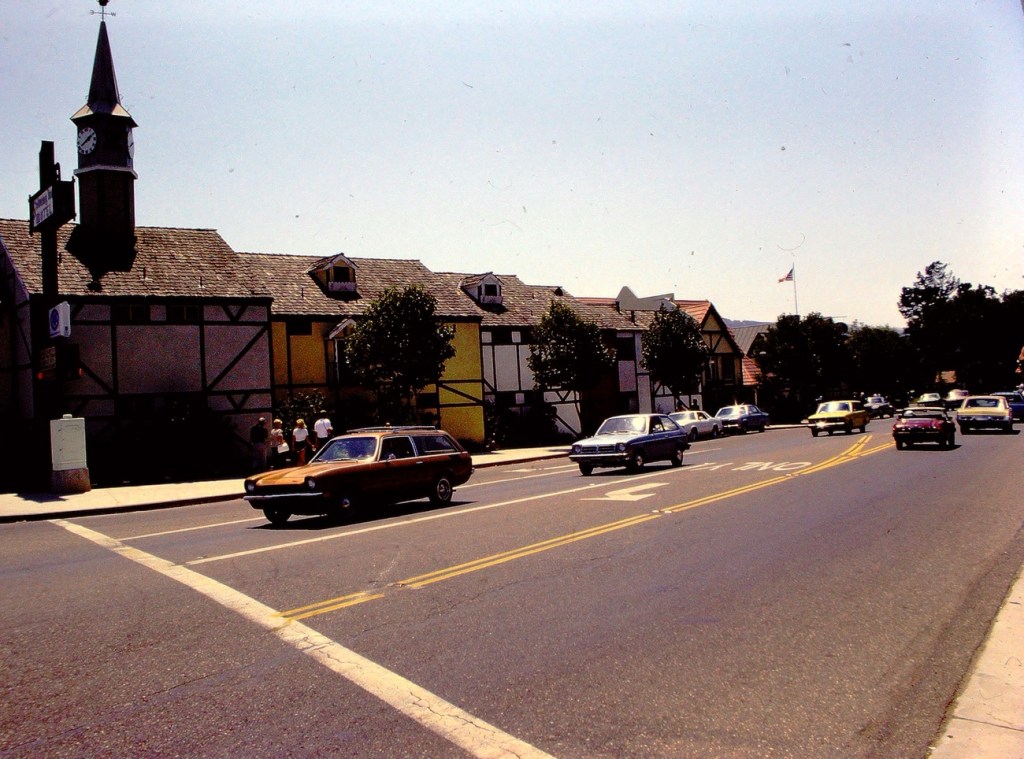
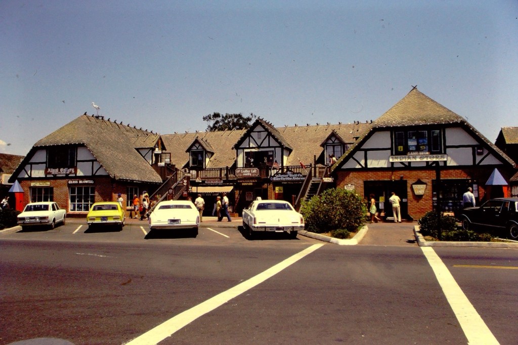
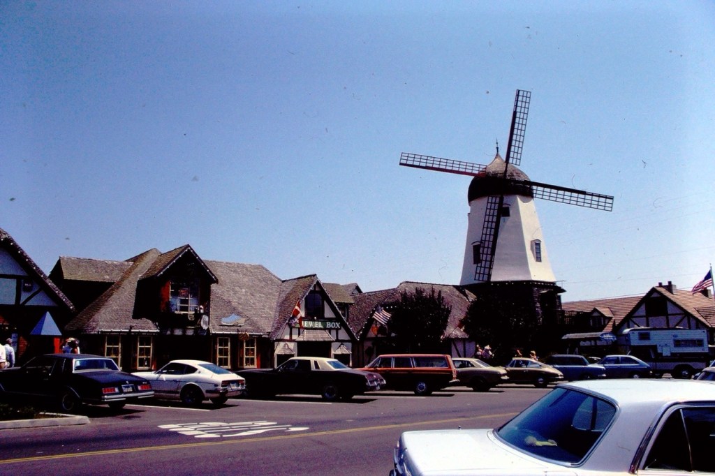
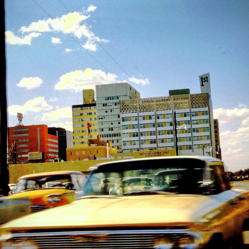
With Solvang being the Danish Capital of America, the Businessmen’s Association thought it would be too their advantage to capitalize on their natural advantages and adopt Danish style architecture in their buildings and in the remodeling of old buildings. Danish architectural styles had been developed in Solvang from its earliest stages of development, however, there was a more intensive effort conducted after their business meeting in 1946.
The Round Table Pizza building originally housed the Roeser Milling Company building (built in the 1930s). Back in the late 1970’s, tourists loved to stop for a bite at Round Table Pizza helping to contribute to their booming business. It is no longer in operation in Solvang, California, but there are plenty of other eateries to delight your appetite.
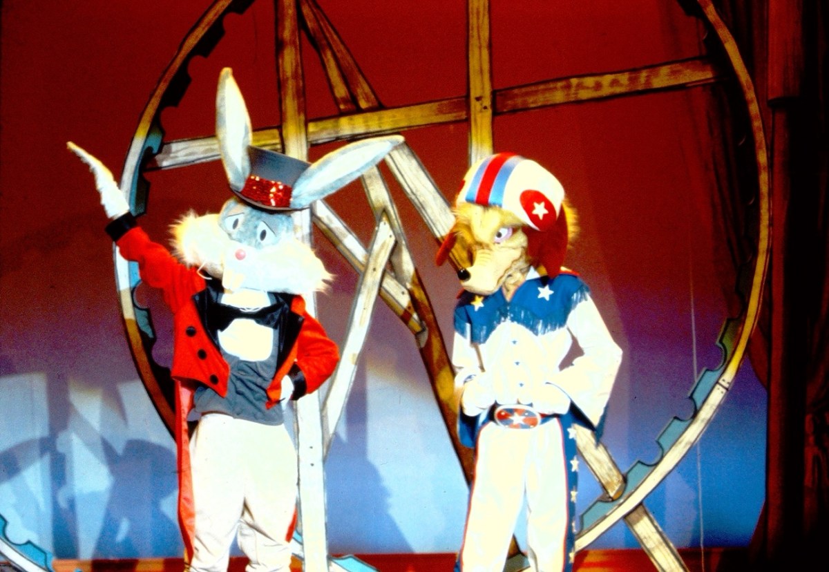
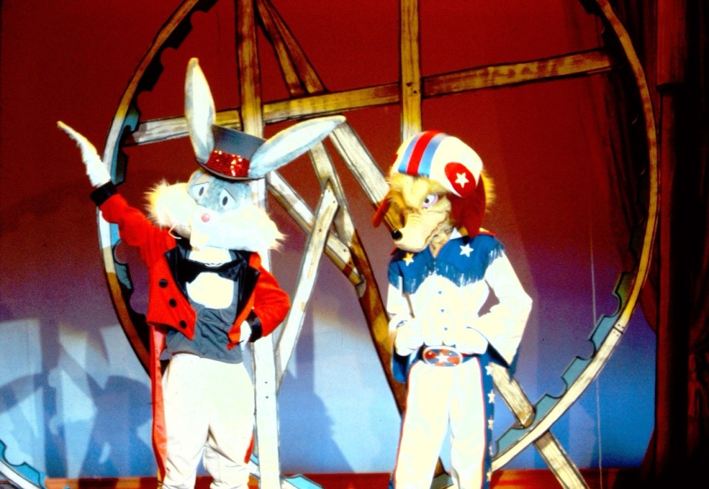
Bugs Bunny & Wile E. Coyote at California’s Great America
Since the Opening of California’s Marriott’s Great America in 1976, the park featured appearances from Warner Bros. Looney Tunes characters. Some of the Looney Tunes characters included Bugs Bunny, Wile E. Coyote, Porky Pig, Elmer Fudd, Daffy Duck, Tweety, and Yosemite Sam. The Looney Tunes characters would roam around the park greeting visitors as well as putting on a fun entertaining show.
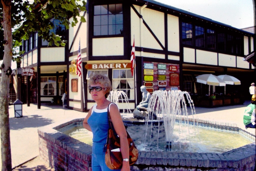
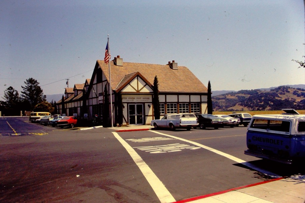
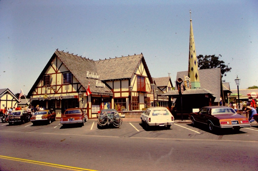
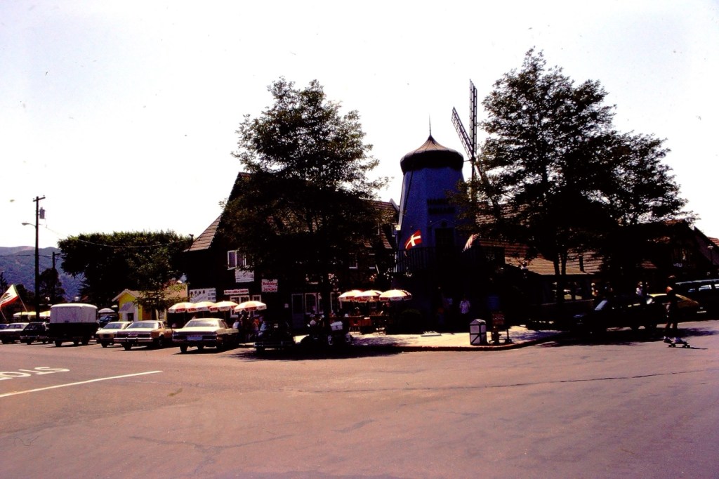
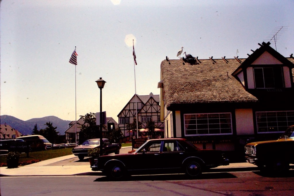
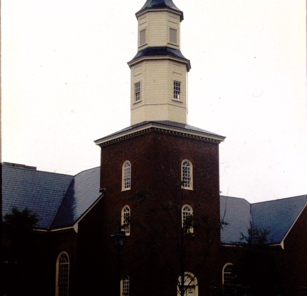
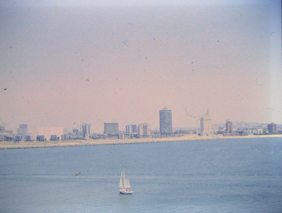
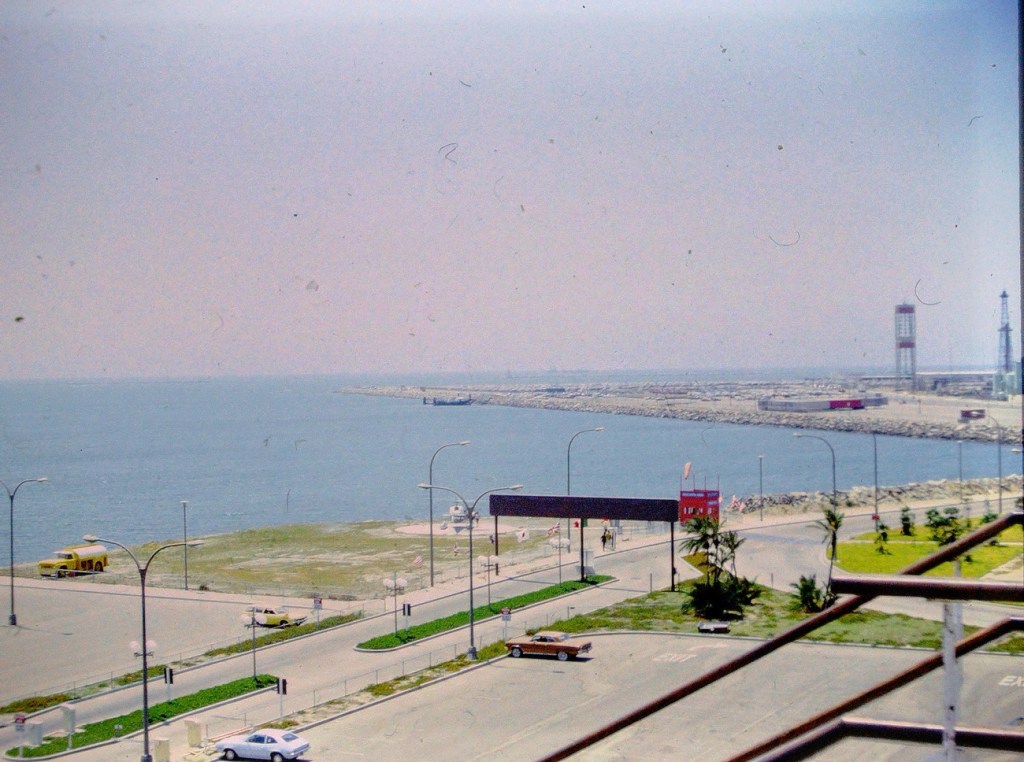
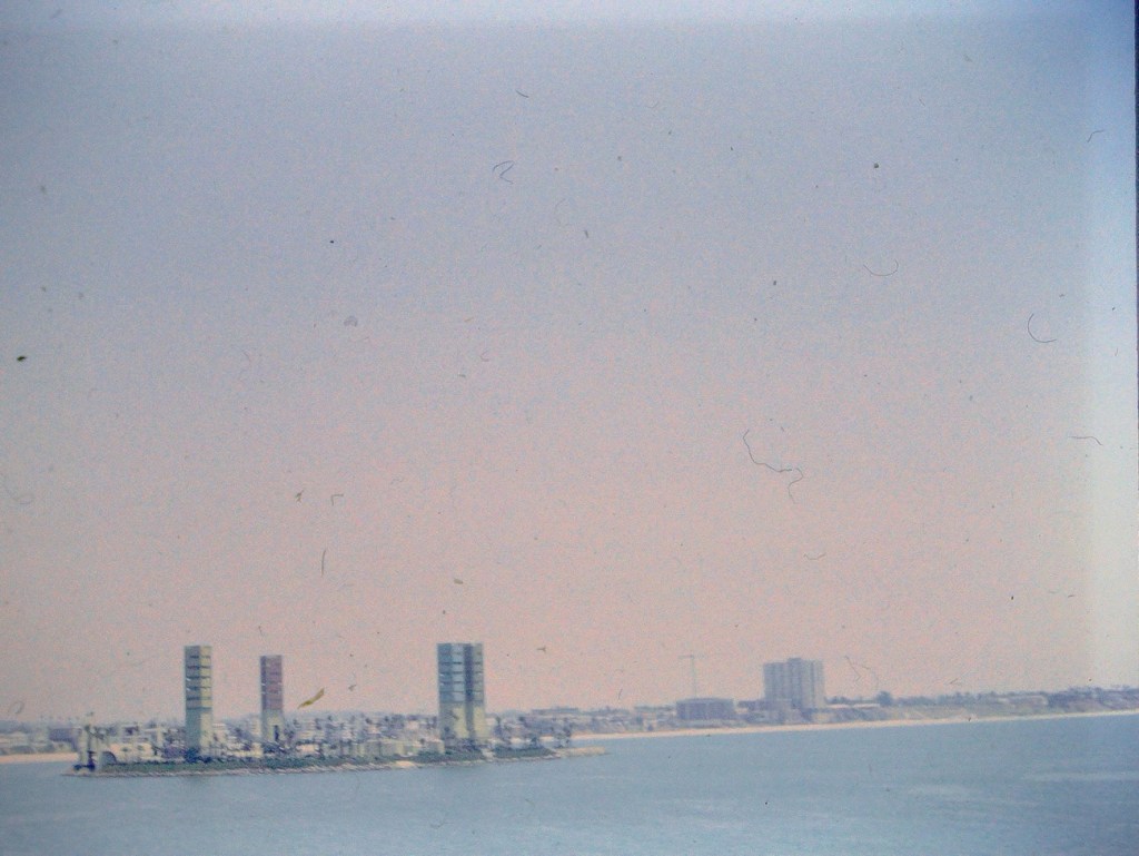
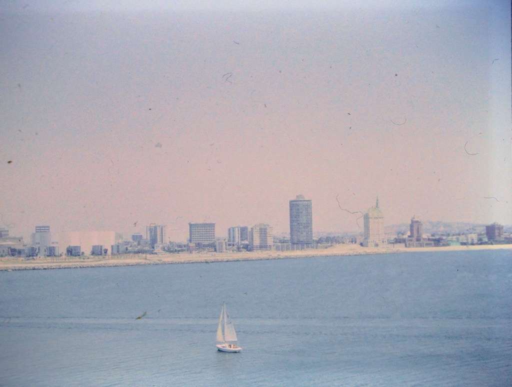
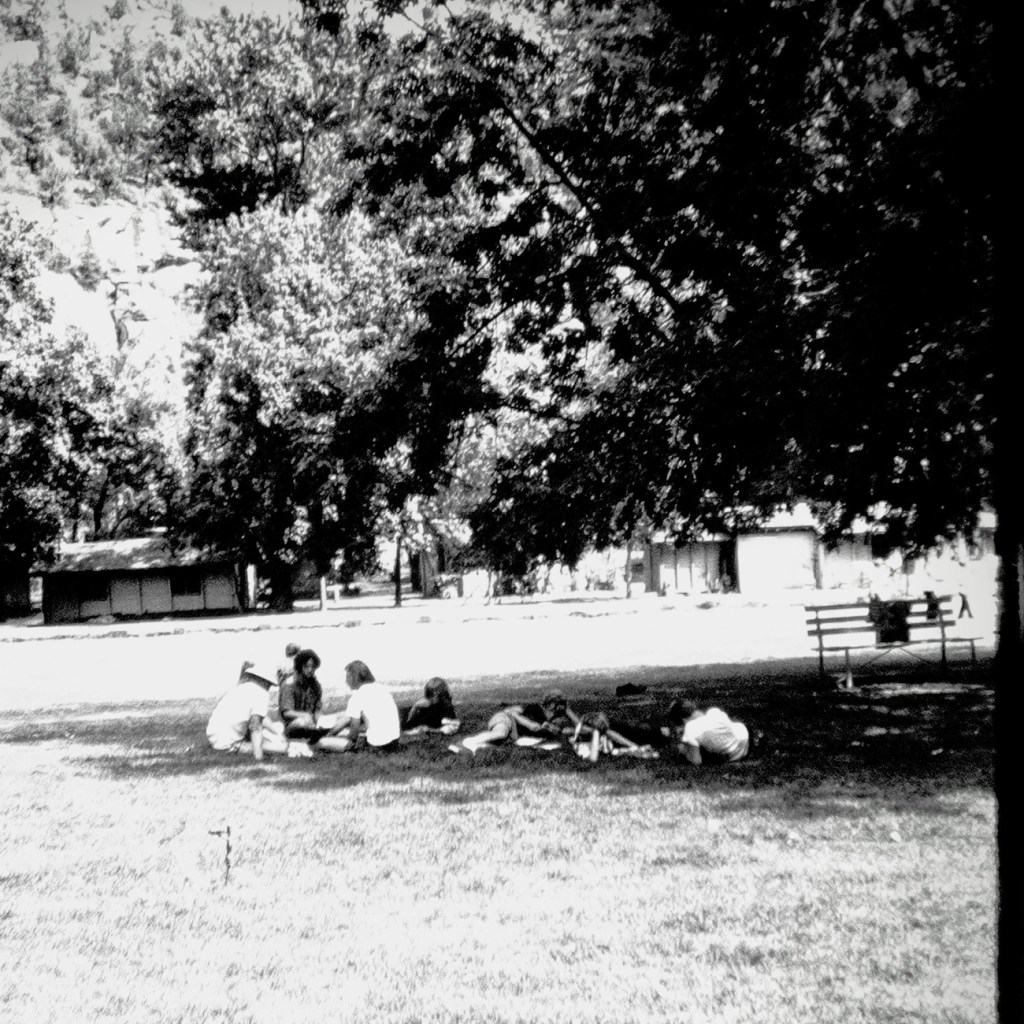
Here is my entry for this week. These are from a trip to Solvang, California back in September of 1978. Solvang is known as “Danish Capital of America” because of its Danish heritage and European-inspired culture, architecture, and museums.
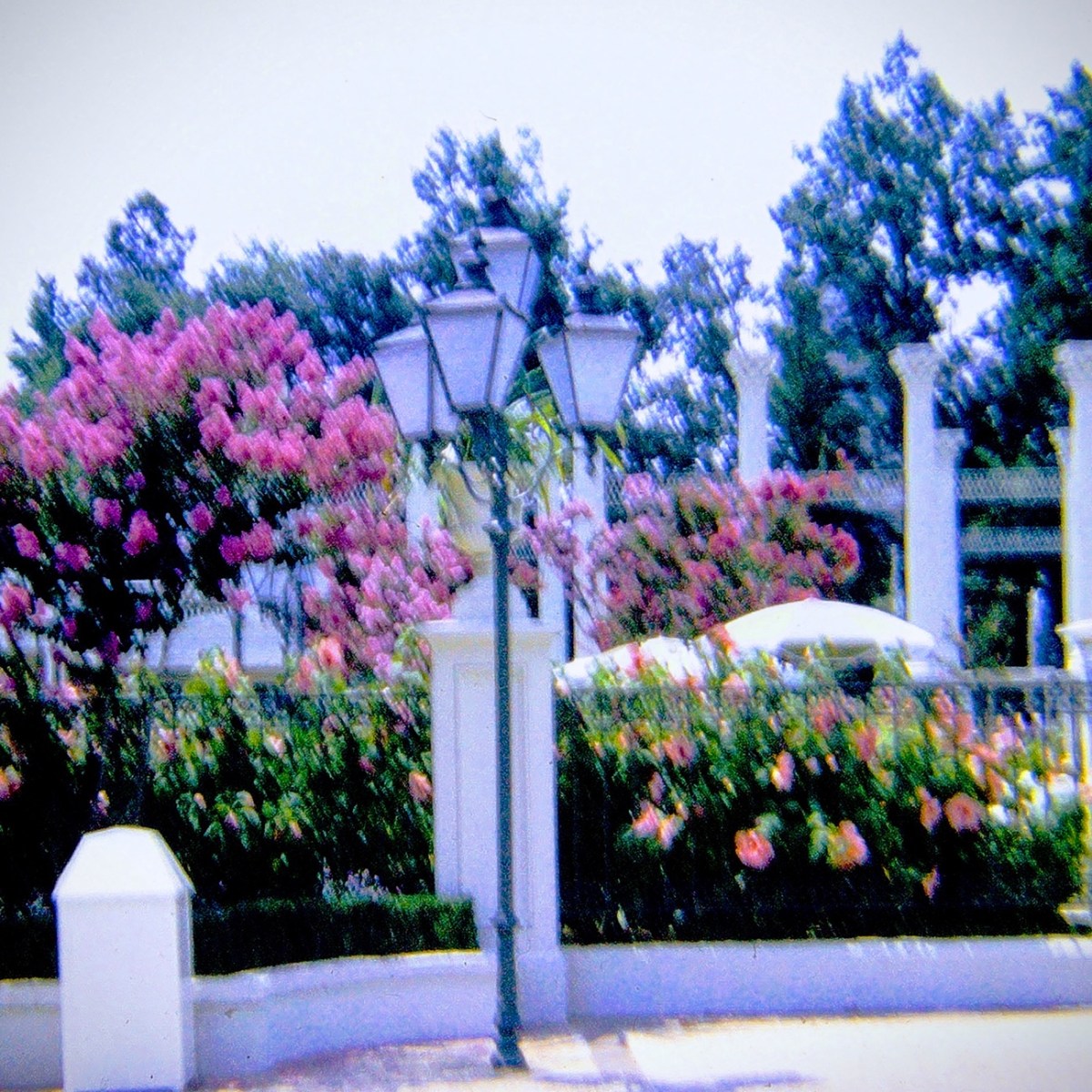
Solvang is a sun-soaked slice of Danish culture in the Santa Ynez Valley, where California wine cellars mix with European bakeries and shops. It’s where you can drink, dine and shop like a Dane without ever leaving the California sunshine.
The name Solvang means “sunny fields” in Danish. The city of Solvang was founded in 1911 by a group of Danish immigrants who purchased 9’000 acres of land near the Old Mission Santa Inés and built a community to preserve and promote Danish culture.
An interesting note (especially for Hallmark fans), A still from “A Very Charming Christmas Town,” the Lifetime Christmas movie set in Solvang.
God Bless. Thank you for visiting and sharing your time and thoughts with us. Take Care Cee! Chris thank you for taking good care of our friend. I appreciate y’all very much.
My selections for this week’s challenge were captured on film in 1978 in Solvang, California many years ago.
11270 KM To Copenhagen
This Statue is a milestone marker indicating the distance from Solvang to Copenhagen, Denmark, a mere 11270 kilometers apart.
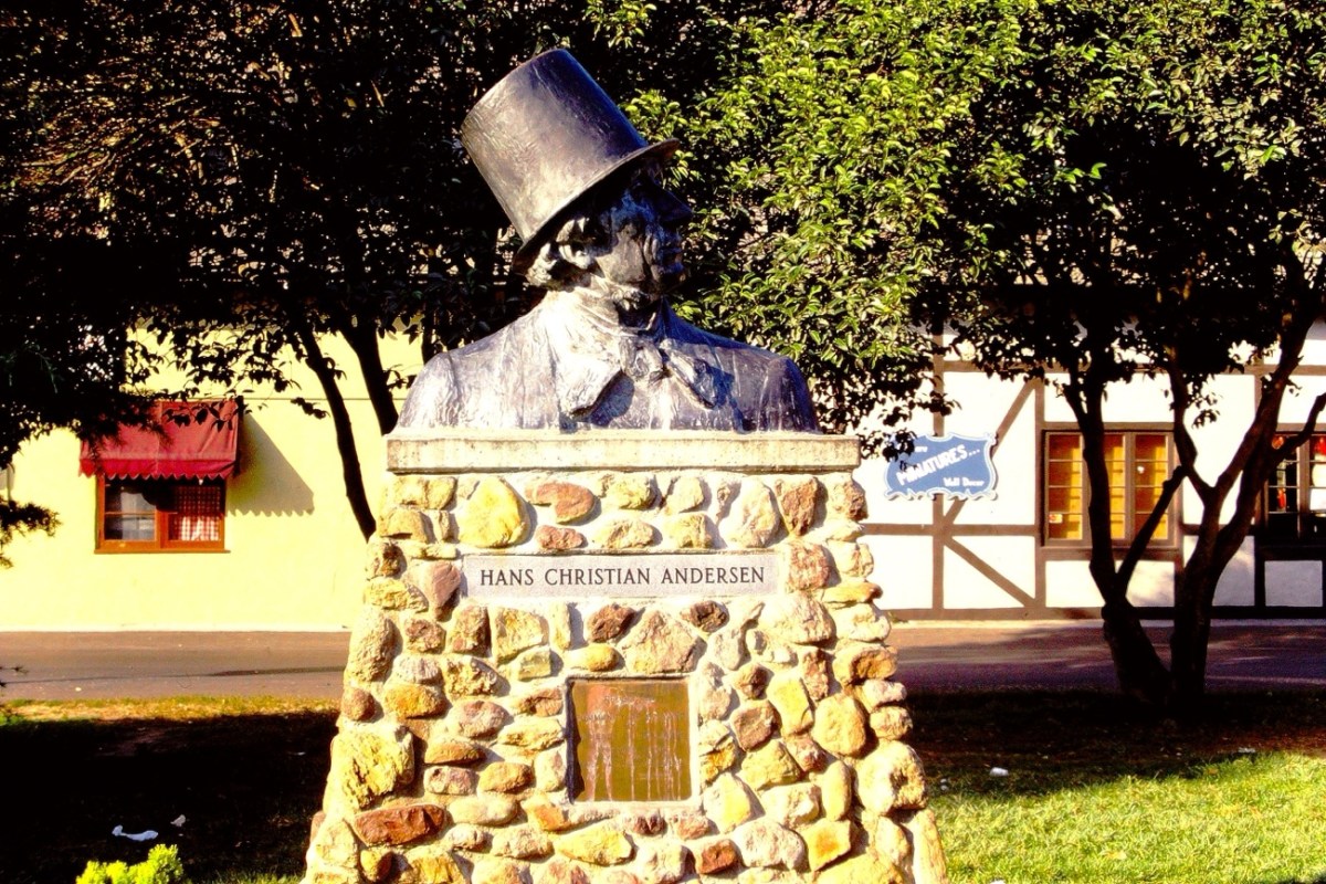
Hans Christian Andersen Statue
The Bronze Statue of Hans Christian Andersen is located in Hans Christian Andersen Park in Solvang, California. This Park is a tribute to the renowned Danish author, Hans Christian Andersen and was founded in 1970.
Presented To The Community Of Solvang By Friends Of Denmark Sponsored By The Solvang Chapter Of Rebuild National Park Society 1976
Solvang is known as the “Danish Capital of America” with its strong Danish heritage and European-inspired culture. It was founded in 1911. It wasn’t incorporated as a city until May 1, 1985.
Besides the Statue of Hans Christian Andersen there is a museum dedicated to him you might be interested in visiting. The monument of Hans Christian Andersen Denmark’s renowned Fairy Tale Writer was created by Henry Luckow Nielsen of Copenhagen, Denmark.
God Bless. Thank you for visiting and sharing your time and thoughts with us. Take Care Cee! Chris, thank you for taking good care of our friend. I appreciate y’all very much.
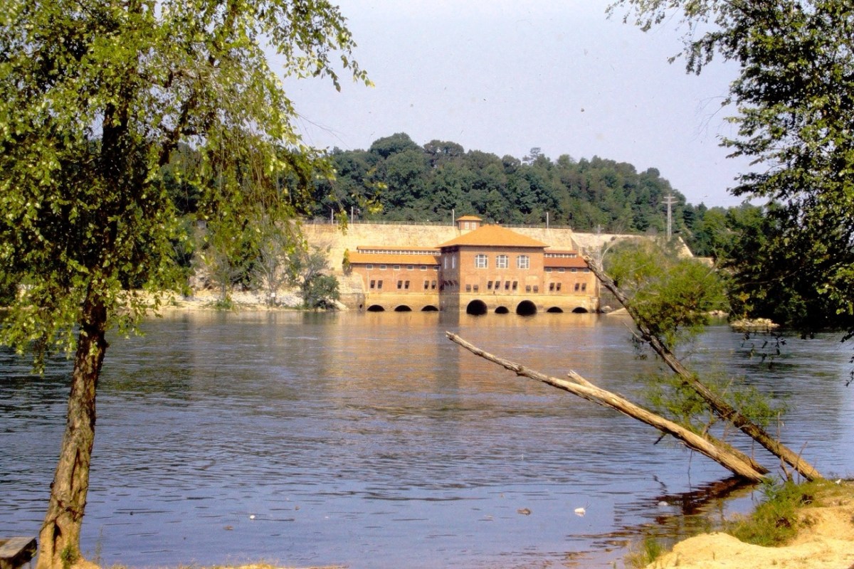
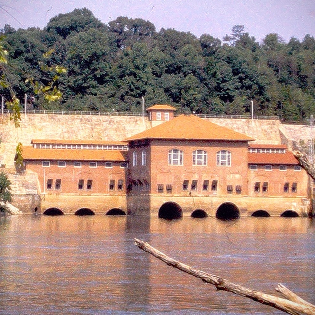
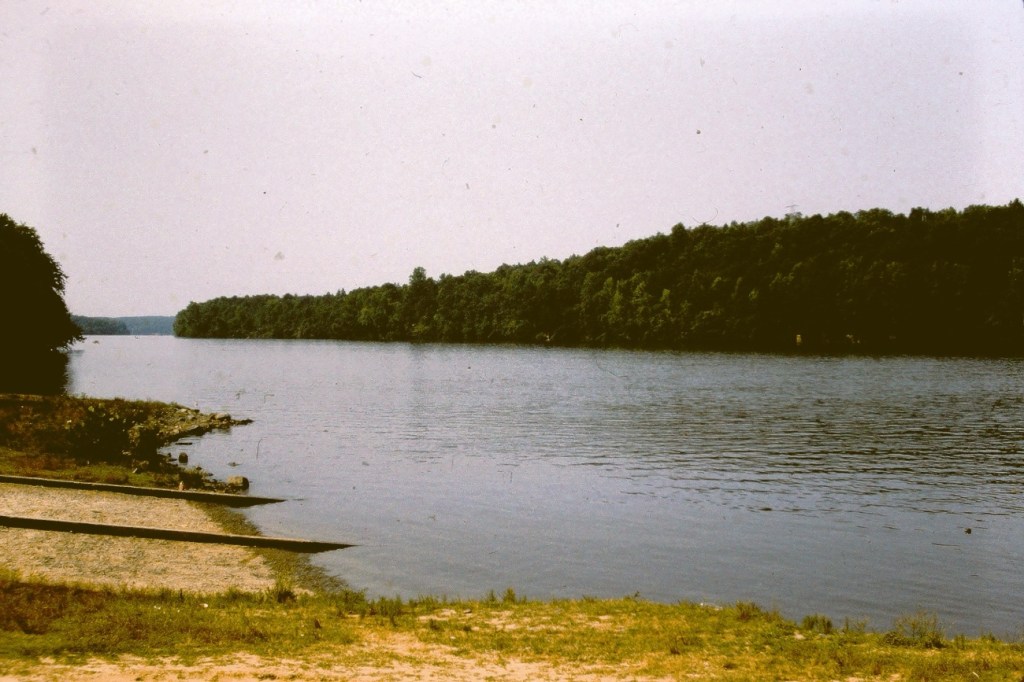
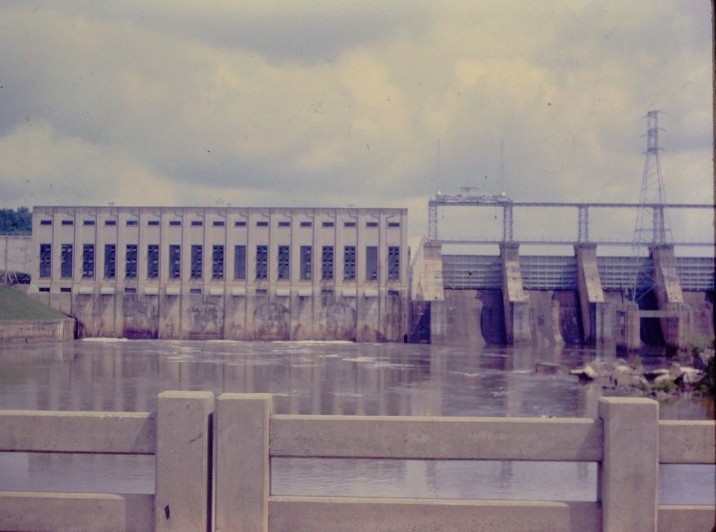
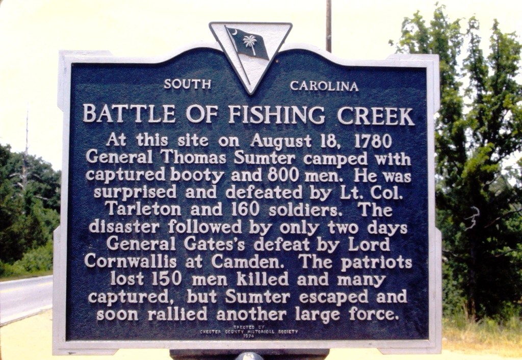
The Fishing Creek Hydro Station, ( I grew up knowing it as the Great Falls Hydro Station/Dam), is located on the Catawba River in Great Falls, Chester County, South Carolina. It borders Lancaster County, South Carolina. It was built in 1916 by the Southern Power Company, predecessor to the station’s current owner, Duke Power.
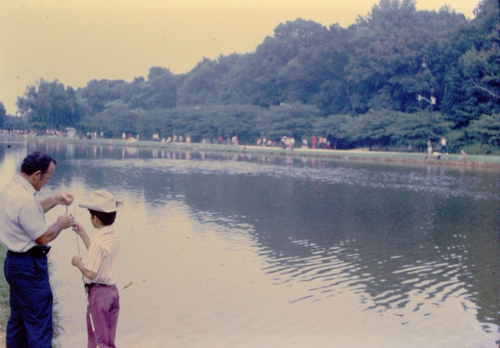
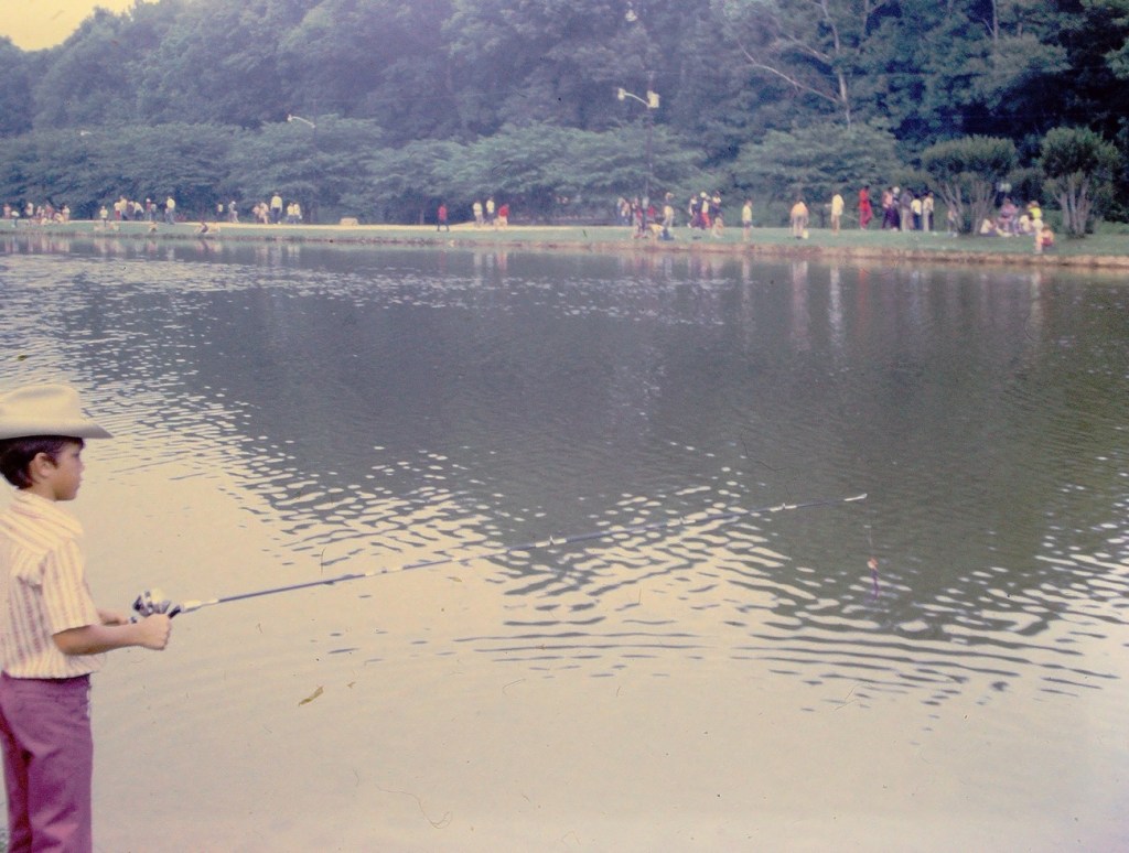
Just like the name suggests, the creek is a popular area for fishing 🎣 and recreation. Fishing Creek Lake – created by the dam – has four access point along the 61 miles of shoreline, including Landsford Canal State Park. [Of a side interest, the Catawba River at Landsford Canal State Park is an excellent area for seeing the Spider Lilies each Spring.]
Hydropower provides about one percent of Duke Energy’s U.S. energy production, but the company’s more than 30 stations are able to activate quickly to meet customer demand during extreme temperatures. In addition to reliable power, communities near lakes created by Duke Energy’s stations are able to enjoy fishing, swimming, kayaking, and even photography.
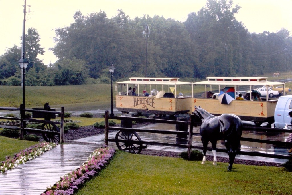
Leanne’s Monochrome Madness is a non-themed week; my own theme this week is surrounded by photos I’ve recently digitized about Heritage USA. To make viewing easier, I have made a slideshow of the monochrome photos in the beginning and ending with the original photos from my dad’s slides.
Heritage USA was a Christian -themed amusement park opened in 1978 by televangelists Jim and Tammy Faye Bakker, founders of The PTL Club. At its peak, it was the third-largest park in the USA behind Disney World and Disney Land, with almost 6 million visitors annually.
In the late 1980’s, Heritage USA was rocked by two debilitating scandals all while they were in the middle of a massive expansion. The organization had its tax-exempt status revoked after Jim Bakker was indicted on various federal fraud charges. Later he was accused of sexual improprieties with an encounter with a church secretary.
To add to the problems Heritage USA was experiencing, the park was heavily damaged by Hurricane Hugo in 1989, it shut down for good shortly after.
In this present day and age, only a few remnants of the park are still visible. The abandoned 21-story Heritage USA Hotel stands as an eerie and empty shell looming over the suburban landscape. The Upper Room Chapel was purchased sometime after the park’s closing and is maintained as a prayer room for a local ministry. The Heritage Grand Hotel is now the Heritage International Ministries Conference Center.
This month is going to be a little different for me since I haven’t been anywhere to use my camera this month. I have been busy digitizing my dad’s old slides. I hope it’s alright to post the last picture from the last roll of his I converted to digital format.
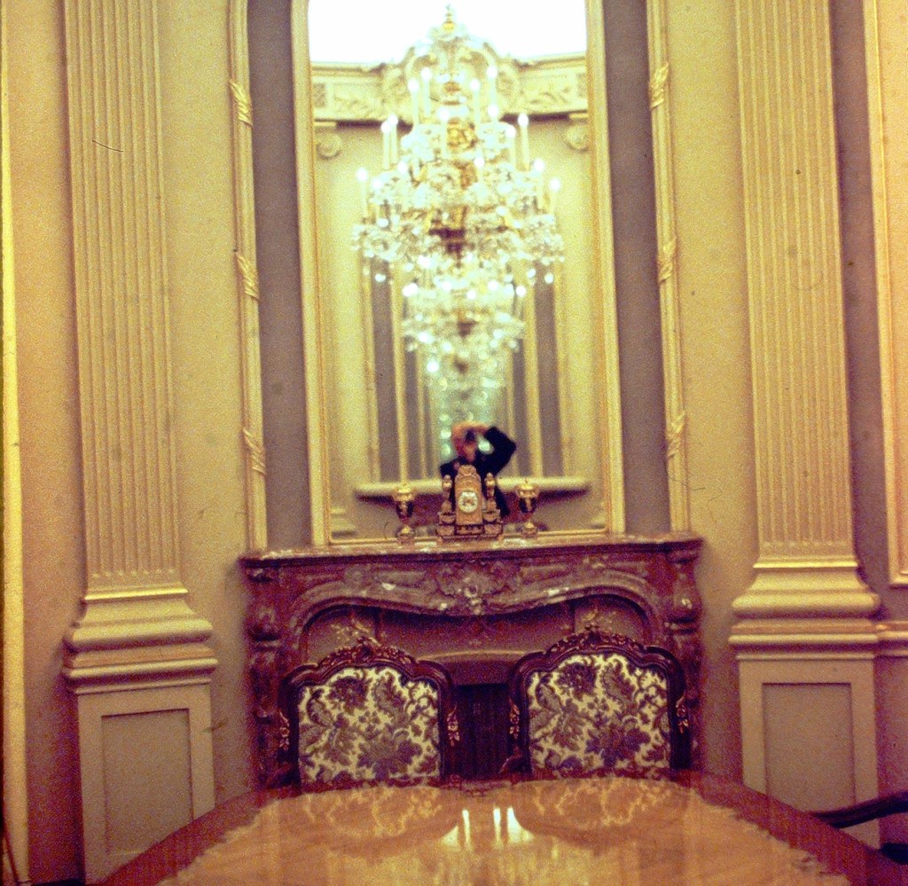
From my Dad’s Minolta XG-7 35mm:
My dad’s reflection of him taking the photo is in the mirror.
Dirt Path to the Boat DockDirt Road to the Catawba RiverDirt Pathway between the Trees Dirt Paths along the Catawba River & Great Falls DamBattle of Fishing Creek Sign by Road Great Falls, South Carolina
Location: Catawba River; Great Falls Dam; Great Falls, South Carolina, USA
God Bless. Thank you for visiting the Great Falls Dam. Enjoy the beautiful great outdoors. Thank you for sharing your time and thoughts with us. I appreciate y’all very much.
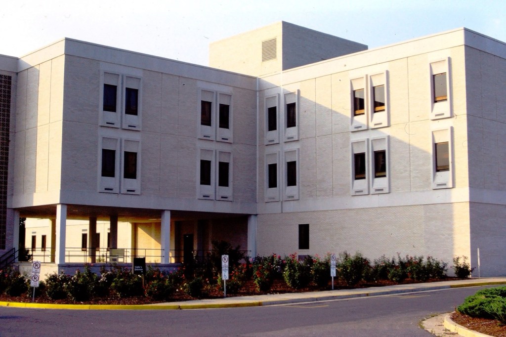
Huntersville Oaks is a short-term nursing and rehabilitation facility located in Huntersville, North Carolina. Huntersville is in northern Mecklenburg County just north of Charlotte, North Carolina.
My paternal grandfather stayed here receiving short-term medical care during the summer of 1980. When he was released, my dad took him back to his home in Great Falls, South Carolina.
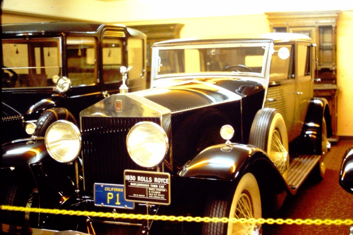
This is be the first in a line of Antique Car Doors and Windows that I’ll be posting from my dad’s photo albums of old slides. My dad worked for FORD most of his adult life except during his service in the U.S. Navy. He loved to attend car shows of any kind. These weekly features will be from an Antique Car Show he attended somewhere in California ( I’m guessing here since all the cars have California license plates.) The cars appear to possibly be from a private collection.
Do you like to attend cars shows? I have attended car shows in the past, however, I do not plan a whole day or outing around a car show like my dad used to do.
God Bless. Thank you for visiting. Have a wonderful week and enjoy the Outdoors. Thank you for sharing your time and thoughts with me. I appreciate y’all very much.
This hospital is currently known as Atrium Health Huntersville. It was formerly operated under the name of Charlotte-Mecklenburg Hospital Authority and was formerly known by Carolinas HealthCare System.
This was how it looked in the summer of 1978 when my paternal grandfather was receiving medical treatment here. My dad and his brother both visited frequently and stayed with him periodically until he was able to return home.
Location: Huntersville Hospital, Huntersville, Mecklenburg County, North Carolina, USA
God Bless. Take care of yourself and your loved ones. Appreciate them. Thank you for visiting and sharing your time and thoughts with me. I appreciate y’all very much.
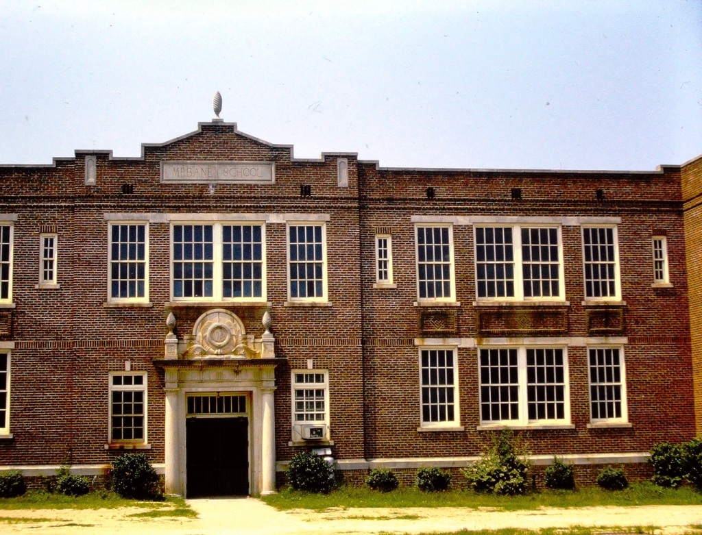
This is Great Falls Elementary School (formerly called Mebane Grammar School.) This is the school my dad attended when he was growing up in Great Falls, South Carolina.
Monochrome Rectangular Windows + Bricks, Doors & SignOriginal
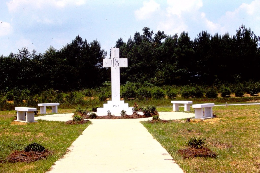
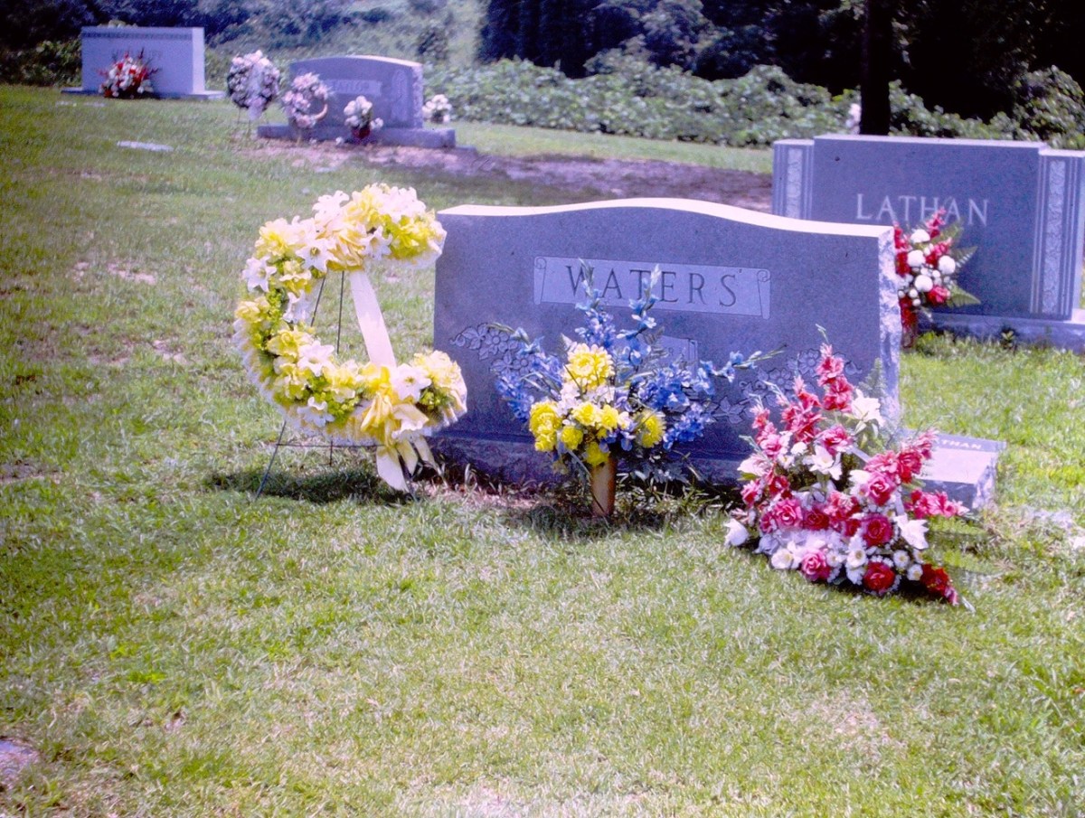
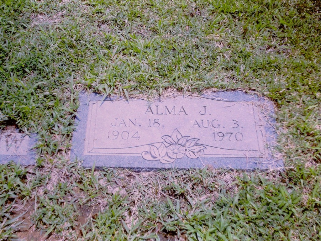
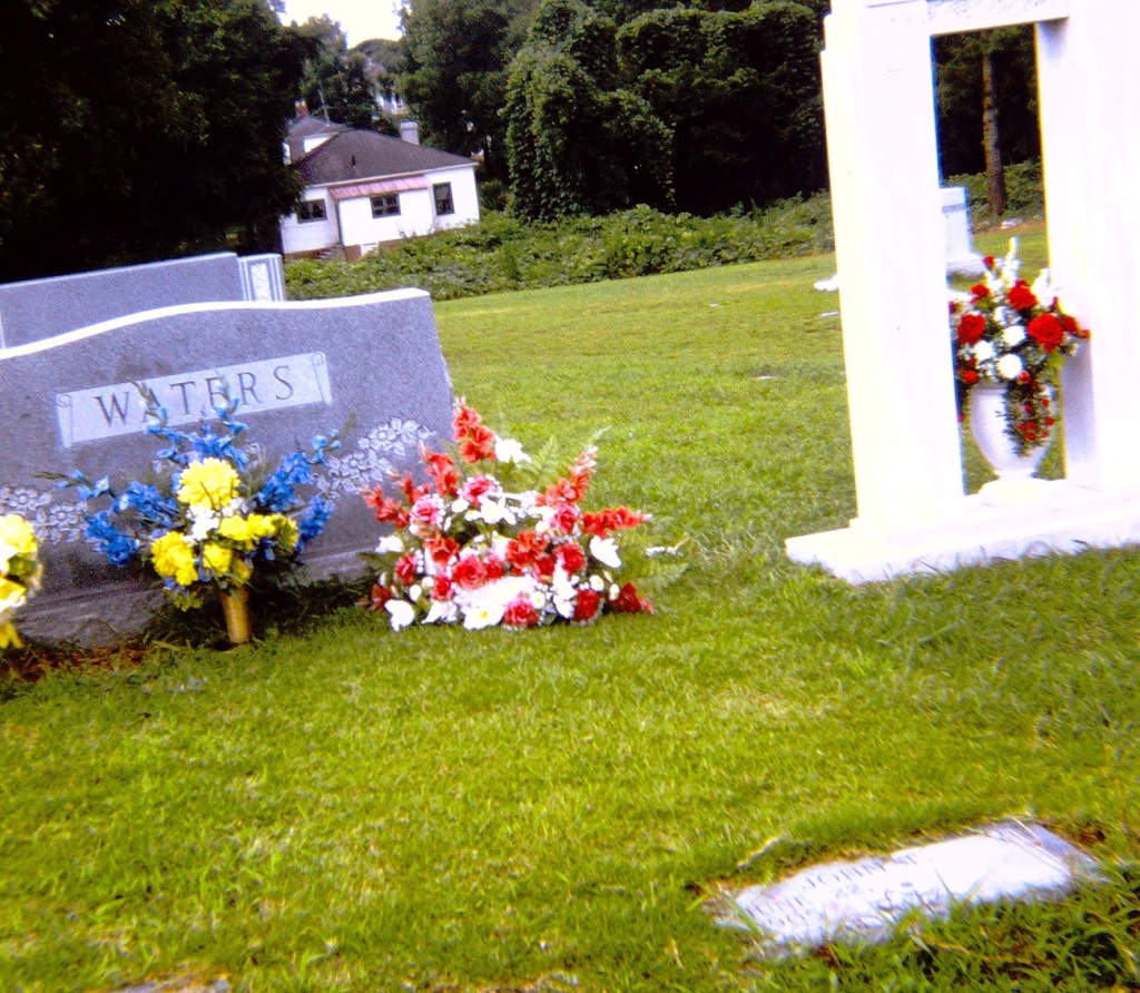
This FOWC is in alignment with the latest of my dad’s slides I have recently (just yesterday) digitized. They are of the familial burial grounds of my paternal grandparents.
Waters’ Headstone of my paternal grandparents
My father took them on one of our trips to visit his dad, his brother, his sister and her family. The location of the cemetery can be walked to through a path off of the street below my grandparents home.
Alma J. Jan. 18, 1904 – Aug. 3, 1970 My paternal grandmother
This was the first time we (my immediate family) had been to the cemetery since my paternal grandmother’s passing in 1970. When she passed, my dad was the only one of us that could fly back for her funeral service.
This view allows us to see both the Headstone and my paternal grandmother’s Foot Marker in the Greenlawn Cemetery.
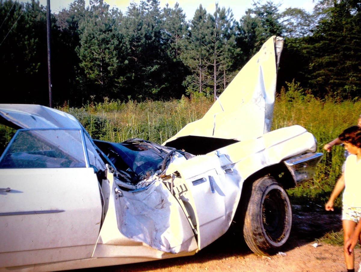
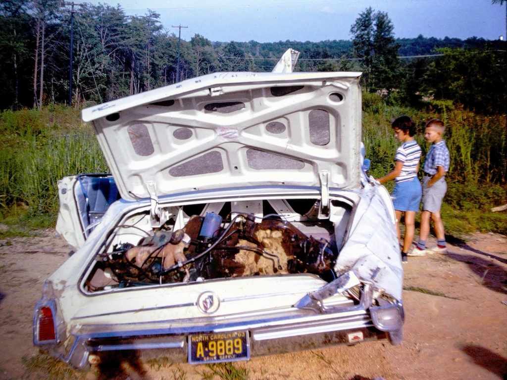
Rummaging through my dad’s old slides I ran across these pictures of a crashed and smashed car where you could clearly see the damage done to the doors, the windows, the hood, and trunk of the car.
Crashed & Smashed Car Doors
I am not sure who the car belonged to, but I know the children who are shown looking at the crashed and smashed vehicle. They are my cousin and my brother. I do not even want to consider what happened to the person or persons who might have been in the car. By looking at those car doors it would have been a miracle if anyone survived without injuries.
Crashed Car Trunk “Door”
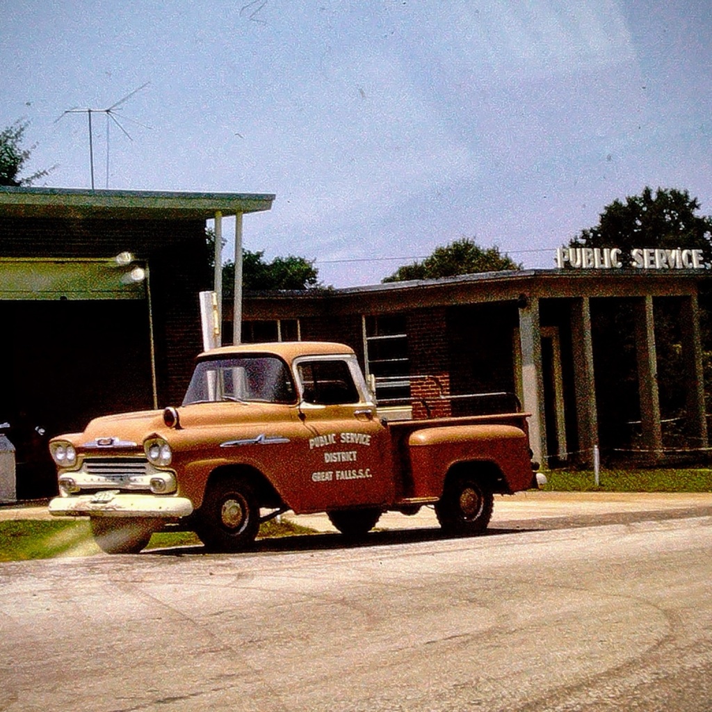
I believe I would prefer the Public Service District truck which drives around Great Falls performing the necessary maintenance and repairs making sure the Town of Great Falls is safe, secure, and it proper working order.
Location: Town of Great Falls, Chester County, South Carolina, USA
God Bless. Thank you for visiting the Town of Great Falls with us. Hope you have a fantastic day filled with joy, laughter, and no wrecks. Thank you for sharing your time and thoughts with me. I appreciate y’all very much.
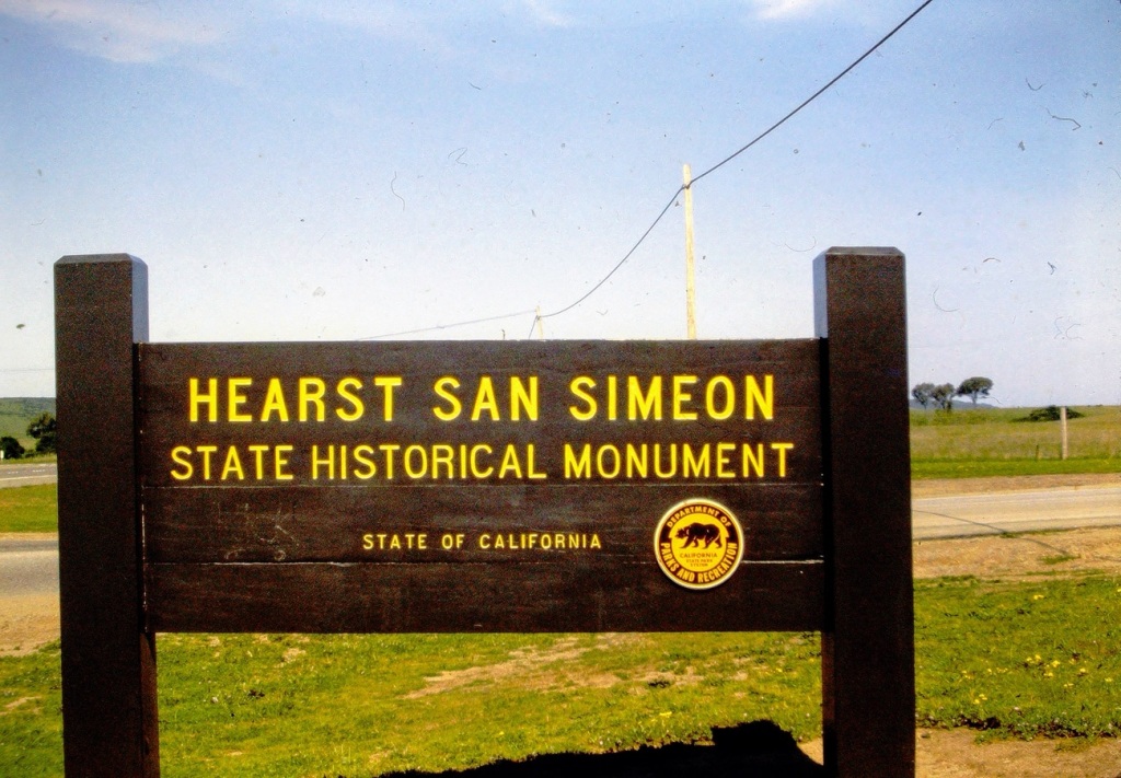
Judy’s Numbers Game can bring about interesting results and insights from those who choose to participate. The challenge is alive, let’s get Blogging. In searching for the #147 and its variations the results that popped up all had the central focus around Hearst. Therefore, I selected a variety of photos around the Word Hearst and Hearst Castle.
As we approach Hearst Castle we see the sign informing us we are arriving at our desired destination.
Hearst San Simeon State Historical Monument
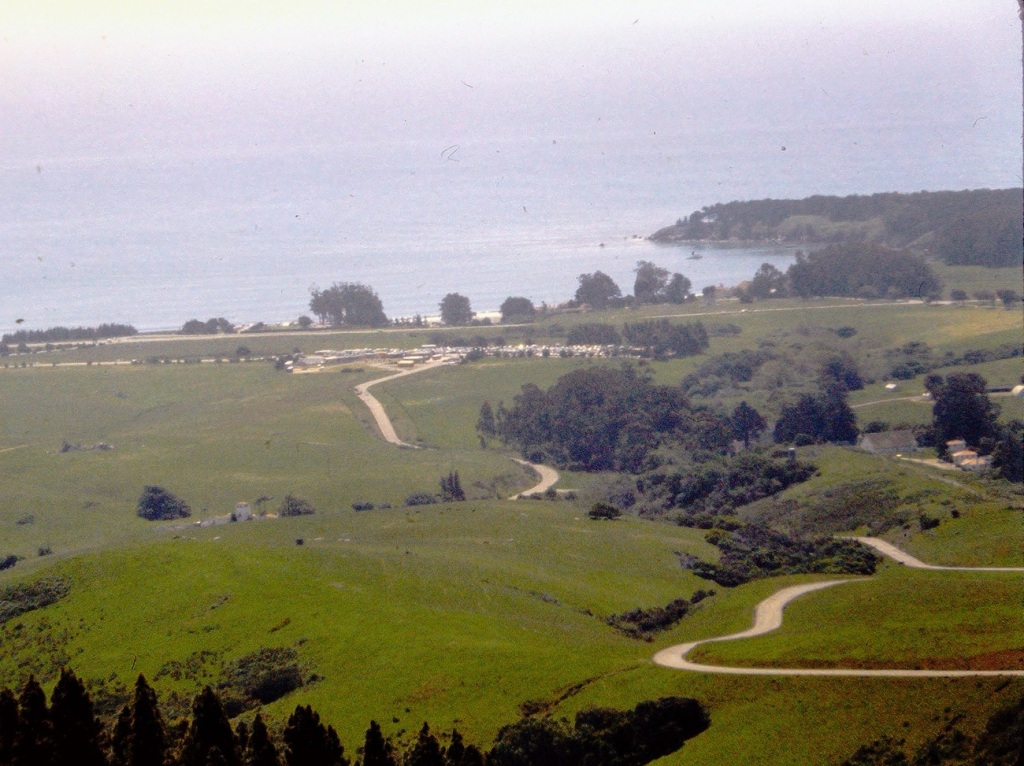
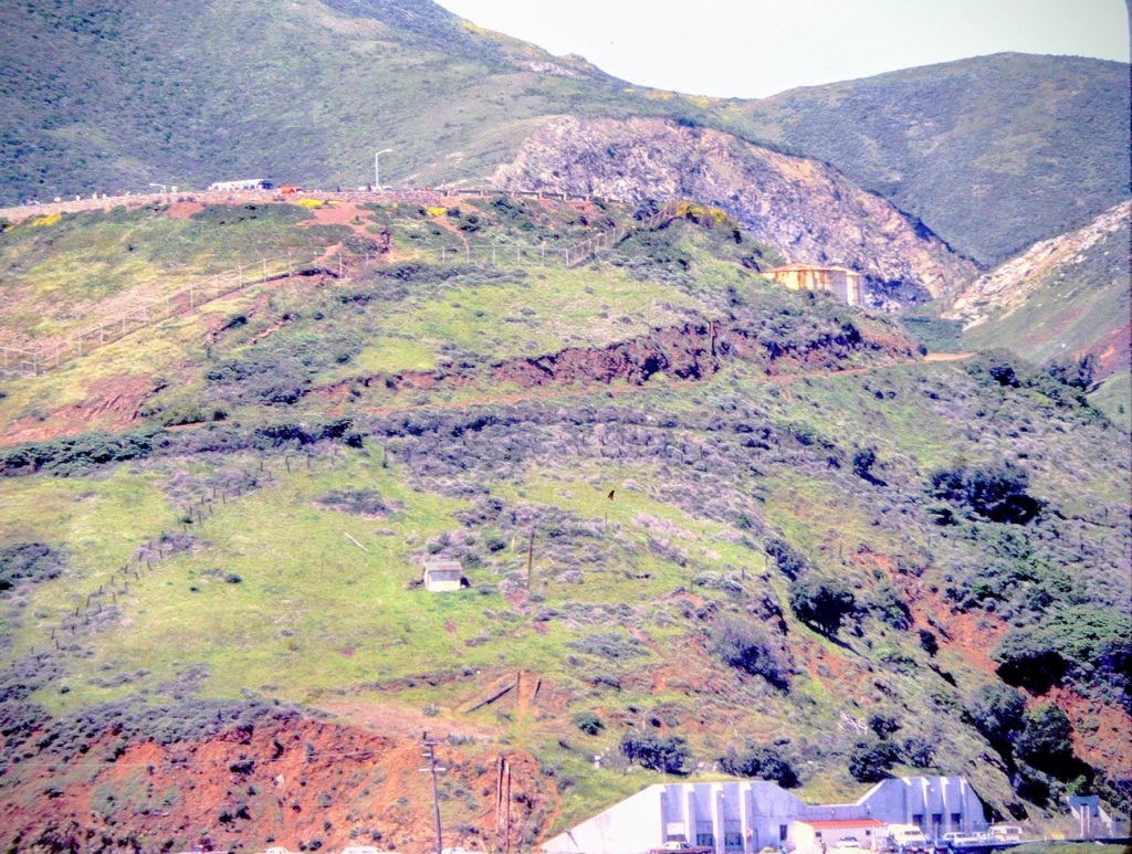
The long and winding road up to the top where Hearst Castle is located.
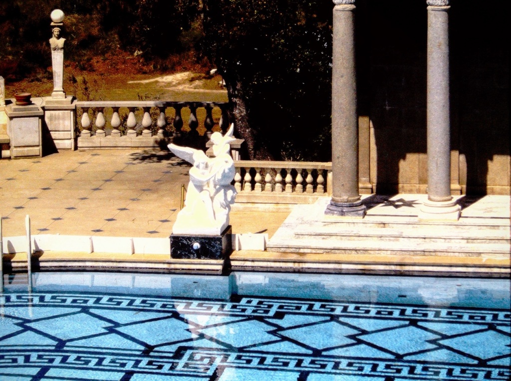
Touring the outside grounds at Hearst San Simeon we see statues poolside …
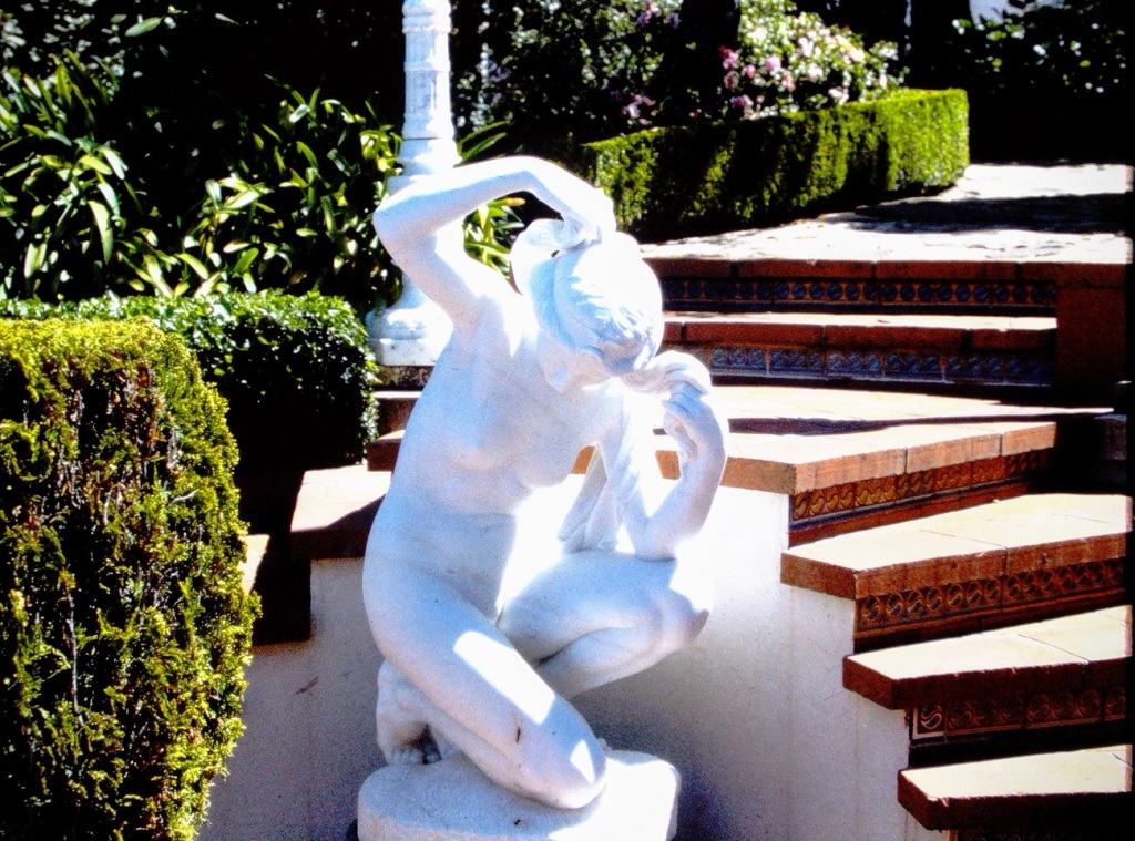
And by the stairs leading upward …
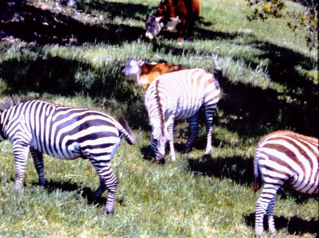
Continuing our tour of the grounds we come upon the Hearst Ranch. William Randolph Hearst kept Fifty (50) species of herbivores on his ranch. They included around 126 Zebras plus bison, fallow deer, antelope, zebras, elk, camels, kangaroos, and giraffes.
We also could see the vastness of the Hearst Ranch where the numerous animals grazed.
At last we come to the end of today’s tour as more about Hearst Castle will come in a later post.
Location: Hearst San Simeon State Historical Monument; San Simeon, California, USA
God Bless. Thank you for tagging along on our tour. Thank you for sharing your time and thoughts with us. Have a wonderful week. I appreciate y’all very much.
Ritvais this week’s host for the Lens-Artist Photography Challenge; she has chosen the theme of behind. What backgrounds to choose may seem easy, but some thought process may determine just the right background & balance you what to achieve and capture when you are snapping your photos.
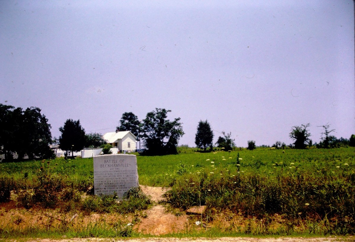
Battle of Beckhamville Marker Beckhamville, Chester, South Carolina, USA
BATTLE OF BECKHAMVILLE
May 1780
Inscription.
British under Houseman surprised and defeated by band of 33 patriots under Capt. John McLure with 9 Gaston brothers and neighbors, who struck first blow for liberty and resisted attempt to subject people to oath of allegiance to king.
Erected.
By Citizens of Chester County
Mary Adair Chapter DAR
May 10, 1942
This Historical Marker was taken by my father in the summer of 1963. It is located at 34° 35.424′ N, 80° 55.194′ W in Beckhamville, South Carolina. Beckhamville is located in Chester County just south of Great Falls where my dad grew up. You can find the Marker at the intersection of State Highway 97 and State Highway 99, on the left when traveling east on State Highway 97.
The Battle of Beckhamville is recorded to have been fought during the Revolutionary War around June 6, 1780. This was following the disasters at Charleston and Waxhaws where Patriot forces struck a blow against the British in South Carolina.
On June 6, 1780, Captain McClure and his small force, wearing hunting shirts, wool hats and deer-skin caps and each armed with a knife and rifle, attacked Houseman and routed about 200 of the gathered loyalists at Alexander’s Old Fields. The Battle of Beckhamville’s victory helped solidify resistance to the Crown in this up country area.
Beckhamville was also known by Beckham’s Old Field and Alexander’s Old Field. Chester County has battlefields, historic markers, monuments, cemeteries, and stories that relate to the important role this area played in our winning our Independence from England.
DAR stands for the Daughters of the American Revolution. The DAR strives to promote the historic preservation, education, and patriotism.
Location: Beckhamville, Chester County, South Carolina, USA
God Bless. Thank you for taking a trip with me to visit an historical marker near my father’s hometown. Thank you for sharing your time and thoughts with me. I appreciate y’all very much.
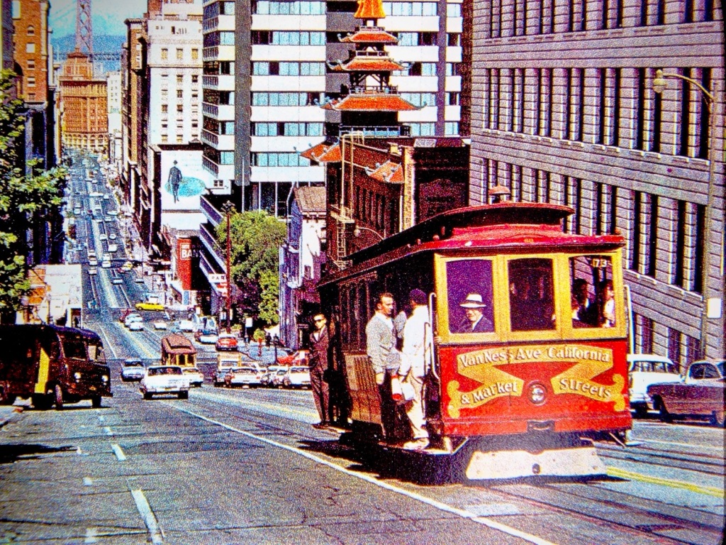
San Francisco Cable Car – Van Ness Ave California Street
Cable Cars have been carrying passengers in San Francisco since 1873. Cable cars were invented by Andrew Smith Hallidie. He based his system on early mining conveyance systems which dominated the city’s transit scene for more than 30 years.
The San Francisco cable car system is the world’s last manually operated cable car system and an icon of the city of San Francisco. Of the 23 cable car lines established between 1873 and 1890, only three remain (one of which combines parts of two earlier lines): two routes from downtown near Union Square to Fisherman’s Wharf, and a third route along California Street.
The vast majority of the millions of passengers who use the system every year are tourists. Due to the high volume of tourists desiring to ride the cable cars, the wait time to get on can be up to or exceeding two (2) hours. The Cable Cars are amongst the most significant tourist attractions in San Francisco, along with Alcatraz Island, the Golden Gate Bridge, and Fisherman’s Wharf.
The San Francisco Cable Cars are one (1) of two (2) street railways named on the National Register of Historic Places as a National Historic Landmark. The other street railway on the National Register of Historic Places is the St. Charles Streetcar Line in New Orleans.
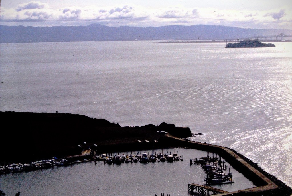
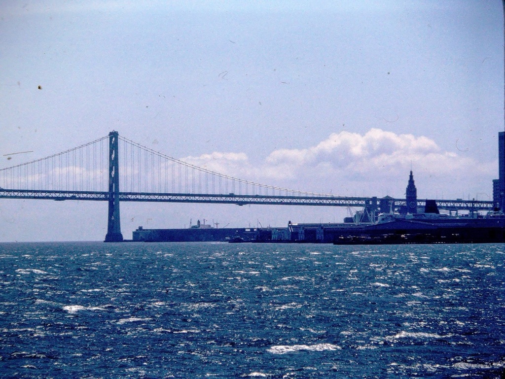
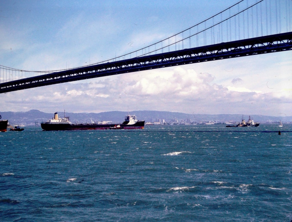
While on our San Francisco Bay Discovery Cruise we were able to see beautiful views surrounding the Bay. We were able to view unique perspectives of the amazing architectural features of the Bay Area Bridges.
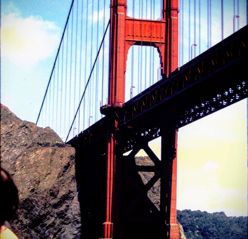
Looking at The Golden Gate Bridge from the waters below …
The Golden Gate Bridge is a suspensionbridge spanning the Golden Gate, the one-mile-wide (1.6 km) strait connectingSan Francisco Bay and the Pacific Ocean.
Golden Gate Bridge
The structure links the U.S. city of San Francisco, California—the northern tip of the San Francisco Peninsula—to Marin County, carrying both U.S. Route 101 and California State Route 1 across the strait.
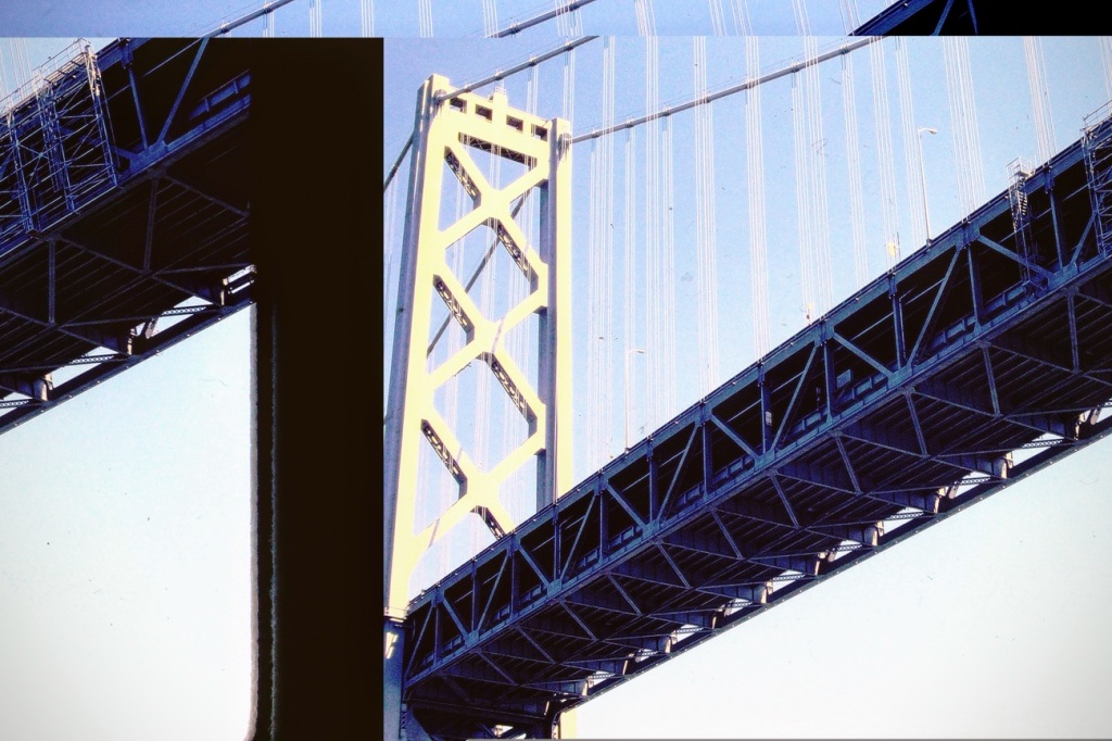
The San Francisco-Oakland Bay Bridge is made up of two (2) bridge segments: a skyway structure/single anchored suspension bridge between Oakland and Yerba Buena Island, and a suspension span from the island to San Francisco. The two (2) are connected by the world’s largest diameter bore tunnel.
The San Francisco-Oakland Bay Bridge is the region’s workhorse bridge, carrying more than a third of the traffic of all of the state-owned bridges combined. It is also a jewel along the San Francisco waterfront.
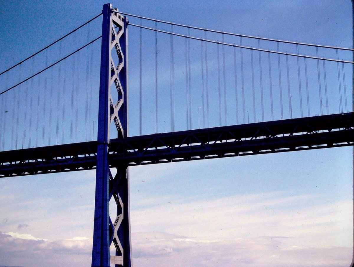
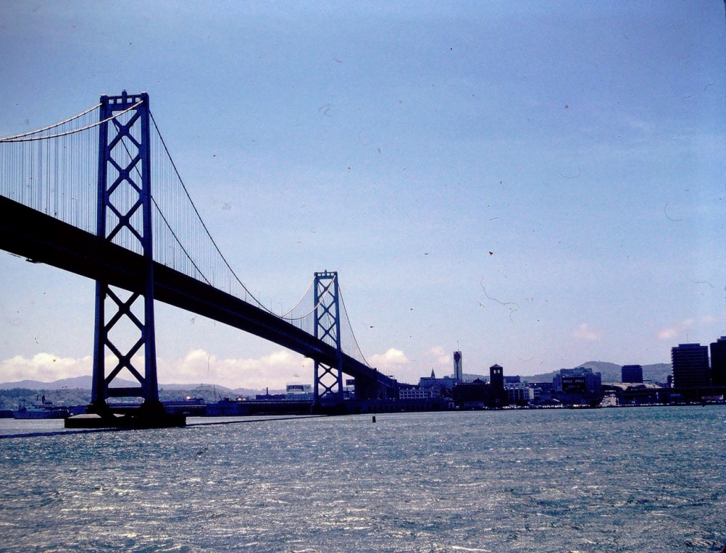
San Francisco Bay Bridge
The Eastern Span of the San Francisco-Oakland Bay Bridge underwent an extensive replacement renovation to replace a seismically unsound portion of the Bay Bridge with a new self-anchoredsuspension bridge (SAS) and a pair of viaducts. The span replacement took place between 2002 and 2013, and is the most expensive public works project in California history. The Eastern Span replacement upgrade was part of a plan to make the bridge more seismically sound. The replacement was necessary due to an earthquake of unanticipated magnitude of the horizontal motion caused by the Loma Prieta Earthquakecausing significant damage to the Bay Bridge. It also caused section of a major highway along the bay (a portion of it double-decked) to collapse; repairs on these were completed by the late 1990s.
Oakland Bay Bridge
The San Francisco-Oakland Bay Bridge was listed in the National Register of Historic Places in 2001. The Bay Bridge is significant for its influence in the California Bay Area.
Bay Bridge Architectural Design
The San Francisco-Oakland Bay Bridge’s multi-modal design is a direct example of the mindset of commuters during the 1930s. Constructed in 1936, the bridge was used to support the increase of automobiles and public transit lines in the early half of the 20th century.
San Francisco-Oakland Bay Bridge
Today the Bridge continues to pay a vital role in transportation as it serves as a major freeway connector for many who travel to and from the Bay Area.
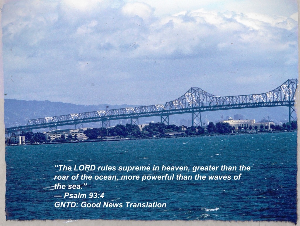
Looking through the my dad’s old slides the photos of these Bridges reminds me of a 70’s song by Simon and Garfunkel called “Bridge Over Troubled Water.”
This week’s number for Judy’s Number Game is 145. Come play along with us. You’ll never know what fun you’ll be missing if you don’t join in the game.
Rummaging through my photos I came up with a mixture of old and more recent photos for your viewing pleasure for this week’s challenge.
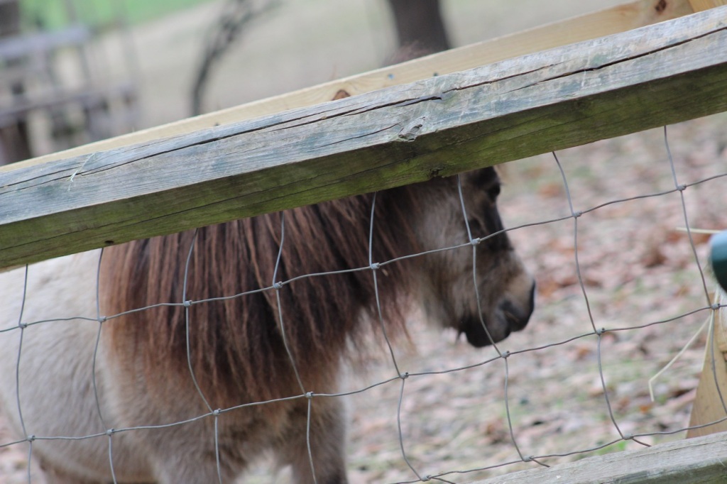
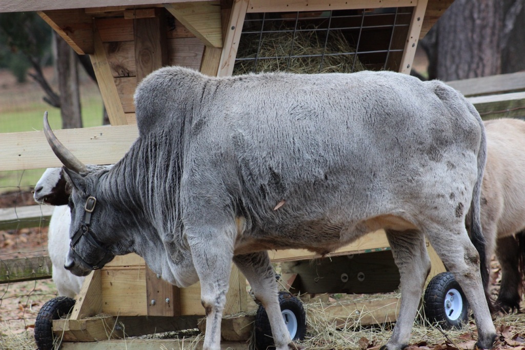
First up we have Farm Animals …
Donkey
At Anne Springs Close Greenway’s Stables Entrance in Fort Mill, South Carolina.
Zebu Cattle Bos taurus indicus
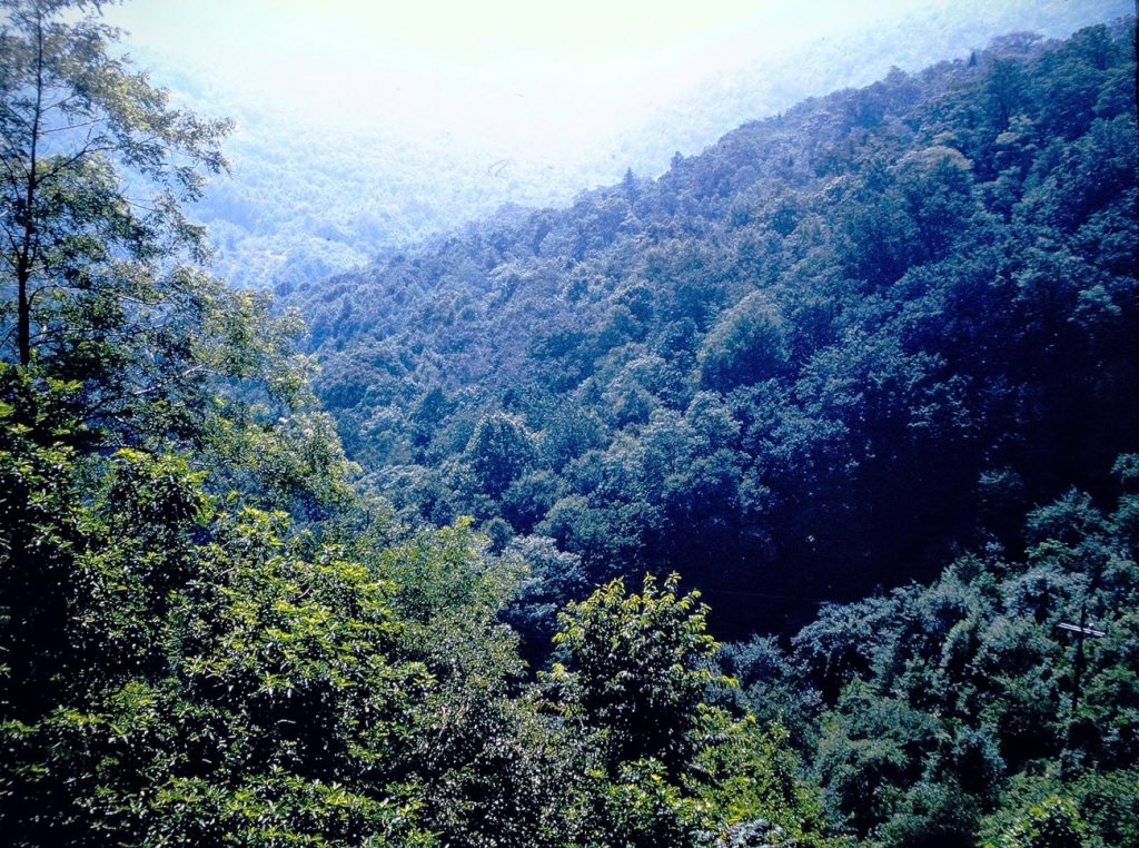
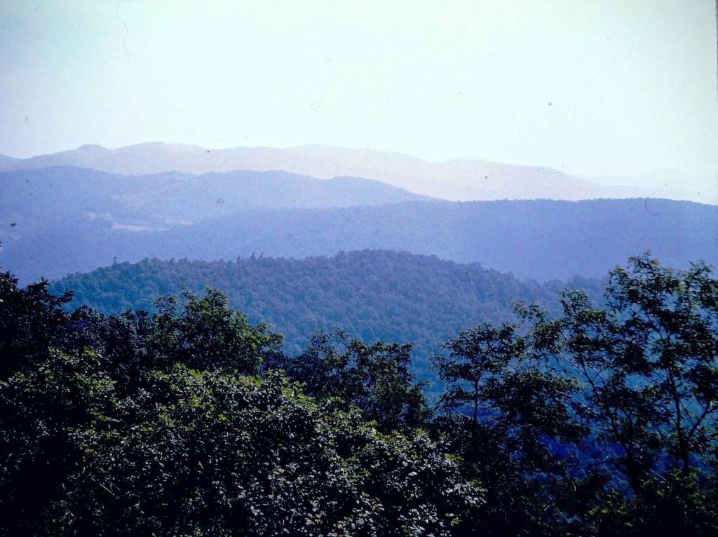
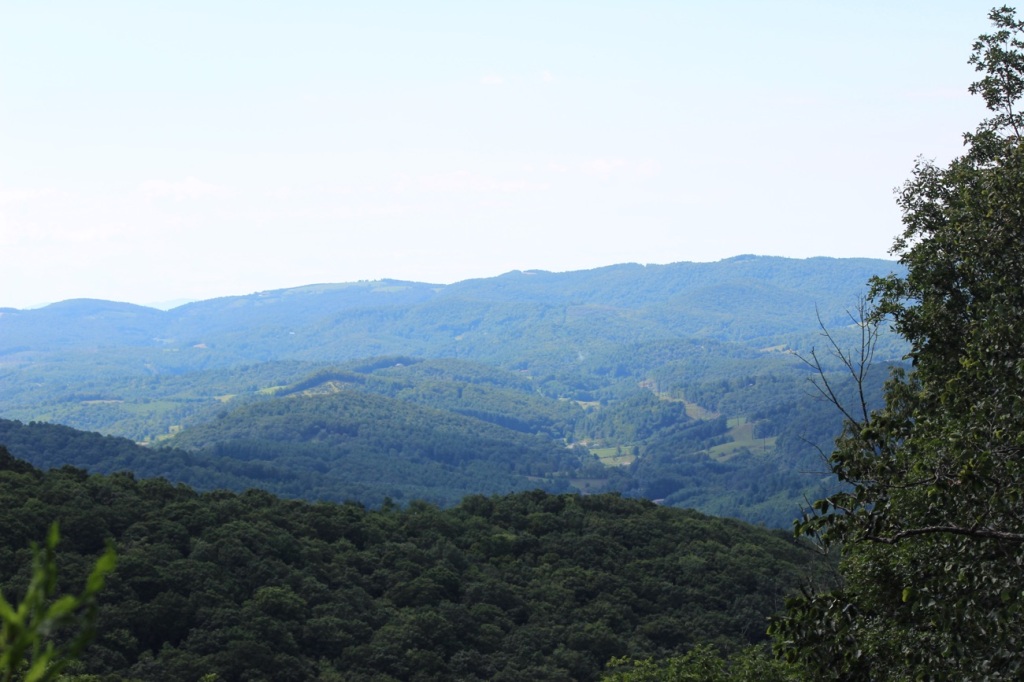
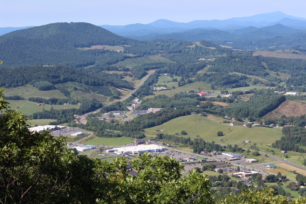
Next, We Head Up to the Mountains of North Carolina …
View from Sunrise Overlook Blue Ridge Parkway, North Carolina View from Mount Jefferson Mount Jefferson State Natural Area Ashe County, North Carolina
And Lastly for this Week we have a Couple of Miscellaneous Throwbacks …
At Franklin D. Roosevelt’s Little White House Historic Site Museum Warm Springs, Meriwether County, Georgia, USAThe Sophia Loren diorama Movieland Wax Museum Buena Park, California
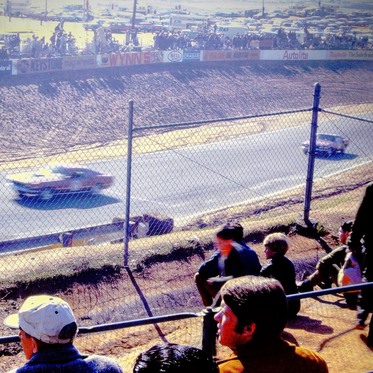
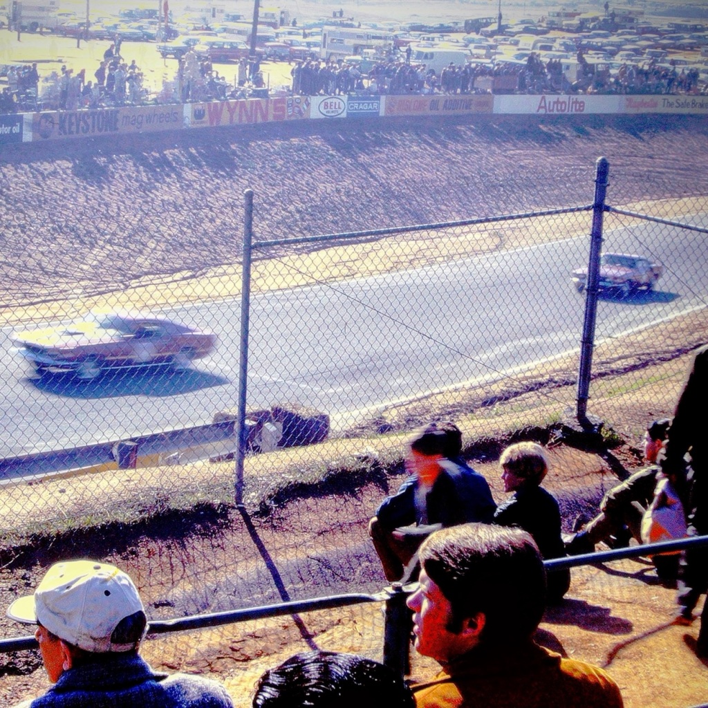
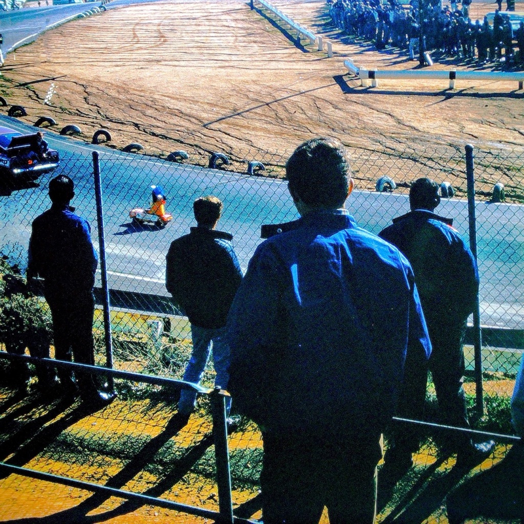
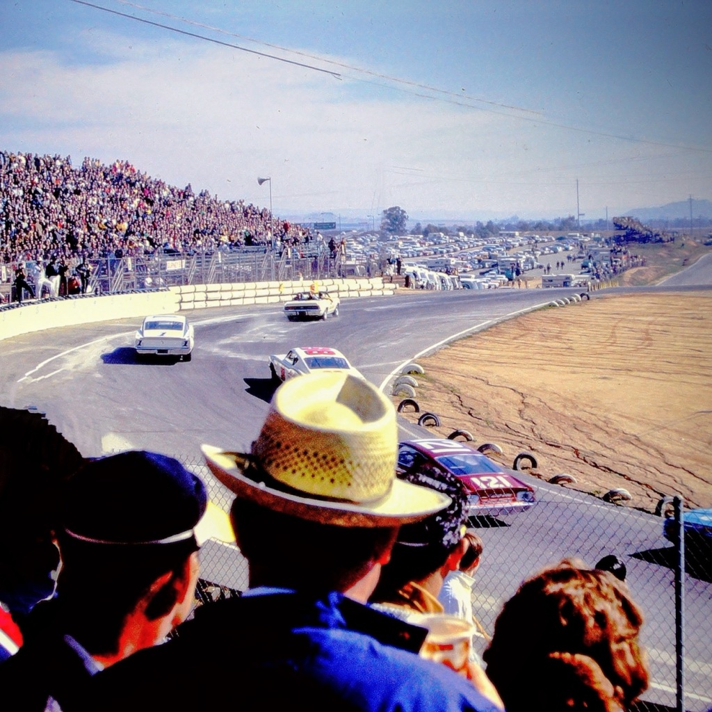
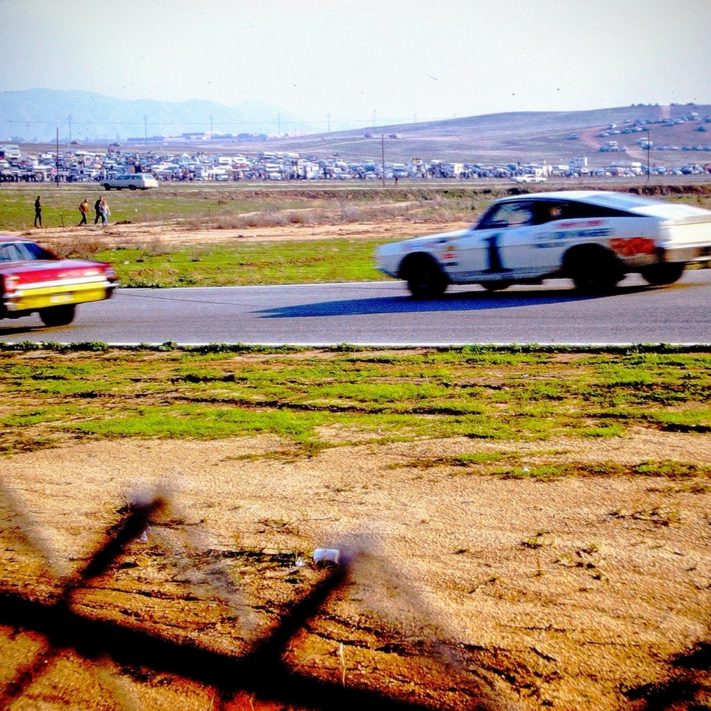
Watching Races at the Cajon Speedway was one of my dad’s favourite things to do on a weekend. It is not something he was able to enjoy that often, but he was thrilled whenever the possibility occurred. When he wasn’t able to go to the Speedway, he would watch NASCAR or the Indy 500 when he could get control of the TV away from my mom. My dad would have been 95 this week. He’s been gone now for 28 years, however, I still miss him.
Location: Cajon Speedway; El Cajon, California, USA September 1970
God Bless. Thank you for watching the races with us. The Cajon Speedway races don’t compare to the Coca Cola 600 which many people watched this weekend, but for El Cajon and San Diego County it was an amazing pastime. Thank you for sharing your time and thoughts with me. I appreciate y’all very much.
Wow, we made it the Summit. It took all our energy and determination, but we did it. Look at the views, they are so amazingly beautiful. It was worth the strenuous hike to see the spectacular view.
Location: Zion National Park; near Springdale, Utah, USA
God Bless. Thank you for Moving Forward hiking up to the Summit of Lost Peak with us. Thank you for sharing your time and thoughts with me. I appreciate y’all very much.
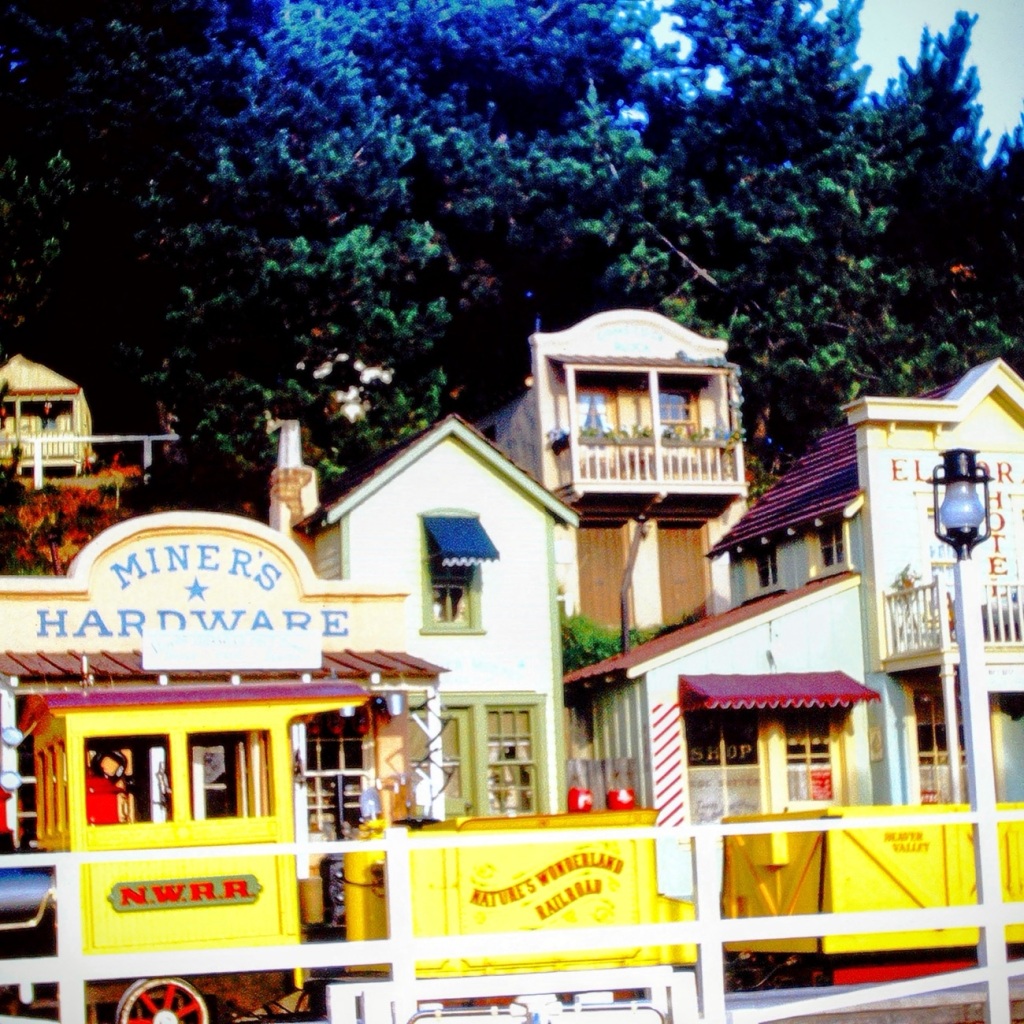
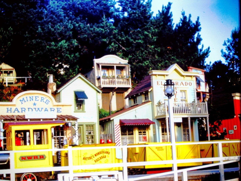
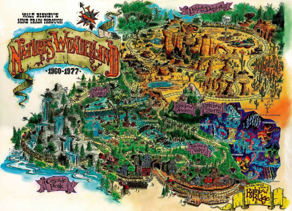
Going back to our Disneyland adventure let’s take. Look at another attraction we rode. We are taking a look at our ride on Disneyland’s Mine Train through Nature’s Wonderland.
The Disneyland Mine Train was an attraction through Nature’s Wonderland in Frontierland that ran from May 28, 1960 until January 2, 1977. It was previously called Rainbow Caverns Mine Train and later became Big Thunder Mountain Railroad.
Nature’s Wonderland Railroad
The Mine Train rode past the mining town of Rainbow Ridge where you could observe what a mining town would have looked like with a hardware store, the El Dorado Hotel. It allowed you to feel like you were in the old west. The train would take you through a tunnel and into Beaver Valley, where you could witness beavers at work chomping their wood, squirrels, raccoons, rabbits, foxes and other forest animals.
After Beaver Valley the train moved forward going across a bridge by Cascade Peak, where you could feel the mist coming from the waterfall on your skin. At this point you could see jumping fish, mountain goats, and swimming bears.
The narrator would announce where you were coming to and what you would see at each destination. From Beaver Valley the train moved forward into Bear Country where you could see 2 large elk with their antlers intertwined, fighting each other.
From there the Mine Train would continue moving forward taking you in a circular shape around the Living Desert, with the other half being a forest filled with desert cottontails, rattlesnakes, waterholes, tortoises, badgers, and armadillos. The displays made everything seem so realistic and lifelike.
The last portion of the ride took you through Rainbow Caverns. In the Caverns you could see giant stalagmites, stalactites, and colorful falls on every side.And if you looked real carefully, you’d see geyser grotto, and the witch’s cauldron.
Thanks for climbing aboard and joining us for our ride on Disneyland’s Mine Train through Nature’s Wonderland adventure.
Traveling back in time to December 1965, to a family day trip. Packed and loaded in our 1962 Ford Galaxie 500 with a cooler of drinks, snacks, and sandwiches; we began our approximately hour and fifty-one (1hr 51min) drive north moving forward through the city streets until turning onto CA-94 and eventually onto the recently constructed I-5.
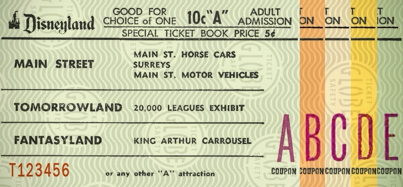
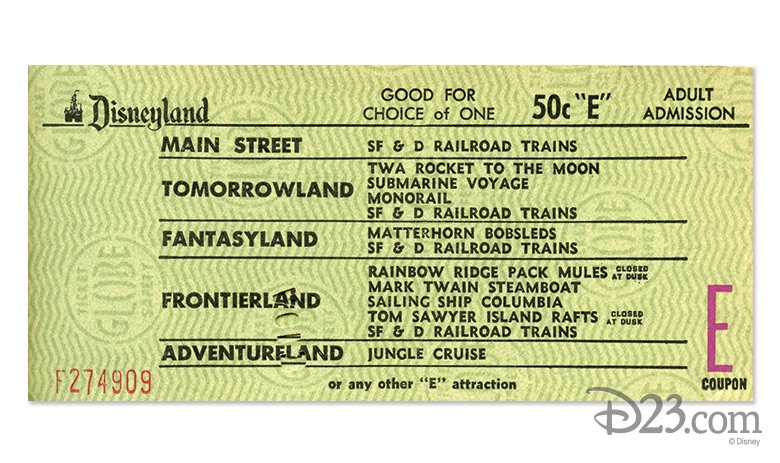
Upon arriving at the Disneyland entrance, my parents purchased our admission and ride tickets. General Admission prices for adults at that time was $2.60 per adult and included a ticket for the Monorail. Junior prices were $1.80 and Children’s admission prices were $1.10. Tickets for the rides cost extra. A book of 10 tickets ranged from $3.00 to $5.00.
1965 Disneyland Ride Tickets A-ESelection of E Ticket Rides
In 1965, the cost of admission was considered a lot of money. However, people considered visiting Disneyland was a worthwhile family adventure.
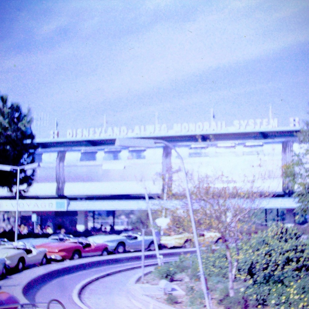
After our tickets were purchased and we entered the park, we selected what rides we wanted to ride. We went to each ride or attraction as a family unit, not venturing off individually. Our first ride of choice was the Monorail.
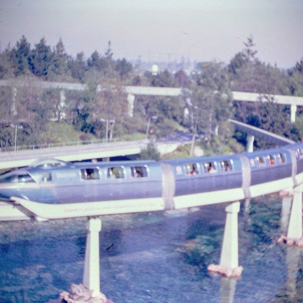
Disneyland Monorail
The Monorail was considered as a mid-century marvel and captured the hearts and imaginations of the theme park and Disney fans. The Monorail was a Highway in the Sky which allowed for a unique experience viewing the park from above.
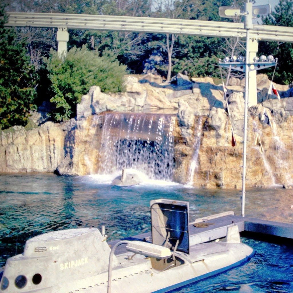
Our next selection was to ride the submarine adventure. The attraction features vehicles that were designed to look like submarines. It required the E ticket was in the Tomorrowland area of the park.
Early Disneyland Submarine
The submarines took us on an adventure under the sea simulating fish and other sea creatures allowing us to imagine we were really being submerged and viewing the undersea life of a tropical lagoon.
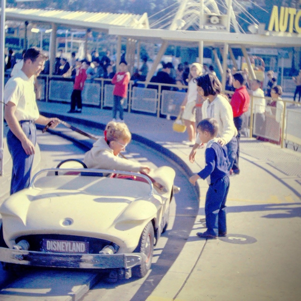
Next up was the Autopia adventure. This was where we could get in cars and race around an enclosed track. We could imagine we were actually racing the other drivers.
My mom getting out of the Race Car.
After a full day of adventures Moving Forward around the park, we selected a spot on the side of Disneyland’s Main Street to watch the Parade. The waiting was a time of excitement as we looked forward to the parade starting.
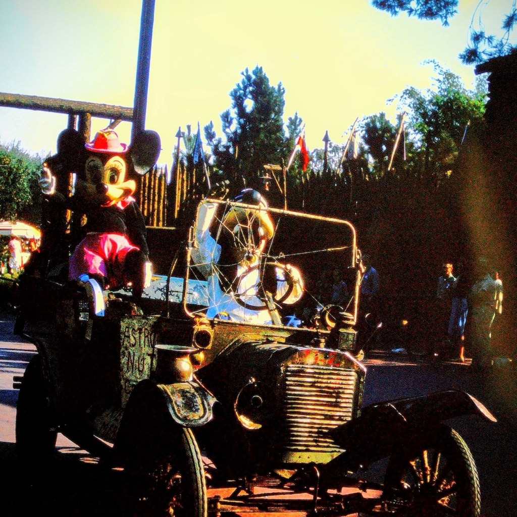
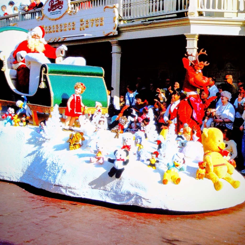
Mickey Mouse riding in a Vintage Car with Goofy1965 Disneyland Santa Claus Float
Well folks, that’s all for today. We had fun, but now it’s time to head home.
Growing up almost three thousand miles (actually 2,512 by today’s calculations) away from my dad’s family in South Carolina; we only traveled the long distance every three (3) to five (5) years. My parents always drove straight through switching off driving every several hours and/or miles as deemed necessary.
On every family vacation to visit my dad’s family, my parents would plan places for us to visit during our trip. One place would always represent a place of historical significance. The other place would always be some fun attraction. Sometimes it’d just be our immediate family visiting the chosen places and at other times my dad’s sister’s family would join us.
On our trip in July of 1967, my dad selected The Little White House in Warm Springs, Georgia for us to visit. The Little White House was the personal retreat for Franklin Delano Roosevelt, the 32nd president of the United States of America. It is located in the historic district of Warm Springs, Georgia.
When Roosevelt first started coming to Warm Springs (previously known as Bullochville) in 1924 it was to receive treatment for Polio. He loved the area tremendously, so he had a home built on Pine Mountain located close to Warm Springs. On April 12, 1945, President Franklin Delano Roosevelt died in this home shortly after he began his fourth term in office.
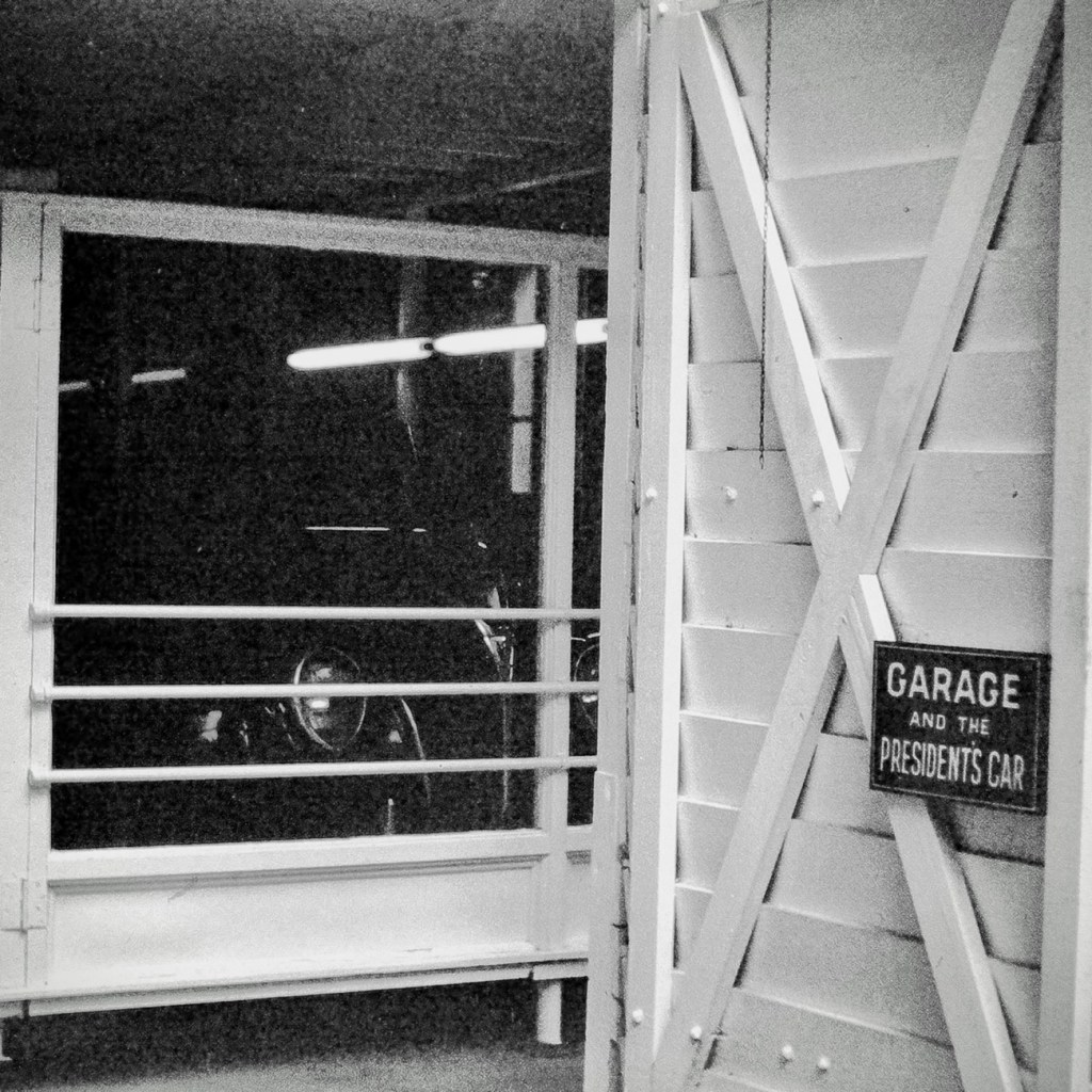
In 1948, Roosevelt’s Little White Housewas opened to the public as a museum. Part of the Museum displays include his 1938 Ford V-8 convertible coupe and his custom built 1940 Willys roadster. Many of his cars were equipped with special controls that allowed the partially paralyzed Roosevelt to operate the foot pedals with his hands.
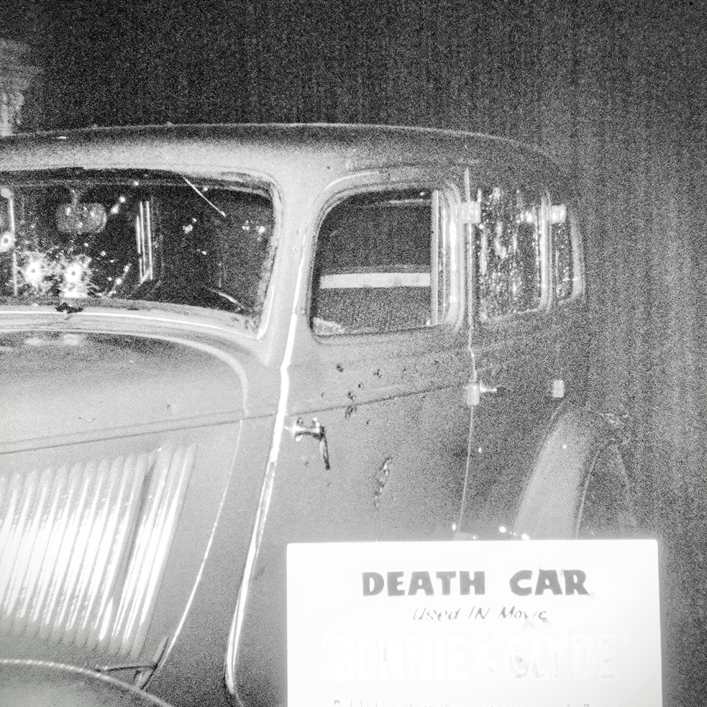
Death Car used in movie Similar to Car FDR was riding in when an Assassination Attempt Occurred
There was a movie made in 1933 that depicted the attempted assassination on Franklin D. Roosevelt. It references the assassination of Chicago Mayor Anton Joseph Cermak and hiswho was mistakenly killed during the attempt on FDR. The Death Car shown here and in the museum is the car that was used during that filming.
To learn more about the assassination attempt on Franklin D. Roosevelt click on Death Caror to learn more about FDR click on his name.
Pictures were Reconstructed from slide format to digital format via a Wolverine Digital Converter Renewing them for preservation and future generations.
Location: Roosevelt’s The Little White House; Warm Springs, Georgia, USA
God Bless. Thank you for visiting and reminiscing with me. Thank you for sharing your time and thoughts with me. I appreciate y’all very much.
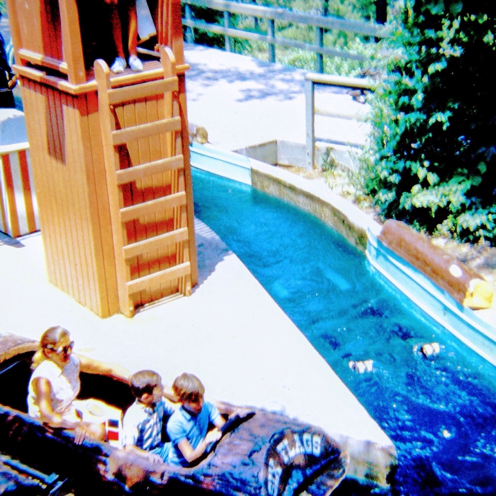
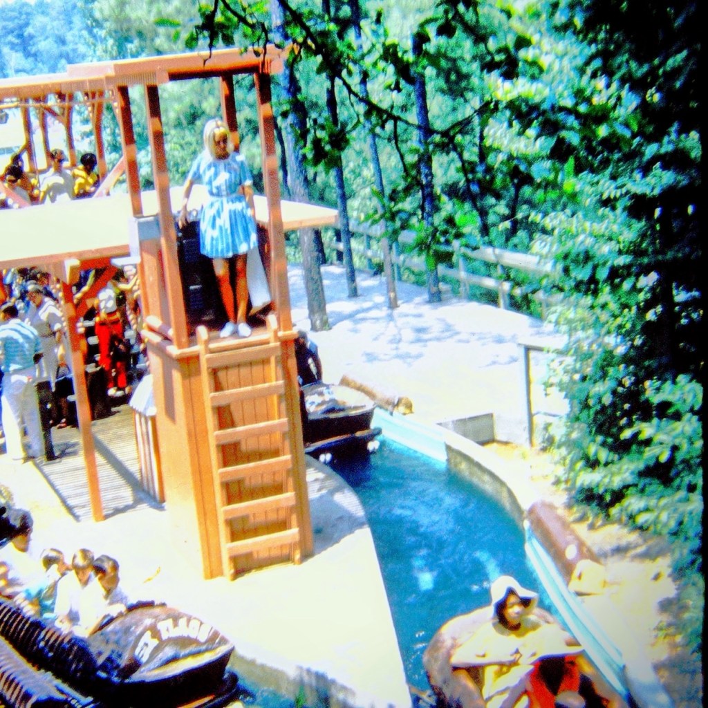
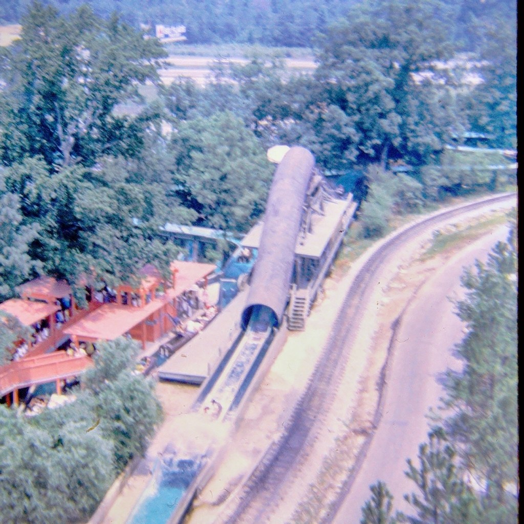
Come on and climb in the “boat” with us. We can make room for one or two more. It’s gonna be a fun ride, just you wait and see.
We’re moving forward, our turns coming up.
The ride lets boats go first from one side and then the other side. Our turn is next. Get ready. It’s our turn.
Moving forward along the ride we are going up, up, up …
And Splash … we zoom down almost to the end of our log ride. Did you feel the water 💦 splashing us? Oh right, you were in the back so you didn’t get oat all.
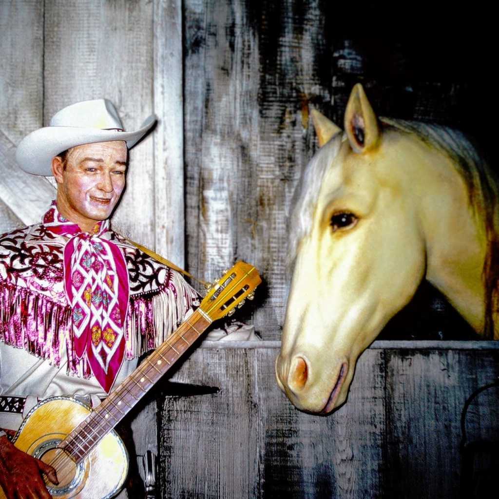
The photo was taken at the Movieland Wax Museum in Buena Park, California back in 1966 by my dad when we visited. These are wax figures of Roy Rogers and Trigger. The sign in front of the display (not pictured here) states CO. REPUBLIC 1945; “DON’T FENCE ME IN”; ROY ROGERS; DIR. ENGLISH; PROD. DONALD H. BROWN; SCENE N. 20; TAKE NO; EXT: STABLE.
The photos have been reconstructed by digitizing them via Wolverine digital converter to create a renewed version for save keeping for future generations.
Today we are going backwards in time Reconstructing my dad’s slides to reminisce family journeys from 1963. These are from one of our vacations traveling from San Diego, California to Great Falls, South Carolina and back home again.We progressed along the interstate Moving Forward Eastbound and Down loaded up and truckin’ heading to see my paternal grandparents for the first time in five years.
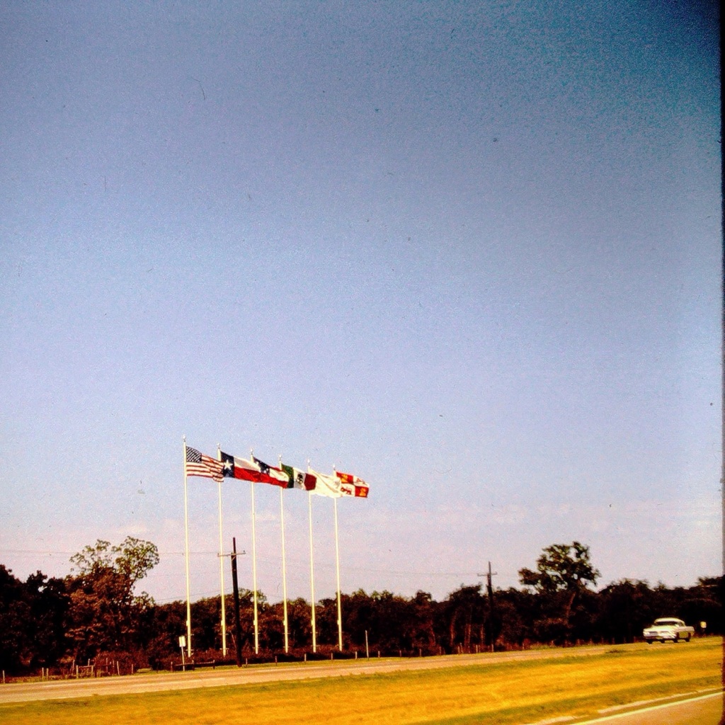
Coming or Going Somewhere in Texas
The Six Flags can be seen from Interstate 20 nearing the Arlington, Texas. They signify being close to the Six Flags over Texas amusement theme park.
Which way are we going? From the photo I’m not sure if we were headed east or going back west at this point in time as I can barely remember the trip.
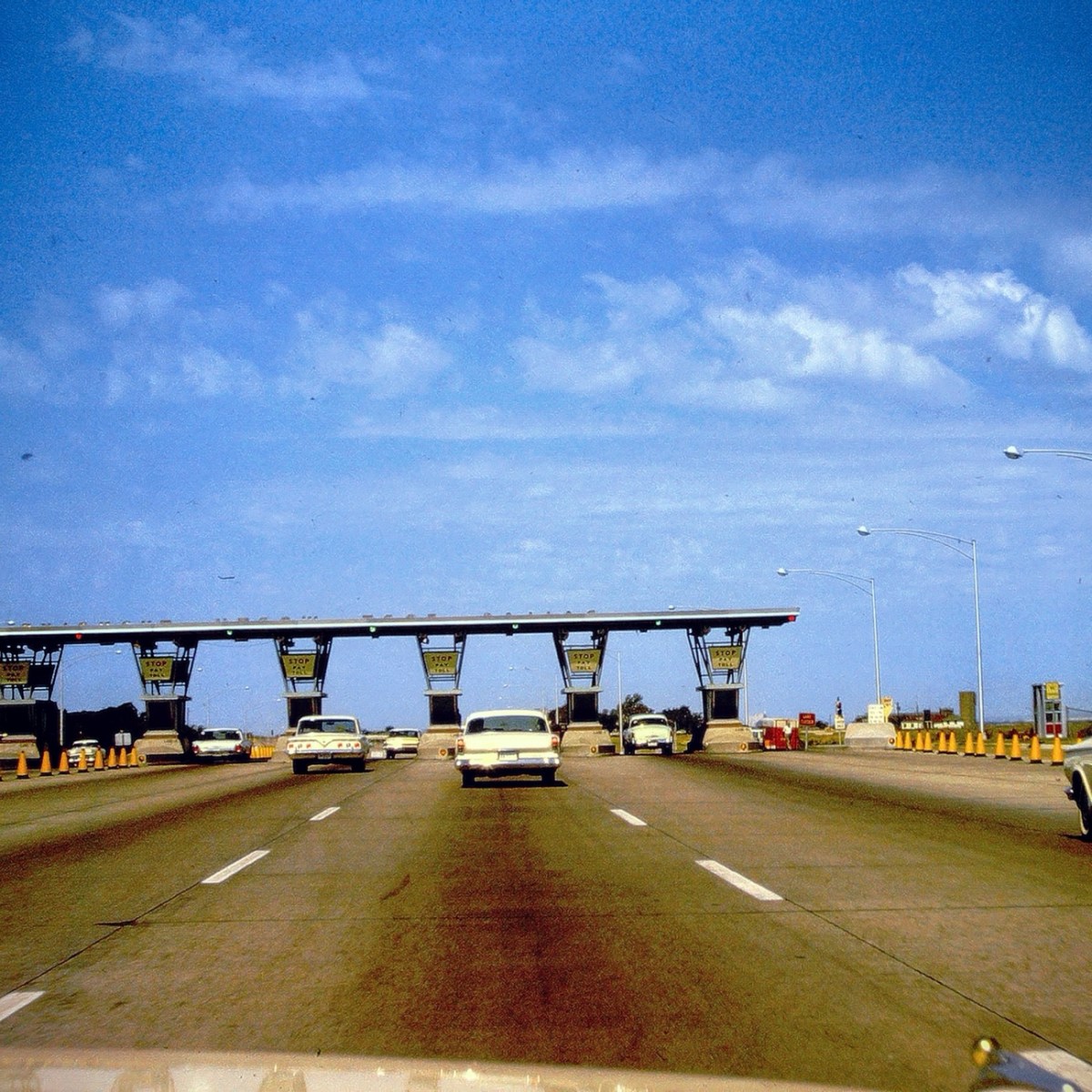
Stop 🛑 and Pay 💰 Toll Texas Toll Booths
Nowadays, there are over 50 toll roads in Texas. All drivers are required to pay the toll (fee) regardless of where you live. The first major toll road in Texas, which opened in 1957, was a 30-mile, six-lane stretch of highway between Dallas and Fort Worth. A drive from one end to the other cost 50 cents.
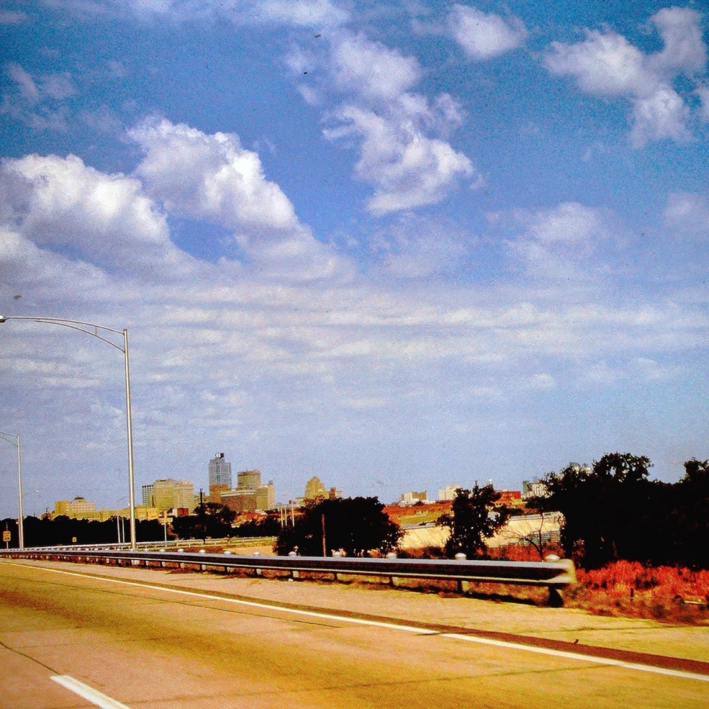
Passing through El Paso, Texas
After a long tiring vacation visiting family in the Carolinas, we are passing forward through El Paso heading home to San Diego. At this point of our trip we are excited to be almost home (over half way back across country.