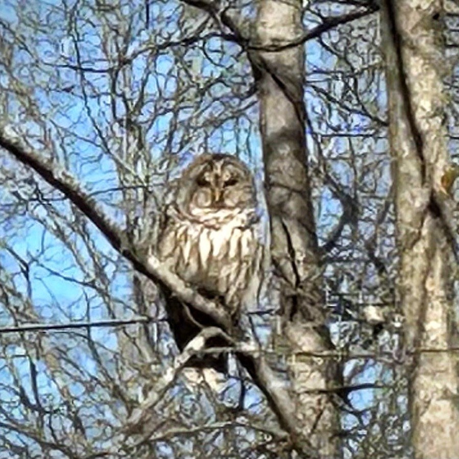
To play along, go to your photos file and type that number into the search bar. Then post a selection of the photos you find that include that number and post a link to your blog in my Numbers Game blog of the day. If instead of numbers, you have changed the identifiers of all your photos into words, pick a word or words to use instead, and show us a variety of photos that contain that word in the title.This prompt will repeat each Monday with a new number. If you want to play along, please put a link to your blog in comments below. Here are my contributions to the album.
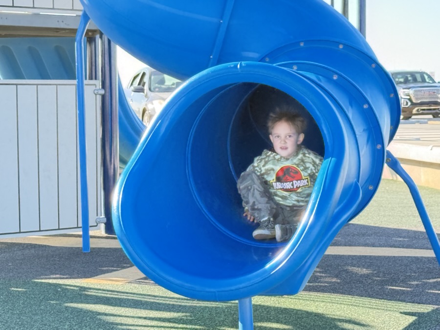
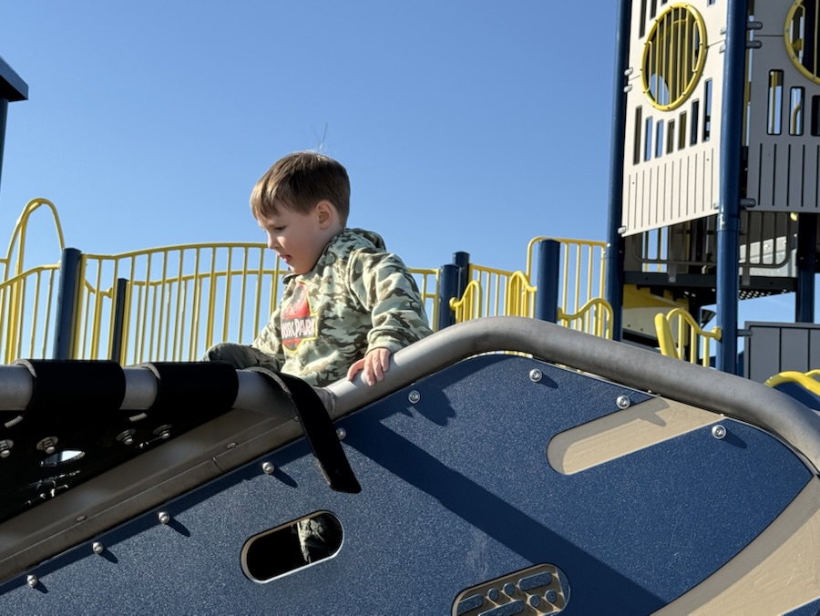
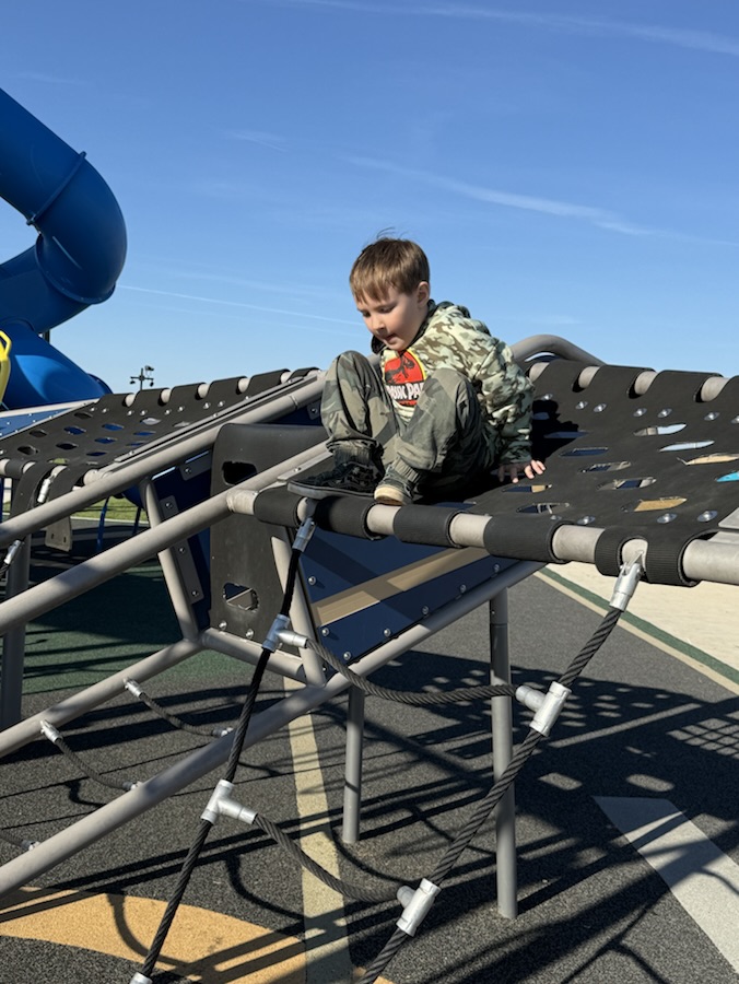
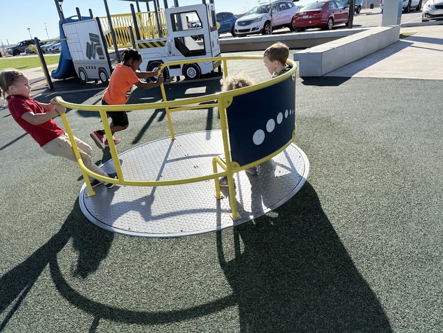
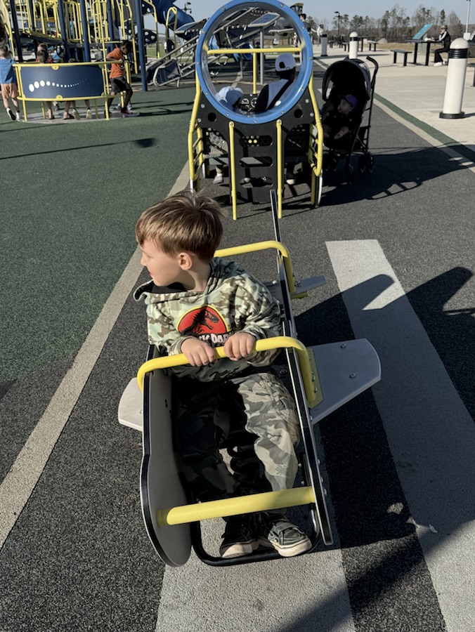
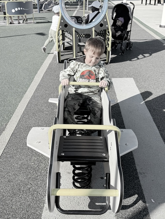
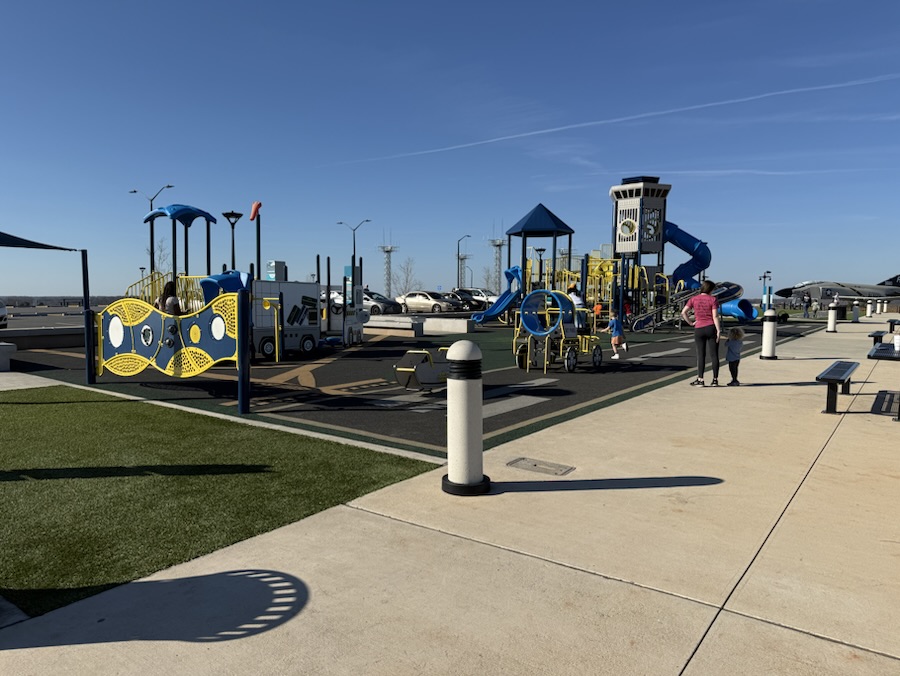
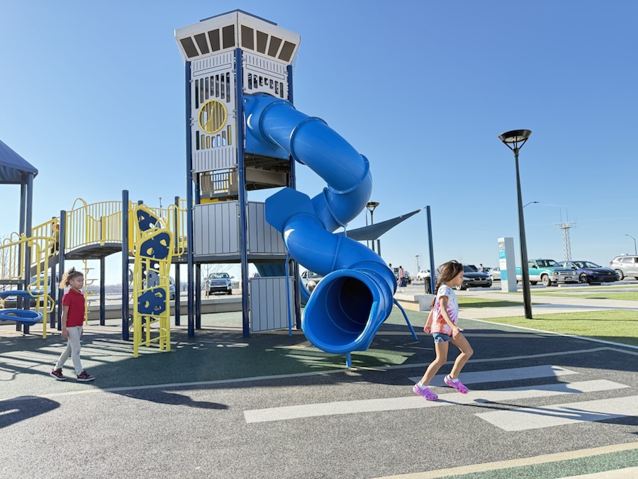
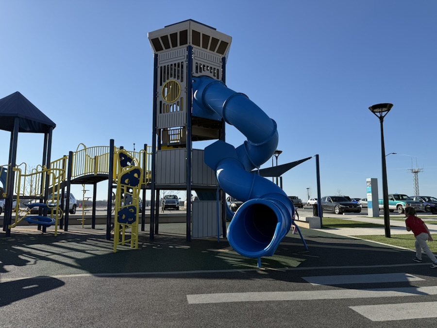
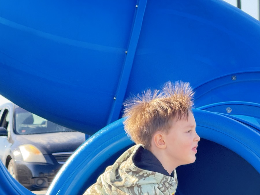
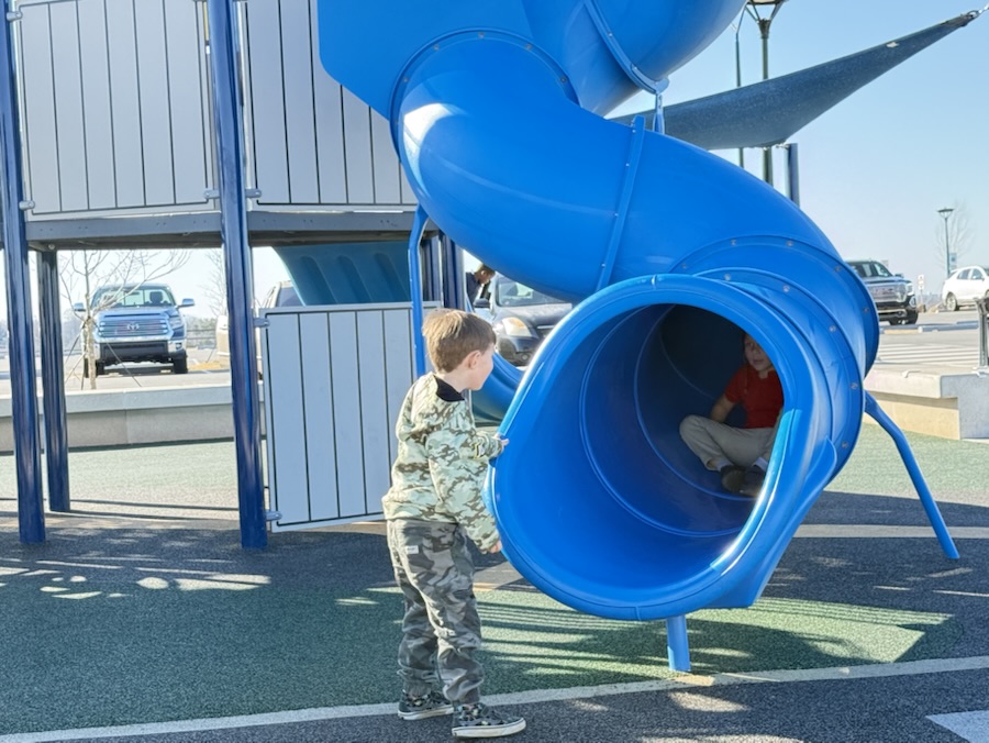
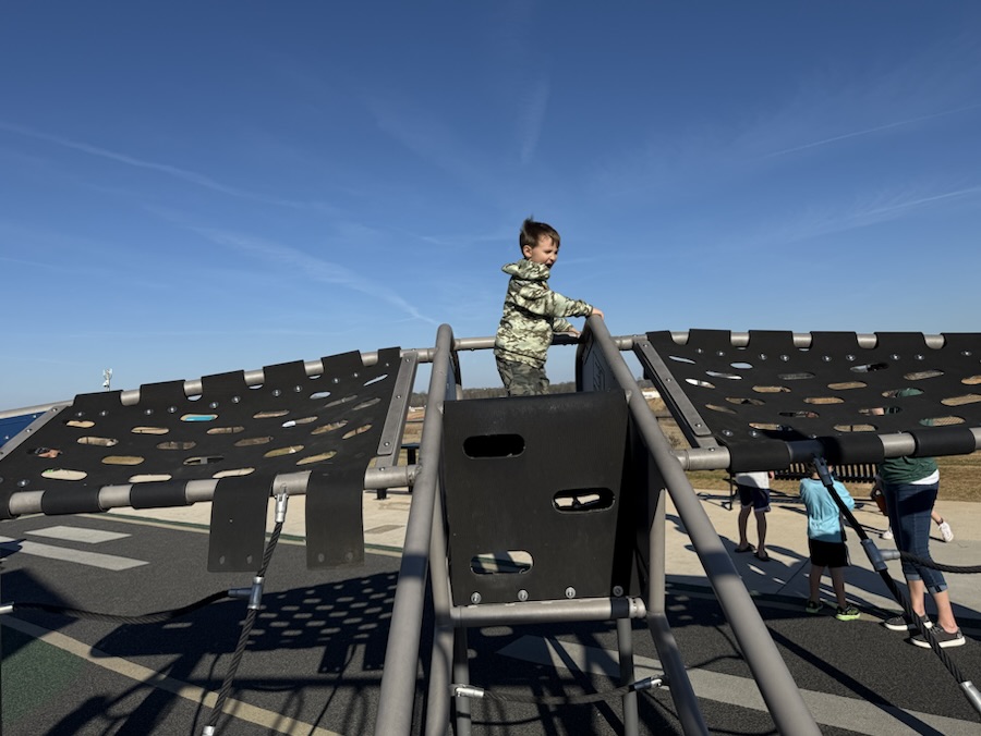
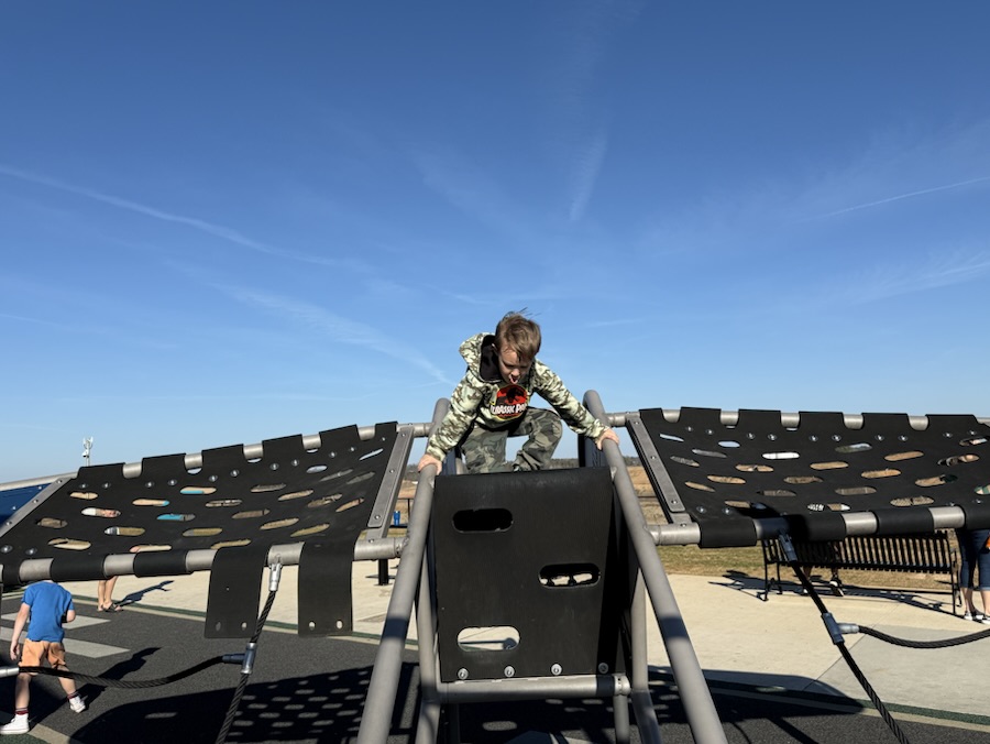
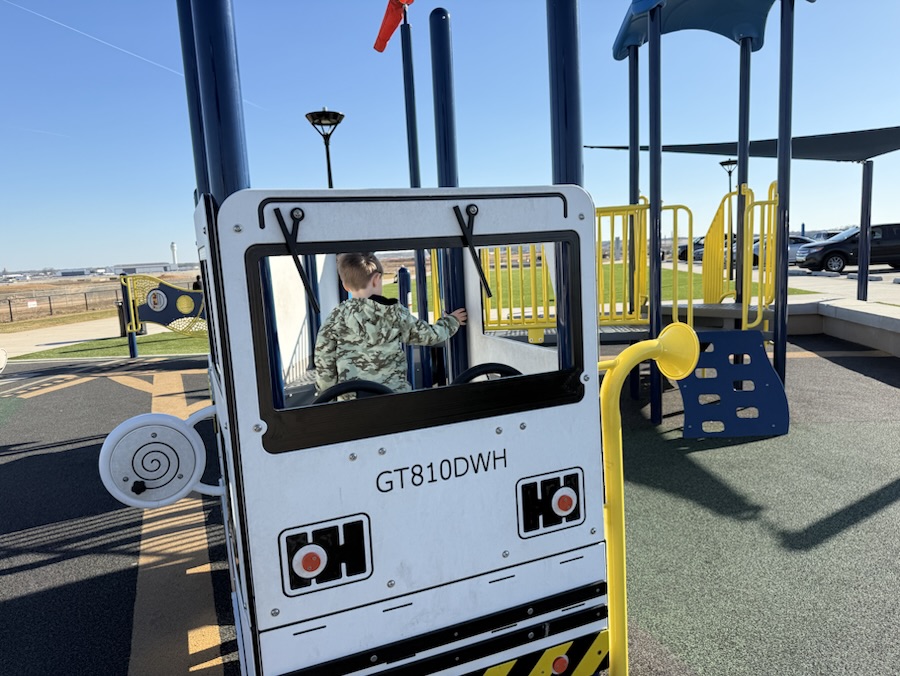
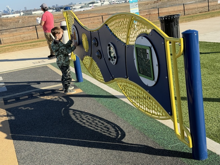
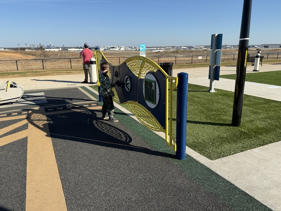
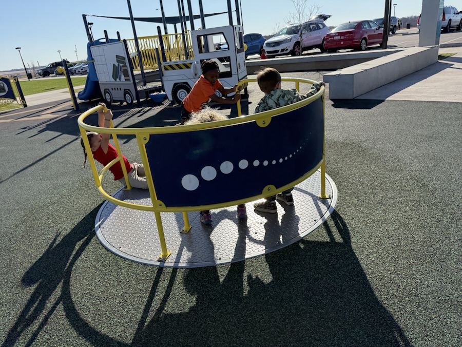
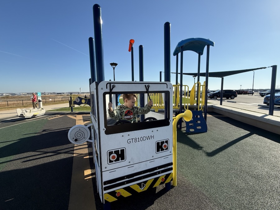
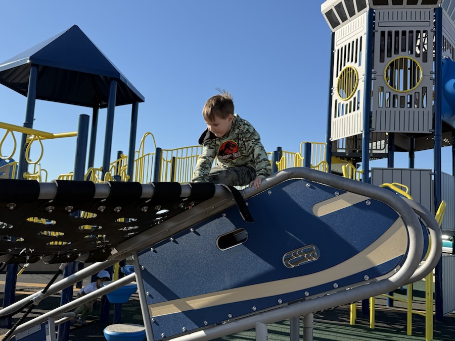
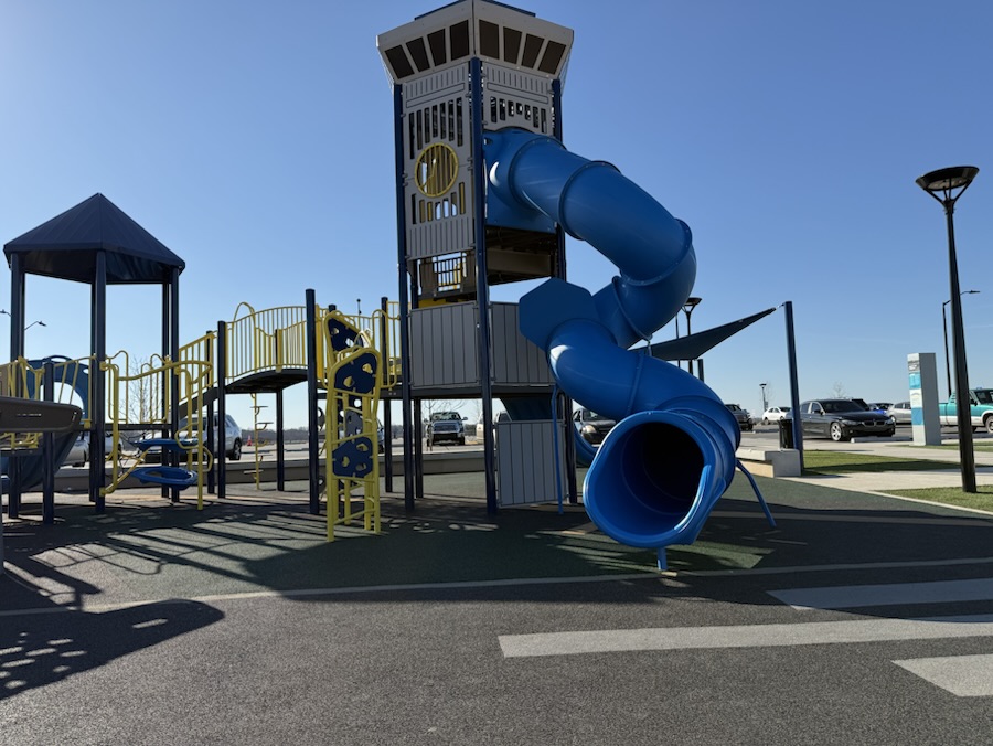
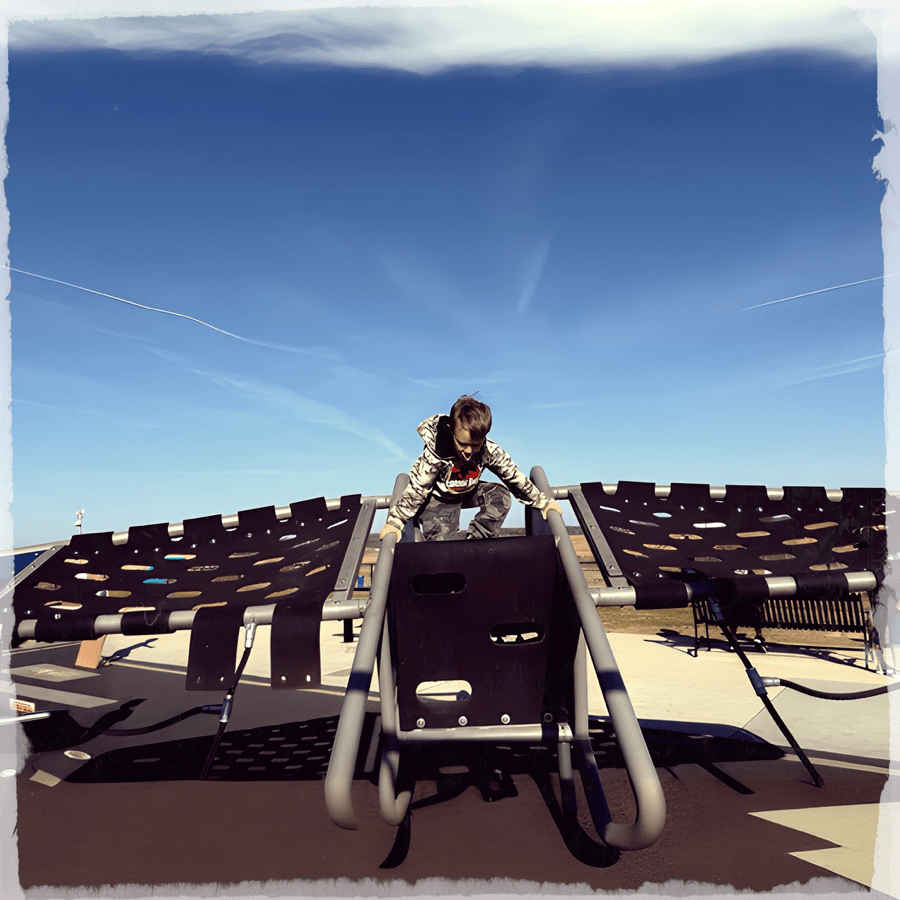
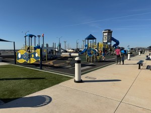
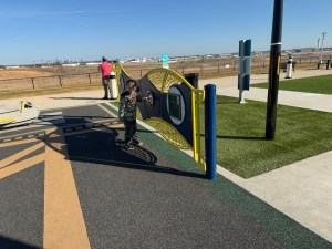
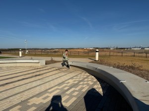
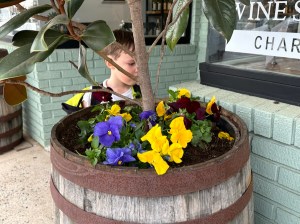
This week I am choosing to use a theme of Playground focusing on the CLT Airport Overlook playground in Charlotte, North Carolina. Coleman enjoyed playing in CLT Charlotte Douglas International) Airport Overlook’s Playground. He kept zipping to and fro checking out all the various playground equipment and all the unique places to Pull Up a Seat.
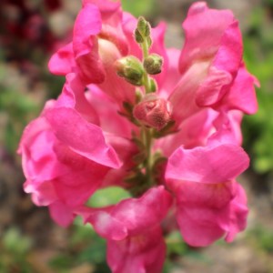
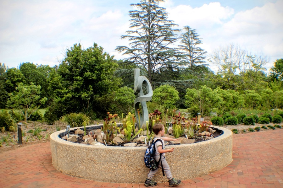
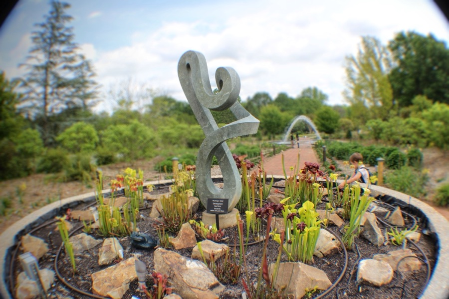
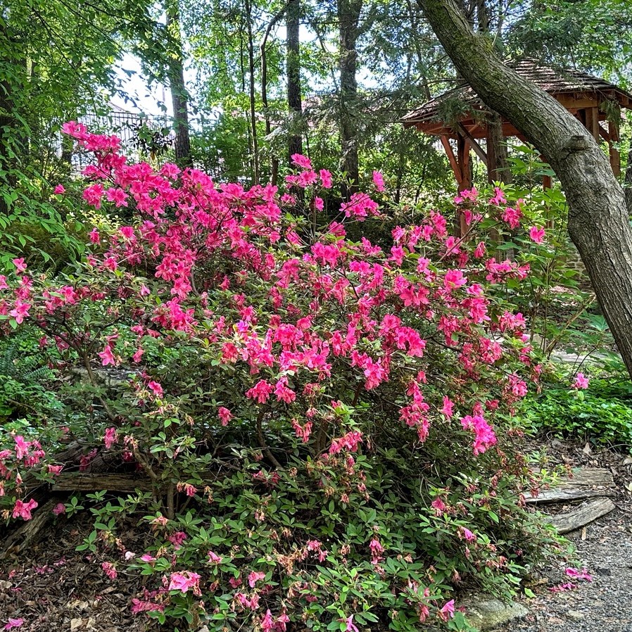
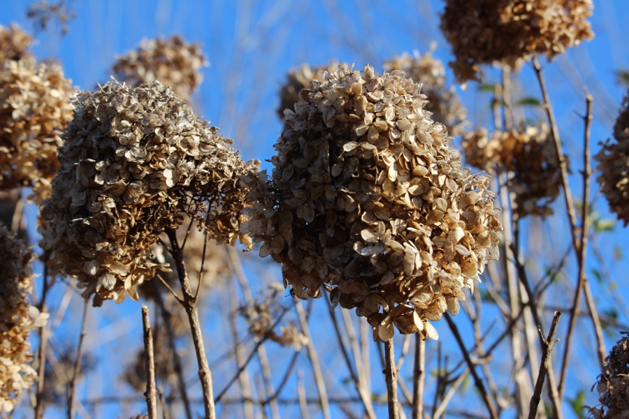
Camera: Canon EOS Rebel T3i with Canon EF-S18-55mm lens
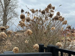
Location: Daniel Stowe Botanical Garden; Belmont, North Carolina, USA
God Bless. Breathe. Stop and Smell the Flowers. Enjoy Nature’s Beauty. Thank you for visiting and sharing your time and thoughts with us. I appreciate y’all very much.
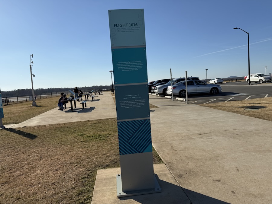
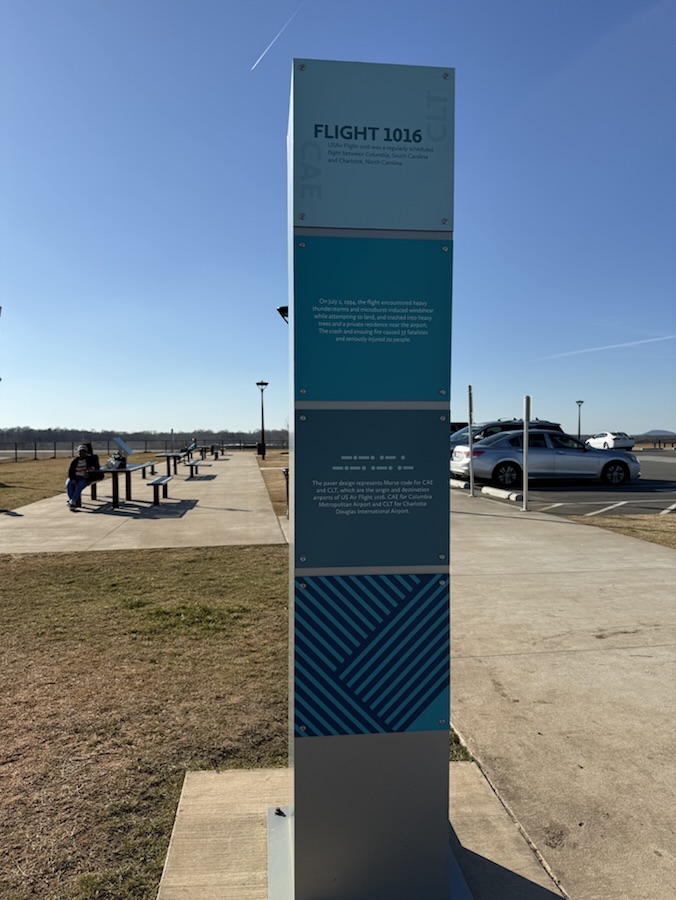
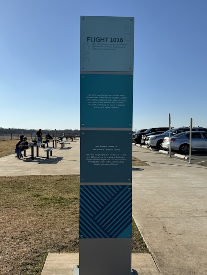
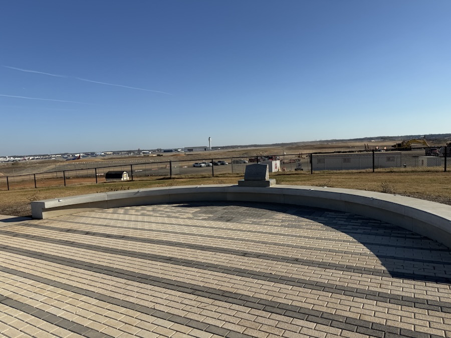
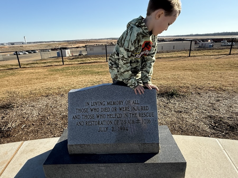
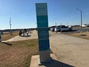
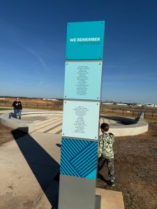
The U.S. Air Flight 1016 Memorial honors the people who died on board the flight from Columbia, S.C. to Charlotte on July 2, 1994. The Memorial includes a plaque in memory of those who died or were injured and those who helped rescue efforts. The Memorial is located in a section of the CLT (Charlotte Douglas International) Airport Overlook in Charlotte, North Carolina.
The U.S. Air Flight 1016 crashed in Charlotte 30 1/2 years ago. During that horrific crash in 1994 thirty-seven (37) of the fifty-seven (57) people on board died. The people in Charlotte and the surrounding areas have not forgotten.
On July 2, 1994, the flight encountered heavy thunderstorms and microburst-induced windshear while attempting to land, and crashed into heavy trees and a private residence near the airport. The crash and ensuing Fire caused 37 fatalities and seriously injured 20 people.
The New CLT Airport Overlook Memorial was designed to represent Morse Code for CAE (Columbia) and CLT, the origin and destination airports for the flight. It includes a plaque in memory of those who died or were injured and those who helped rescue efforts.
This past Tuesday Coleman, my daughter Trisha, and I paid a visit to the CLT Airport Overlook to allow Coleman to play in the Overlook’s new playground. While there we also visited the U.S. Air Flight 1016 Memorial. The reverse side of the pillar about U.S. Air Flight 1016 lists the names of the thirty-seven (37) people who died in the crash.
Name an attraction or town close to home that you still haven’t got around to visiting.
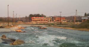
U. S. National Whitewater Center
The U.S. National Whitewater Center in Charlotte, North Carolina has the largest the world’s largest manmade whitewater river and has outdoor activities all year long. Besides the Whitewater River area, the Center also has 1,300 acres of protected woodlands along the Catawba River. No matter your preference, the Whitewater Center offers a wide range of recreational opportunities to intrigue your interest for a fantabulous experience in the great outdoors.
I have not done many water sports since my younger more limber and flexible days of my youth. What does perk my interests in visiting the U.S. National Whitewater Center are the forty (40) miles of trails designed for mountain biking and trail racing. You don’t have to ride a mountain bike or race on the trails to enjoy them. The 40+ miles of trails are a great opportunity for hikers as well. The trails are shared by hikers, runners, and bikers at all times.
The trails are natural surface and wind across the 1,300 acre woods of the Center. The trails run along the Catawba River and through hardwood and pine forests. The use of the trails are free not requiring an access pass, however, the Whitewater Center does charge $12 for a day parking pass and $40 for an annual parking pass.
Parking legend & Off Leash Facility Trail Map
I think Coleman and I would enjoy hikers some of the various trails at the WhitewaterCenter given the opportunity for warmer weather, costs and transportation to and from the Center.
For more information about the U.S. National Whitewater Center and what it has to offer click here .
God Bless. Thank you for visiting and sharing your time and thoughts with us. I appreciate y’all very much.
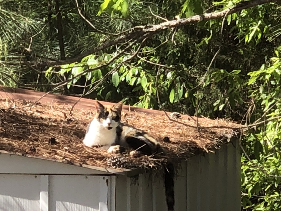
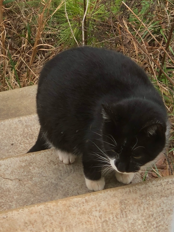
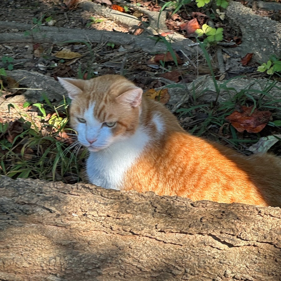
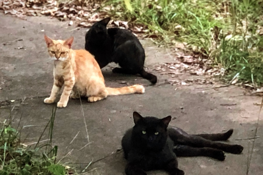
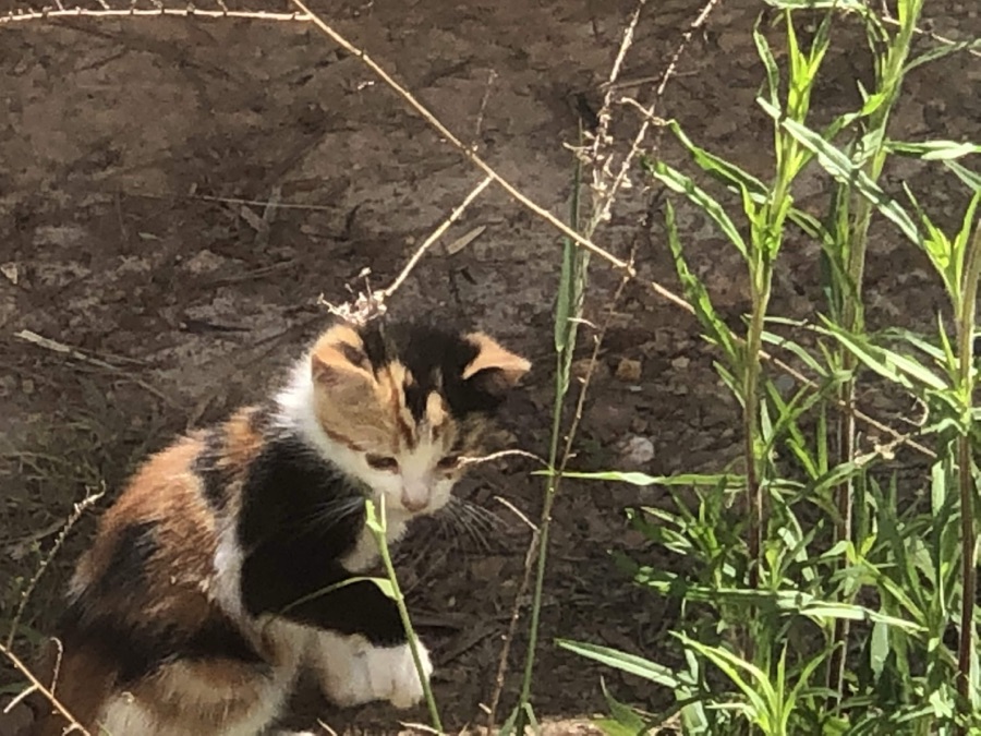
Tina from Travels and Trifles is this week host for the Lens-Artist Challenge. She has chosen a theme of Cats and Dogs.
At this present point in time we do not have any cats or dogs. The only cats that have been around in places we lived were feral cats that would roam the neighborhood. Sometimes female cats would have their litter under our home and their would stick around for awhile.
Here are some photos of those cats …
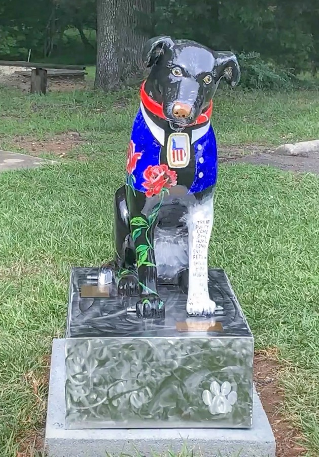
Here are a few pix of my Aunt Irene’s Dog plus one of a Dog Statue at Andrew Jackson State Park in Lancaster, South Carolina.
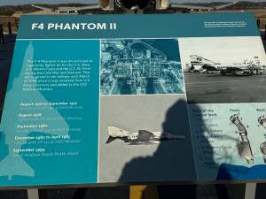
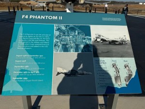
The F-4 Phantom II was built by the McDonnell Douglas Corporation ( McDonnell Aircraft Corporation). It was a supersonic, all-weather, twin-engine, two seat fighter-bomber and interceptor jet. It was originally designed for the U.S. Navy in 1953.
The F-4 Phantom II was the most produced American fighter jet. It had become a symbol of the Cold War. It was a formidable aircraft which played a pivotal role in military aviation from the 1960s into the 1990s.
The F-4 was designed around an all-missile armament system with the expectation that air combat would take place at a distance. Its combination of speed, range, and versatility made it a key player in air combat and ground support, leaving a lasting legacy in military history.
The F-4 Phantom II was retired from service in the United States Navy in the 1980’s. The F-4 Phantom II was also retired from the Royal Air Force in 1992. The last active duty F-4 Phantom II was launched from an aircraft in 1986. The last carrier landing of an F-4 Phantom II was in 1986. The last F-4 Phantom target drones were retired in 2004.
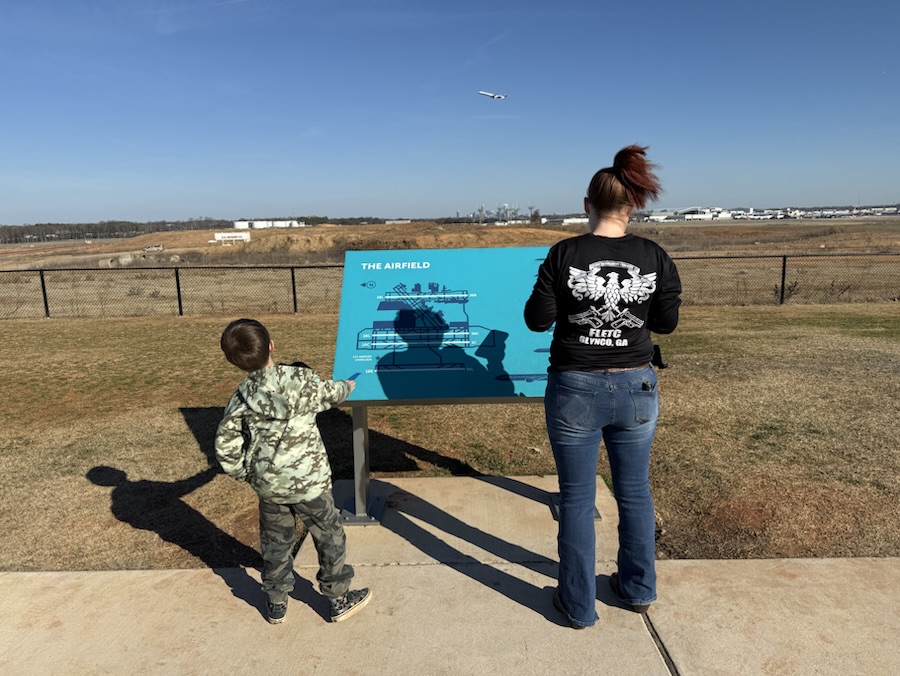
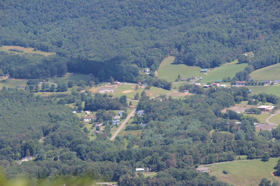
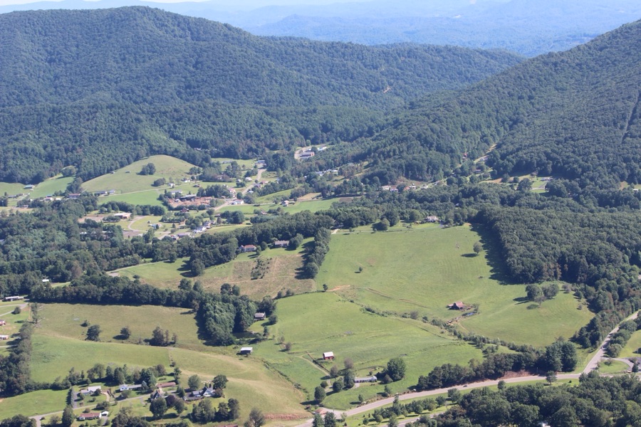
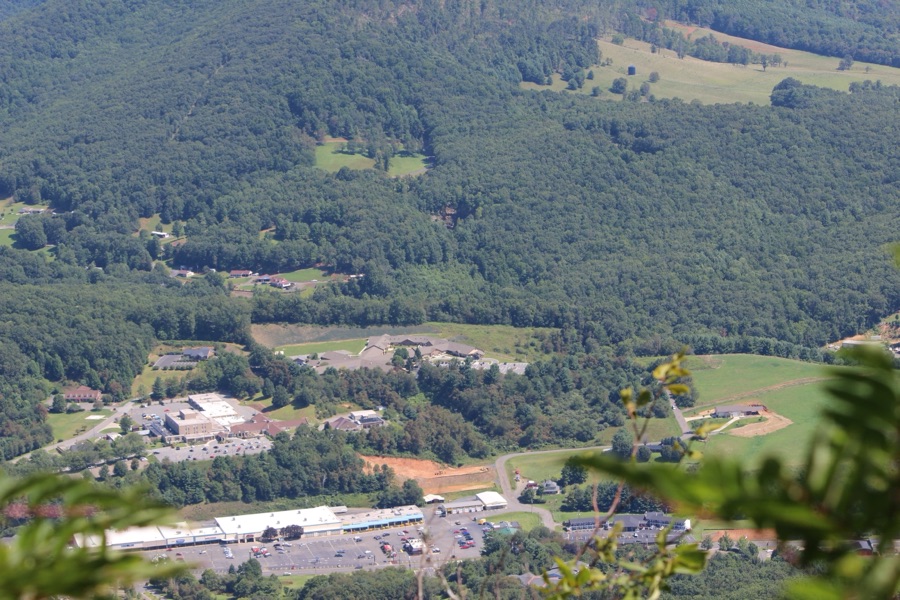
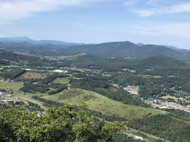
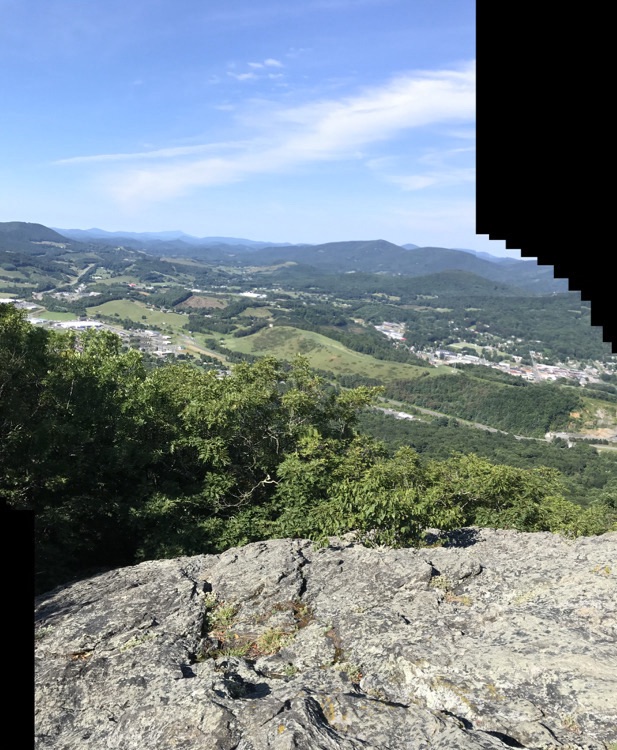
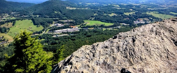
Pictured here is one of the F-4 Phantom II retiredU.S. military fighter jet which is on display at the CLT (Charlotte Douglas International) Airport Overlook. With this exhibit one can learn about the Carolinas’ aviation history and the types of planes that fly in and out of CLT.
Location: CLT Airport Overlook; Charlotte Douglas International Airport; Charlotte, North Carolina, USA
God Bless. I encourage you if you’re ever in the Charlotte area to visit the Charlotte Douglas International Airport Overlook. The views our amazing and children of all ages will love it. Thank you for visiting and sharing your time and thoughts with us. I appreciate y’all very much.
Location: Centennial Center; Downtown Cramerton; Cramerton, North Carolina, USA
God Bless. Spring is Coming. Maybe not soon enough for some. Let the Sonshine/Sunshine shine through everyday. Thank you for visiting and sharing your time and thoughts with us. I appreciate y’all very much.
Dan from no facilities has chosen a them of Nursery Rhyme for this week’s CFFC Challenge. There are many variation, but that’s not too important. Look at the rhyme as written and use any or all of the bold words as prompts. If the words are numbers, use them the way you used them earlier. Otherwise, use the words themselves. This should give you lots of opportunities to choose a photo. New or archive photos are acceptable.
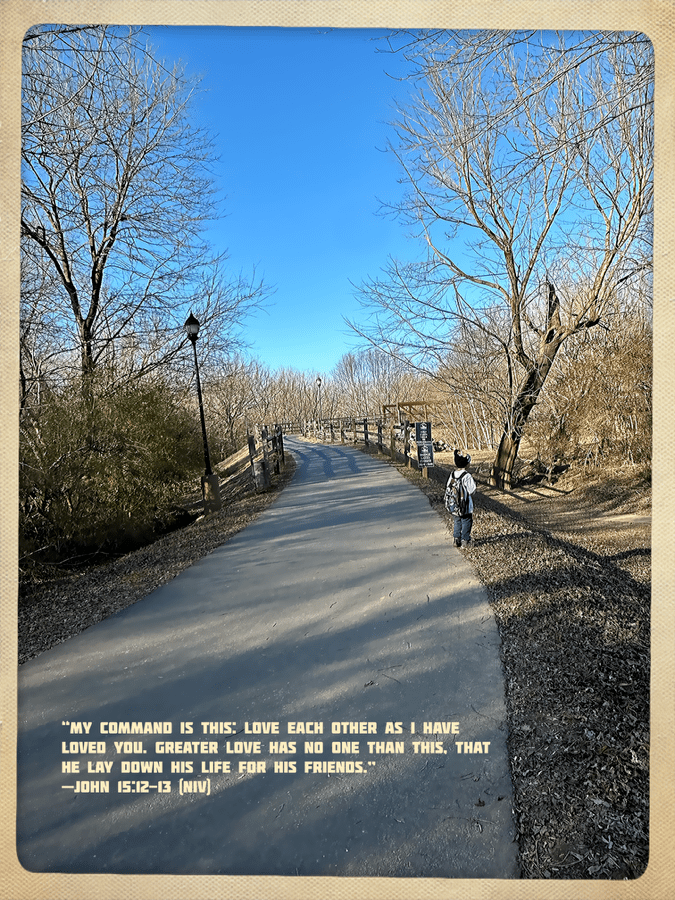
Welcome back to the Which Way Challenge (CWWC), I’m so glad you are enjoying this challenge. For this week I have chosen the theme of (CWWC): Any Which Way with Paved Pathways or Sidewalks. Remember to be sure your Which Ways are clearly defined. Remember signs are always welcome in your Which Ways.
Here are my Which Ways for this week:
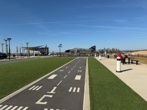
Sidewalks around the CLT Airport Overlook’s Playground Paved Runway Strip (Pathway) at CLT Airport Overlook USAir Flight 1016 memorial at CLT Airport Overlook (Paved Sidewalks)
On Tuesday my daughter had a day off of work and decided to give Coleman a surprise. After he got off the school bus in the afternoon, she drove us to the Charlotte Douglas International (CLT) Airport Overlook.
In 2024 the CLT Airport Overlook underwent a major overhaul. This overhaul project cost a whopping $8 million. This is the fifth overlook for the Charlotte Douglas International Airport since 1937.
This New CLT Airport Overlook has two (2) age-specific playgrounds with shaded areas. Of course, being at the airport, the playgrounds have an airport theme including runway, a cargo transport vehicle, and a mini air traffic control tower.
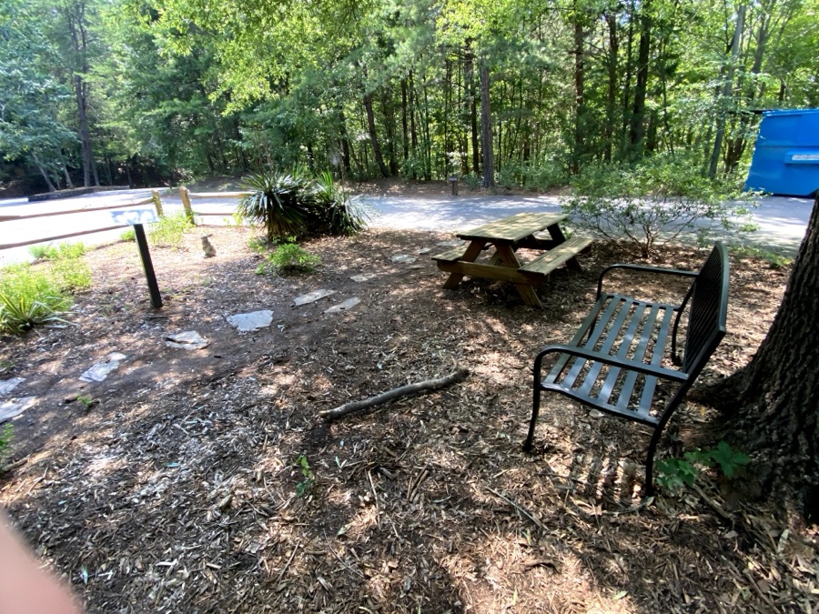
The CLT Overlook also has a covered space with ten (10) covered picnic tables plus uncovered picnic tables and benches with LED lighting for pedestrian and parking areas. There are a couple of other features which I will discuss in an upcoming future post.
Location: Goat Island Park and Greenway; Cramerton, North Carolina, USA
God Bless. Enjoy Nature. Be Observant. Show Gratitude. Love to all. Thank you for visiting and sharing your time and thoughts with us. I appreciate y’all very much.
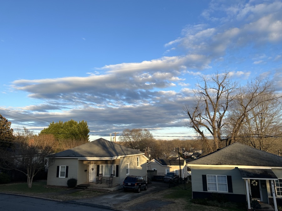
The Sky is a wondrous example of how as the weather changes quickly, so can the events in our lives. Be thankful for the good and the bad and remember God is in Control. Just as we need the rain and look forward to sunny days; our lives may seem dreary but blessings abound amongst us. Be thankful for the Rain as well as the Sunshine. Both are needed even if we prefer the good ole sunshiny days of life.
Brian from bushboy.blogis the host for the #LastontheCard challenge. His rules are simple to follow. As per Brian, Your last photo doesn’t have to be on the very last day of the month if you didn’t take any photos on that day. Maybe it was earlier in the month when the last photo was taken.
The rules are simple: 1. Post the last photo on your SD card or last photo on your phone for the 31st or whenever your last photo was taken. 2. No editing – who cares if it is out of focus, not framed as you would like or the subject matter didn’t cooperate. 3. You don’t have to have any explanations, just the photo will do 4. Create a Pingback to this post or link in the comments 5. Use the tags The Last Photo and #LastOnTheCard
Friday, January 31st turned out warm before the rain storms hit in the evening. So Coleman and I took a walk down to Goat Island Park and Greenway. Of course, I had to bring my camera along and not just my smartphone.
Here are my Last photos for January 2025 …
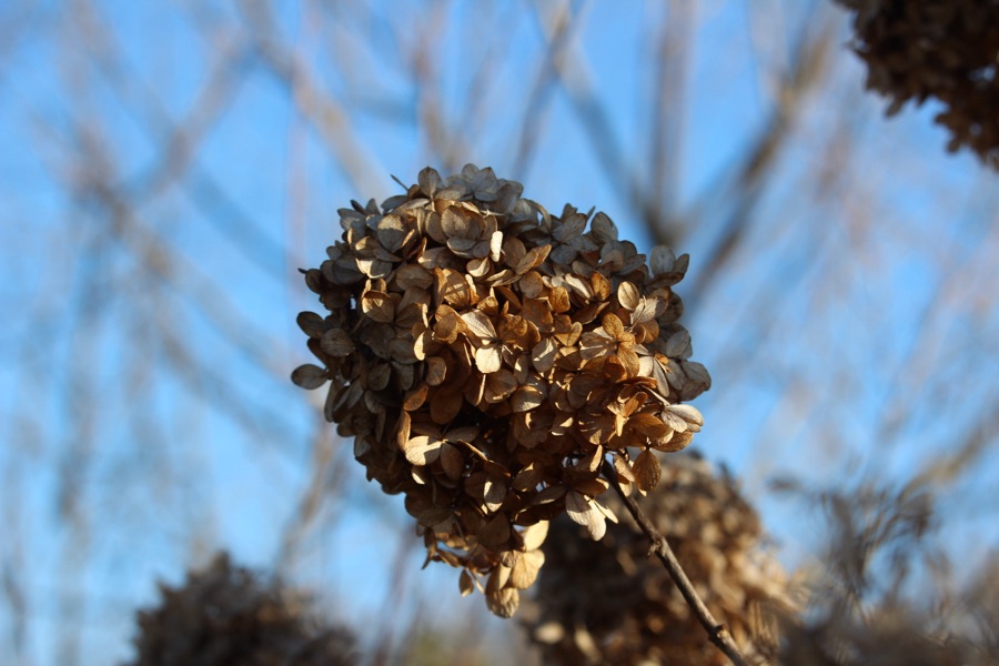
From my iPhone 14 Pro Max
Winter Hydrangea paniculata located at the entrance to Goat Island Park and Greenway.
From my Canon EOS Rebel T3i
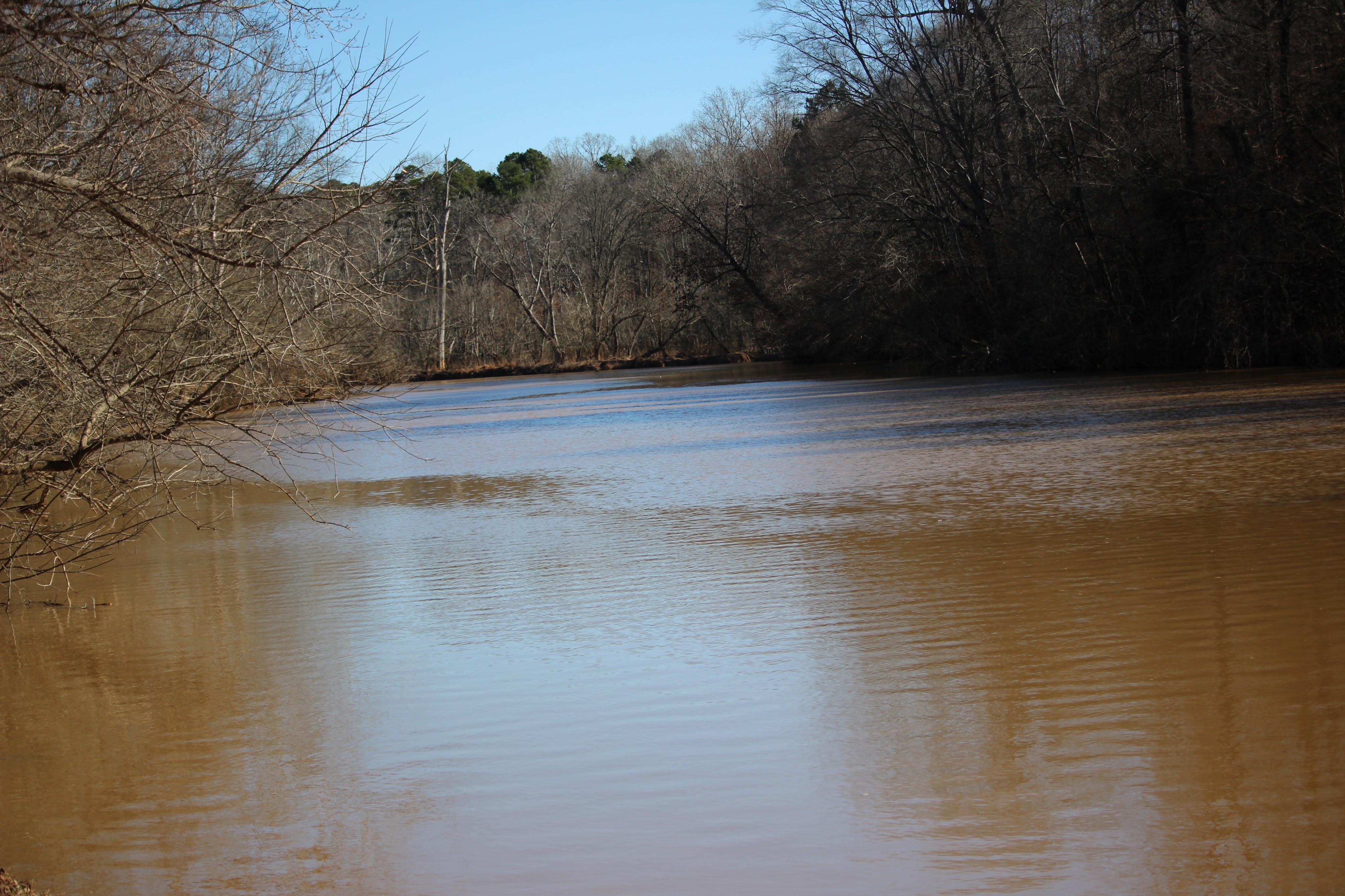
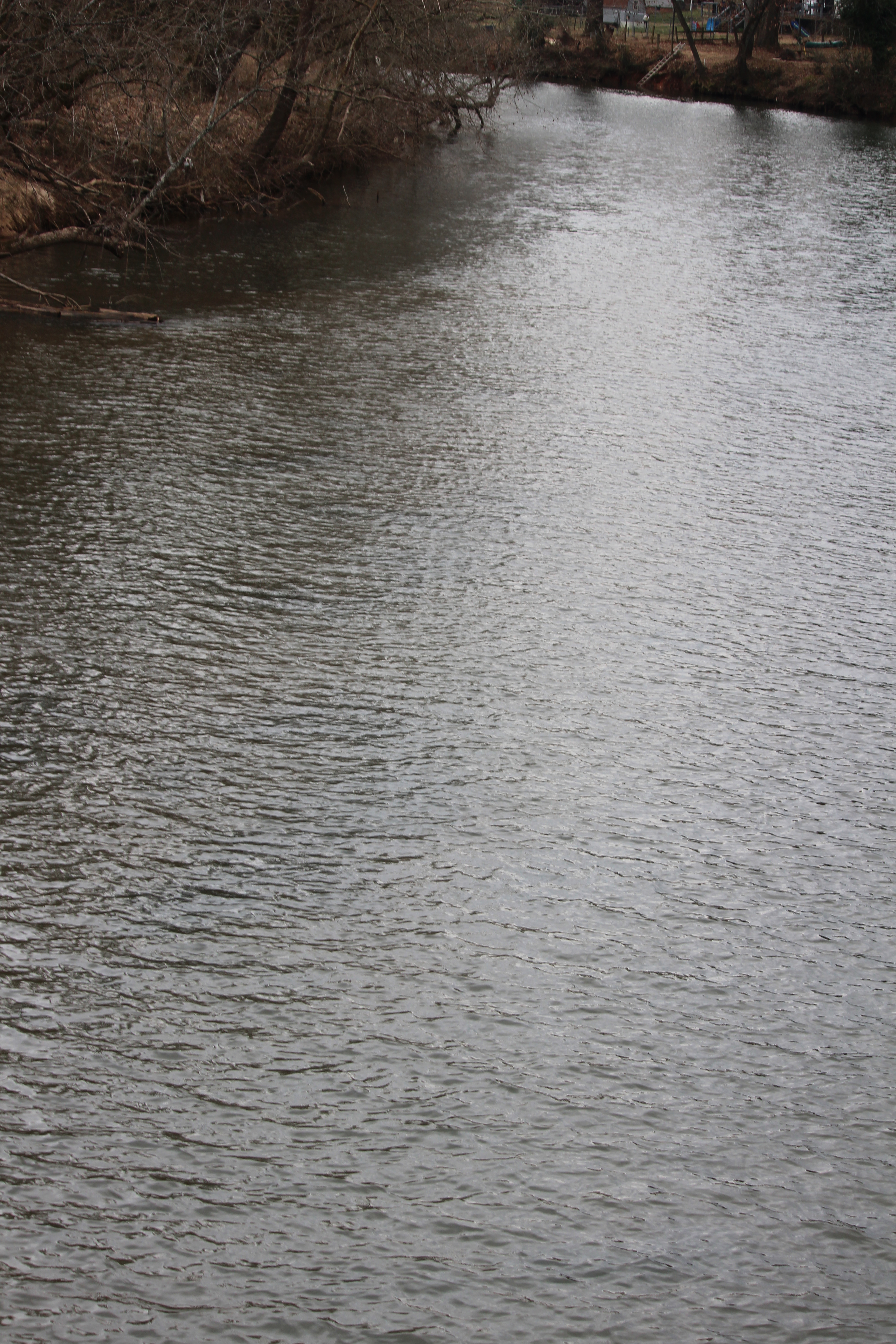
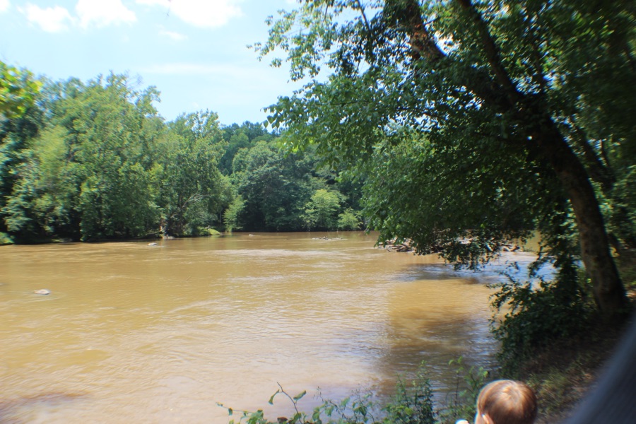
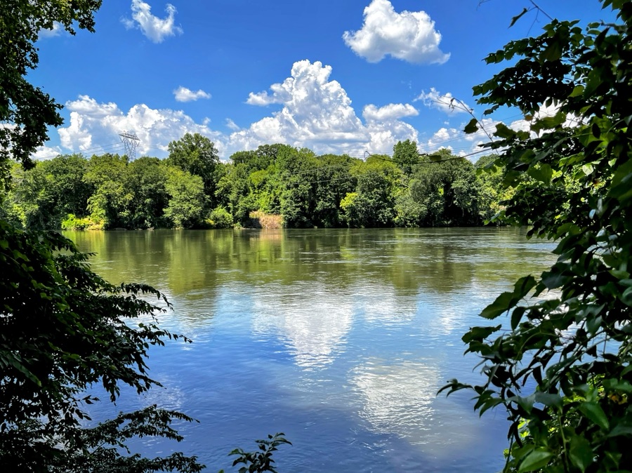
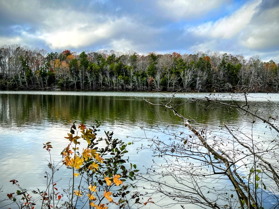
South Fork Catawba River
As an added bonus I thought I would post a comparison of first & last photo for January from my Canon.
Cameras: 1) Apple iPhone 14 Pro Max; 2-4) Canon EOS Rebel T3i with Canon EF-S55-250mm lens and Altura UV filter for Canon.
Location: 1-2 & 4) Goat Island Park and Greenway; 3) Riverside Park and Greenway; Cramerton, North Carolina, USA
God Bless. Have a wonderful weekend. Thank you for visiting and sharing your time and thoughts with us. I appreciate y’all very much.
Image 1 of comparison is the South Fork Catawba River taken on January 1, 2025, from the Riverside Park and Greenway. Image 2 of comparison is the South Fork Catawba River taken on January 31, 2025, from Goat Island Park and Greenway. ↩︎
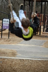
We decided to take a risk with the impending rain and meandered down to Goat Island Park and Greenway for Coleman to have some Funtime in the playground. He loves to swing. Even though he is learning to pump his legs to keep swinging, he still enjoys having me push him to go higher and higher towards the sky.
As you might could tell, he had loads of fun. Especially after a friend from school showed up to play in the playground. His friend, Liam, is a little bit older and rides the same school bus with him. He lives on the other end of our street close to the railroad tracks.
Camera:Canon EOS Rebel T3i with Canon EF-S55-250mm lens.
Settings: f/4.5/5 • 1/800 • 79mm • ISO320-400
Location: Swings; In the Playground; Goat Island Park and Greenway; Cramerton, North Carolina, USA
God Bless. Have a Swinging Good Time. Enjoy your weekend. Thank you for visiting and sharing your time and thoughts with us. I appreciate y’all very much.
Location: Town of Cramerton; Cramerton, North Carolina, USA
God Bless. Have a Sweet Sensational Weekend filled with love and happiness. Thank you for visiting and sharing your time and thoughts with us. I appreciate y’all very much.
Judy from Life Lessons Blog hosts The Numbers Game Challenge and invites us all to play along with her. This week’s number is 179.
To play along, go to your photos file and type that number into the search bar. Then post a selection of the photos you find that include that number and post a link to your blog in myNumbers Game blog of the day. If instead of numbers, you have changed the identifiers of all your photos into words, pick a word or words to use instead, and show us a variety of photos that contain that word in the title.This prompt will repeat each Monday with a new number. If you want to play along, please put a link to your blog in comments below. Here are my contributions to the album.
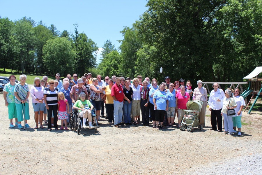
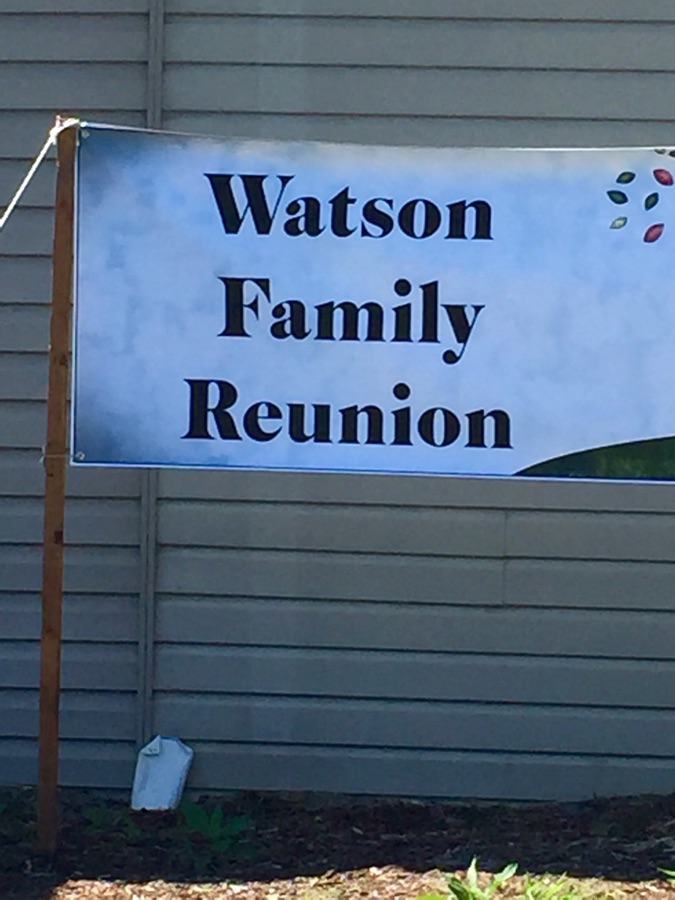
The Ragtag Daily Prompt for today has prompted a look back to Reunions in years past. In my younger days we had a few Family reunions with members of my maternal grandfather’s side of the family. So far, I have not located any of the photos my dad or other relatives would have taken of those get togethers. Some were held at my maternal grandparents home and others at my maternal grandfather’s sister’s daughter’s home. The memories of those Reunions are sporadic and fragmented, but do somewhat remain in the crevices of my mind.
After my maternal grandfather passed away the family reunions seemed to fade away. I hadn’t gone to a reunion in years until after we moved back to the Carolinas and made family connections through AncestryDNA, FamilyTreeDNA, and Facebook. It was with those connections that I found out about the Greer/Watson/Trivette Reunions and the Watson Family Reunions in and surrounding Deep Gap, North Carolina. [My maternal grandfather was born in the Deep Gap area in 1890.]
Here are a few photos from those Reunions …
Watson Family Reunions
2015
Greer/Watson/Trivette ReunionWatson Family Family Reunion Yadkin Valley Community Park Lenoir, North Carolina
2016
Greer/Watson/Trivette Reunion Greer/Watson/Trivette Family Family Reunion Yadkin Valley Community Park Lenoir, North Carolina
2017
Watson Family Reunion David Watson X TwoWatson Family Deep Gap, North Carolina
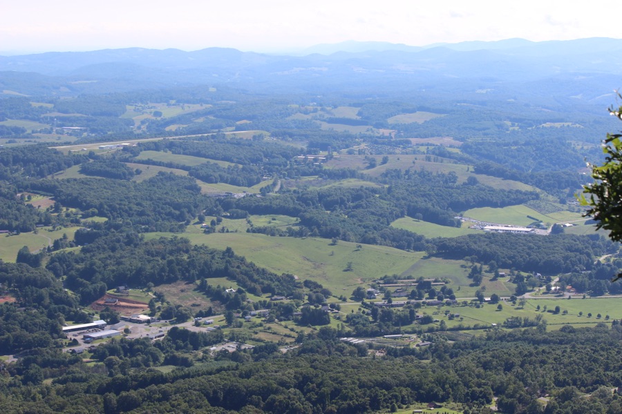
Ritva is this week’s host for the Lens-Artist Challenge and she has chosen a theme of Shoot From Above. I do not always shoot from above, however, on occasion I have a fantastic opportunity to do just that.
Here is remembering one of those occasions …
A Look from Mount Jefferson State Natural Area West Jefferson, Ashe County, North Carolina
More Shots from above at The Peak at Mountain Jefferson State Park …
These were taken in August of 2017 when my eldest son and I drove the Blue Ridge Parkway and visited Mount Jefferson, North Carolina. I was in the area for a family reunion in Deep Gap, North Carolina. While in the area, we decided to do some sightseeing and a little hiking. It was a fun weekend of one on one time together.
God Bless. Take a Hike. Get Outdoors. Enjoy the Beauty all Around. Thank you for visiting and sharing your time and thoughts with us. I appreciate y’all very much.
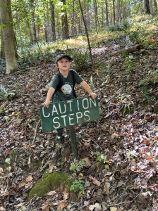
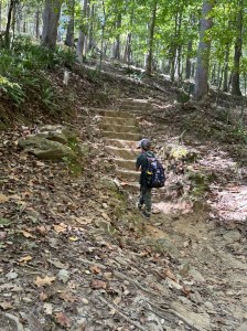
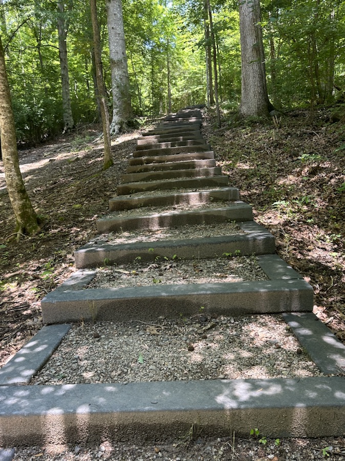
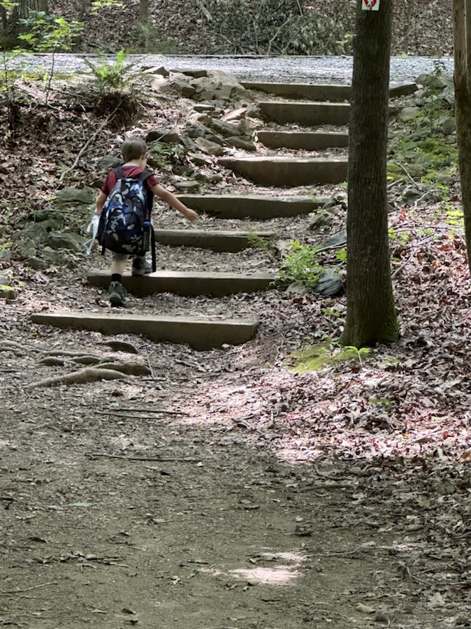
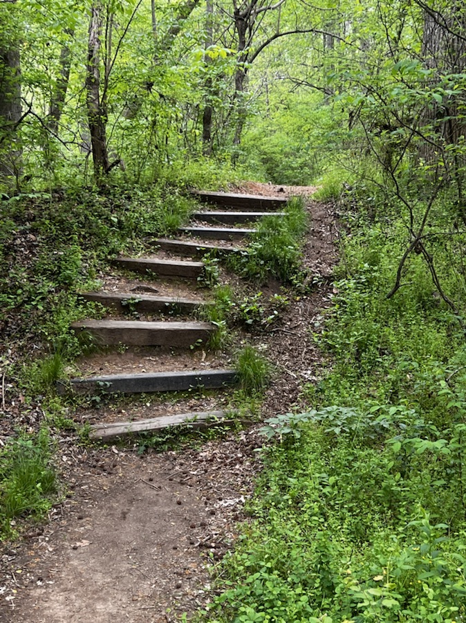
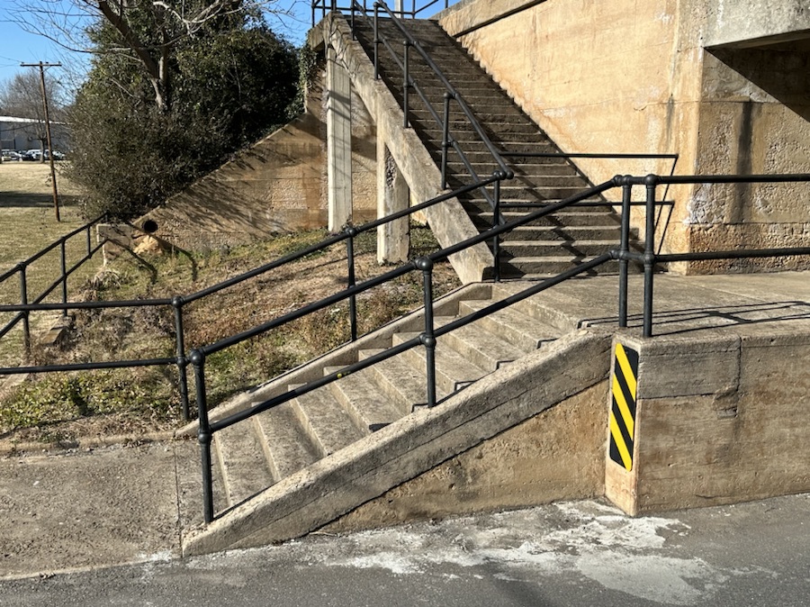
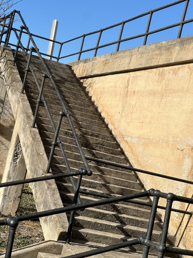
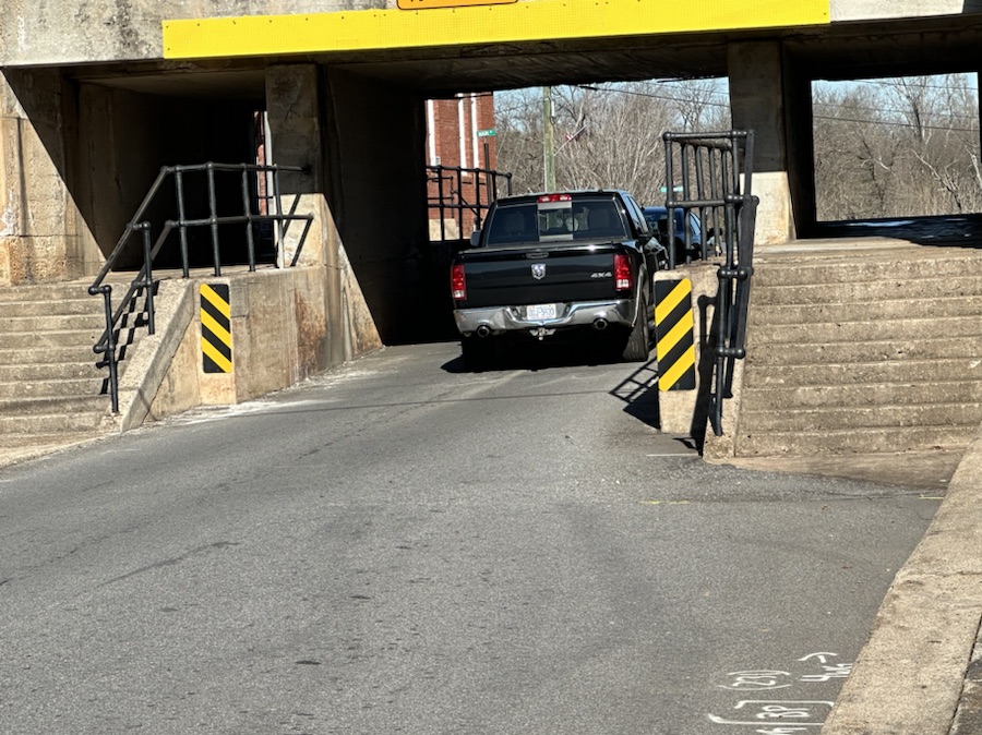
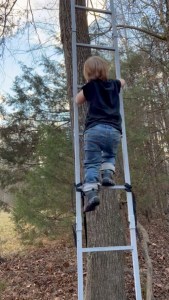
Good Day to y’all. Welcome to the fourth Which Way Challenge for 2025. This week I have chosen a theme of Any Which with Stairs, Steps, and/or Ladders. It can be anywhere you might find Stairs , Steps, or Ladders whether on a road, a trail, a mall, a construction site or any place conceivably possible for Stairs, Steps, or Ladders. As always, signs are welcome in your Which Ways.
Steps on Haigler Loop Trail in Anne Springs Close Greenway Fort Mill, South Carolina
Steps at South Fork Park Trail McAdenville, North Carolina Steps on Fern Trail Crowders Mountain State Park Kings Mountain, North Carolina Landsford Canal State Park Catawba, SC
Stairs …
Two Sets of Stairs to travel into Town Stairs leading to Inaccessible Railroad Tracks Cramerton, North Carolina
Ladders …
Ladders at a Construction site Coleman climbing Ladder -Age 2
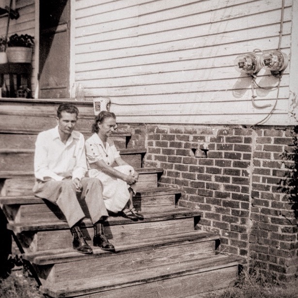
Bonus Throwback Steps …
My Paternal Grandparents Great Falls, South Carolina
Sharing your Which Ways could be one photo or several, it’s all up to you. Don’t feel obligated to share as many as I do.
God Bless. Looking forward to seeing y’all’s Which Ways. Thank you for visiting and sharing your time and thoughts with us. I appreciate y’all so very much.
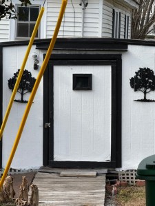
Monday Window is a weekly blog post challenge featuring one or more photos of windows, prominently or as the main subject.
Geometric Construction Windows
► Tag your post “Monday Window” (NOTE: Put a space between Monday and Window, no “s”, Window is singular.) The WordPress Reader will show most of the recent posts tagged this way (alas, not all).
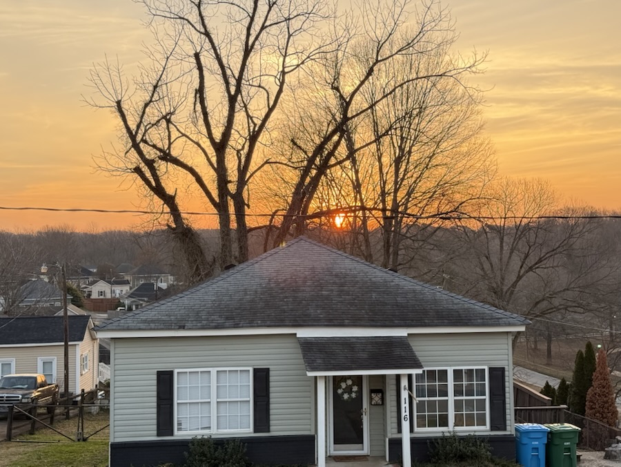
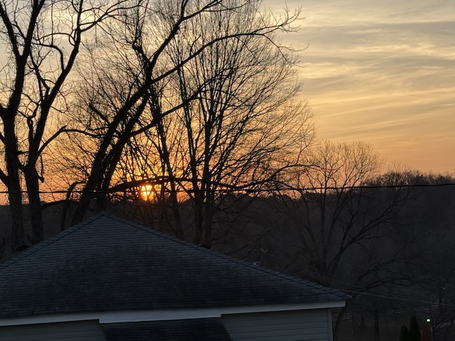
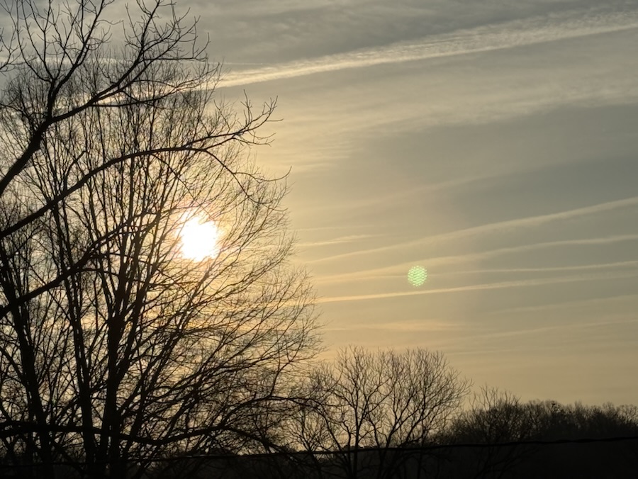
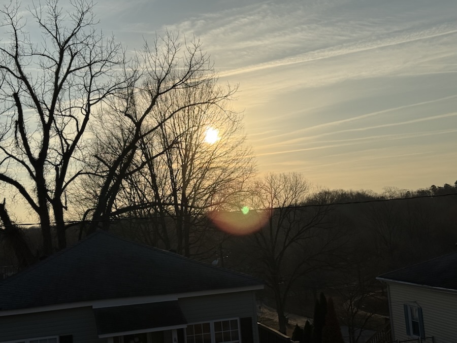
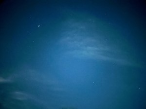
I wish I had a telescope 🔭 and could take pictures through it. This week the evening sky is delightful. Several planets are visible and a rare planetary parade is coming to the skies on the 21st. That’s why I wish I had a telescope, six planets (maybe seven) will be visible including Venus, Mars, Jupiter, Saturn, Neptune and Uranus.
Enough of my wishes and here’s to show you what I could see just through my iPhone tonight.
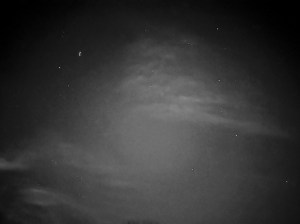
Original
Reel Filter effect
Vista Monochrome filter effect
According to Google Lens Search what I captured is the Constellation Orion.
Now to show you what stylized creation Google Photos Al created of my evening sky.
Google Al Stylized effect
Before you ask, I will tell you that I really do not comprehend how Al arrived at this interpretation of my evening sky. Your guess would be as good as mine.
Location: Our Backyard View; Cramerton, North Carolina, USA
God Bless. Look up and enjoy the fantastic wonders of the 🌌. Thank you for visiting and sharing your time and thoughts with us. I appreciate y’all very my.
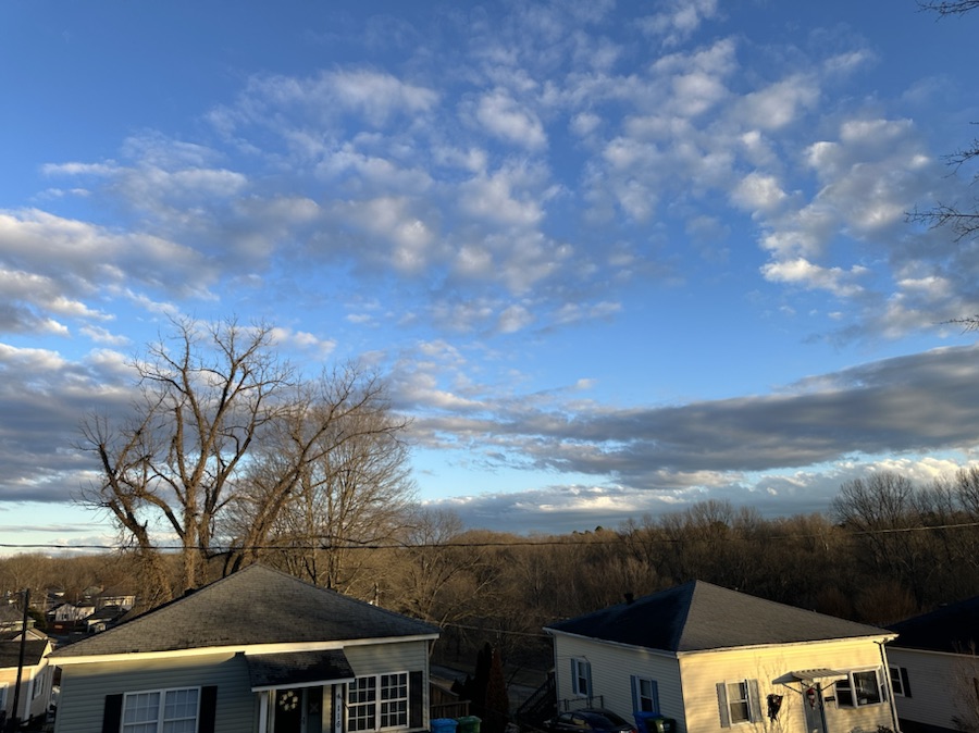
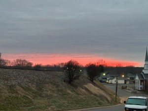
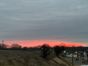
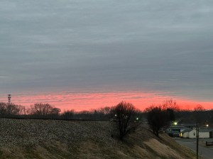
On Monday, after our weekend winter weather, was a delayed start for school for Coleman. Therefore, we were at the bus stop an hour later than normal and were treated with an amazing Red Sky. I am not sure if we need to take warning, that bad weather is coming or not. The weather forecast keeps changing from possible more winter weather to only rainy days ahead.
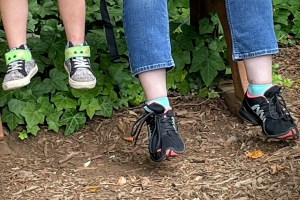
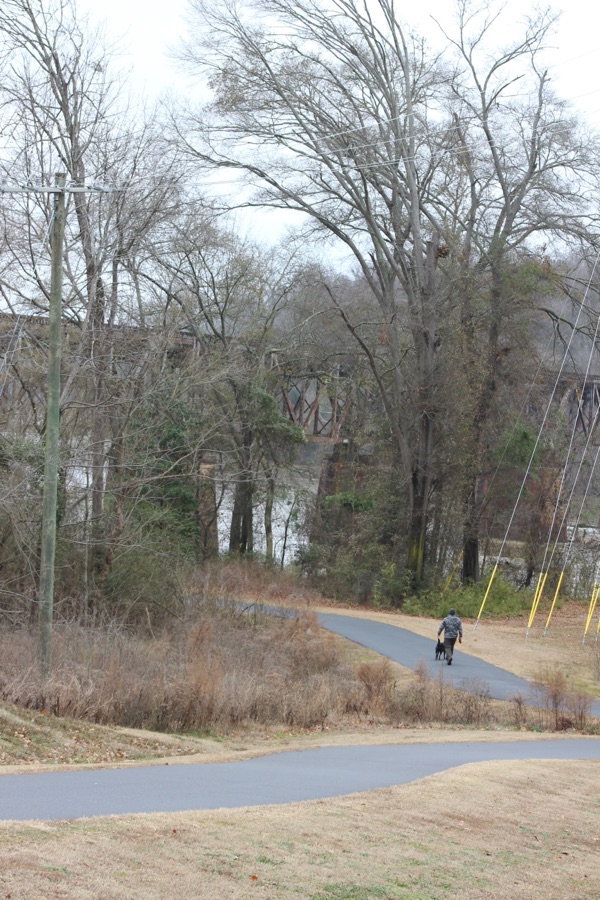
Welcome to the third Which Way Challenge for 2025. This week I have chosen a theme of Any Which Way with People in it. It can be where you capture people unaware as your out and about on the road, path, or trail. As always, signs are welcome in your Which Ways.
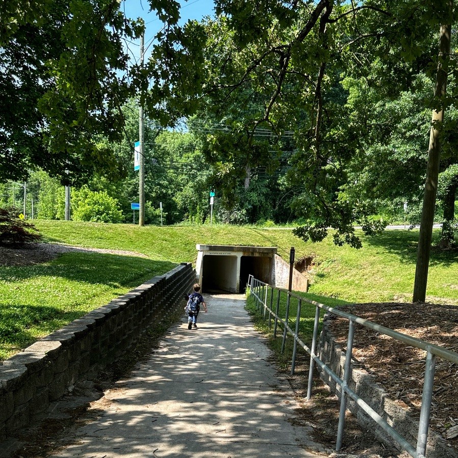
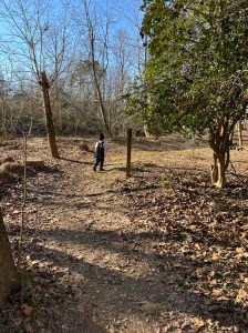
Coleman and I went hiking along the Disc Golf Trail at Goat Island Park and Greenway before the freezing cold weather it our area. The Disc Golf Trail is a natural dirt trail, mostly smooth with some tree roots and lots of leaves this time of the year.
Coleman on the trail
Coleman loves to lead the way and is often ahead of me. I allow some lead way as long as he’s in my line of sight.
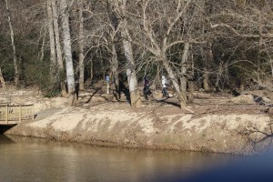
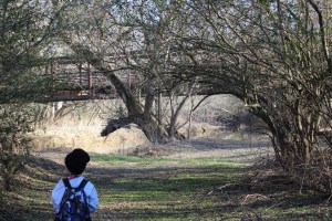
Looking across the river at another trail, we spot a small group of visitors checking out the fishing access.
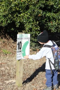
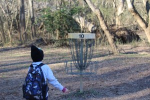
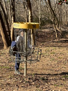
Moving along the way we came across several of the disc catchers. This is number 10 of 20 along the trail course.
Coleman checking out the disc golf sign and catcher.
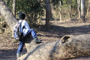
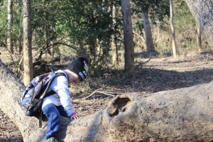
While hiking along the trail Coleman spots a downed tree and decided to climb up And investigate. He hence Pulls Up a Seat waiting for me to catch up.
Crossing over onto another section of the trail we encounter a man jogging through the trail.
A Lone Jogger
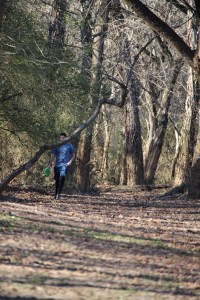
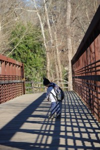
Continuing on our hike we try to maneuver around to reach the bridge.
Coleman heading towards the Bridge
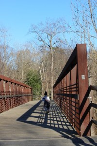
We managed to reach the bridge and were able to venture on towards where we began.
Coleman crossing the bridge & noticing the shadows
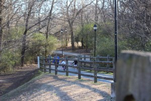
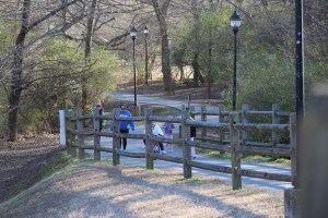
As we near the end of the bridge heading back to the entrance, we see a family approaching our way. One of the little girls is attempting to ride her bike up the hill.
I am looking forward to seeing y’all’s Which Ways with People. I am grateful for those who have chosen to participate and support this challenge. Won’t you take the initiative and join the Which Way Challenge? For more information on the Which Way Challenge Check out the new Which Way Challenge Page here.
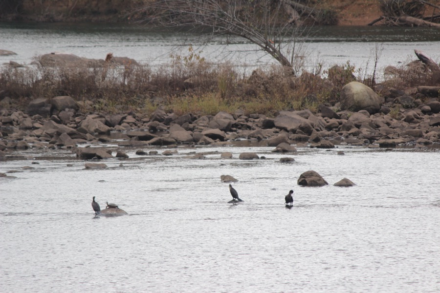
Let’s roam around and embrace numbers in life and in nature. As many of you might know my grandson, Coleman and I enjoy hiking together out amongst the trees, along Greenways, and within our state and local parks. This first image is of a group of about eleven painted rocks some of which display a message which the painter wishes to convey. Others are just for the fun and beauty to hopefully bring you joy and a smile.
“Embrace life with a smile.” Author unknown
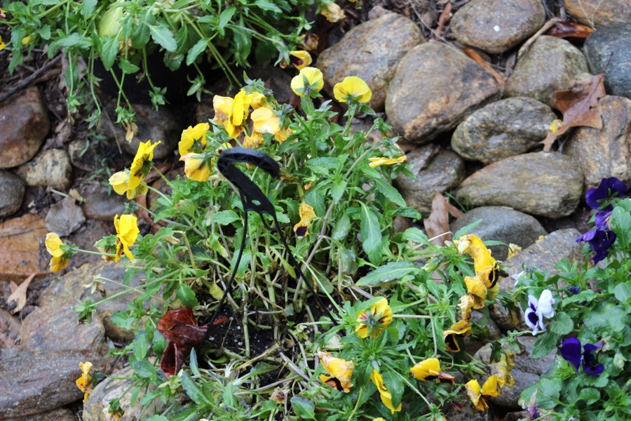
“Life is a journey, not a destination.”(Author unknown). As we continue embracing life and nature, shall we stop and enjoy the beauty of five flowers along the pathway.
“Where flowers bloom so does hope.” — Lady Bird Johnson
As the flowers bloom and remind us there is hope for the world and life needs to be embraced wherever and whenever possible.
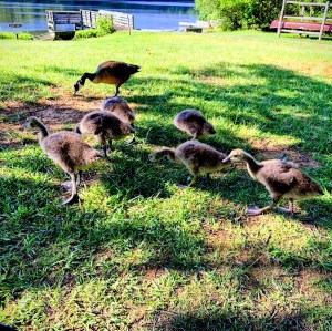
Embracing the living creatures two by two different yet enjoying the same space and time. Embrace the NumbersTwo Horses sharing the pasture with Two Canada Geese at Anne Springs Close Greenway.,
“Strength lies in differences, not in similarities.” — Stephen R. Covey
Whether one is out in nature or in a classroom, there is unity in numbers. Children learn the importance of Embracing Togetherness. They can learn that even though we are different, we are all the same, united for a purpose.
Nine Students and a teacher all wearing green and embracing togetherness in the classroom.
“The unlike is joined together, and from differences results the most beautiful harmony.” — Heraclitus
Leaving the indoor classroom for the classroom in nature, we can learn to embrace the beauty, the elegance, the love one for another, and the strength and power in unity and in numbers.
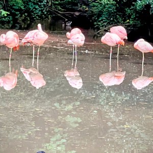
We can enjoy the beauty and elegance in every flamingo. We can admire their stance and embrace their uniqueness as we observe Five Flamingos and their reflections.
“Embrace the elegance of a flamingo, and let it inspire your life.” — Unknown
Each friendship is as unique and beautiful as a flamingo.”- Unknown. Every creature whether human or animal is unique and beautiful in their own way. Every family has its own uniqueness. They may have the same numbers as other families or may not. They maybe similar, but still different in their own special way. No two families are exactly alike, that’s why we should embrace our own families with love and respect.
We see and observe various “families” in nature, like this family of Seven Canada Geese sticking together yet apart at Andrew Jackson State Park.
We are each of us angels with only one wing, and we can only fly by embracing one another. — Luciano De Crescenzo
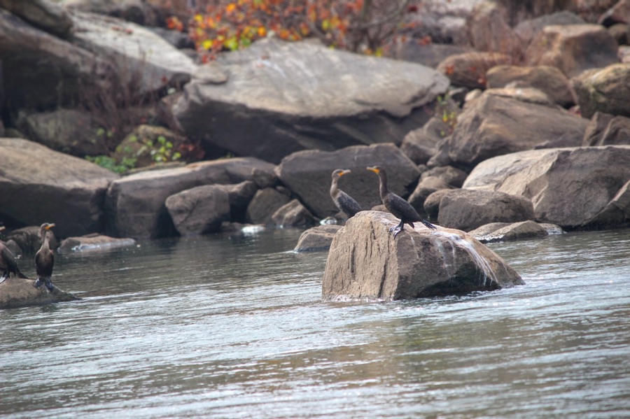
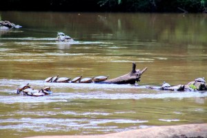
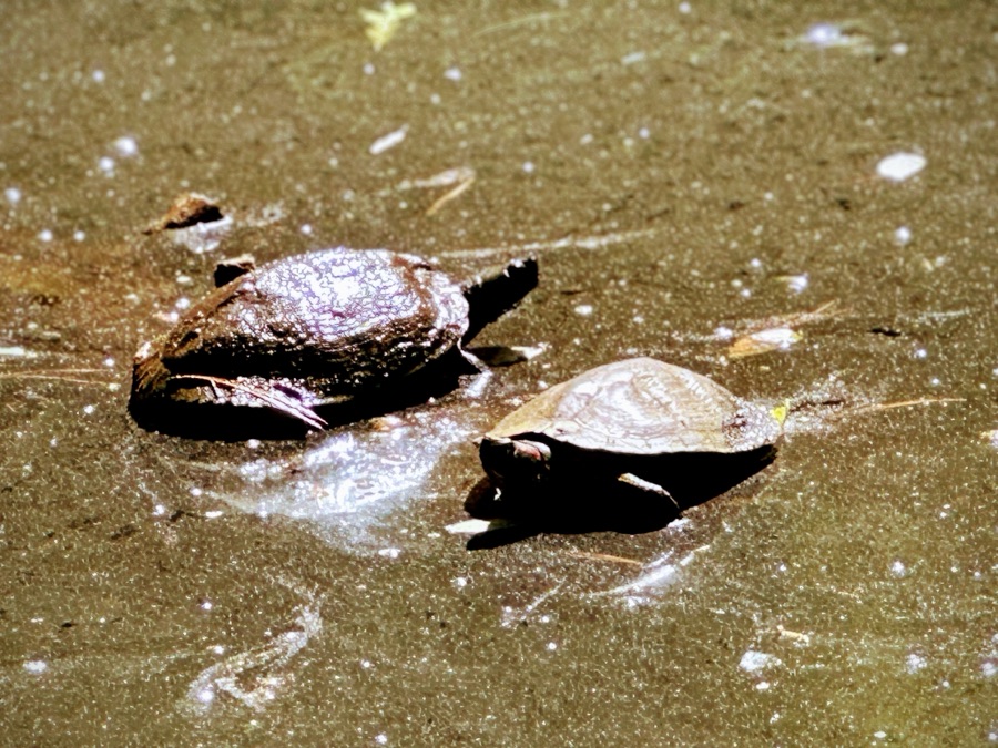
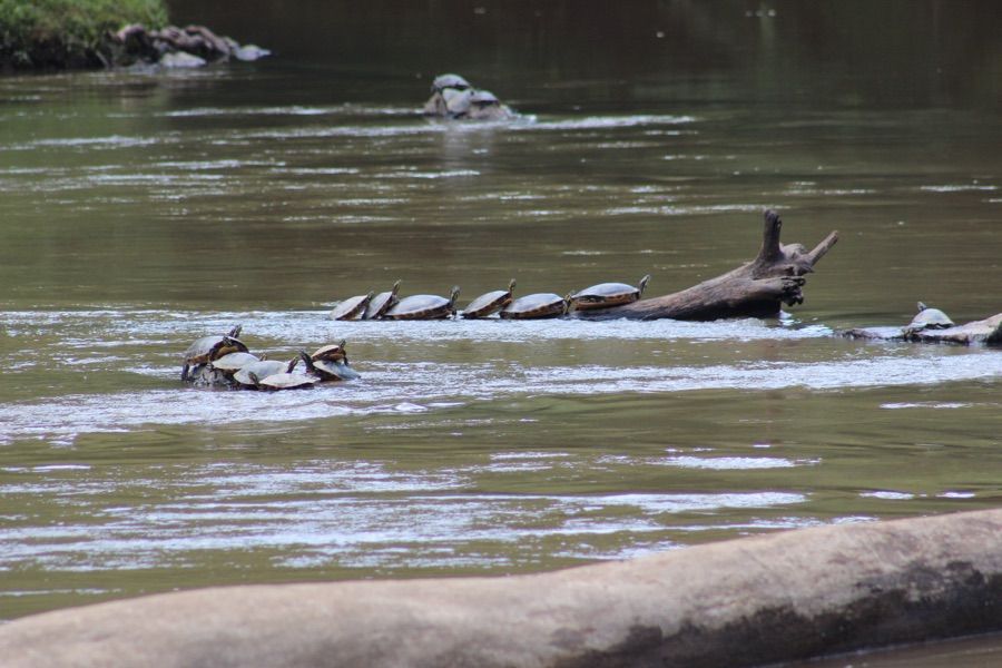
Let’s keep on moving and striving for unity for there is power in numbers. Turtles gather together in numbers sunning on logs and enjoying time swimming together in a river. Fourteen Turtles embracing the warmth of the sun and being together in the South Fork Catawba River by South Fork River Park in Northern section of Gastonia, North Carolina.
“There is power in unity, and there is power in numbers.” From Dr. Martin Luther King’s speech “Keep on Moving.”
Now for each of y’all to embrace the challenge and show us how you Embrace the Numbers.
God Bless. Embrace Life. Embrace One Another. Embrace Togetherness. Embrace the Numbers. Thank you for visiting and sharing your time and thoughts with us. I appreciate y’all very much.
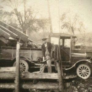
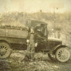
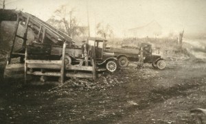
These Throwback images are from my maternal grandfather’s collection of photos I was given from my maternal grandmother after his passing back in 1968. The photo images were originally on personal post cards.
Old Coal Trucks in early 1900’s.
Not sure, but I think this is my maternal grandfather next to the truck.
Original image
I have always thought these were taken in Deep Gap, North Carolina, but I am not one hundred percent (100%) sure. My maternal grandfather did work for a time for a coal mining company.
Remember for enhanced viewing click on each image.
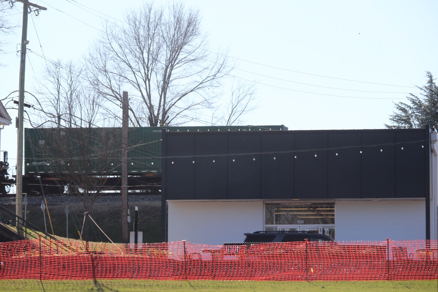
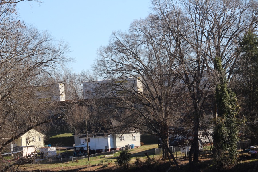
Location: Old Town; Riverside Community; Cramerton, North Carolina, USA
God Bless. Stay Safe. Keep Warm. Be Observant. Geometric shapes are all around. Thank you for visiting and sharing your time and thoughts with us. I appreciate y’all very much.
To do so, simply share the photo* you have set as your wallpaper;
Provide as little or as much detail as you wish;
Use a pingback, or post a link here so I know you have joined in on the fun;
Then finally, share the fun around.
I am sharing my Wallpaper from both my Laptop and my Smartphone. I enjoy looking at different images each month. Most of which revolve around Coleman (my grandson) and nature.
Here are my Smartphone Wallpapers:
Personal Focus
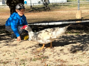
Coleman & Muscovy Duck in Riverside Park and Greenway
Hiking Focus
Coleman checking out the Disc Golf Catcher at Goat Island Park and Greenway
Reading Focus
Coleman playing in the Sand at Riverside Park and Greenway
Here are my Wallpapers from my Laptop:
Laptop Desktop Wallpaper
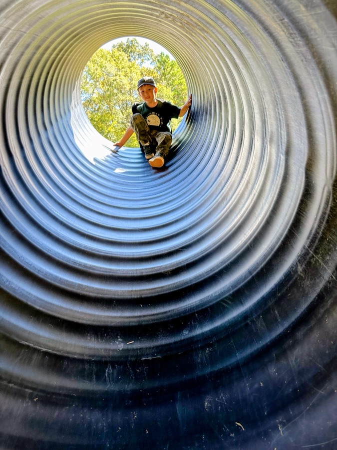
Coleman sitting on a Tree Limb Goat Island Park and Greenway
Cameras: 1-3) Apple iPhone 14 Pro Max; 4-5) Canon EOS Rebel T3i with Canon EF-S55-250mm lens and Altura UV Filter attachment.
Location: 1-2) Riverside Park and Greenway; 3-5) Goat Island Park and Greenway; Cramerton, North Carolina, USA
God Bless. Have a funtastic week. Keep Warm. Stay Safe. Thank you for visiting and sharing your time and thoughts with us. I appreciate y’all very much.
Judy invites us to join in with her to play “The Numbers Game #56.”Today’s number is 177. To play along, she suggests you go to your photos file and type that number into the search bar. Then post a selection of the photos you find that include that number and post a link to your blog in herNumbers Game blog of the day. If instead of numbers, you have changed the identifiers of all your photos into words, pick a word or words to use instead, and show us a variety of photos that contain that word in the title.This prompt will repeat each Monday with a new number. If you want to play along, please put a link to your blog in comments below.
Here are my contributions to The Numbers Game Challenge:
Camera: Canon EOS Rebel T3i with Canon EF-S55-250mm lens and Altura UV & Star filter attachment.
Location:Goat Island Park and Greenway; Cramerton, North Carolina, USA
God Bless. Thank you for visiting. Have a wonderful week and enjoy nature. Thank you for sharing your time and thoughts with me. I appreciate y’all very much.
Camera: Canon EOS Rebel T3i with Canon EF-S55-250mm lens and Altura UV and Star filter attachments.
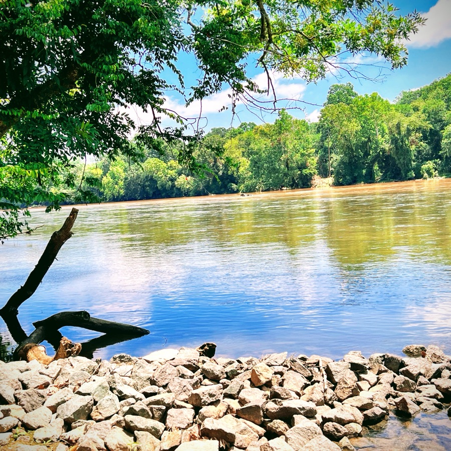
Location: Banks of the South Fork Catawba River; Riverside Park and Greenway; Cramerton, North Carolina, USA
God Bless. Count your blessings one by one. Be Grateful for all you’ve been given. Thank you for visiting and sharing your time and thoughts with us. I appreciate y’all very much.
To join the challenge, release a post featuring a window or windows any time during the week.
► Tag your post “Monday Window” (NOTE: Put a space between Monday and Window, no “s”, Window is singular.) The WordPress Reader will show most of the recent posts tagged this way (alas, not all).
► Add a comment to the latest Monday Window post and include a link to your latest Monday Window post.
Please visit the participating blogs. You will be delighted and astounded by the rich and imaginative offerings by the bloggers from around the world.
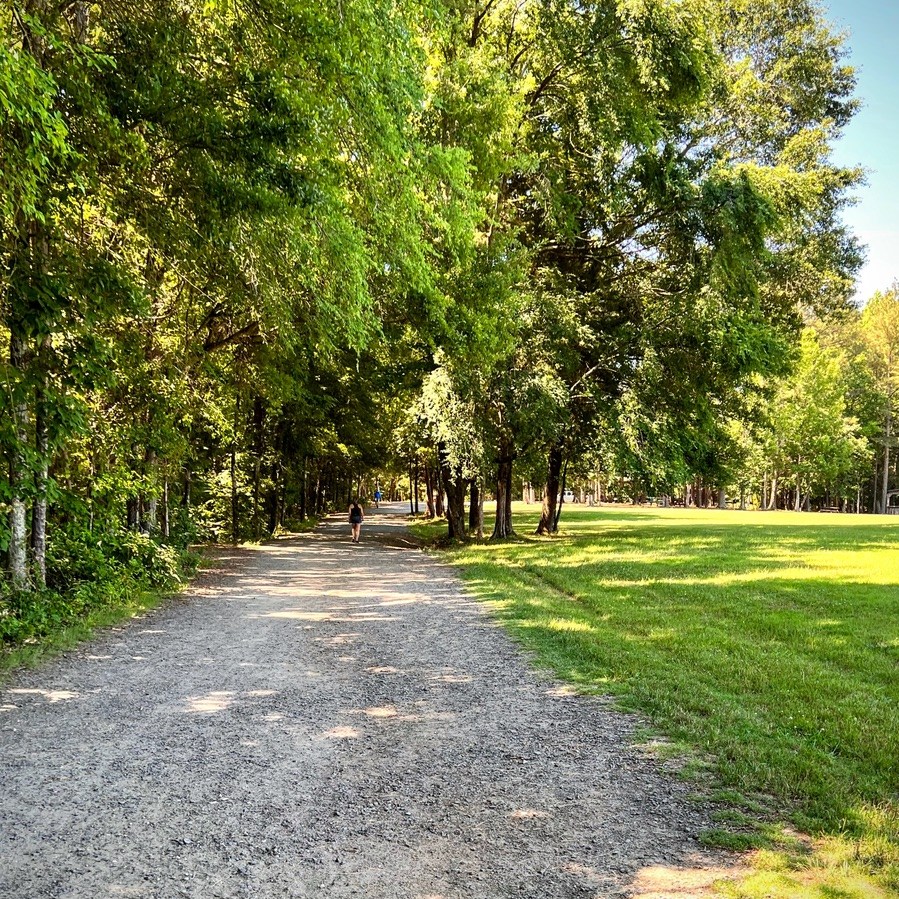
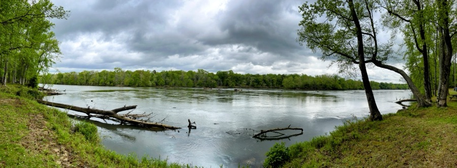
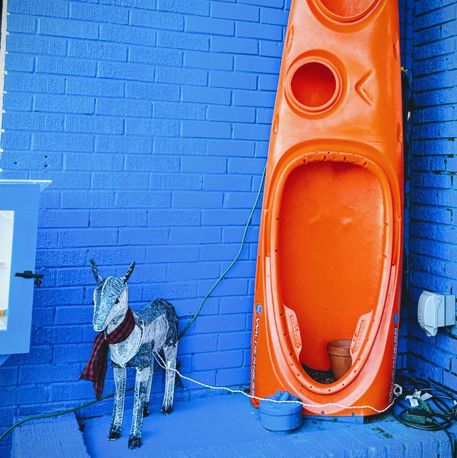
Location: Outside Confluence South Fork; Cramerton, North Carolina, USA
God Bless. Be Kind. Love One Another as Yourself. Don’t let anything get your Goat. Thank you for visiting and sharing your time and thoughts with us. I appreciate y’all very much.
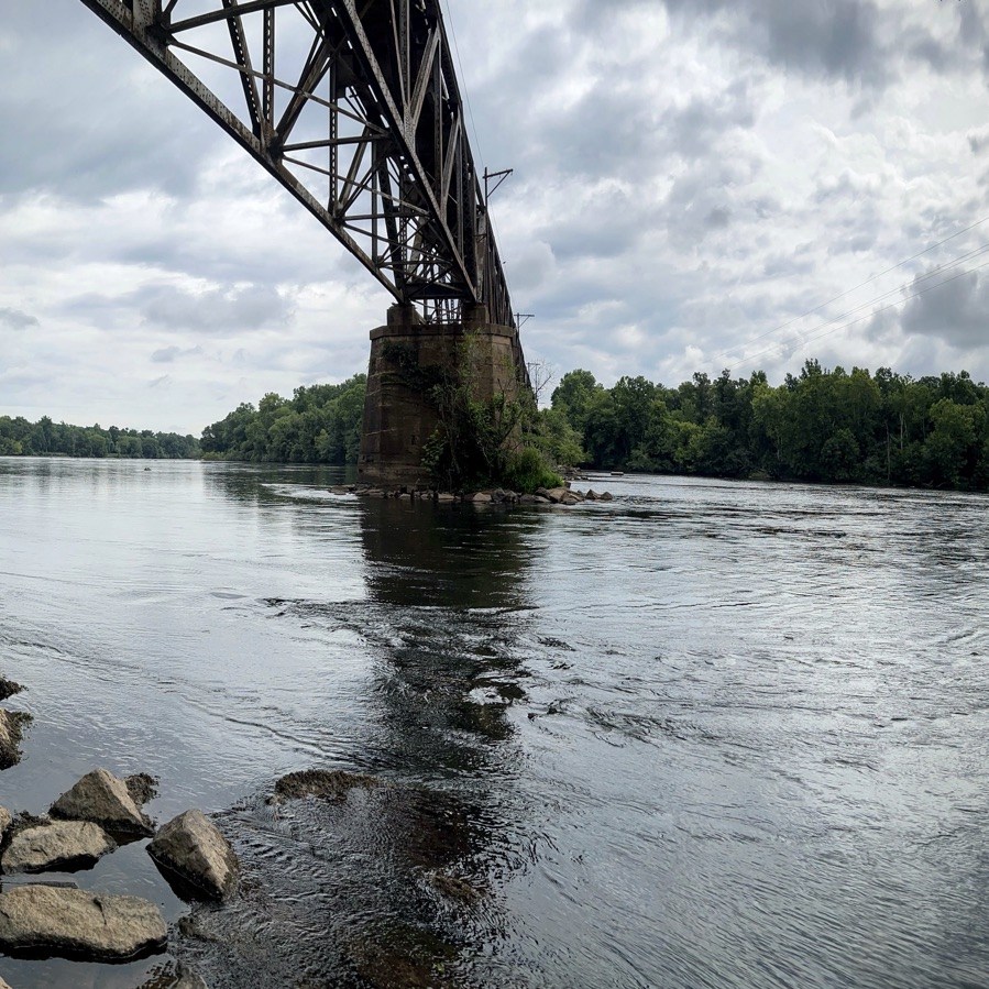
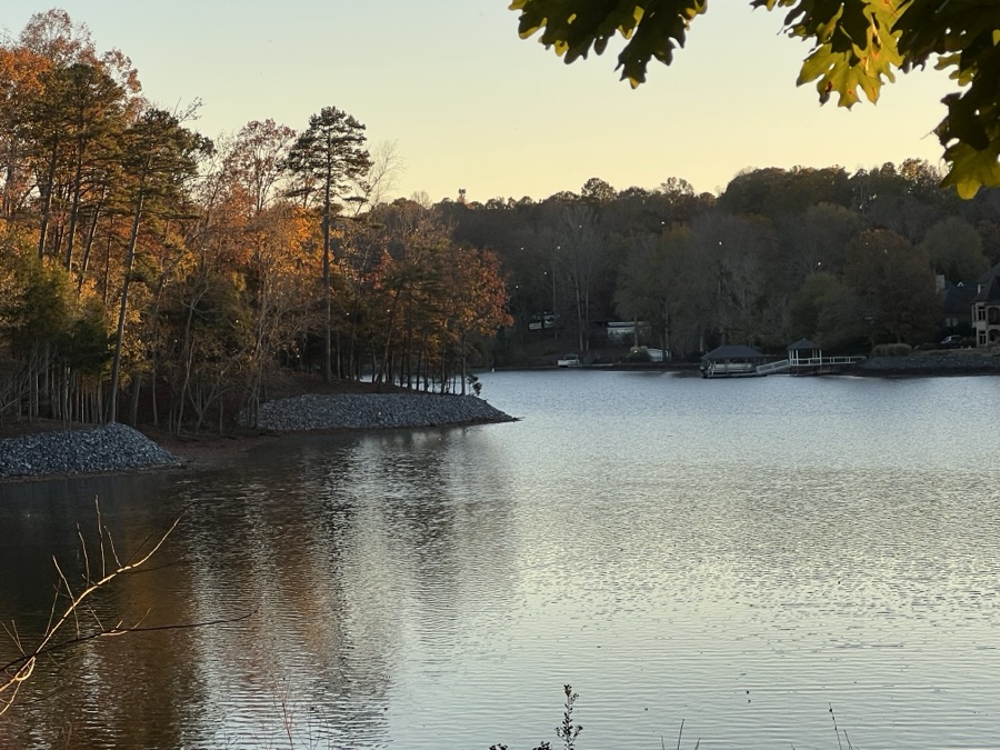
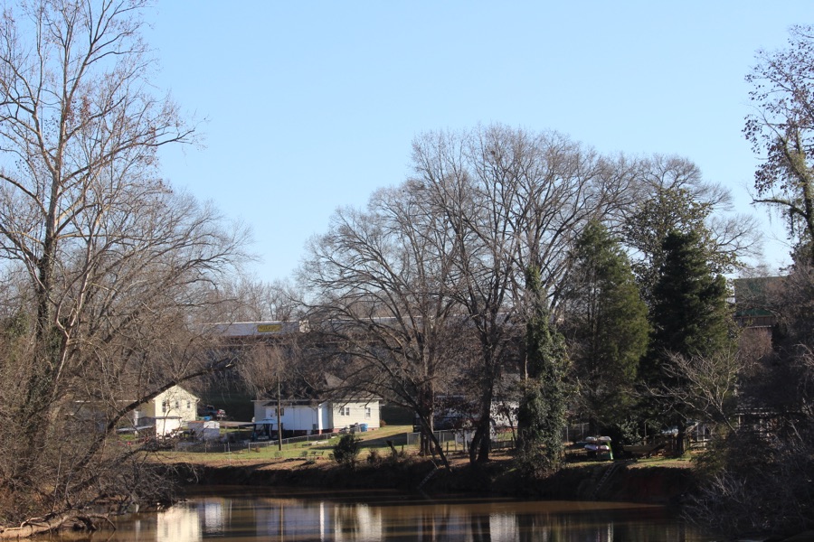
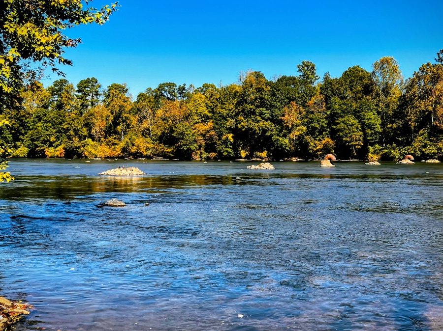
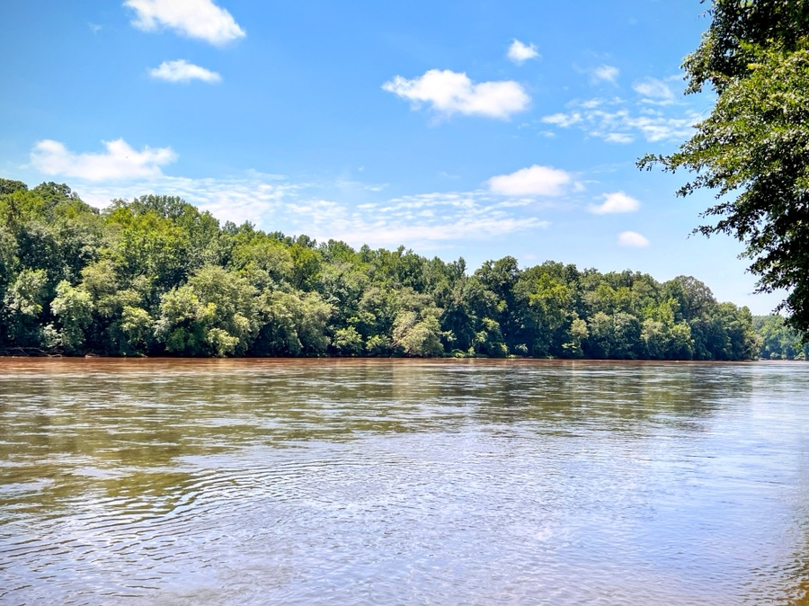
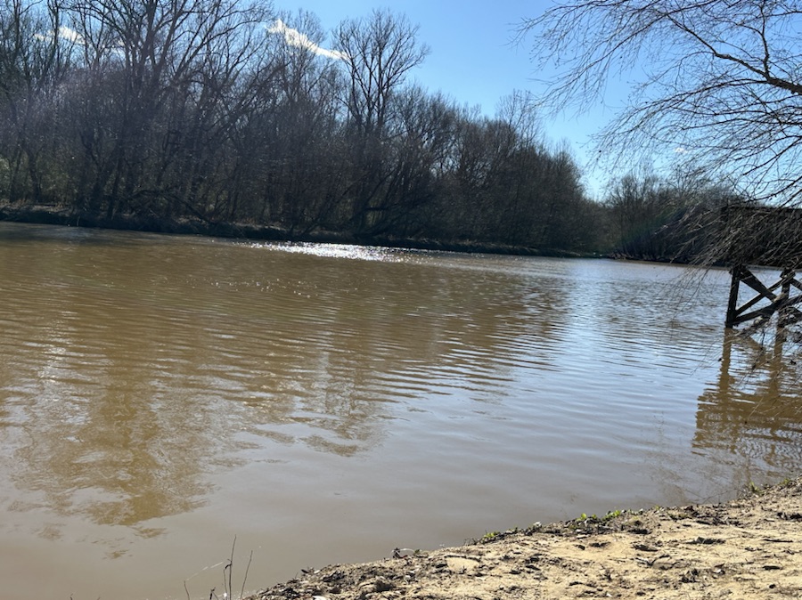
Location: South Fork Catawba River; Riverside Park and Greenway; Cramerton, North Carolina, USA
God Bless. Relax by the River. Be inspired to be You. Nature’s Beauty is amazing. Thank you for visiting and sharing your time and thoughts with us. I appreciate y’all very much.