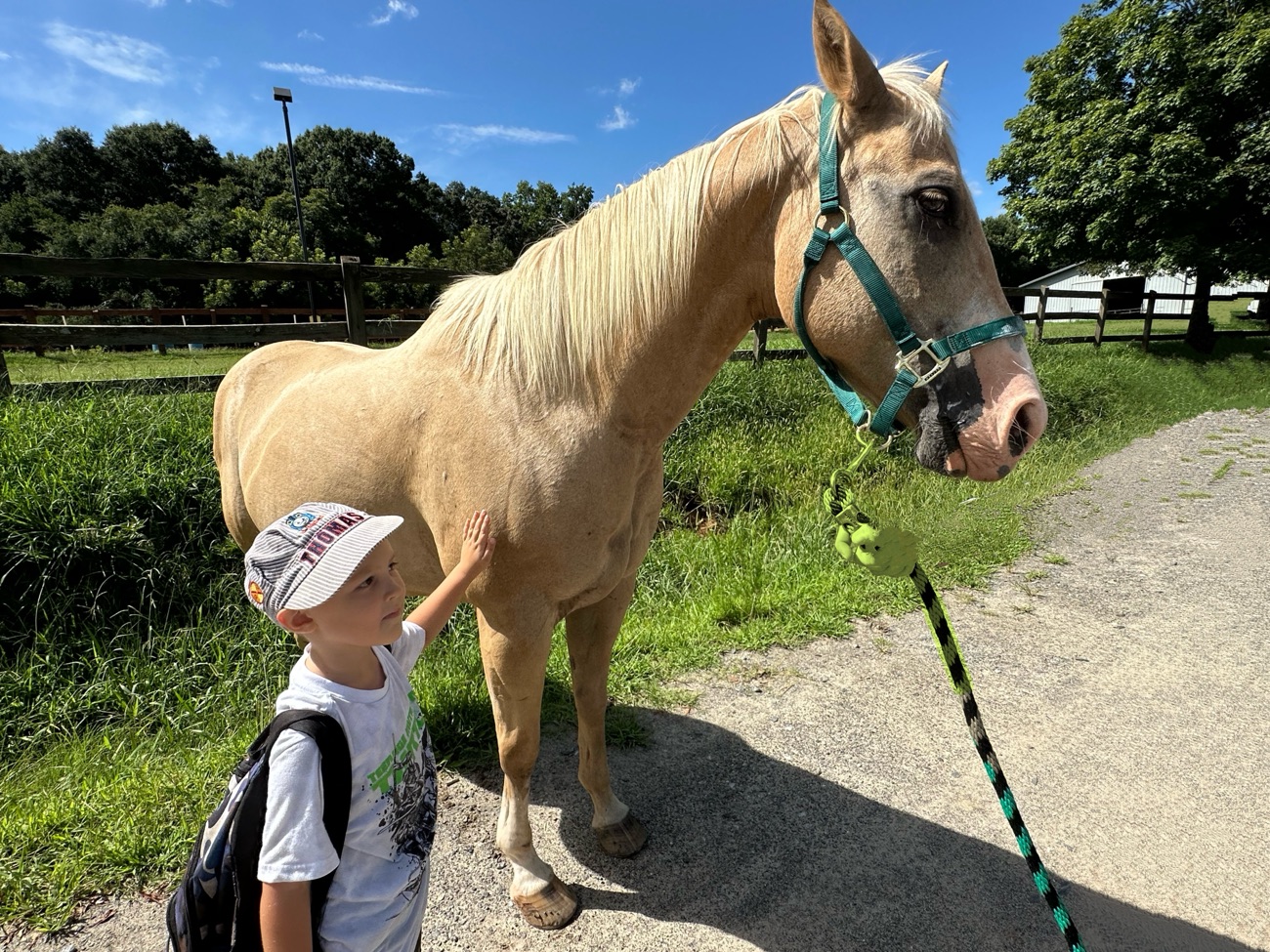
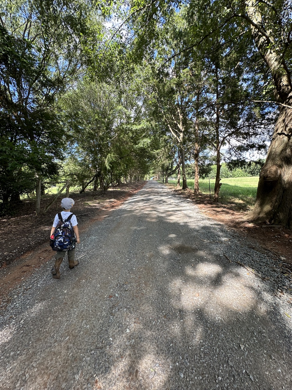
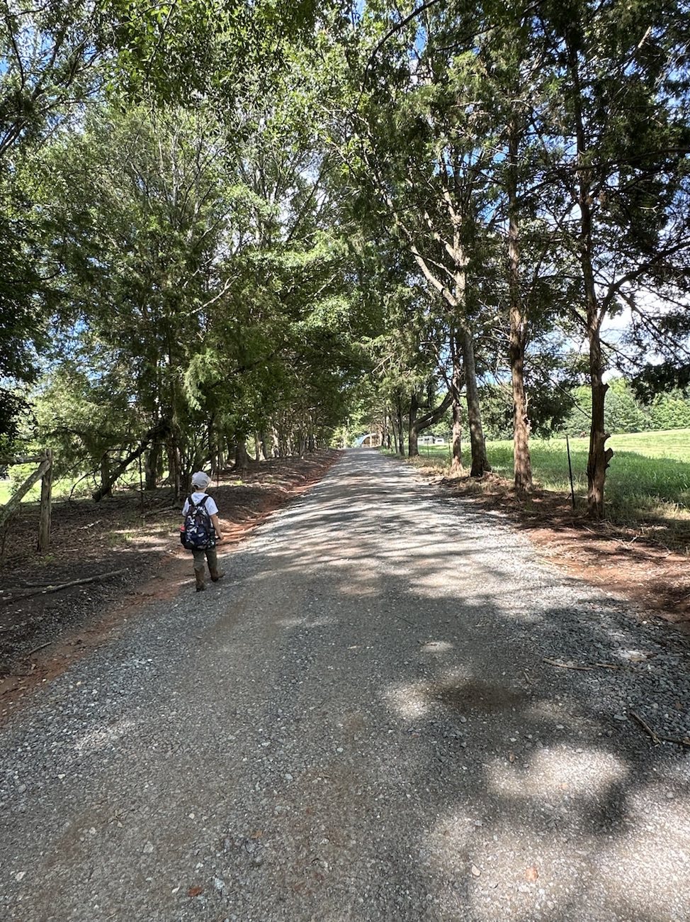
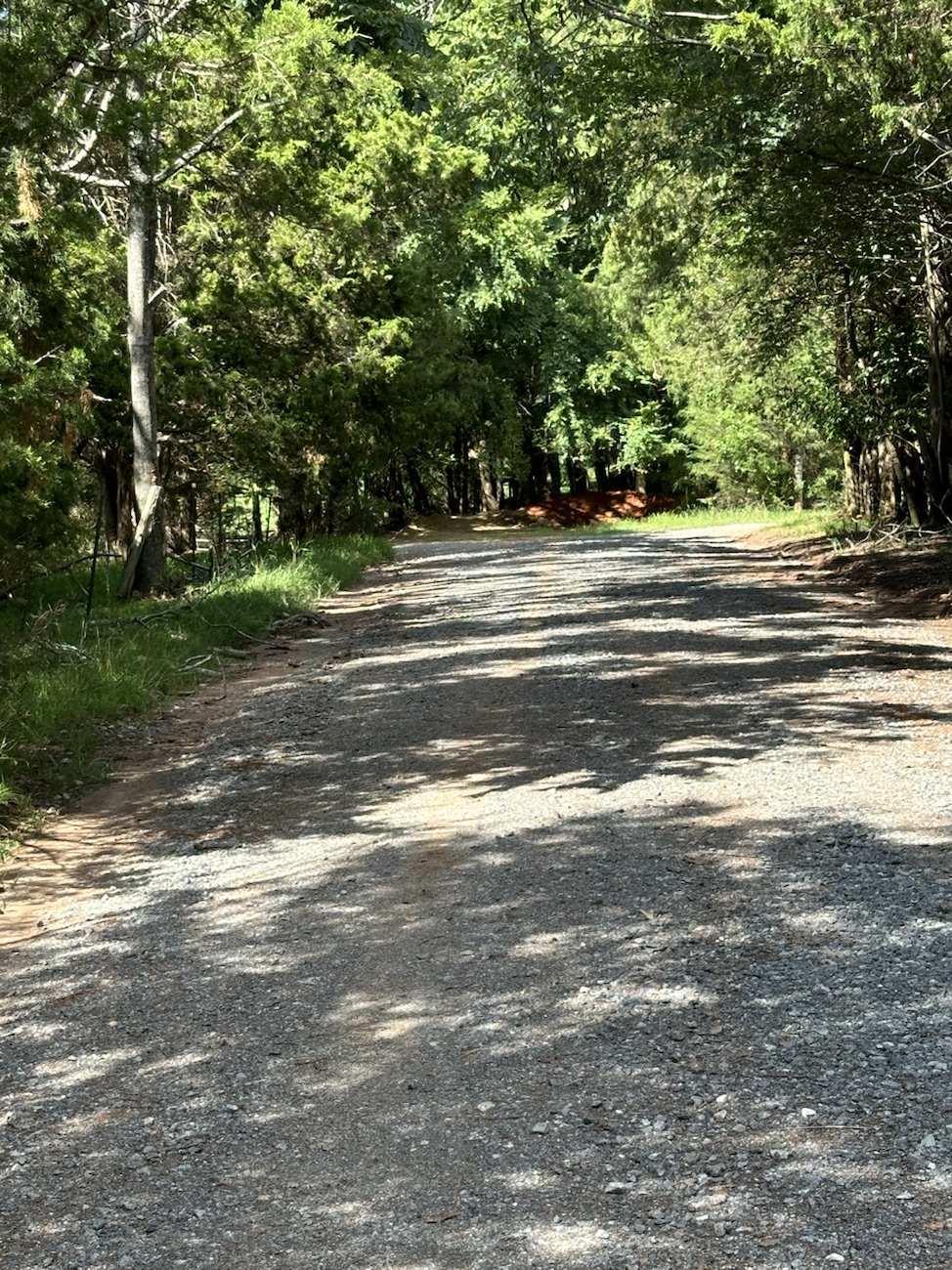
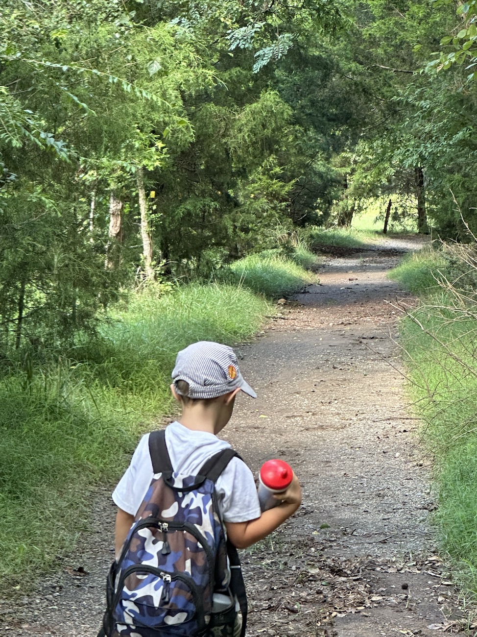
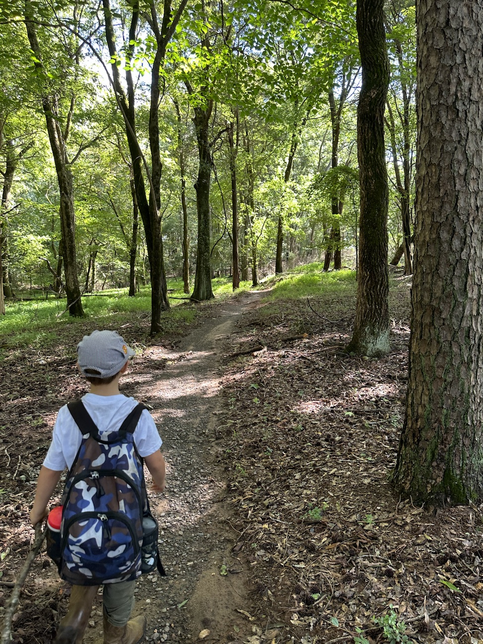
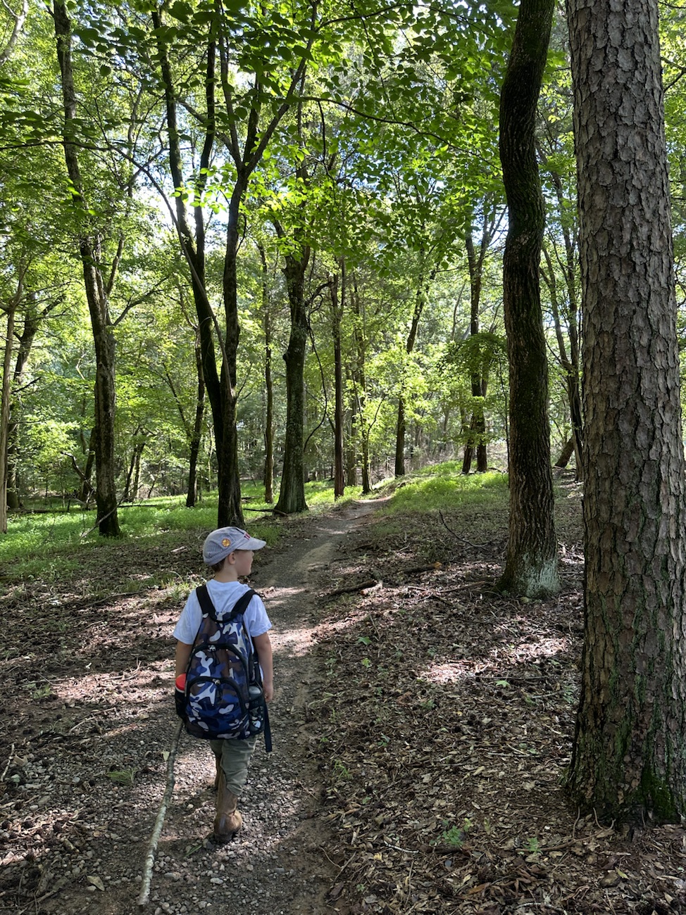
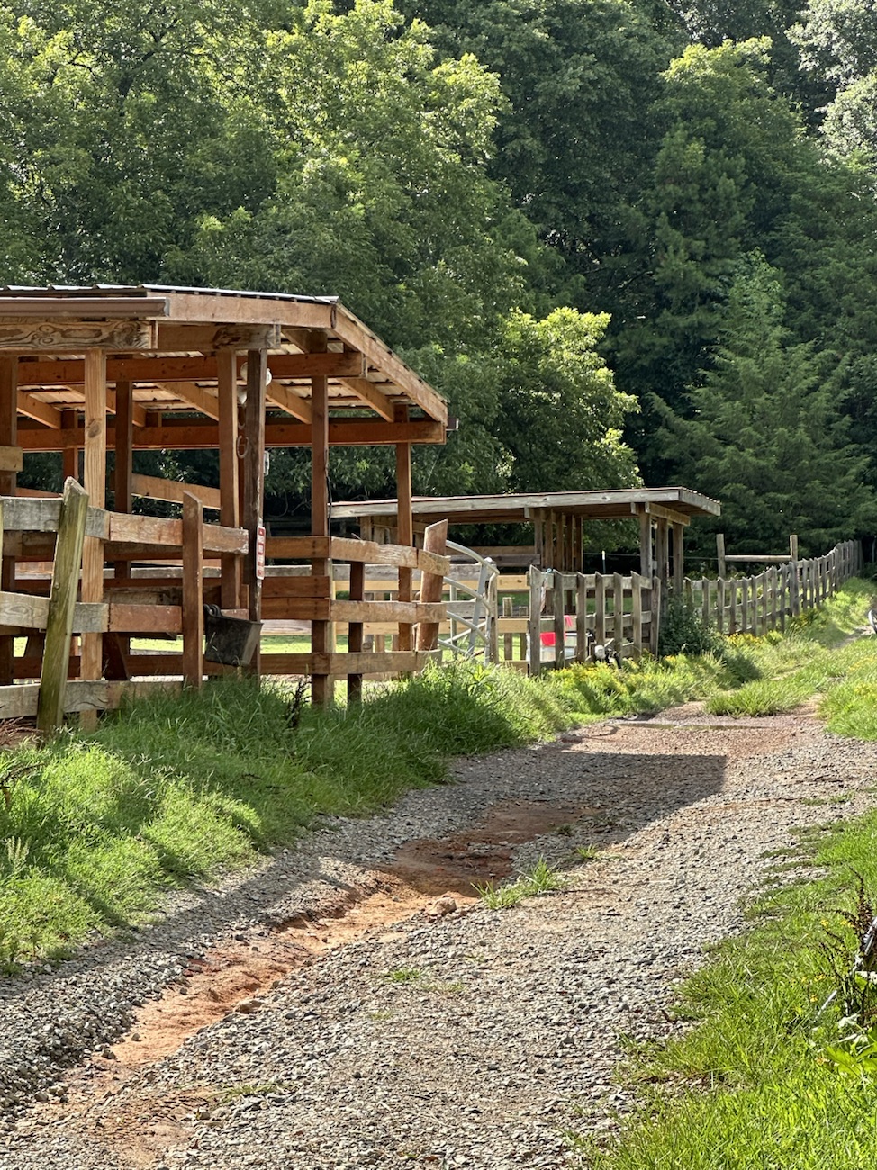
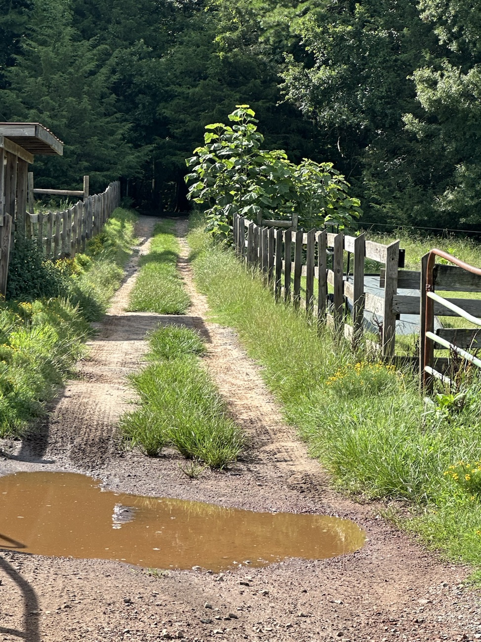
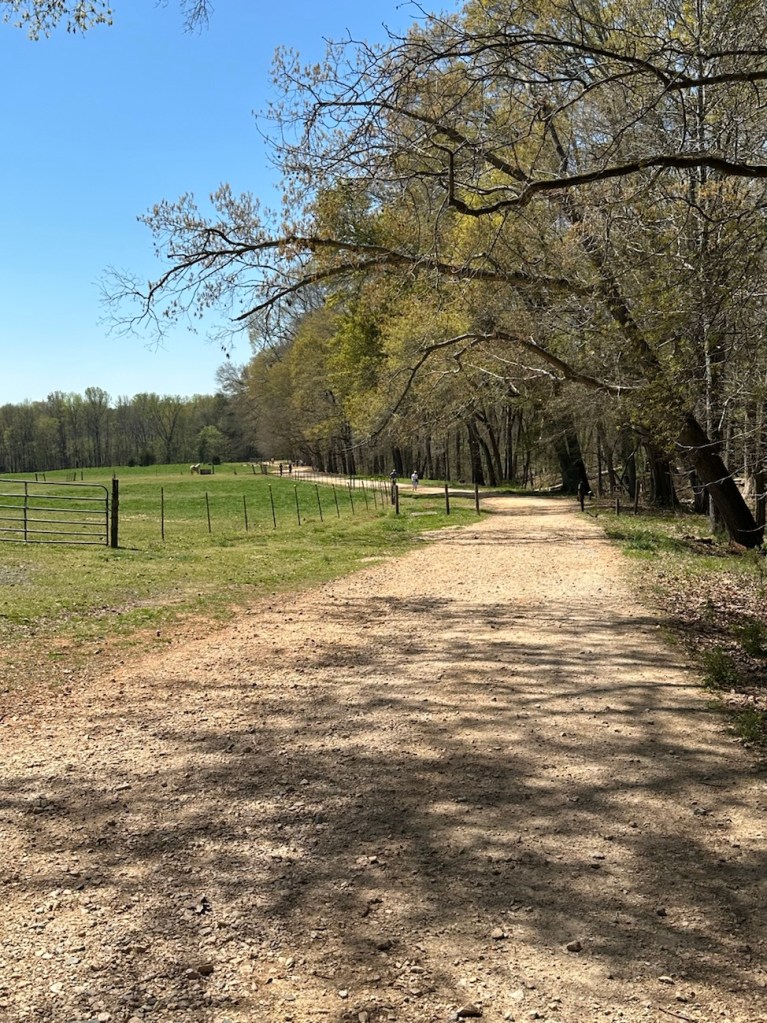
For Cee’s Which Way doing it My Way I have chosen to select Dirt Trails from our favourite Greenway with Coleman. If desired, you can click on each photo for enlarged viewing.
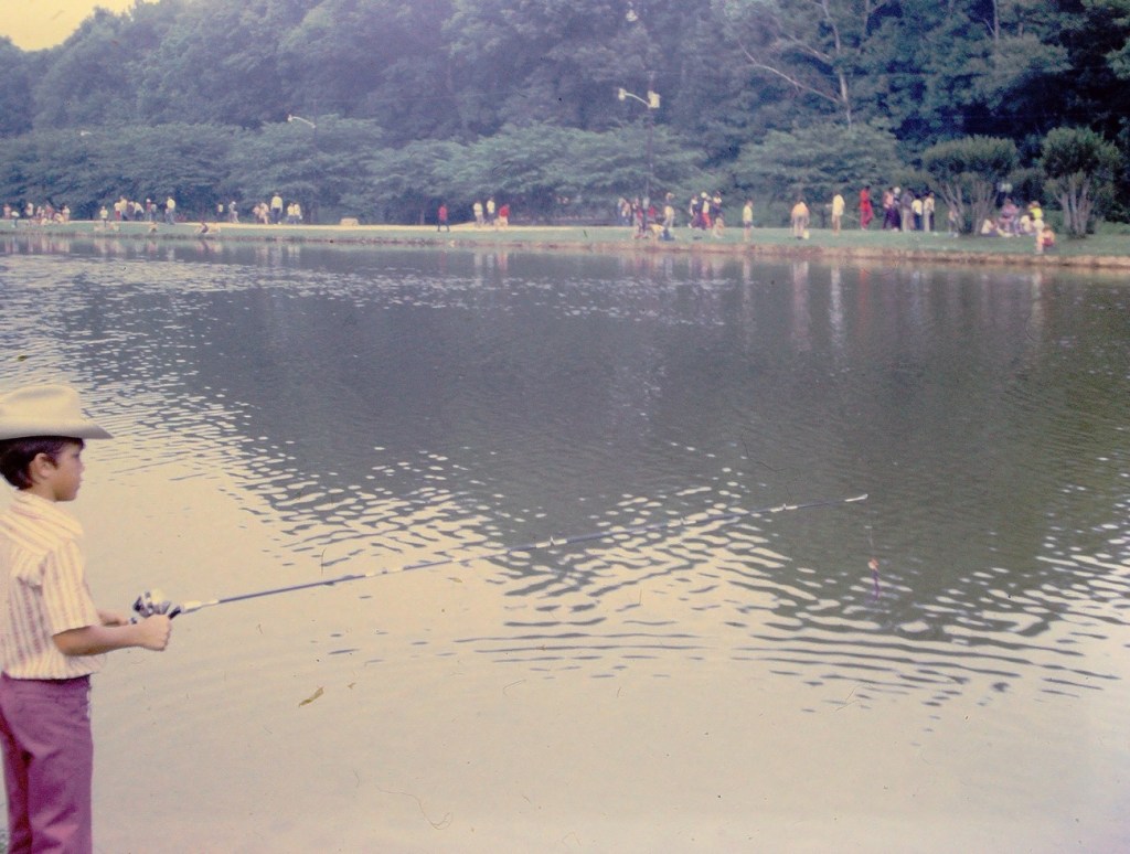
Location: Dogwood Trail; Horse Stables Entrance; Anne Springs Close Greenway; Fort Mill, South Carolina, USA
God Bless. Thank you for visiting and sharing your Dirt Roads, Pathways, and or Trails with us. Thank you for sharing your time and thoughts with us. I appreciate y’all very much.
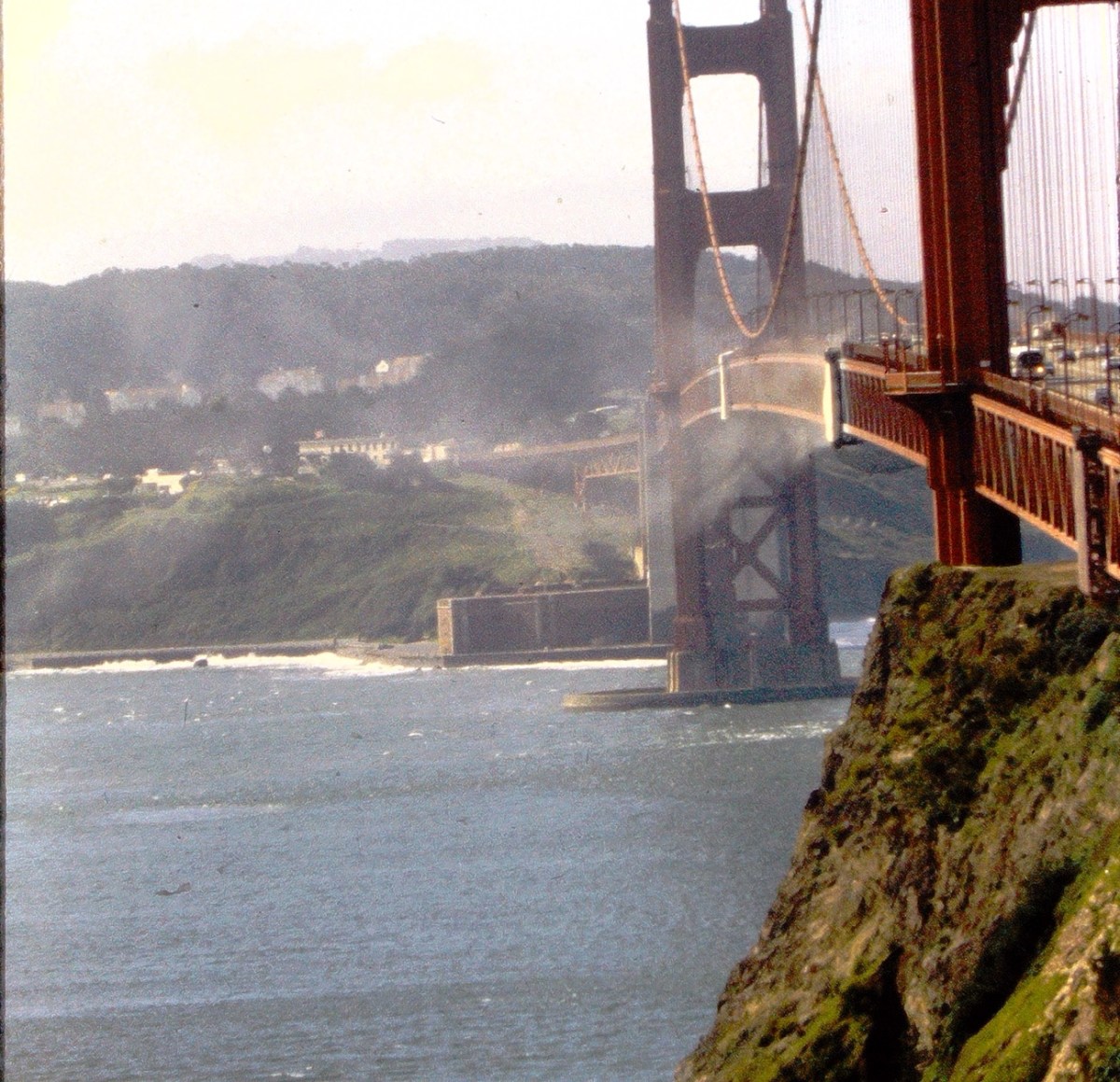
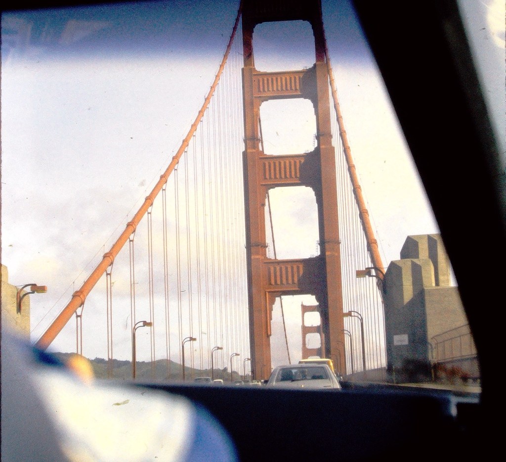
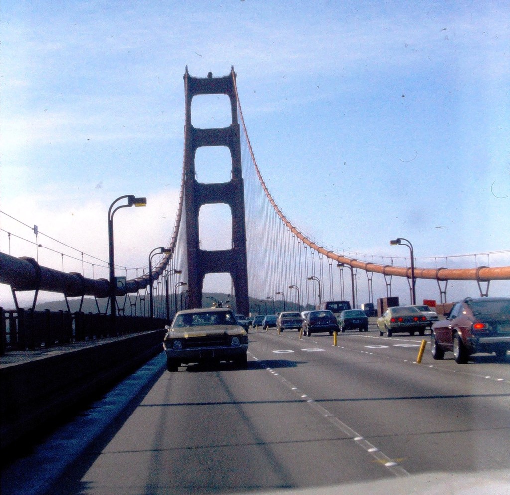
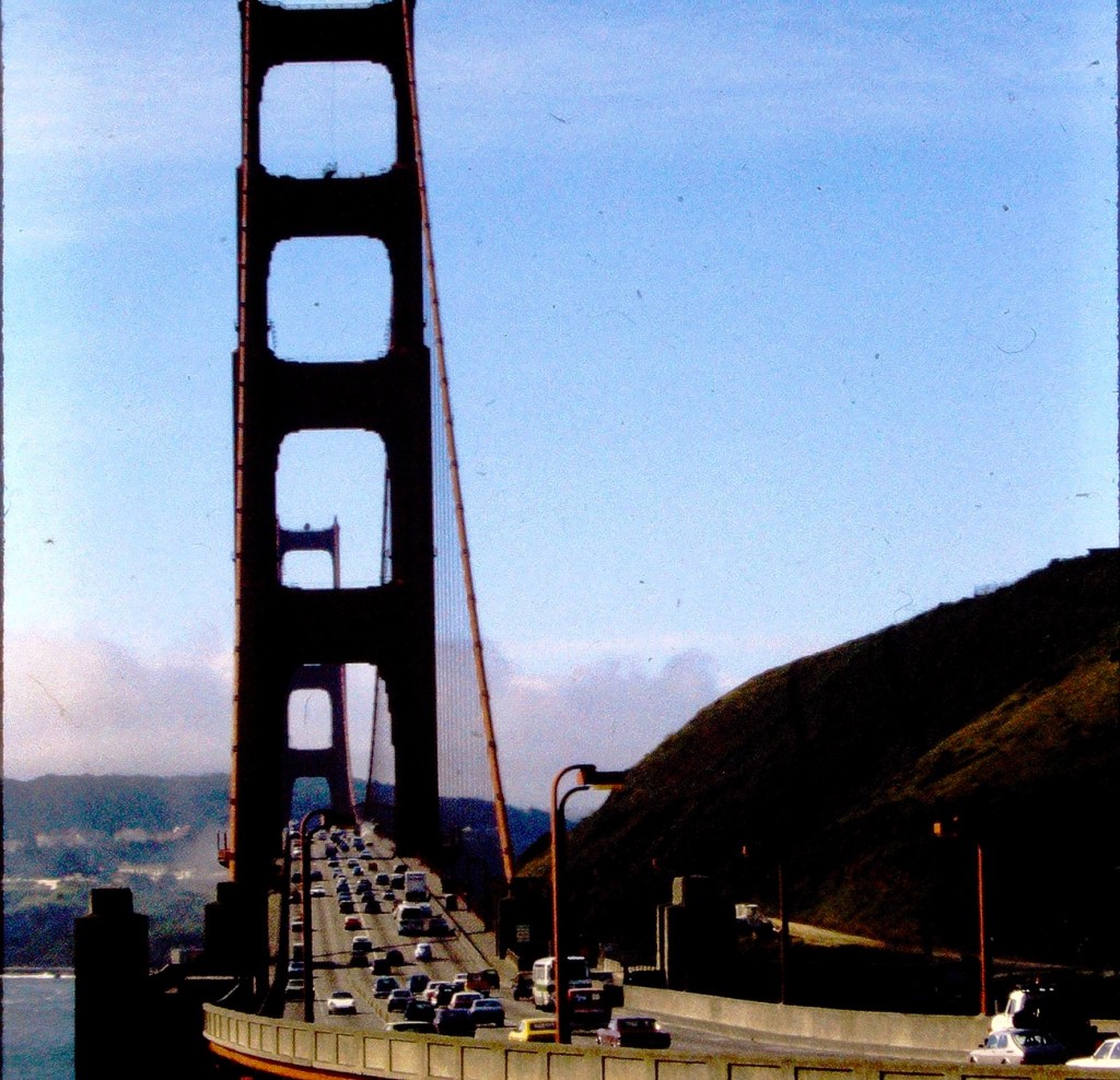
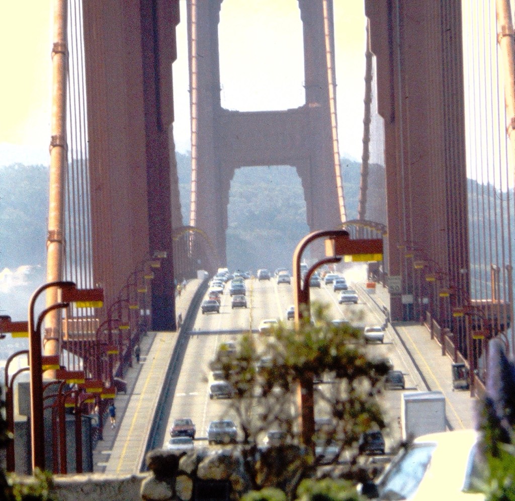
Golden Gate Bridge taken from the passenger seat while crossing the Bridge. Vehicles seen while Driving on the Golden Gate Bridge Golden Gate Bridge with Vehicles (cars, trucks, & buses)San Francisco’s Golden Gate Bridge loaded with Vehicles
My selections of Bridges with Vehicles were all taken during a family trip to San Francisco, California back in the Spring of 1979. Hope y’all enjoy the views and join in on the fun. Click here to link to My Which Way or here to link to Cee.
According the Oxford Dictionary, a Pathway is a path which you can walk along or a route you can take and a Passage is a way of exit or entrance; the act or process of moving through, under, over, or past something on the way from one place to another.
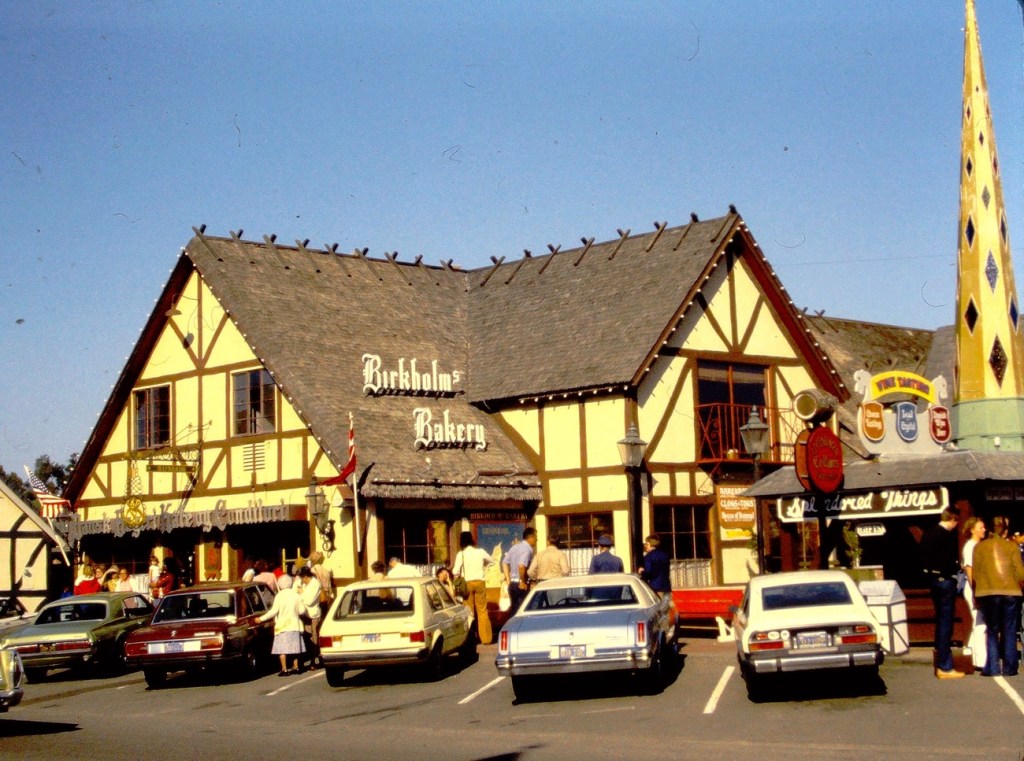
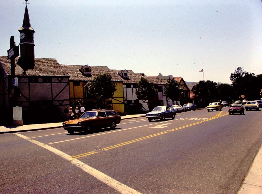
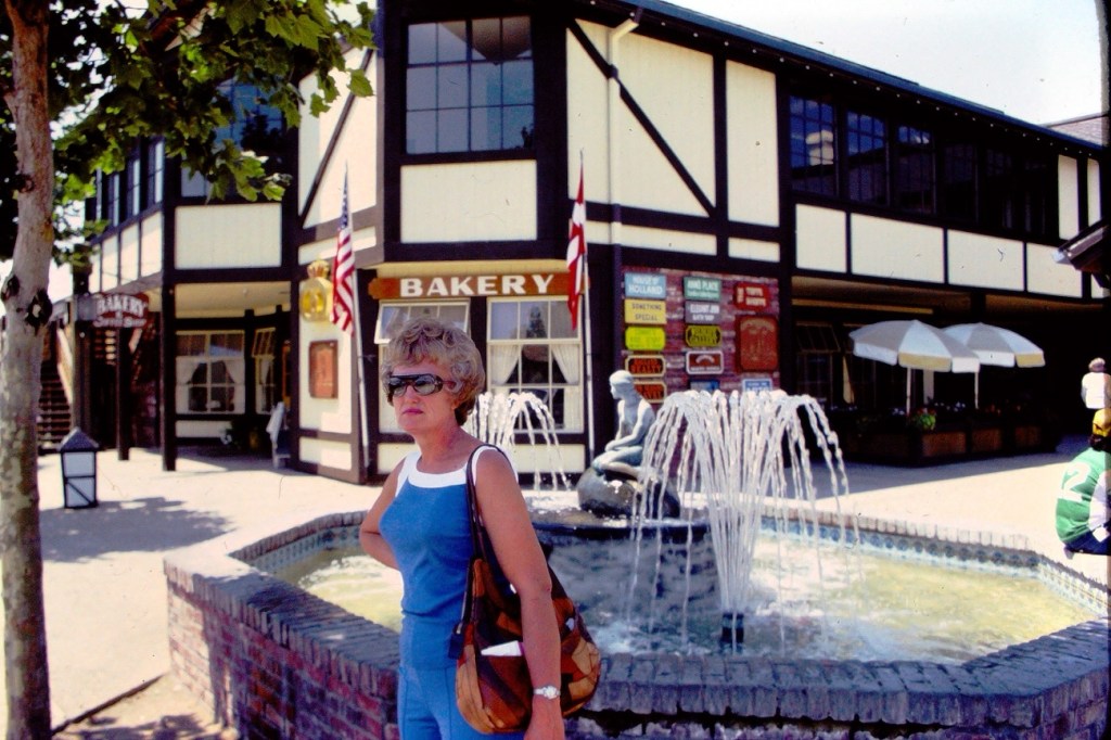
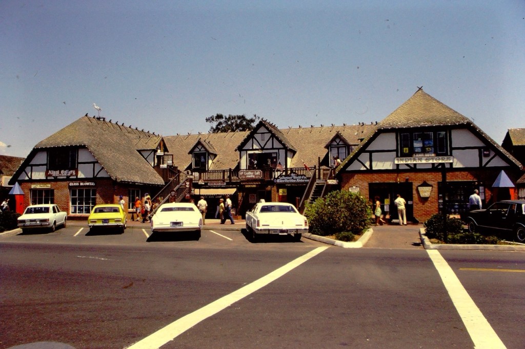
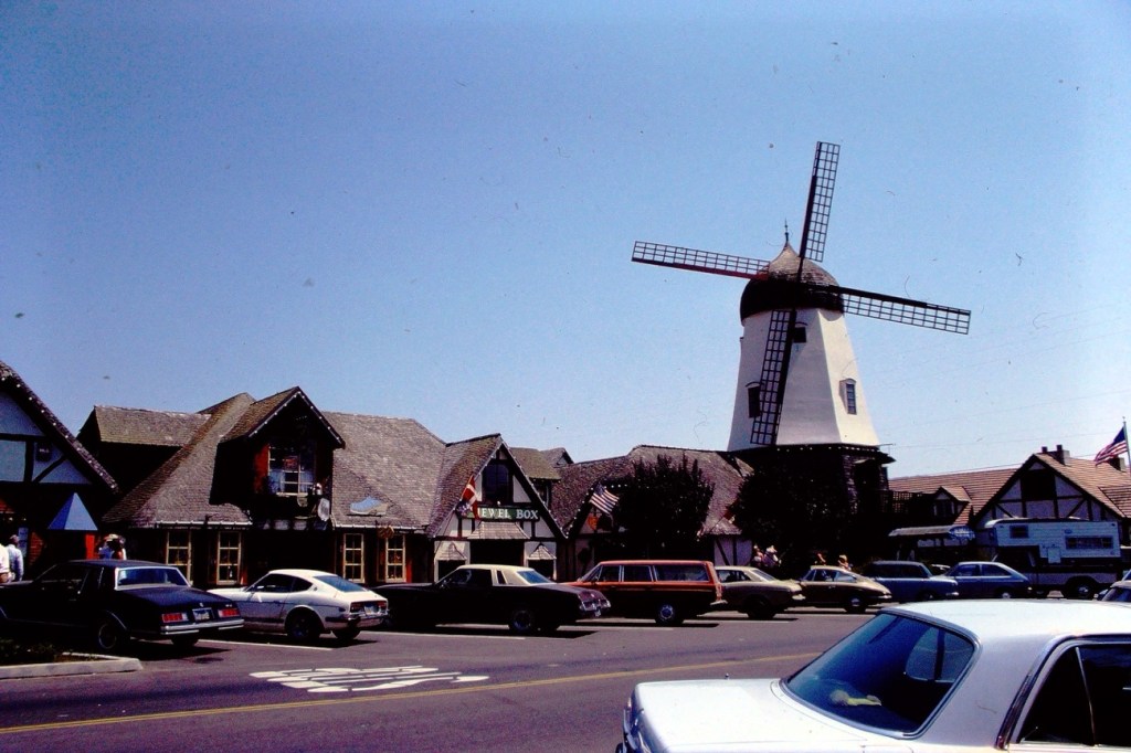
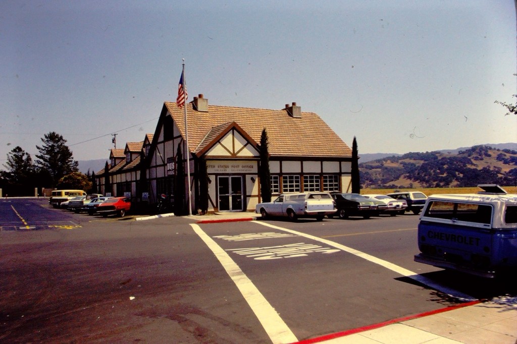
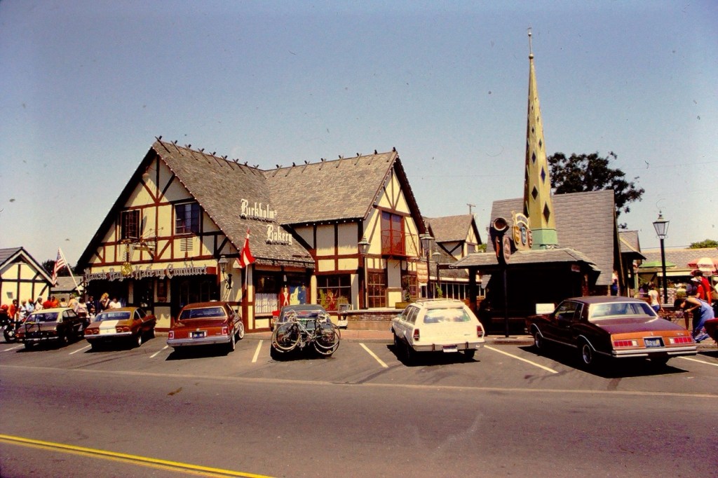
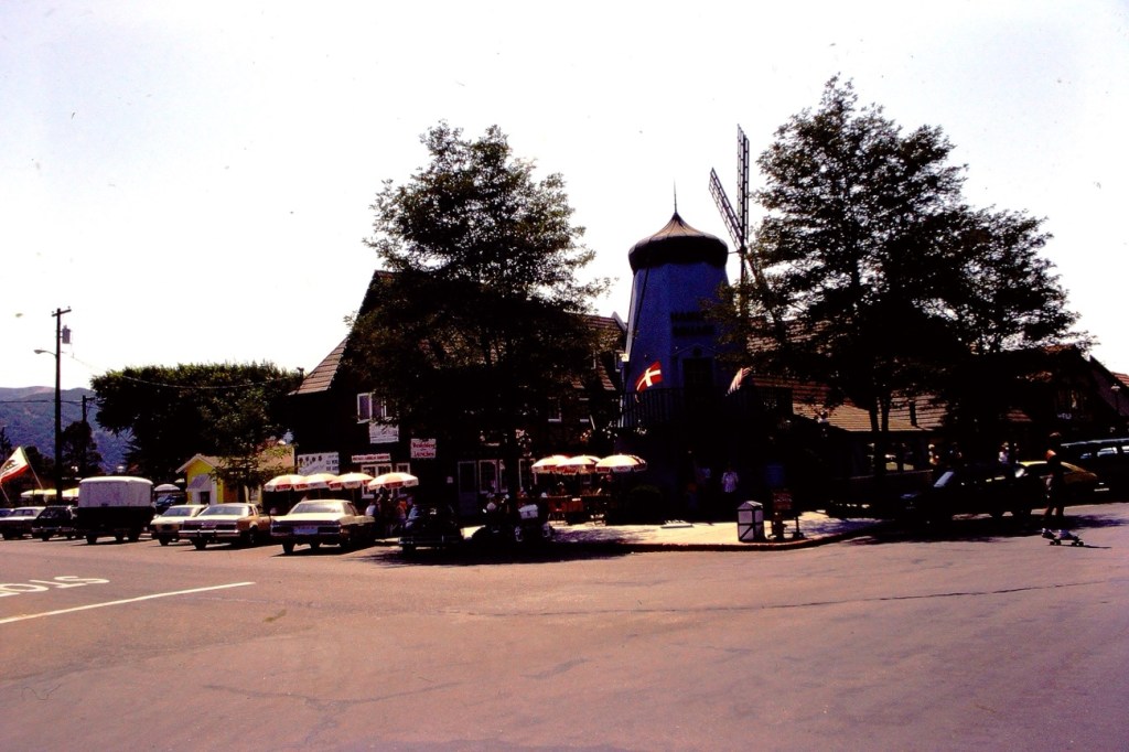
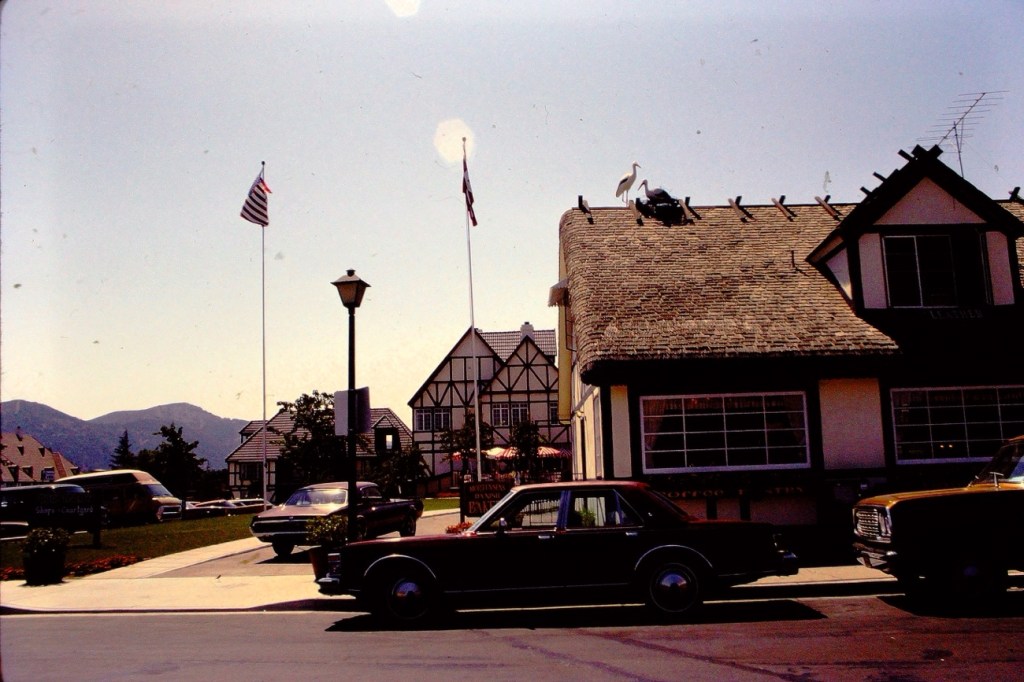
Here is my entry for this week. These are from a trip to Solvang, California back in September of 1978. Solvang is known as “Danish Capital of America” because of its Danish heritage and European-inspired culture, architecture, and museums.
Solvang is a sun-soaked slice of Danish culture in the Santa Ynez Valley, where California wine cellars mix with European bakeries and shops. It’s where you can drink, dine and shop like a Dane without ever leaving the California sunshine.
The name Solvang means “sunny fields” in Danish. The city of Solvang was founded in 1911 by a group of Danish immigrants who purchased 9’000 acres of land near the Old Mission Santa Inés and built a community to preserve and promote Danish culture.
An interesting note (especially for Hallmark fans), A still from “A Very Charming Christmas Town,” the Lifetime Christmas movie set in Solvang.
God Bless. Thank you for visiting and sharing your time and thoughts with us. Take Care Cee! Chris thank you for taking good care of our friend. I appreciate y’all very much.
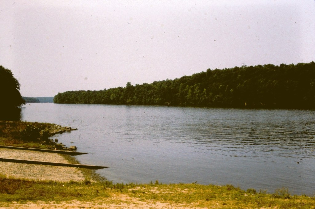
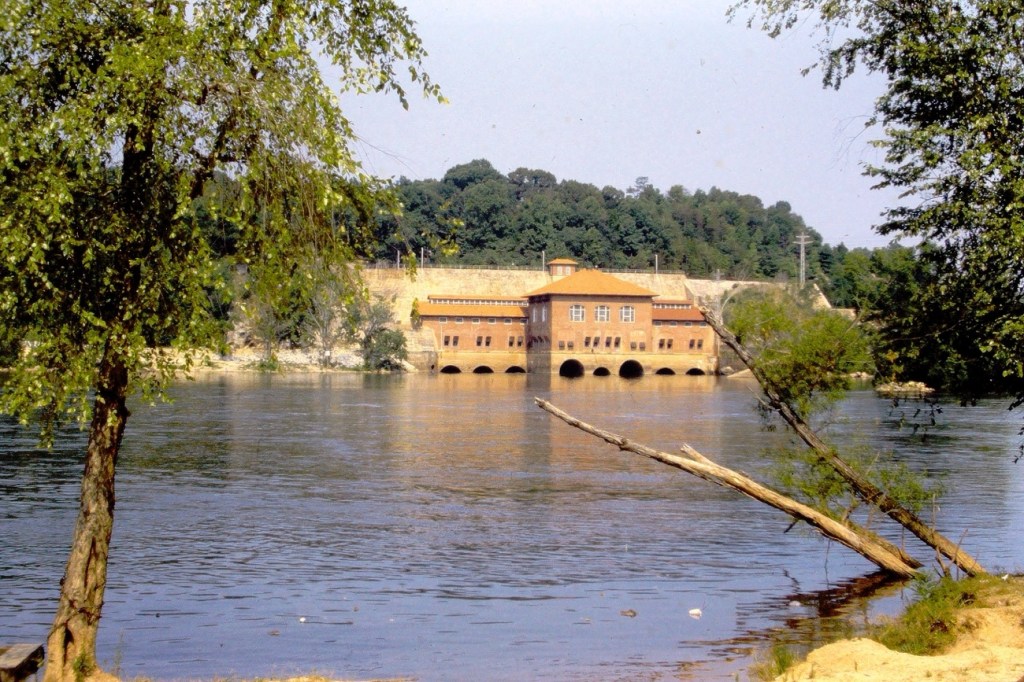
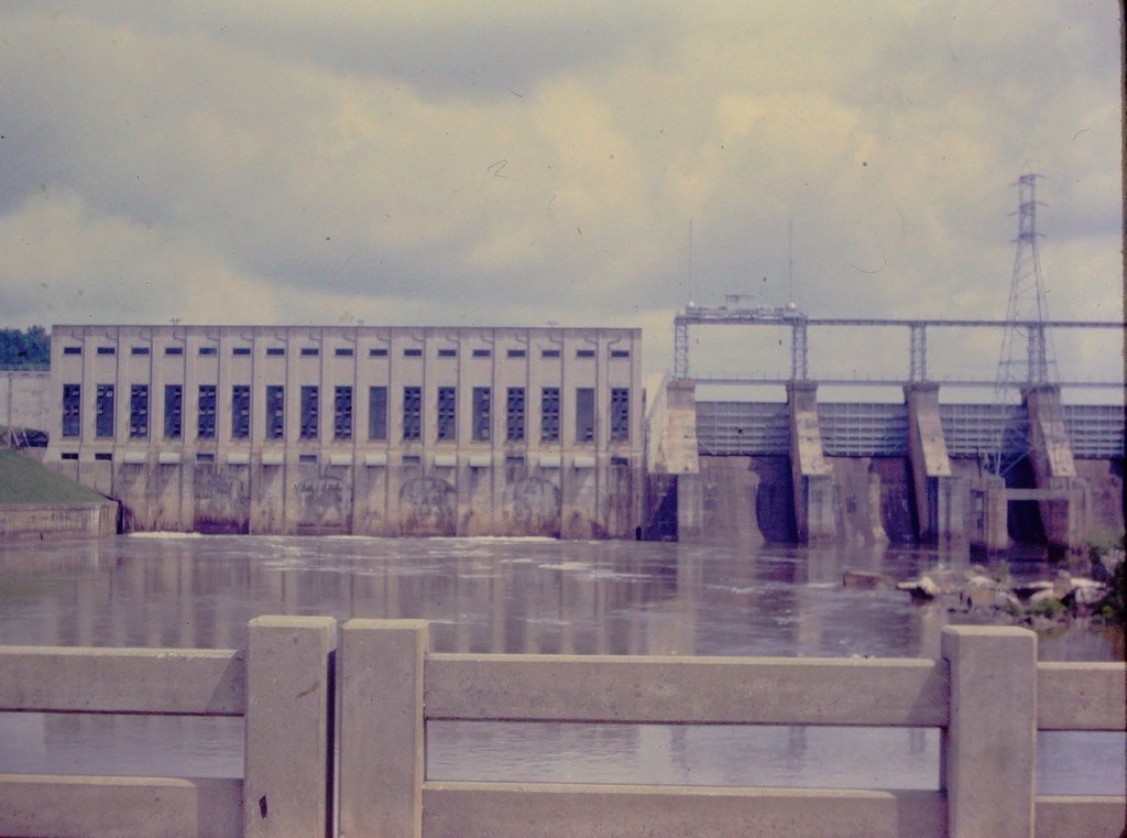
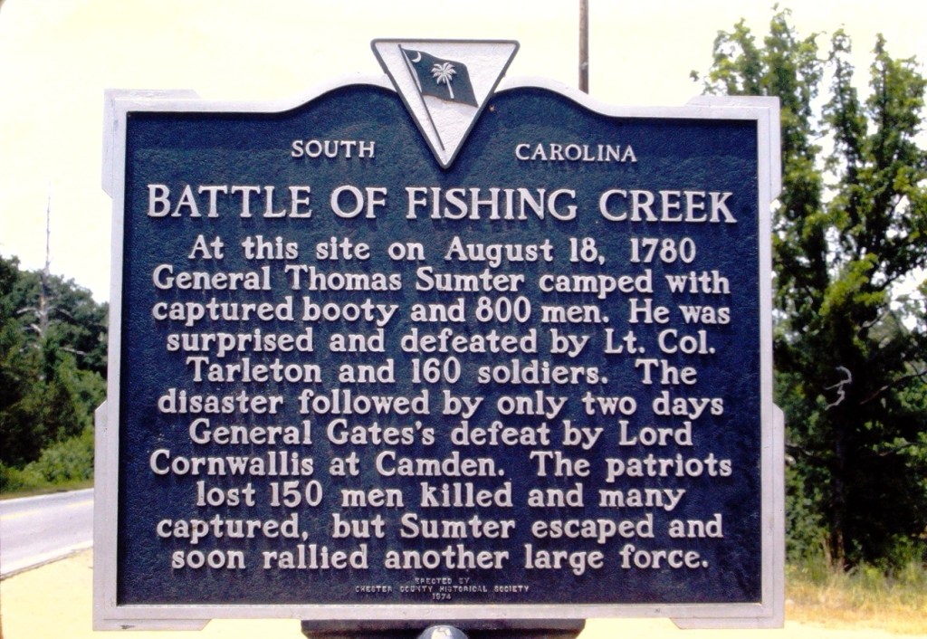
Dirt Path to the Boat DockDirt Road to the Catawba RiverDirt Pathway between the Trees Dirt Paths along the Catawba River & Great Falls DamBattle of Fishing Creek Sign by Road Great Falls, South Carolina
Location: Catawba River; Great Falls Dam; Great Falls, South Carolina, USA
God Bless. Thank you for visiting the Great Falls Dam. Enjoy the beautiful great outdoors. Thank you for sharing your time and thoughts with us. I appreciate y’all very much.
This week I’m continuing Cee’s Which Way Challenge doing it My Way. Therefore for this the third week of June I have chosen a theme of Roads/Dirt Roads. I welcome anyone who desires to join me on this week’s Which Way Challenge.
As I have been working to digitize my dad’s old slides I have come across several photos my dad took of Roads in Great Falls, South Carolina back in 1963.
We are starting our (my) Which Way with the Road in front of my Paternal Grandparents home. Their home was originally a Mill Duplex Home and converted into a single family residence.
Walnut Street Home of John & Alma Waters My Paternal Grandparents
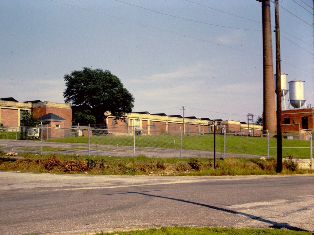
Next, we come to the corner of Walnut Street and Argonne Avenue. This is the location of the J P Stevens & Company Mill where my paternal grandfather worked. The Mills in Great Falls were formerly known as Republic Cotton Mills. [Closed in the early 1980’s.]
Cottom Mill #3
1923 Republic Cotton Mill #3 – a silk mill production. The building had a unique saw-tooth roof. There was Village housing and a neighborhood grocery store.
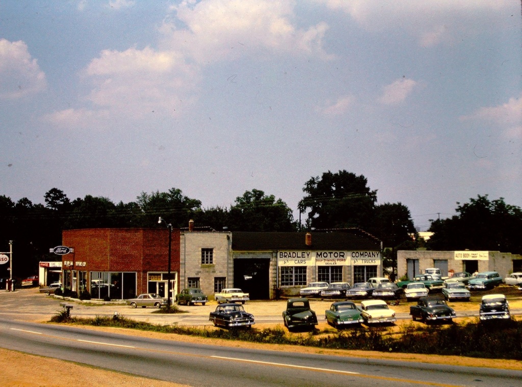
Continuing on our journey, we drive along Chester Avenue. On this Road we can see the Bradley Motor Company ( a FORD Dealership) where my dad worked when he finished high school and again when he first was discharged from the U S Navy.
Bradley Motor Company
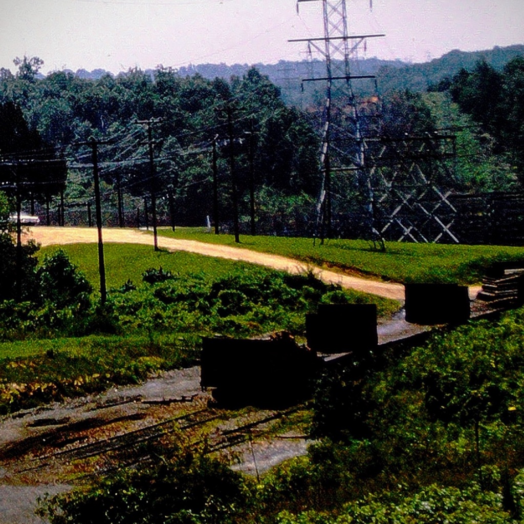
As we continue cruising through the Town of Great Falls, we see a Dirt Road behind the Power plant. Here we notice old Railroad tracks no longer in use. They would have kept extremely busy in the heyday of the town.
The Town of Great Falls is located in Chester County, South Carolina. The name of the Great Falls came from the nearby waterfalls on the Catawba River. The Town was founded by the power company owned by Mr. J.B. Duke. J.B. Duke built hydro electric plants on the Catawba and was the founder of the three Republic Cotton Mills.
Location: Town of Great Falls, Chester County, South Carolina, USA
God Bless. Thank you for visiting in my reminiscing of the Town of Great Falls, SC. Thank you for sharing your time and thoughts with me. I appreciate y’all very much.
Cee, I pray you’re better and home soon. In the meanwhile I’m continuing with the CWWC – Any Which Way in my Way until you are back well and able choose a theme. Anyone care to join me, let’s let Cee know we’re thinking and caring about her.
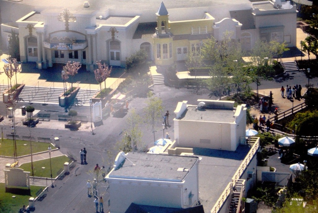
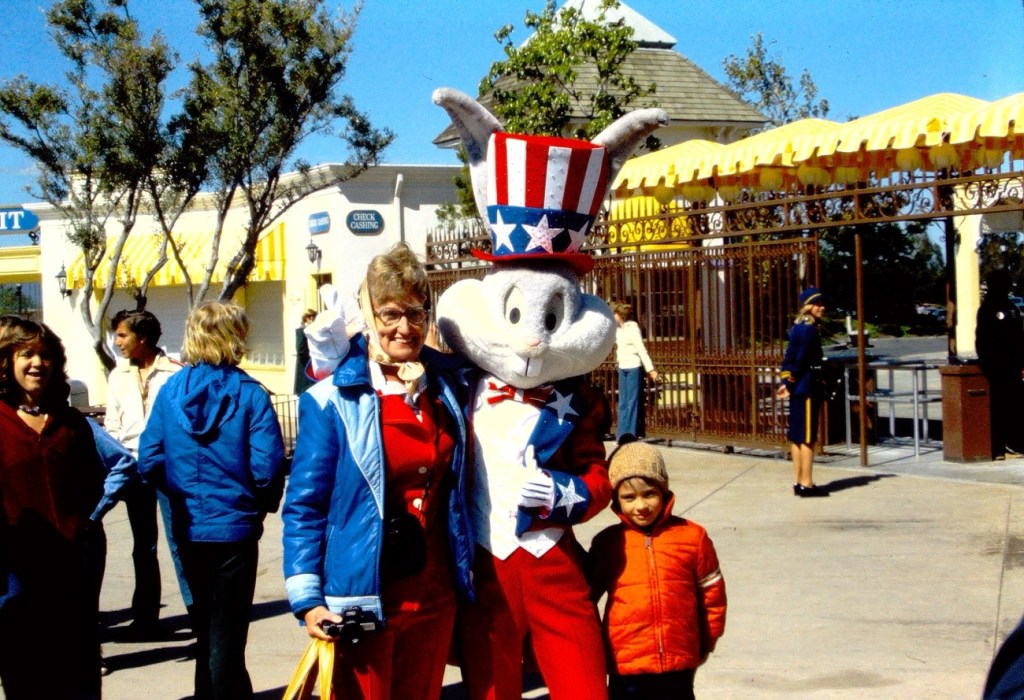
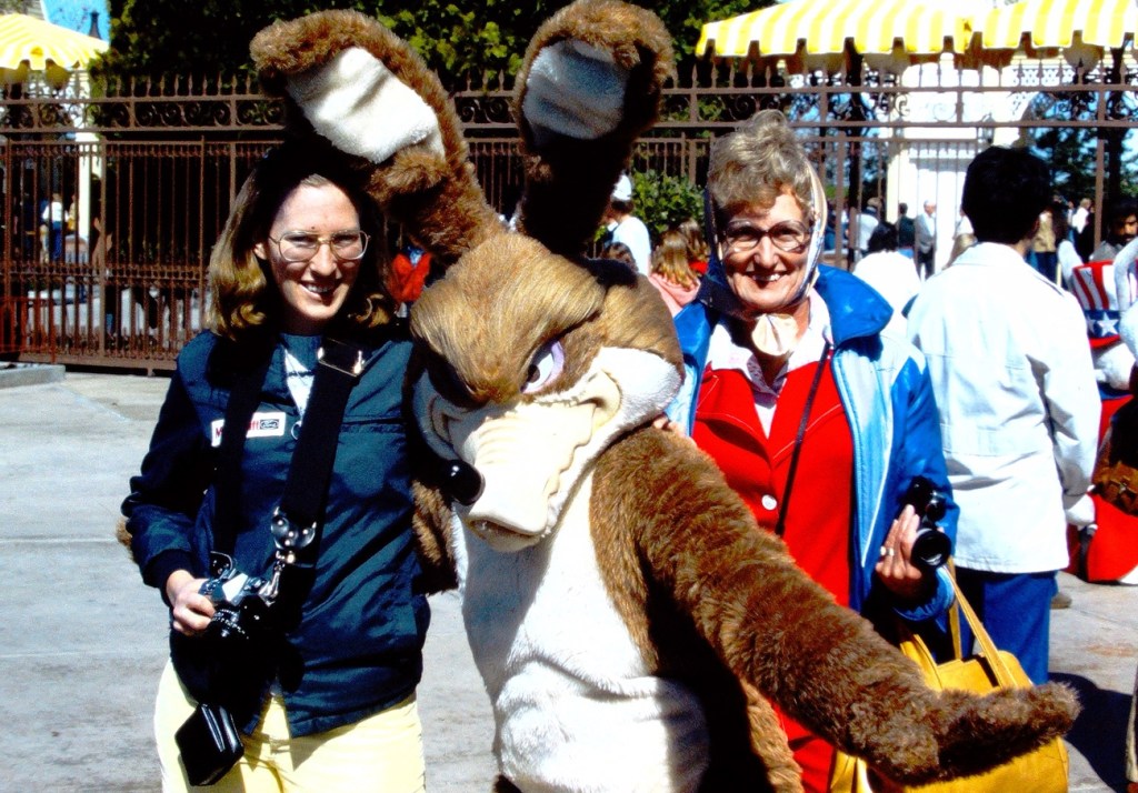
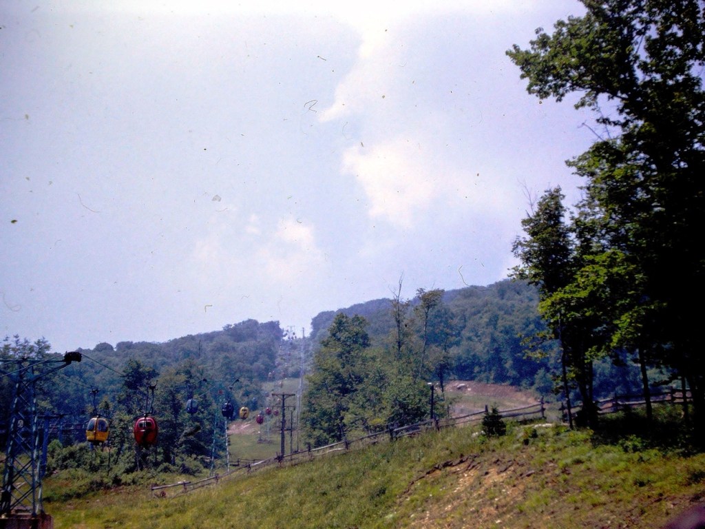
Back in the day there were three (3) ways you could choose from to get to Land of Oz. One could choose the Hot Air Balloon ride, the Gondola Lift, or a shuttle bus to reach the Land of Oz location in Beech Mountain.
People milling about deciding which option they want to take to reach the Land of Oz.
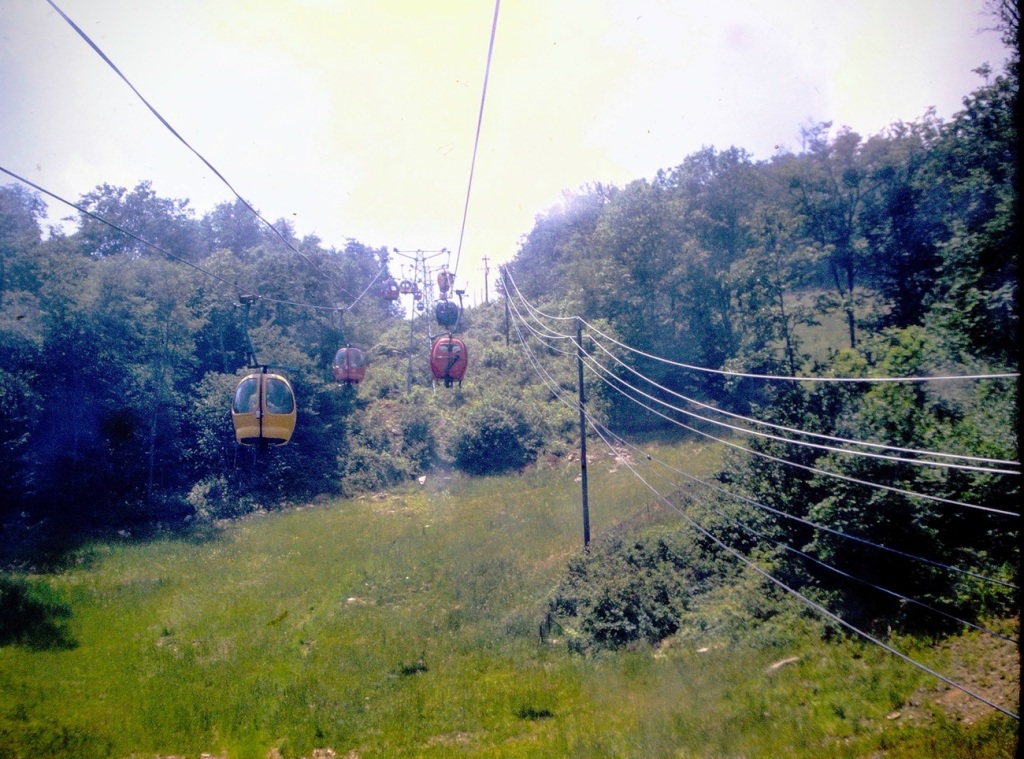
The Hot Air Balloon ride up to the Land of Oz offers a different perspective, a different and unique experience and yet similar in approach to the Gondola Lift. Both the Hot Air Balloons and the Gondola Lift operate similar to a ski resorts ski lift would operate.
They are both aerial lifts that uses a continuous cable loop to transport passengers up a mountain. The cable is driven by a bullwheel at each end of the lift, which is usually connected to an electric motor or engine. The cable runs through sheaves at towers that support the cabins, or carriers, as they travel up the mountain. The cabins are attached to the cable by detachable grips that allow for secure boarding and exiting at slow speeds.
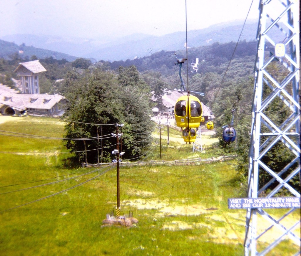
Having chosen our method of reaching the top of Beech Mountain for our Land of Oz adventure, we are delighted we are on our way up.
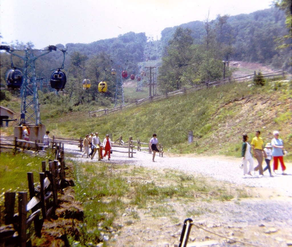
Up, up, up we go … look at our amazing climb through the air. It seems as if I chose to ride in a Hot Air Balloon while others in the family chose to ride in one of the Gondolas.
Visitors to the Land of Oz walking along the trail after exiting their chosen path.
The Gondolas continue throughout the day to carry visitors to the Land of Oz.
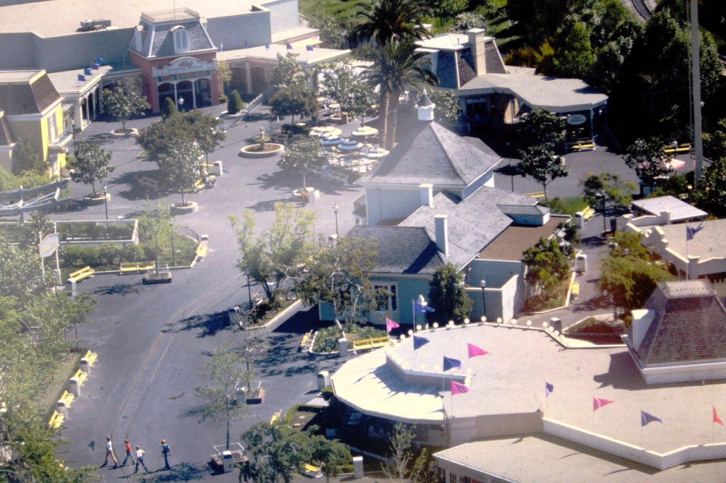
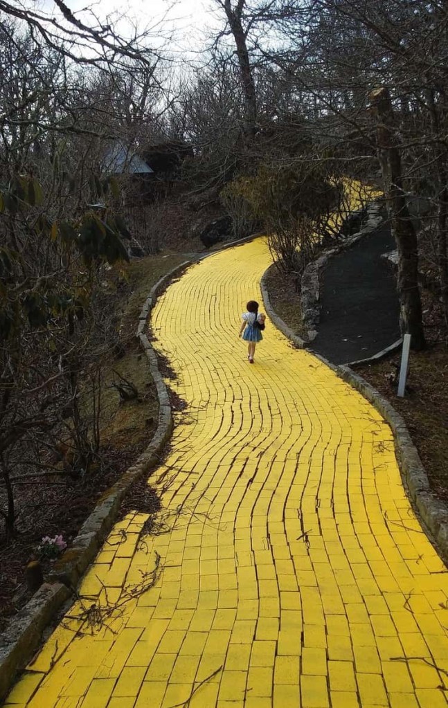
Once you’ve completed your ride, follow the Yellow Brick Road to the Emerald City and your adventure begins.
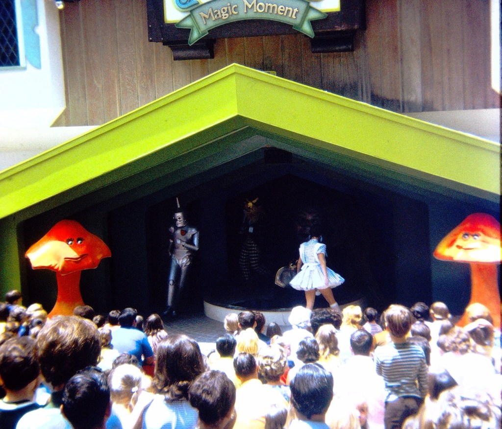
When your tiredness overwhelms you, take a breather from following the Yellow Brick Road and sit a spell and enjoy the show.
Amphitheater hosting the Magic Moment Show
The Magic Moment Show was staged every half hour. During the show Dorothy appeared with her friends to meet the Wizard and entertain the park’s guests.
The forward thinking of concerned citizens, volunteers, business partners, and in partnership with the Katawba Valley Land Trust; the ideas, planning, and reconstruction of certain areas into a Greenway of trails in Lancaster began to develop beginning in 2014. The Greenway includes numerous pedestrian connections with linkages to residential, commercial, and local school properties, trail heads, and nature centers, bridge crossings, and sidewalk improvements.
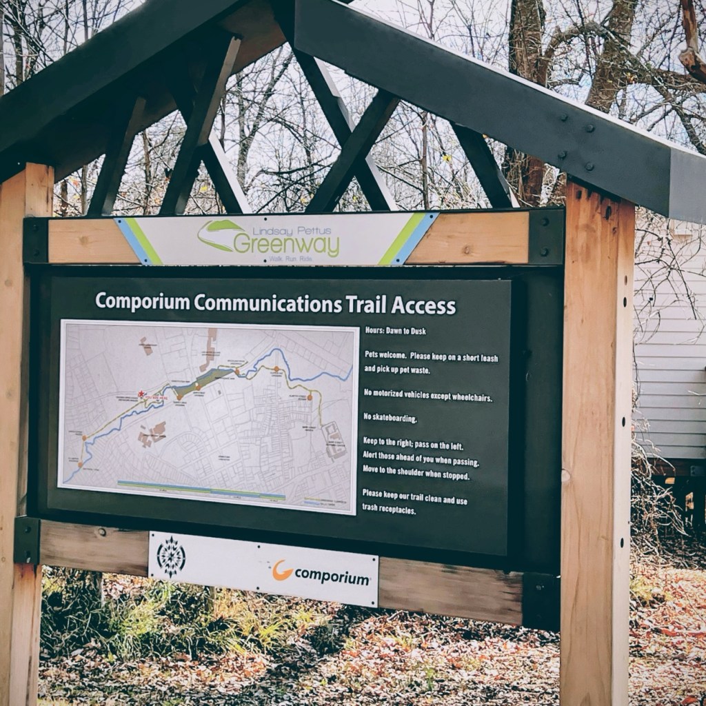
Comporium Communications Trail Access is the starting point for Coleman’s and my hike along the first phase of the Greenway’s Master Plan. The first phase of the Reconstruction of Land in Lancaster was completed in 2019. Our hike took place in February of 2022.
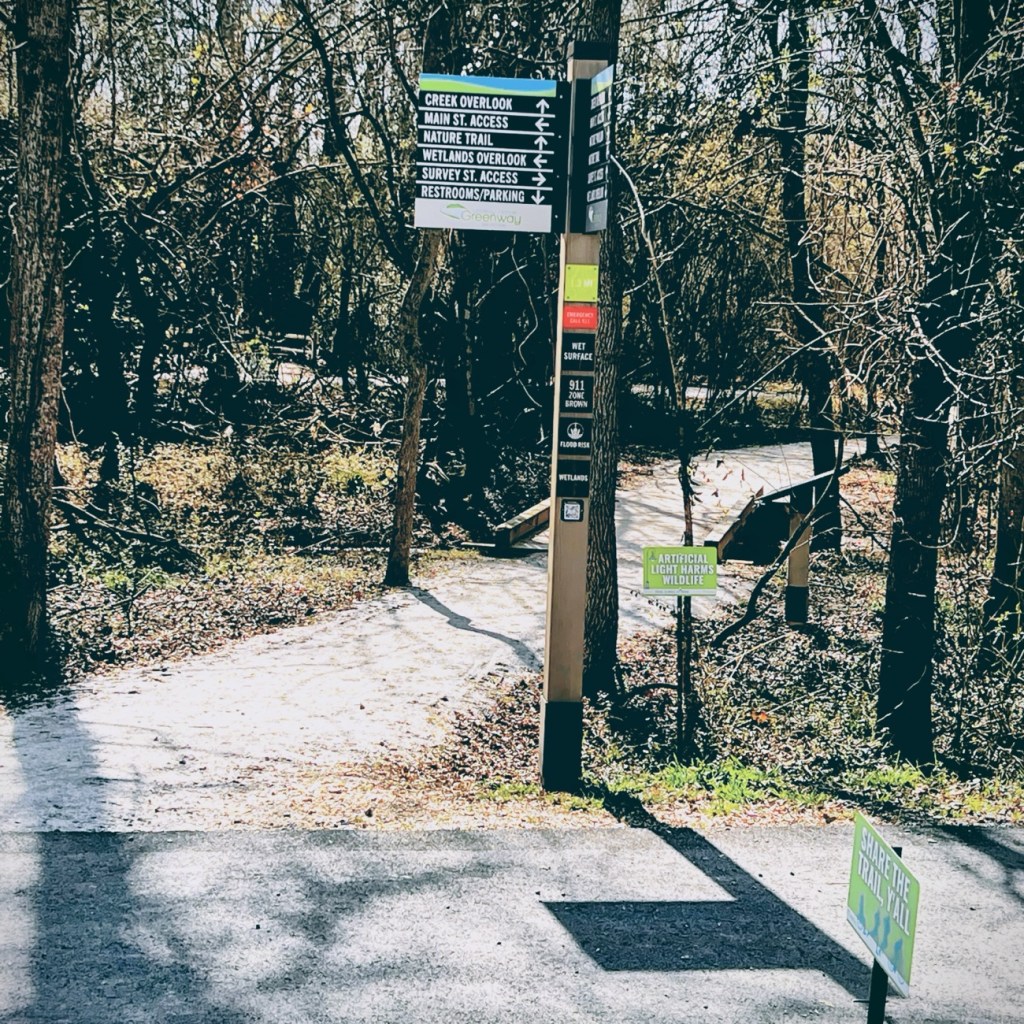
As we moved forward in our adventure, we encountered several informational signs which were a tremendous help in guiding us as we moved forward along the Greenway.
Coleman and I decided to move forward together along the nature trail towards creek overlook and eventually the Wetlands Overlook.
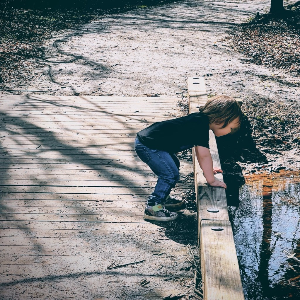
Here Coleman takes a minute to look out over the bridge at the creek below.
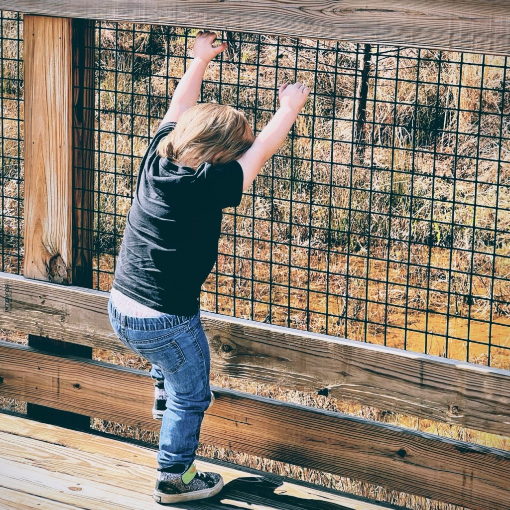
Coleman can’t resist climbing on the bridges railing at this next point or interest.
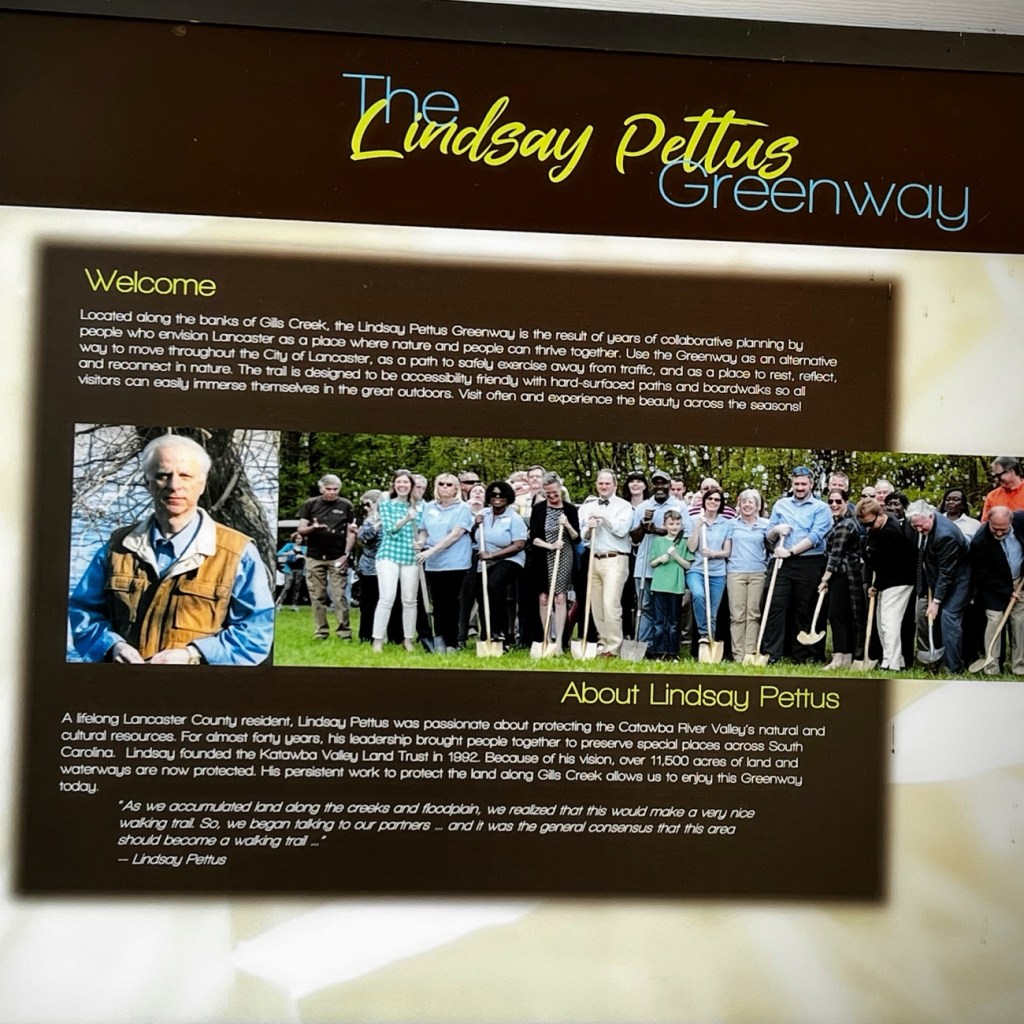
Informational Signs are located strategically throughout the Greenway. This particular one gives information about out the Lindsay Pettus Greenway and Lindsay Pettus himself.
The forward thinking of Mr. Lindsay Pettus and the many volunteers ensured the Greenway is and will continually be accessible to everyone regardless of their mobility needs.
Before we head out on the road I suggest we stop and fill up the car with some good old fashioned gasoline ⛽️. I doubt you’ll find these prices nowadays though.
I Spy Something Red
I Spy Red on the Gas Station Sign
Now that we’ve filled up the car 🚘 and made sure we have everything we need, let’s get going on our adventure.
I Spy Red Street Lights
Where are we going you might ask? It doesn’t really matter as long as we have a bit of fun along the way.
I Spy Red Trail Signs
How about we pull over for a while and go on a hike. These signs might direct us on our way.
I Spy Coleman Wearing a Red Shirt
Oh Look, Stairs. Shall we go down them? What might we see when we reach the bottom? Who knows, but let’s go on down and discover what we can find.
I Spy Coleman Looking Out Over the Water at a Dam
Wasn’t that fun? Did you enjoy our little game of I Spy? I know Coleman and I had a great time together on our adventures.
Cee’s Which Way Challenge is fun to join and exciting to see everyone’s take on the challenges. No two people have the exact same perspective and I look forward to seeing y’all’s perspectives. Click Hereto link to Cee’s blog.
God Bless. Thank you for traveling with us. I truly hope you enjoyed the adventure. Thank you for sharing your time and thoughts with me. I appreciate y’all very much.
On this hiking adventure I parked at the Dairy Barn Entrance to the Anne Springs Close Greenway. After exiting the car we proceeded to hike along the fencing before hitting the trails. Following the fence line we were able to view the horses, some of which trotted over to our location. [More on horses later].
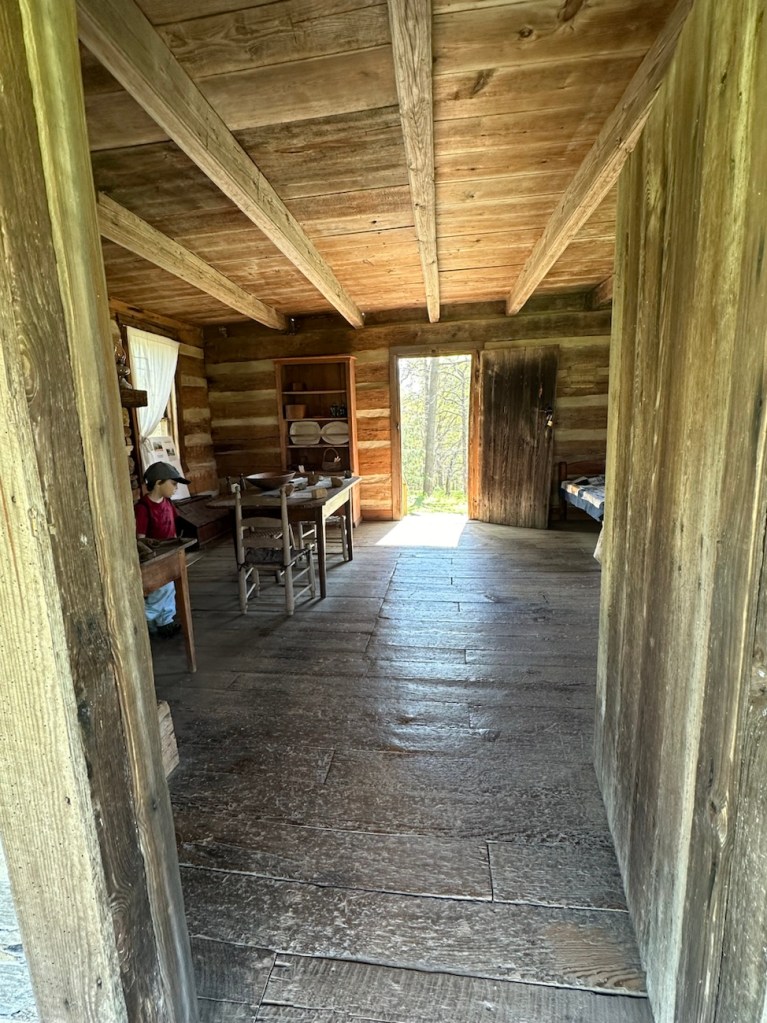
Our first stop along the Blue Star Trail was to take a look at the Faires/Coltharp Cabin. To our surprise and delight it was open to the public (first time we’d seen it open). So naturally, Coleman with me following went inside to see what was inside.
A Look inside the Faires/Coltharp Cabin
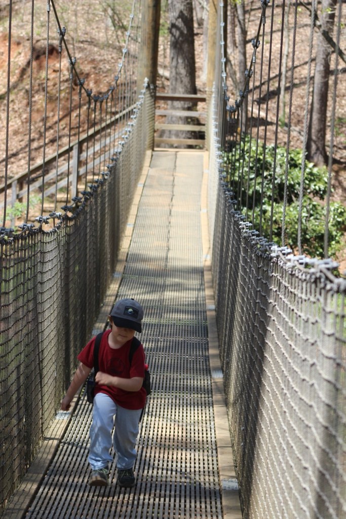
After leaving the cabin, we hiked further along the Blue Star Trail towards the Swinging Bridge and the Schroering Forest Playground located on the other side of the Spillway.
Blue Star Trail
When the Spillway is up and streaming with a steady flow of water, the only way to cross it is to walk across the Greenway’s Swinging Bridge. Since our destination was on the far side of the Swinging Bridge we/I slowly walked across. Coleman used to walk across it when he was younger, but now if no one else is on it he’ll run across.
Coleman crossing the Swinging Bridge
We made it safely across the Swinging Bridge, walked around the Artisan Market, ordered lunch from the Greenway’s Canteen and rested a bit before heading to the Schroering Forest Playground. We had a clear view of the Playground from where we chose to sit. This was the first official day the Playground was open. They had been working on it all fall and winter. Being its opening day, the playground was crowded with children from all age groups.
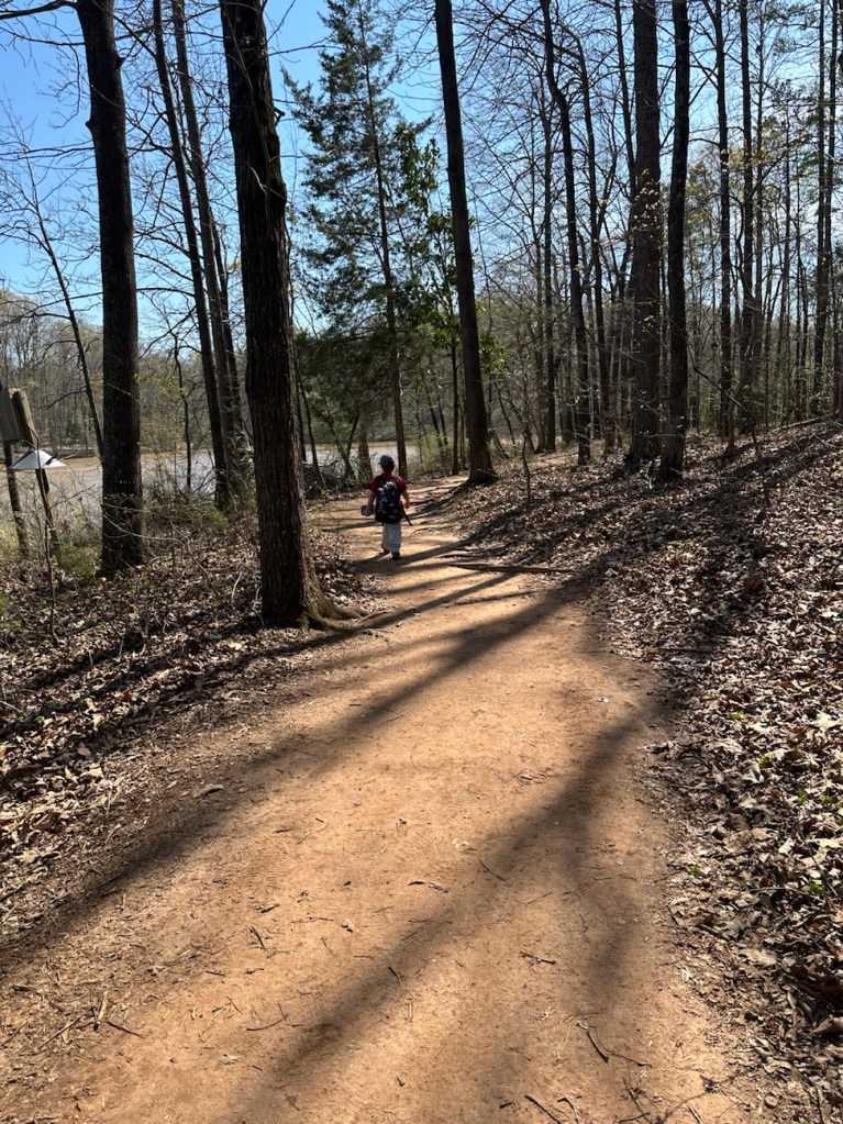
Coleman hiking the Blue Star Trail
Upon completion of our lunch we noticed there were still a lot of children on the playground. I decided to have Coleman wait to play in it until it wasn’t nearly so crowded. Therefore, we continued on with our hiking and headed down to Lake Haigler.
Blue Star Trail Almost down to Lake Haigler
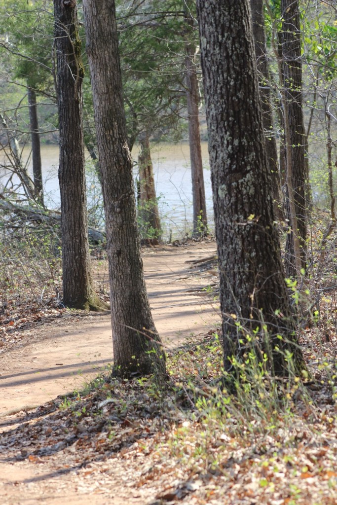
We hiked along the narrow side pathway towards the lake. The straight pathway is wider and more widely traveled by the majority of visitors to the Greenway.
We hiked a short loop with great views of Lake Haigler and then hiked back up to the Playground. Coleman climbed up on the Climbing structure and wasn’t sure about what to do after climbing up a short ways and just sat down for a few minutes. [The all natural wood climbing structure seemed to puzzle Coleman. He’ll probably climb more next time we visit.]
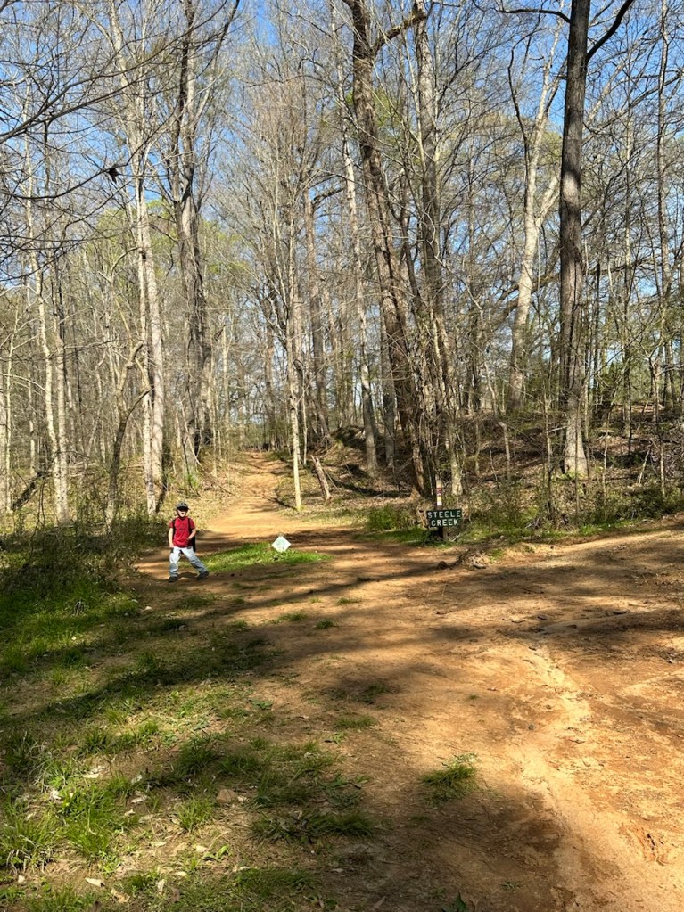
Steele Creek Trail
After a full afternoon of hiking and Coleman playing I decided it was time to head home. Hence, we proceeded to hike back up to the car. Instead of hiking the exact same trail we hiked down, we started out hiking on the Steele Creek Trail. The Steele Creek Trail is a narrow trail that leads up towards the Graham Historical Cabin.
From the cabin we traverse back onto the Blue Star Trail. After short distance from the cabin, Coleman starts searching for the cows. Sometimes they are up close to the fence line, but on this day we really had to look for them. Searching the pasture as we hiked up the trail, two of the cows came walking towards our direction from the far end of the pasture. That made a Coleman’s day. He was then ready to go home.
For this week’s challenge I went off script a little using throwback photos of my mom depicting various types of transportation used way back when. Not quite sure the pathway that were used are clearly detectable or not. I might need to do an additional post that would be more accurately depict the trail, road, or paths used for traveling.
I chose these particular photos in remembrance of my mom. She would have been 92 on Wednesday. We were not close after I became an adult, but that didn’t mean I didn’t care or think about her. No matter what she was still my mom and I did love her.
Military tanks the way to travel … Care to hop aboard Maybe you’d prefer to travel … in a pony cart… Or climb on up and ride bareback Then again, you might prefer … to take a walk