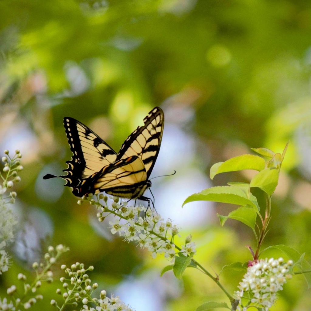
This blog is for my insights on life, the Bible, hiking adventures with my grandson and whatever is important to me
Author: Deb L Waters
I am an avid reader. I read mostly Amish fiction but also read other novels. I enjoy romance, mystery, and Christian devotionals. I enjoy hiking in the outdoors, especially in Greenways and State or National Parks. I love my grandson. He is my favorite subject, so I'll post about him and his antics.
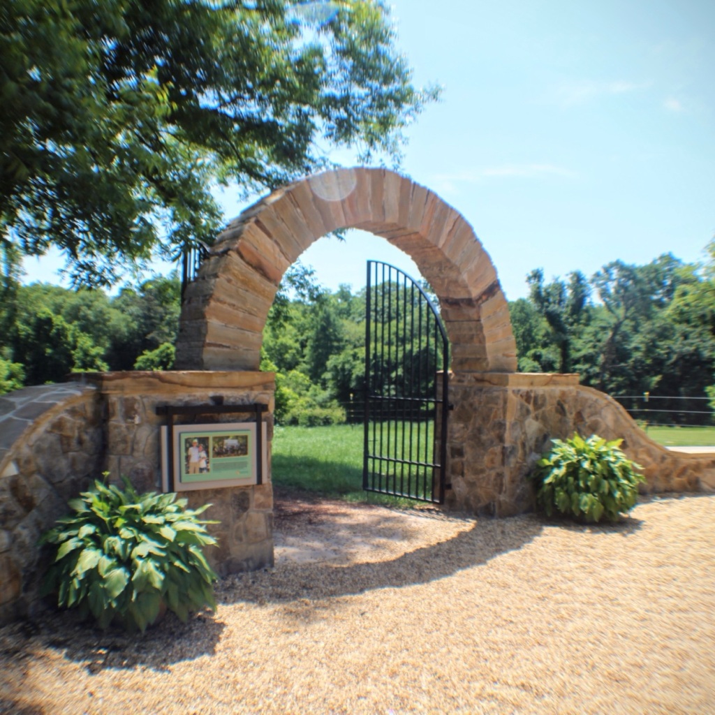
Location: Greenway Stables Entrance; Anne Springs Close Greenway; Fort Mill, South Carolina, USA
God Bless. Sending y’all my birthday wishes of happiness, good health, peace, and an abundance of love throughout 2024 and beyond. Thank you for visiting and sharing your time and thoughts with me. I appreciate y’all very much.
Traveling back in time to December 1965, to a family day trip. Packed and loaded in our 1962 Ford Galaxie 500 with a cooler of drinks, snacks, and sandwiches; we began our approximately hour and fifty-one (1hr 51min) drive north moving forward through the city streets until turning onto CA-94 and eventually onto the recently constructed I-5.
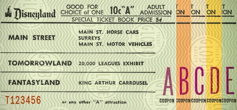
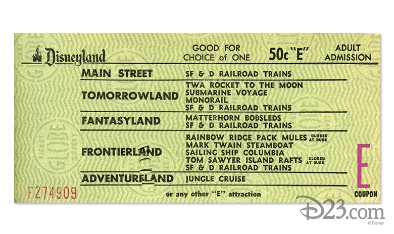
Upon arriving at the Disneyland entrance, my parents purchased our admission and ride tickets. General Admission prices for adults at that time was $2.60 per adult and included a ticket for the Monorail. Junior prices were $1.80 and Children’s admission prices were $1.10. Tickets for the rides cost extra. A book of 10 tickets ranged from $3.00 to $5.00.
1965 Disneyland Ride Tickets A-ESelection of E Ticket Rides
In 1965, the cost of admission was considered a lot of money. However, people considered visiting Disneyland was a worthwhile family adventure.
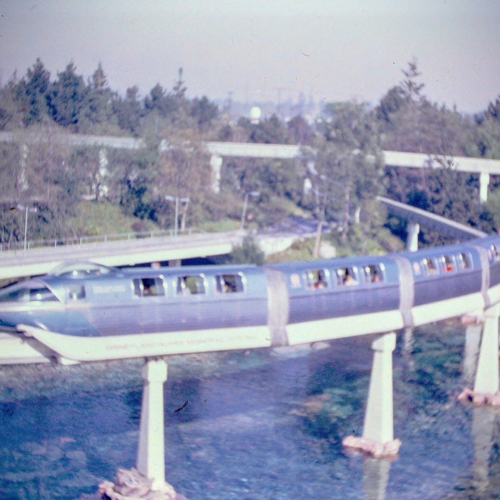
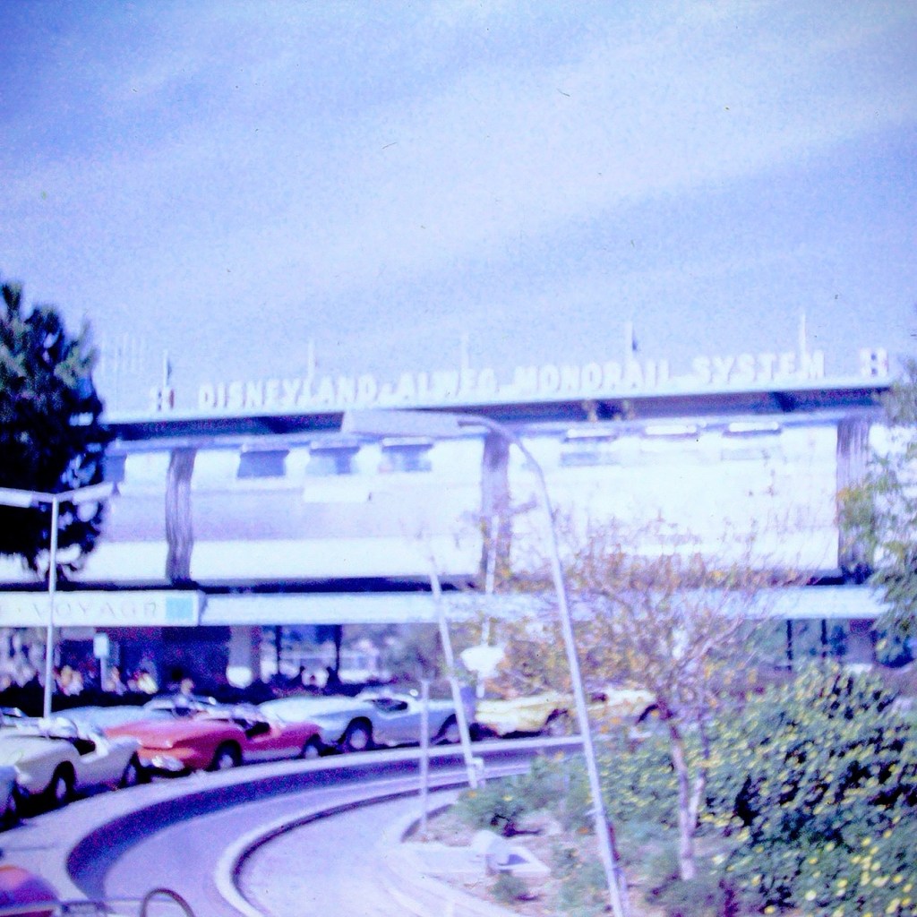
After our tickets were purchased and we entered the park, we selected what rides we wanted to ride. We went to each ride or attraction as a family unit, not venturing off individually. Our first ride of choice was the Monorail.
Disneyland Monorail
The Monorail was considered as a mid-century marvel and captured the hearts and imaginations of the theme park and Disney fans. The Monorail was a Highway in the Sky which allowed for a unique experience viewing the park from above.
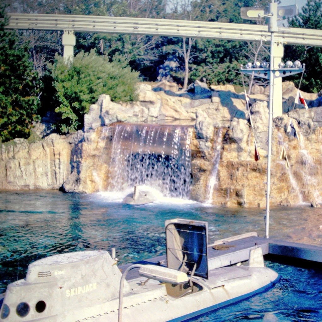
Our next selection was to ride the submarine adventure. The attraction features vehicles that were designed to look like submarines. It required the E ticket was in the Tomorrowland area of the park.
Early Disneyland Submarine
The submarines took us on an adventure under the sea simulating fish and other sea creatures allowing us to imagine we were really being submerged and viewing the undersea life of a tropical lagoon.
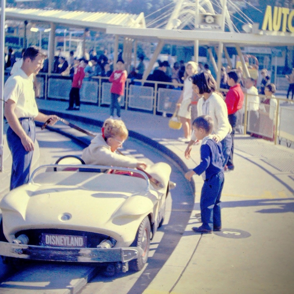
Next up was the Autopia adventure. This was where we could get in cars and race around an enclosed track. We could imagine we were actually racing the other drivers.
My mom getting out of the Race Car.
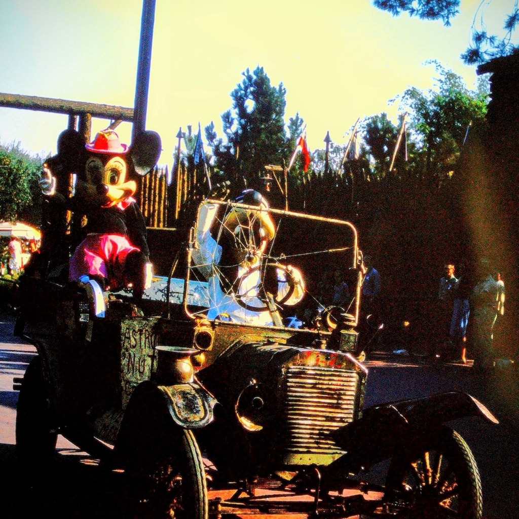
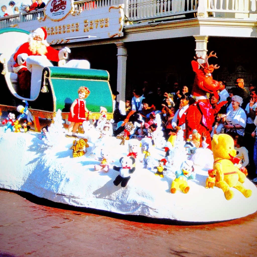
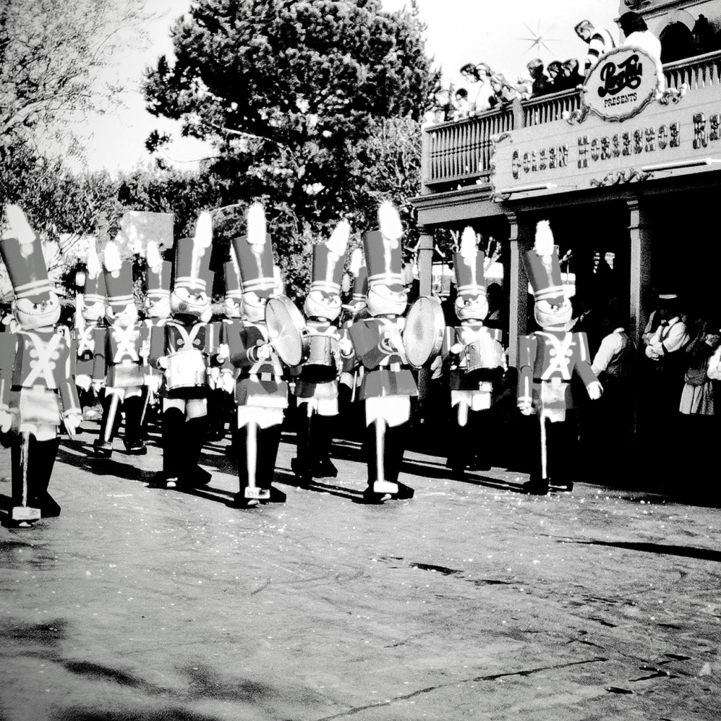
After a full day of adventures Moving Forward around the park, we selected a spot on the side of Disneyland’s Main Street to watch the Parade. The waiting was a time of excitement as we looked forward to the parade starting.
Mickey Mouse riding in a Vintage Car with Goofy1965 Disneyland Santa Claus Float
Well folks, that’s all for today. We had fun, but now it’s time to head home.
I’m not sure if these are actually Cobalt Blue or not, but they’re the closest I have for this month’s color challenge for Terri’s Sunday Stills.
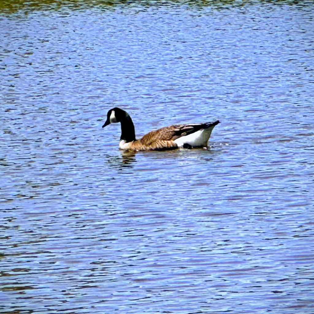
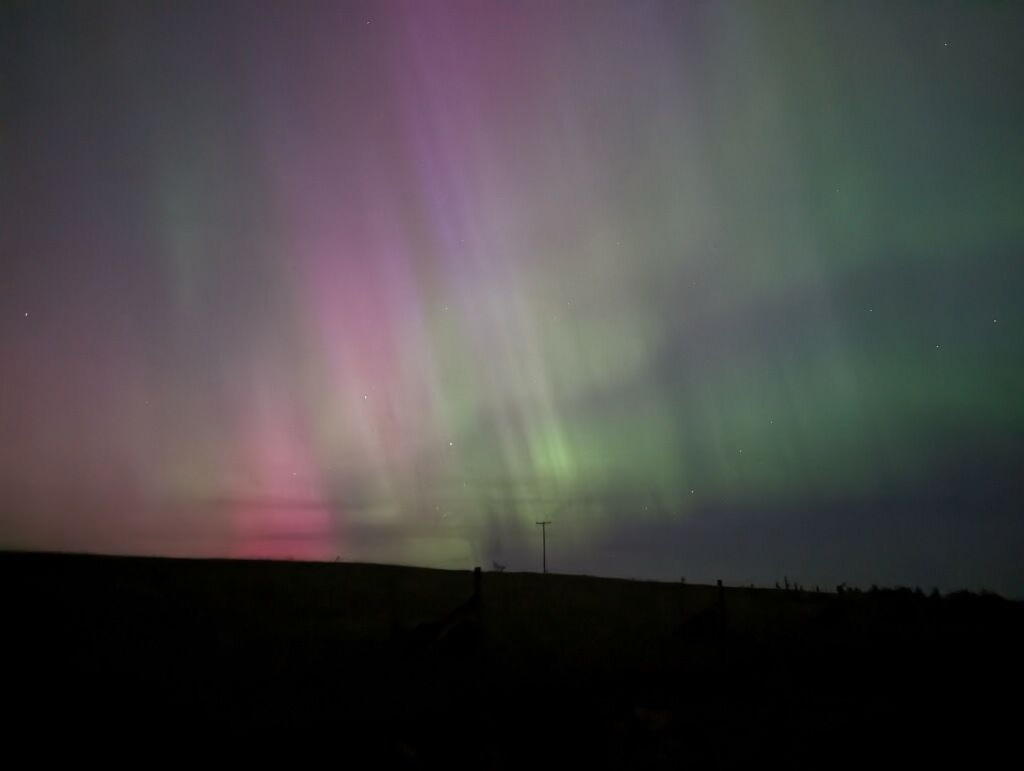
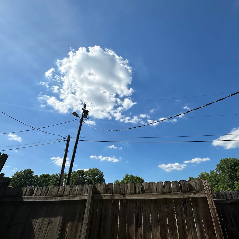
Here’s looking at the Blue Sky as we begin hiking on Dogwood Trail. Another day, another beautiful blue sky When we hike around Patterson Pond we spot a Canada Goose swimming in the Blue Waters.This is one of the views we saw when we were searching the skies for the Northern Lights.
Growing up almost three thousand miles (actually 2,512 by today’s calculations) away from my dad’s family in South Carolina; we only traveled the long distance every three (3) to five (5) years. My parents always drove straight through switching off driving every several hours and/or miles as deemed necessary.
On every family vacation to visit my dad’s family, my parents would plan places for us to visit during our trip. One place would always represent a place of historical significance. The other place would always be some fun attraction. Sometimes it’d just be our immediate family visiting the chosen places and at other times my dad’s sister’s family would join us.
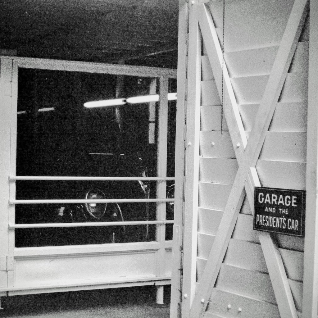
On our trip in July of 1967, my dad selected The Little White House in Warm Springs, Georgia for us to visit. The Little White House was the personal retreat for Franklin Delano Roosevelt, the 32nd president of the United States of America. It is located in the historic district of Warm Springs, Georgia.
When Roosevelt first started coming to Warm Springs (previously known as Bullochville) in 1924 it was to receive treatment for Polio. He loved the area tremendously, so he had a home built on Pine Mountain located close to Warm Springs. On April 12, 1945, President Franklin Delano Roosevelt died in this home shortly after he began his fourth term in office.
In 1948, Roosevelt’s Little White Housewas opened to the public as a museum. Part of the Museum displays include his 1938 Ford V-8 convertible coupe and his custom built 1940 Willys roadster. Many of his cars were equipped with special controls that allowed the partially paralyzed Roosevelt to operate the foot pedals with his hands.
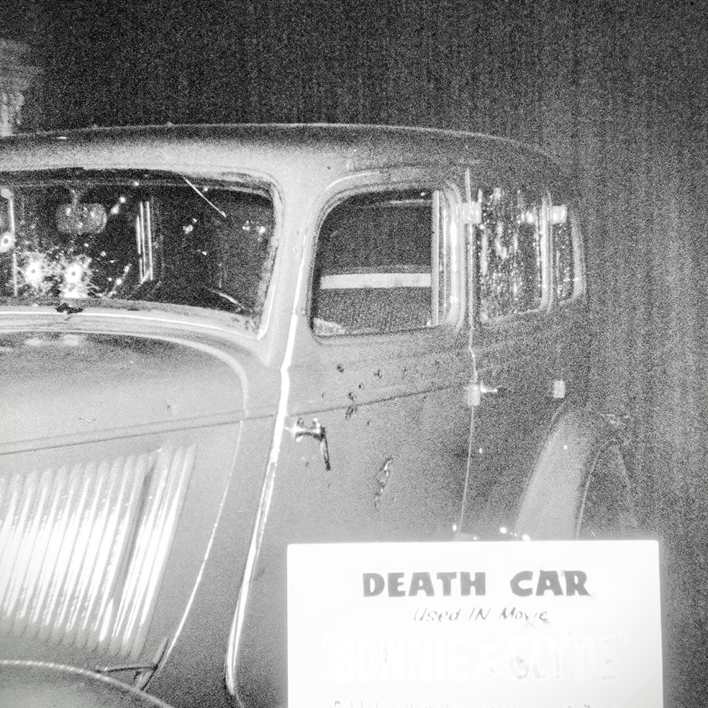
Death Car used in movie Similar to Car FDR was riding in when an Assassination Attempt Occurred
There was a movie made in 1933 that depicted the attempted assassination on Franklin D. Roosevelt. It references the assassination of Chicago Mayor Anton Joseph Cermak and hiswho was mistakenly killed during the attempt on FDR. The Death Car shown here and in the museum is the car that was used during that filming.
To learn more about the assassination attempt on Franklin D. Roosevelt click on Death Caror to learn more about FDR click on his name.
Pictures were Reconstructed from slide format to digital format via a Wolverine Digital Converter Renewing them for preservation and future generations.
Location: Roosevelt’s The Little White House; Warm Springs, Georgia, USA
God Bless. Thank you for visiting and reminiscing with me. Thank you for sharing your time and thoughts with me. I appreciate y’all very much.
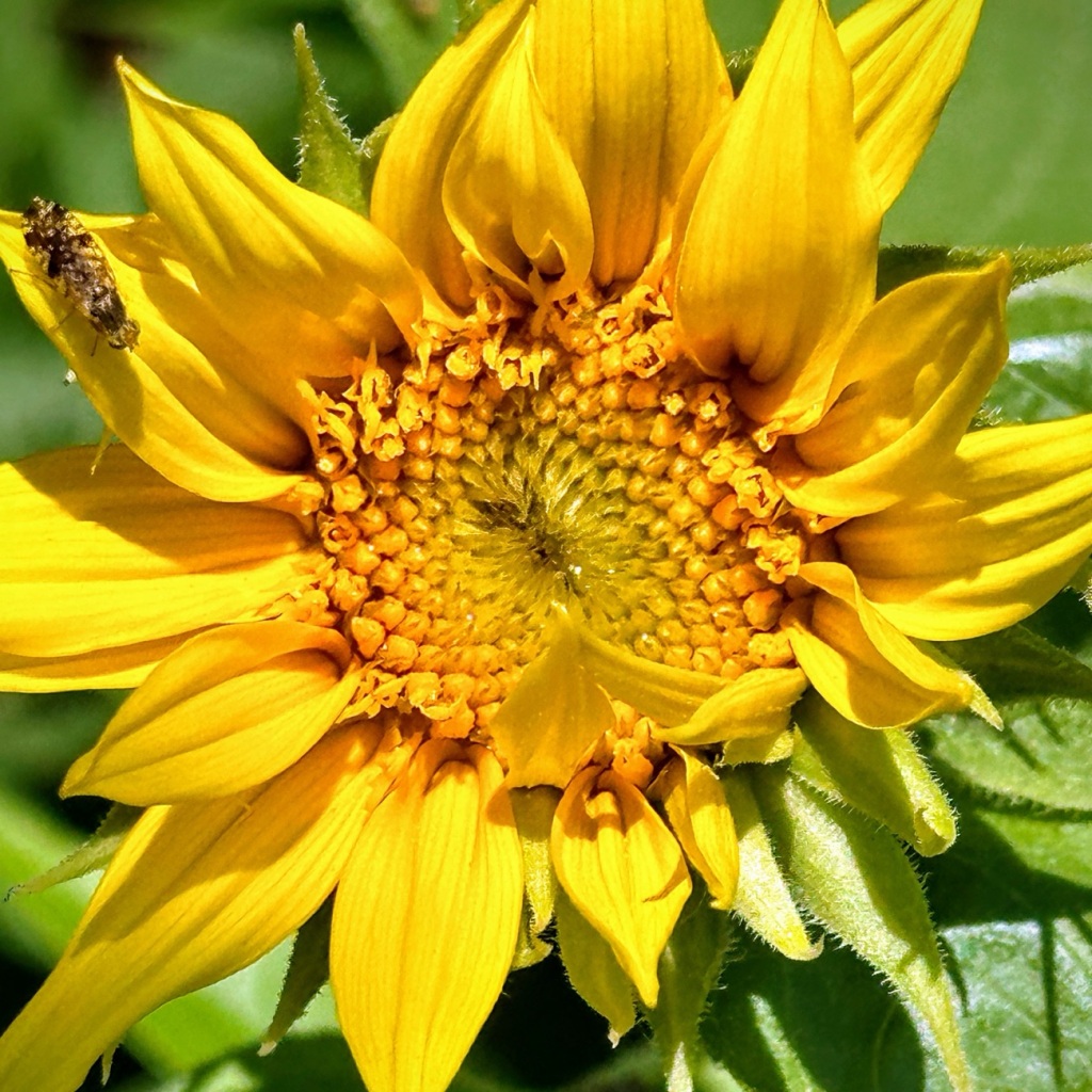
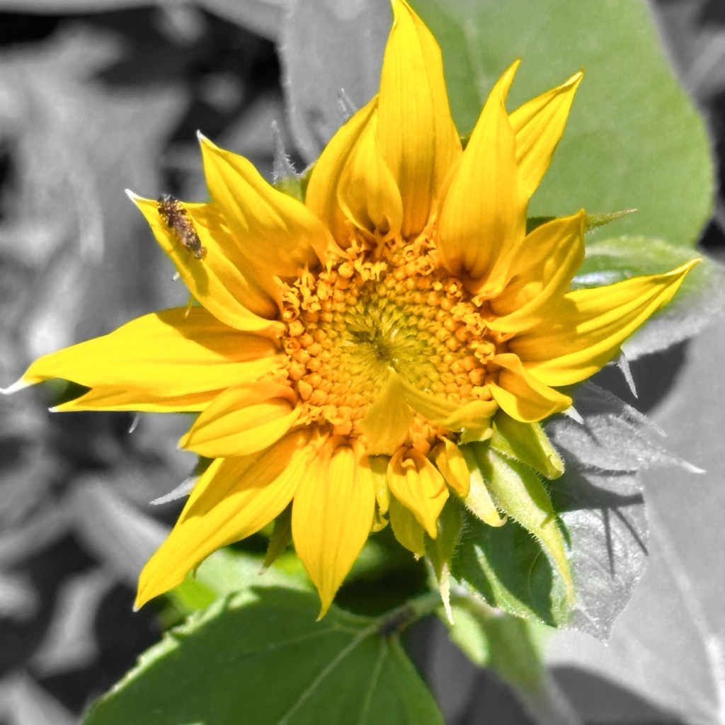
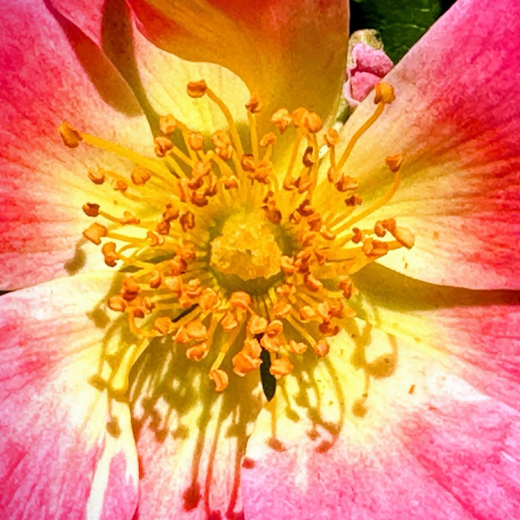
Sunflowers are popular flowers especially during the summer. Have you ever considered what Sunflowers 🌻 represent? Here are a few things they represent:
Long life and lasting happiness
Good Fortune and Positive Opportunities
Optimism and happiness – their vibrant yellow and orange colorful petals help to brighten your mood.
Positivity and Strength
Warmth, adoration, dedication and love for family members and friends
God Bless. Embrace joy, Seek out Light, and always Seek out the Sunlight in your life. Thank you for sharing your time and thoughts with me. I appreciate y’all.
Luckily we had a beautiful sunny day on Sunday which enabled me to capture plenty of signs, and shots with words in them as Cee’s CMMC – Pick a Topic from my Photorequests us all to post.
Our visit to Anne Springs Close Greenway is extremely accommodating in the aspect of Signs and various Objects with Words.
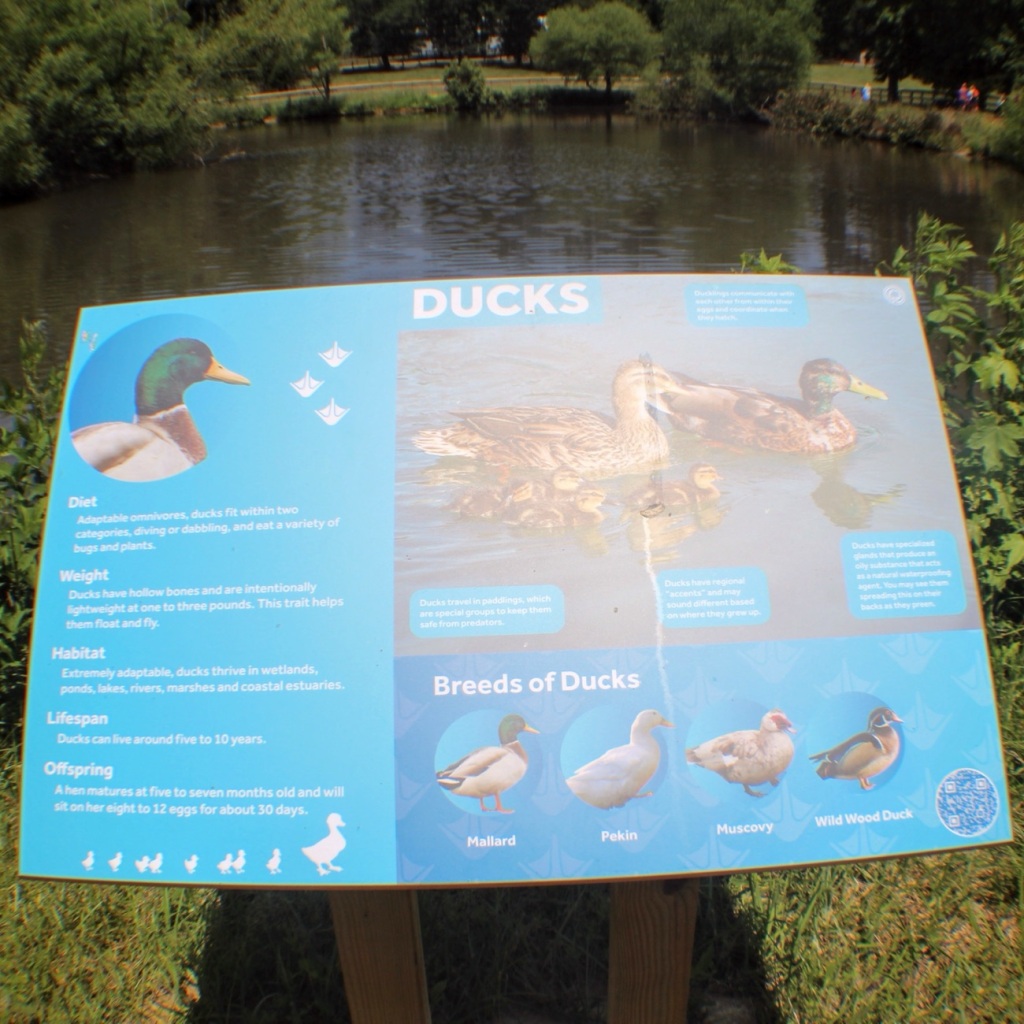
Signs can be found all around the Reconstructed Children’s Farm ..,
Ducks Signage by Patterson Pond
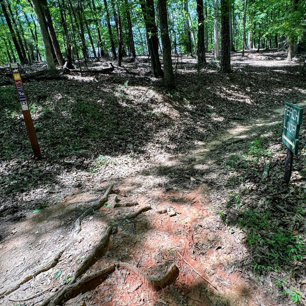
Along all the various Trails …
Trail Signs
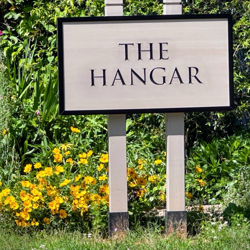
In front of buildings such as The Hangar …
The Hangar
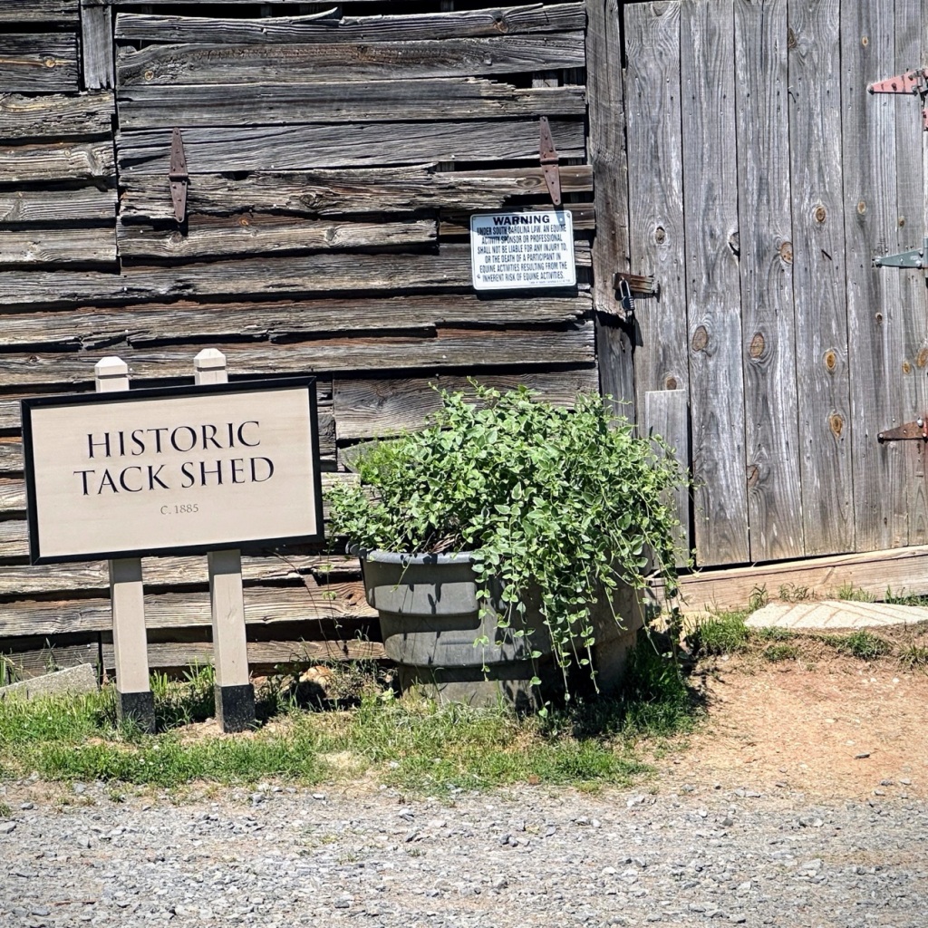
Or on and in front of an Historic Tack Shed …
Historic Tack Shed
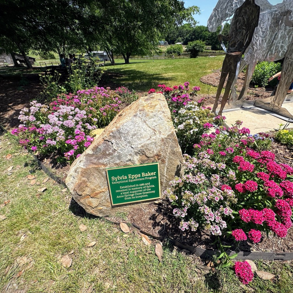
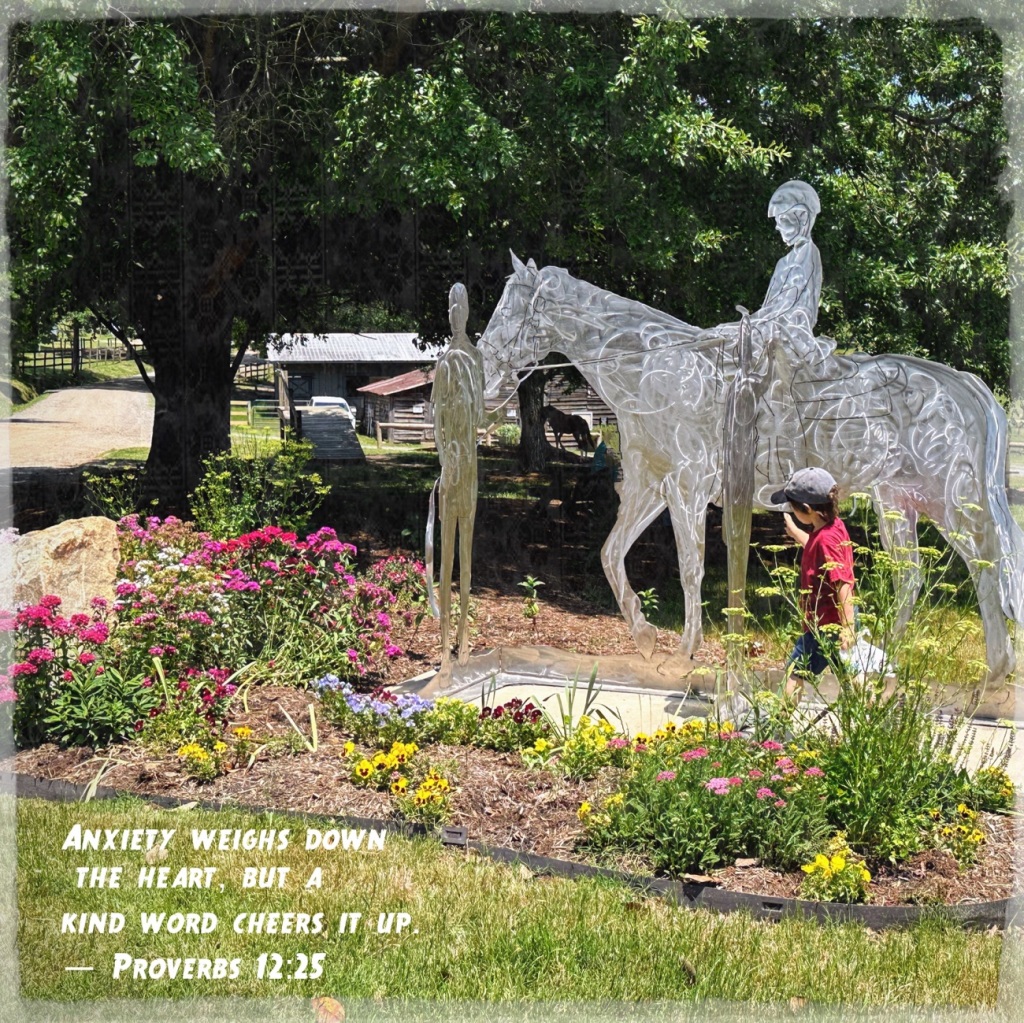
And even in a flower bed informing everyone about the Sylvia Epps Baker Metal Sculpture.
For this journey of discovery we are beginning in Southern California at Knott’s Berry Farm. We are Renewing a remembrance by exploring a time of a family outing my dad captured with his camera and had developed onto slides which I Reconstructed into digital formatting for better visibility and preservation.
Stage Coach Ride at Knotts Berry Farm Buena Park, California Circa May 1966
The Stage Coach ride allowed people to seat inside the coach or on the Outside up top of the coach. Being up top allowed for a unique experience and perspective of the exciting surroundings.
Moving Forward we venture out towards the California desert for a weekend of camping and the freedom of the great outdoors for a time of refreshing recreation and a time for renewing the closeness of family togetherness.
Anza-Borrego Desert State Park Borrego Springs, California
We join friends from our church family at Anza-Borrego Desert StatePark for a time of food, fellowship, and tons of fun.
Whether we choose a seat at a table near the chuck wagon or close to an outdoor cook stove/oven is our choice. We may sit together or apart, however the point of the weekend is renewing and strengthening family bonds and friendships.
Anza-Borrego Desert State Park Borrego Springs, California
Moving Forward remembering the past by Reconstructing old slides renewing the photos for future generations.
Good Day! Be sure to click on each photo for larger viewing.
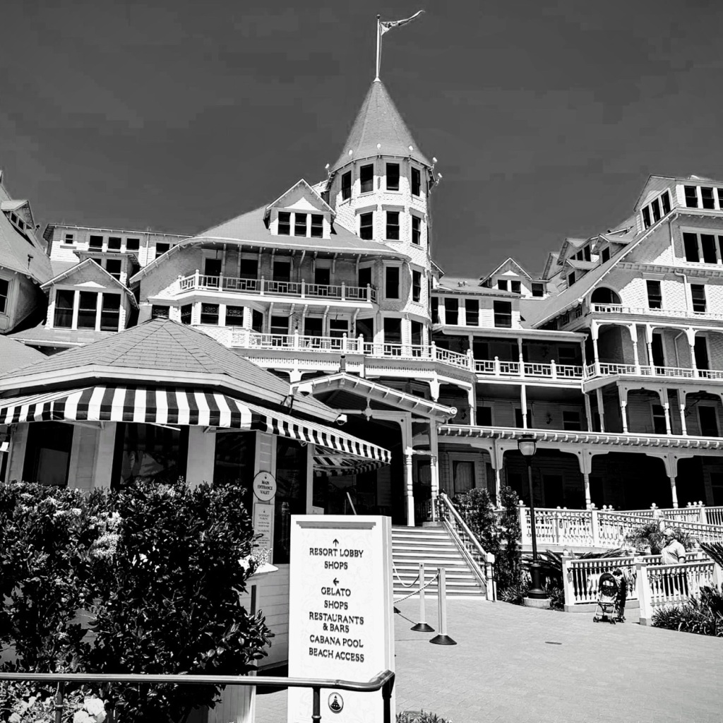
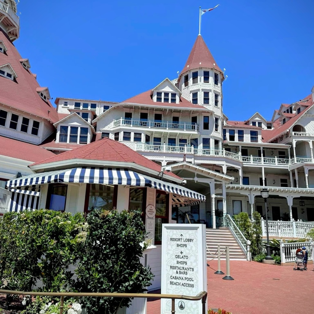
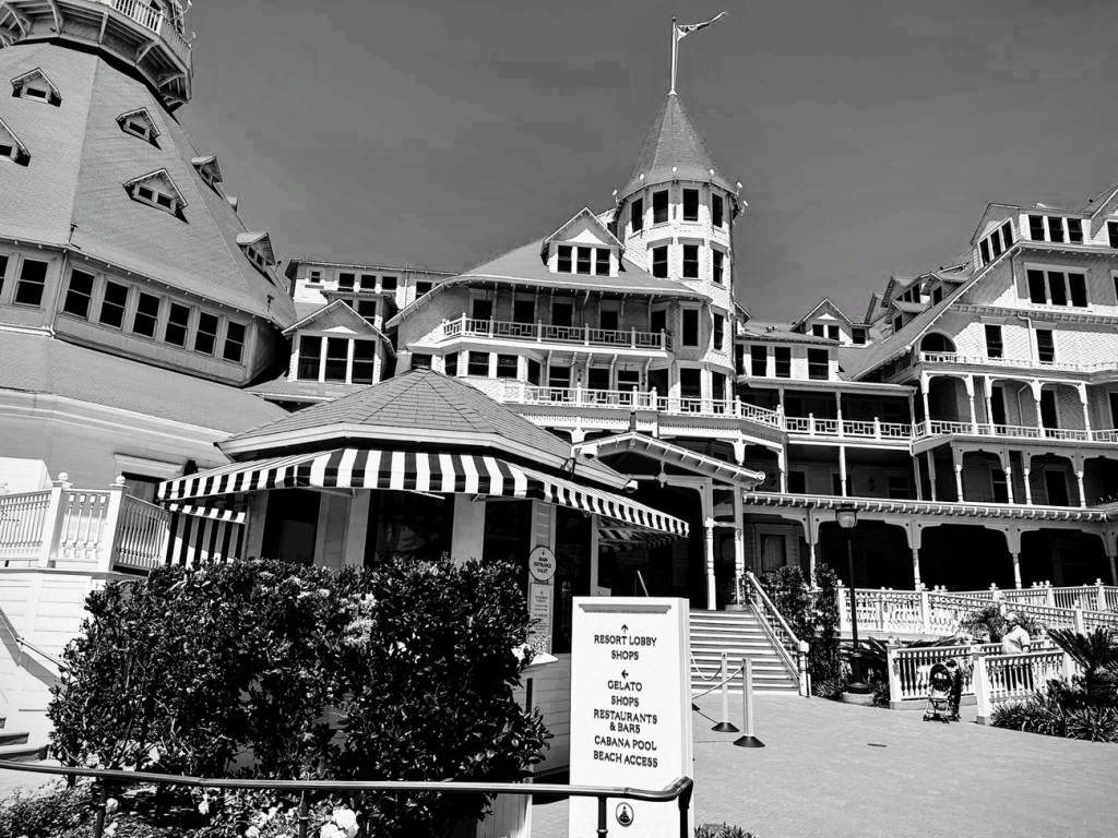
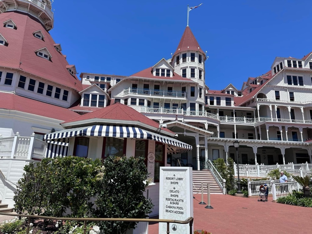
The Hotel Del Coronado has been a living legend for more than One Hundred Thirty (130) years. It has proudly hosted U.S. Presidents, movie stars, celebrities, and royalty as well as many beach loving guests (tourists and locals) for many many decades of generations throughout history.
With Non-Squared
B/W & Color Windows
The Hotel del Coronado was built in 1888 after much dreaming, planning, and inspiration of its founders Elisha Babcock and Hampton Story. Babcock and Story enlisted a local San Diego developer, Alonzo Horton to help them survey Coronado beach in 1886. The natural beauty of Coronado inspired the founders to buy the island and build the magnificent hotel.
Babcock and Story created the Coronado Beach Company and then proceeded to establish several enterprises to support and develop the Coronado Community. Those enterprises included a ferry company, a water company, a railroad company, and an electrical power plant.
Construction began on the hotel in 1887 with approximately 250 men working the construction crew. It was built entirely wood using many different types from across the United States. The lumber used included Douglas Fir for framing, California Redwood for its exterior siding; hemlock and cedar was also made available for use. The Hotel’s lobby featured Illinois White Oak while the Crown Room ceiling was done with Oregon’s Sugar Pine. Each type of lumber was selected for their unique qualities to enhance the hotel’s beauty and ensure its longevity.
Coronado Island and The Hotel del Coronado are wonderful places to visit. The beautiful landscape, the beautiful ocean views, the stunning elegance of the hotel are sites to behold and experience. I have to admit I have never stayed in the hotel (too rich for my blood), however I have visited and walked along the beach with friends. A truly wonderful experience for sure and for certain.
Can you believe it? We are half through the month of May and one-fourth (1/4) of the way through twenty twenty-four (2024). It is already time for another ofClare’s Share Your Desktopwhere Clare asks us to share our desktops/wallpaper either from our desktop, laptop, tablet, or smartphones.
Now it’s my turn to share my desktops/wallpapers with you. First up is from my iPhone followed by my laptop.
From my iPhone 14 Pro Max:
Personal Focus
Coleman
Hiking Focus
Coleman at a crossroads between Dogwood, Timberline and Peach LoopTrails
Reading Focus
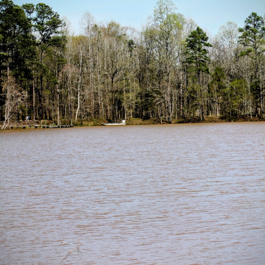
Lake Haigler Anne Springs Close Greenway
From my HP Laptop:
Screensaver Wallpaper
Coleman
Desktop
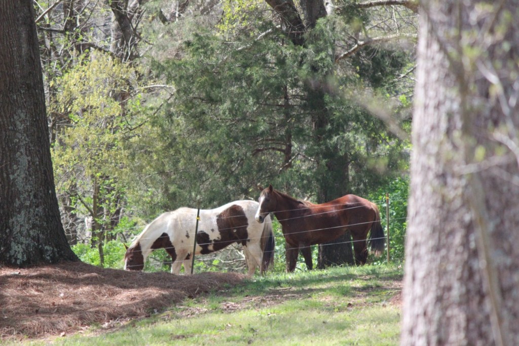
Horses at Dairy Barn Entrance Anne Springs Close Greenway
Getting out in nature always helps to renew my mind, refresh my spirit, and rejuvenate my soul. This view is from the side porch of the Gibson House.
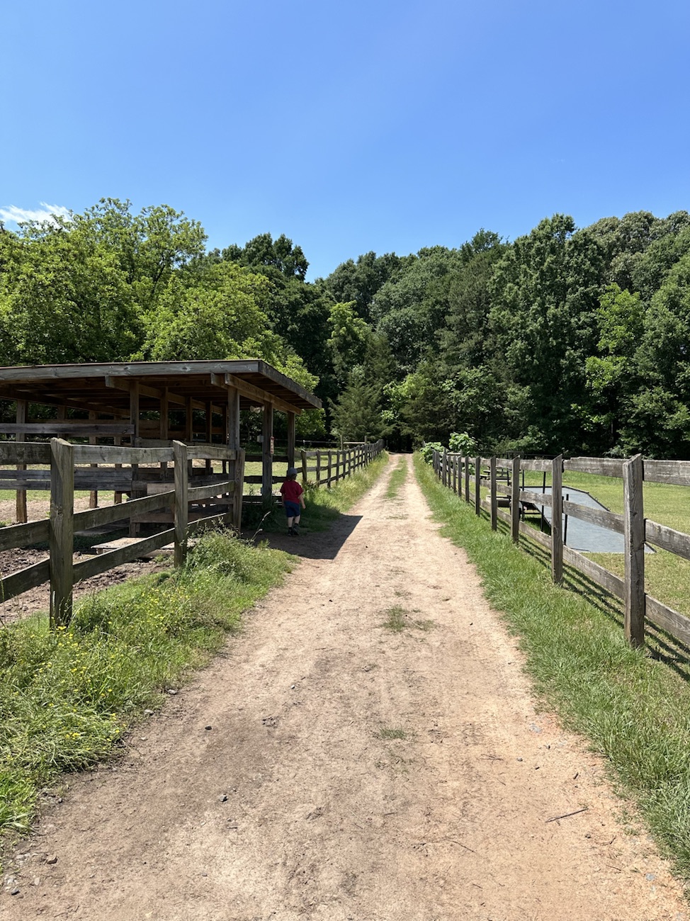
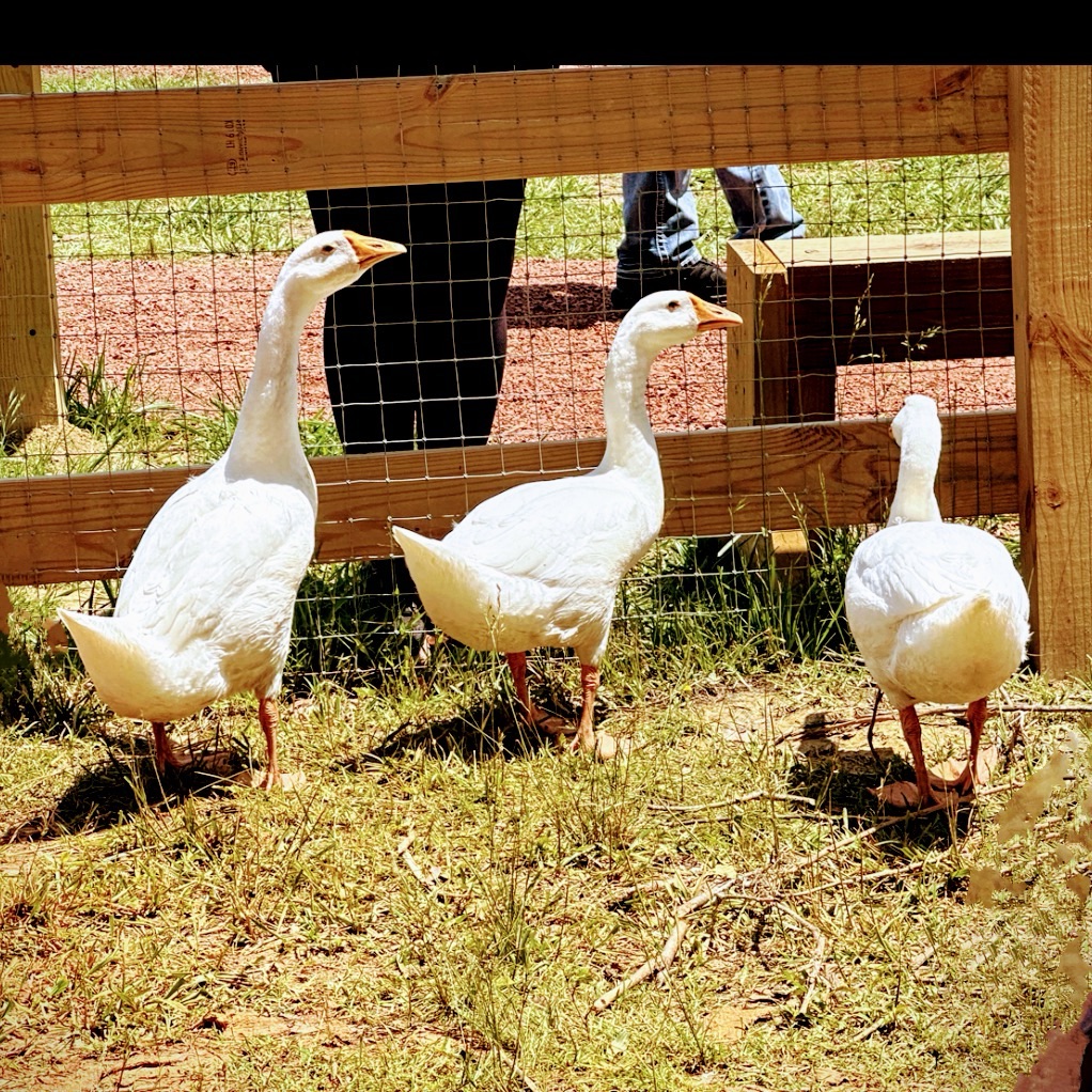
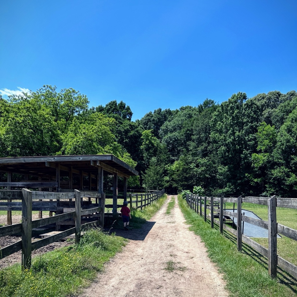
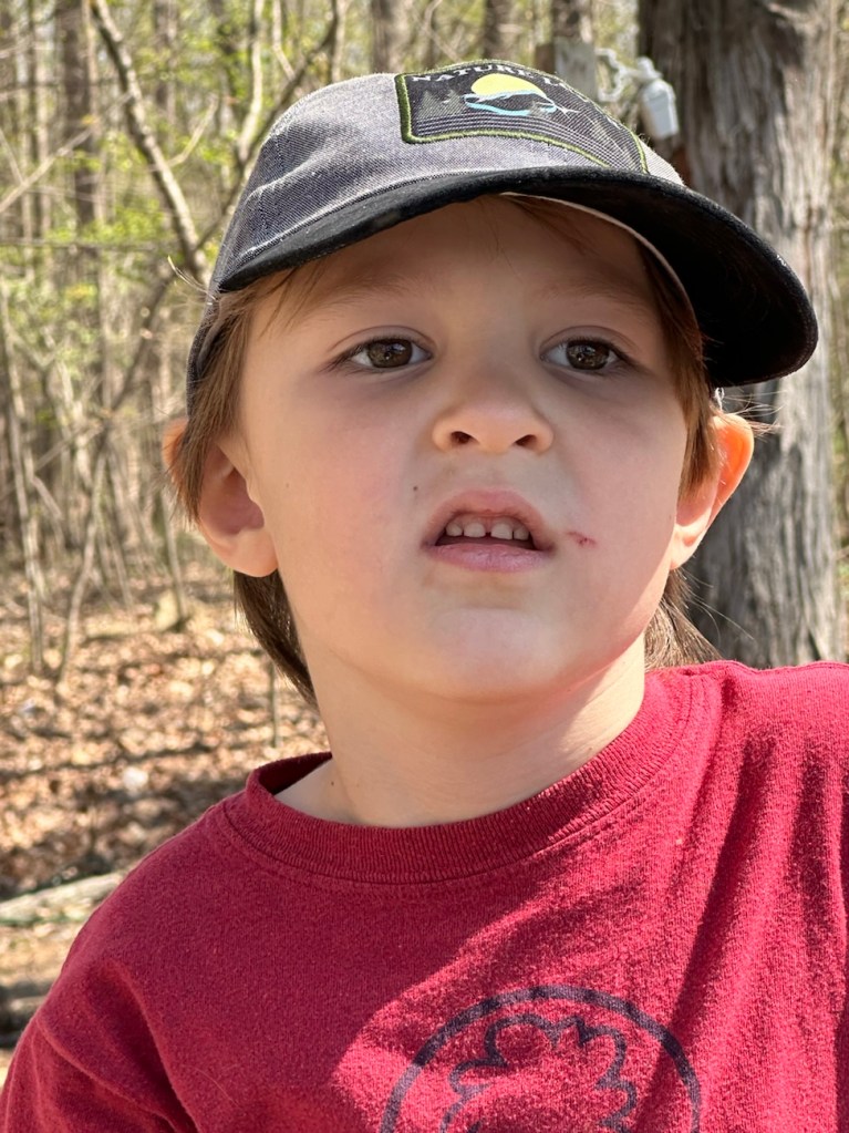
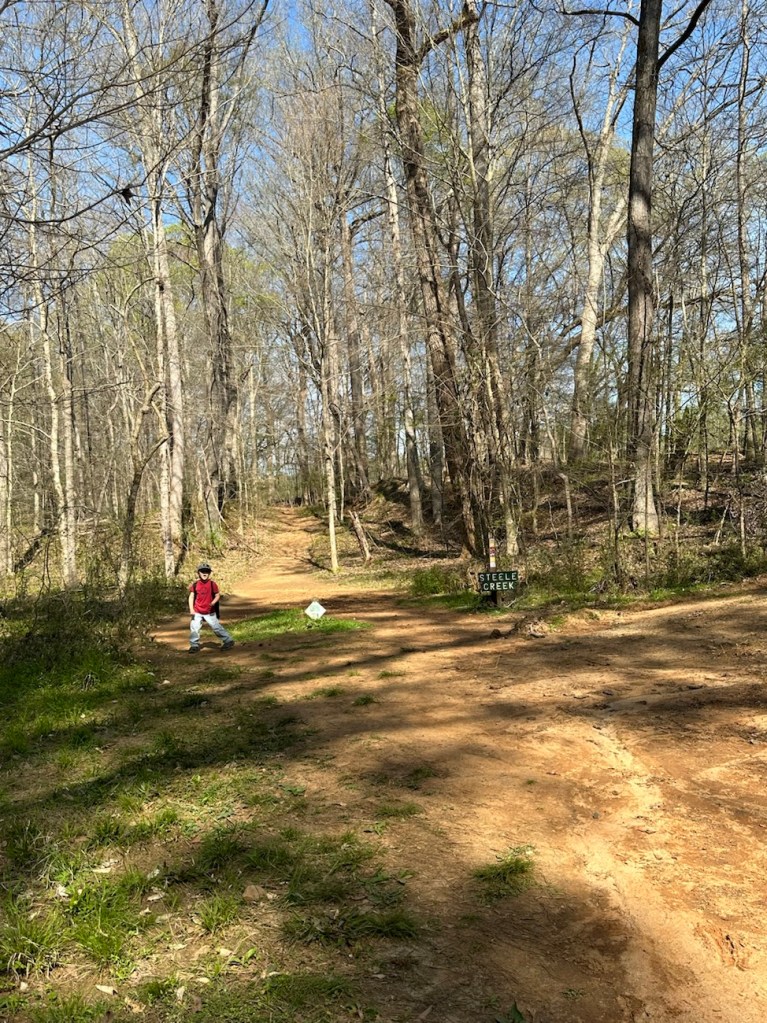
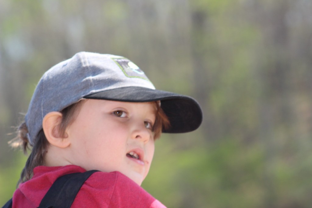
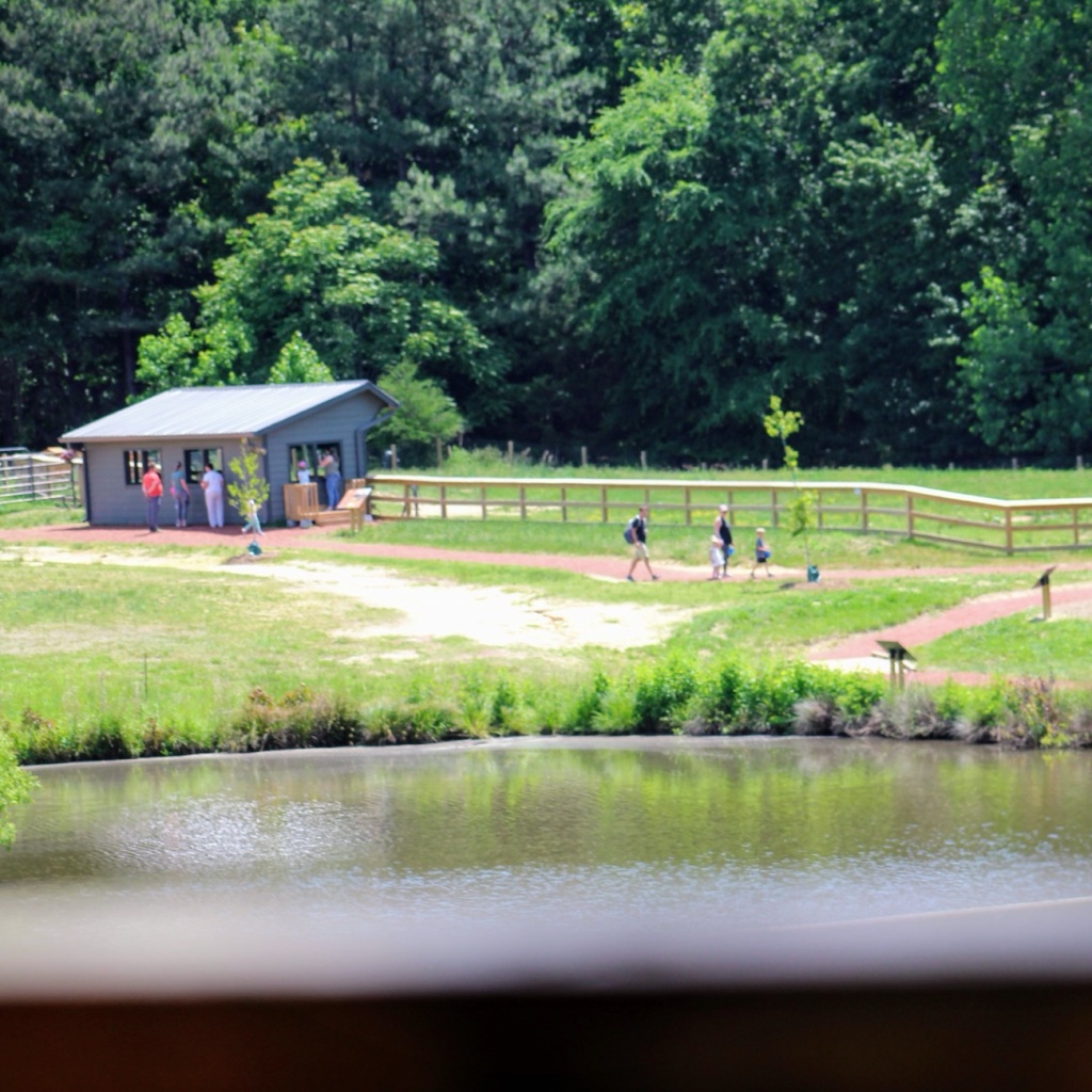
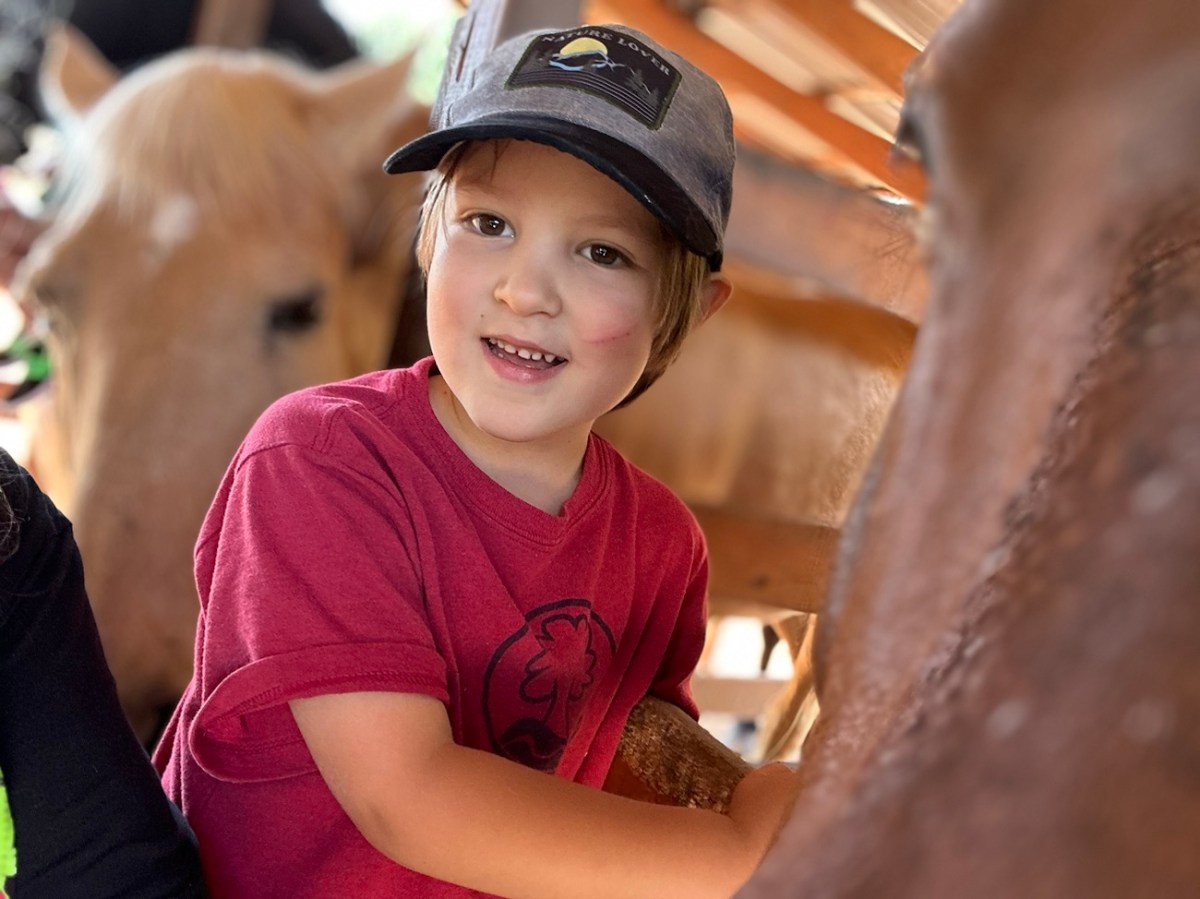
On Sunday, Coleman and I drove into Fort Mill to visit the newly renewed and reconstructed Crandall Bowles Children’s Farm at the Anne Springs Close Greenway. The newly reconstructed children’s farm is accessible through the Greenway Stables Entrance. We are moving forward ( I know you can’t see our movements, but you can imagine them) to visit the Farm animals (chickens, rabbits, alpacas, and cattle.)
After visiting the farm animals, Coleman and I went back to the car to grab our snacks and put my backpack in it as my camera battery had died. So then I continued taking photos with my iPhone as we proceeded to Move Forward through the horse stables on towards the trails for a bit of hiking. We hiked along on the Dogwood Trail, made a loop onto Peach Loop to watch out over Lake Haigler before heading back to the car and home.
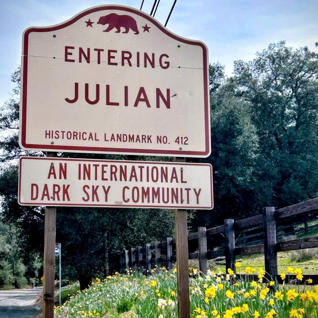
While gazing out over Lake Haigler, I reminisced for a short while remembering a time of apple picking, fresh apple cider, and fresh bread with a dollop of fresh homemade apple butter in Julian, California.
Now that I have your mouth watering for the delicious delightful aroma of fresh homemade apple delicacies, I trust you’ll have a wonderful rest of your weekend and a blissful weekend.
Location: Horse Stables; Greenway Stables Entrance; Anne Springs Close Greenway; Fort Mill, South Carolina, USA
God Bless. Have a fabulous rest of your week. Enjoy the Outdoors. Thank you for visiting and sharing your time and thoughts with us. I appreciate y’all very much.
Sylvia Epps Baker Exceptional Equestrians Program Established in 1983 and renamed in memory of Sylvia, a loyal supporter of the Anne Springs Close Greenway from its inception.
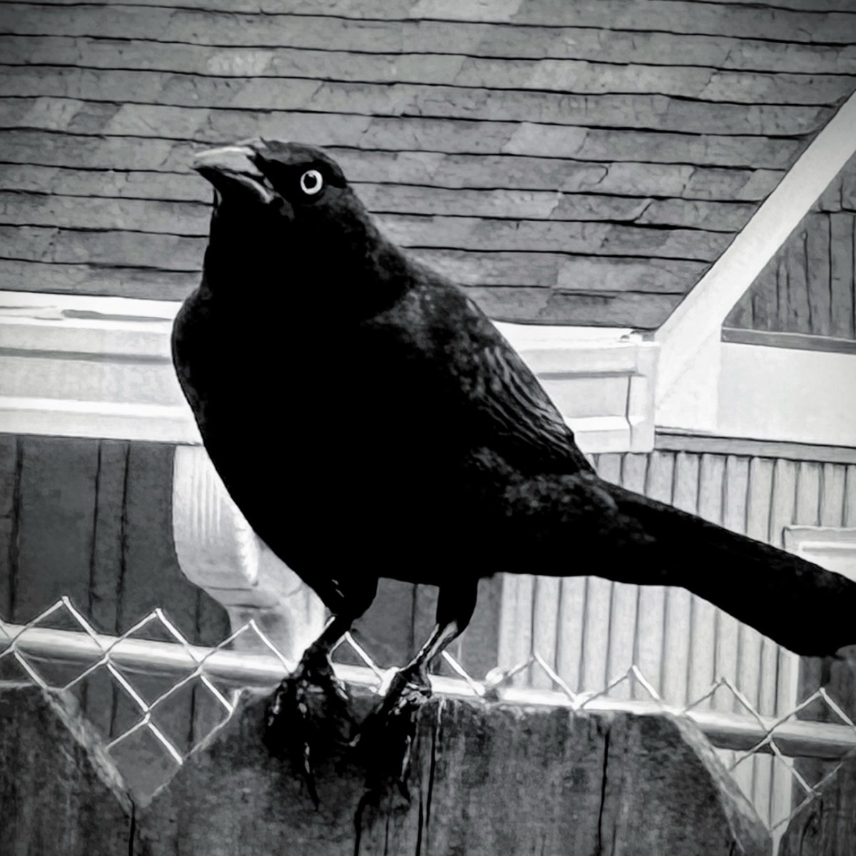
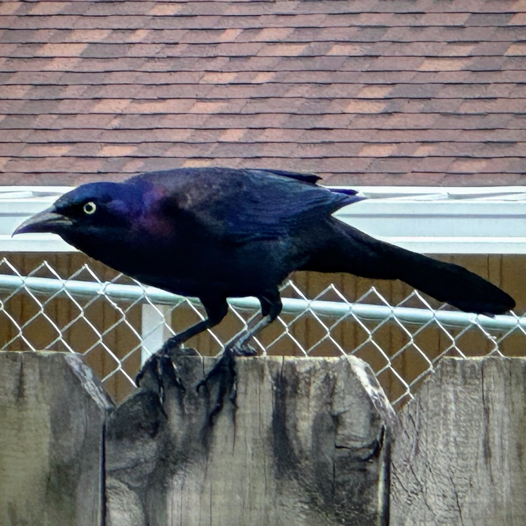
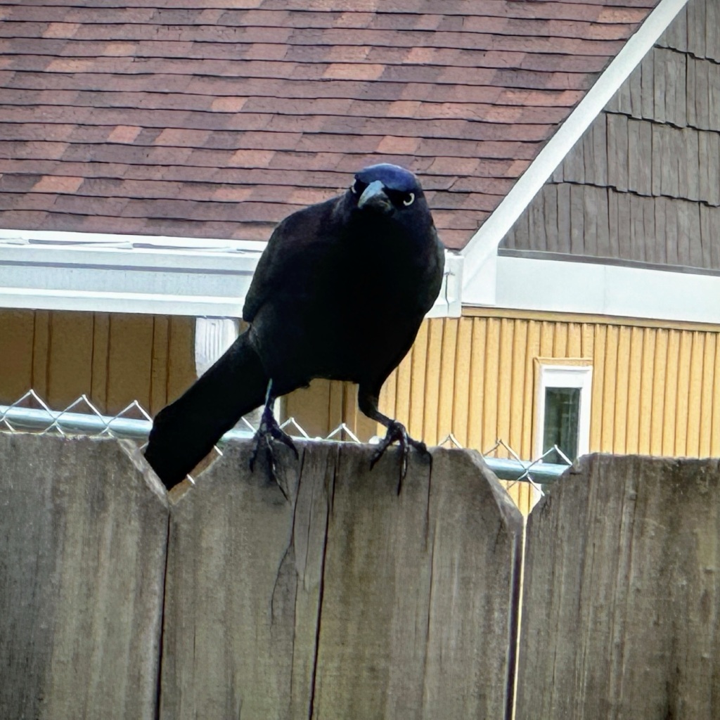
The Carib Grackle also referred to as the Common Grackle is a tropical blackbird which is taller and longer than the typical blackbird. The plumage of Grackles are entirely black, however it has a beautiful glossy iridescent body that may display violets, purples, blues, and greens when the sun is shining on them in just the right manner.
Quiscalus lugubris
Grackles eat almost anything and everything they can find. They commonly eat insects, minnows, frogs, lizards, berries, grains, and even small birds and mice. They will confiscate food from other birds. And sometimes as these Grackles pictured here are exemplifying HOPE for a few morsels of bread crust or crumbs that may get dropped on the ground or scattered for other birds.
Carib Grackle
The Carib Grackle’s song is a mixture of harsh and melodic musical squeaks, croaks, and whistles which seem to sound anywhere from guttural to high-pitched clear whistles. Some people have compared their singing as sounding like a rusty gate.
Carib Grackle Quiscalus lugubris in Monochrome
If you see them foraging around your yard or picnic table they are scavenging and are hoping you’ll share your food (or at least some bread crumbs) with them.
Location: Huntingtowne Neighbourhood; Gastonia, North Carolina, USA
God Bless. May all your hopes, dreams, and prayers be fulfilled. Take care of yourselves and have a fantastic rest of your week. Thank you for visiting and sharing your time and thoughts with me. I appreciate y’all very much.
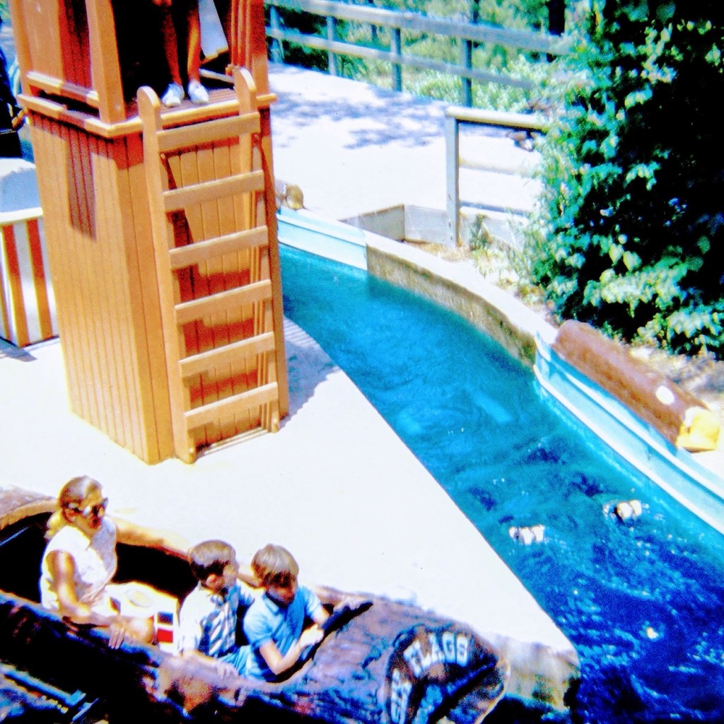
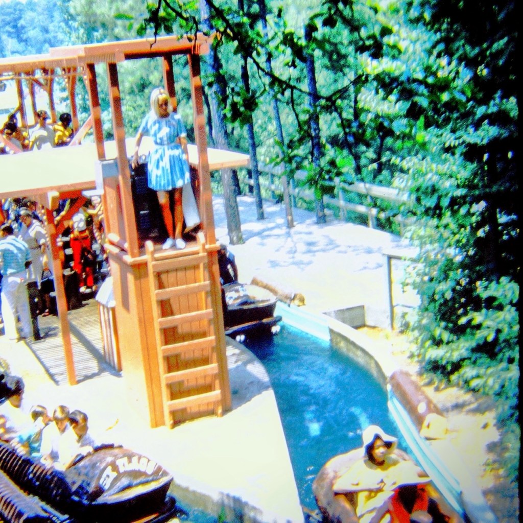
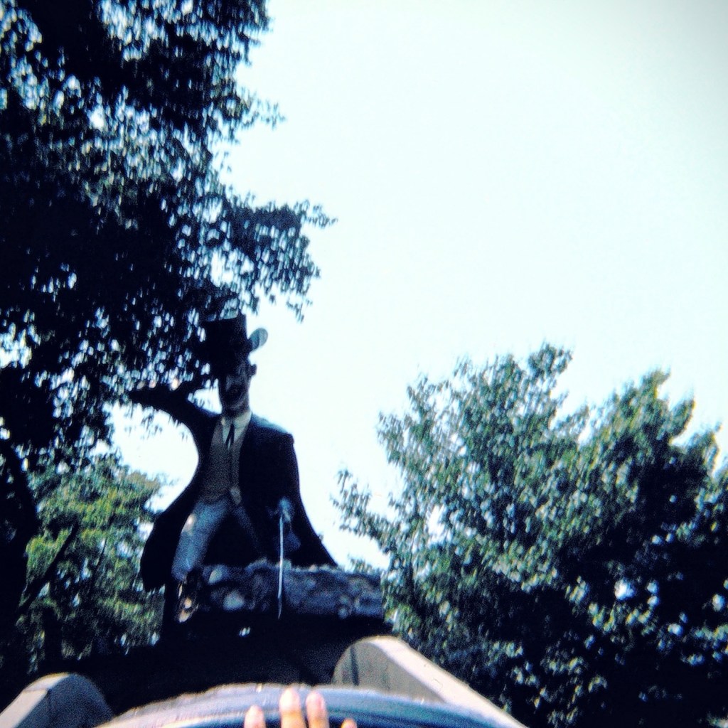
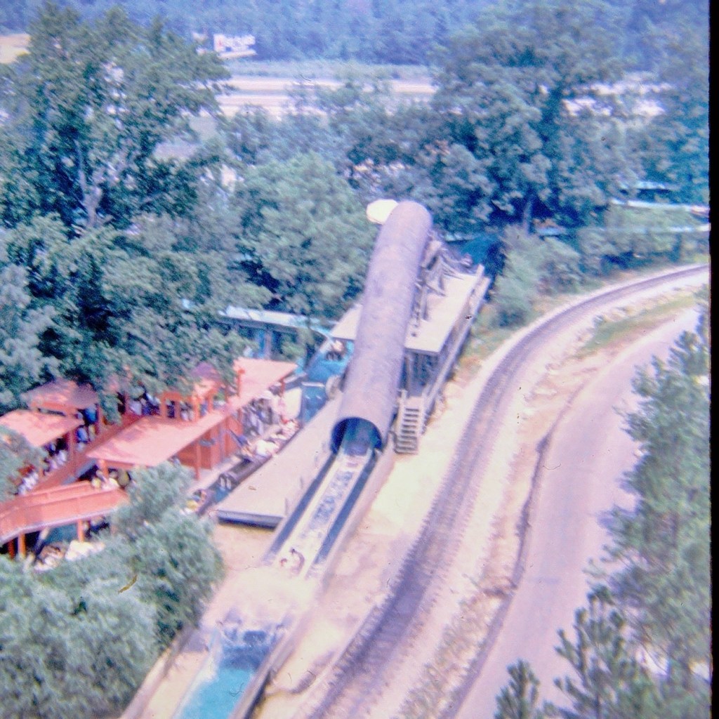
Come on and climb in the “boat” with us. We can make room for one or two more. It’s gonna be a fun ride, just you wait and see.
We’re moving forward, our turns coming up.
The ride lets boats go first from one side and then the other side. Our turn is next. Get ready. It’s our turn.
Moving forward along the ride we are going up, up, up …
And Splash … we zoom down almost to the end of our log ride. Did you feel the water 💦 splashing us? Oh right, you were in the back so you didn’t get oat all.
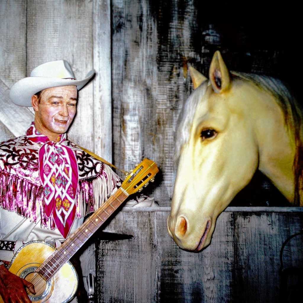
The photo was taken at the Movieland Wax Museum in Buena Park, California back in 1966 by my dad when we visited. These are wax figures of Roy Rogers and Trigger. The sign in front of the display (not pictured here) states CO. REPUBLIC 1945; “DON’T FENCE ME IN”; ROY ROGERS; DIR. ENGLISH; PROD. DONALD H. BROWN; SCENE N. 20; TAKE NO; EXT: STABLE.
The photos have been reconstructed by digitizing them via Wolverine digital converter to create a renewed version for save keeping for future generations.
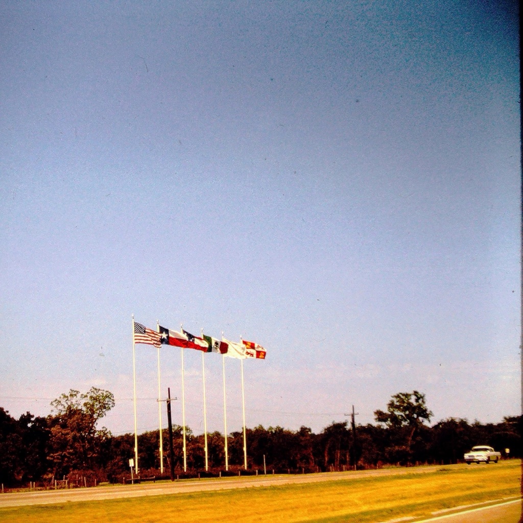
Today we are going backwards in time Reconstructing my dad’s slides to reminisce family journeys from 1963. These are from one of our vacations traveling from San Diego, California to Great Falls, South Carolina and back home again.We progressed along the interstate Moving Forward Eastbound and Down loaded up and truckin’ heading to see my paternal grandparents for the first time in five years.
Coming or Going Somewhere in Texas
The Six Flags can be seen from Interstate 20 nearing the Arlington, Texas. They signify being close to the Six Flags over Texas amusement theme park.
Which way are we going? From the photo I’m not sure if we were headed east or going back west at this point in time as I can barely remember the trip.
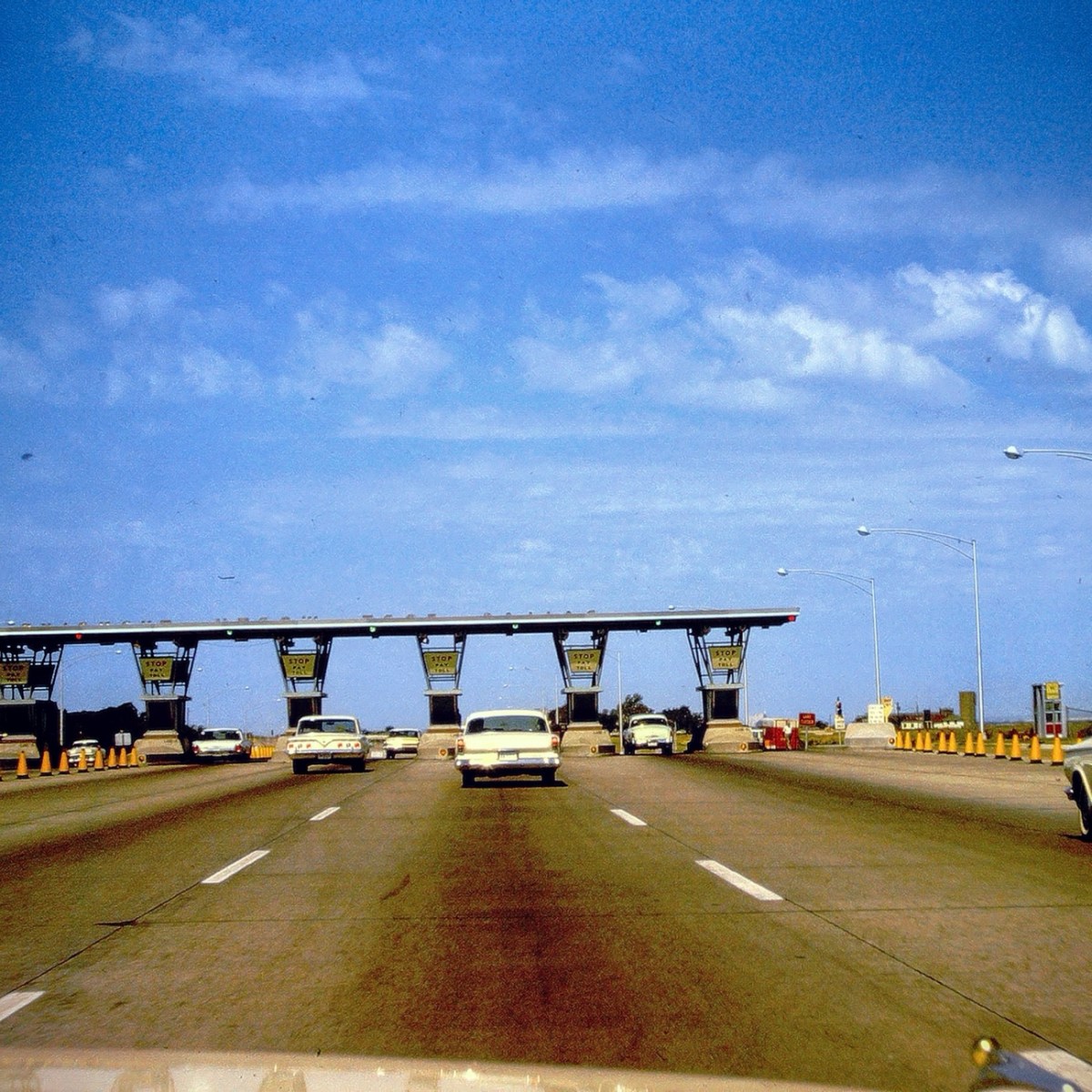
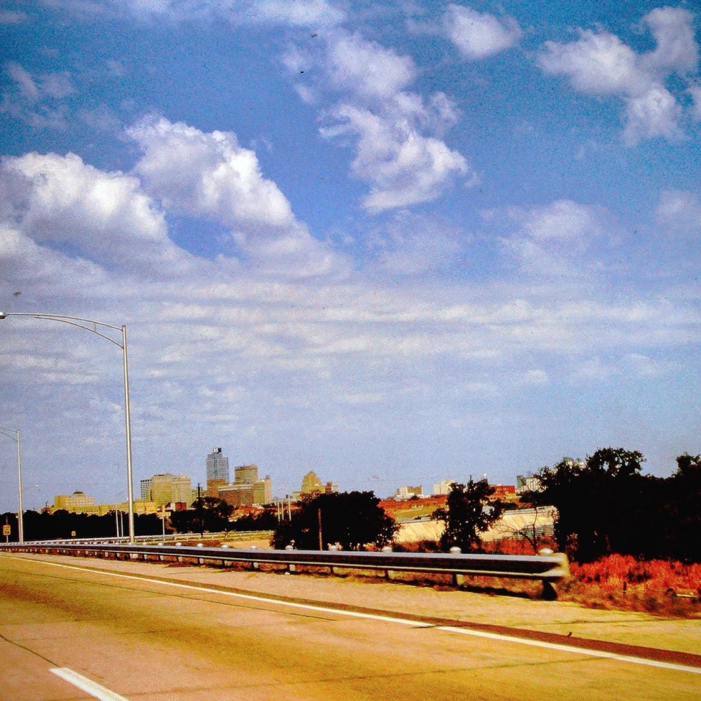
Stop 🛑 and Pay 💰 Toll Texas Toll Booths
Nowadays, there are over 50 toll roads in Texas. All drivers are required to pay the toll (fee) regardless of where you live. The first major toll road in Texas, which opened in 1957, was a 30-mile, six-lane stretch of highway between Dallas and Fort Worth. A drive from one end to the other cost 50 cents.
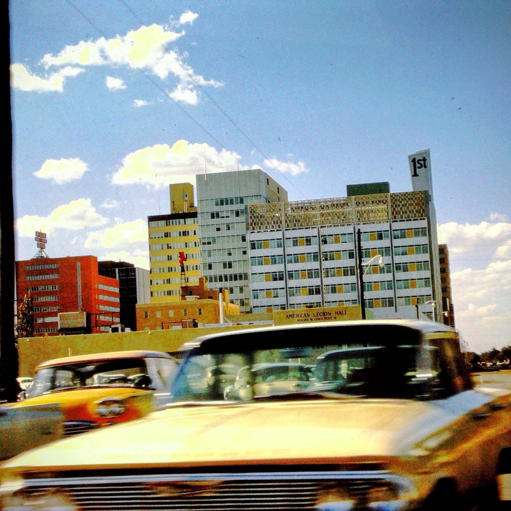
Passing through El Paso, Texas
After a long tiring vacation visiting family in the Carolinas, we are passing forward through El Paso heading home to San Diego. At this point of our trip we are excited to be almost home (over half way back across country.
I’ve been working on preserving and digitizing my dad’s old slides and thought these might fit the theme for Debbie’s OWS-Red Challenge.
3-speed GM Turbo Hydra-Matic automatic transmission in 1969Pirate Ship at Disneyland in 1965The Little Train by Lois LenskiLarry Dean Waters (my brother) and Debbie Lynn Waters (myself) in 1963
When we see an infiltration of these Tipulidae we know summer is approaching and we do not want a burgeoning of them like we’re having with the cicadas.
TipulaLuna
Crane flies are harmless to people but can cause damage to plants and your lawn. Plus, they can be really annoying if they make their way into your house!
Acutipula
Most species of crane flies have no mouth parts, and the ones that do only drink nectar. Crane flies don’t bite. They don’t sting, either. Though they may show up in large numbers and can be obnoxious, crane flies are harmless.
True Cranefly
Crane Flies need a moist environment to survive and we have had more than our share of rain 🌧️ and thunderstorms ⛈️ practically daily as of late.
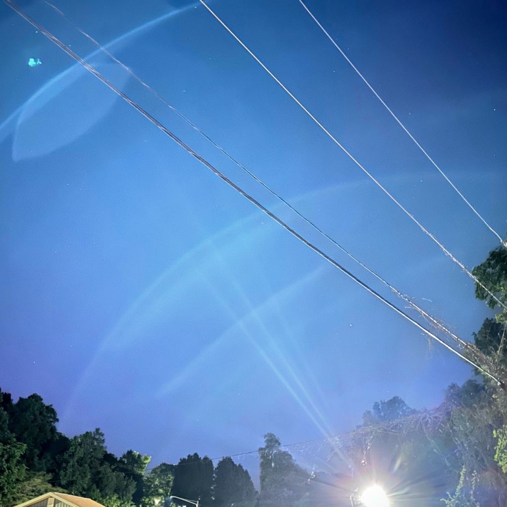
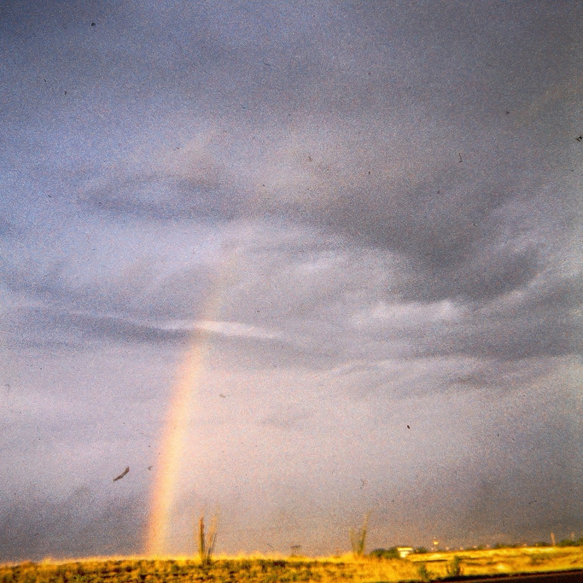
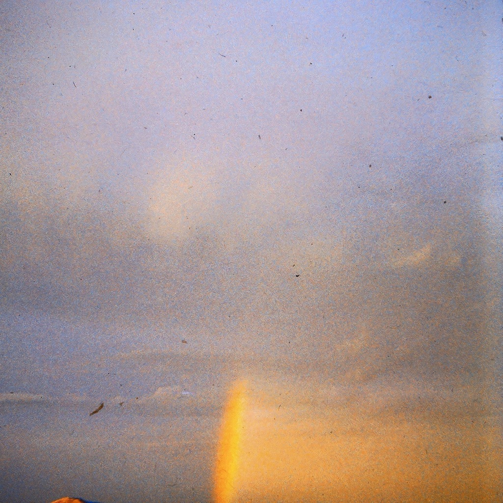
A Rainbow burgeoning across the sky captured many years ago by my dad as we were traveling to parts unknown (at least to me nowadays) somewhere in the USA.
I reconstructed my dad’s slides by Digitizing them via a Wolverine Titan 8-in-1 High Resolution Digital Converter renewing them for viewing for years to come.
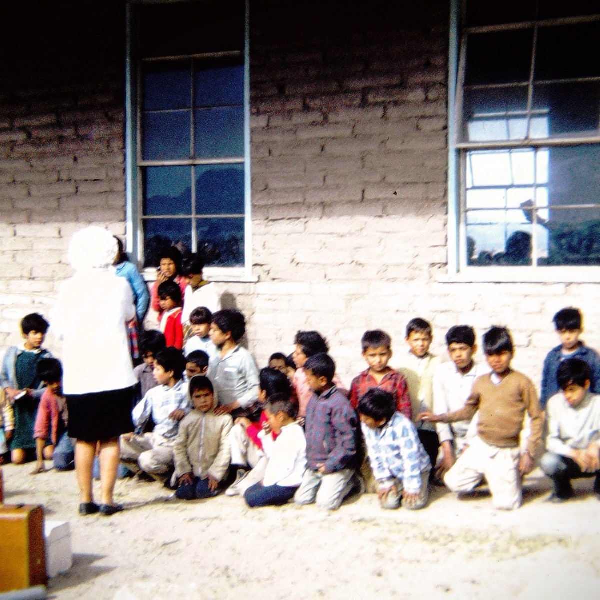
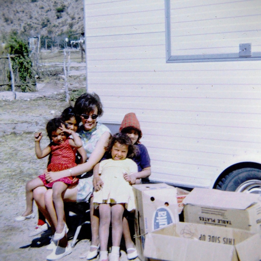
We can’t go back to being young again, but that doesn’t stop us from feeling young once again. When we reminisce we remember how we felt when we were young, the excitement of getting on a bus for a week of adventure with friends.
Youth group loading onto the church bus for a time of fun and adventure in the desert. Children from an Orphanage in Tecate, Baja California.
We remember the fun times of venturing into Baja California ( or a place we’d never been to before), of sharing our time and helping others. We remember the dreams and ideas we had, the places we wanted to see, the things we wanted to do.
A Young Family resting a spell by the church’s Chuck Wagon
We remember sharing our love,passion, enthusiasm, and experiences with children and families. We remember how it was when we were young and smile at all our happy memories.
Done with reminiscing for a while; we share our memories, our stories, our experiences with the young of today … our grandchildren. Just maybe they will find joy and excitement in doing some of the same things we enjoyed doing when we were young.
The Blue Iris is a symbol of Faith and Hope. They have been used at funerals as a symbol of sympathy since the times of Ancient Greek Mythology. The goddess Irish has been considered the link between heaven and earth, where she guides souls into the kingdom of heaven.
This week I chose a variety of photos from previous years I hope will meet Cee’s CMMCtheme sufficiently.
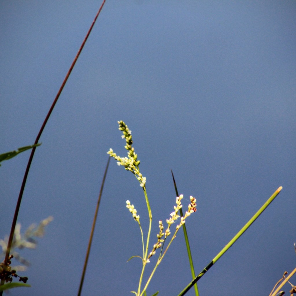
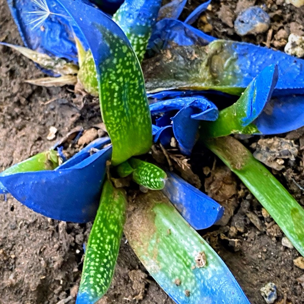
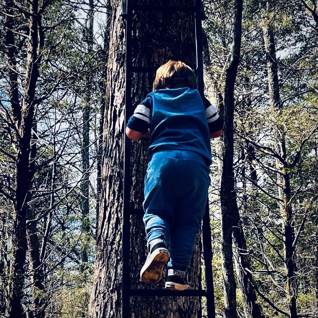
Polygonum punctatum Elliott Dotted Smartweed with a “Denim Blue” Sky (2023)Blue Agave plants (2020)Coleman Climbing a Deer Stand (2022)Doyce Eileen (Watson) Waters one of the last pictures of my mom (2018)
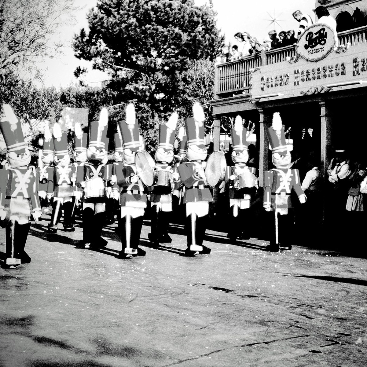
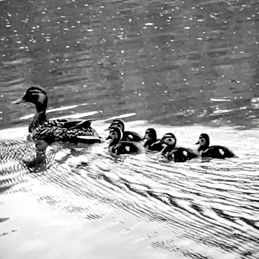
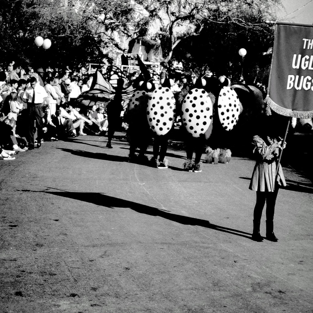
It’s been raining quite a bit here with thunderstorms today as well as off and on all week. Therefore, I decided to comb through my arch to see what I could come up with to (hopefully) satisfy the themes. I’m combining Sunday Stills, Becky’s Squares-Moving Forward, Throwback Thursday, and Leanne’s Monochrome Madness (couldn’t find the theme for this one.)
The last two photos were taken by my dad on his 35mm camera. I’m not sure what brand of camera he used in the mid-60’s. These last two photos were taken in Disneyland in May of 1966.
Duckling Paddling Forward Behind their HenFerry Boat with Cars Moving Forward Through the WaterThe Ugly Bugs Marching Forward with Spectators Watching Nutcracker Marching Band Marching Forward Along the Parade Route
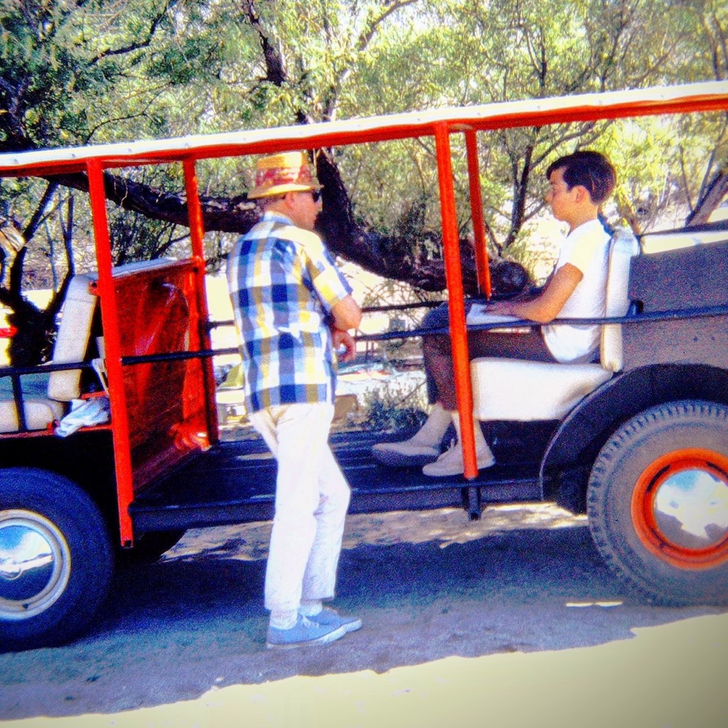
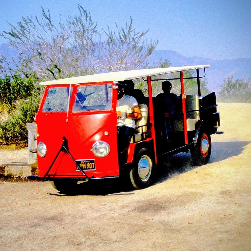
Come on along for the ride, we’re just gonna meander around through the desert here in Anza-Borrego Desert State Park.
Growing up in San Diego, California my church youth group would practically make annual camping trips out to Anza-Borrego Desert State Park. Several church families would bring their dune buggies, dirt bikes and give rides to the enthusiastic youth.
Ever since that time period, I have loved to go camping and hiking. I love being out in nature and my grandson, Coleman is learning to love and enjoy it as well.
Pictured here are actually two separate church camping trips; one in May of 1968 and the other in June of 1969. Those were the good old days my friends.
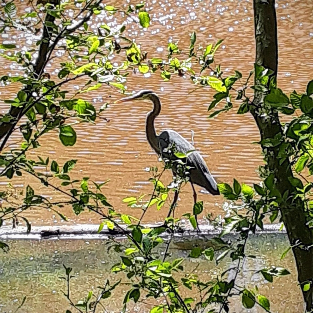
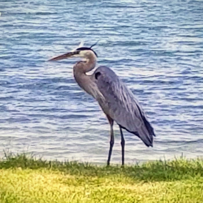
The Great Blue Heron (Ardea herodias) can be spotted around ponds and lakes. I normally see them around the smaller lakes and ponds in and around Anne Springs Close Greenway.
Great Blue Herons can hunt during the nighttime as well as during the day. Interestingly they have a high percentage of rodents-type photoreceptors in their eyes that improve their night vision. They congregate at fish hatcheries, creating potential problems for the fish farmers.
Ardea herodias Great Blue Heron Anne Springs Close Greenway
The Great Blue Heron is a majestic sight to behold. Its subtle blue-grey plumage frequently stands motionless as it scan for prey or wades belly deep with long, deliberate steps. They may move slowly, but Great Blue Herons can strike like lightning to grab a fish or snap up a gopher. In flight, look for this widespread heron’s tucked-in neck and long legs trailing out behind.
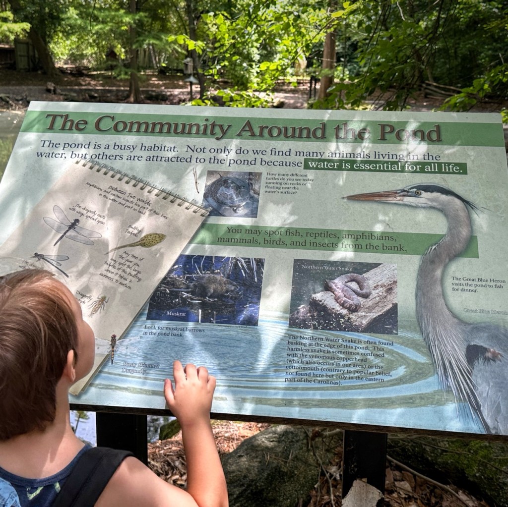
Informational Sign includes The Great Blue Heron The Schiele Museum of Natural History
Did you know that the Great Blue Heron is often seen as a symbol of patience? This I had not previously heard or known. Several Native American Tribes look at the heron as a symbol of patience and good luck. On the Northwest coast, people believe that if Native American fishermen spot a heron, it means good luck is with them, and they will have a successful fishing trip.
I have always considered the Great Blue Heron to be an amazing bird to observe. I did not ever realize that they were considered symbols or omens if you saw them. Evidently they are though.
In China, the Great Blue Heron represents strength, purity and long life. According to Native American tradition the heron symbolizes wisdom and good judgment. In ancient Egypt the heron was a symbol of creation while in Africa and Greece the heron was a messenger of the gods. Watching a heron fish also instructs us in patience.
Another interesting note regarding the Blue Heron is that it is believed to symbolize being calm, presence, being at peace, uniqueness, and balance. When seeing a Blue Heron one should take a moment to look inside yourself and consider nurture all aspects of yourself. Embrace who you are; your flaws (your weaknesses), your uniqueness, and ever your feelings of shame with self-love.
God Bless. May you have strength, purity, patience and long life. Take care of yourselves and have a fantastic rest of your week. Thank you for visiting and sharing your time and thoughts with me. I appreciate y’all very much.
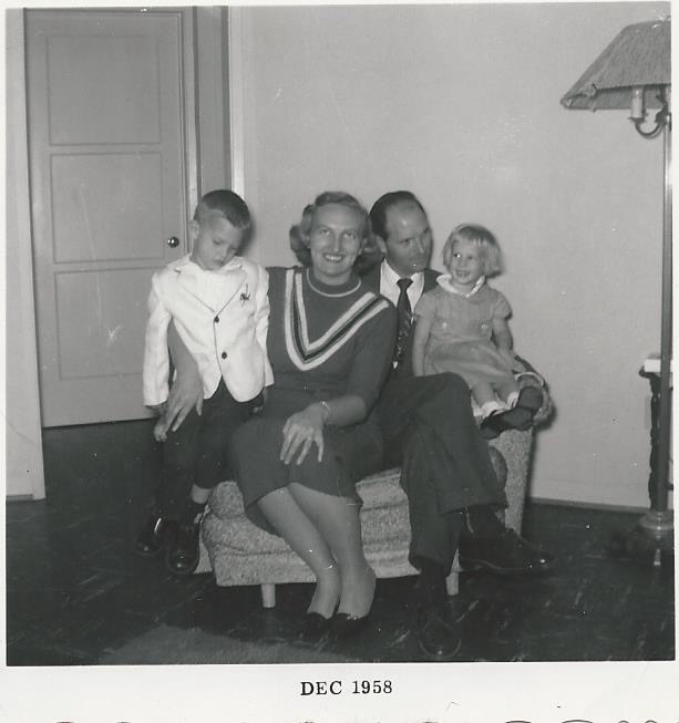
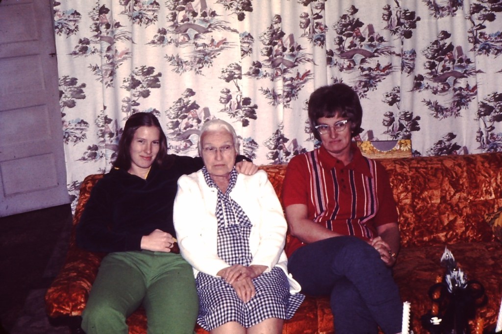
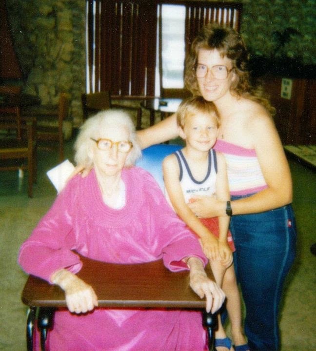
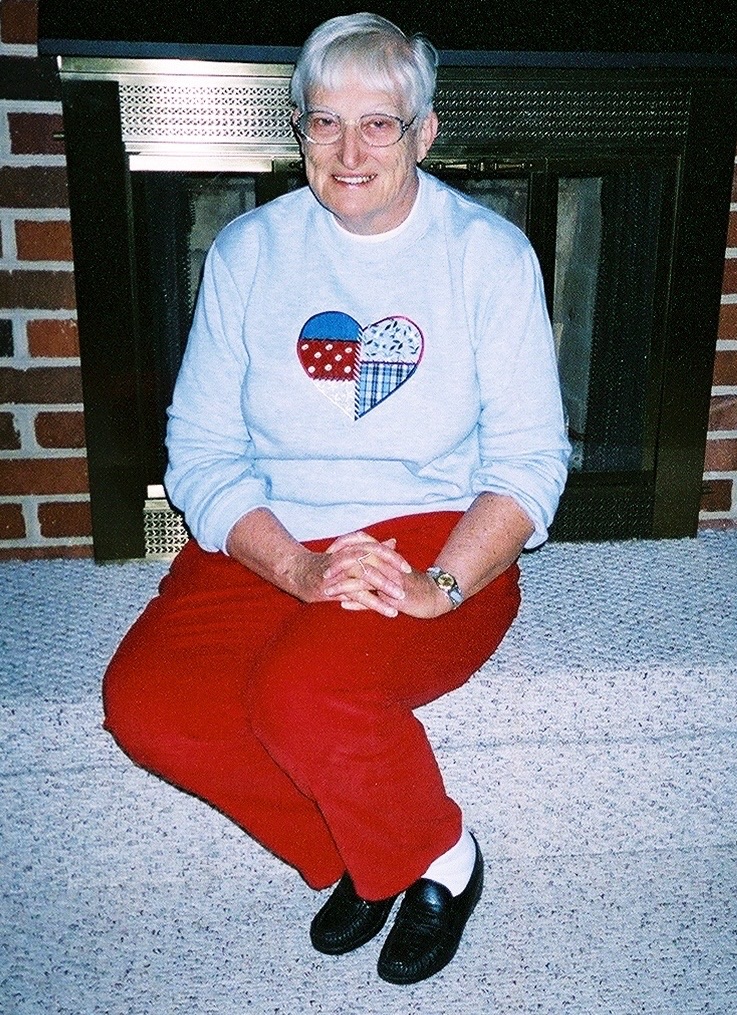
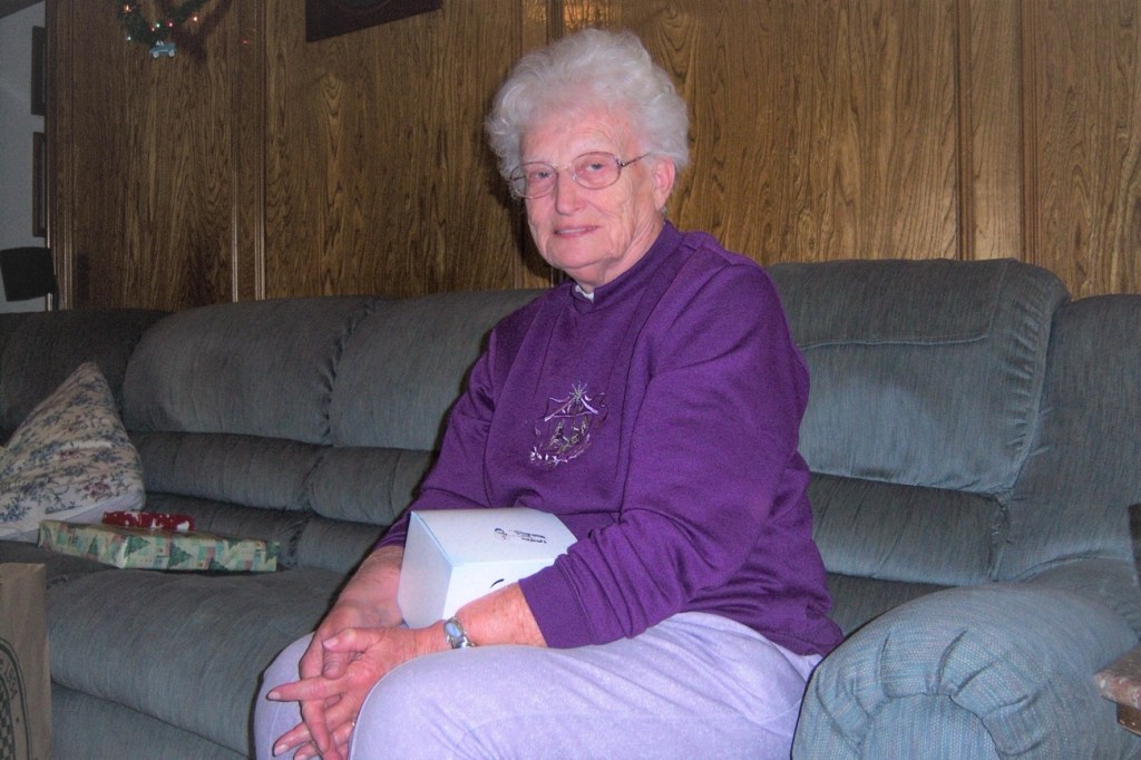
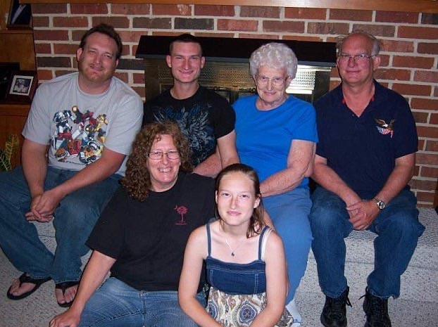
For Cee’s CFFC challenge this week for Indoor Seating I chose a selection to honor the mom’s in my life [My mom, My Maternal Grandmother, My Grand Aunt (my maternal grandfather’s sister).] I also selected a couple which are the reasons I’m a Mom and Grandma. This is also my post for XingfuMama’sPull Up a Seat Challenge.
December 1958 Family Portrait Mid-1970’s Me, My Grandma, & My Mom in San Diego February 1985 Grand Aunt Sophie, My son John, & Myself August 1989 2 Reasons I’m a Mom — John & David2004 Doyce Eileen Waters (my mom)2007 My mom in TexasMay 2010 Family Portrait 2017 Alona, Trisha, & Myself
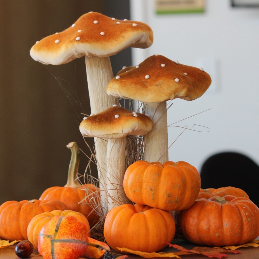
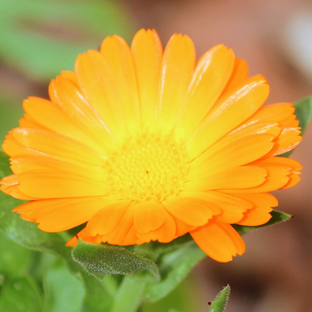
A Beautiful Sunset Pumpkin and Mushroom Counter Display Anne Springs Close Greenway Fort Mill, South Carolina, USAOrange Chrysanthemums Calendula officinalis, common marigoldOrange Life Jackets on my Spouse & Daughter in 1995 at Lake Fort Smith; Lake Fort Smith State Park; Mountainburg, Crawford County, Arkansas, USA
South Carolina has experience a burgeoning of Cicadas due to the simultaneous emergence of two large broods, Brood XIX and Brood XIII. Brood XIX is the brood that has infiltrated the Carolinas. The Brood XIX variety, also referred to as periodical cicadas, emerge every thirteen (13) years across the Midwest and the Southeast. This is said to be a once-in-a-decade event where you have this many hatched.
Magicicada septendecim
The emergence began in April in the south and is expected to start in June in the north. The cicadas’ emergence caused a major commotion in South Carolina, with some residents calling the police to complain about the noise.
Pharaoh cicada or the 17-year locust
The loud sounding noise that people hear is caused by male cicadas singing to attract mates after spending more than a decade underground.
Cicada exoskeleton
If you do not wish to have cicadas burgeoning in your yard or in your garden, you can spray your trees and plants with some essential oils or other sprays that won’t harm the vegetation to detour them from coming into your yard. Cicadas hate the smells of peppermint, vinegar, and eucalyptus.
“Do not conform to the pattern of this world, but be transformed by the renewing of your mind. Then you will be able to test and approve what God’s will is—his good, pleasing and perfect will.”
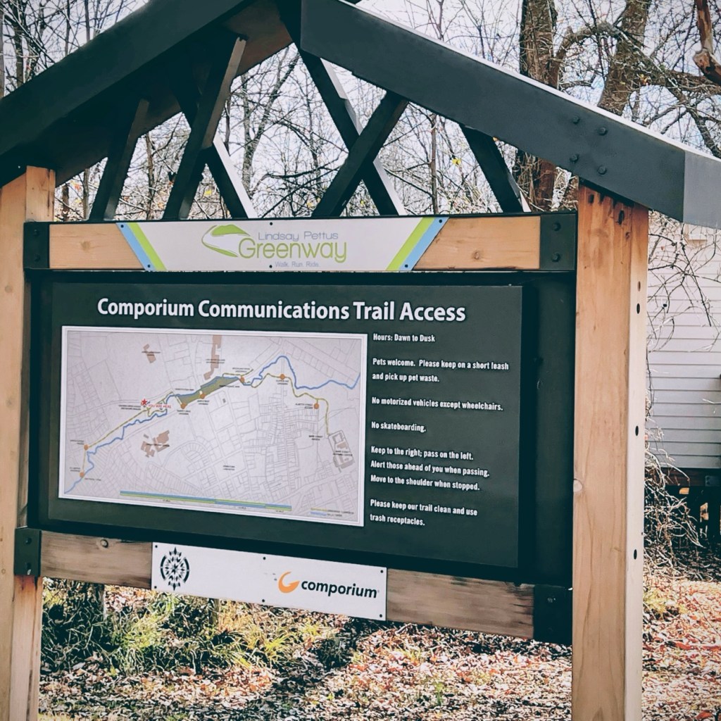
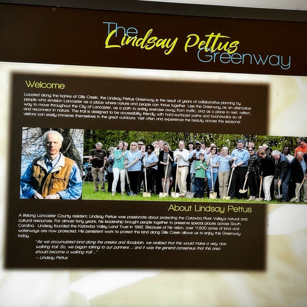
The forward thinking of concerned citizens, volunteers, business partners, and in partnership with the Katawba Valley Land Trust; the ideas, planning, and reconstruction of certain areas into a Greenway of trails in Lancaster began to develop beginning in 2014. The Greenway includes numerous pedestrian connections with linkages to residential, commercial, and local school properties, trail heads, and nature centers, bridge crossings, and sidewalk improvements.
Comporium Communications Trail Access is the starting point for Coleman’s and my hike along the first phase of the Greenway’s Master Plan. The first phase of the Reconstruction of Land in Lancaster was completed in 2019. Our hike took place in February of 2022.
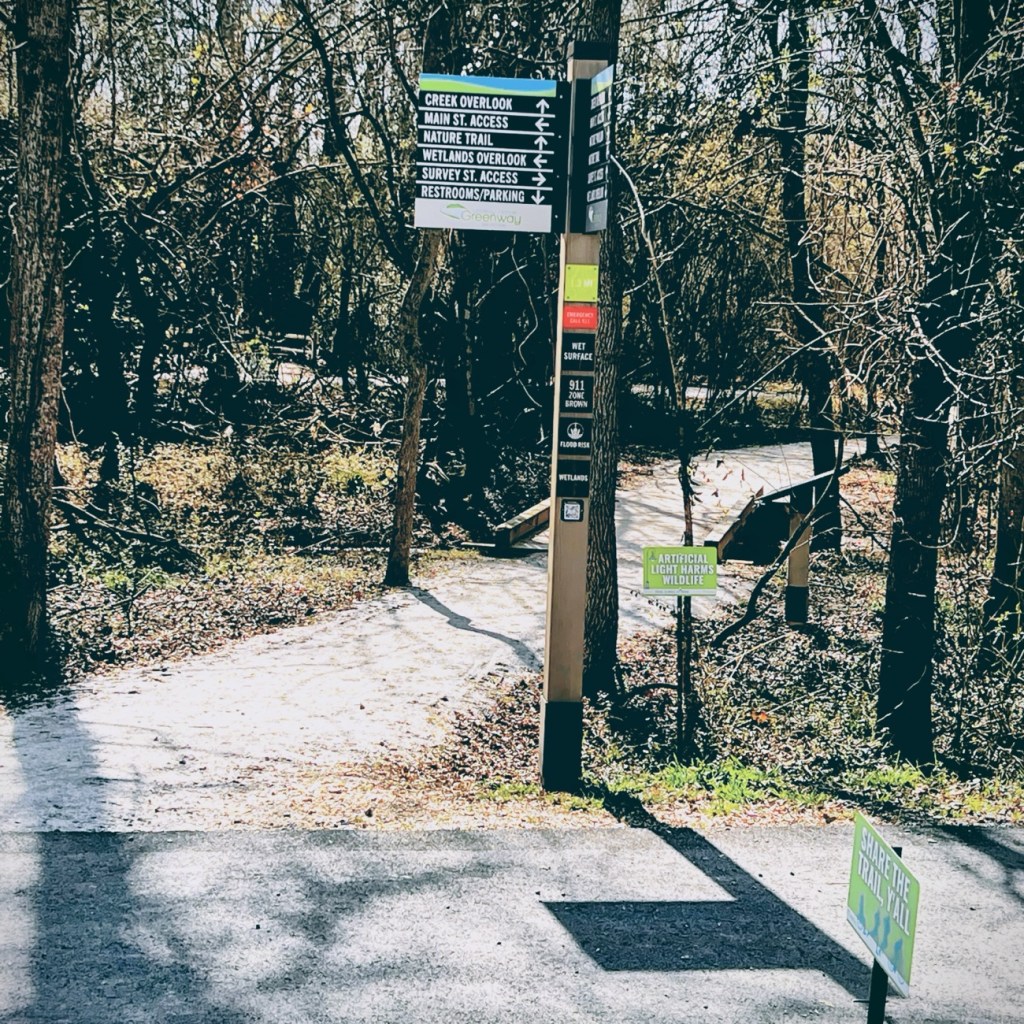
As we moved forward in our adventure, we encountered several informational signs which were a tremendous help in guiding us as we moved forward along the Greenway.
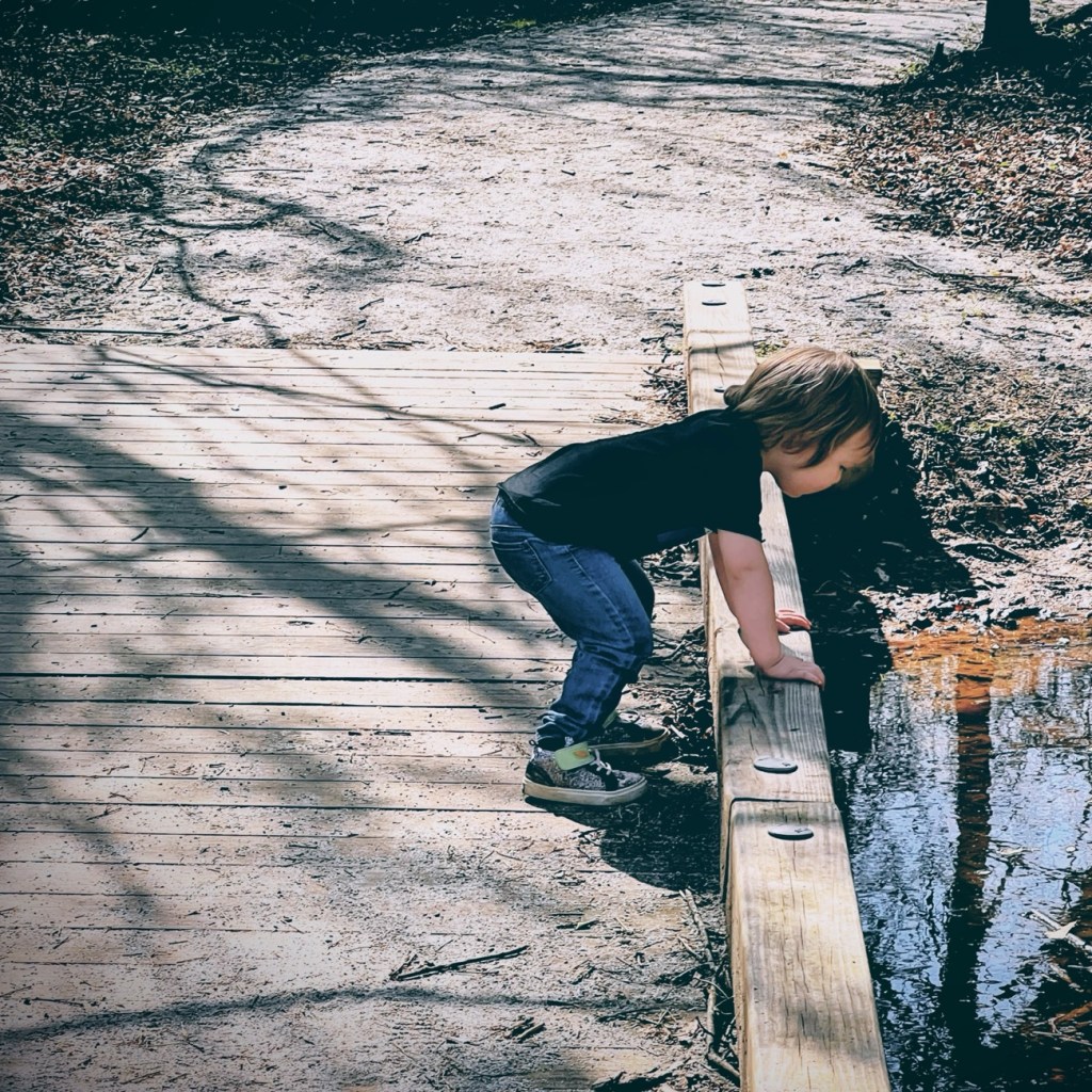
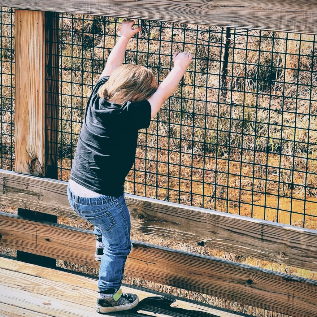
Coleman and I decided to move forward together along the nature trail towards creek overlook and eventually the Wetlands Overlook.
Here Coleman takes a minute to look out over the bridge at the creek below.
Coleman can’t resist climbing on the bridges railing at this next point or interest.
Informational Signs are located strategically throughout the Greenway. This particular one gives information about out the Lindsay Pettus Greenway and Lindsay Pettus himself.
The forward thinking of Mr. Lindsay Pettus and the many volunteers ensured the Greenway is and will continually be accessible to everyone regardless of their mobility needs.
I have attended First Aid Courses in the past, though it has been several years since I have had a refresher course. It might be time for one soon.
2. Apart from grazed knees and applying a band aid, have you ever applied First Aid?
Fortunately, I have not needed to apply First Aid for anything other than minor cuts and scratches. I have tended to the sick, even nursing my daughter and grandson through the aches, fever, and fatigue of Covid-19.
3. Are you squeamish about the sight of blood?
No, I am not squeamish at the sight of blood. If I was then I wouldn’t be able to tend to my own cuts, scrapes, and any other kind of injury which blood would be escaping from my limbs.
4. How far away is the nearest hospital?
The closest hospital is a mere 1.8 miles away from my location.
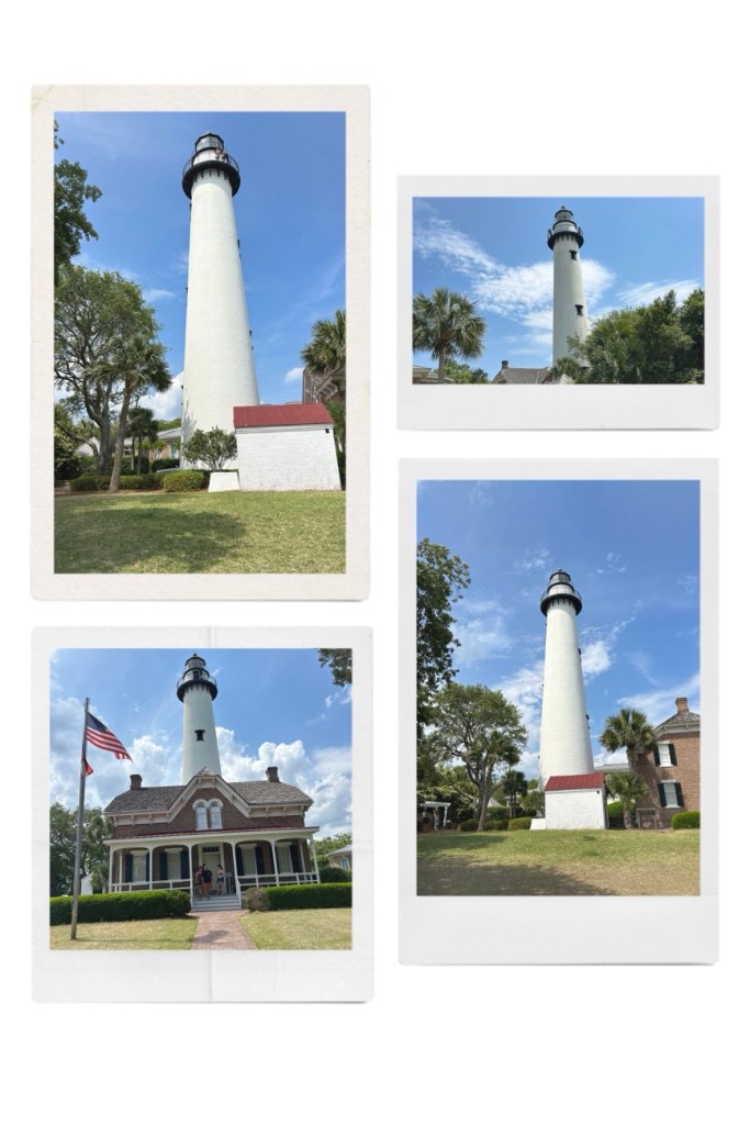
St. Simons Lighthouse is one of only five remaining Georgia lighthouse towers. The Lighthouse and keeper’s Dwelling were built in 1872. The original Lighthouse which this Lighthouse replaced was built in 1810 by James Gould of Massachusetts, the first lighthouse keeper. The original Lighthouse was destroyed by Confederate forces in 1861 in order to prevent the beacon’s use by Federal troops during the Civil War.
St. Simons Island Lighthouse
The Lighthouse still serves as an active aid to navigation for ships entering St. Simons Sound, casting its beam as far as 23 miles to sea. The Lighthouse is located near the pier on the southern tip of St. Simons Island, Georgia, United States of America. Its purpose is to guide ships into St. Simons Sound and warns them of the many sandbars in the area.
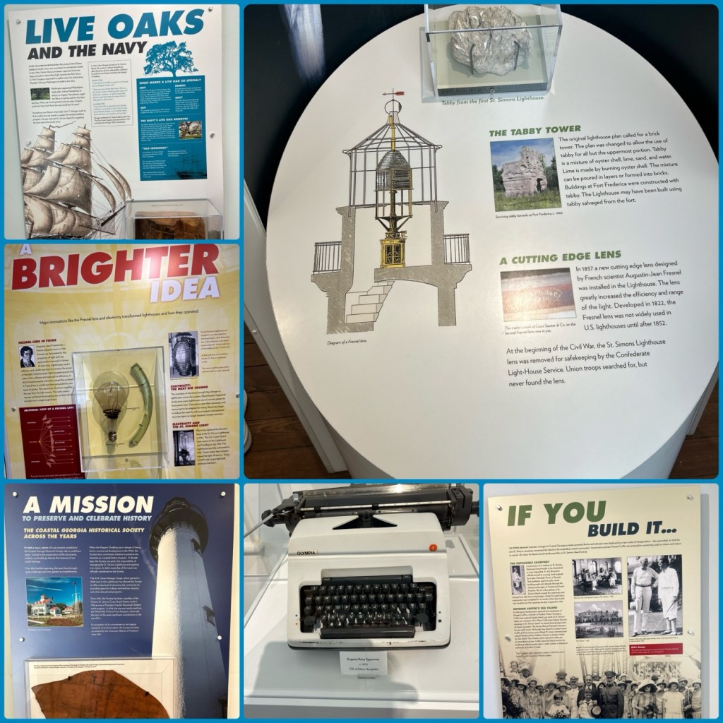
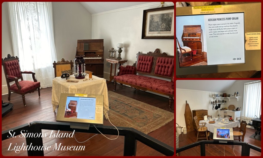
Inside St. Simons Island Lighthouse Museum
In 1972, the lightkeepers’ cottage was leased to Glynn County. The Coastal Georgia Historical Society spent three years restoring the two-story Victorian light keepers’ cottage at the base of the lighthouse, which was then converted into a museum.
St. Simons Island Lighthouse Museum
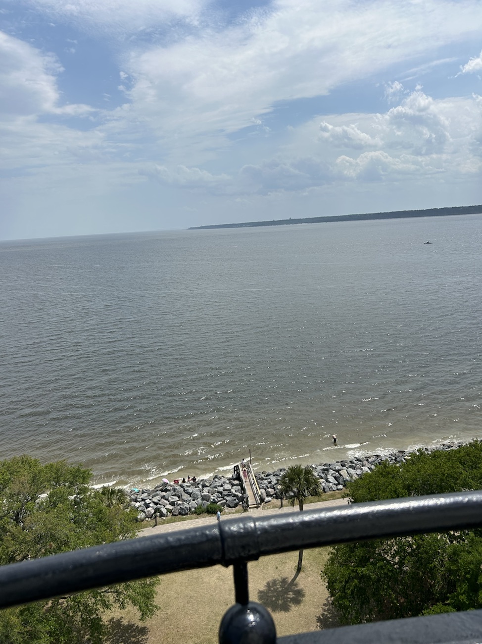
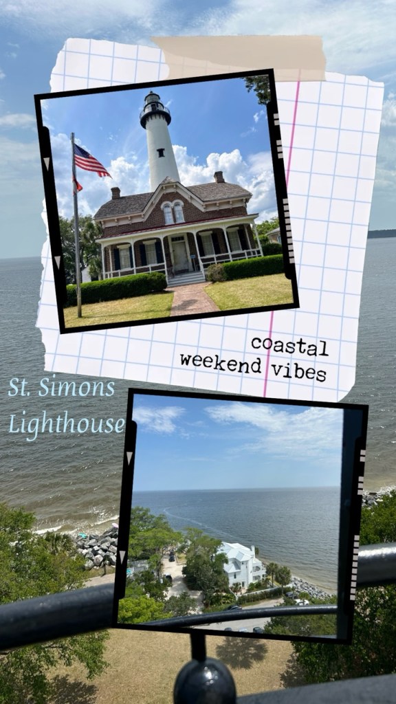
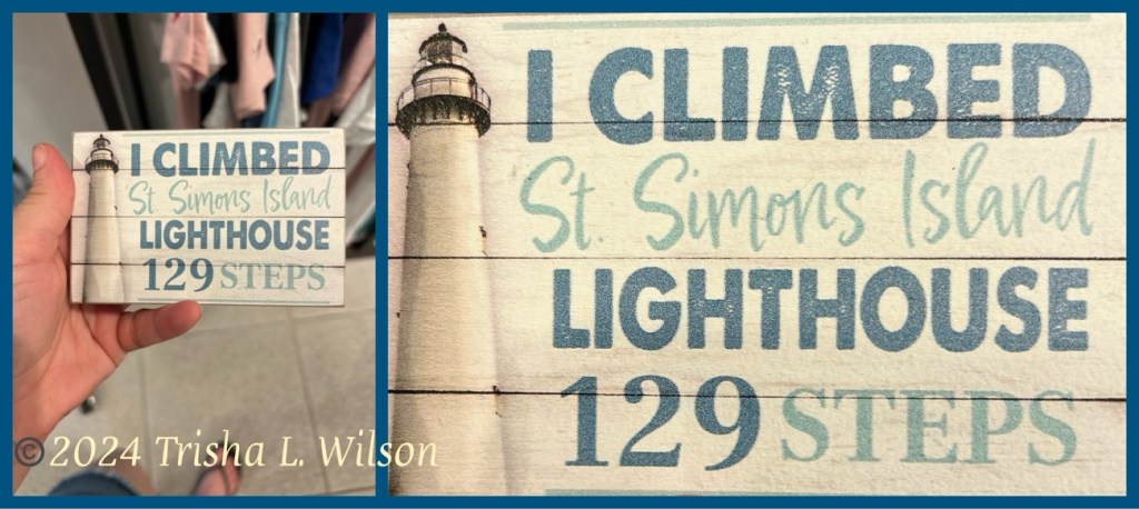
Currently, the public can tour the museum and climb the 129 steps to the top of the Lighthouse for a view of St. Simons Sound and the surrounding area. The admission cost to tour the Lighthouse Museum and climb the 129 steps is $12 for adults; $6 for ages 6-12; $2 Military discount is offered with Valid Military ID. Children under 6 are free.
St. Simons Island Lighthouse and View from the Top
Some of the spectacular, panoramic views of the coast including Jekyll Island, the mainland (Brunswick), and the south end of St. Simons Island can be seen from the top of the Lighthouse.
The Keeper’s Dwelling is a two-story Victorian structure which was the home of the lighthouse keepers from 1872 up until the 1959’s. It currently houses the Lighthouse Museum and includes interactive exhibits, rare artifacts, and period rooms that reveal the history of St. Simons Island and the life of a lighthouse keeper.
My Daughter, Trisha, climbed the 129 Steps to the Top of the Lighthouse so I could see the View.