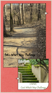
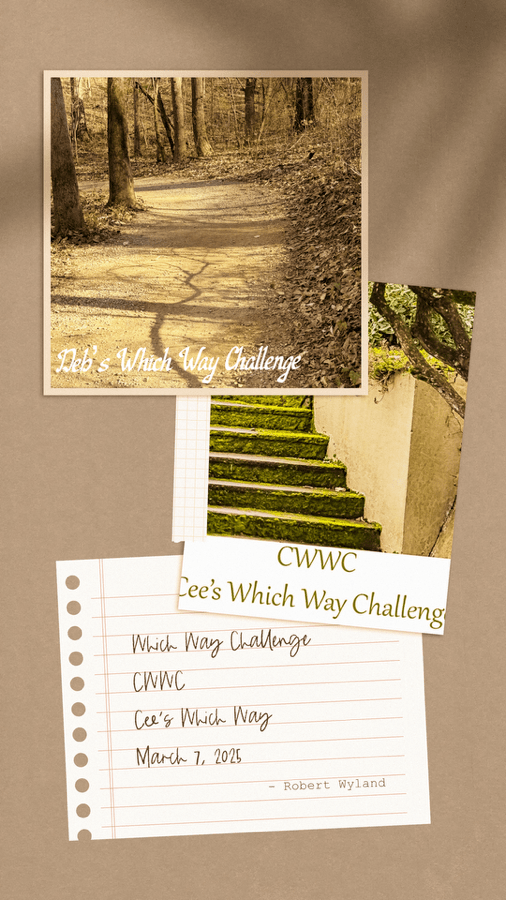
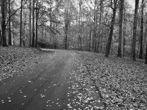
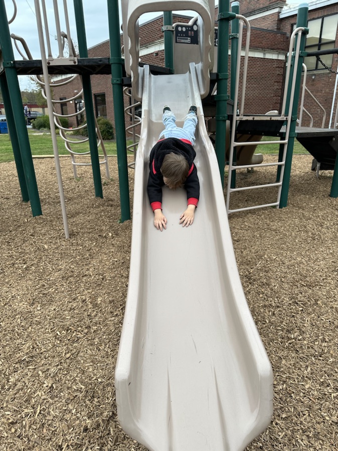
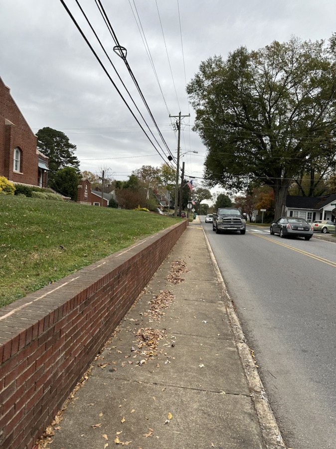
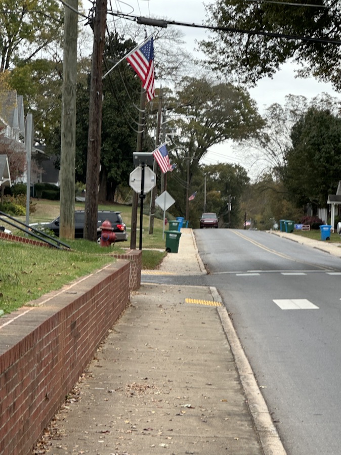
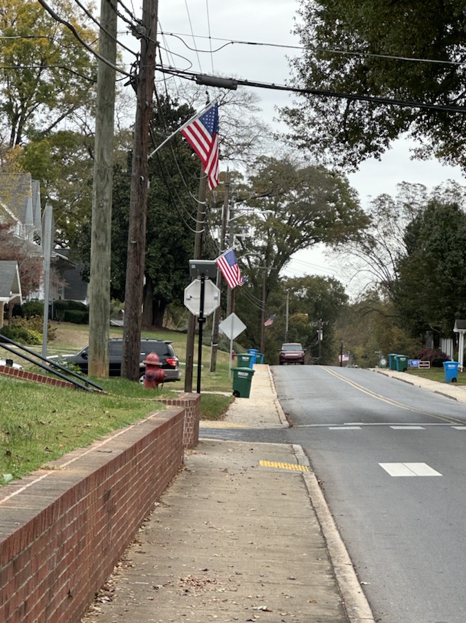
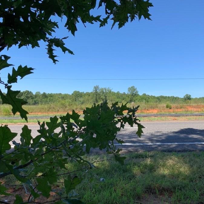
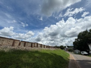
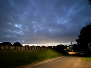
Welcome back to another Which Way Challenge (CWWC). This week I have chosen Which ways on a cloudy or stormy day for this week’s theme. The Which Way can be any path, sidewalk, trail, or road as long as the Which Way is clearly discernible. For further information regarding the Which Way Challenge (CWWC) feel free to check out the home page here.
Whether traveling by car or hiking on foot there are times we run across storms and/or clouds in our pathways/roadways. These are a few examples of what we have endured in our adventures.
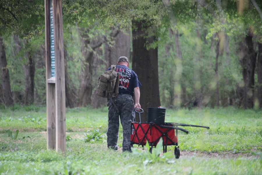
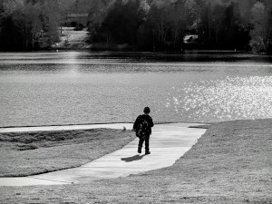
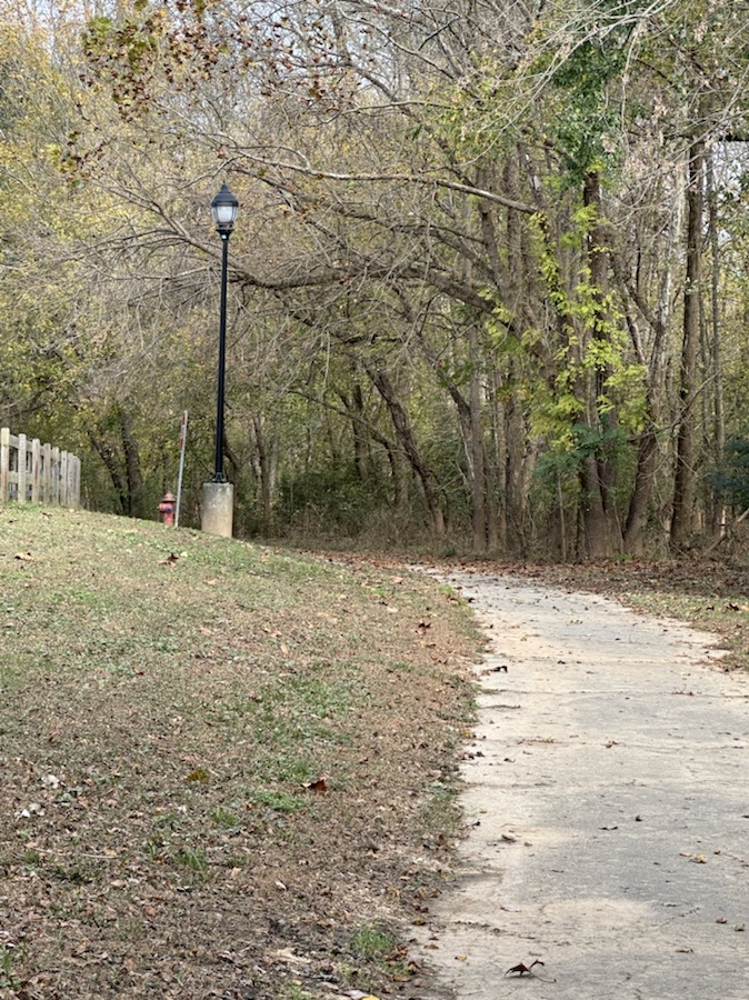
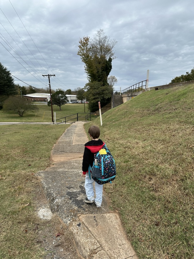
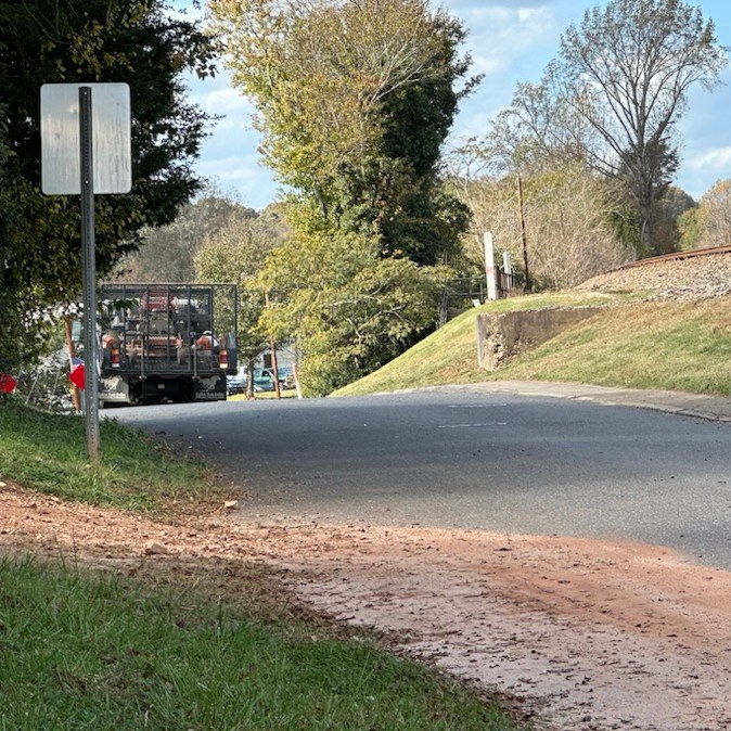
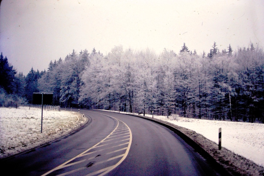
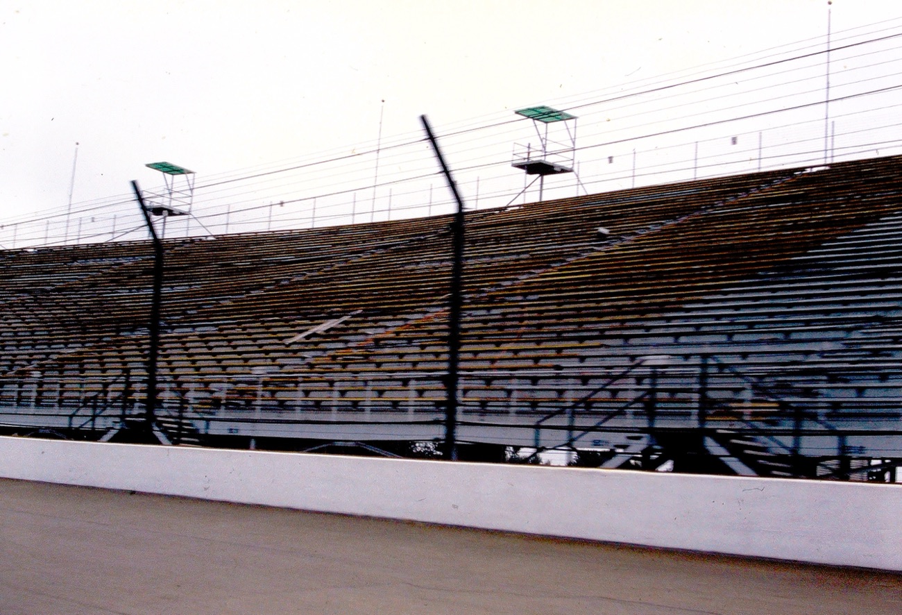
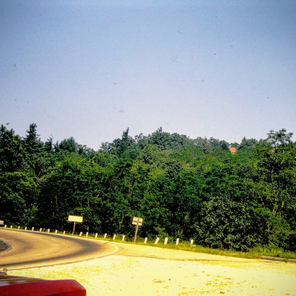
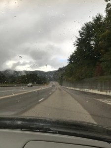
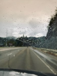
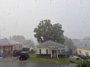
US 321 Blowing Rock, NC October 9, 2017
US 321 Blowing Rock, NC October 9, 2017
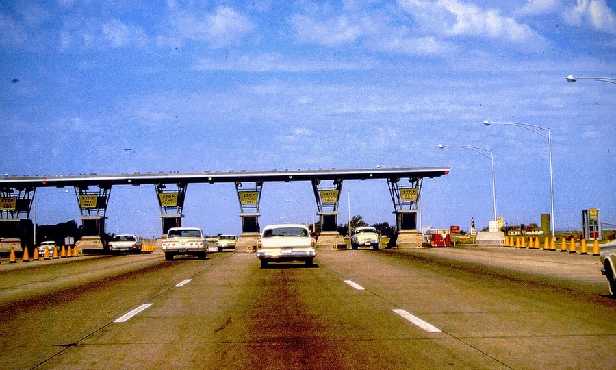
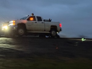
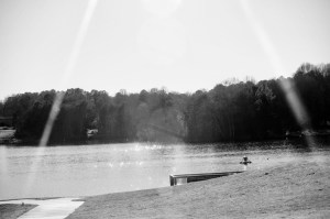
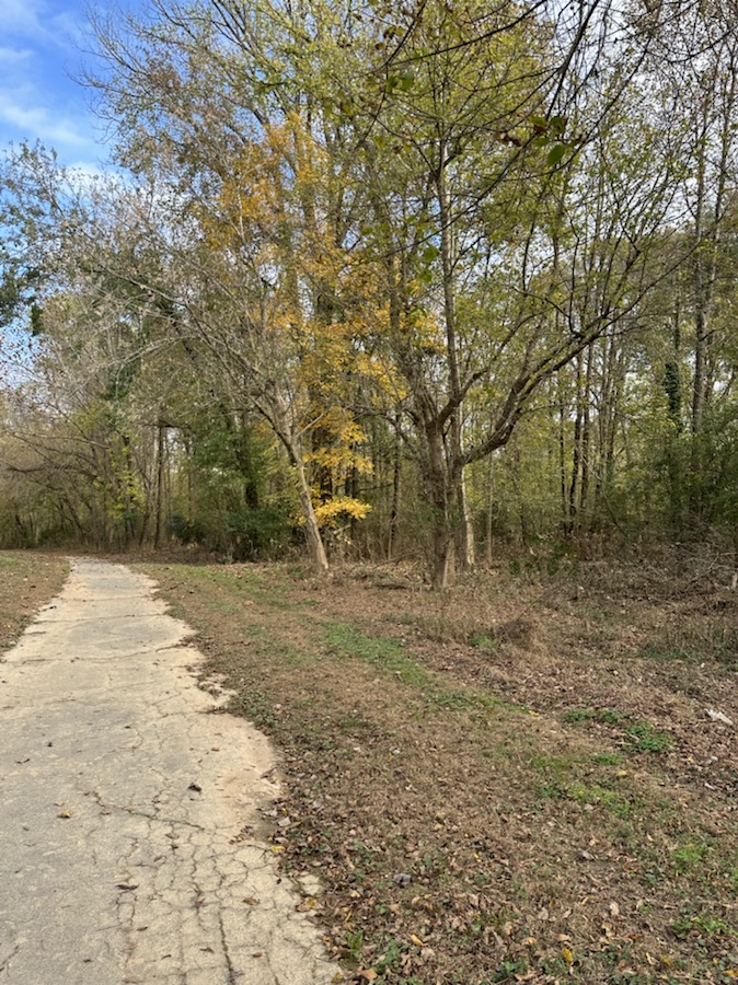
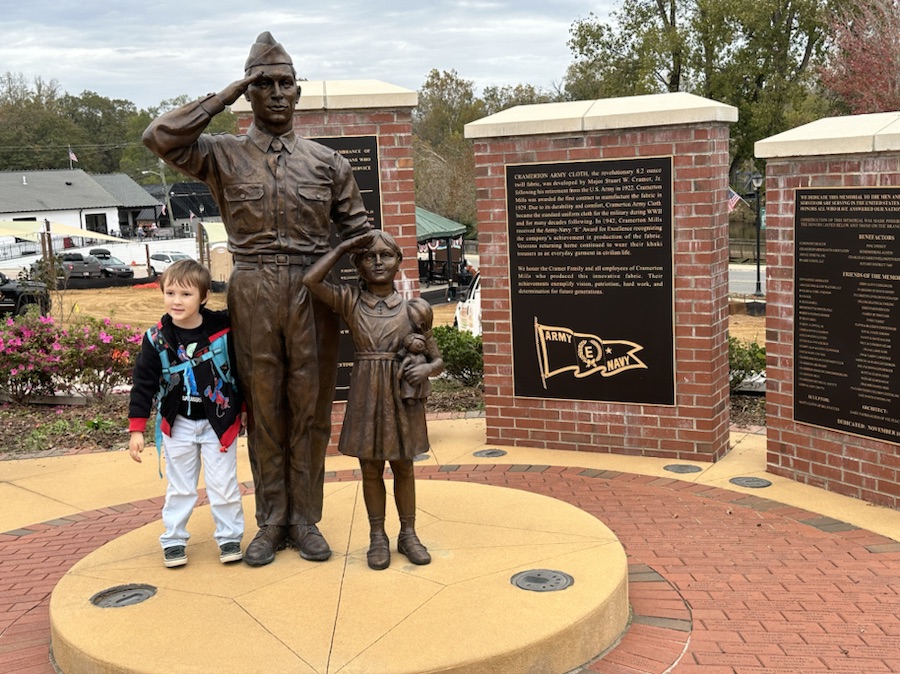
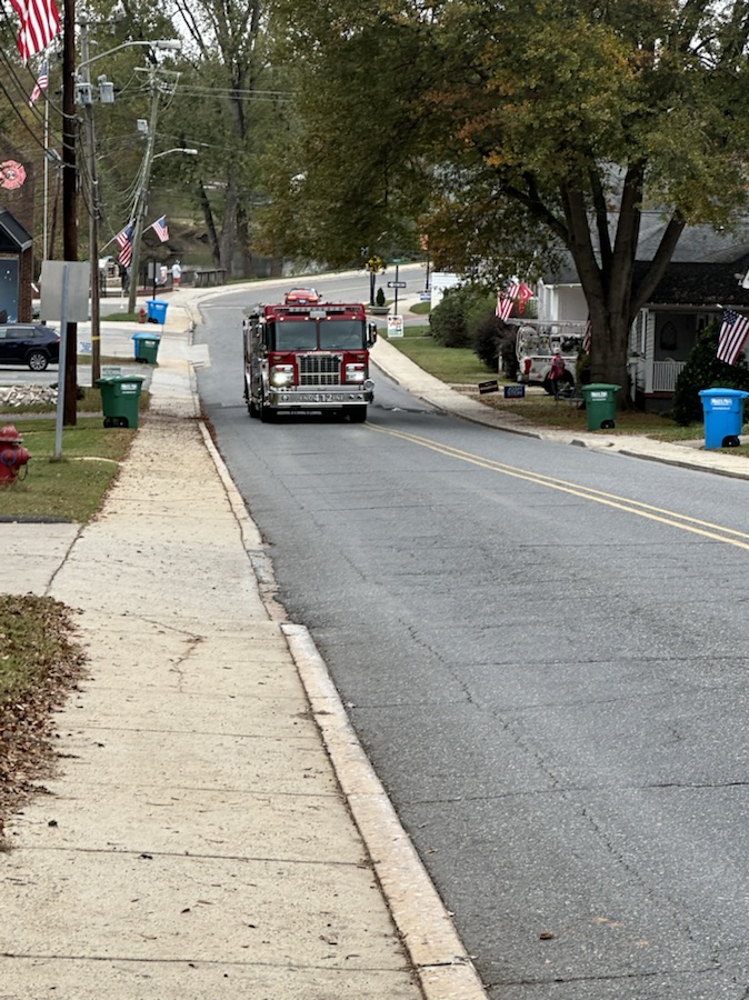
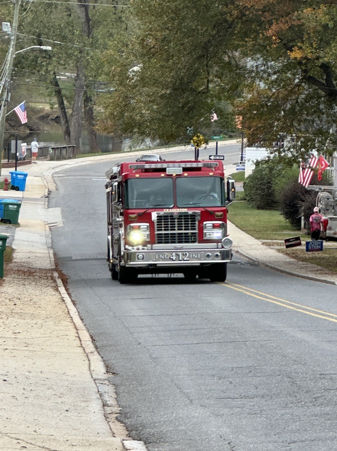
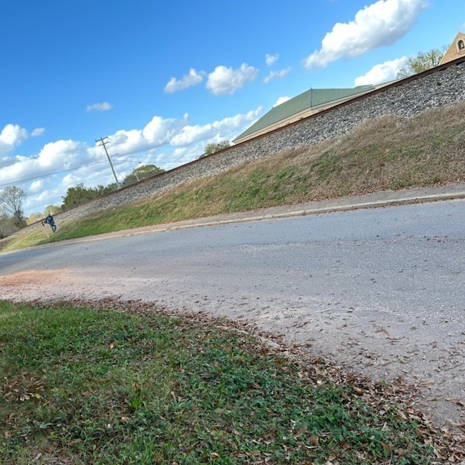
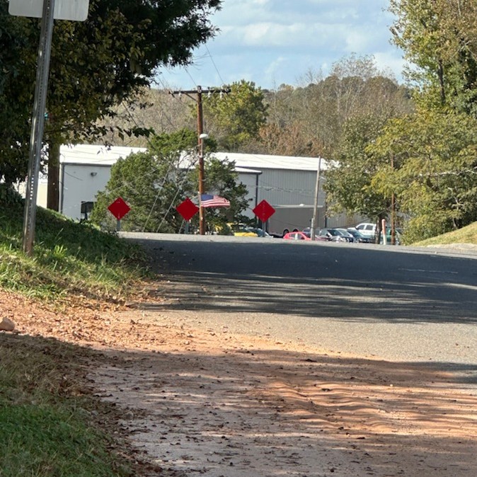
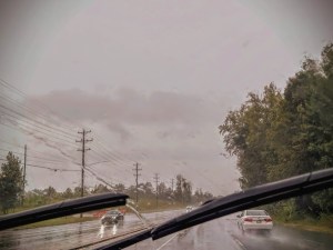
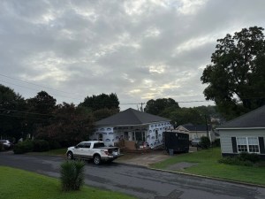
NC State Hwy 74 Charlotte, NC September 16, 2024
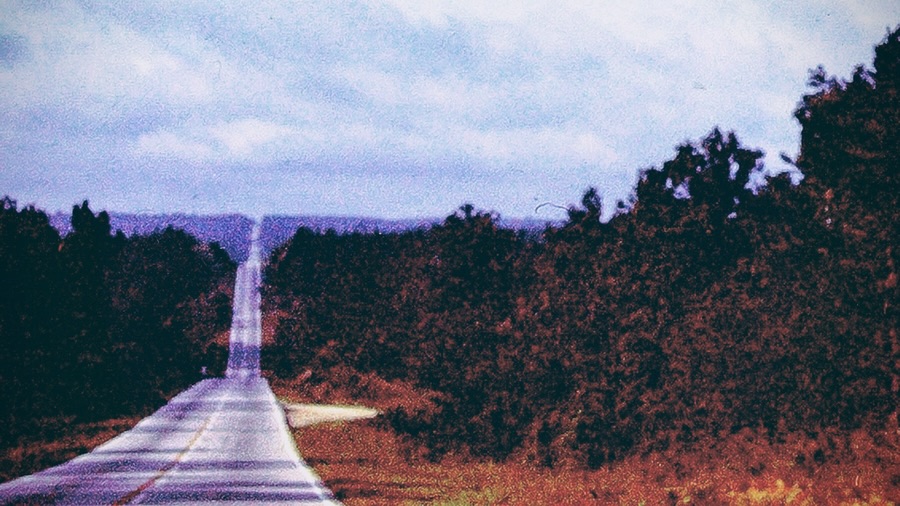
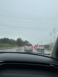
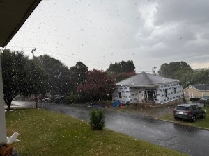
W. Wilkinson Blvd Cramerton, NC September 26, 2024
Camera: Apple iPhones 7 Plus; 14 Pro Max; and 16 Pro Max
God Bless. Get Outdoors. Take a Hike/Walk. Enjoy Nature’s Beauty. Thank you for visiting and sharing your time and thoughts with us. I appreciate y’all very much.
Note: Next week we will be looking at Any Which Ways with People.
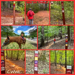
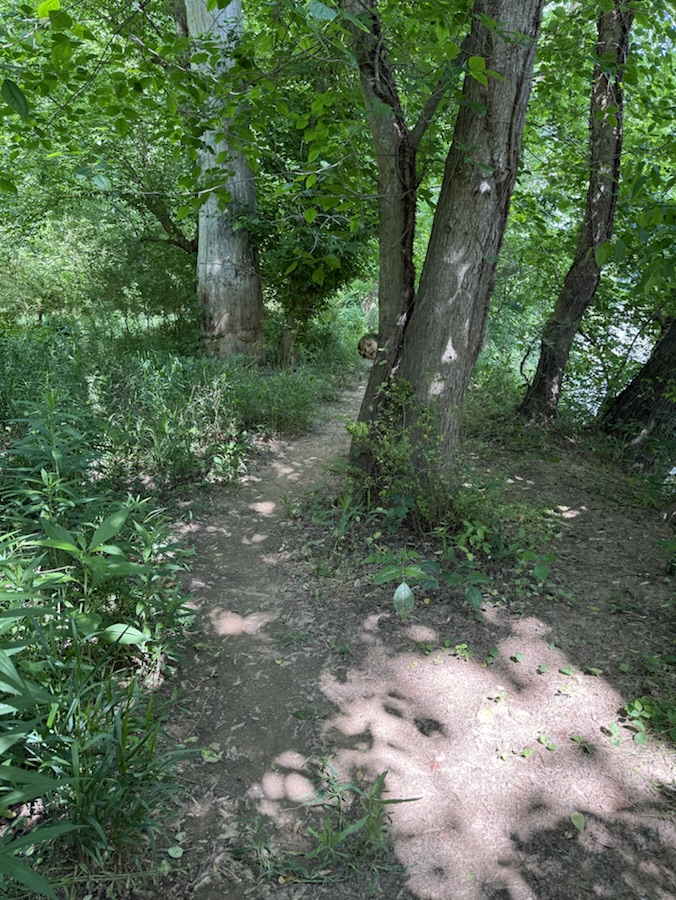
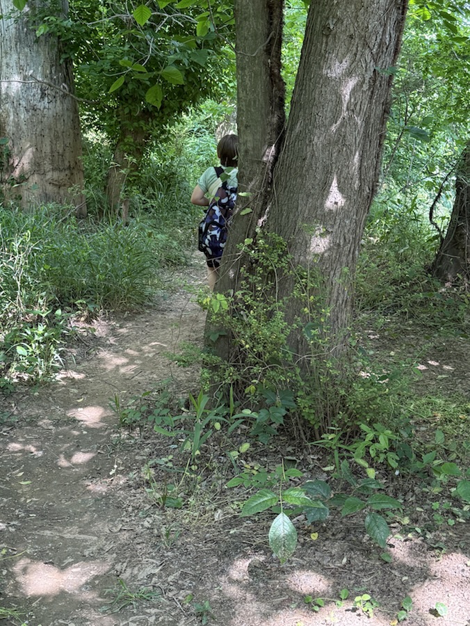
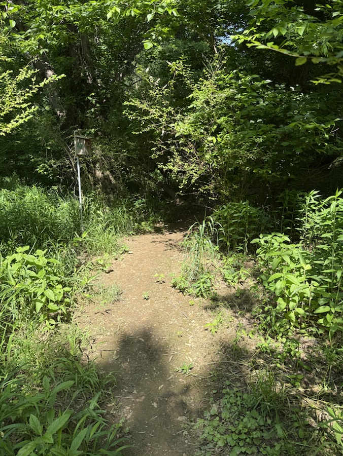
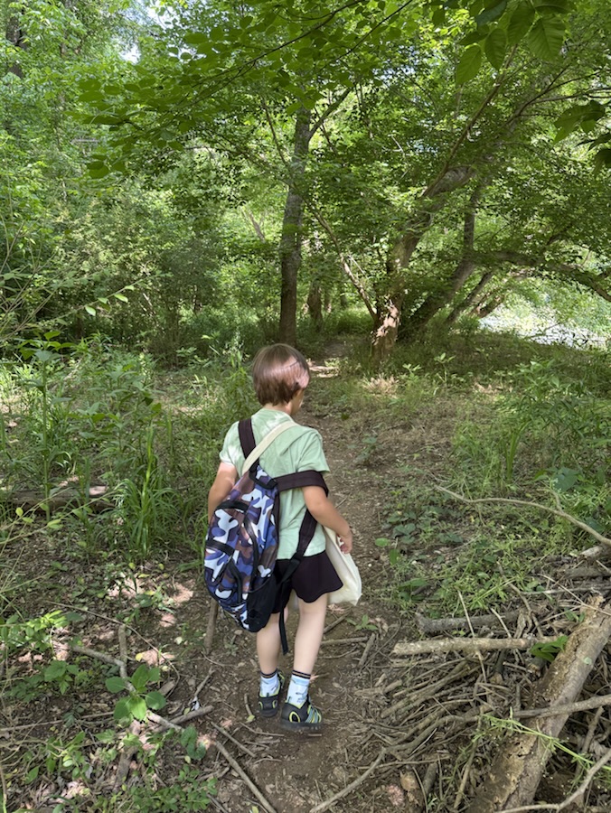
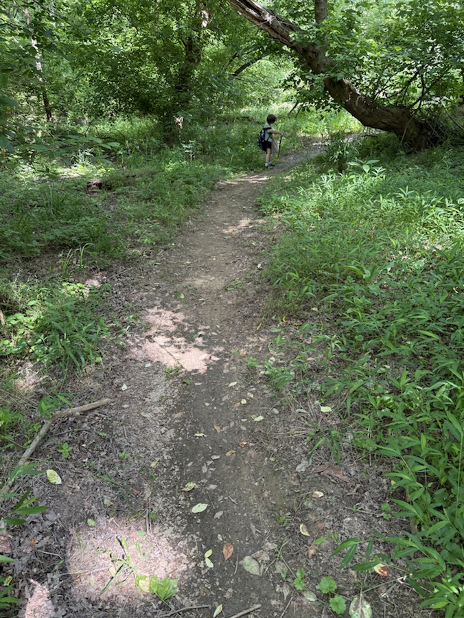
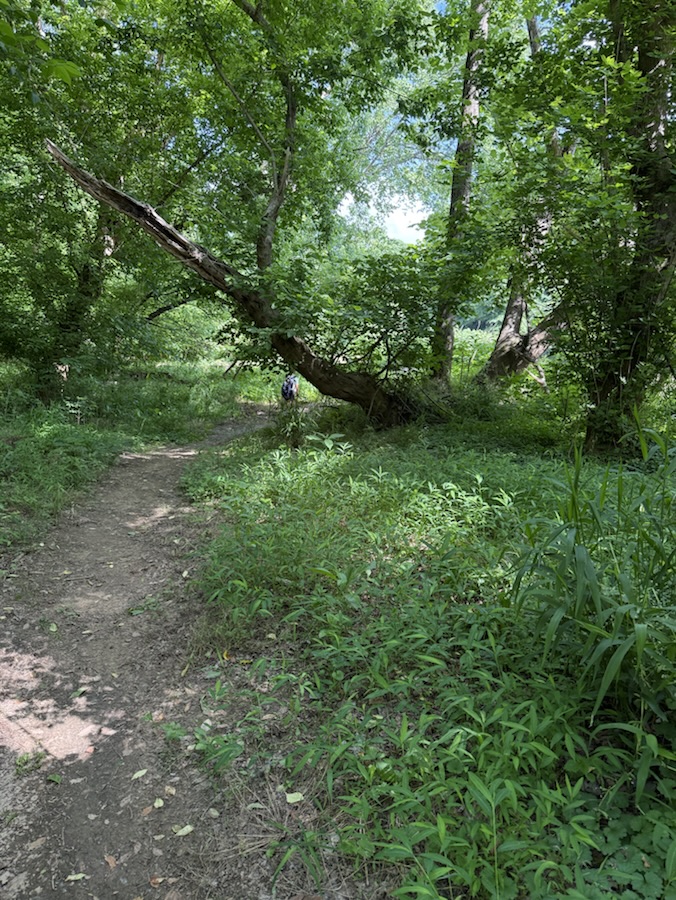
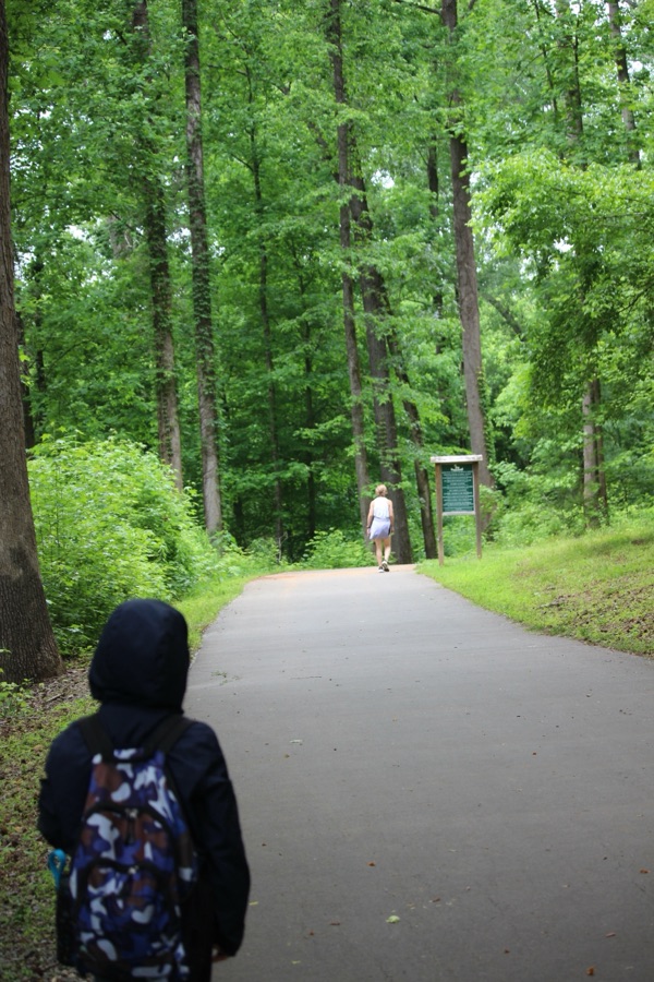
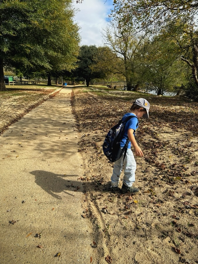
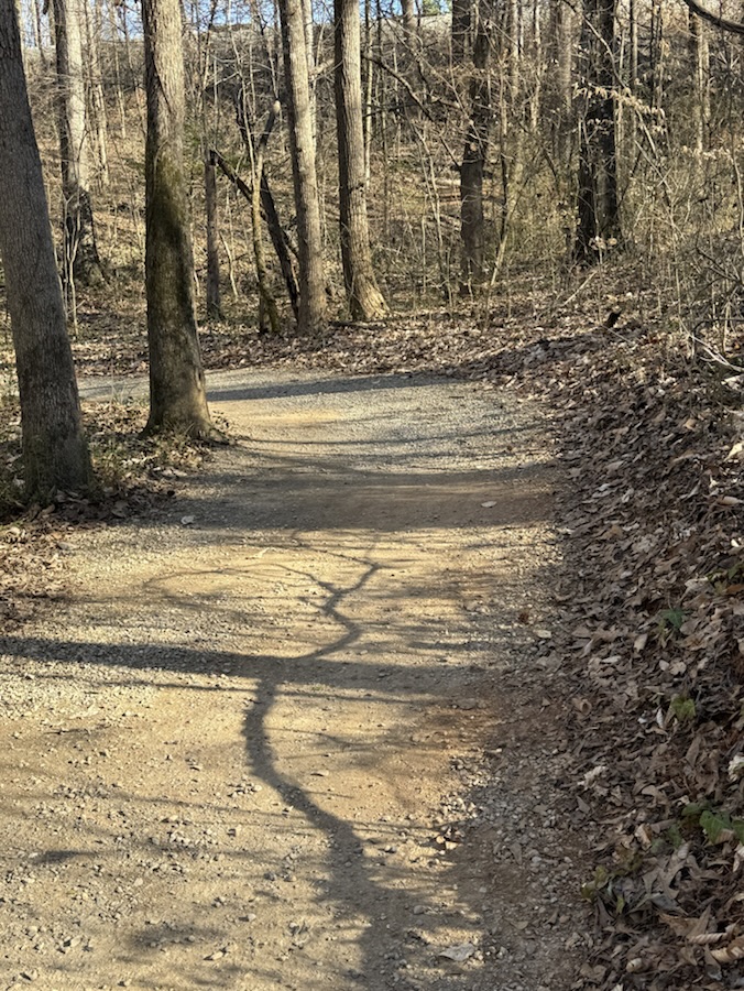
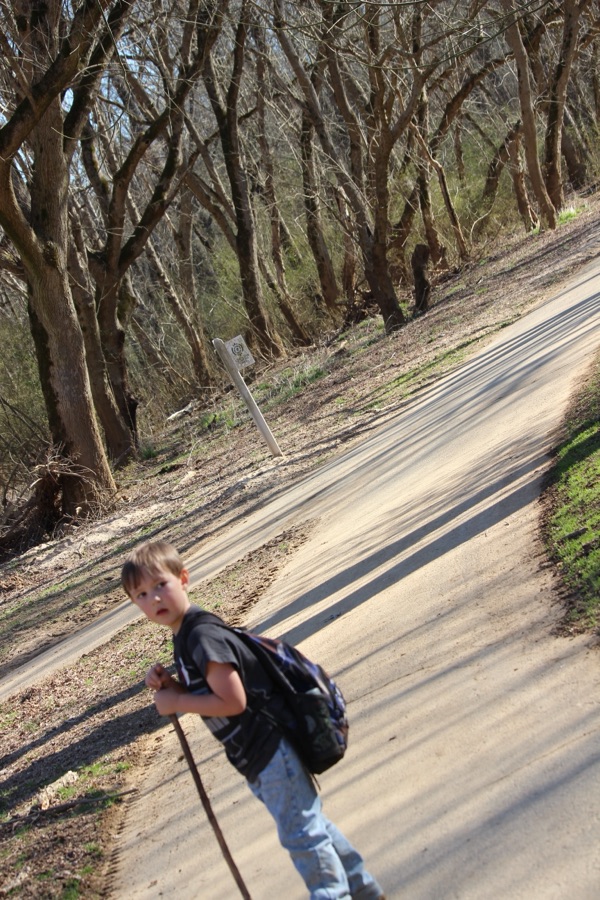
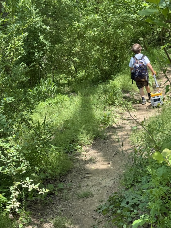
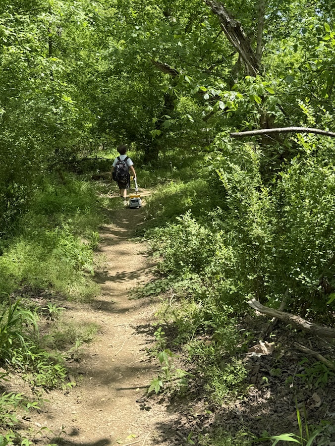
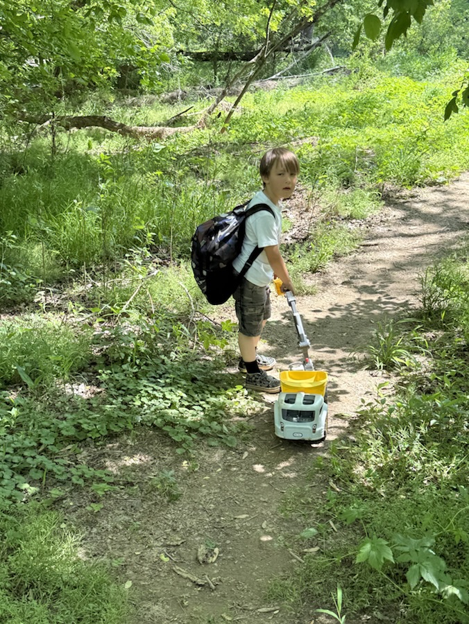
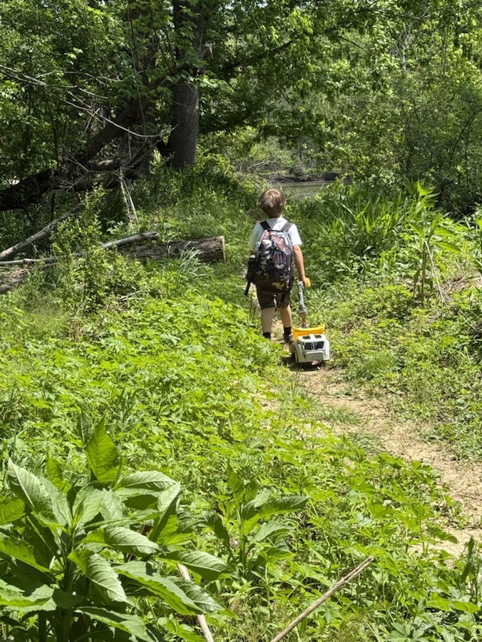
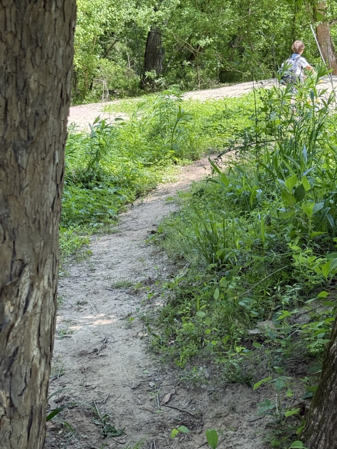
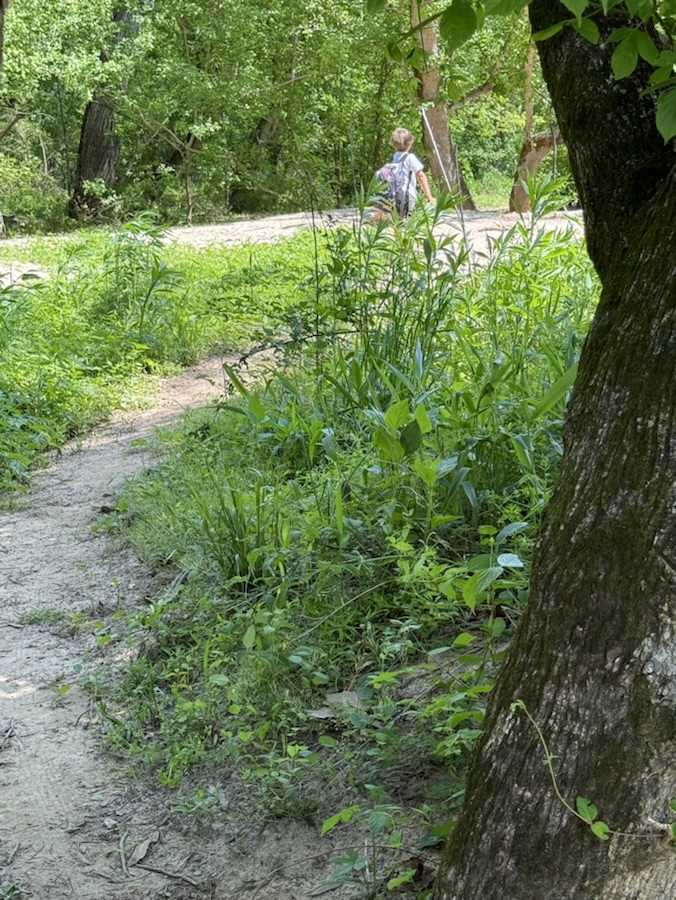
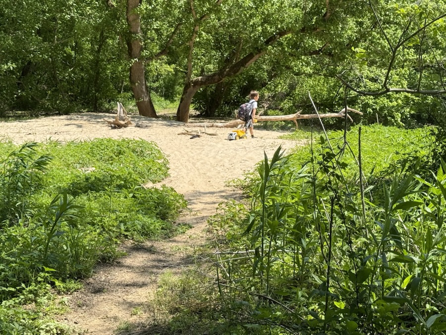
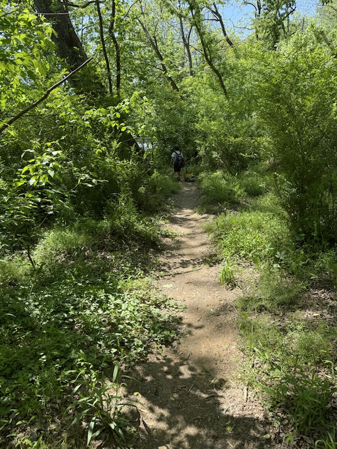
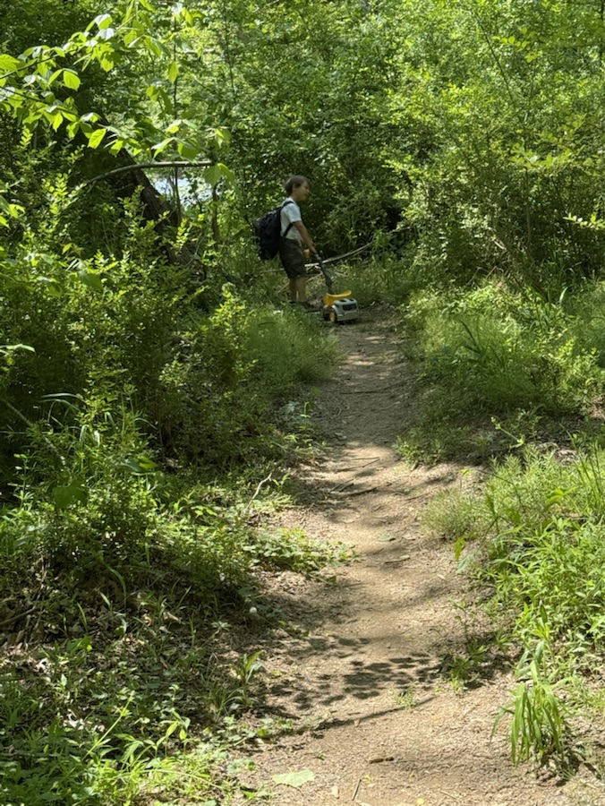
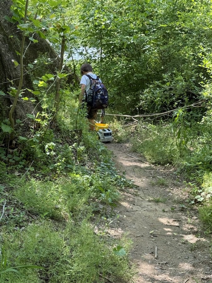
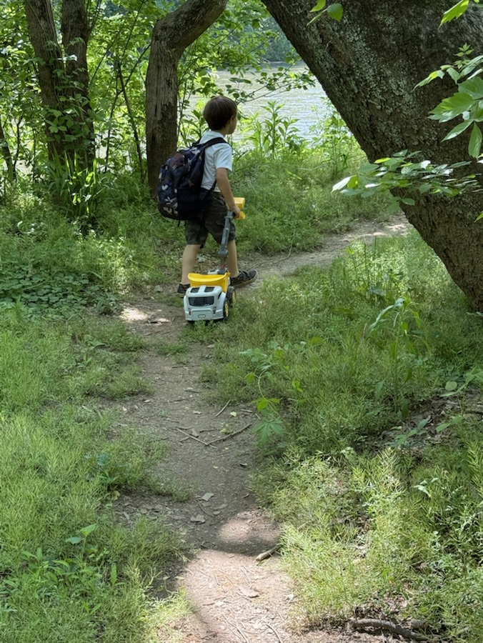
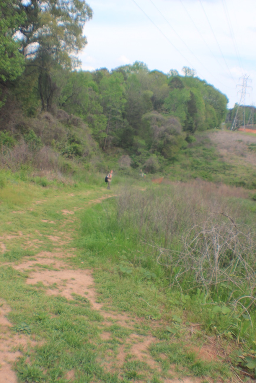
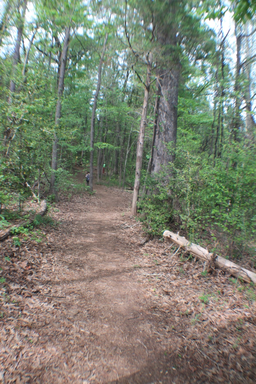
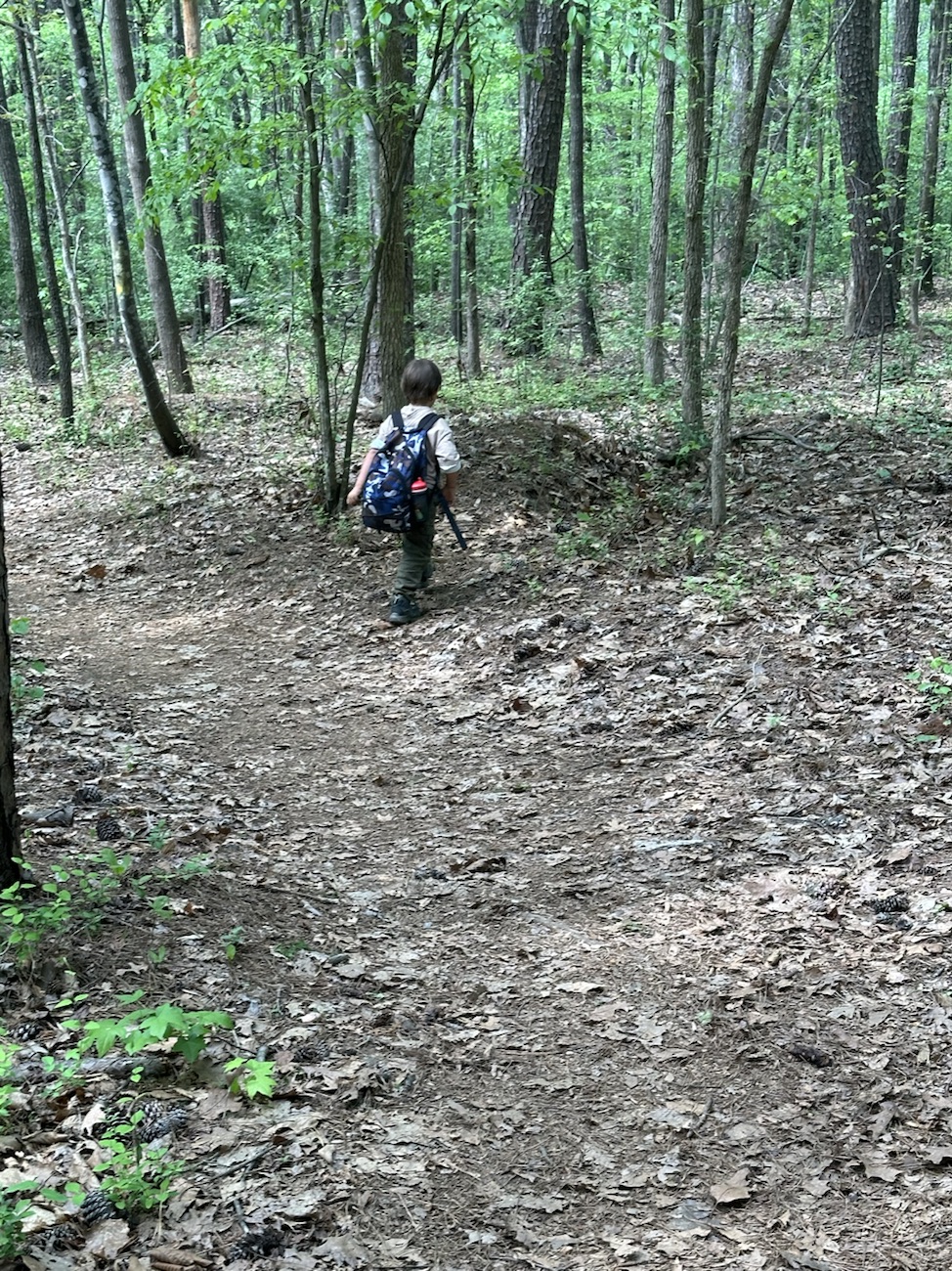
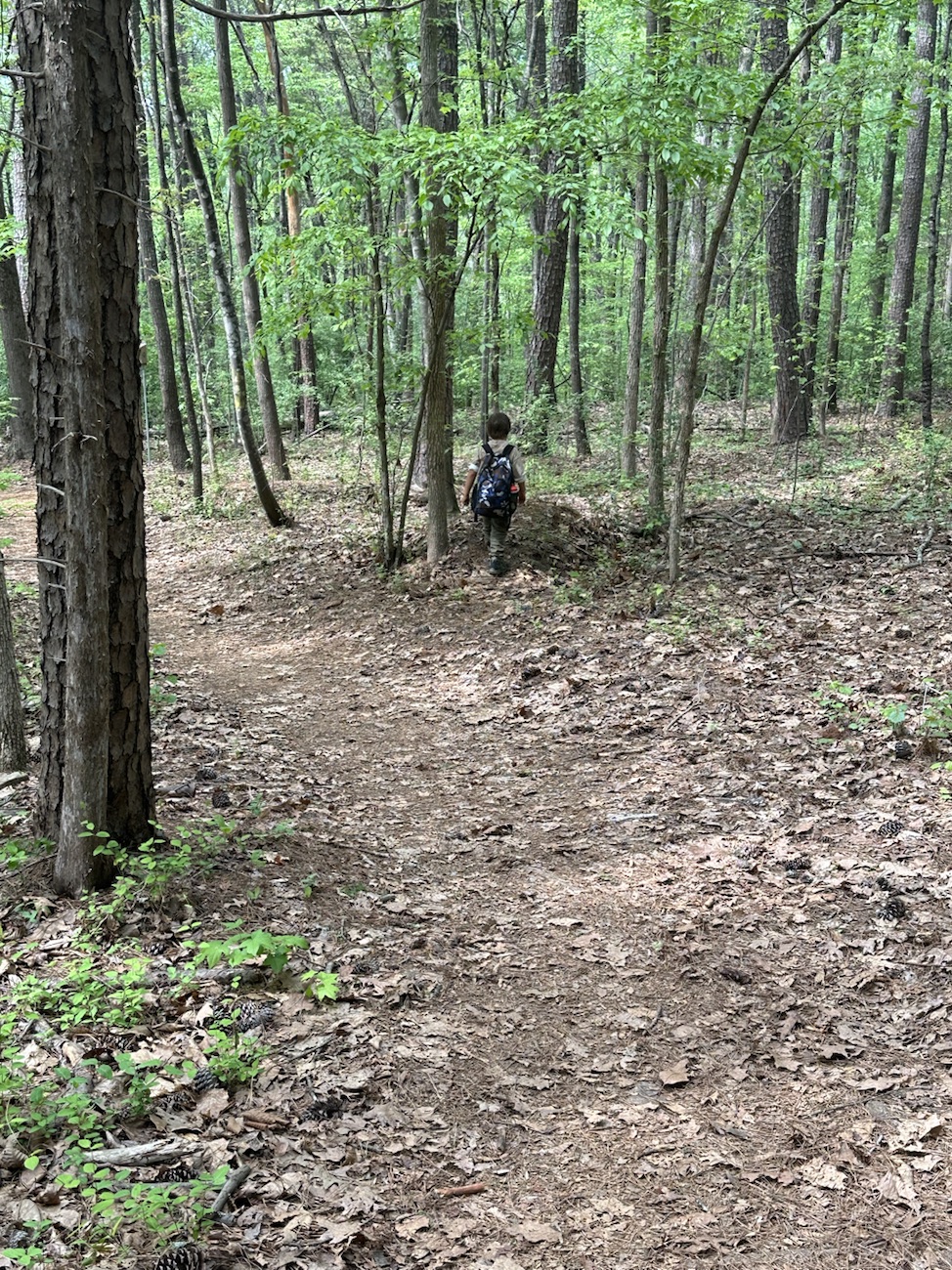
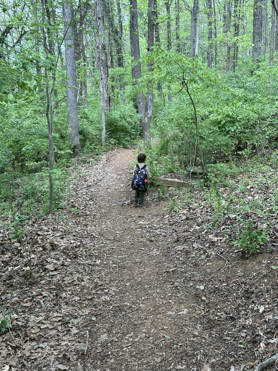
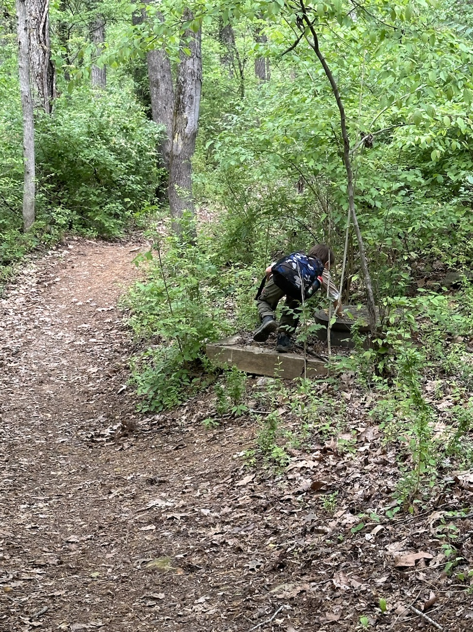
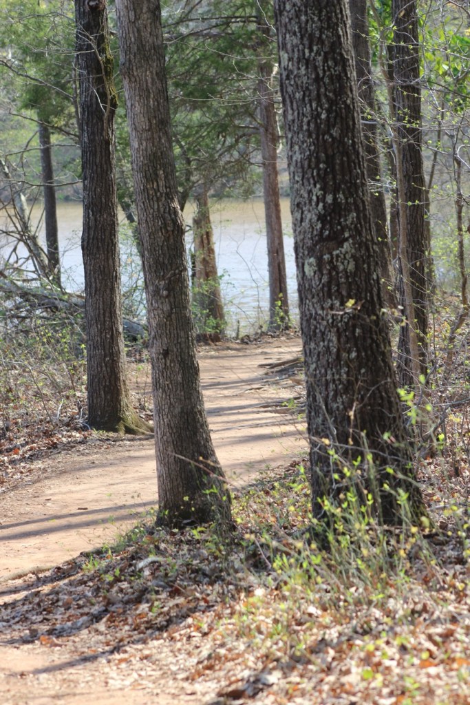
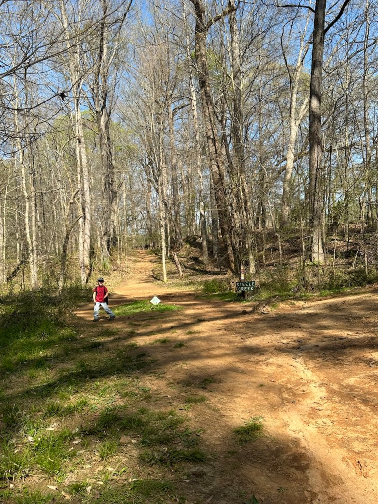
Hope y’all have had a fantastic week so far. It’s Friday already and time for another Which Way Challenge. This week we are looking at(CWWC): Any Dirt roads or dirt pathways or trails [Bonus if RED is included]. They can be any type of Dirt Road, Dirt Pathway or trail you travel as you take a walk/hike. Remember your Which Ways should be clearly discernible. Since the month is #SimplyRED for Becky’s Squares, I’ll be checking to see if y’all have any RED in your Which Ways. The photos can be ones you’ve taken recently or from your archives. Let’s all have fun!
Here are my Which Ways for this week’s challenge …
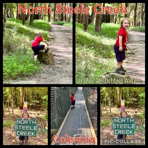
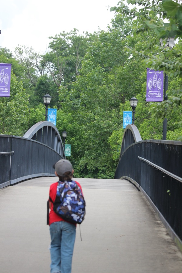
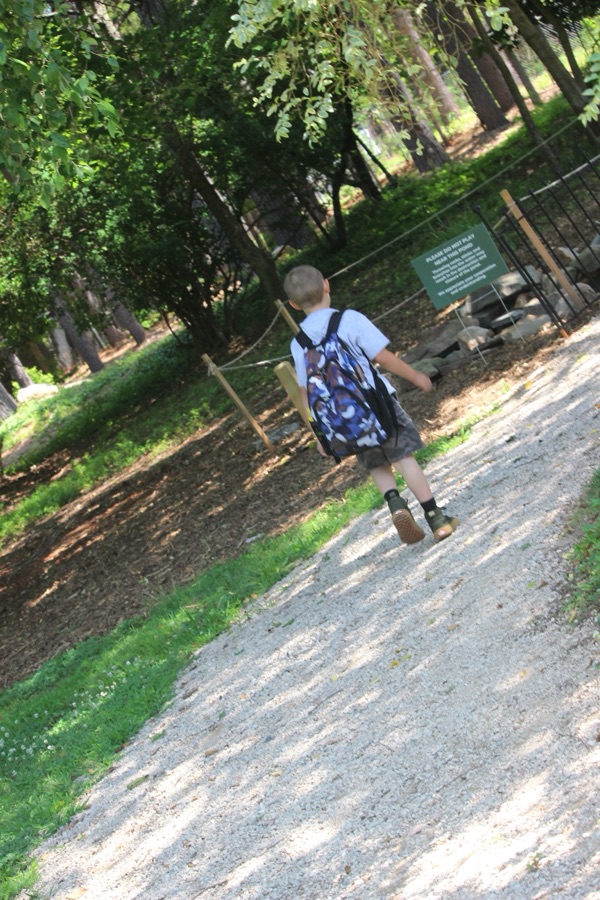
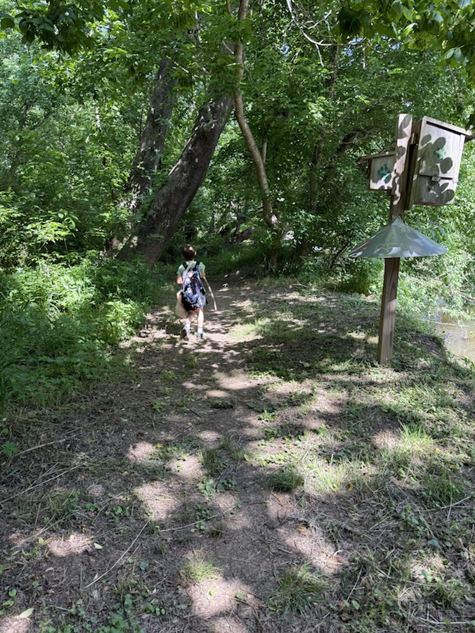
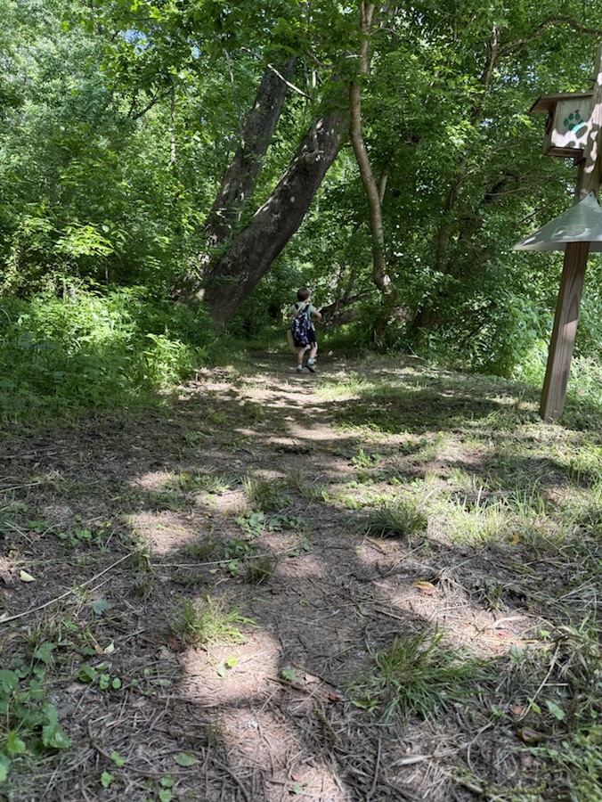
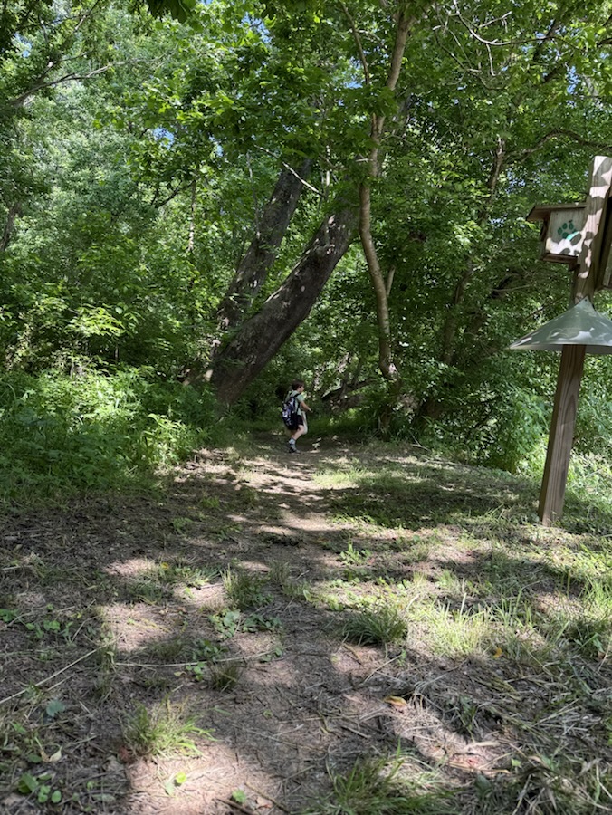
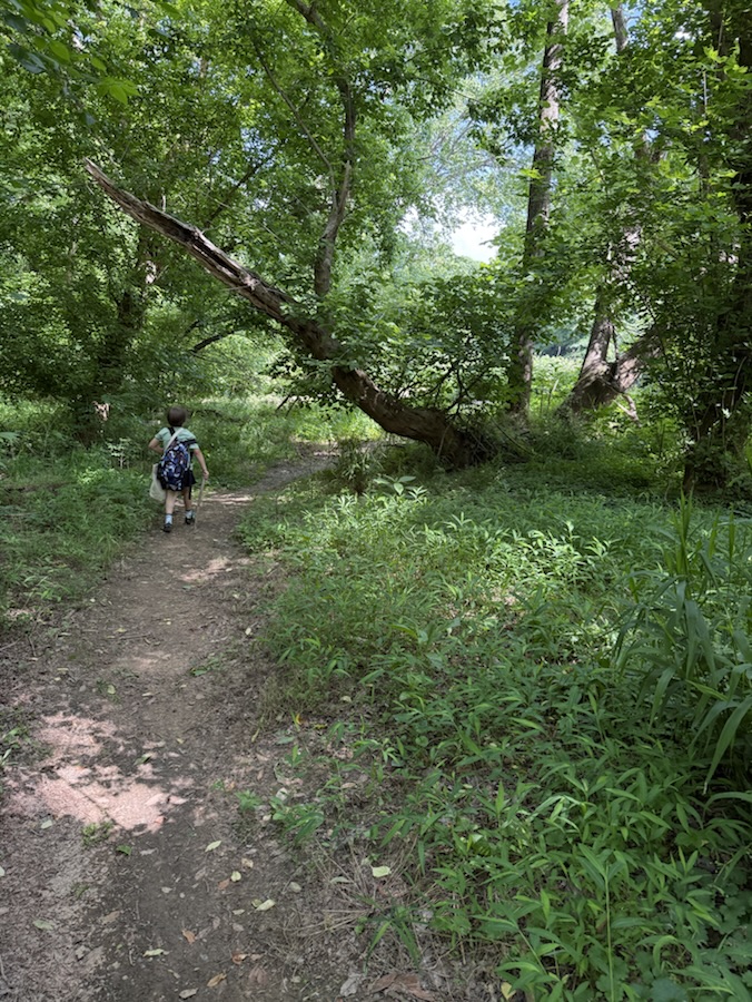
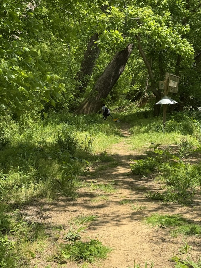
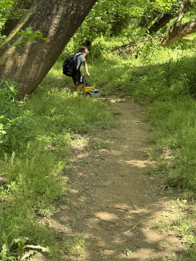
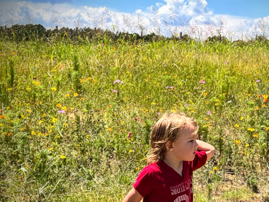
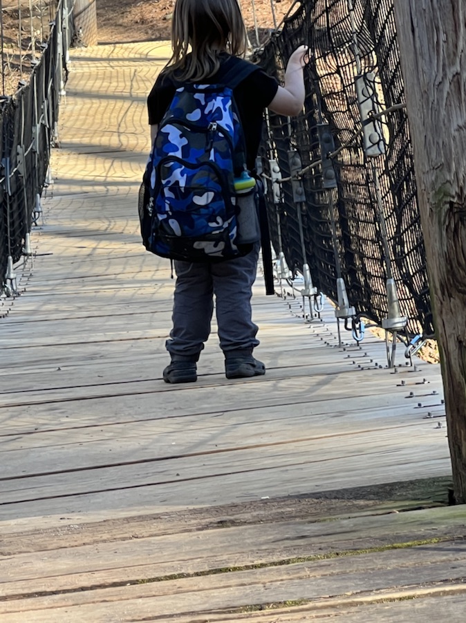
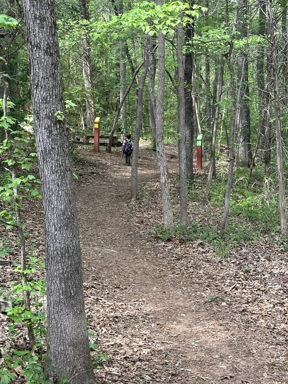
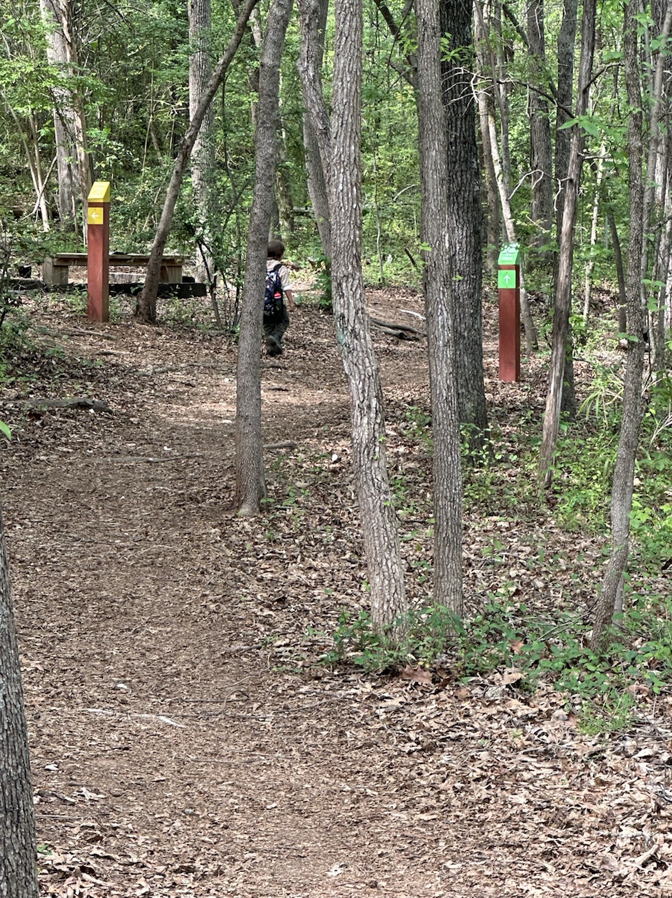
Coleman wearing RED on the dirt trails. Notice the RED on the Trail Signs.
Coleman wearing a RED South Carolina Gamecocks shirt while hiking on the North Steele Creek Trail
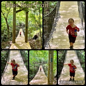
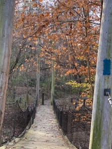
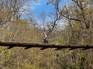
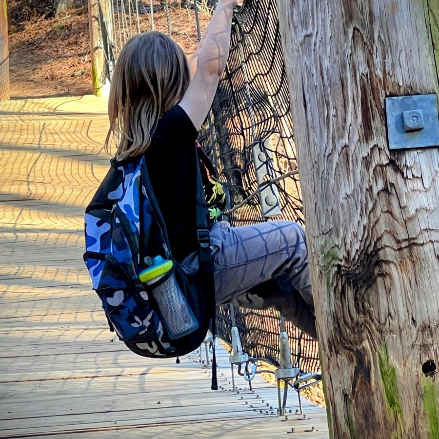
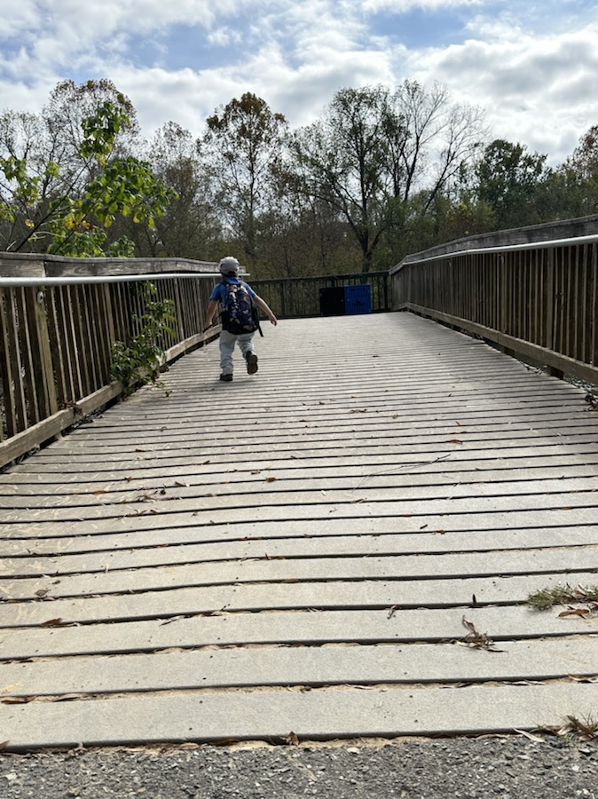
Coleman running back and forth on the Blue Star Swinging Bridge wearing a RED Shirt
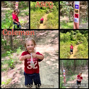
Coleman and Trail Signs with RED
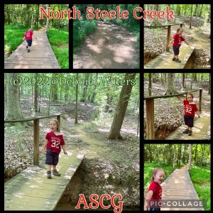
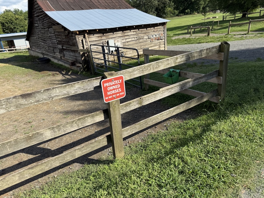
RED Jacket, RED backpack, RED on Trail Signs, RED Horse Blanket, and a RED car at Anne Springs Close Greenway
Coleman wearing a RED shirt in ASCG
Quite a number of my collages have RED in Squares so I figure this counts as Double as also included in #SimplyRED-Becky’s Squares
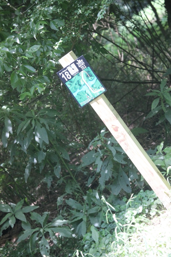
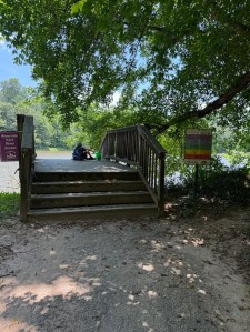
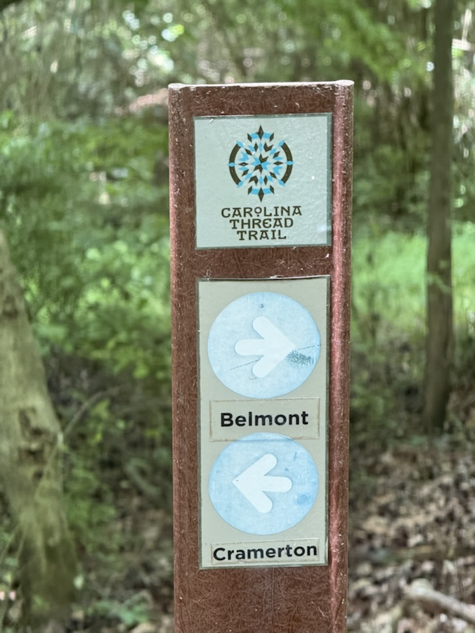
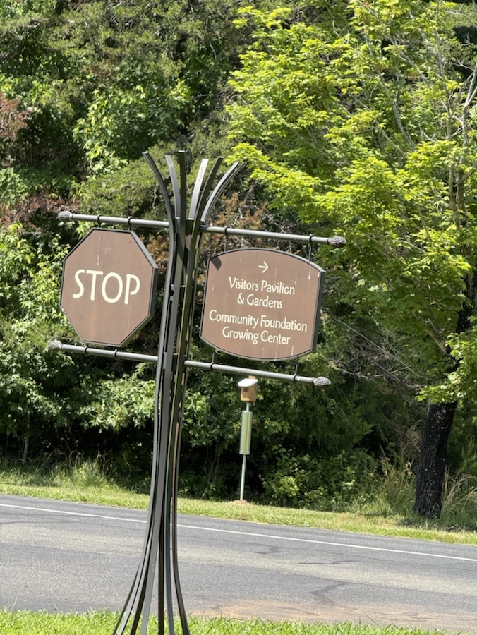
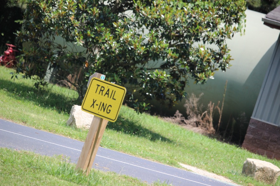
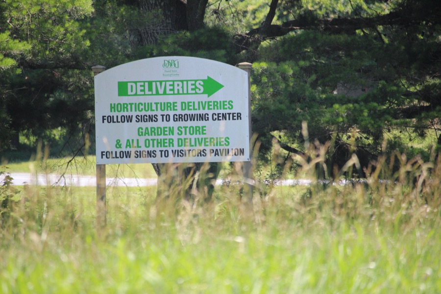
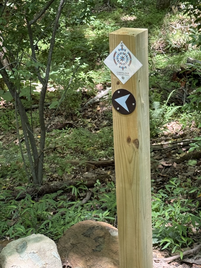
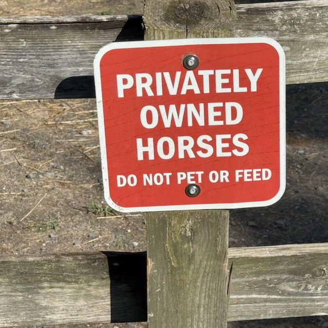
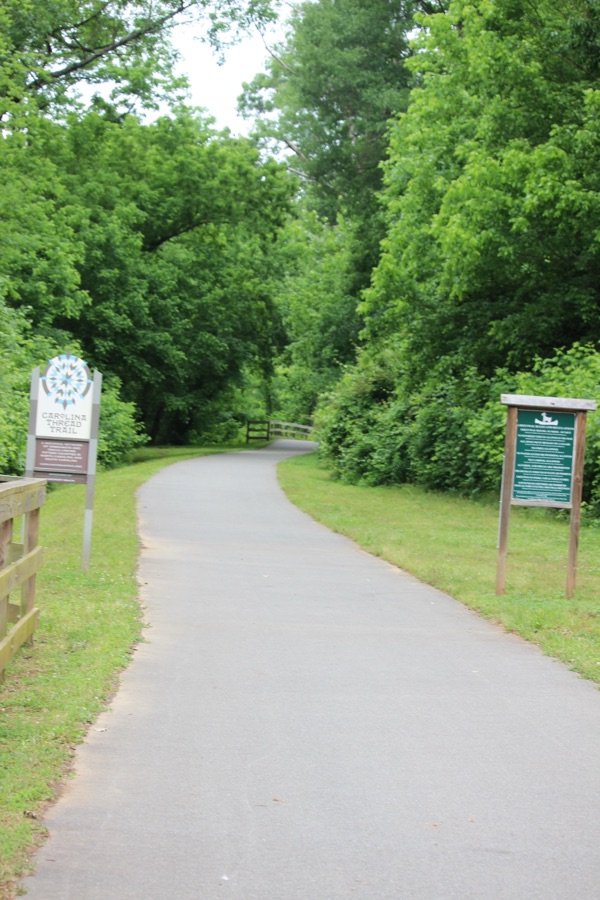
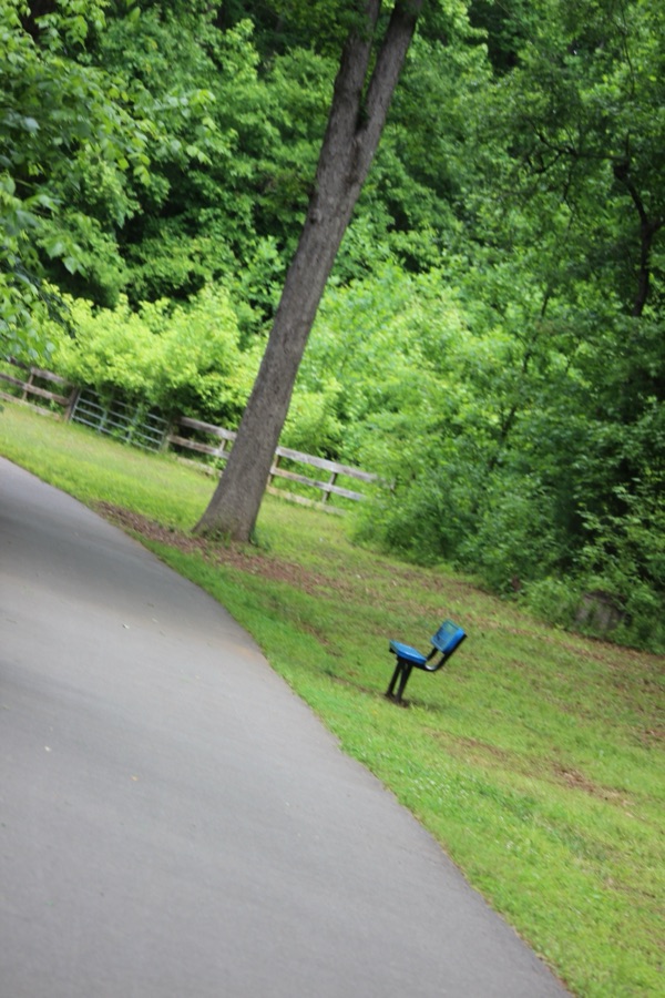
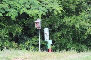
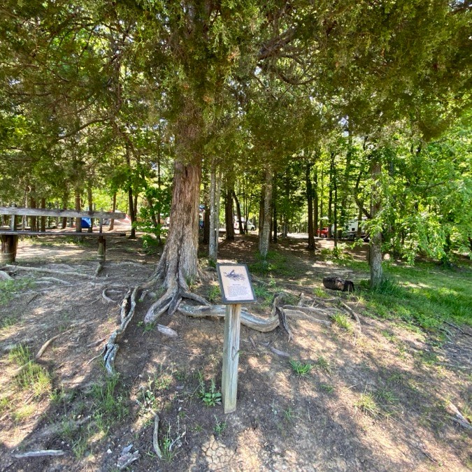
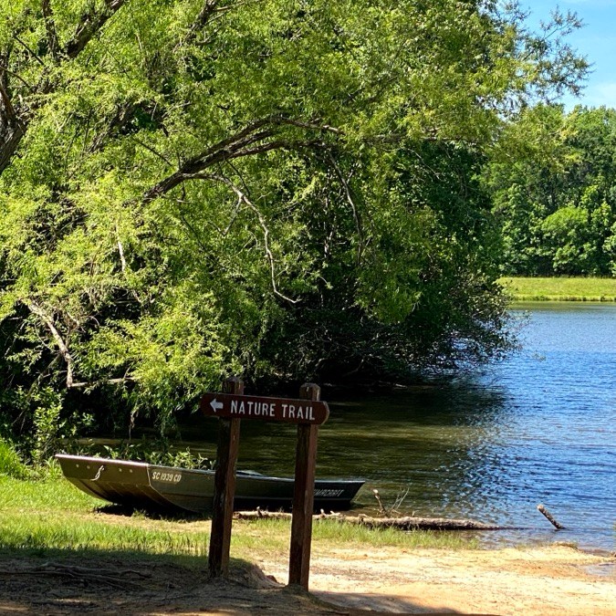
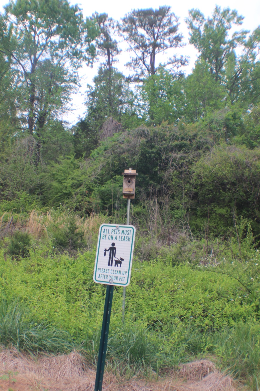
Hope y’all have had a fantastic week so far. It’s Friday already and time for another Which Way Challenge. This week we are looking atAny Which Ways with Any Type of Sign(s). They can be street signs, trail signs, or any type of sign you see in your Which Ways as you meander around your pathway or roadway.
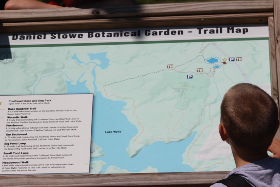
Trail Signs at Carolina Thread Trail; Daniel Stowe Conservancy …
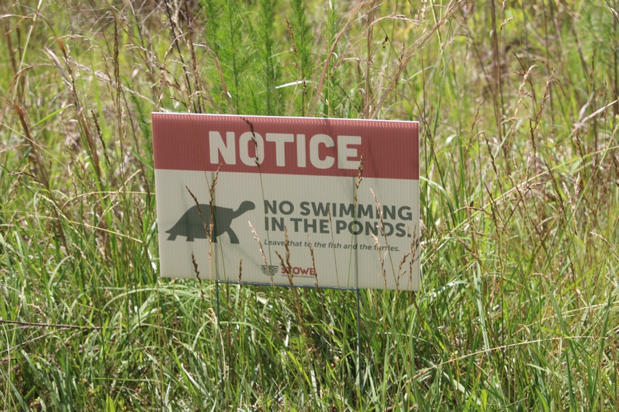
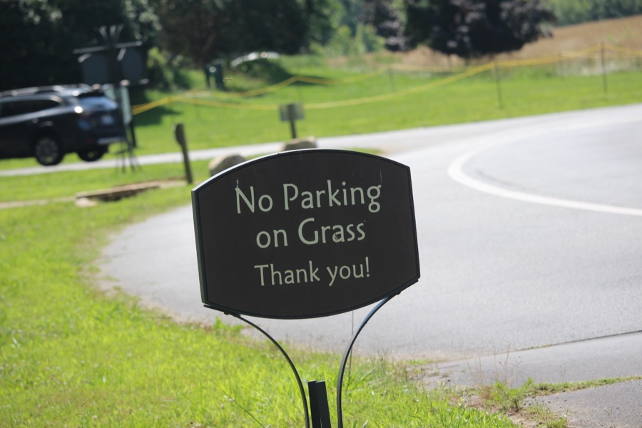
Signs on Side of Trail at Anne Springs Close Greenway …
For enhanced/enlarged viewing click on each image.
Thank you to all who have supported and contributed to the Which Way Challenge this past week or at any time. Be sure to check out other Which Ways by clicking on the links below.
Camera: Apple iPhone 16 Pro Max; Canon EOD Rebel T3i with Canon EF-S55-250mm lens.
Location: As Stated Above
God Bless. Take a hike. Enjoy a stroll through nature’s beautiful pathways and parks. Thank you for visiting and sharing your time and thoughts with us. I appreciate y’all very much.
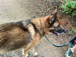
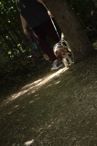
Good day! I trust everyone has had a wonderful week so far. Welcome back to another Which Way Challenge (CWWC). The theme isAny animal in your which way. Let’s see the amazing Which Ways y’all can come up with to display Animals in your Pathways, Sidewalks, Trails, Roads, or in any Which Way You Choose. Here are my entries …
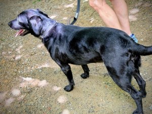
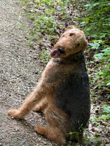
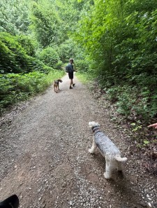
Dogs on Trails or Pathways:
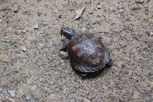
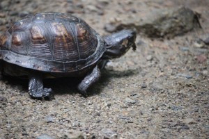
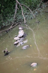
Turtles on & Seen from the Trail:
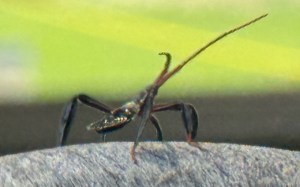
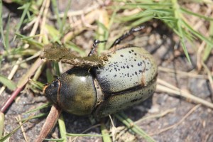
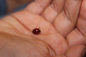
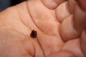
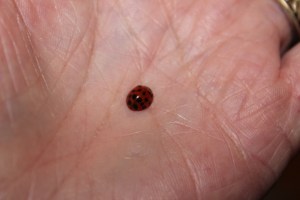
Bugs Encountered on Trails:
For enhanced/enlarged viewing click on each image.
Thank you to all who have supported and contributed to the Which Way Challenge this past week or at any time. Be sure to check out other Which Ways by clicking on the links below.
Cameras: Apple iPhone 16 Pro Max; Canon EOS Rebel T3i with Canon EF-S55-250mm lens and Altura UV & CPL filter attachments.
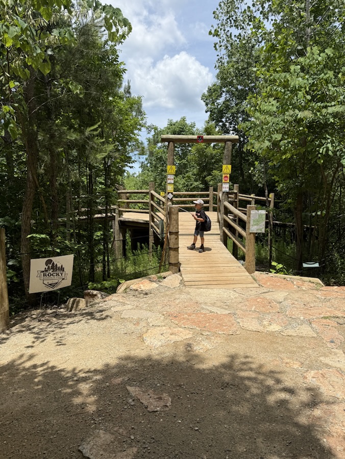
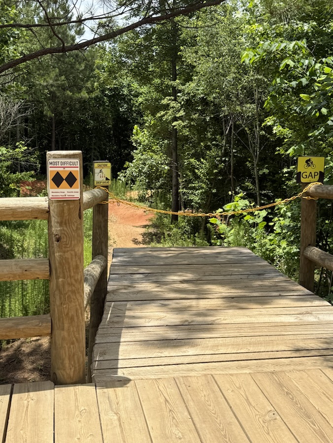
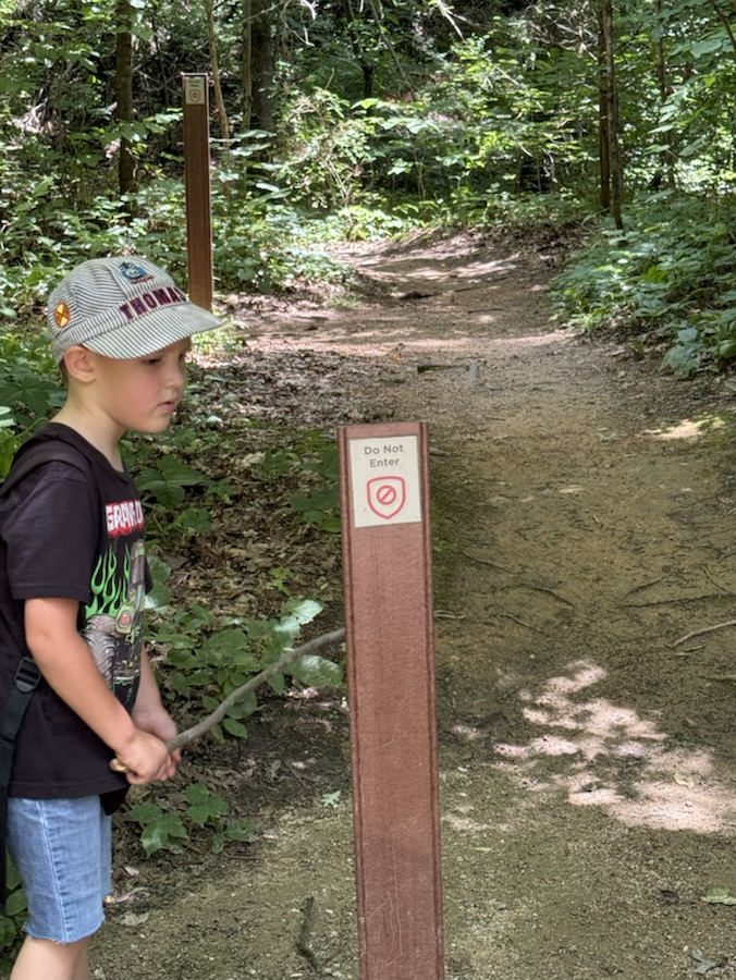
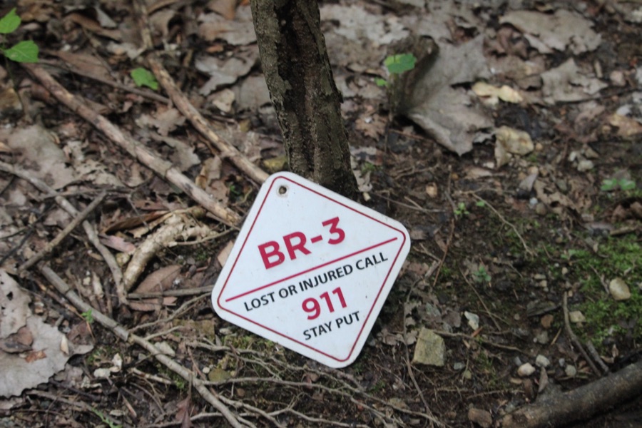
Locations: 1-9) Rocky Branch Trail; 10 & 12) Goat Island Park and Greenway; 11) The Trailhead Store, Belmont; 13-15) Seventh Street; Cramerton, North Carolina, USA
God Bless. Have a wonderful weekend. Get Outdoors and enjoy nature. Thank you for visiting and sharing your time and thoughts with us. I appreciate y’all very much.
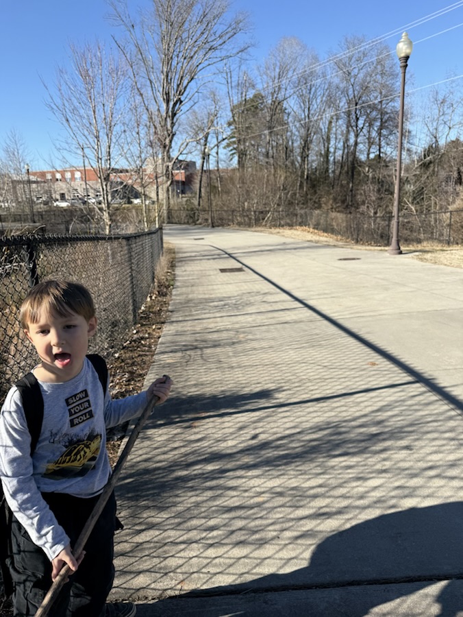
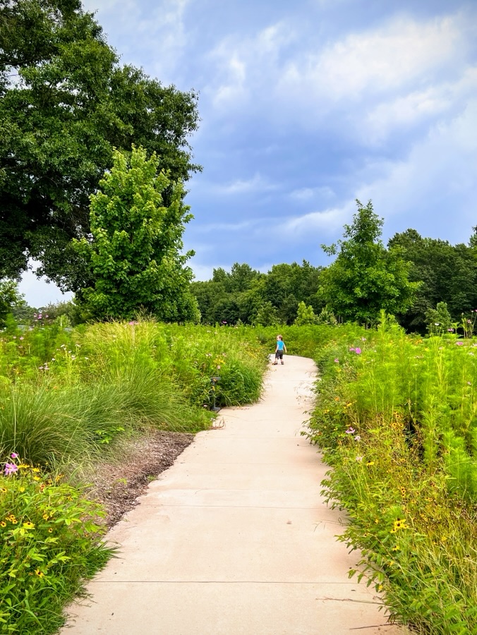
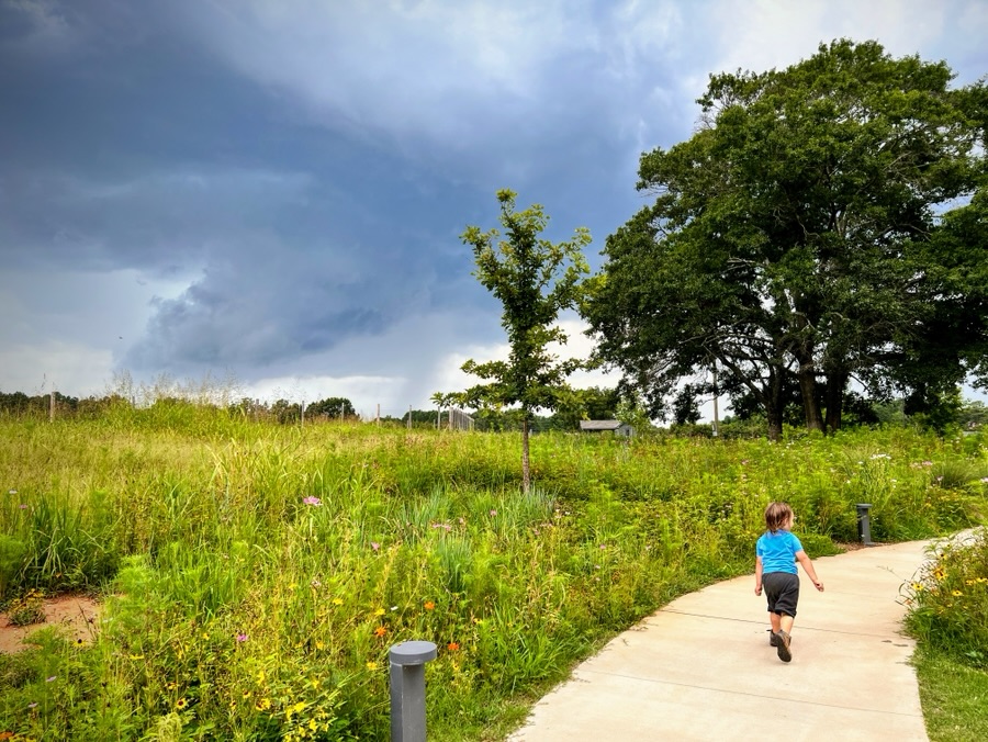
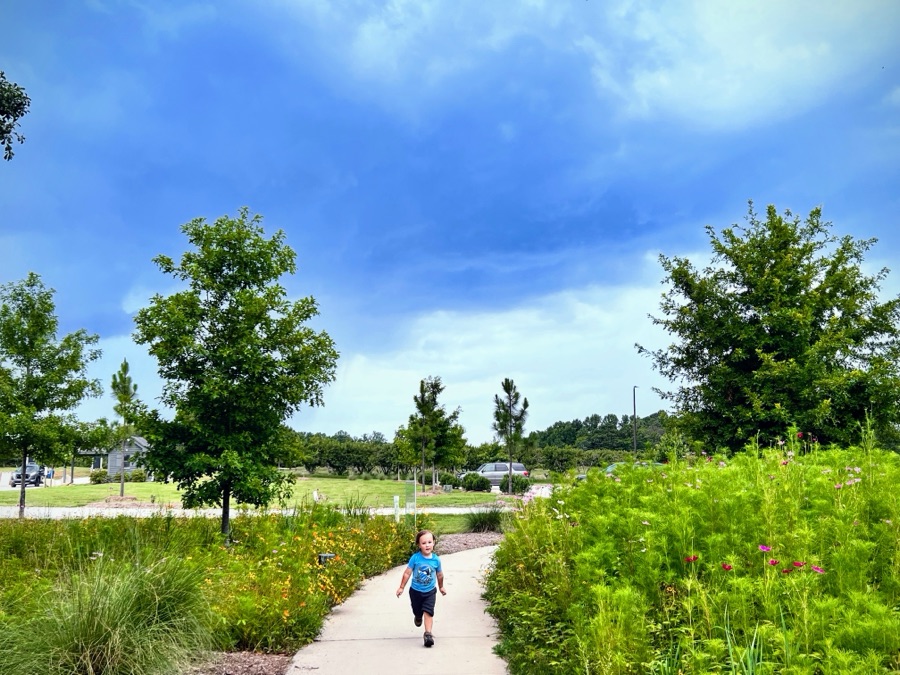
There are times Coleman and I run across traffic as we walk to our destination or Trailhead. On Saturday we had to walk along a few different roads (some with sidewalks and some without sidewalks) to reach our intended destination to begin our hike for the day.
Here are my entries for this week’s challenge … from our walk …
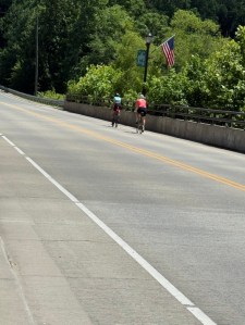
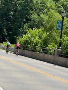
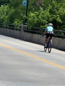
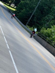
Bicycles/Bicyclists:
Bicyclists on the Road
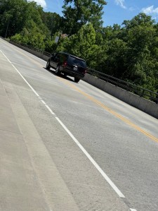
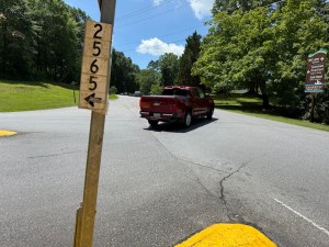
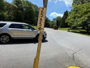
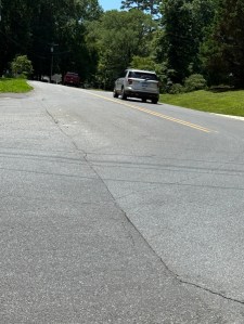
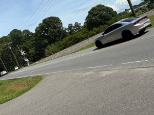
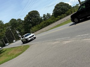
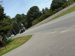
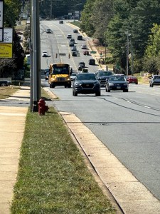
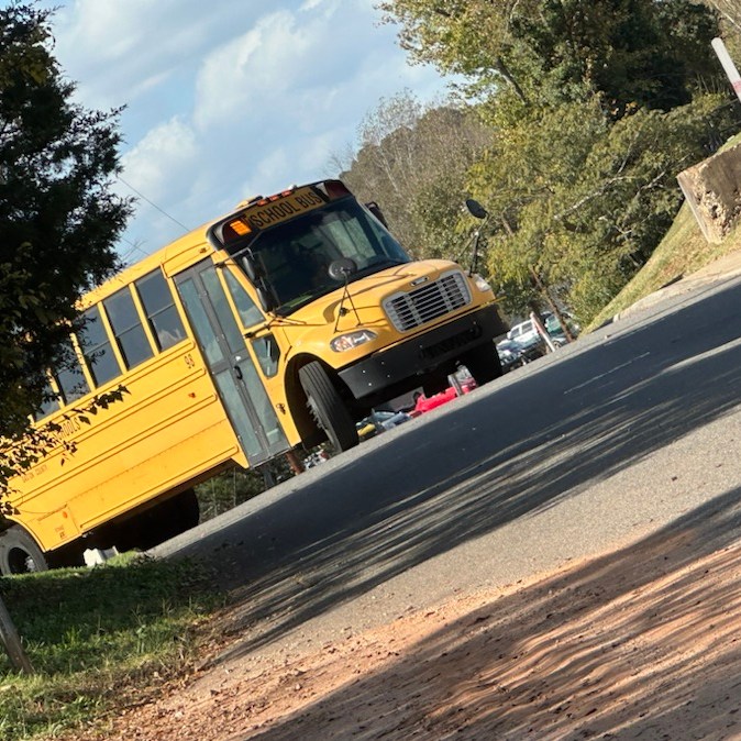
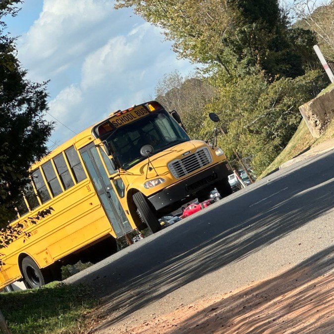
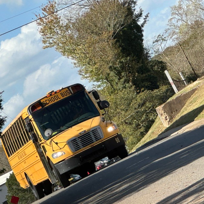
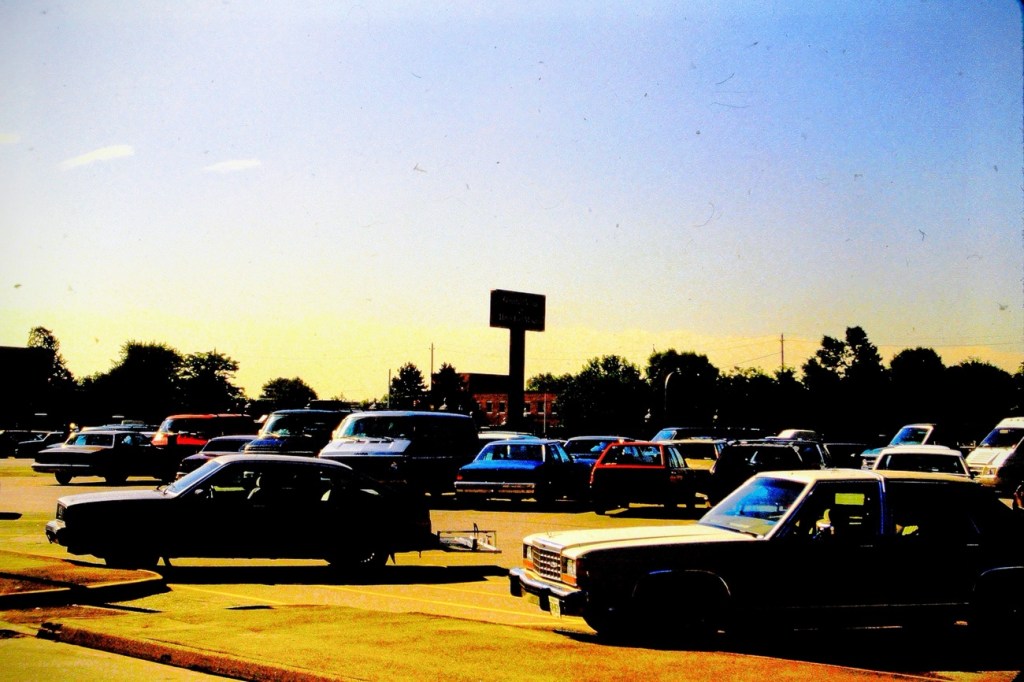
Cars, SUV’s, and Trucks:
Vehicles on the Road
For enhanced/enlarged viewing click on each image.
Thank you to all who have supported and contributed to the Which Way Challenge this past week or at any time. Be sure to check out other Which Ways by clicking on the links below.
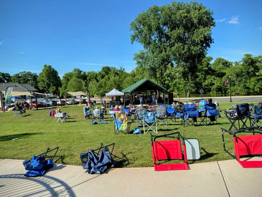
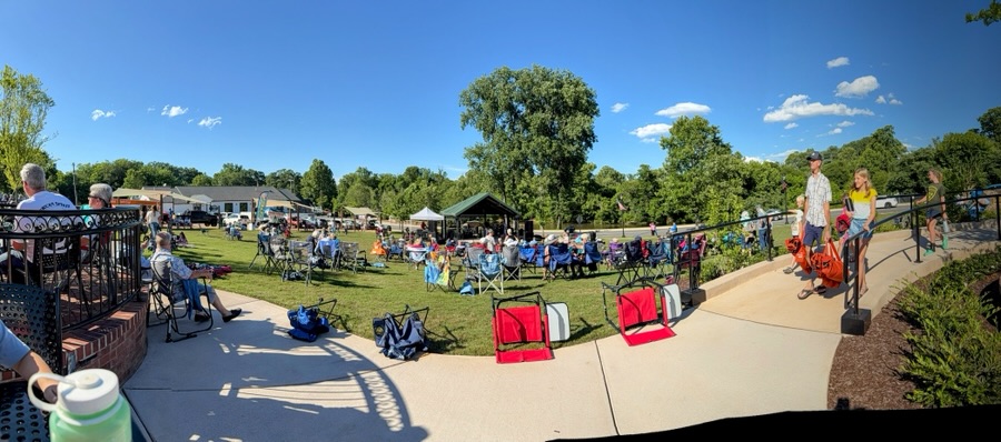
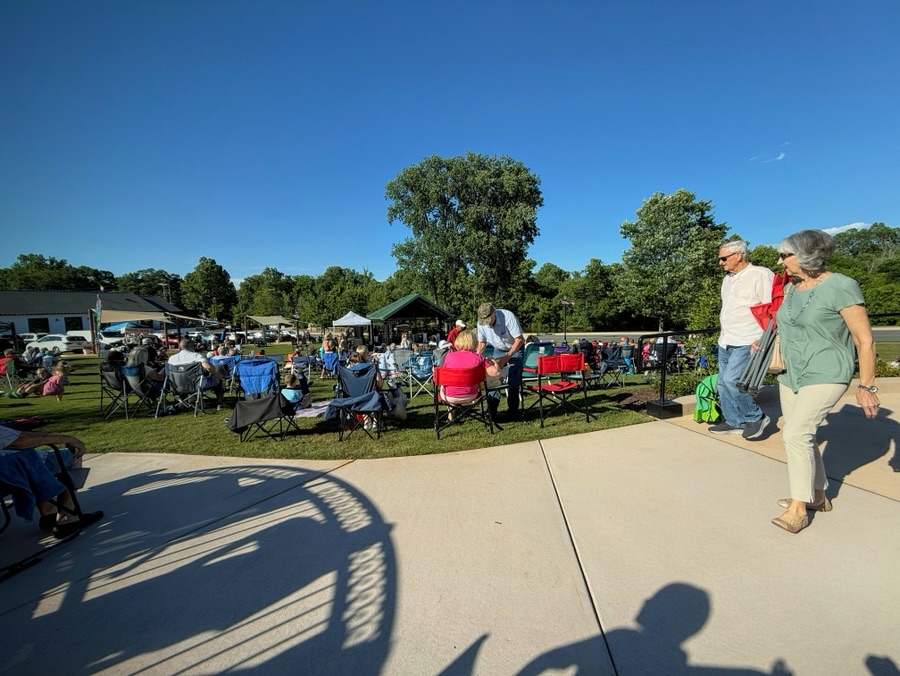
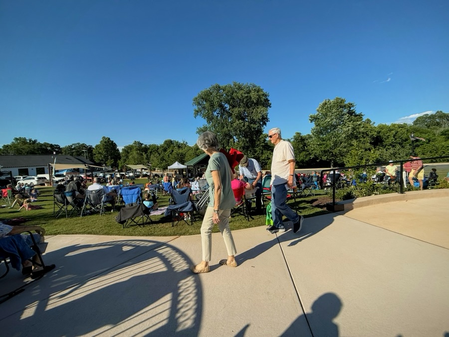
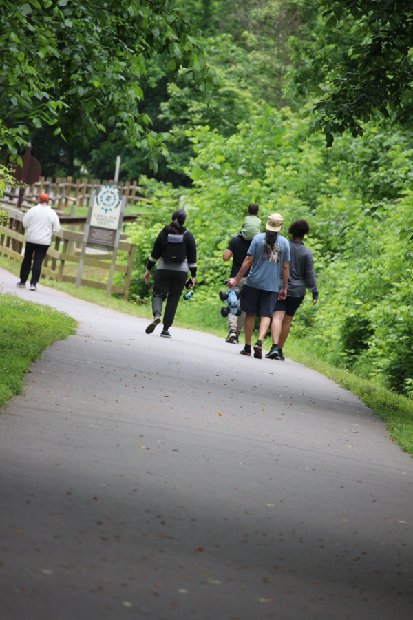
Remember your Which Ways can be any way one travels, whether on foot, or other means. This week we are focusing on people in our Which Ways. And as always, Be sure to have fun.
For other Which Ways, check out the links below. Thank you to all who contributed to the Which Way Challenges.
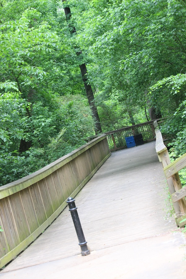
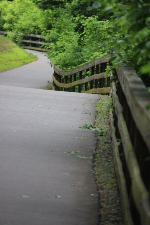
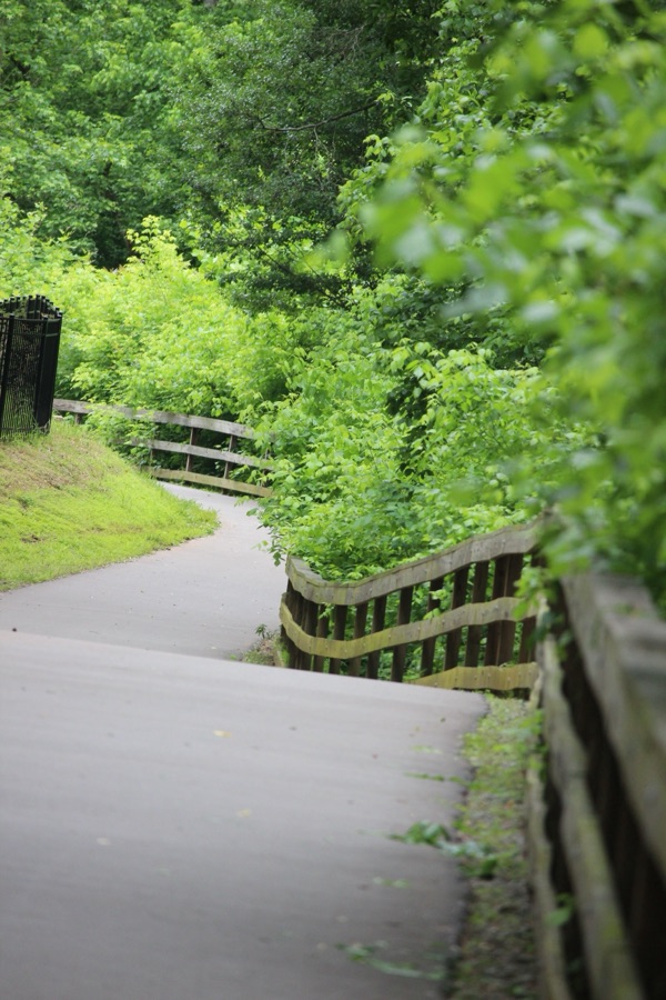
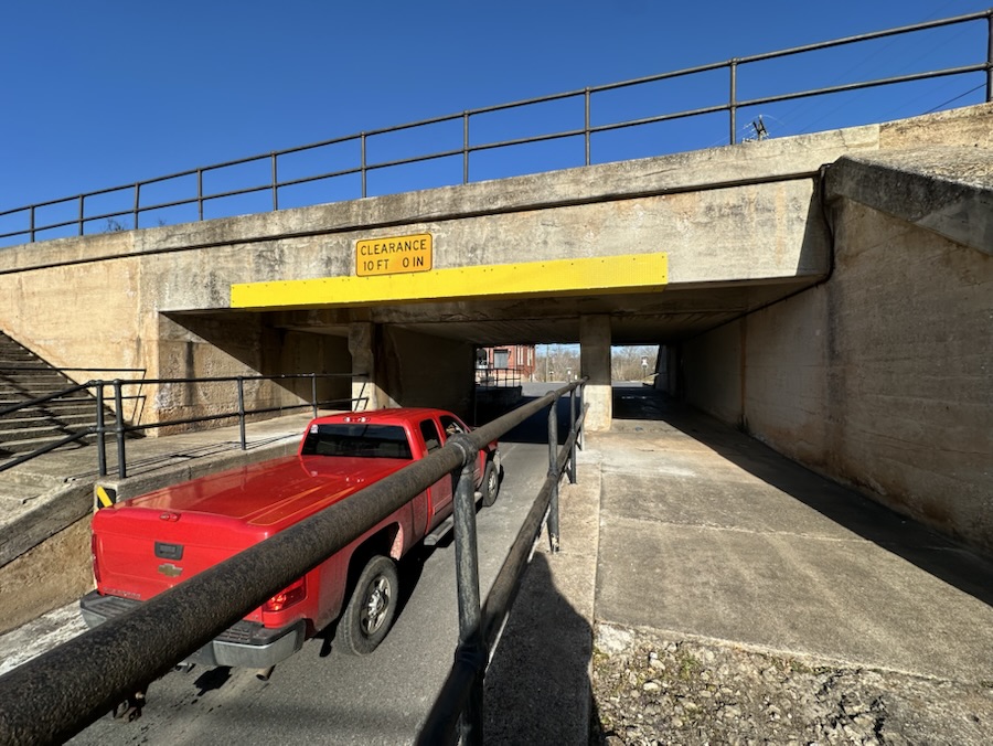
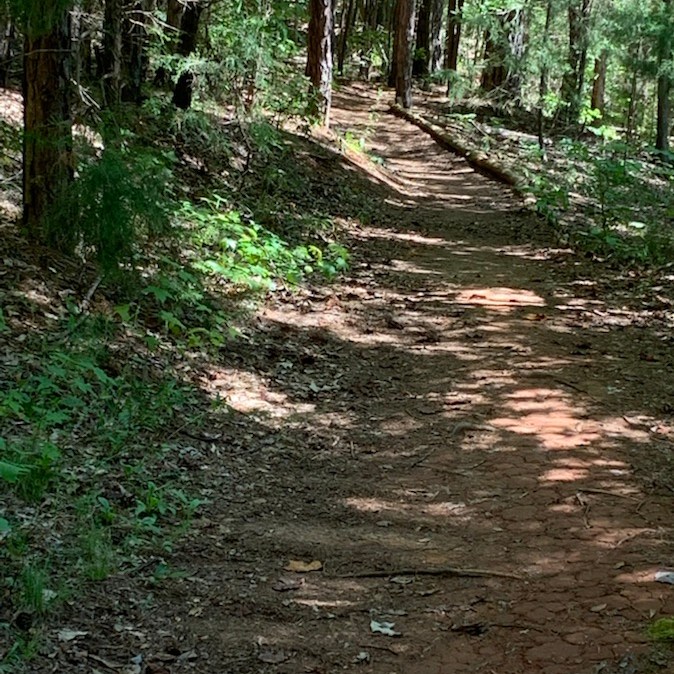
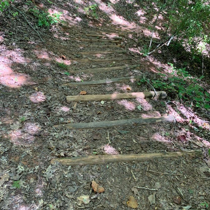
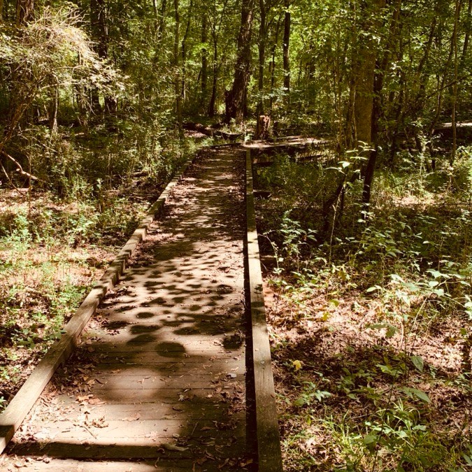
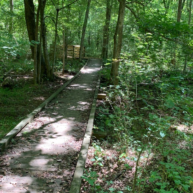
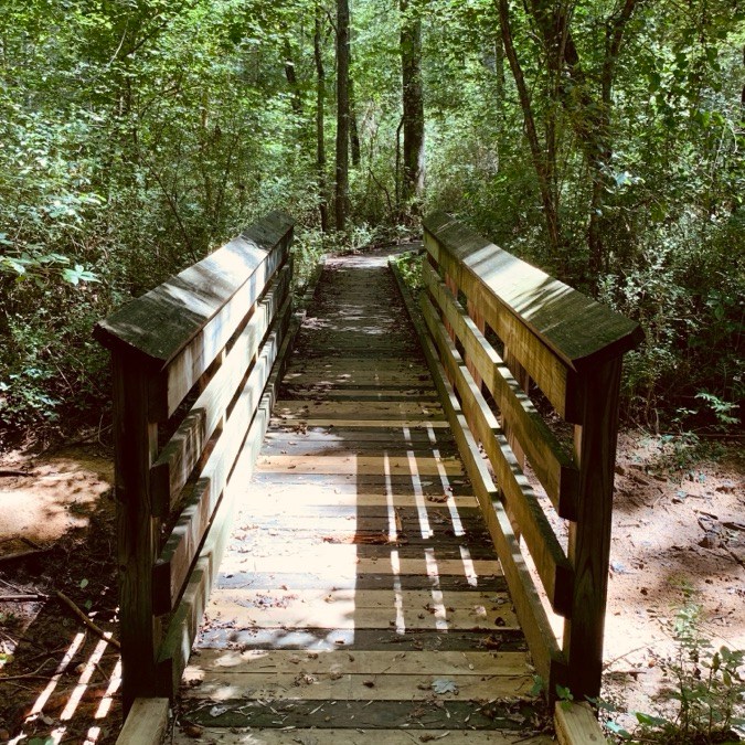
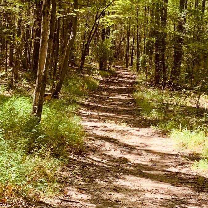
Welcome back to another Which Way Challenge (CWWC). This week I have chosen (CWWC): Any Type of Road, Path, Step, Bridge, or Sign for this week’s theme. Your Which Ways can be on any pathway, road, step, bridge, and/or sign as long as the Which Way is clearly discernible. For further information regarding the Which Way Challenge (CWWC) feel free to check out the home page here. As always remember to have fun.
Here are my entries for this week’s challenge …
Pathway/Sidewalk:
Roads:
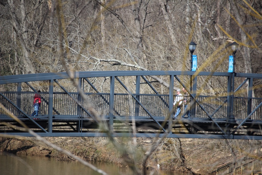
Bridges:
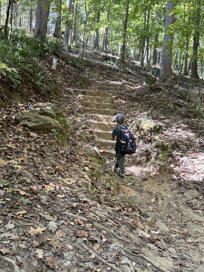
Steps:
Signs:
Thank you to those who have participated and supported the Which Ways Challenge. I appreciate y’all sharing your Which Ways with us.
For an idea of other’s Which Ways from this past week’s challenge, be sure to click on the following links below.
This week’s theme of Things Made of Glass/Ceramics was an interesting one for me to find images that I’d like to share. We’ve had rain this week and Coleman has been feeling under the weather with a bad chest cough, therefore we haven’t been out and about that much. So I decided to search through my archives to figure out what I could possibly come across to use for this CFFC challenge.
Here are my selections:
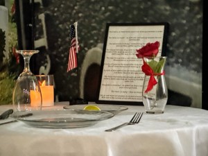
First off to Remember the Fallen, But Never Forgotten …
God Bless. Have a funtastic week. Keep an eye out for the CWWC post on Friday. Thank you for visiting and sharing your time and thoughts with us. I appreciate y’all very much.
Welcome back to the Which Way Challenge (CWWC), I’m so glad you are enjoying this challenge. For this week I have chosen the theme of (CWWC): Any Which Way with Dirt roads or dirt pathways or trails. Remember to be sure your Which Ways are clearly defined. Remember signs are always welcome in your Which Ways.
School is out for the summer or about to be if not already in your area. Summer is a fitting time to be out in the nature hiking (or taking a walk) leisurely enjoying the beauty of God’s creation.
Here are my entries for (CWWC): Any Which Way with Dirt roads or dirt pathways or trails. Now over to y’all to show us the dirt roads, pathways, or trails you enjoy while you’re hiking or walking about in y’all’s favorite areas.
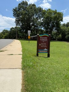
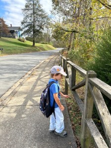
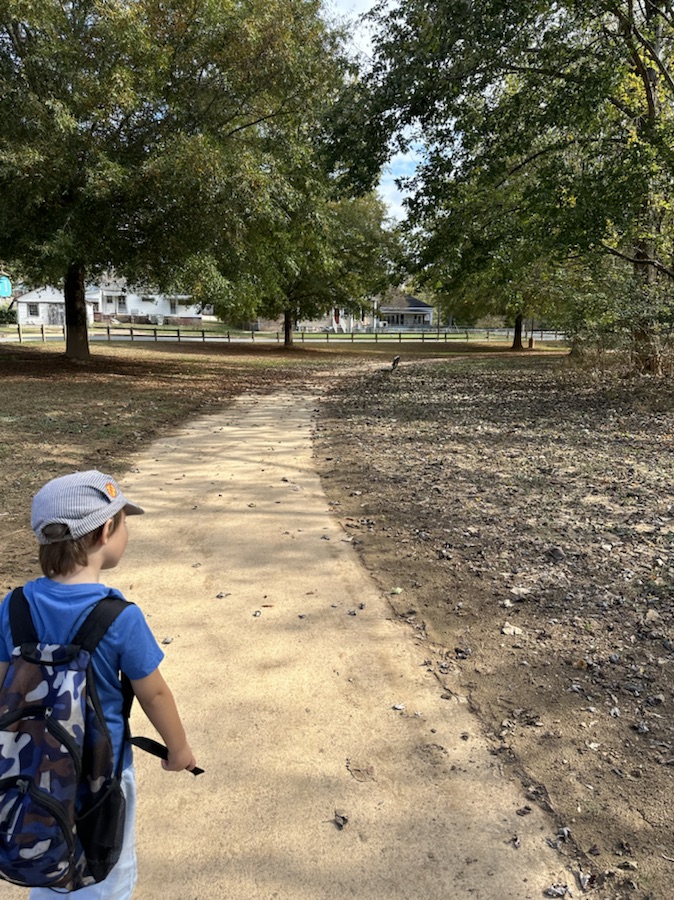
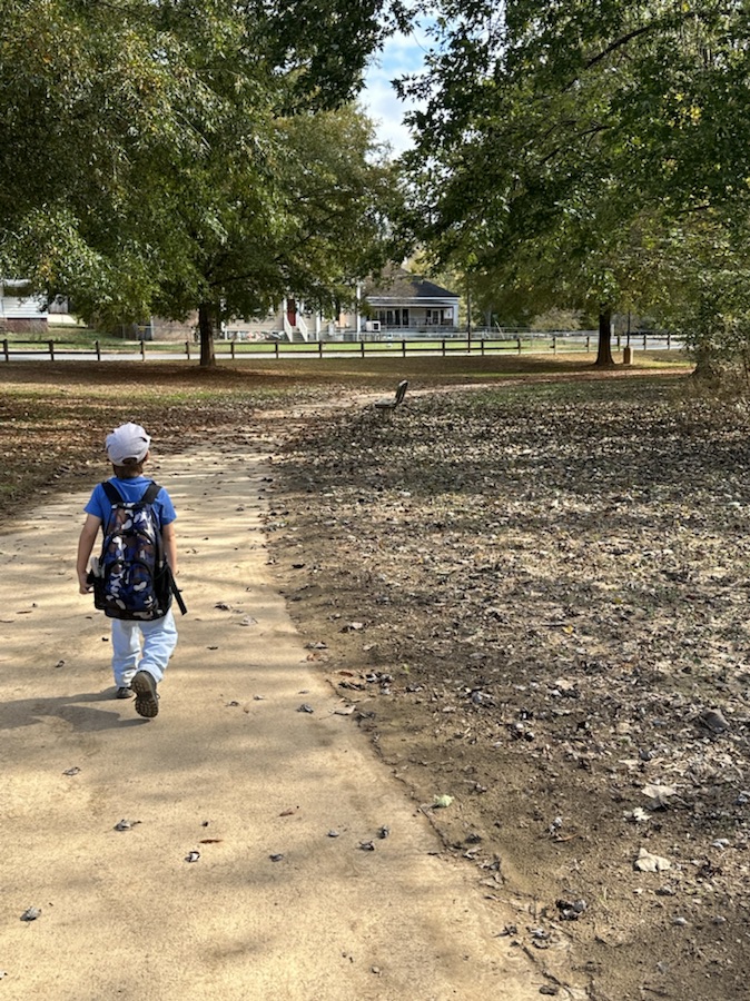
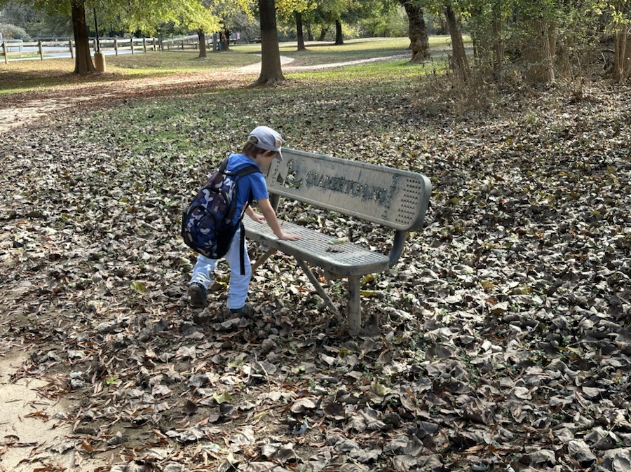
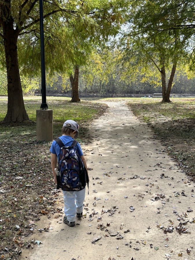
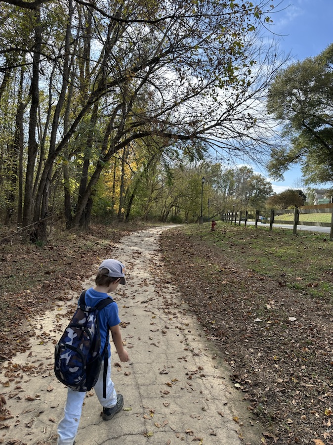
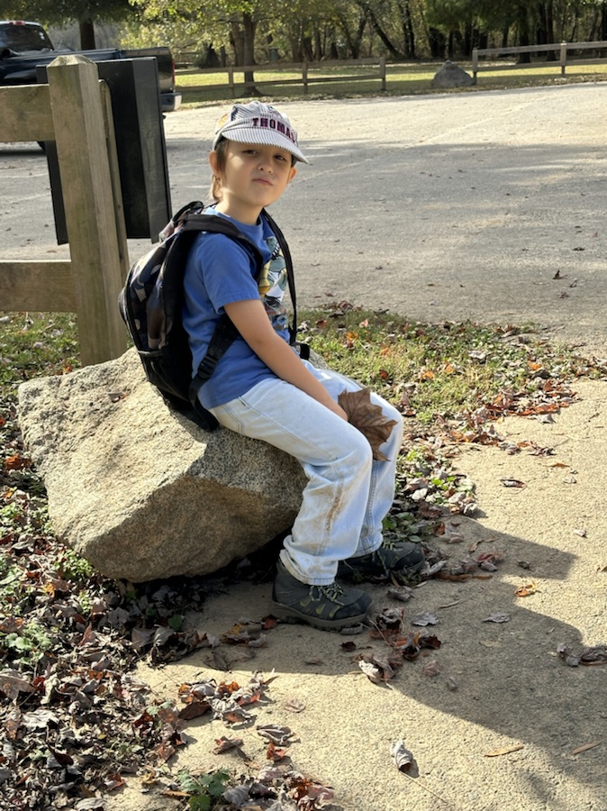
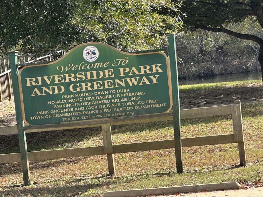
Coleman hiking in Riverside Park and Greenway’s Dirt Trail
You might enjoy taking a look at other Which Ways from this past week; check out the links below:
Location: Dirt Trail; Riverside Park and Greenway; Cramerton, North Carolina, USA
God Bless. Take a hike. Enjoy a stroll through nature’s beautiful pathways and parks. Thank you for visiting and sharing your time and thoughts with us. I appreciate y’all very much.
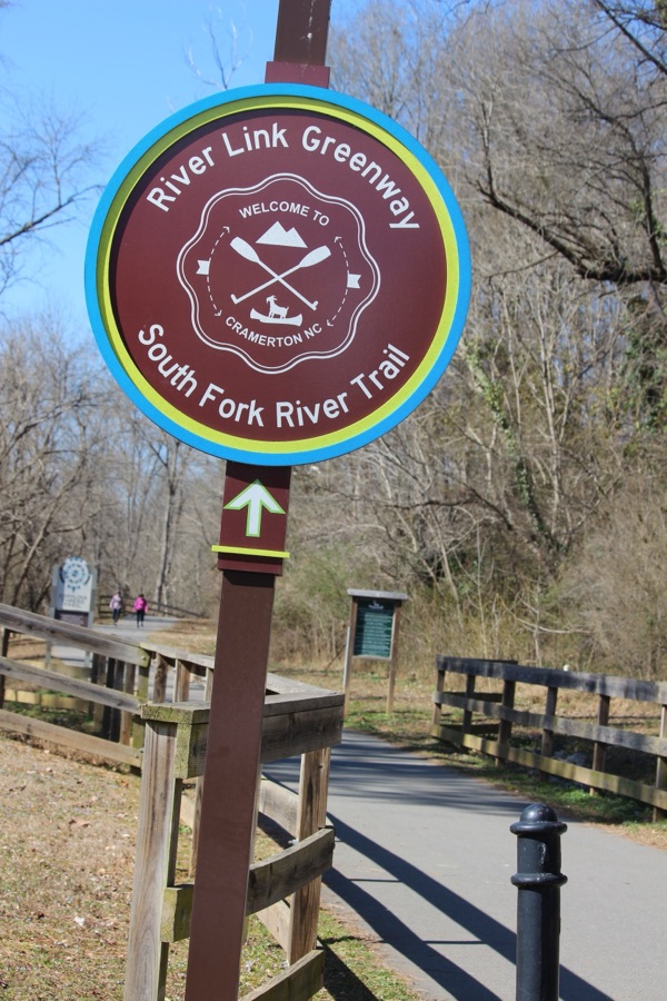
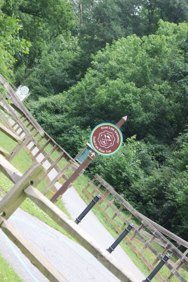
Welcome back to another Which Way Challenge (CWWC). This week I have chosen Any Which Way (Your Choice) for this week’s theme. The Which Way can be any path, sidewalk, trail, or road as long as the Which Way is clearly discernible. For further information regarding the Which Way Challenge (CWWC) feel free to check out the home page here.
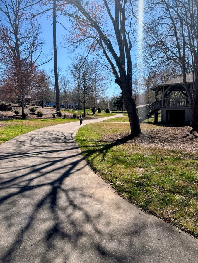
My Choice of Which Waysfor this week’s theme are in two segments. The first Which Waybeing a paved pathway, aka nature trail) some with people and some without.
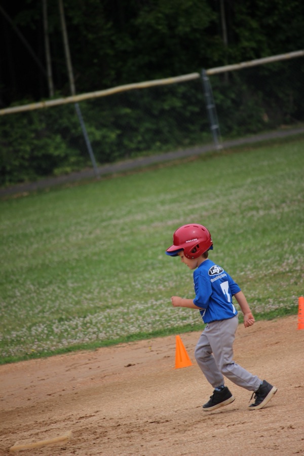
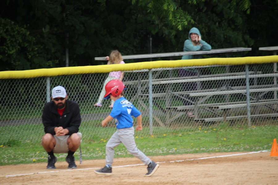
My second segment of Which Waysare of a dirt pathway within a baseball field.
Camera: Canon EOS Rebel T3i with Canon EF-S55-250mm lens and Altura UV filter attachment.
Locations: Segment One) South Fork River Trail; Carolina Thread Trail; Goat Island Park and Greenway; Segment Two) C.B. Huss Recreation T-Ball Field; Cramerton, North Carolina, USA
God Bless. Get Outdoors. Take a Hike/Walk. Enjoy Nature’s Beauty. Thank you for visiting and sharing your time and thoughts with e. I appreciate y’all very much.
Note: Next Week’s Theme => CWWC: Dirt roads or dirt pathways or trails
Welcome back to another Which Way Challenge (CWWC). This week I have chosen Any Which Way with Shadows for this week’s theme. Shadows can be on any path, sidewalk, trail, or road as long as the Which Way is clearly discernible. For further information regarding the Which Way Challenge (CWWC) feel free to check out the home page here.
Here are my entries for this week’s Which Way Challenge – Any Which Way with Shadows …
My Which Ways with Shadows are a mixture of paved pathways, sidewalks, and dirt trails. Hope you enjoy the hike with Coleman and myself.
Thank you to those who have participated and supported the Which Ways Challenge. I appreciate y’all sharing your Which Ways with us.
For an idea of other’s Which Ways from this past week’s challenge, be sure to click on the following links below.
Camera: Apple iPhone 14 Pro Max and Apple iPhone 16 Pro Max
Locations: Gastonia and Cramerton, Gaston County, North Carolina, USA
God Bless. Get Outdoors. Take a hike/walk. Enjoy nature’s beauty. Thank you for visiting and sharing your time and thoughts with us. I appreciate y’all very much.
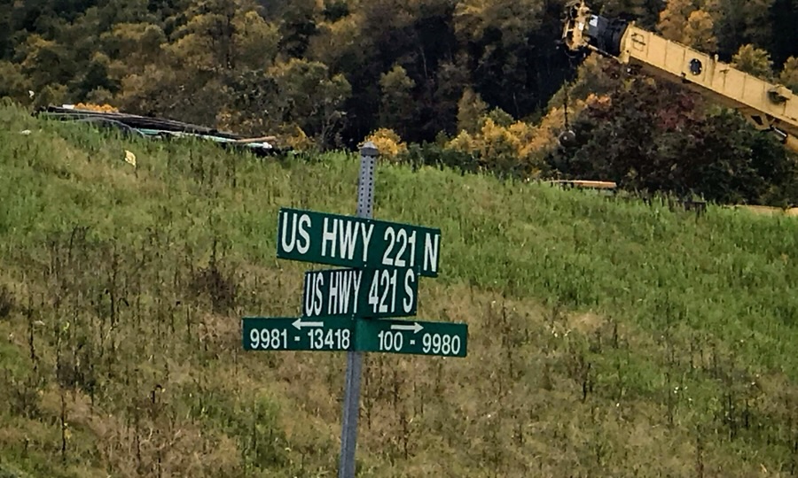
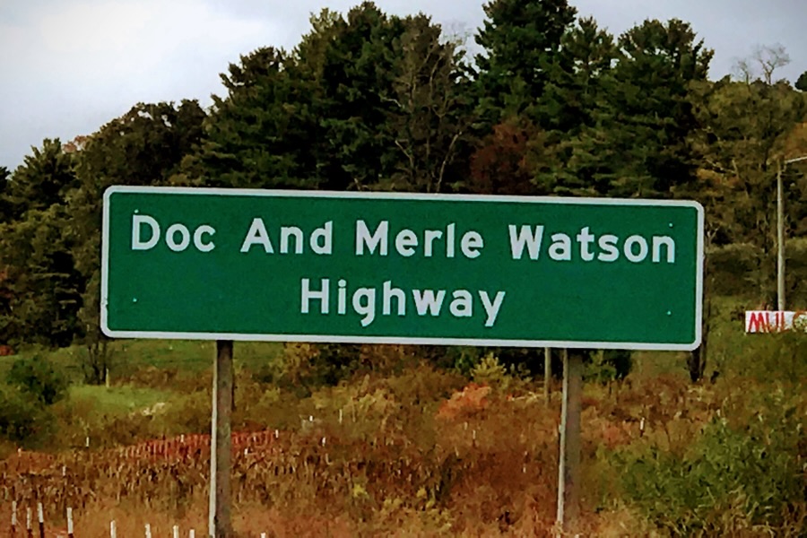
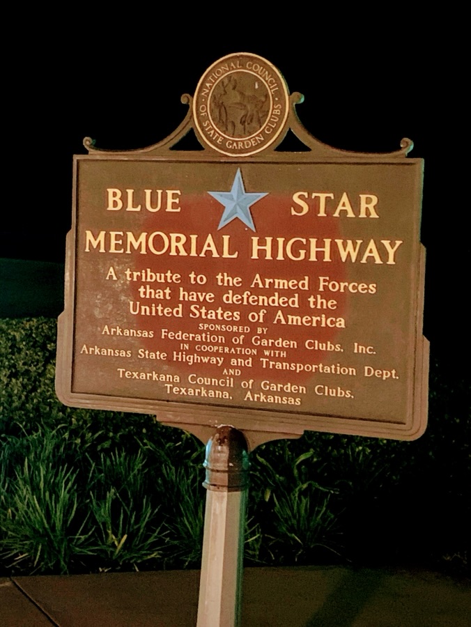
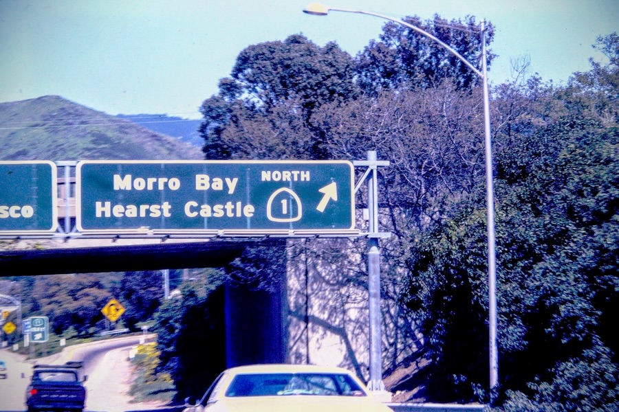
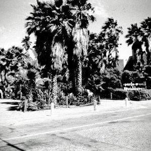
Good day! I trust everyone has had a wonderful week so far. Welcome back to another Which Way Challenge (CWWC). This week I have decided to combine the Which Way Challenge (CWWC) with the Fun Foto Challenge (CFFC). The theme is Any Which Way with (CFFC)/CWWC Highways, Structures and/or Highway Signs. Let’s see the amazing Which Ways y’all can come up with to demonstrate Highways, Highway Structures, and/or Highway Signs.
Interstate 85 Signs Charlotte, North Carolina U.S. Highway 221 N US Highway 421 S Signs Highway Sign | Doc and Merle Watson Highway, US 421, North Carolina Arkansas State Highway Signs Texarkana, Arkansas US 101/California Highway 1 Signs Dallas Fort Worth Turnpike I-30US 21 South of Great Falls, South Carolina
I deeply appreciate and extend my greatest gratitude for all who have supported and participated in the Which Way (CWWC) Challenge. Be sure to click on the links below to see what others have as their Which Ways.
God Bless. Don’t let the Highways and Byways of Life get you down, instead be a friend bringing hope, happiness, and encouragement to those you meet along the Highways and Byways of your Life. Thank you for visiting and sharing your time and thoughts with us. I appreciate y’all very much.
Go to Places change from time to time especially whenever our dwelling places change or as we progress through the ages. Our interests may change, our surroundings may change, regardless of how or when changes occur we tend to develop new ideas and locations for our “Go to Places.”
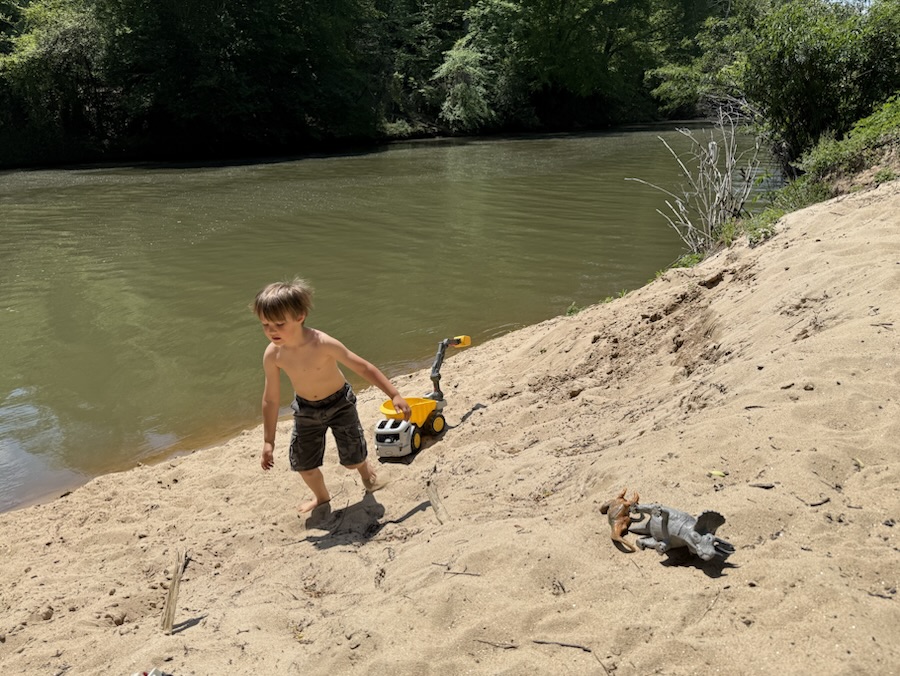
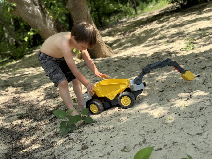
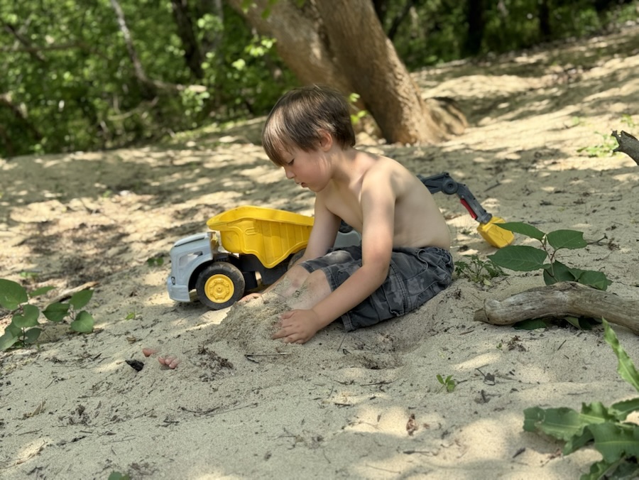
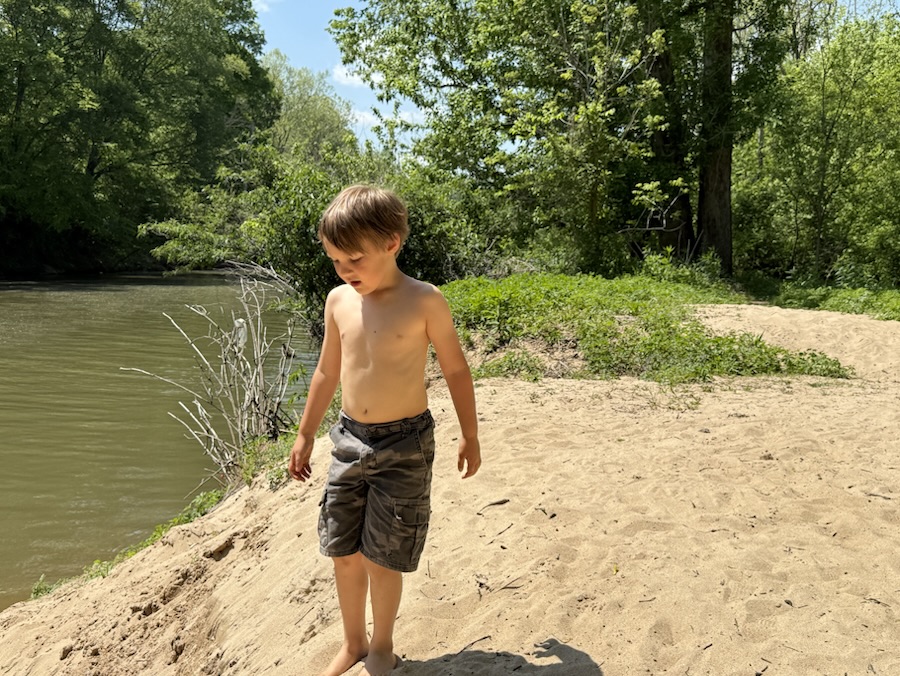
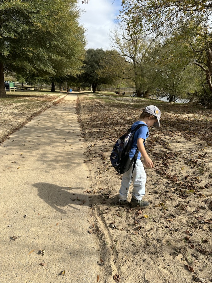
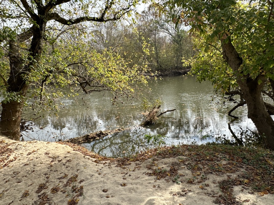
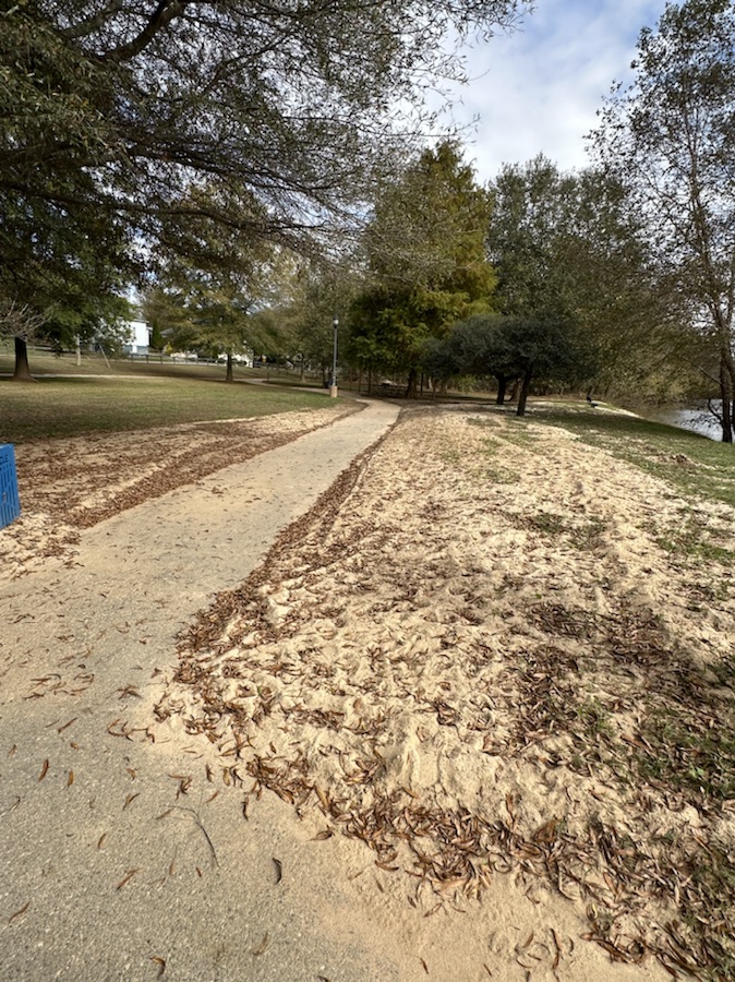
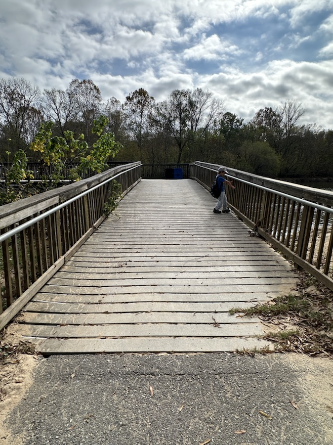
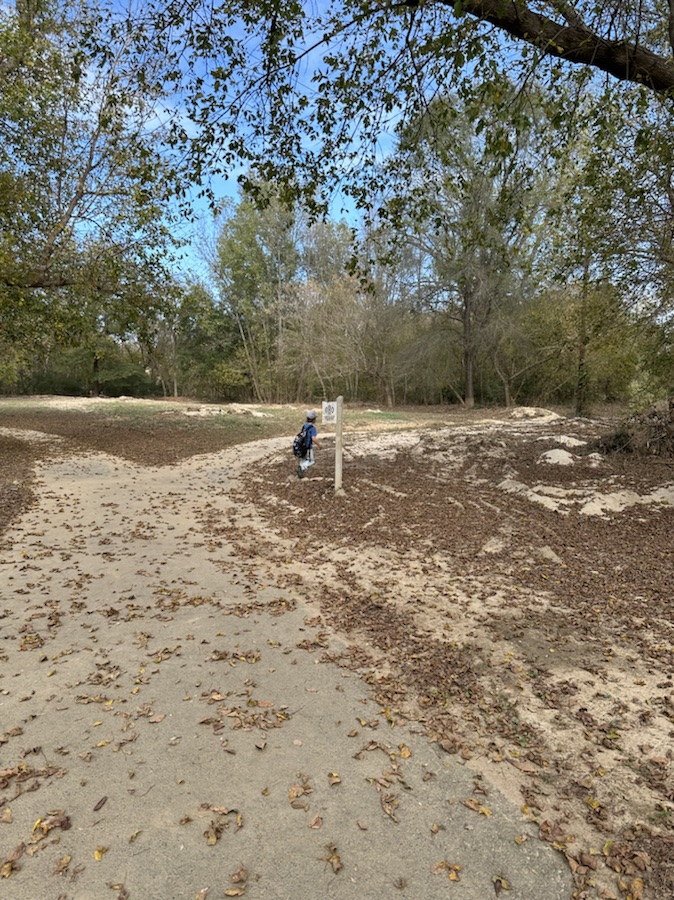
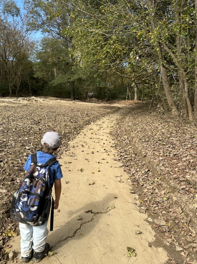
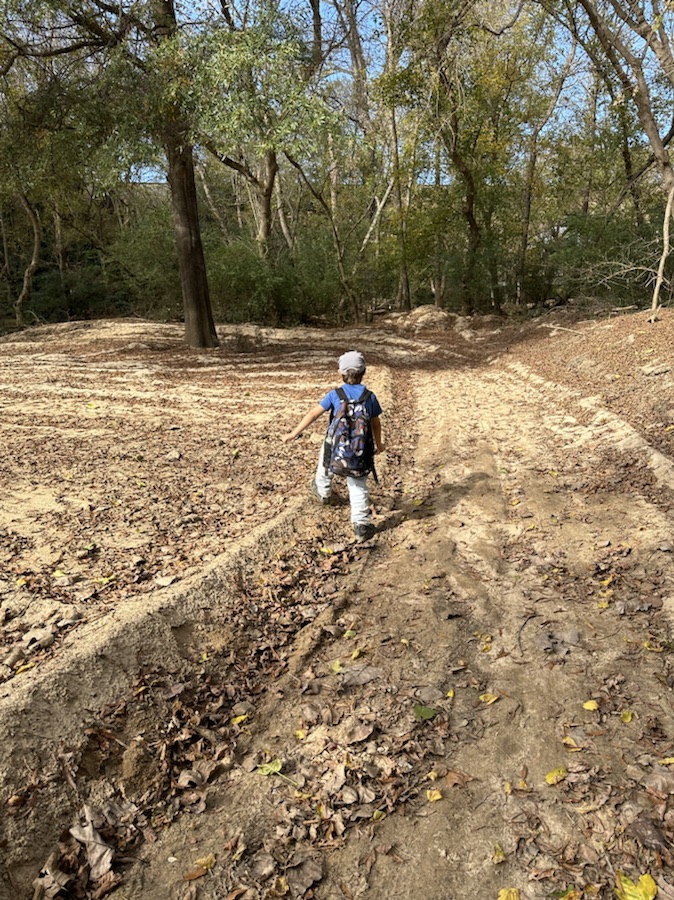
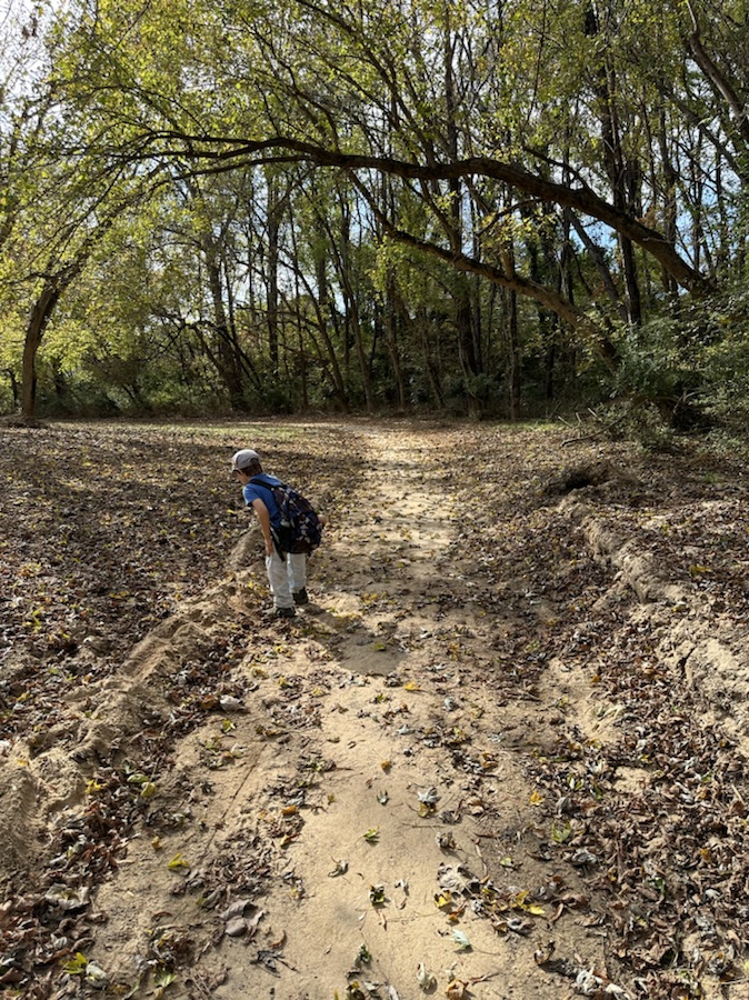
Currently, my “Go to Places” depends on Coleman’s interests and selection of the day. Whenever we go hiking we go to one of two Greenways within walking distance from our home. It just so happens that both of these “Go to Places” contain Any Unpaved Roads or Pathways. More often than not Coleman prefers to hike along unpaved nature surface trails or off the beaten pathways out in nature.
Here are our Unpaved Roads and/or Pathways … Coleman leads the way to one of his favourite “Go to Places.”
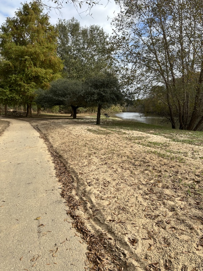
An Unpaved off the beaten Pathway at Riverside Park and Greenway
Coleman’s favourite spot at Riverside Park and Greenway “The Big Sand Pit”
Be sure to click on the links below to see what others have as their Which Ways.
Location: Off the Beaten Path Trail; Riverside Park and Greenway; Cramerton, North Carolina, USA
God Bless. Take a hike/walk in Nature. Commune with the beautiful landscapes, the trees and flowers, and (maybe) natural wildlife. Refresh your soul. Renew your mind. Life is a journey … relax and enjoy it. Thank you for visiting and sharing your time and thoughts with us. I appreciate y’all very much.
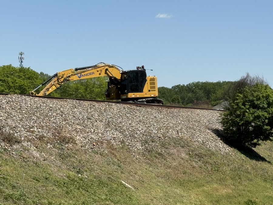
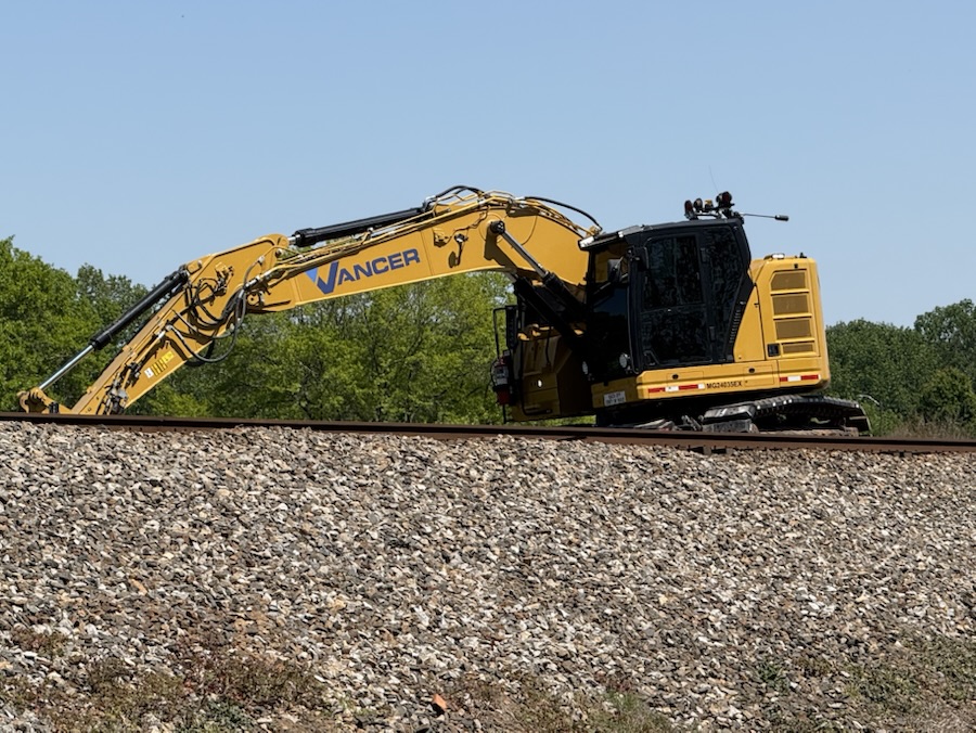
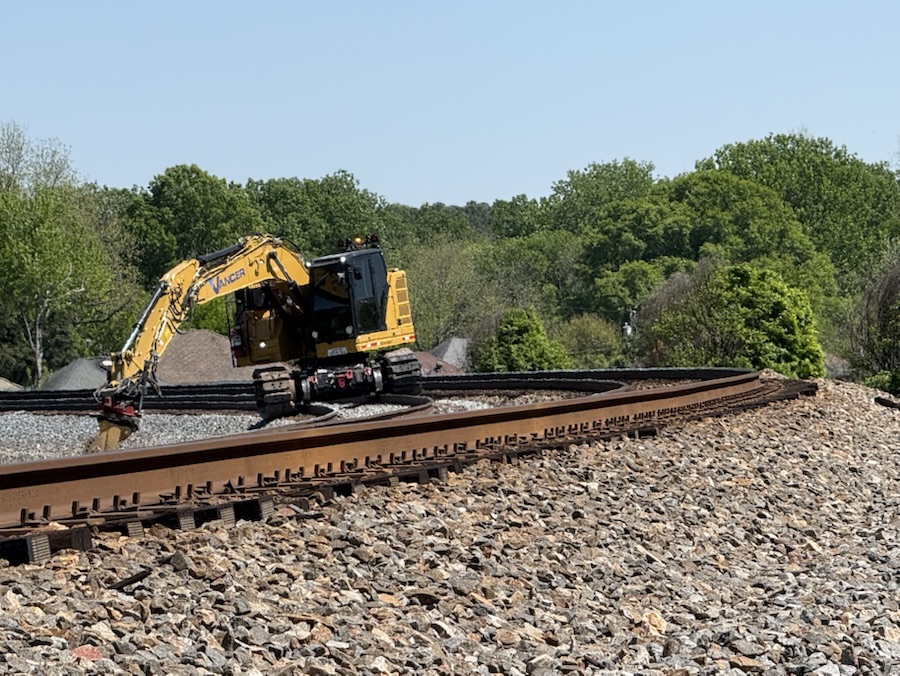
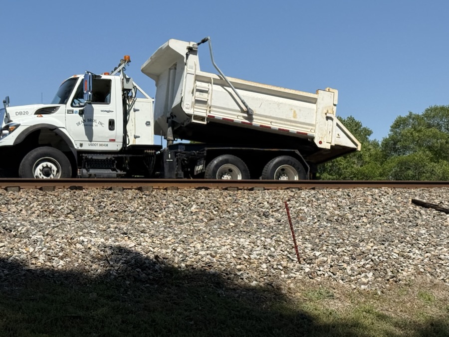
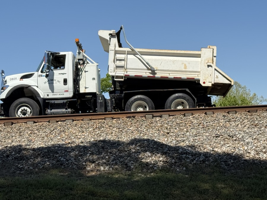
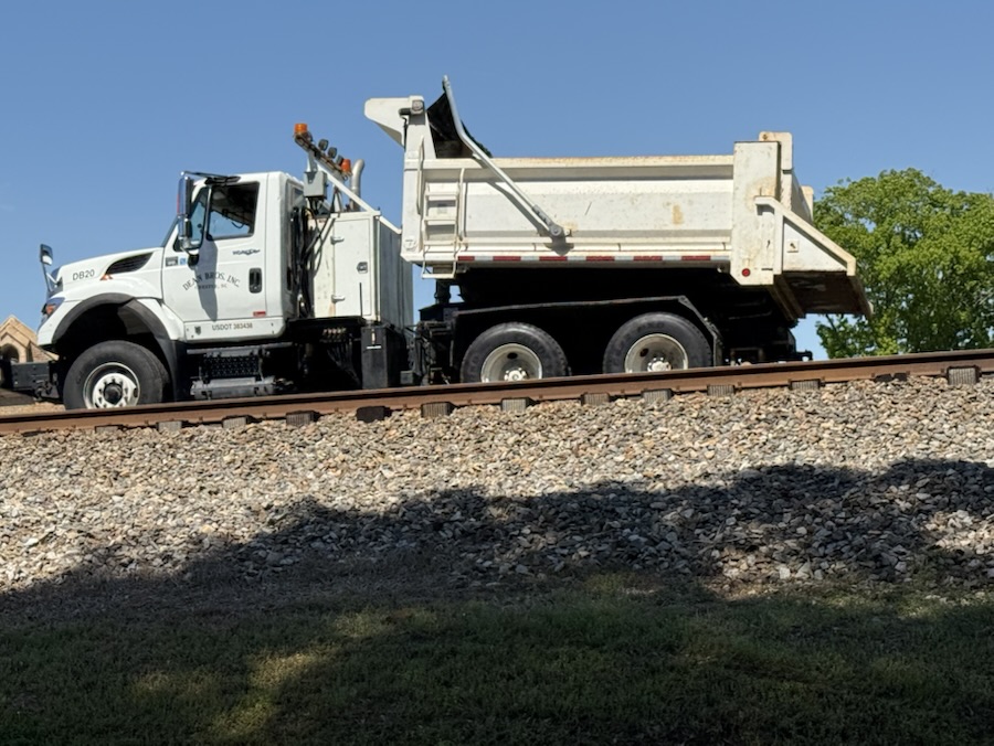
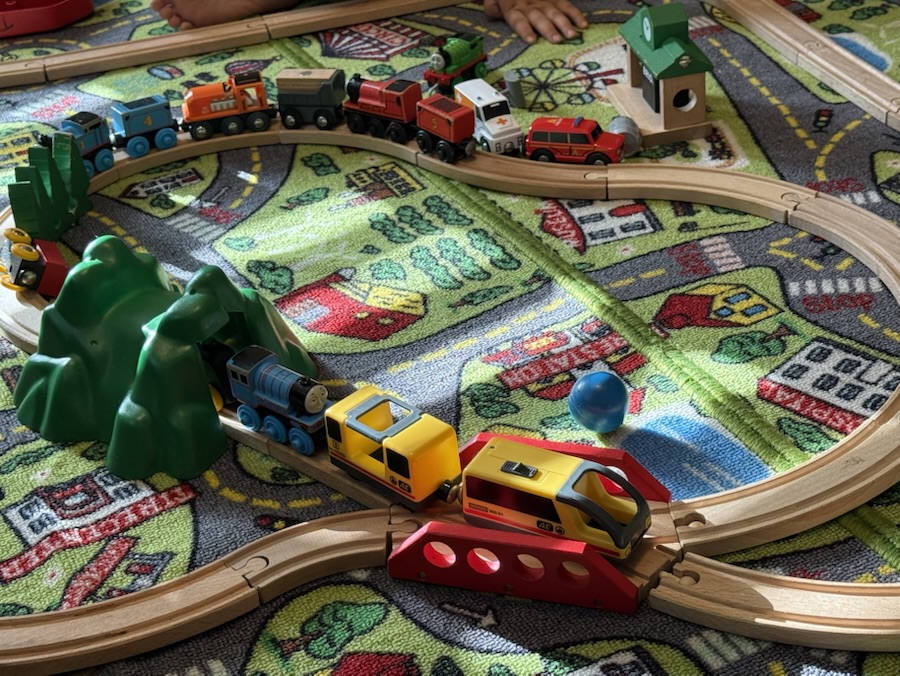
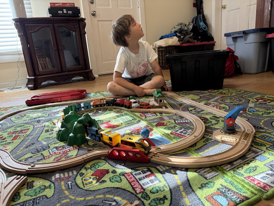
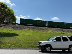
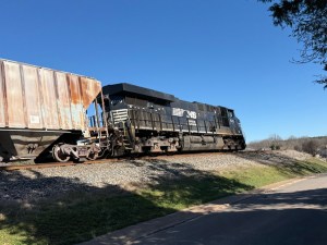
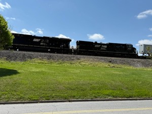
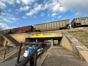
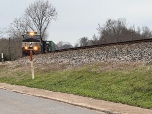
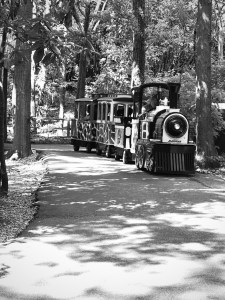
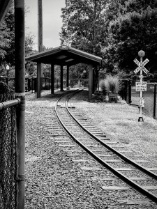
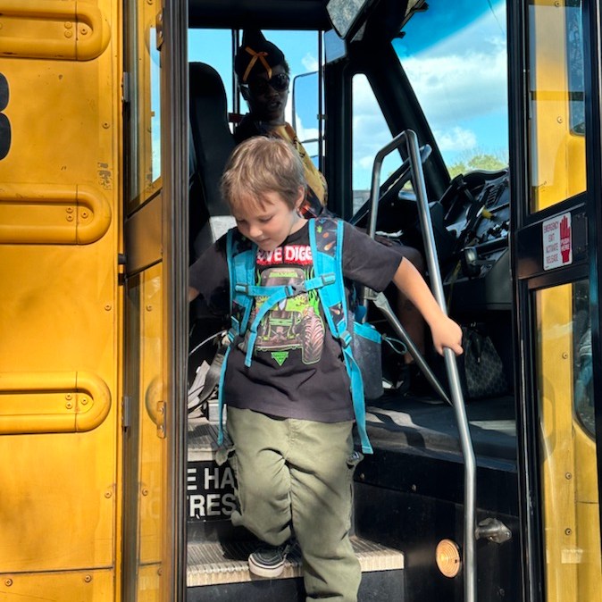
This is a bonus Train post (CWWC )/(CFFC) for this week showing what was seen on the Railroad Tracks up the road from our home and across from Coleman’s school bus stop. I also added Coleman’s Train. I’m also linking this post to Dan’s Thursday Doors and Debbie’s Six Word Saturday (sorry if it’s a tad bit over).
May the Trains of time bring your Easter basket filled with joy, happiness, and peace this season and always.
This week I’m asking y’all to show your Which Ways in Black and White in Memory of Cee Neuner (1960-2025). Cee hosted several photo challenges including Cee’s Which Way Challenge (CWWC) – currently hosted by Deb L. Waters (aka me) from Gfpacificbee’s Insights and Photography, Cee’s Fun Foto Challenge (CFFC) – currently hosted by Dan Antion from No Facilities, Cee’s Midweek Madness Challenge (CMMC), and Cee’s Black andWhite Challenge (CBWC) and Cee’s Flower of the Day Challenge (FOTD) – hosted by Chris Donner (Cee’s Life Partner & wife).
In Memory of Cee’s Black and White Challenge let us all show our Which Ways this week in Black and White for this week’s Which Way Challenge (CWWC). Remember to have Fun and Signs are always welcome.
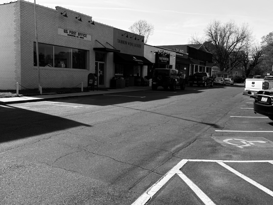
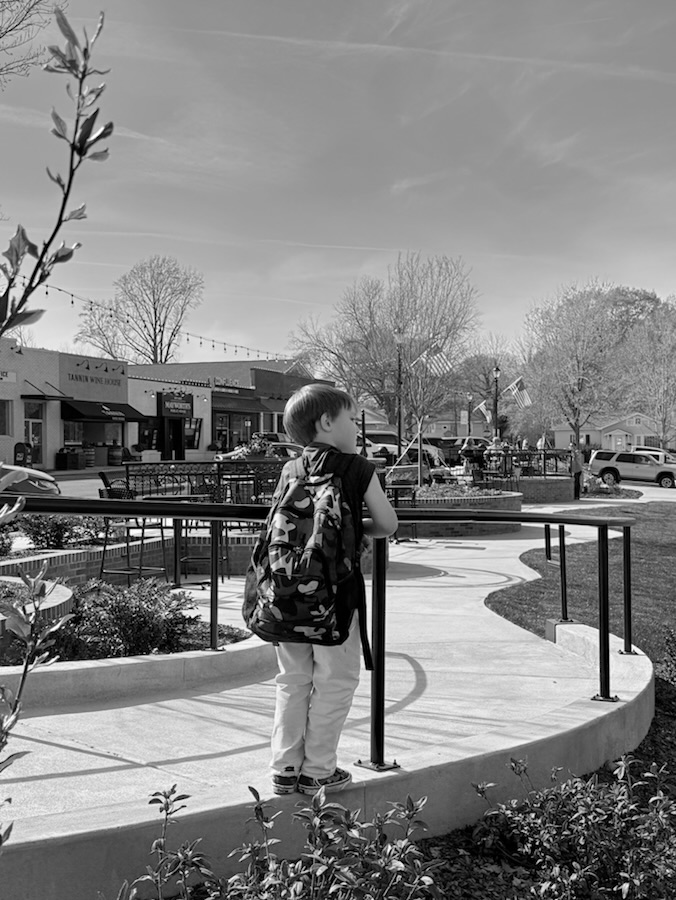
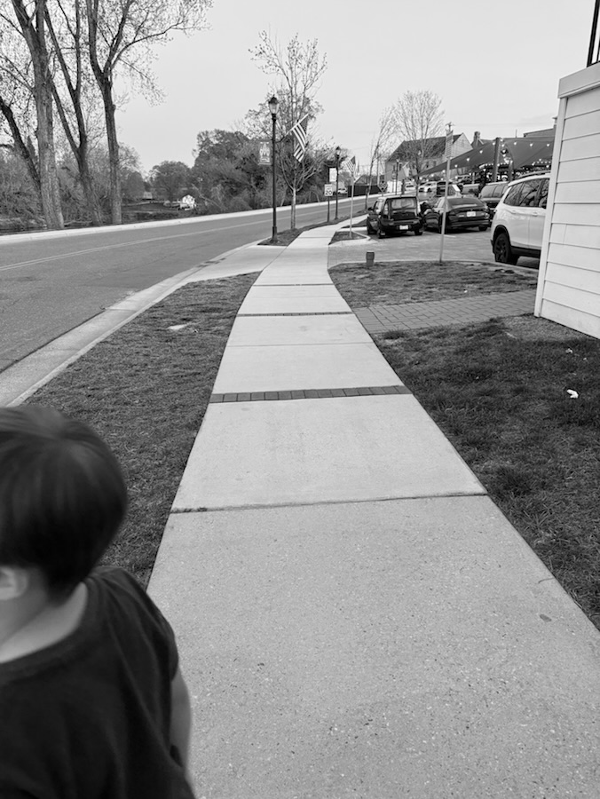
Here are my entries:
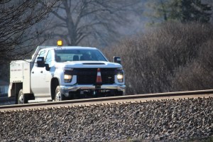
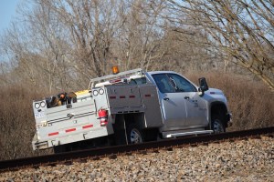
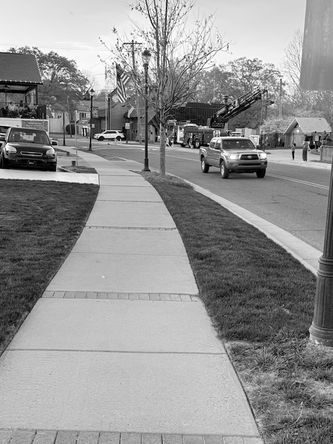
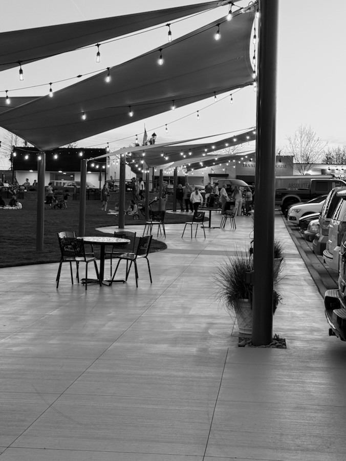
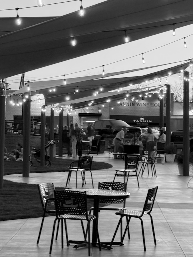
On the Road with Cars and Trucks:
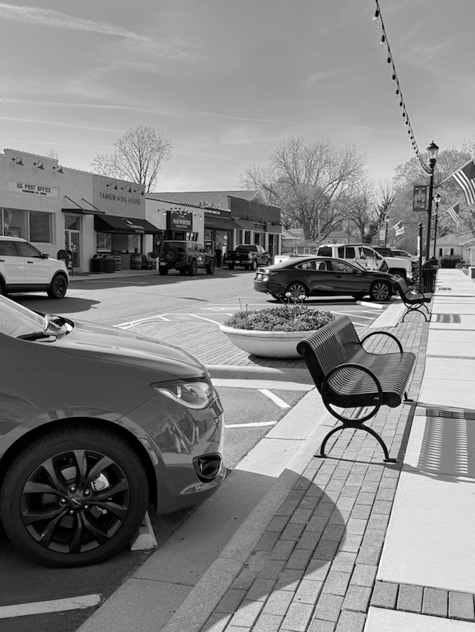
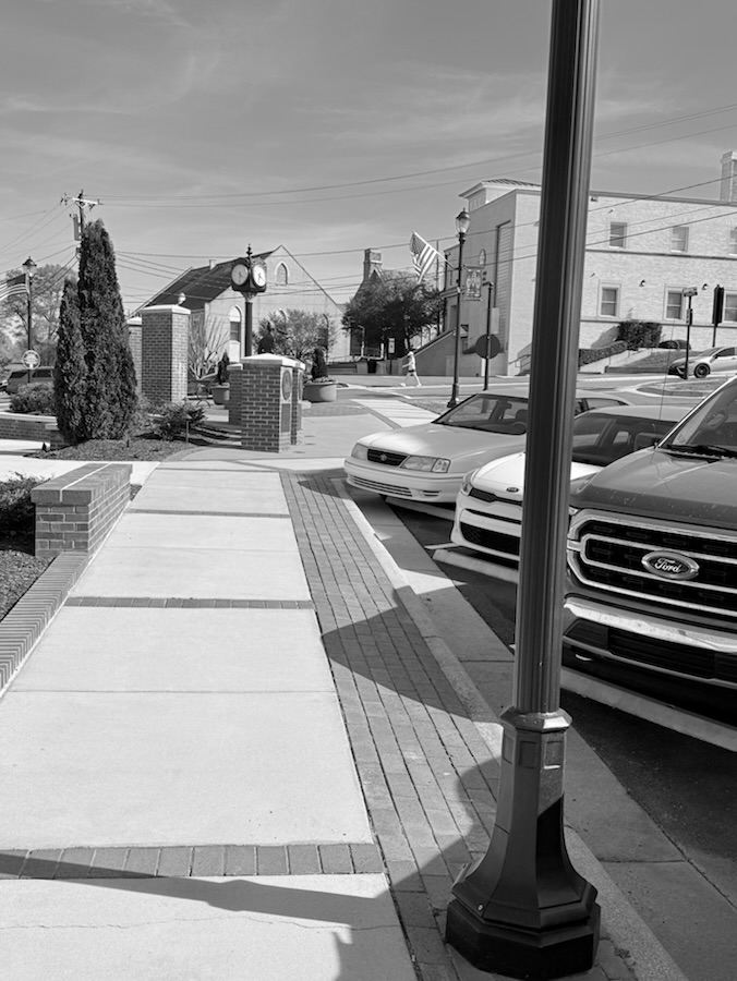
Roads and Pathways with Parked Cars and Trucks:
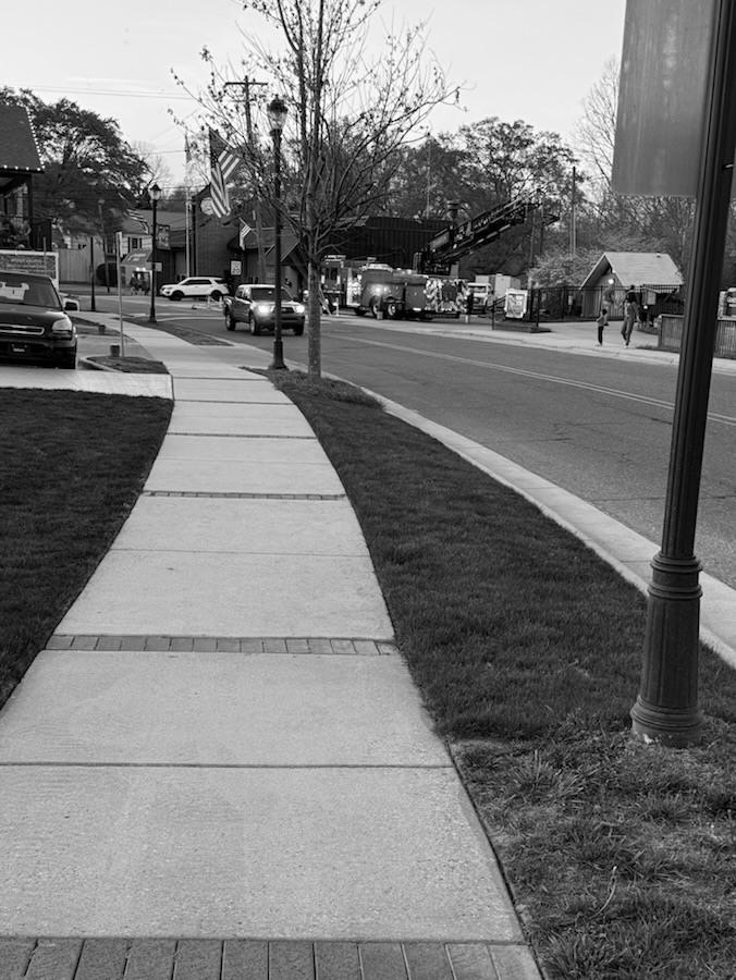
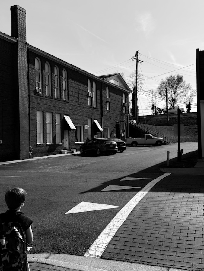
On Sidewalks and Pathways:
All photos were taken in Downtown Town of Cramerton the end of March.
Next week the theme will be CWWC: Any Which Way with Trains and/or Trolleys (or anything else on a railroad track.) This maybe in combination with Dan’s CFFC.
Check out other Which Ways by clicking on the links below.
Dan is hosting the CFFC and graciously took it over when Cee was no longer feeling the strength to continue. He has posted a wonderful tribute honoring Cee’s memory. Feel free to read it on Dan’s CFFC’s blog here.
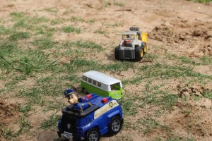
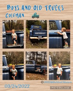
Cars and trucks come in all different shapes. Sizes, and colors. They range from toy cars and trucks to 18-Wheelers. They can be found in museums. On and off the road and sometimes on the back of a tow truck.
Evans Shell NC Transportation Museum BCS & Coleman’s Garbage TrucksJ.B. Hunt Now Hiring on the back door of a J.B. Hunt TruckParked 18-Wheeler TruckTow Truck Hauling 2 Cars & a Chevrolet El CaminoA Paw Patrol Truck, a VW Bus, and a Little Tikes Front LoaderColeman moving sand with the front loaderColeman and his trucksColeman investigating an old Chevrolet Truck
To help keep Cee’s Challenges alive including Cee’s Which Way Challenge (CWWC) check out what’s happening on the CWWC homepage here. This Friday’s CWWC theme is: Any which way with in black and white.
God Bless. Have a fantastic week. Have some Fun and enjoy the Outdoors. Thank you for visiting and sharing your time and thoughts with us. I appreciate y’all very much.
God Bless. Please keep Chris in your thoughts & Prayers. Thank you for visiting and sharing your time and thoughts with us. I appreciate y’all very much.
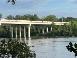
Welcome back to the Which Way Challenge. Another week has passed and we’re almost through with one-quarter (1/4) of 2025. Hope you’re all doing well and will be joining in on the Which Way Challenge .
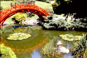
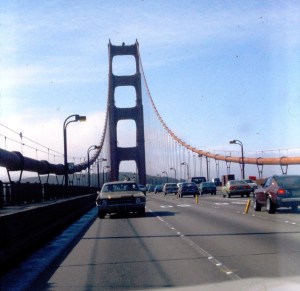
This week I have chosen a theme of Bridges. As you can see from my images the Bridges can be of a variety of types from Road Bridges to Swinging Bridges to Garden Bridges. Any type of Bridge will be suitable for this post.
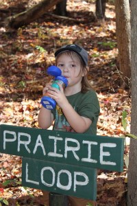
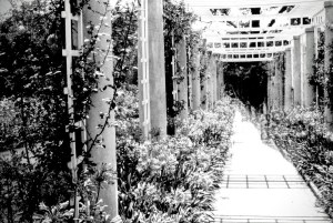
Good Day my friends and fellow bloggers. I trust y’all are well. This being the week of St Patrick’s Day, I thought I would have us show our Which Ways with Any Shade of Green in them. Posting your Which Way for this CWWC challenge could be one photo or multiple photos depending on what you desire to post. I look forward to seeing all your Which Ways with Shades of Green . Remember signs are always welcome in your Which Way Challenge posts.
Here are my entries for this week’s Which Way Challenge (CWWC): Any Which Way with Shades of Green:
Pathway at Texas Welcome Center I-20 near Waskom, Texas
Pathway at Glencairn Garden Rock Hill, South Carolina
Coleman behind Prairie Loop Sign Prairie Loop, Anne Springs Close Greenway Fort Mill, South Carolina
Nature Trail at Warlick YMCA Gastonia, North Carolina
Nicotiana tabacum Cultivated Tobacco by Pathway at Schiele Museum of Natural History Gastonia, North Carolina
Deb’s Which Way Challenge (CWWC): March Week 3 — Any Which Way with Shades of Green
Cameras: 1-2) Apple iPhone XR; 3-4) Canon EOS Rebel T3i with Canon EF-S18-55mm lens and Canon EF-S75-300mm lens; 5) Apple iPhone 14 Pro Max
God Bless. Here’s hoping y’all will share your Which Ways this week. Thank you for visiting and sharing your time and thoughts with us. I appreciate y’all very much.
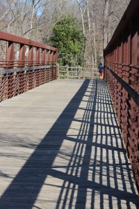
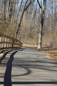
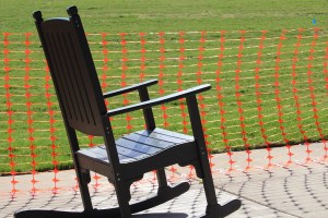
Good Day! Here it is time again for another Which Way Challenge. I hope y’all will join in on the fun. This week I have selected CWWC — Any Which Way with Lines. As you can see from my selections, the lines may be from shadows casting lines across a road, pathway, or trail. And as always signs are welcome. Be sure your Which Way is clearly visible. Have fun!
Here are my entries for this week’s challenge:
Shadow lines across a pathShadow & bridge rail linesLines from shadows & the fencing Tree lines and shadows Rocking Chair lines & netting lines with shadows
My images are all my own taken at Goat Island Park and Greenway while Coleman and I were hiking along the Trail.
Thank you to everyone who played along last week. Feel free to click on the link to check out her Which Way below.
Welcome back to the Which Way Challenge . For this week you may choose Any Which Way, just be sure your Which Ways are clearly distinguishable.
For this week I have chosen to show various Which Waysin Black and White/Monochrome. You do not need to post Monochrome Which Ways unless you desire to do so. My Which Ways consists of paved roads, pathways, sidewalks and tracks. Choose your own Which Ways, you your image, be creative, be uniquely you in your inspired style and selections.
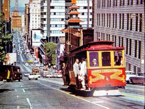
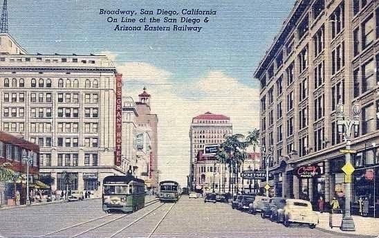
Ports O’ Call; San Pedro, CaliforniaThe Rose Garden; The Huntington Library; San Marino, CaliforniaRoad in Germany Hare Snipe Creek Greenway Trail; Raleigh, North Carolina Lejeune Memorial Gardens; Jacksonville, North CarolinaRiverbanks Zoo; Columbia, South CarolinaTrain Tracks in Lineberger Park; Gastonia, North Carolina Warlick YMCA; Gastonia, North Carolina Warlick YMCA; Gastonia, North CarolinaWarlick YMCA; Gastonia, North CarolinaPearson Ford; 12th and Broadway; San Diego, California (1941)2912 E Street; San Diego, California
That’s all for this week. Next week will be CWWC: Any which way with lines.
With much appreciation for those who entered this past week, click on the links below to check out their Which Ways.
Which Way Challenge (CWWC): February Week 4 — Any Which Way — Your Choice
God Bless. Looking forward to seeing y’all’s Which Ways. Thank you for visiting and sharing your time and thoughts with us. I appreciate y’all very much.
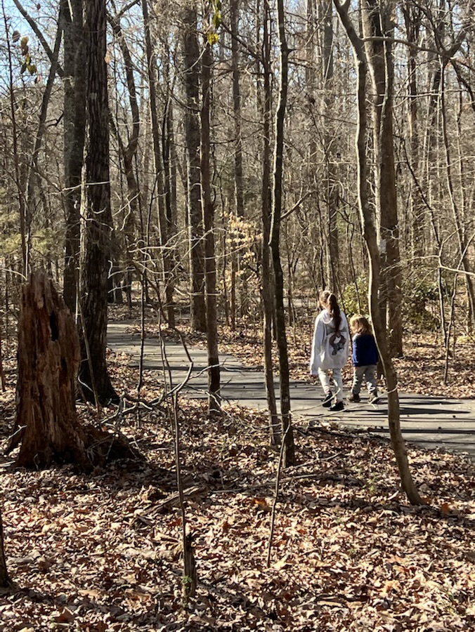
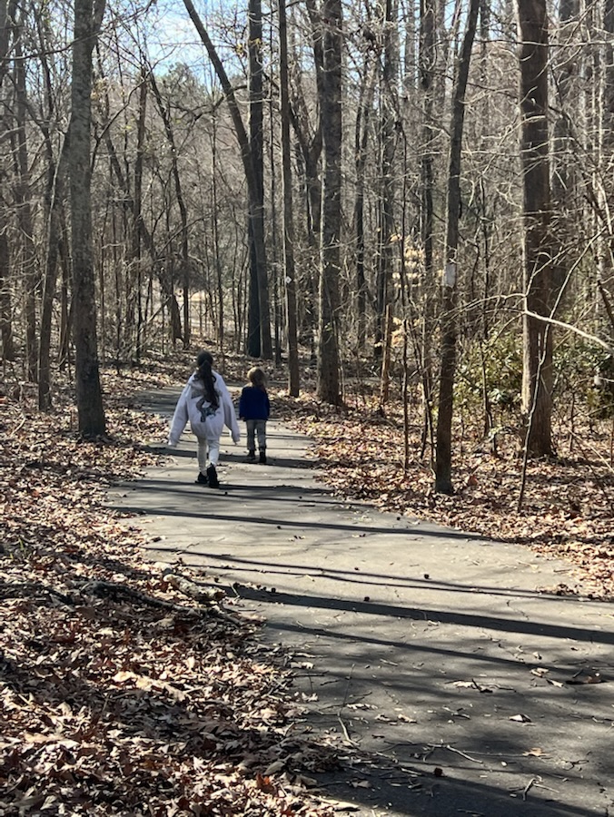
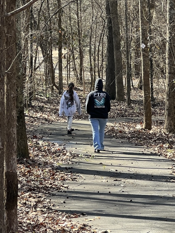
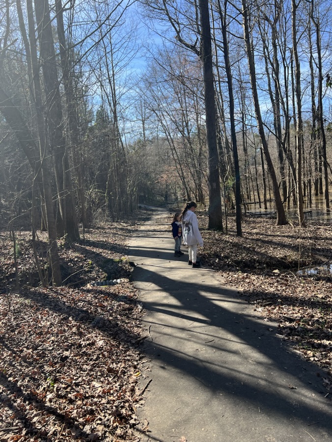
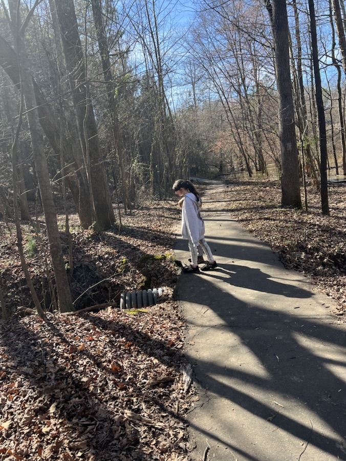
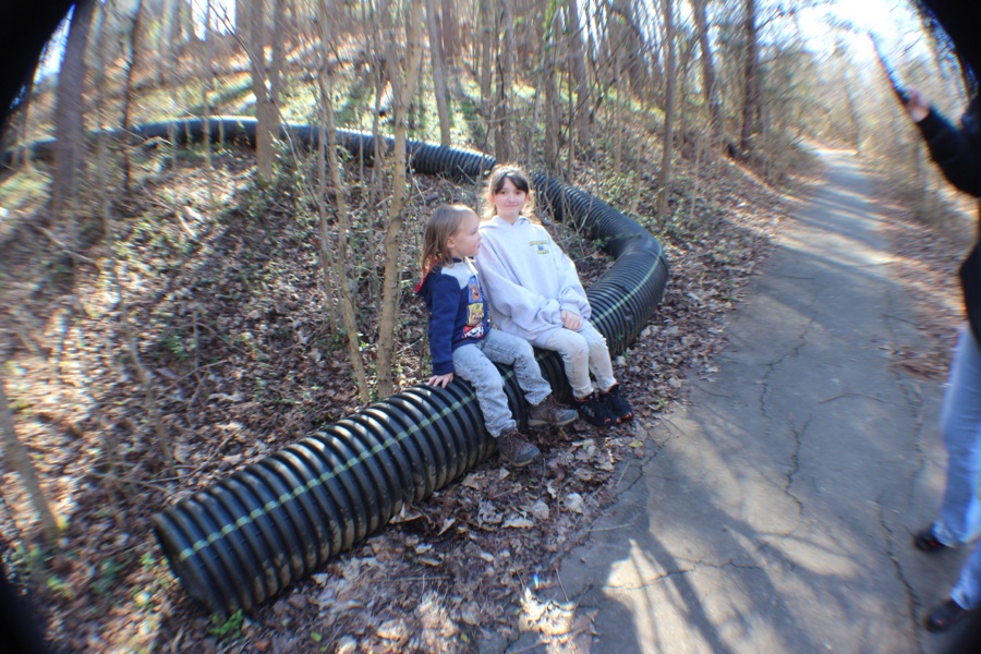
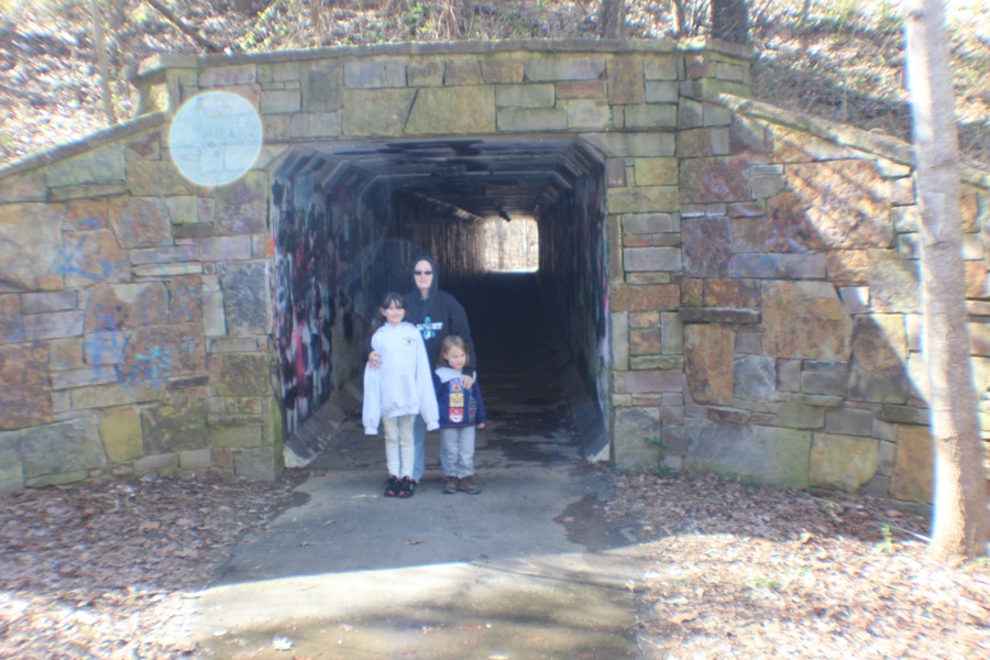
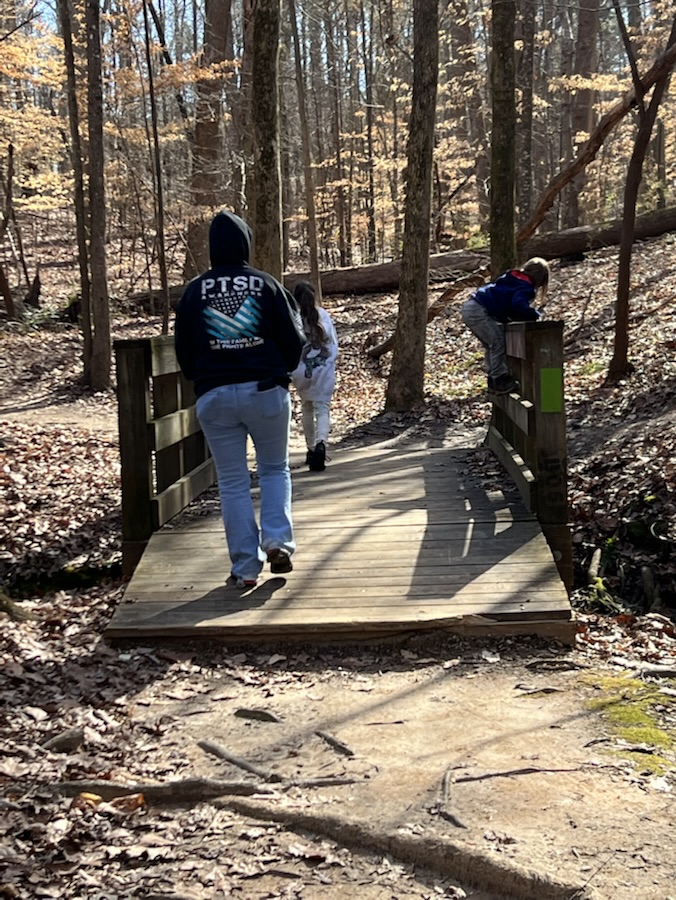
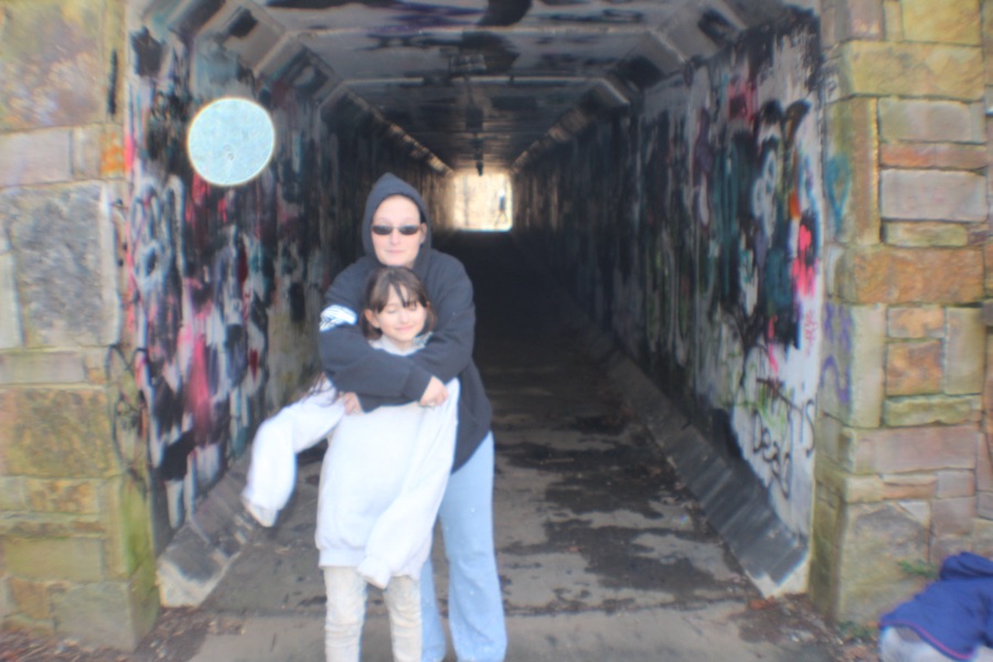
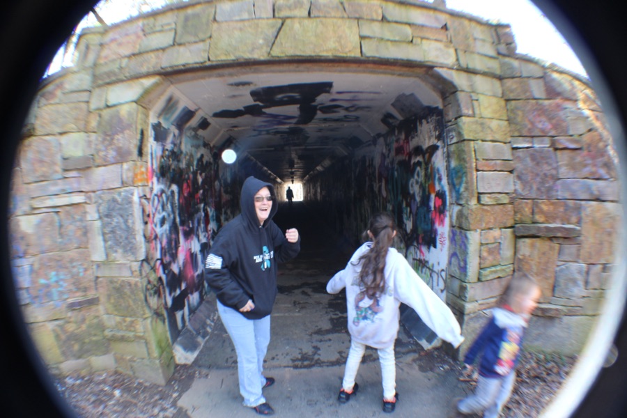
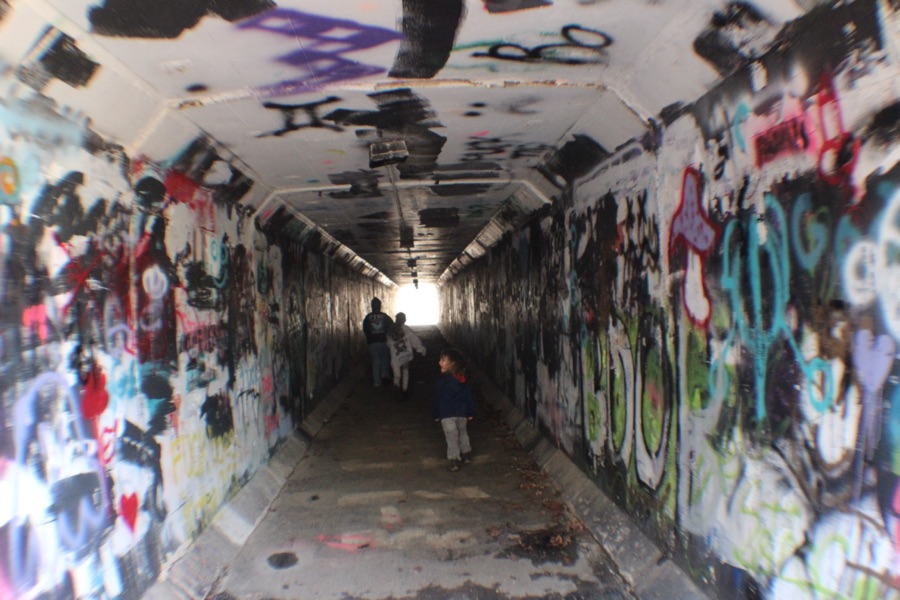
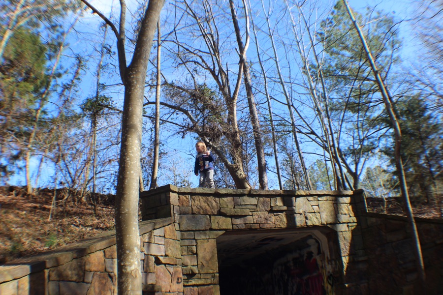
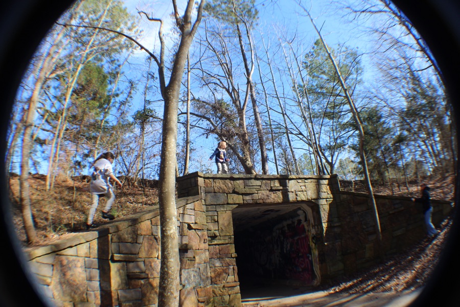
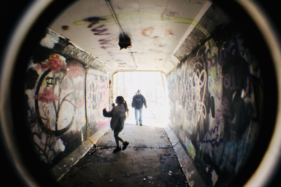
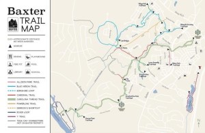
These were taken back in February of 2023 when Coleman and I convinced my daughter and granddaughter to Tag-along on one of our hiking adventures. For this hike, we chose to visit the Baxter Village Trail which begins near the Library in Fort Mill, South Carolina. Hiking along on the trail we encounter plenty of Brown and a bit of Black as well as some other colours.
The Baxter Village Trail is a part of the Carolina Thread Trail network of trails within North and South Carolina. It is also a part of a 9-mile network of trails within the Baxter Village Community. This particular trail is a 3.3-mile segment of the Thread Trail trail is moderately hilly and features several streams along its length.
Baxter Trail Map
The trail consisted of natural surfaces, boardwalks, and some pavement. The rating for the trail is moderate, but for Coleman and I it was rather easy. As you can see we wound through a forest of trees and through tunnel and for my grandchildren over the tunnel as well.
To take a look at other Which Ways from this past week check out the links below:
Camera: Apple iPhone 13 Pro and Canon EOS Rebel T3i with Canon EF-S15-55mm lens.
Location: Baxter Village Trail; Baxter Village Community; Fort Mill, South Carolina, USA
God Bless. Have a wonderfully fabulous rest of your week. Enjoy Nature. Thank you for visiting and sharing your time and thoughts with us. I appreciate y’all very much.
Welcome back to the Which Way Challenge (CWWC), I’m so glad you are enjoying this challenge. For this week I have decided to let it be your choice, Any Which Way. Just be sure your Which Ways are clearly defined. Remember signs are always welcome in your Which Ways.
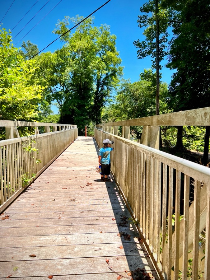
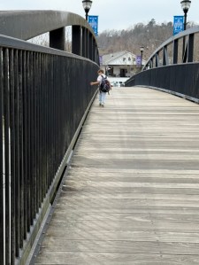
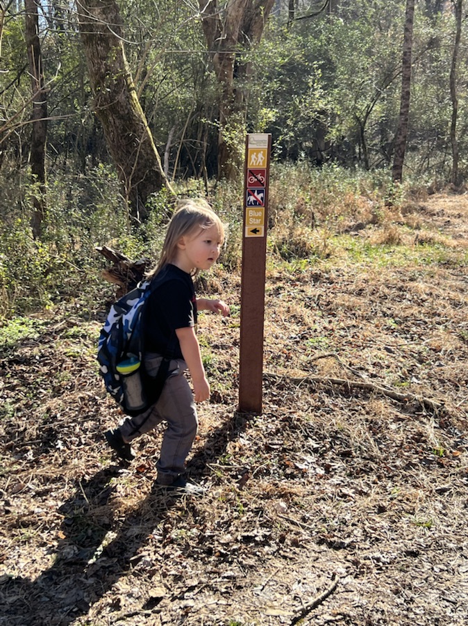
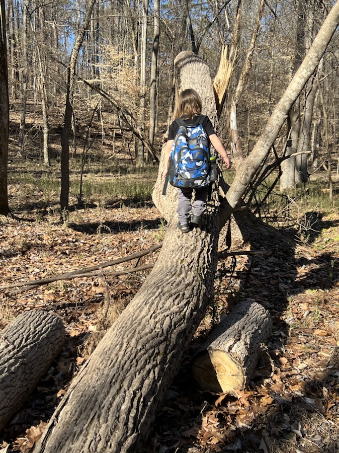
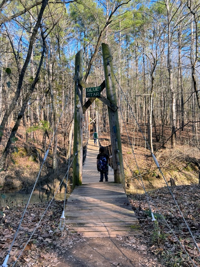
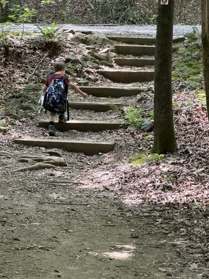
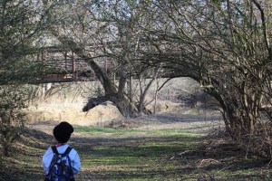
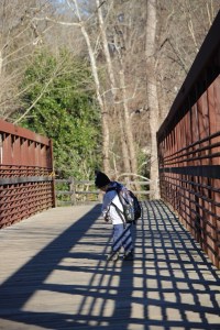
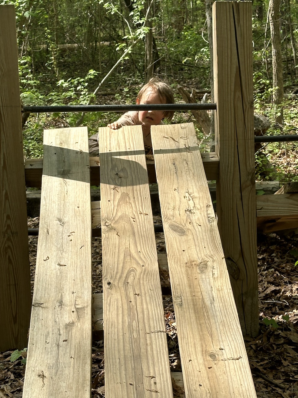
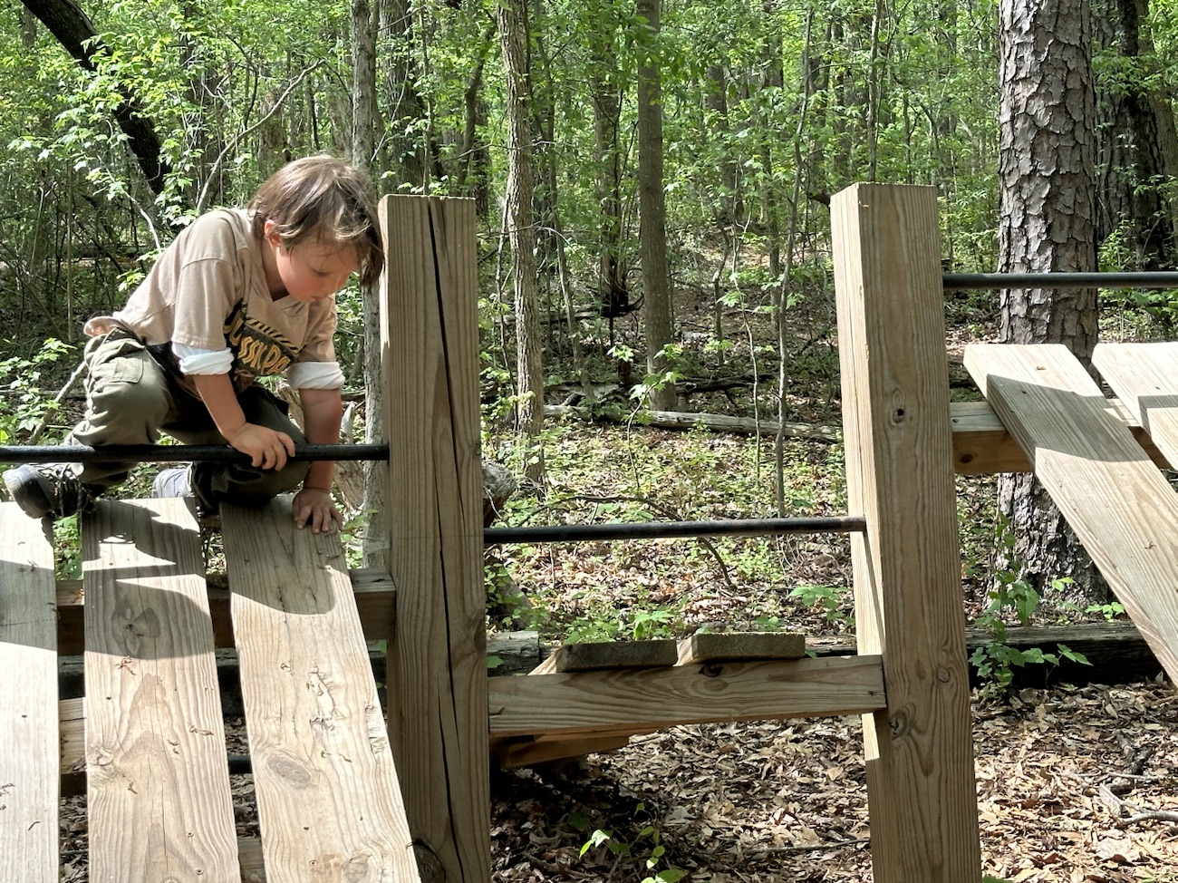
My Which Way selections for this week are my grandson, Coleman’s choices for how prefers his Which Ways. They include dirt trails, bridges, and even trees.
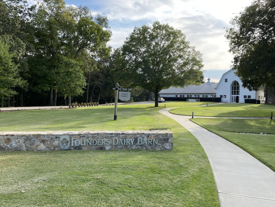
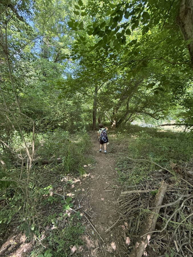
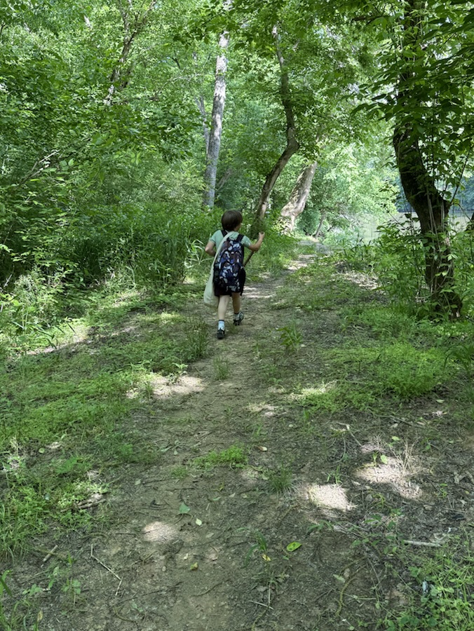
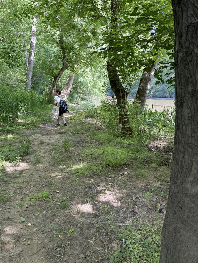
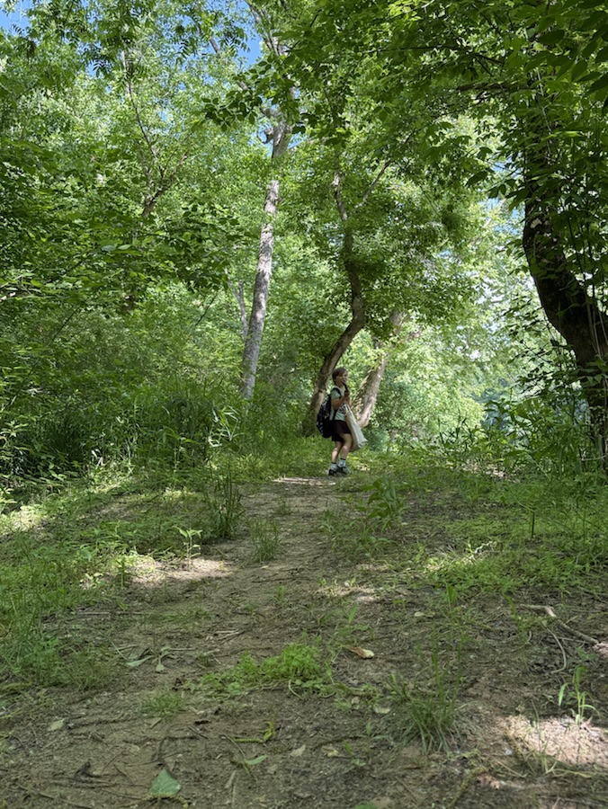
Here we are hiking at Anne Springs Close Greenway beginning on North Steele Creek Trail and crossing onto the Blue Star Trail.
We parked at the Dairy Barn Entrance down almost to the Spillway, then ventured onto North Steele Creek Trail for our hiking adventures of the day. After our fill of hiking we eventually wound our hiking around and back up to the Dairy Barn parking lot to go back home.
To learn more about Anne Springs Close Greenway and what all it has to offer click here.
I am grateful for those who shared there Which Ways last week. To view their Which Ways clink on their links below:
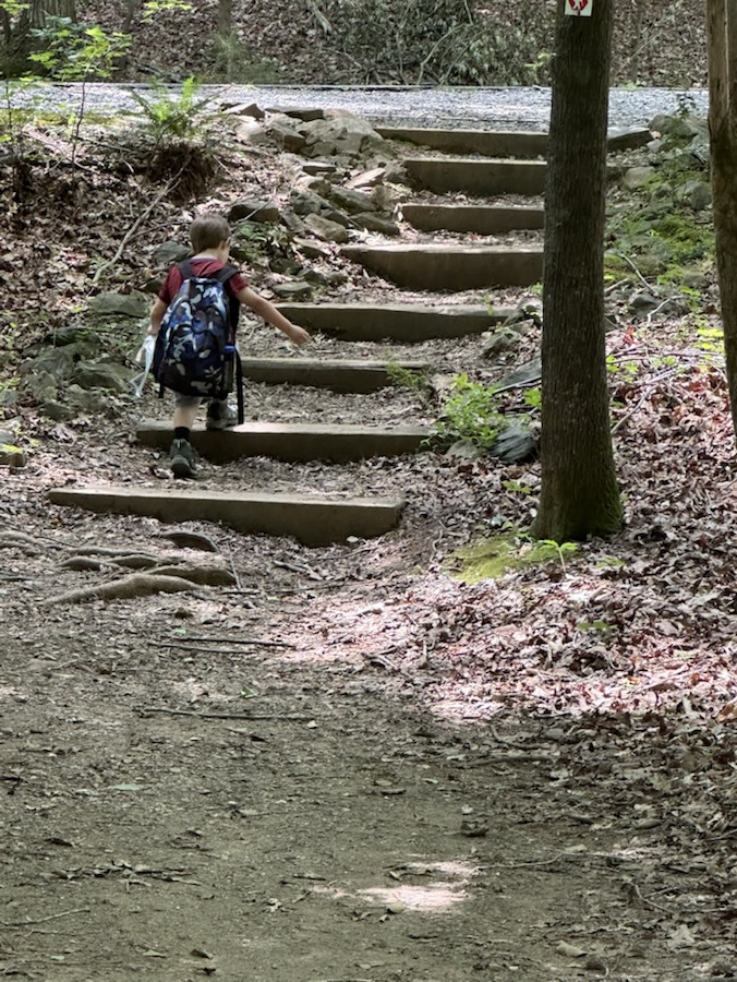
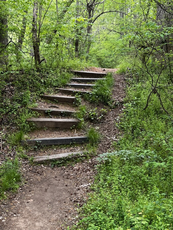
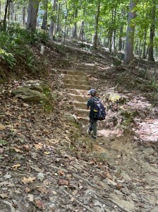
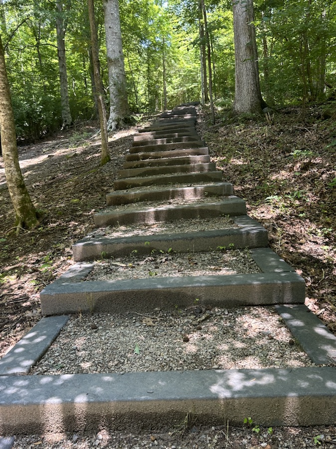
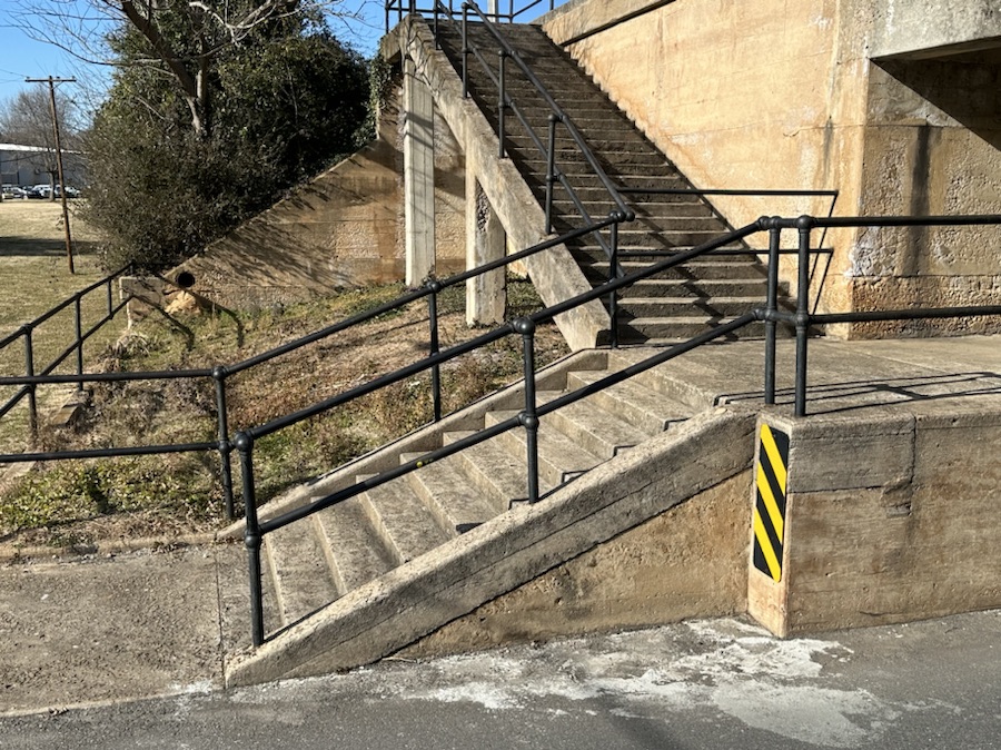
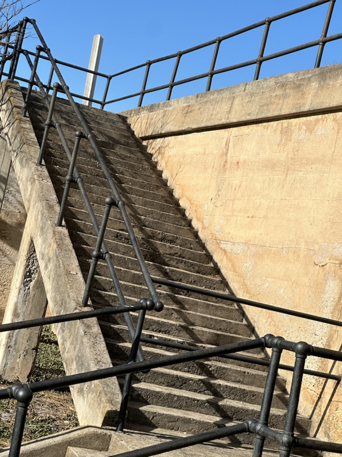
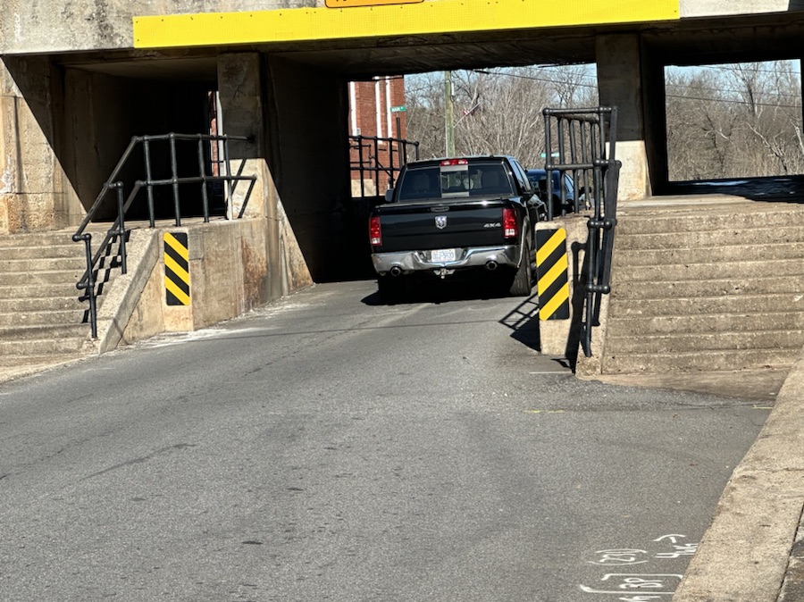
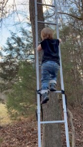
Good Day to y’all. Welcome to the fourth Which Way Challenge for 2025. This week I have chosen a theme of Any Which with Stairs, Steps, and/or Ladders. It can be anywhere you might find Stairs , Steps, or Ladders whether on a road, a trail, a mall, a construction site or any place conceivably possible for Stairs, Steps, or Ladders. As always, signs are welcome in your Which Ways.
Steps on Haigler Loop Trail in Anne Springs Close Greenway Fort Mill, South Carolina
Steps at South Fork Park Trail McAdenville, North Carolina Steps on Fern Trail Crowders Mountain State Park Kings Mountain, North Carolina Landsford Canal State Park Catawba, SC
Stairs …
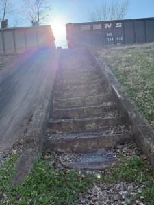
Two Sets of Stairs to travel into Town Stairs leading to Inaccessible Railroad Tracks Cramerton, North Carolina
Ladders …
Ladders at a Construction site Coleman climbing Ladder -Age 2
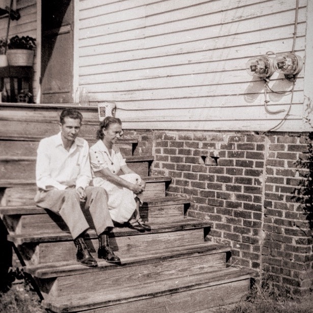
Bonus Throwback Steps …
My Paternal Grandparents Great Falls, South Carolina
Sharing your Which Ways could be one photo or several, it’s all up to you. Don’t feel obligated to share as many as I do.
God Bless. Looking forward to seeing y’all’s Which Ways. Thank you for visiting and sharing your time and thoughts with us. I appreciate y’all so very much.
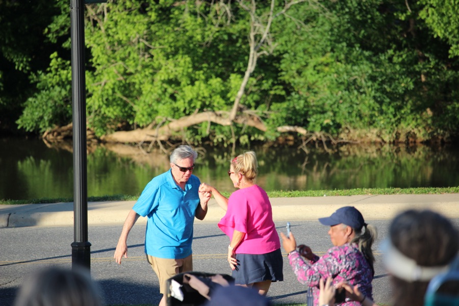
Welcome to the third Which Way Challenge for 2025. This week I have chosen a theme of Any Which Way with People in it. It can be where you capture people unaware as your out and about on the road, path, or trail. As always, signs are welcome in your Which Ways.
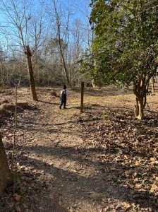
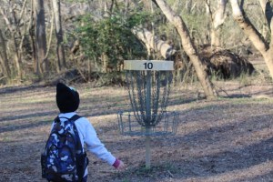
Coleman and I went hiking along the Disc Golf Trail at Goat Island Park and Greenway before the freezing cold weather it our area. The Disc Golf Trail is a natural dirt trail, mostly smooth with some tree roots and lots of leaves this time of the year.
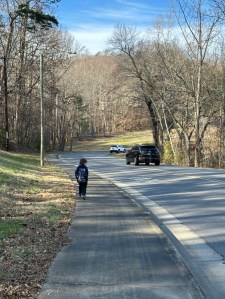
Coleman on the trail
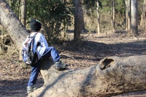
Coleman loves to lead the way and is often ahead of me. I allow some lead way as long as he’s in my line of sight.
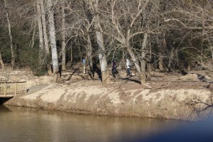
Looking across the river at another trail, we spot a small group of visitors checking out the fishing access.
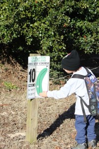
Moving along the way we came across several of the disc catchers. This is number 10 of 20 along the trail course.
Coleman checking out the disc golf sign and catcher.
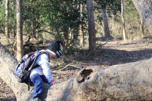
While hiking along the trail Coleman spots a downed tree and decided to climb up And investigate. He hence Pulls Up a Seat waiting for me to catch up.
Crossing over onto another section of the trail we encounter a man jogging through the trail.
A Lone Jogger
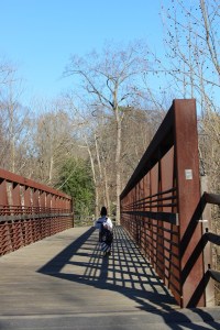
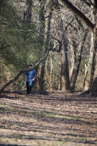
Continuing on our hike we try to maneuver around to reach the bridge.
Coleman heading towards the Bridge
We managed to reach the bridge and were able to venture on towards where we began.
Coleman crossing the bridge & noticing the shadows
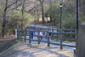
As we near the end of the bridge heading back to the entrance, we see a family approaching our way. One of the little girls is attempting to ride her bike up the hill.
I am looking forward to seeing y’all’s Which Ways with People. I am grateful for those who have chosen to participate and support this challenge. Won’t you take the initiative and join the Which Way Challenge? For more information on the Which Way Challenge Check out the new Which Way Challenge Page here.
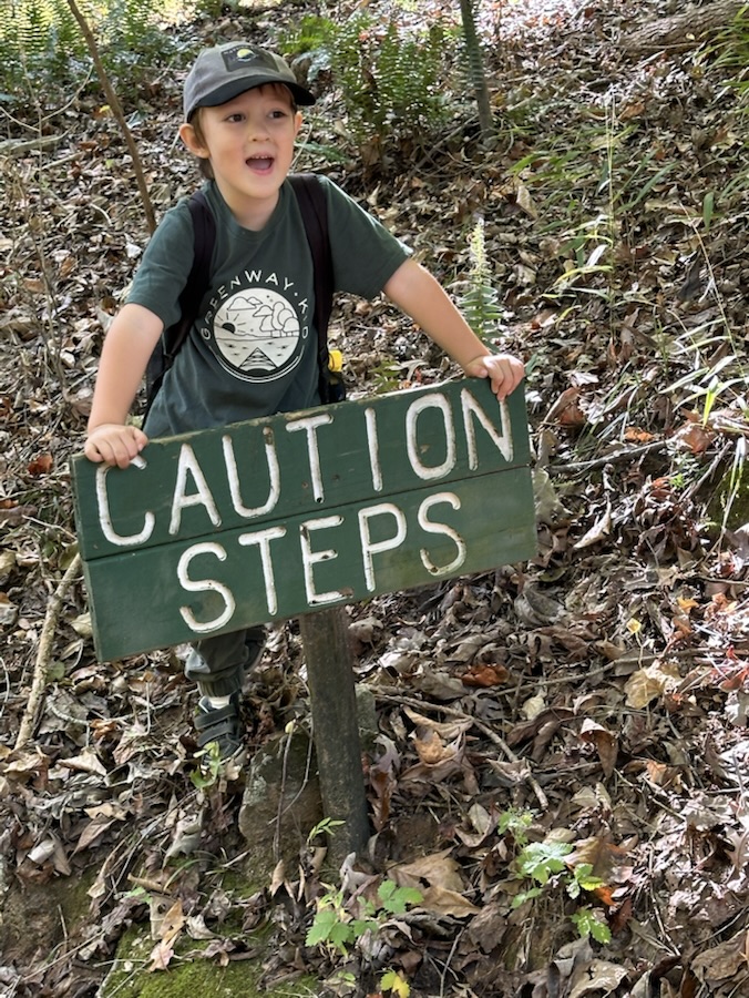
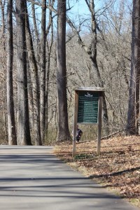
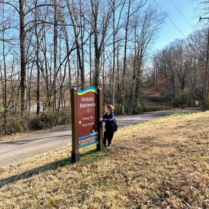
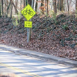
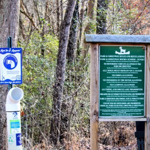
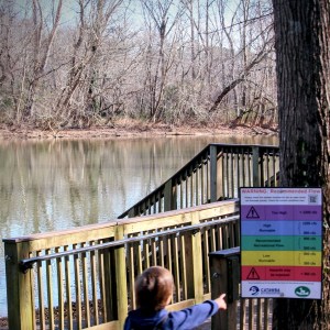
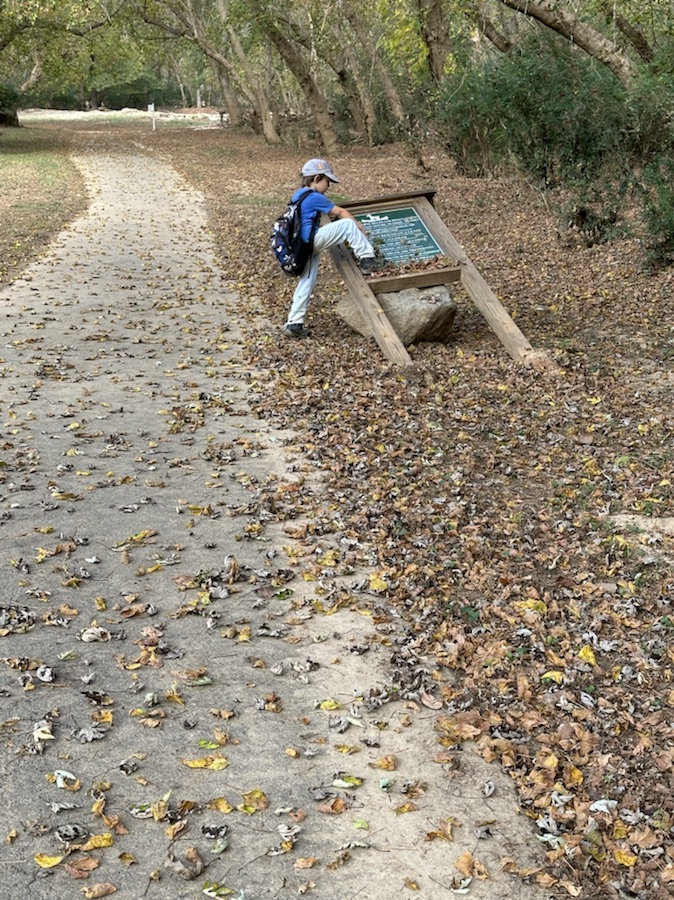
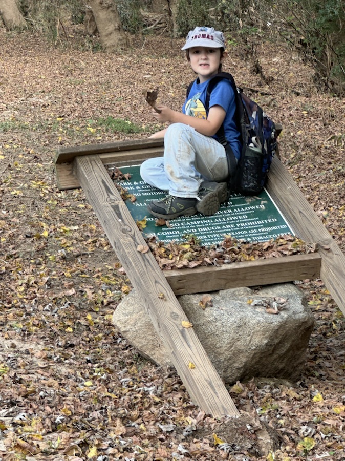
Signs can be found on almost any road, dirt road, trail or greenway. When Coleman and I go hiking we usually see a sign or two. It doesn’t matter if we are walking through town or hiking along a trail or greenway, signs help guide the way or possibly warn of danger. No matter the sign or location one can gather pertinent information and notice the different geometric shapes the signs represent.
Here are my entries for this week …
On the Road to the Historic Baltimore Fishing Pier
Share the Road Sign on Cramer Mountain Road
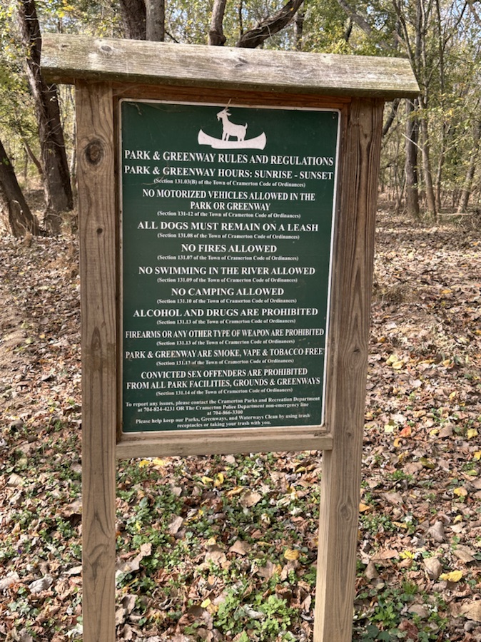
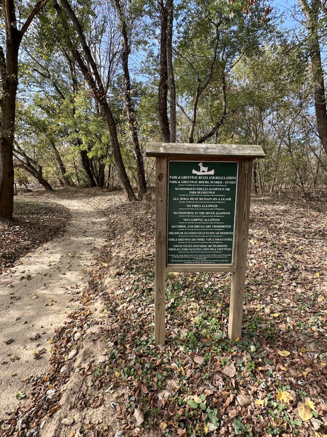
Fishing Line Recycling Bin Sign on left Park & Greenway Rules and Regulations Sign on right located on side of entrance to the Historic Baltimore Fishing Pier
Warning: Recommended Flow by the Catawba Riverkeeper Sign by the Ramp to the Fishing Pier
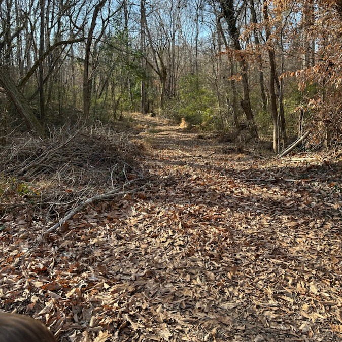
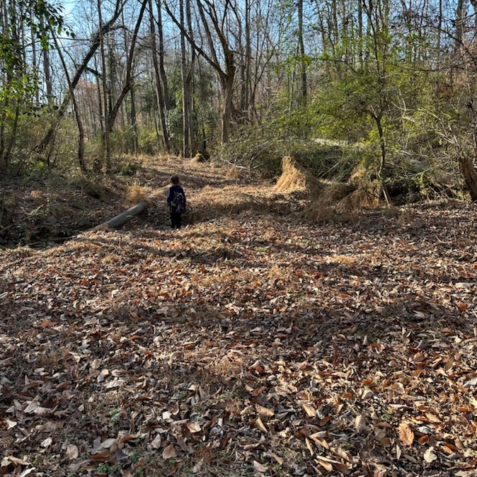
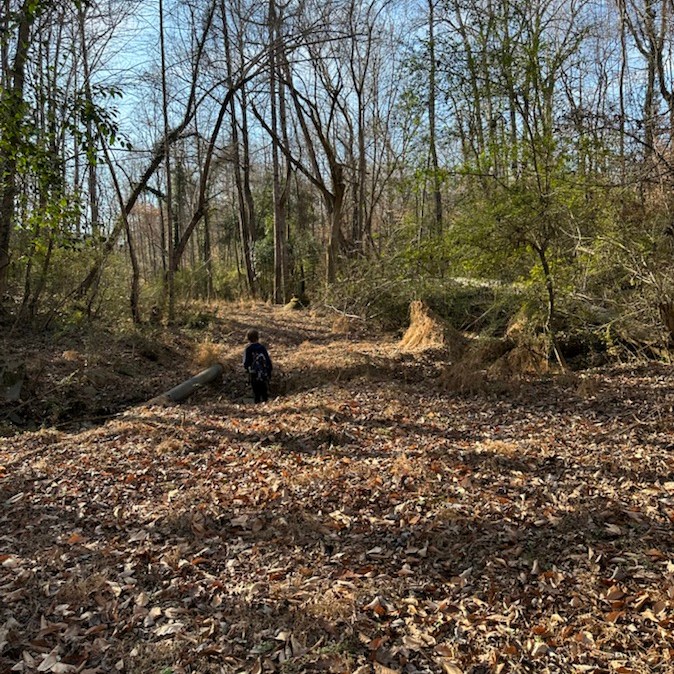
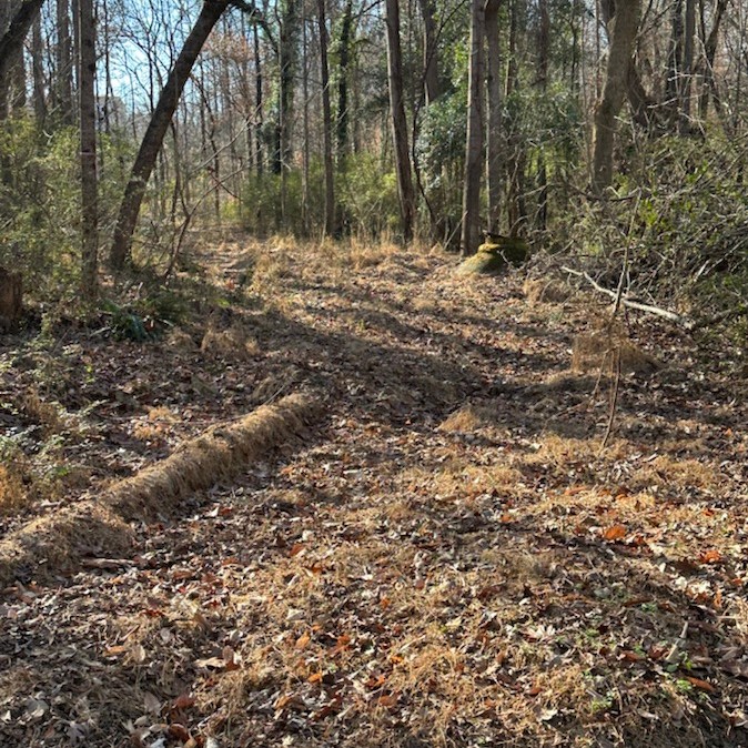
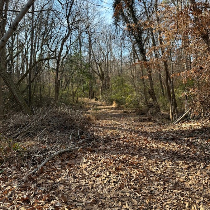
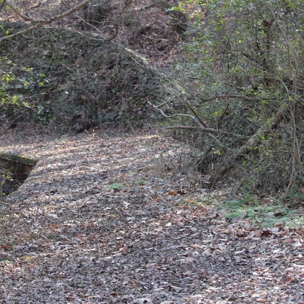
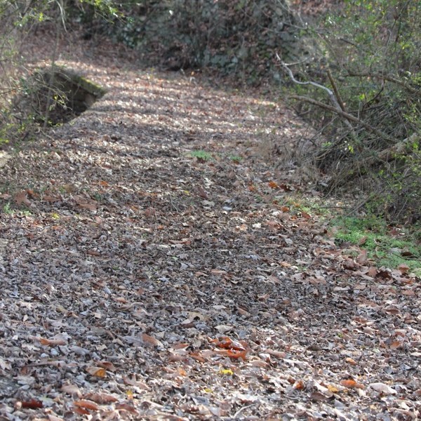
This week’s Which Way Challenge theme is Any Dirt roads or dirt pathways or trails. You may post one or as many as you like, just make sure your Which Way is clearly distinguishable. Remember signs are always welcome.
Here are my Which Ways for this week …
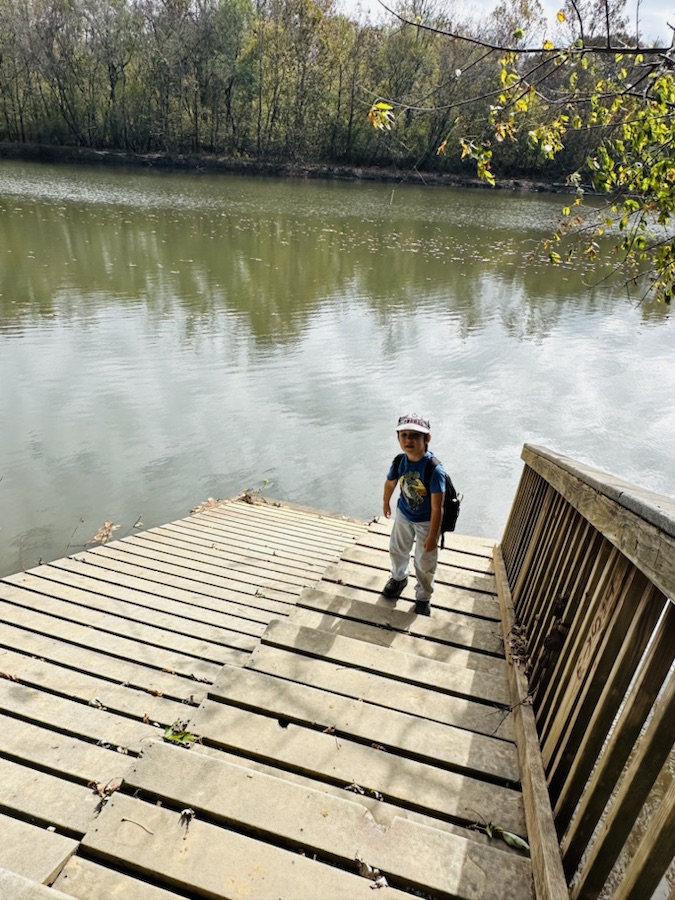
These are leaf covered dirt trails at the Historic Baltimore Fishing Pier location in Cramerton, North Carolina. Coleman and I hiked them, on Christmas Day, to see where they’d take us. Unfortunately, due to unrepaired damage to the trails from Hurricane Helene, parts of the trails are unrestored and nonfunctional at this time.
This Bridge was barricaded declaring it was unsuitable and hazardous rendering it off-limits to hikers/pedestrians.
Many thanks to WoollyMuses, for their Which Ways. You might want to check out their Silver and/or Gold Which Ways.
Cameras: 1-5) Apple iPhone 14 Pro Max; 6-7) Canon EOS Rebel T3i with Canon EF-S55-250mm lens and Altura NP filter attachment.
Location: Historic Baltimore Fishing Pier Trails; Cramerton, North Carolina, USA
God Bless. Thank you for visiting and sharing your time and thoughts with us. Hope to see your Which Ways showing your Dirt roads or dirt pathways or trails. I appreciate y’all very much.
The Which Way Challenge (CWWC)is all about capturing the means we travel from place to place such as roads, walkways, trails, and rails. The roads could be paved or unpaved, gravel, or dirt. Walkways could cover sidewalks, hallways, or pathways. Trails are paths we travel through Greenways, Local, State, or National Parks. Also permissible are any kinds of signs and any bridge angle. Remember to ensure your “Way” is visible and the main focus of your photo.
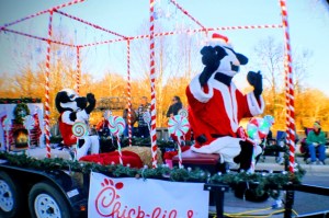
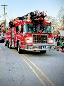
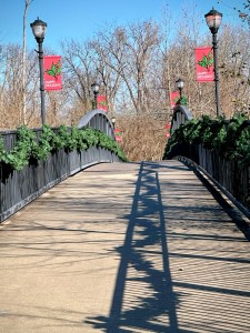
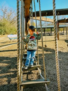
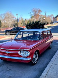
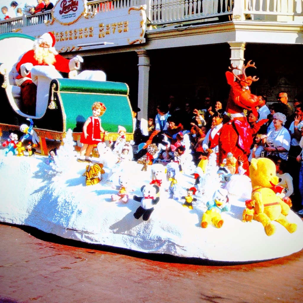
This week’s Theme for the Which Way Challenge (CWWC) is Any Which way with the colors of Red and Green.
My Which Ways this week are from the Cramerton Christmas Parade and Goat Island Park and Greenway. Remember signs are always welcome in the Which Way Challenge.
Letters to Santa North Pole
Chick-Fil-A Parade Float
Cramerton Fire Engine Ladder 41
Goat Island Bridge Cramerton, North Carolina
Coleman’s Which Way Goat Island Playground
1962 Chevrolet Corvair 700 Wagon with Christmas Tree on Rooftop
Please make sure your which way is the main object of your photo. Thanks.
Next week’s Which Way theme will be CWWC: Which way with the colors of Silver and Gold.
Location: Downtown Parade Route; Town of Cramerton; Cramerton, North Carolina, USA
God Bless. Season Greetings. Enjoy your holidays. Remember the Reason for the Season. Thank you for visiting and sharing your time and thoughts with us. I appreciate y’all very much.
Hi! Let me introduce myself to y’all. My name is Debbie, however, I go by Deb. I post several times a week on my blog, Gfpacificbee’s Insights & photography.
Many of you may not know that while Cee has been under the weather, I have been continuing the Which Way Challenge. I have recently officially taken over Cee’s Which Way Challenge. I will continue the Which Way Challenge with a theme each week. For now, I will be leaving it as CWWC, but may change it later if I feel it to be for the betterment. I will try to begin posting the upcoming themes in the coming weeks.
Here are a general list of upcoming themes for December:
CWWC: Any which way with people
CWWC: Which way with a Christmas holiday theme
CWWC: Which way with the colors of Red and Green
CWWC: Which way with the colors of Silver and Gold
Possible Upcoming Topics:
CWWC: Dirt roads or dirt pathways or trails
CWWC: Roads with any signs
CWWC: Which way with the colors of brown or black
CWWC: Any which way with people in it
CWWC: Roads with vehicles and or traffic
CWWC: Any which way with in black and white
CWWC: Any which way with lines
CWWC: Any animal in your which way
I plan on posting my Which Ways on Fridays, however, sometimes life interferes with the best laid plans. It might be late but it will be posted by late Friday evening/Early (Around Midnight) Saturday morning at the latest.
This week’s theme will be CWWC: Any which way with people. I will be looking for y’all to join me as I lead the Which Way Challenge.
God Bless. Thank you for welcoming me as I lead the Which Way Challenge. Thank you for sharing your time and thoughts with me. I appreciate each and every one of y’all very much.
I’ve missed Cee so much and know this is a difficult time for her and Chris. Praying for strength and comfort for them both. I’ve been trying to keep up with the Which Way Challenge even though Cee is unable to do so. I encourage everyone who wishes to show Cee our Which Ways. Just post any Which Way you desire and link up to Cee’s Which Way Challenge.
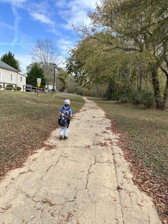
This week I am again posting a Which Way My Wayshowing Which Ways Coleman and I discovered in Riverside Park and Greenway. My grandson, Coleman and I are beginning to roam around our new neighborhood and town investigating what interesting things and places we can find in the area. Riverside Park and Greenway is just a short walking distance away from our new home. Here are a few shots from our walk through Riverside Park and Greenway.
Coleman and I left our home and turned right out of the driveway; walked to the end of our street (which is curved downhill) and then proceeded to walk across the street onto the Carolina Thread Trail.
On the way to Riverside Greenway
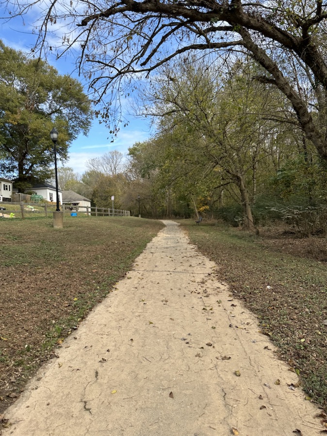
The Carolina Thread Trail leads into the Riverside Greenway Trail. We walked the entire length of the Riverside Greenway Trail and even a little bit of off trail hiking. During parts of the hike we were walking parallel to the South Fork Catawba River.
It was a fun enjoyable relaxing day out discovering a (new to us) local trail. Hope y’all have a wonderfully funtastic weekend.
I’ve been missing Cee’s posts. I pray she is doing alright. This week I am again posting a Which Way My Wayshowing Which Ways in My New Neighbourhoodand Town. My grandson, Coleman and I are beginning to roam around our new neighborhood and town investigating what interesting things and places we can find in the area. Here are a few shots from our walk through our new town.
I’ve been missing Cee’s posts. I pray she is doing alright. This week I am again posting a Which Way My Wayshowing Which Ways in My New Neighbourhood. My grandson, Coleman and I are beginning to roam around our new neighborhood investigating what interesting things and places we can find in the area. Here are a few shots from yesterday’s walk through the neighbourhood.
This week Cee is allowing us to post any type of road, path, step, bridge or sign. I have chosen to post some paths, steps, dirt trails, and wooden paths and bridges along the Lake Nature Trail at Andrew Jackson State Park. I took these photos when was camping there the summer after my mom passed. It was a relaxing, peaceful, meditative experience of communing with nature.
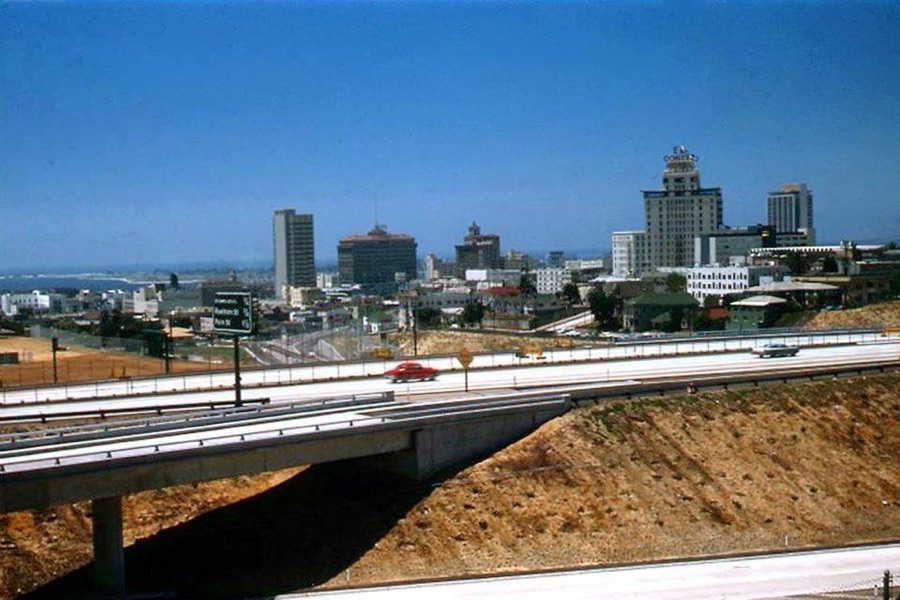
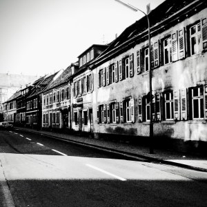
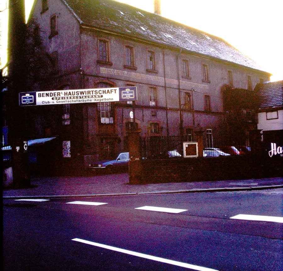
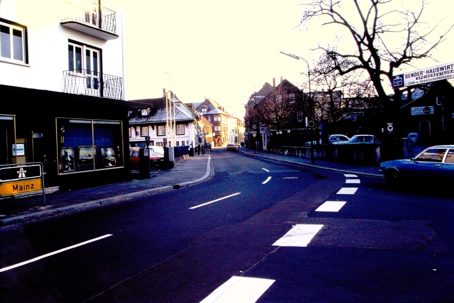
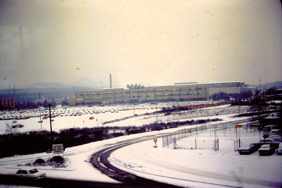
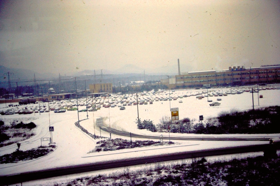
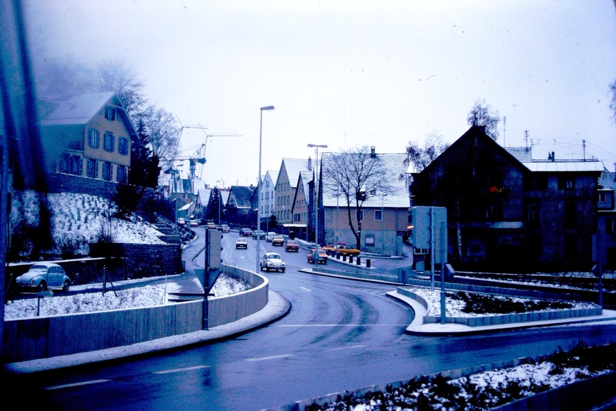
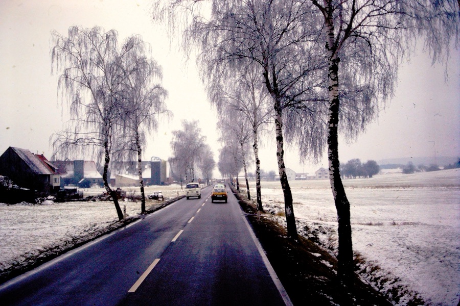
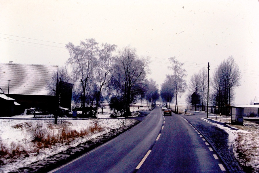
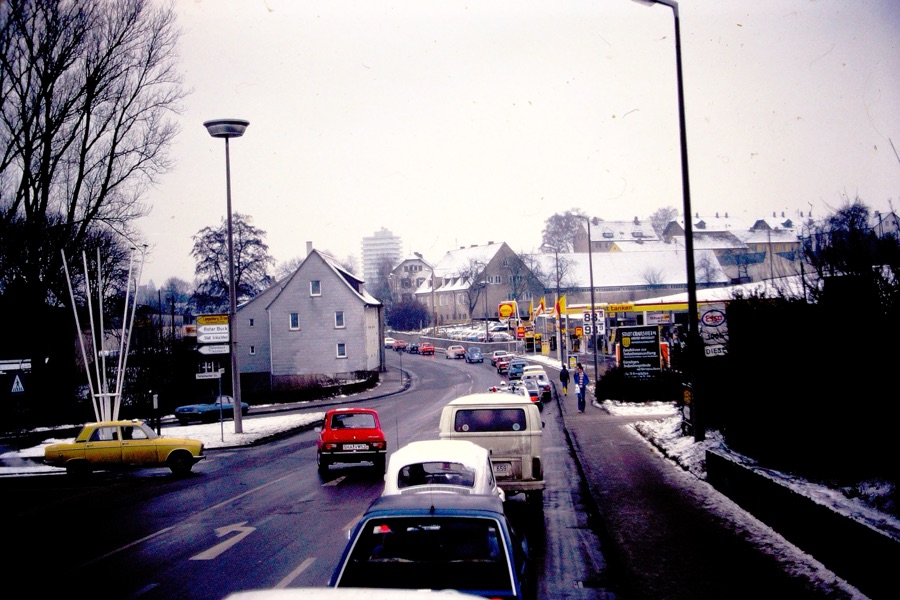
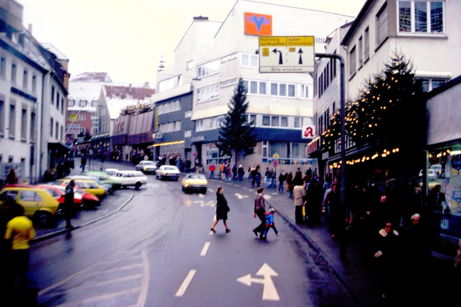
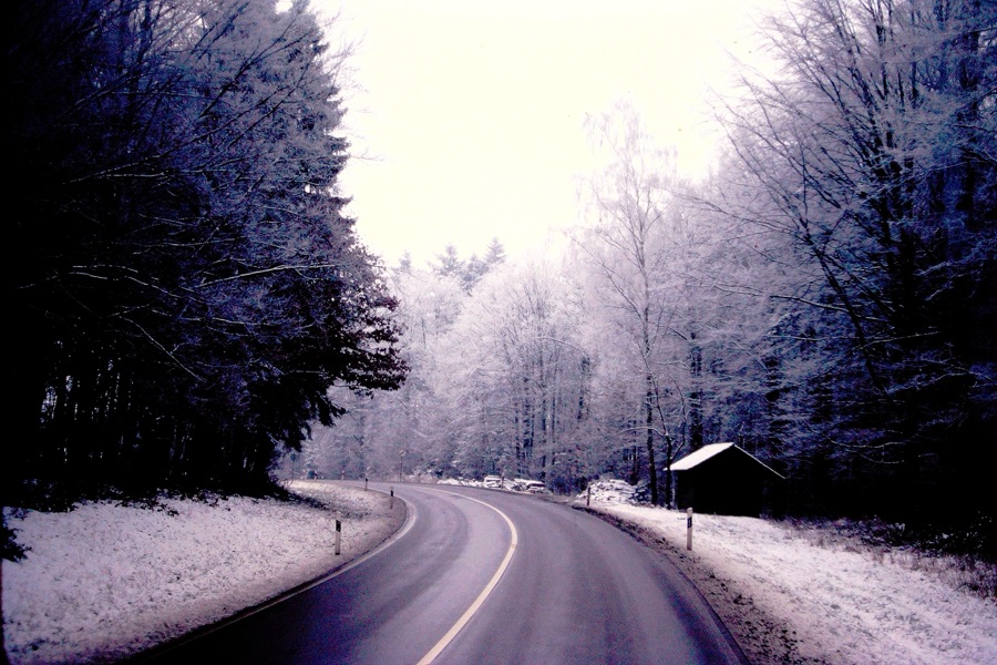
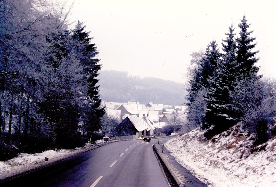
For this the last week of September and I light of the Effects of Hurricane Helene, I have chosen to choose a theme of Any Paved Roads where I am focusing on Paved Roads in Germany. I am challenging everyone to participate in this week’s Which Way Challenge by sharing your Paved Roads.
In the Winter of December 1978/January 1979 my parents flew over to Germany to visit my brother & his family. [My brother was stationed there for a few years while serving in the United States Air Force.]
Shown above are just a few of the Paved Roads my parents rode on while visiting with my brother in Germany. What kind of Paved Roads will you find to share with us? I hope y’all will share your Which Ways with us. Looking forward to Cee taking the Which Way Challenge back on in October.
Thank you for visiting and sharing my parents memories with me. They enjoyed their time in Germany, however, I do not recall seeing their slide photos before I began digitizing my Dad’s slides.
For this week in doing Cee’s Which Way My Way I’m choosing a theme of Any Which Way. Basically Any Which Way you choose; be sure we can see your Which Ways Clearly. And as always, signs are welcome anytime. I’d love for y’all to join me in posting your Which Ways you have Chosen to Share. Remember to link your Which Way posts to Cee’s Which Way hereor if you wish you can link to My Which Way here.
Road Trippin’ USA #6
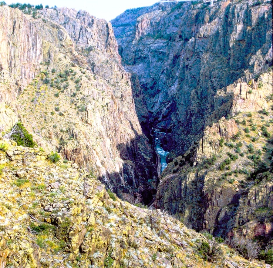
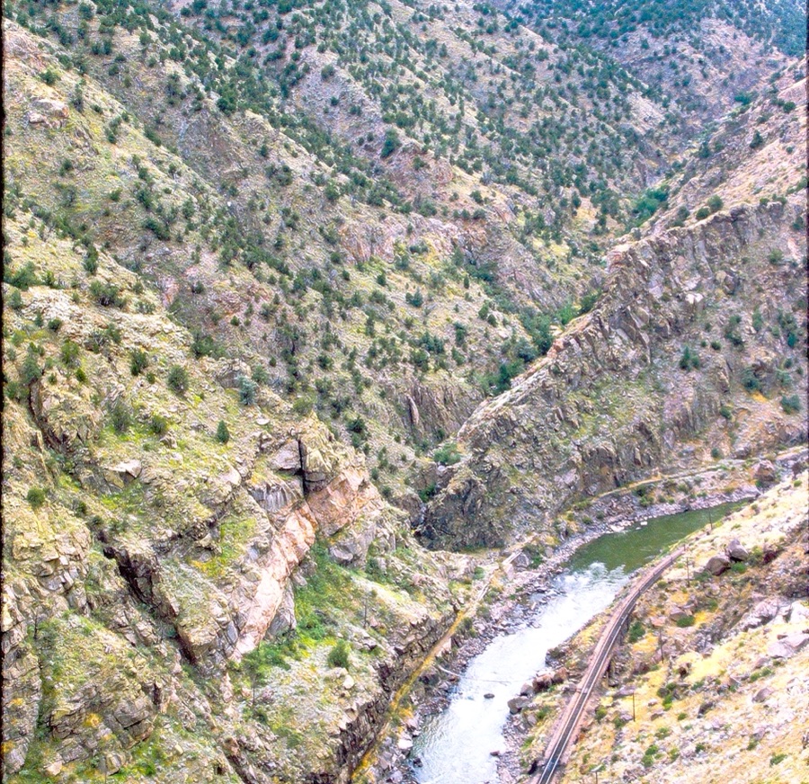
Black Canyon of the Gunnison National Park
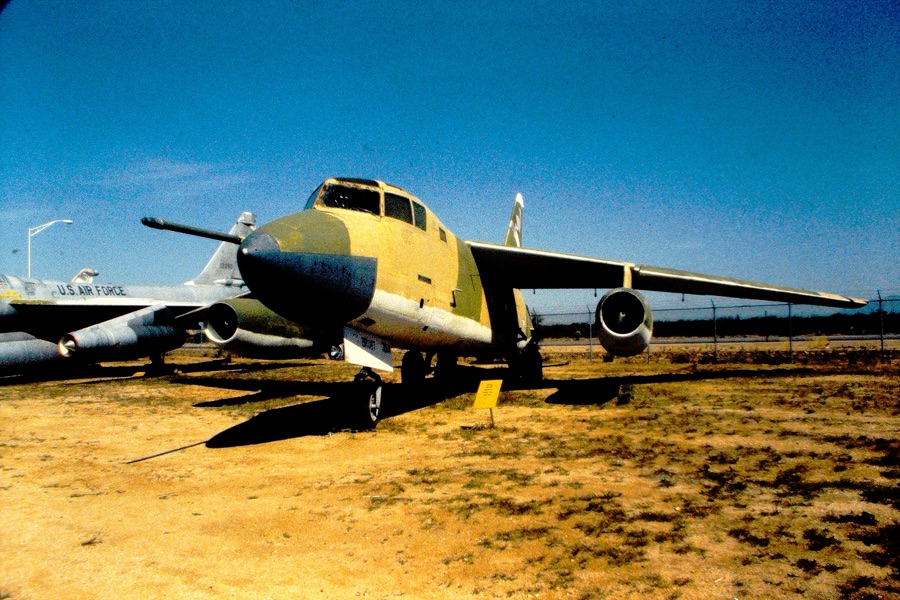
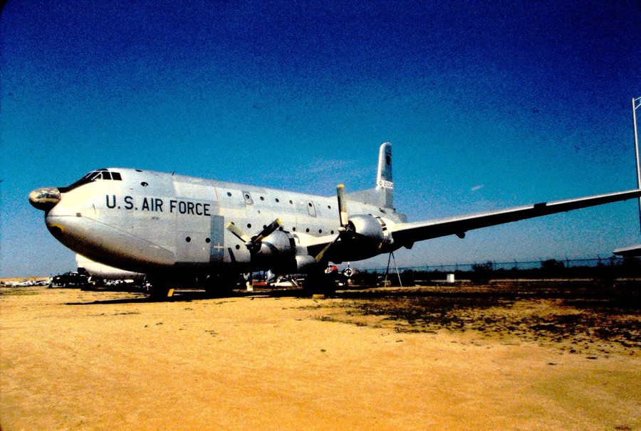
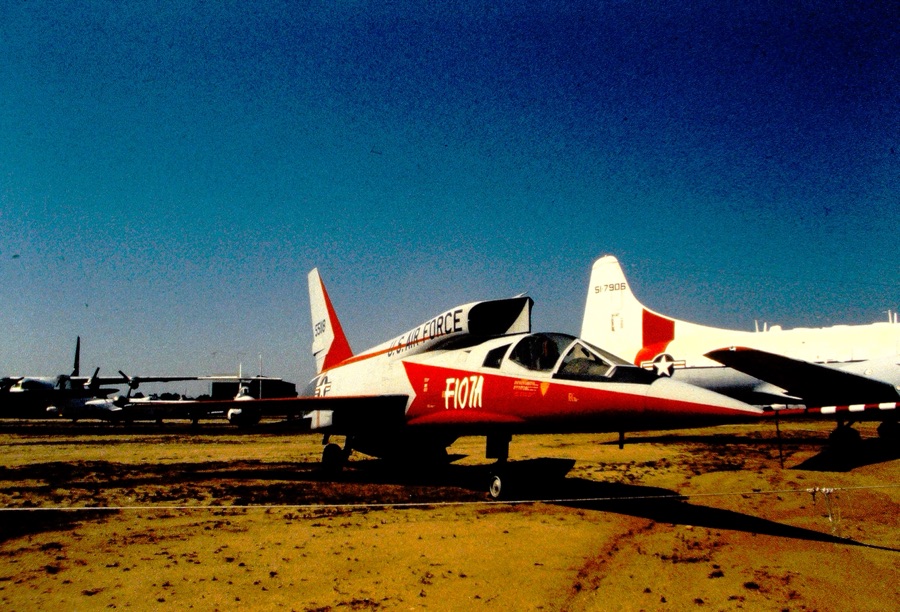
Pima Air & Space Museum
And Westward
In the Summer of 1985, my parents went Road Trippin’ across the United States of America. They began their Road Trip leaving from their home in San Diego, California. They always planned what or whom they wanted to visit ahead of time.
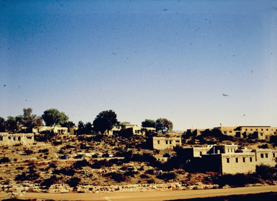
This week I’m continuing with their Road Trippin’ adventures for My Which Way of Cee’s Which Way Challenge in Tucson, Arizona at the Pima Air & Space Museum.
Last week we saw some of the sights my parents visited at the U.S. Air Force Academy. When they left Colorado behind to continue on their Road Trippin’ USA adventures, they drove south into New Mexico before continuing westward towards their home in San Diego, California.
On their way driving south to New Mexico, they stopped at Black Canyon of the Gunnison National Park in Montrose, Colorado.
Here are a couple of photos of Black Canyon of the Gunnison National Park they viewed from the North Rim of the Canyon. I’m sure besides enjoying the views, they were glad to stretch the legs before they proceeded driving again.
Chasm View on the North RimOak Flat Loop TrailBlack Canyon of the Gunnison National Park
Next stop for them was to visit the Carlsbad Caverns National Park in Carlsbad, New Mexico.
Buildings at Carlsbad Caverns National ParkEntrance to Carlsbad Caverns Carlsbad Caverns National Park
Onward and Westward, they continued driving westward upon leaving Carlsbad, New Mexico with one final stop before finishing their Road Trippin’ USA adventure. Their next and final stop before arriving back home was to tour the Pima Air & Space Museum in Tucson, Arizona.
Thank you for tagging along with me on my parents Road Trippin’ USA Adventures. Cee will be back soon (I think beginning in October). Please continue showing us your which way adventures. Have a fantastic weekend.
For this week in doing Cee’s Which Way My Way I’m choosing a theme of Any Which Way. Basically Any Which Way you choose; be sure we can see your Which Ways Clearly. And as always, signs are welcome anytime. I’d love for y’all to join me in posting your Which Ways you have Chosen to Share. Remember to link your Which Way posts to Cee’s Which Way hereor if you wish you can link to My Which Way here.
Road Trippin’ USA #5
Which Ways
St. Louis, Missouri
And Westward
In the Summer of 1985 my parents went Road Trippin’ across the United States of America. They began their Road Trip leaving from their home in San Diego, California. They always planned what or whom they wanted to visit ahead of time.
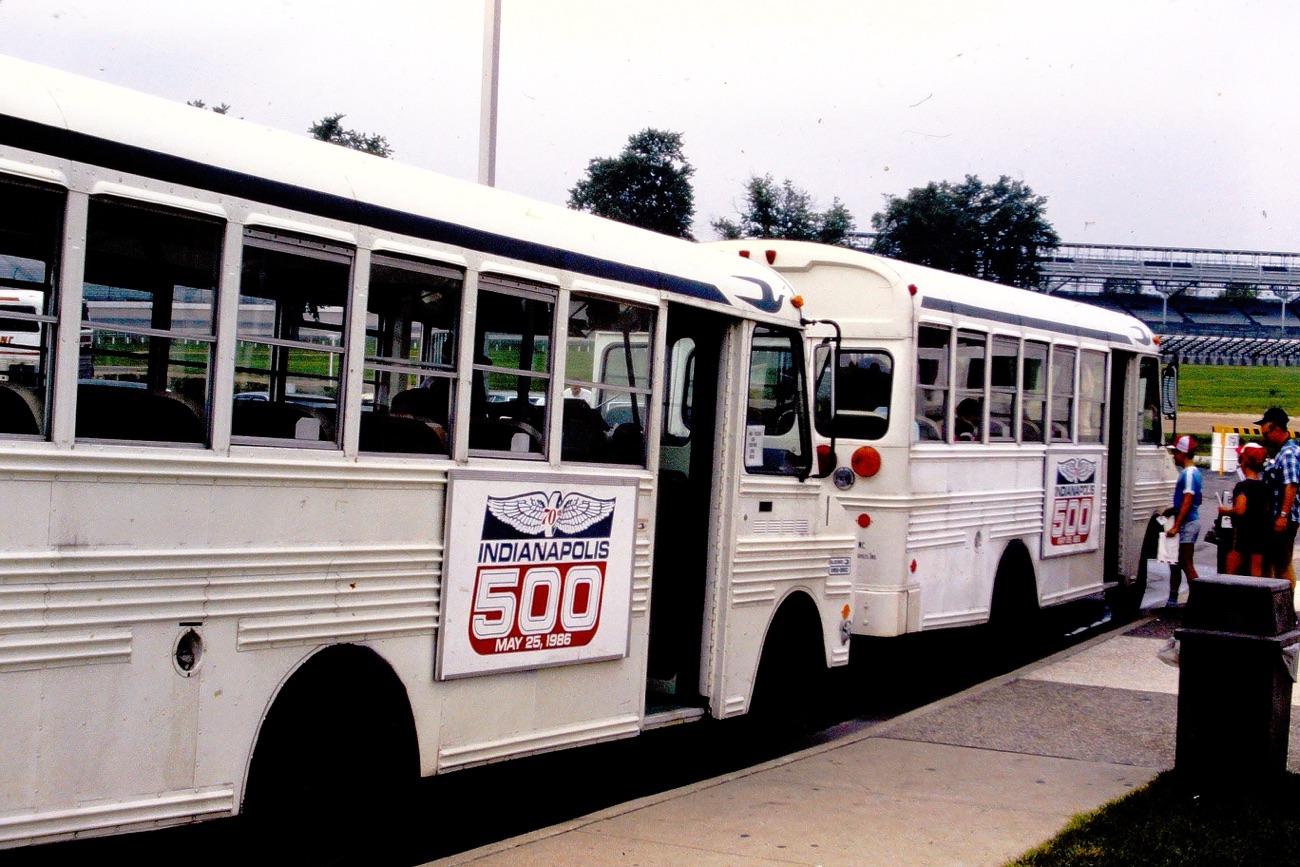
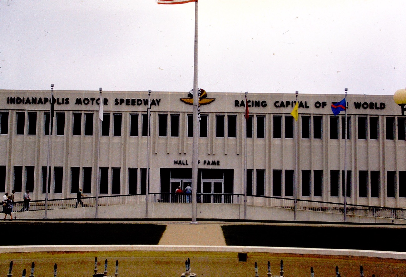
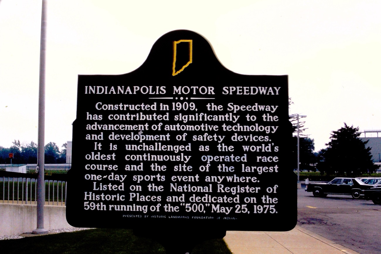
Last week we saw my parents driving southbound from Indianapolis, Indiana after they completed their tour of the Indianapolis Motor Speedway. Today, we are taking a look first around St. Louis, Missouri and then we’ll continue on their westward journey.
St. Louis, Missouri:
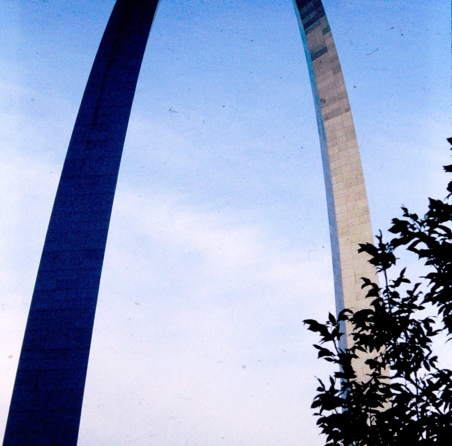
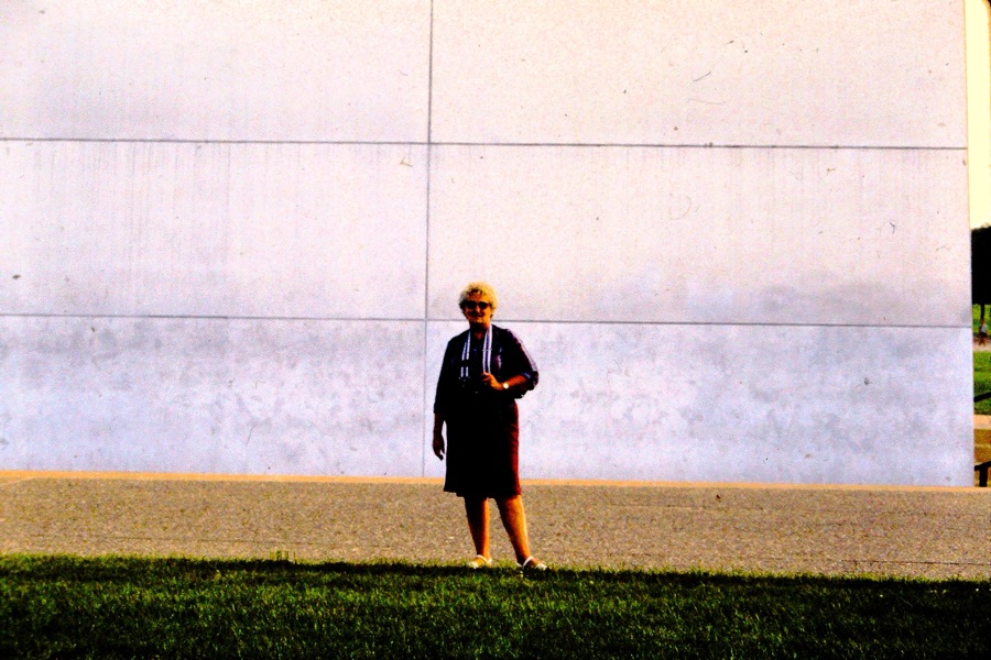
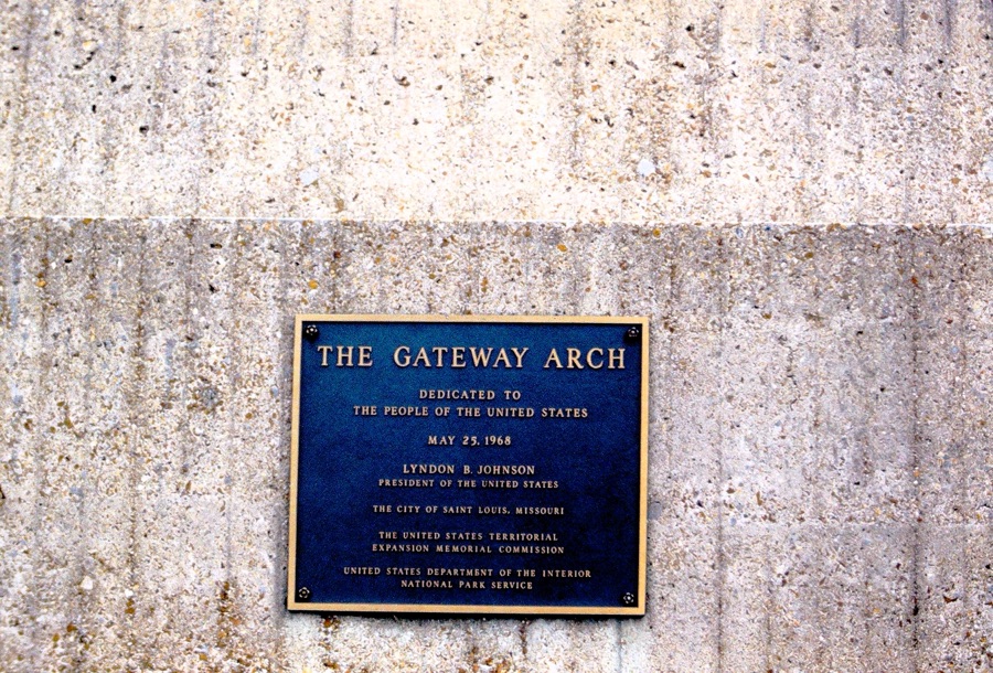
The first stop they made was in St. Louis was at the Gateway Arch National Park. At the Gateway Arch they were able to take a tram ride to the top. The tram lifts you up 630 feet up to the top of the tallest monument in the United States.
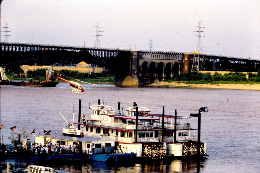
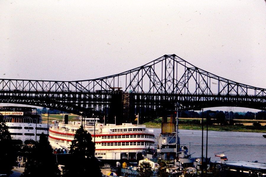
While there they also visited the Gateway Arch Museum and later took a Riverboat Dinner Cruise on a 19-century paddle-wheel riverboat. They rode on the Tom Sawyer Riverboat along the Mississippi River seeing stunning views of the skyline. It was a unique and relaxing way for them to experience seeing the Gateway Arch and downtown St. Louis.
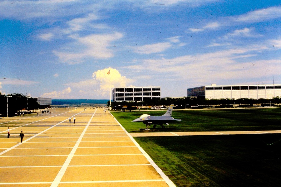
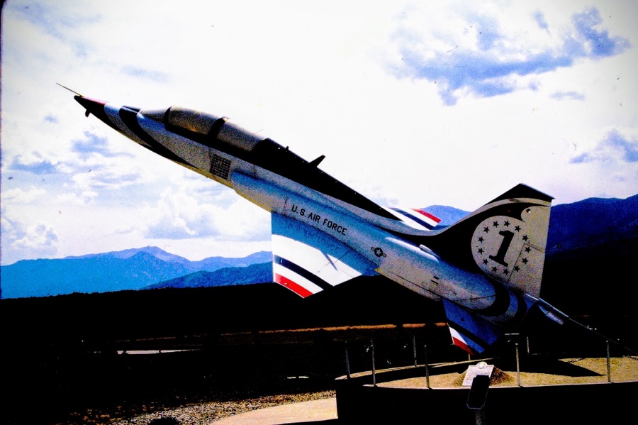
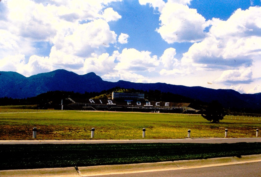
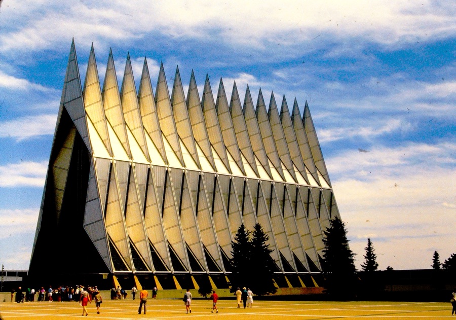
Next up on their Road Trippin’ USA Adventure was to drive westward to the U.S. AIR FORCE ACADEMY in Colorado Springs, Colorado.
TheU.S. AIR FORCE ACADEMY has many sites and facilities available for visitors to see on a self-guided tour. Their visit stop at the Academy was the Barry Goldwater Visitor Center, here they explored the resources available to help them with their tour.
Among the many various facilities they were able to visit were the Planetarium, the Cadet Chapel, Honor Court, Polaris Hall, Arnold Hall, Dolittle Hall, Falcon Stadium, and Thunderbird Overlook. The Cadet Chapel is located at the base of the Chapel Trail. From the Chapel Trail, they were able to view the historical statues and sculptures on displayed at the Honor Court. The U.S. AIR FORCE ACADEMY’s Gift Shop is located on the second floor of Doolittle Hall, which I’m sure they bought souvenirs to bring home.
Next week I’ll continue with their Road Trippin’ adventures for My Which Way of Cee’s Which Way Challenge. We’ll begin in New Mexico and venture onto visiting the Pima Air & Space Museum in Tucson, Arizona.
In the Summer of 1985 my parents went Road Trippin’ across the United States of America. They began their Road Trip leaving from their home in San Diego, California. They always planned what or whom they wanted to visit ahead of time.
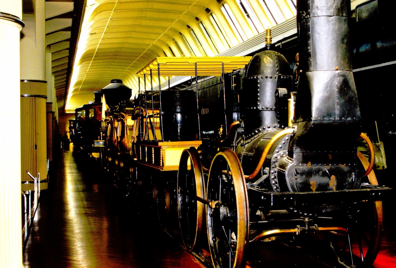
This week I’m continue with their Road Trippin’ adventures for My Which Way of Cee’s Which Way Challenge at The Henry Ford – Museum Of American Innovation. Let’s take a look at some of the interesting displays they had the pleasure of seeing on their visit.
When they were finished touring The Henry Ford Museum of American Innovation, they drove to Indianapolis, Indiana for more sightseeing and tour at the Indianapolis Motor Speedway.
Next up on their Road Trippin’ USA Adventure was to begin driving southwest towards their next destination.
In the Summer of 1985 my parents went Road Trippin’ across the United States of America. They began their Road Trip leaving from their home in San Diego, California. They always planned what or whom they wanted to visit ahead of time.
Continuing with their stop in Washington D.C. and a few sites in Manassas, Virginia with a side visit with my brother and his family.
The above are their last views of Washington D.C. before leaving the area. From D.C. my parents drove to near Manassas, Virginia to visit with my brother and his family for a spell.
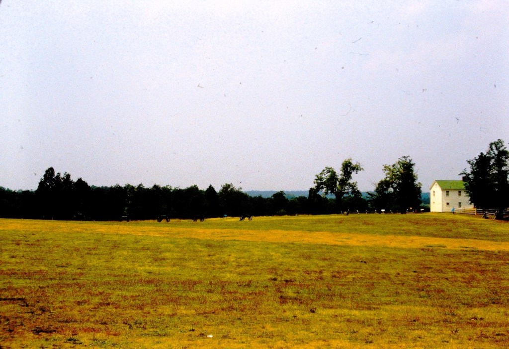
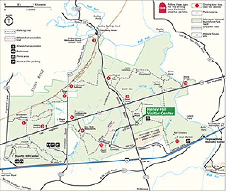
Having rested up and enjoyed a nice family visit, they set out again for further site seeing adventures. They stopped in Manassas enjoying several sites including the Manassas National Battlefield Park.
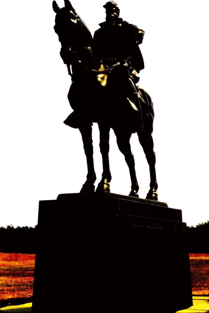
Henry Hill Visitor CenterConfederate General Barnard Elliott Bee Jr. Monument Brigadier General Thomas J. Jackson monument (AKA Stonewall Jackson)Manassas Loop TrailManassas National Battlefield Park Map
My dad loved to plan at least one stop on our vacations which had an historical significance. He would also plan a different site for our family to enjoy some fun. On this trip he and my mom planned to visit sites that held significant interest to them.
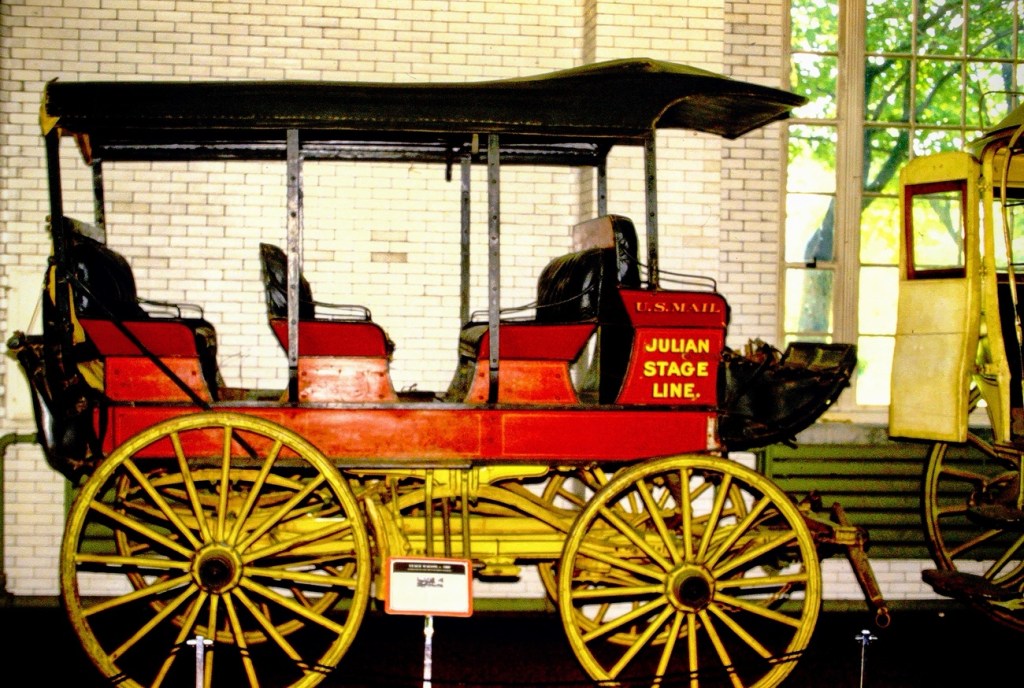
The next stop on their Road Trippin’ USA adventure was The Henry Ford – Museum Of American Innovation in Dearborn, Michigan.
Parking Lot for The Henry Ford – Museum Of American InnovationJulian Stage Line
As they walked up to the entrance they enjoyed seeing the displays at the entrance like this Julian Stage Line vehicle. Julian reminds me of a town just a short ways east of San Diego County in California that has the best Apple pies and beautiful countryside.
Next week I’ll continue with their Road Trippin’ adventures for My Which Way of Cee’s Which Way Challenge at The Henry Ford – Museum Of American Innovation.
Location: Washington D.C.; Manassas National Battlefield Park; Manassas, Virginia; The Henry Ford – Museum Of American Innovation; Dearborn, Michigan, USA
God Bless. Thank you for visiting with us. Thank you for sharing your time and thoughts with us. I appreciate y’all very much.
In the Summer of 1985 my parents went Road Trippin’ across the United States of America. They began their Road Trip leaving from their home in San Diego, California. They always planned what or whom they wanted to visit ahead of time.
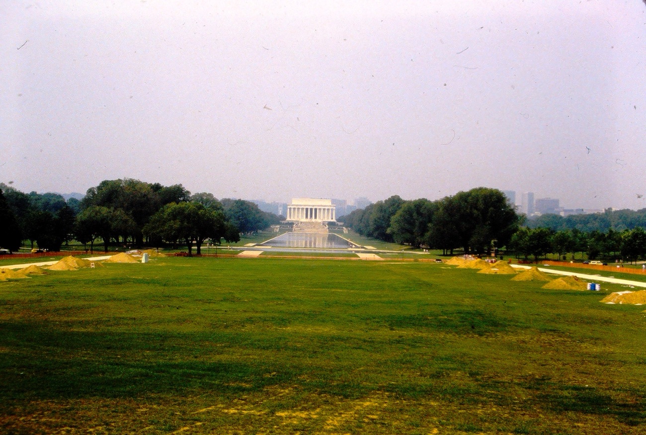
On the road again, their next planned stop was in Washington D.C. after a side visit to my brother near Manassas, Virginia. My parents toured many of the historical sites and monuments around the area. Some of the sites were seen via a tour bus while others were seen via self-guided walking tour routes. They toured the Bureau of Engraving and Printing Building, the National Museum of American History, The Washington Monument, The Lincoln Memorial, The Smithsonian Castle, Capitol Hill and the Ulysses S. Grant Memorial Statue. What would be your interests if you toured Washington D.C. or your country’s Capitol?
Here you may see some of the Roads, Routes, or Pathways they took on their tour of D.C.:
The last photo isn’t exactly a pathway unless you consider going round and round on a merry-go-round one you’d also enjoy taking on occasion.,
According the Oxford Dictionary, a Pathway is a path which you can walk along or a route you can take and a Passage is a way of exit or entrance; the act or process of moving through, under, over, or past something on the way from one place to another.
This week I’m continuing Cee’s Which Way Challenge doing it My Way. Therefore for this the third week of June I have chosen a theme of Roads/Dirt Roads. I welcome anyone who desires to join me on this week’s Which Way Challenge.
As I have been working to digitize my dad’s old slides I have come across several photos my dad took of Roads in Great Falls, South Carolina back in 1963.
We are starting our (my) Which Way with the Road in front of my Paternal Grandparents home. Their home was originally a Mill Duplex Home and converted into a single family residence.
Walnut Street Home of John & Alma Waters My Paternal Grandparents
Next, we come to the corner of Walnut Street and Argonne Avenue. This is the location of the J P Stevens & Company Mill where my paternal grandfather worked. The Mills in Great Falls were formerly known as Republic Cotton Mills. [Closed in the early 1980’s.]
Cottom Mill #3
1923 Republic Cotton Mill #3 – a silk mill production. The building had a unique saw-tooth roof. There was Village housing and a neighborhood grocery store.
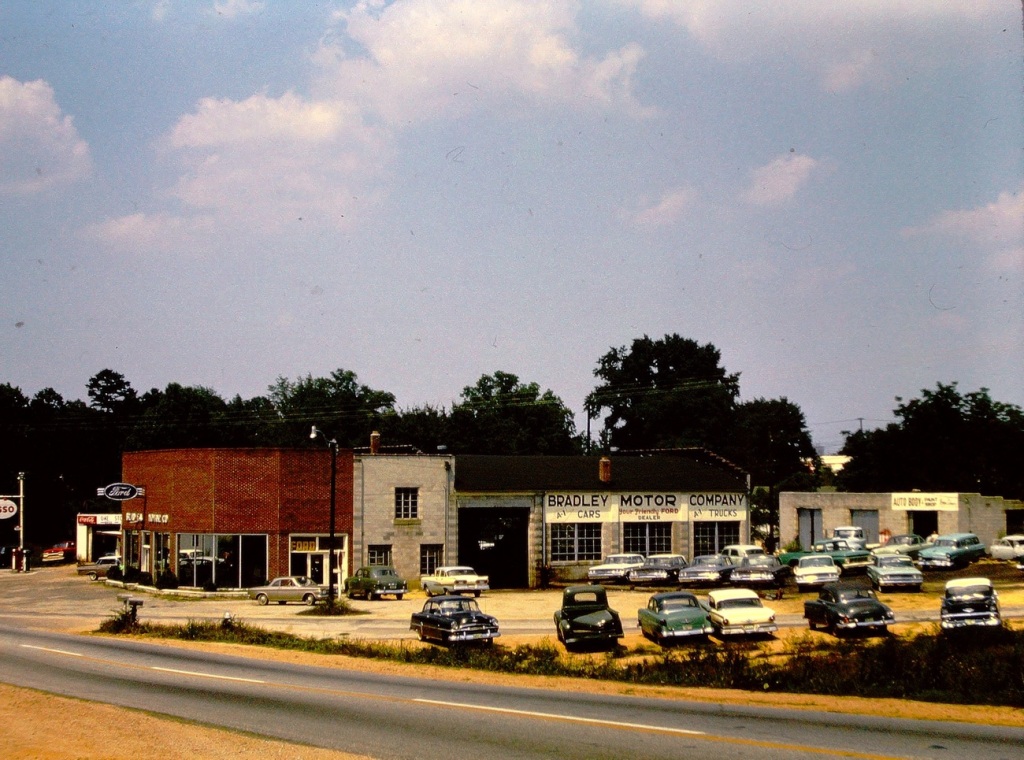
Continuing on our journey, we drive along Chester Avenue. On this Road we can see the Bradley Motor Company ( a FORD Dealership) where my dad worked when he finished high school and again when he first was discharged from the U S Navy.
Bradley Motor Company
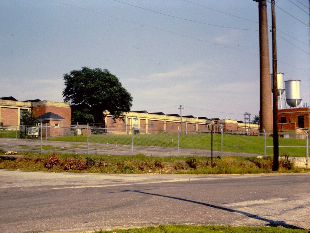
As we continue cruising through the Town of Great Falls, we see a Dirt Road behind the Power plant. Here we notice old Railroad tracks no longer in use. They would have kept extremely busy in the heyday of the town.
The Town of Great Falls is located in Chester County, South Carolina. The name of the Great Falls came from the nearby waterfalls on the Catawba River. The Town was founded by the power company owned by Mr. J.B. Duke. J.B. Duke built hydro electric plants on the Catawba and was the founder of the three Republic Cotton Mills.
Location: Town of Great Falls, Chester County, South Carolina, USA
God Bless. Thank you for visiting in my reminiscing of the Town of Great Falls, SC. Thank you for sharing your time and thoughts with me. I appreciate y’all very much.
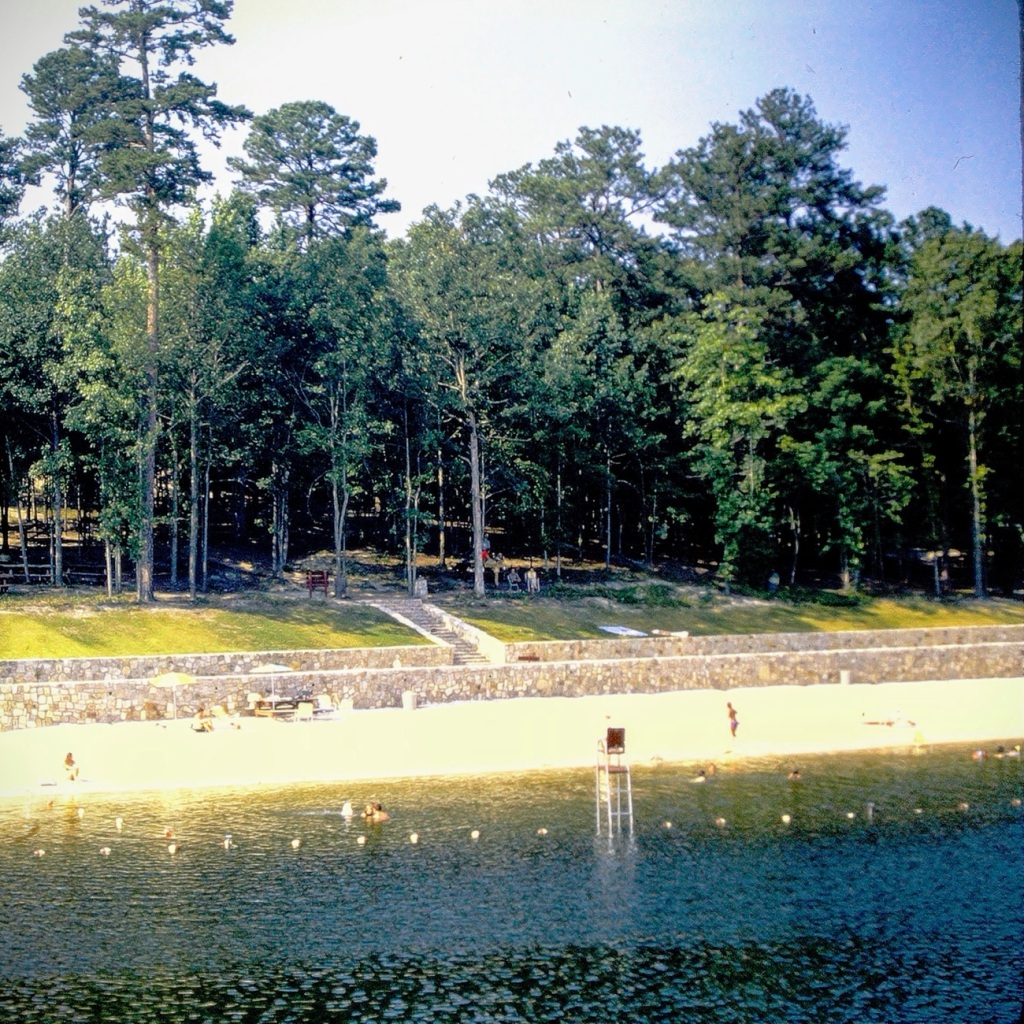
We begin our journey in n July of 1972, having made it from California to Georgia we stop for a bit of fun. We were glad to pull into the park and finally be able to get out of the car and stretch our legs. After traveling cross country for days we were more than ready to enjoy some fun and excitement.
Driving into Stone Mountain Park in Stone Mountain, Georgia
We enjoyed a time of Sun, Sand. and Water Fun relaxing on the beach.
Sun, Sand. and Water Fun
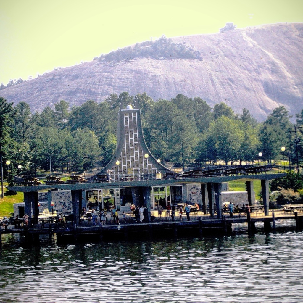
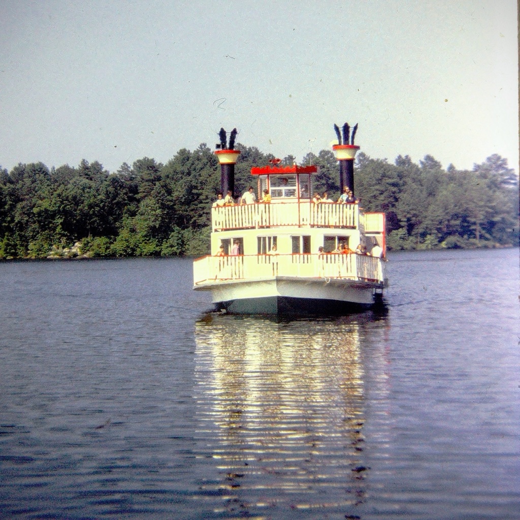
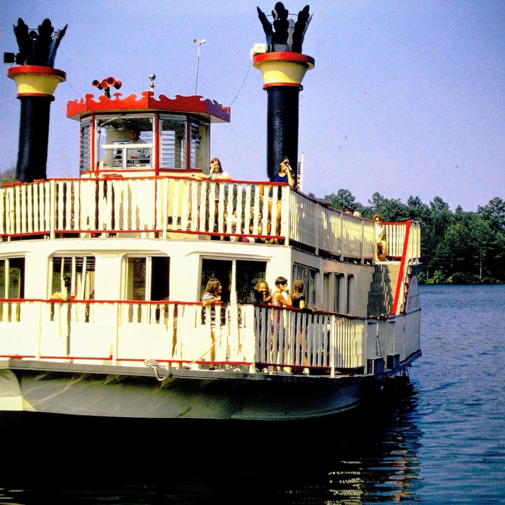
Next, we moved forward to wait our turn for a ride on one of the Paddle-boats. The paddle-boats are large Riverboats which give tourists and guests a thirty minute ride out on Stone Mountain Park Lake. [From what I have discovered, the Riverboats no longer operate on Stone Mountain Park Lake.]
Riverboat Marina Complex Area to wait for a Riverboat Cruise 🚢 ride.
Moving forward out into the lake aboard the Scarlet O’Hara, we had an opportunity to see a uniquely captivating side of the park. The Scarlet O’Hara was one of two (2) paddle boats in the Stone Mountain Fleet that once cruised the lake delighting guests with the beautiful scenic views. It was a side wheeler which could carry up to One Hundred Fifty (150) passengers on board.
Scarlet O’Hara
The Henry W. Grady was the name of the other Stone Mountain paddle boat. It was designed to carry approximately three hundred (300) passengers. Its sole purpose was to be used for private party charters.
The Riverboats departed the Riverboat Marina Complex approximately every half hour moving forward into the lake giving guests a chance to enjoy the waterways, and the beauty surrounding Stone Mountain. The short cruise lasted about twenty (20) to thirty (30) minutes. While out on the lake on one of the paddle-boats you might have noticed the sunken remains of the very first riverboat, the Robert E. Lee, seen at the bottom of the lake.
Location: Stone Mountain Park Lake; Stone Mountain Park, Stone Mountain, Georgia, USA
God Bless. Thank you for visiting and sharing in our memories of cruising on a Riverboat. Thank you for sharing your time and thoughts with me. I appreciate y’all very much.
For Cee’s Which Way Challenge this week I’m taking y’all on a hiking adventure back in time to Nineteen Seventy-One (1971). This adventure was a part of a church youth group outing to the Grand Canyon in Arizona. It started off as approximately an 8 hour and 35-minute drive traveling by bus for five hundred sixty-nine miles (569) east northeast loaded with enthusiastic teenagers. [Bus ride not pictured.]
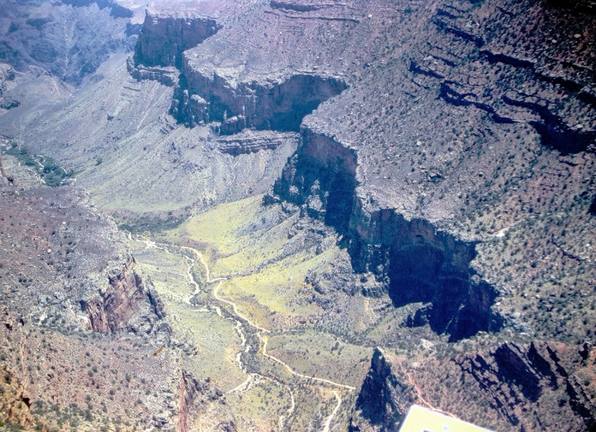
Our first stop at the Grand Canyon was the South Rim where we happened upon the Trans-Canyon Waterline. The South Rim water is pumped up 3200 feet from springs at Indian Gardens, but flow is inadequate for today’s needs (the thoughts in 1971.) Thus the Trans-Canyon Waterline was constructed beginning in 1965 and took until 1970 to complete.
This waterline stretches from the current water intake at Roaring Springs on the north side of the canyon, down to Phantom Ranch, and back up to Indian Garden through extremely rugged terrain accessible only by trail or helicopter. It carries about 190 million gallons of drinking water to over 5,000,000 visitors and 2,500 residents at the Inner Canyon Corridor and South Rim developed area.
Besides the view of the signage, we could see the pipeline which transports the water up to the South Rim and have a terrific view of the Bright Angel Trail. The Bright Angel Trail is the trail which led us to the bottom of the Canyon and the Silver Bridge.
Before we started hiking on the trail we stopped at Hermits Rest to enjoy some spectacular views. Hermits Rest is an iconic and historic stop, at the conclusion of Hermit Road, and the Canyon Rim Trail. It also serves as the gateway to magnificent backcountry hiking trails that originate from the Hermit Trail, a steeply winding path into the canyon that begins 0.25 miles (0.4 km) west of this distinctive building.
Now that we’ve had an overlook of where we are going to be hiking, let’s Move Onward and Forward along the trail. We have a long way to go ahead of us before we’ll reach the bottom of the Grand Canyon and Phantom Ranch.
Once we reach the bottom we had to cross the Silver Bridge to reach our destination. The Silver Bridge is a 500 feet long steel suspension bridge spanning a green river with canyon slopes and cliffs on the opposite side. The Silver Bridge, is located a short distance downstream from the Black Bridge. Both the Silver Bridge and the Black Bridge serve as critical transportation links between the South and North rims at Grand Canyon National Park.
When you visit the South Rim of the Grand Canyon don’t forget to stop at Yavapai Point to see some fabulous views. Make sure you have your camera (or at least your smartphone) with you to capture the beautiful scenic views.
Location: South Rim; Hermits Rest; Silver Bridge; Grand Canyon, Arizona, USA
God Bless. Thank you for visiting and sharing in our memories of hiking the Grand Canyon. Thank you for sharing your time and thoughts with me. I appreciate y’all very much.
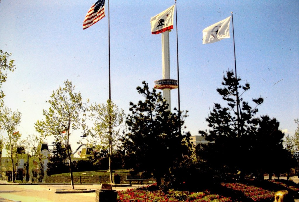
Traveling back in time to December 1965, to a family day trip. Packed and loaded in our 1962 Ford Galaxie 500 with a cooler of drinks, snacks, and sandwiches; we began our approximately hour and fifty-one (1hr 51min) drive north moving forward through the city streets until turning onto CA-94 and eventually onto the recently constructed I-5.
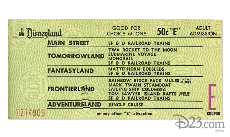
Upon arriving at the Disneyland entrance, my parents purchased our admission and ride tickets. General Admission prices for adults at that time was $2.60 per adult and included a ticket for the Monorail. Junior prices were $1.80 and Children’s admission prices were $1.10. Tickets for the rides cost extra. A book of 10 tickets ranged from $3.00 to $5.00.
1965 Disneyland Ride Tickets A-ESelection of E Ticket Rides
In 1965, the cost of admission was considered a lot of money. However, people considered visiting Disneyland was a worthwhile family adventure.
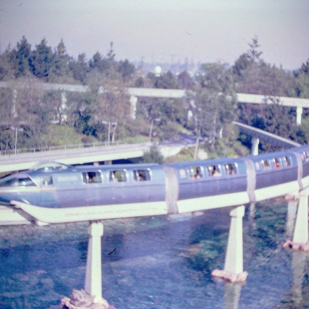
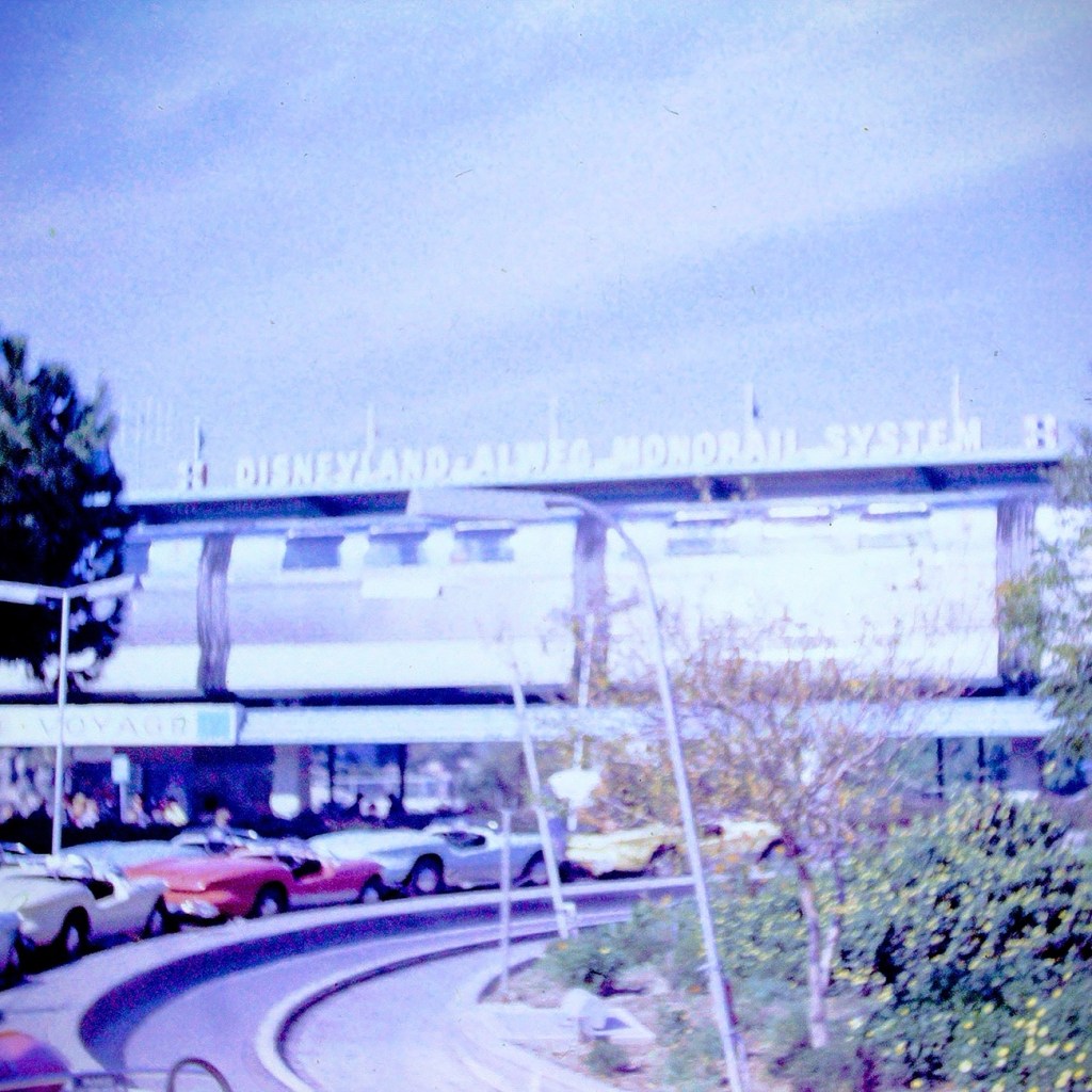
After our tickets were purchased and we entered the park, we selected what rides we wanted to ride. We went to each ride or attraction as a family unit, not venturing off individually. Our first ride of choice was the Monorail.
Disneyland Monorail
The Monorail was considered as a mid-century marvel and captured the hearts and imaginations of the theme park and Disney fans. The Monorail was a Highway in the Sky which allowed for a unique experience viewing the park from above.
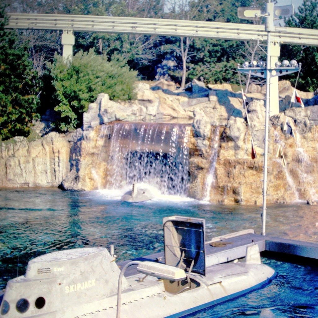
Our next selection was to ride the submarine adventure. The attraction features vehicles that were designed to look like submarines. It required the E ticket was in the Tomorrowland area of the park.
Early Disneyland Submarine
The submarines took us on an adventure under the sea simulating fish and other sea creatures allowing us to imagine we were really being submerged and viewing the undersea life of a tropical lagoon.
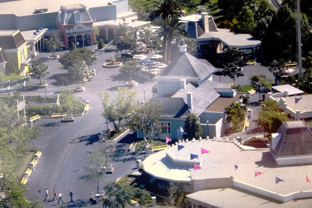
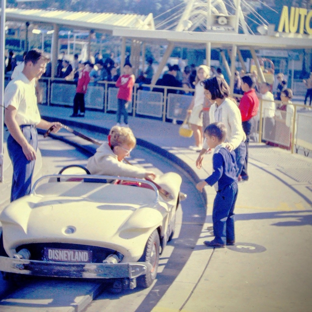
Next up was the Autopia adventure. This was where we could get in cars and race around an enclosed track. We could imagine we were actually racing the other drivers.
My mom getting out of the Race Car.
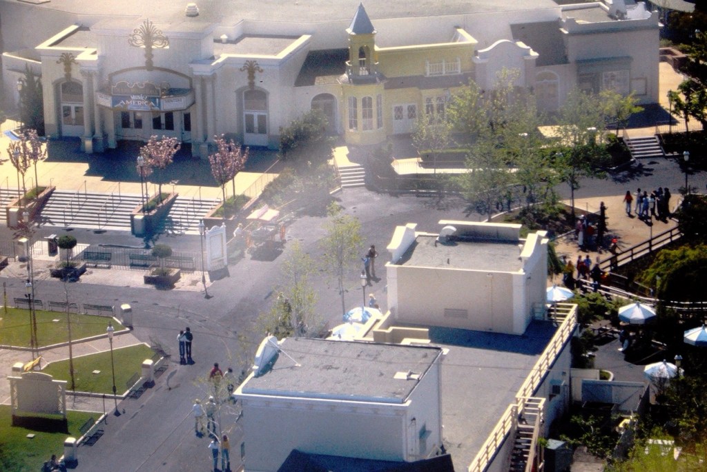
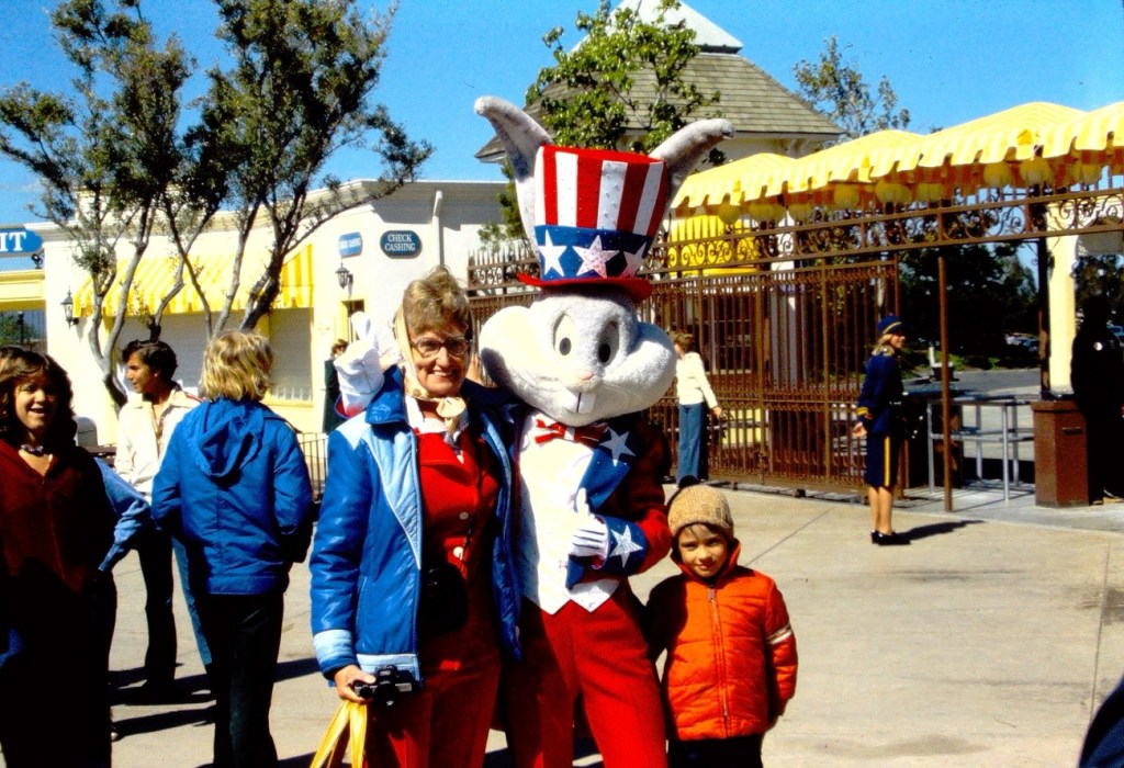
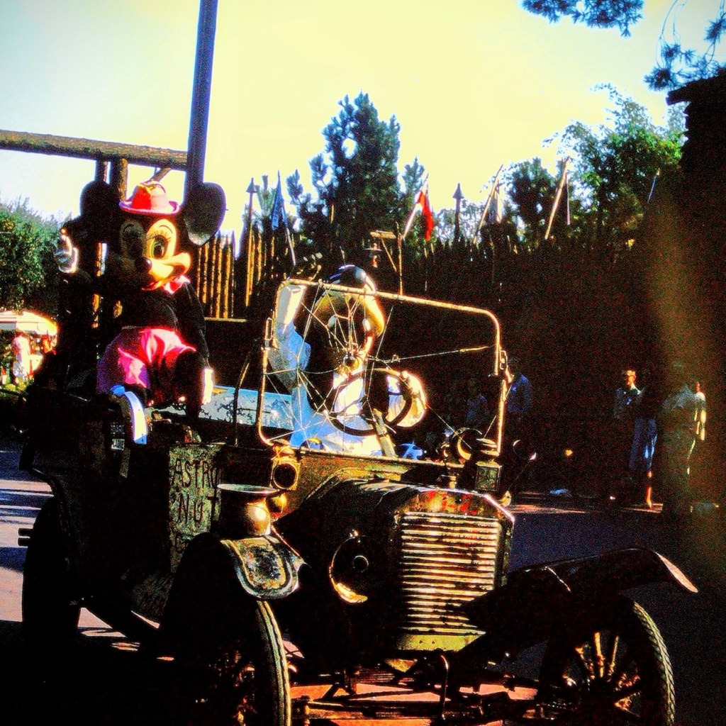
After a full day of adventures Moving Forward around the park, we selected a spot on the side of Disneyland’s Main Street to watch the Parade. The waiting was a time of excitement as we looked forward to the parade starting.
Mickey Mouse riding in a Vintage Car with Goofy1965 Disneyland Santa Claus Float
Well folks, that’s all for today. We had fun, but now it’s time to head home.
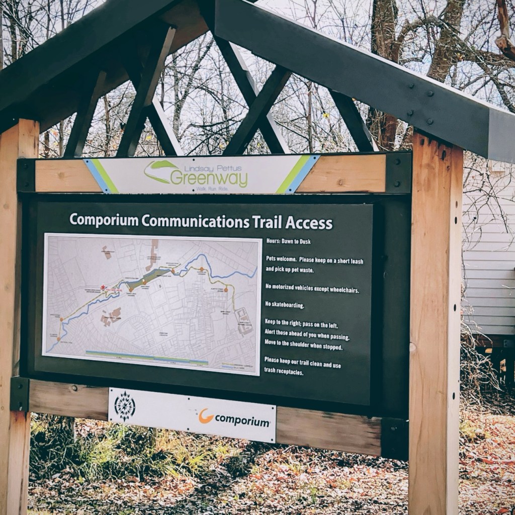
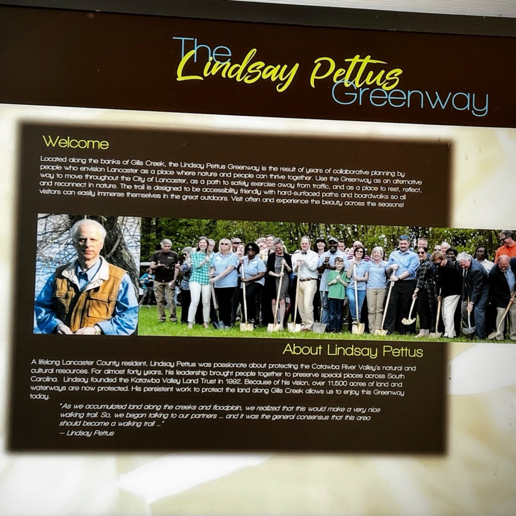
The forward thinking of concerned citizens, volunteers, business partners, and in partnership with the Katawba Valley Land Trust; the ideas, planning, and reconstruction of certain areas into a Greenway of trails in Lancaster began to develop beginning in 2014. The Greenway includes numerous pedestrian connections with linkages to residential, commercial, and local school properties, trail heads, and nature centers, bridge crossings, and sidewalk improvements.
Comporium Communications Trail Access is the starting point for Coleman’s and my hike along the first phase of the Greenway’s Master Plan. The first phase of the Reconstruction of Land in Lancaster was completed in 2019. Our hike took place in February of 2022.
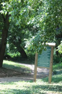
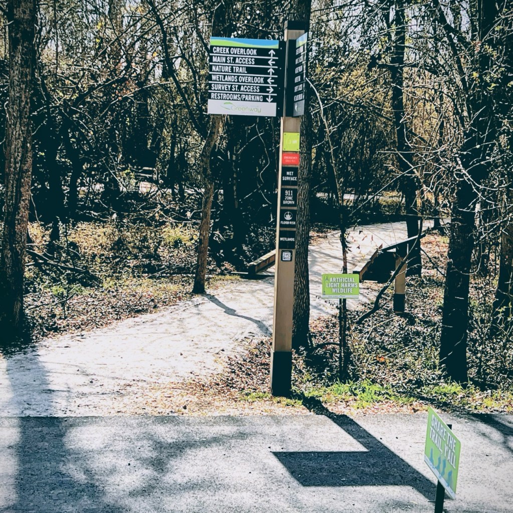
As we moved forward in our adventure, we encountered several informational signs which were a tremendous help in guiding us as we moved forward along the Greenway.
Coleman and I decided to move forward together along the nature trail towards creek overlook and eventually the Wetlands Overlook.
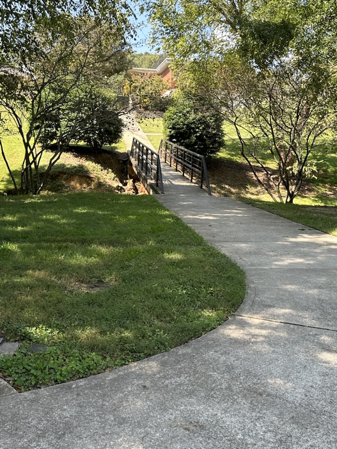
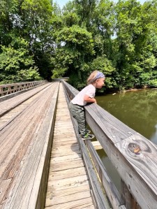
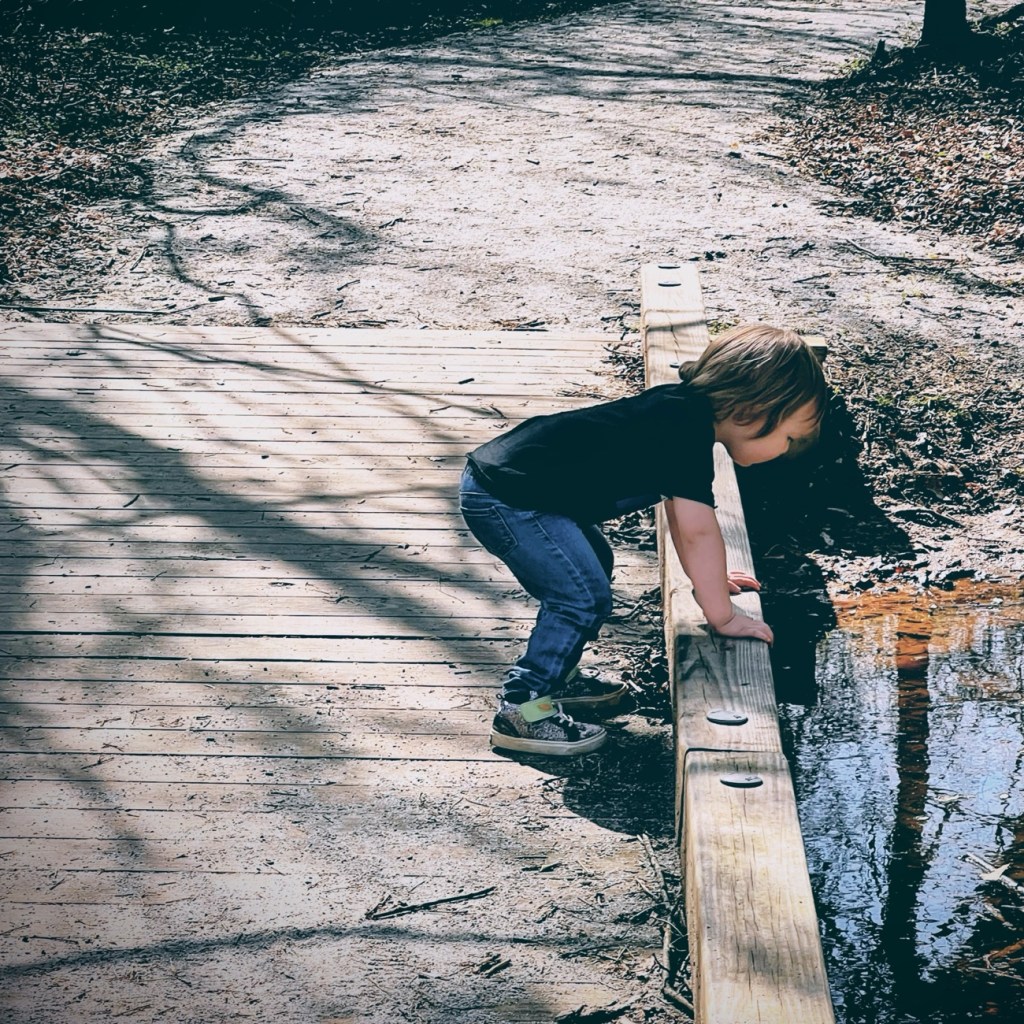
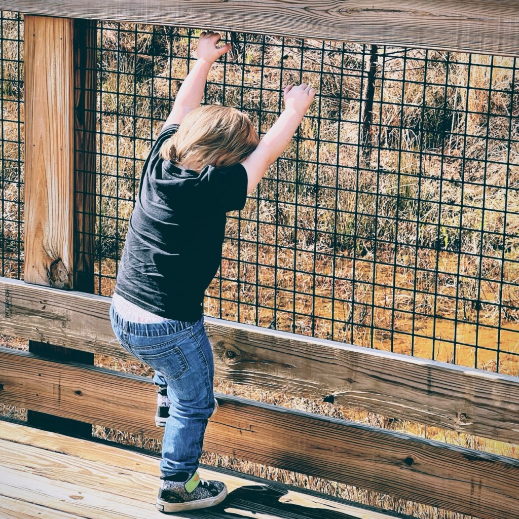
Here Coleman takes a minute to look out over the bridge at the creek below.
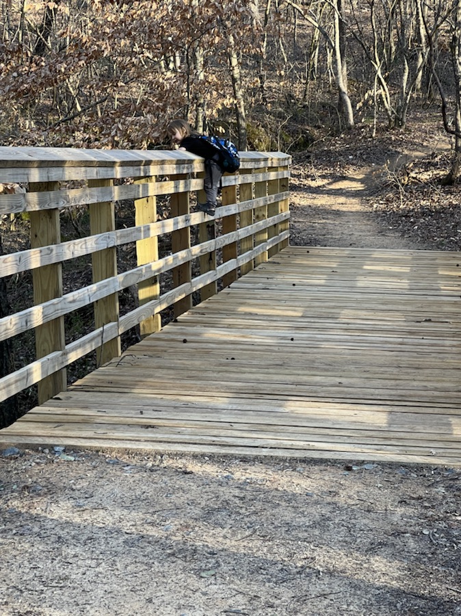
Coleman can’t resist climbing on the bridges railing at this next point or interest.
Informational Signs are located strategically throughout the Greenway. This particular one gives information about out the Lindsay Pettus Greenway and Lindsay Pettus himself.
The forward thinking of Mr. Lindsay Pettus and the many volunteers ensured the Greenway is and will continually be accessible to everyone regardless of their mobility needs.
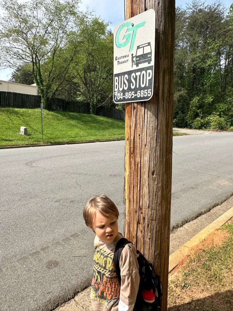
We managed to have a beautiful clear day yesterday (almost), so Coleman and I rode the bus to the Y for some fresh air and a bit of hiking.
All aboard, we’re on our way.
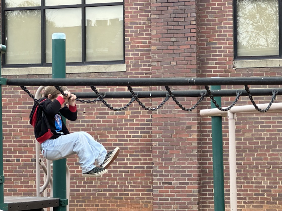
Before we begin our hike, it’s Coleman swing time. If we waited till later the school kids would have taken over and he couldn’t have been able to play.
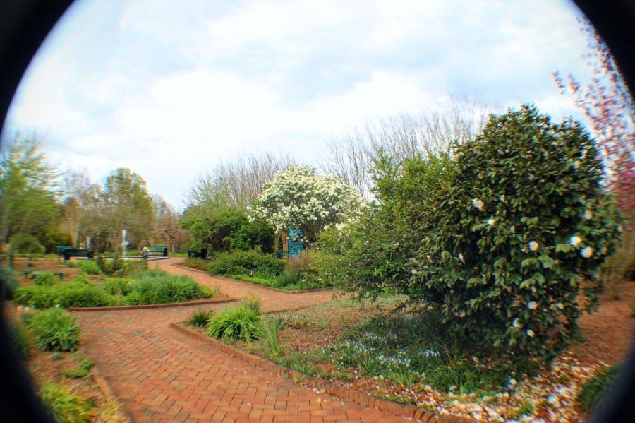
Cameras: iPhone 14 Pro Max and Canon EOS Rebel T3i with Canon EF-S18-55mm lens with Altura UV & NP filter and also Altura Wide-Angle Fisheye attachments.
Location: Gaston County Warlick Family YMCA; Gastonia, North Carolina, USA
God Bless. Get Outdoors and Enjoy Our Beautiful Earth. Thank you for traversing the trail with us. Thank you for sharing your time and thoughts with us. I appreciate y’all very much.
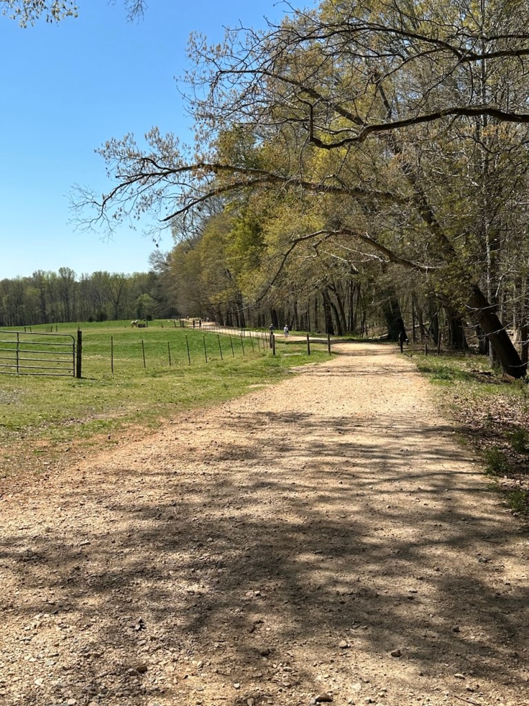
On this hiking adventure I parked at the Dairy Barn Entrance to the Anne Springs Close Greenway. After exiting the car we proceeded to hike along the fencing before hitting the trails. Following the fence line we were able to view the horses, some of which trotted over to our location. [More on horses later].
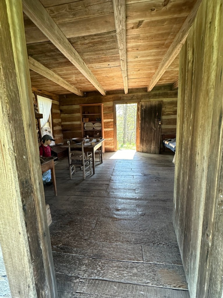
Our first stop along the Blue Star Trail was to take a look at the Faires/Coltharp Cabin. To our surprise and delight it was open to the public (first time we’d seen it open). So naturally, Coleman with me following went inside to see what was inside.
A Look inside the Faires/Coltharp Cabin
After leaving the cabin, we hiked further along the Blue Star Trail towards the Swinging Bridge and the Schroering Forest Playground located on the other side of the Spillway.
Blue Star Trail
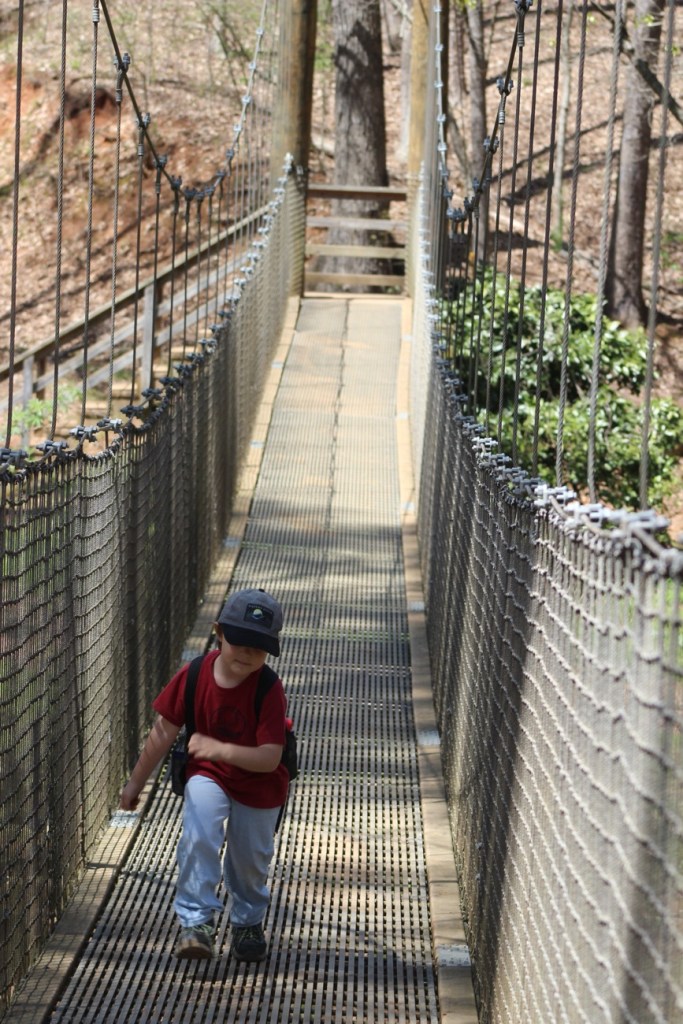
When the Spillway is up and streaming with a steady flow of water, the only way to cross it is to walk across the Greenway’s Swinging Bridge. Since our destination was on the far side of the Swinging Bridge we/I slowly walked across. Coleman used to walk across it when he was younger, but now if no one else is on it he’ll run across.
Coleman crossing the Swinging Bridge
We made it safely across the Swinging Bridge, walked around the Artisan Market, ordered lunch from the Greenway’s Canteen and rested a bit before heading to the Schroering Forest Playground. We had a clear view of the Playground from where we chose to sit. This was the first official day the Playground was open. They had been working on it all fall and winter. Being its opening day, the playground was crowded with children from all age groups.
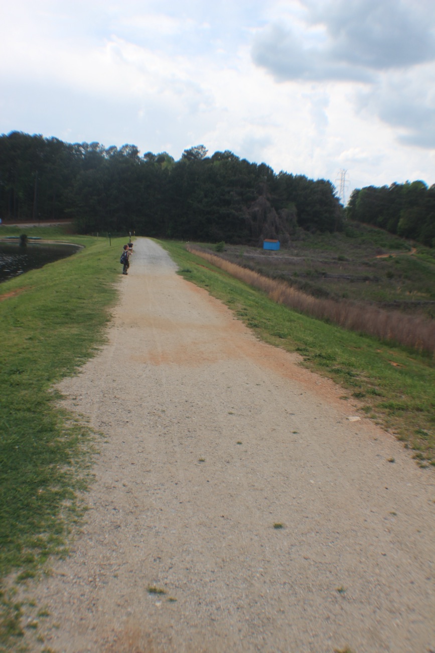
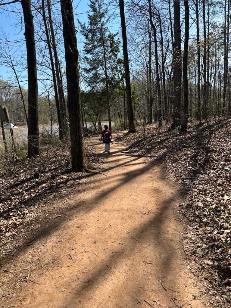
Coleman hiking the Blue Star Trail
Upon completion of our lunch we noticed there were still a lot of children on the playground. I decided to have Coleman wait to play in it until it wasn’t nearly so crowded. Therefore, we continued on with our hiking and headed down to Lake Haigler.
Blue Star Trail Almost down to Lake Haigler
We hiked along the narrow side pathway towards the lake. The straight pathway is wider and more widely traveled by the majority of visitors to the Greenway.
We hiked a short loop with great views of Lake Haigler and then hiked back up to the Playground. Coleman climbed up on the Climbing structure and wasn’t sure about what to do after climbing up a short ways and just sat down for a few minutes. [The all natural wood climbing structure seemed to puzzle Coleman. He’ll probably climb more next time we visit.]
Steele Creek Trail
After a full afternoon of hiking and Coleman playing I decided it was time to head home. Hence, we proceeded to hike back up to the car. Instead of hiking the exact same trail we hiked down, we started out hiking on the Steele Creek Trail. The Steele Creek Trail is a narrow trail that leads up towards the Graham Historical Cabin.
From the cabin we traverse back onto the Blue Star Trail. After short distance from the cabin, Coleman starts searching for the cows. Sometimes they are up close to the fence line, but on this day we really had to look for them. Searching the pasture as we hiked up the trail, two of the cows came walking towards our direction from the far end of the pasture. That made a Coleman’s day. He was then ready to go home.
Coleman Hiking & Playing Along the Avon and Catawba Creeks Greenway
The hiking adventures with Coleman are always fun and interesting. He doesn’t always stick to actual pathways or trails, however, he always gets to where he wants to go and has a fantastic time along the way.
![2025 Which Way Challenge (CWWC): Any Dirt roads or dirt pathways or trails [Bonus if RED is included]](https://gfpacificbeeintrospection.com/wp-content/uploads/2025/06/image-1-1.jpg?w=489)