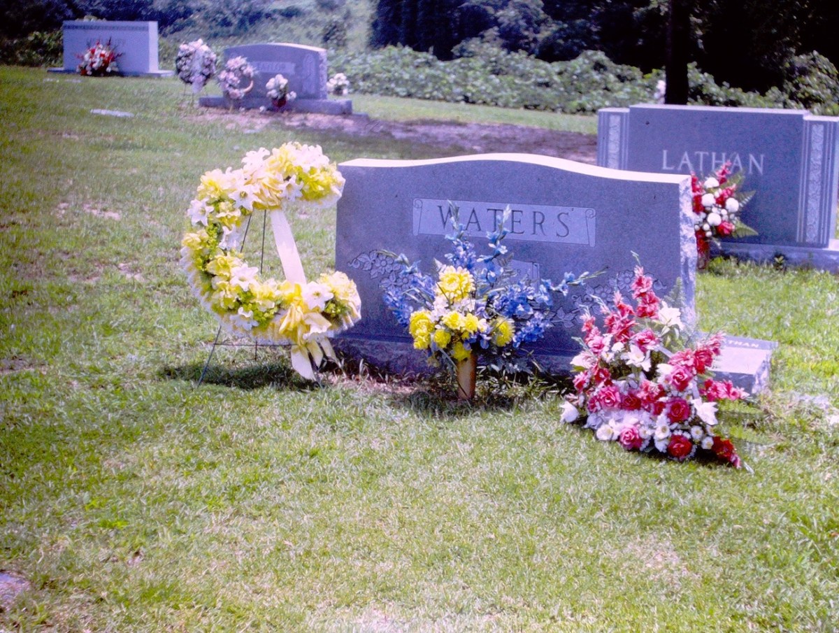
This FOWC is in alignment with the latest of my dad’s slides I have recently (just yesterday) digitized. They are of the familial burial grounds of my paternal grandparents.
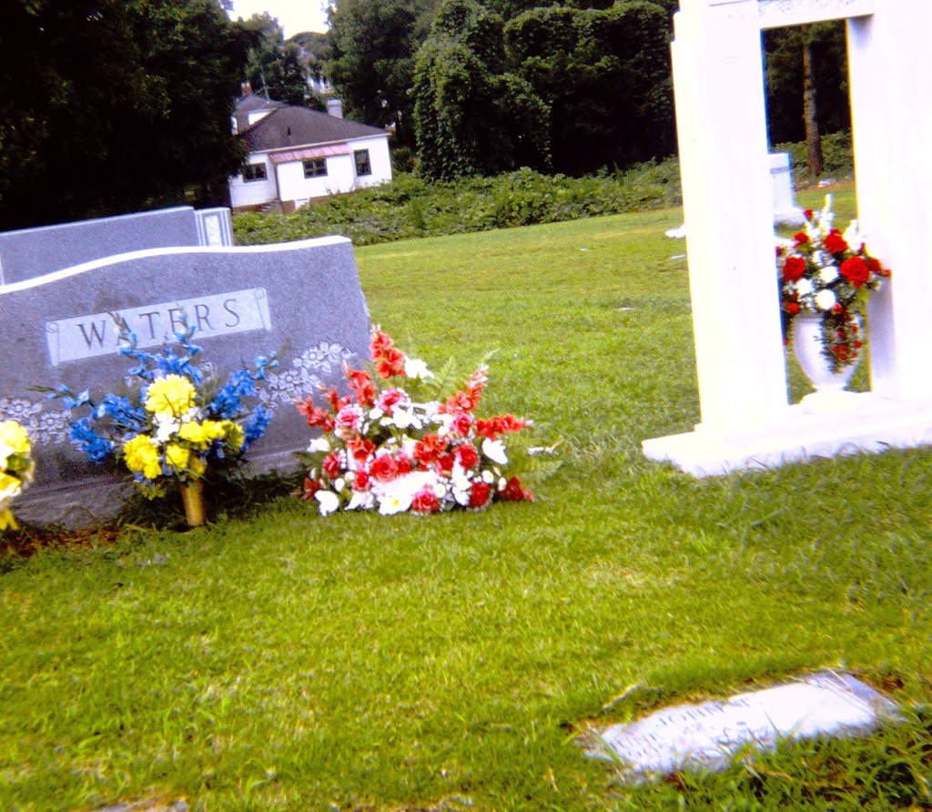
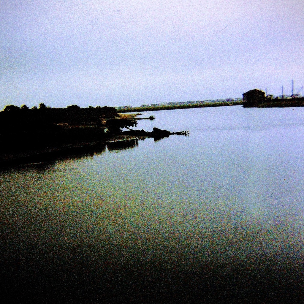
Waters’ Headstone of my paternal grandparents
My father took them on one of our trips to visit his dad, his brother, his sister and her family. The location of the cemetery can be walked to through a path off of the street below my grandparents home.
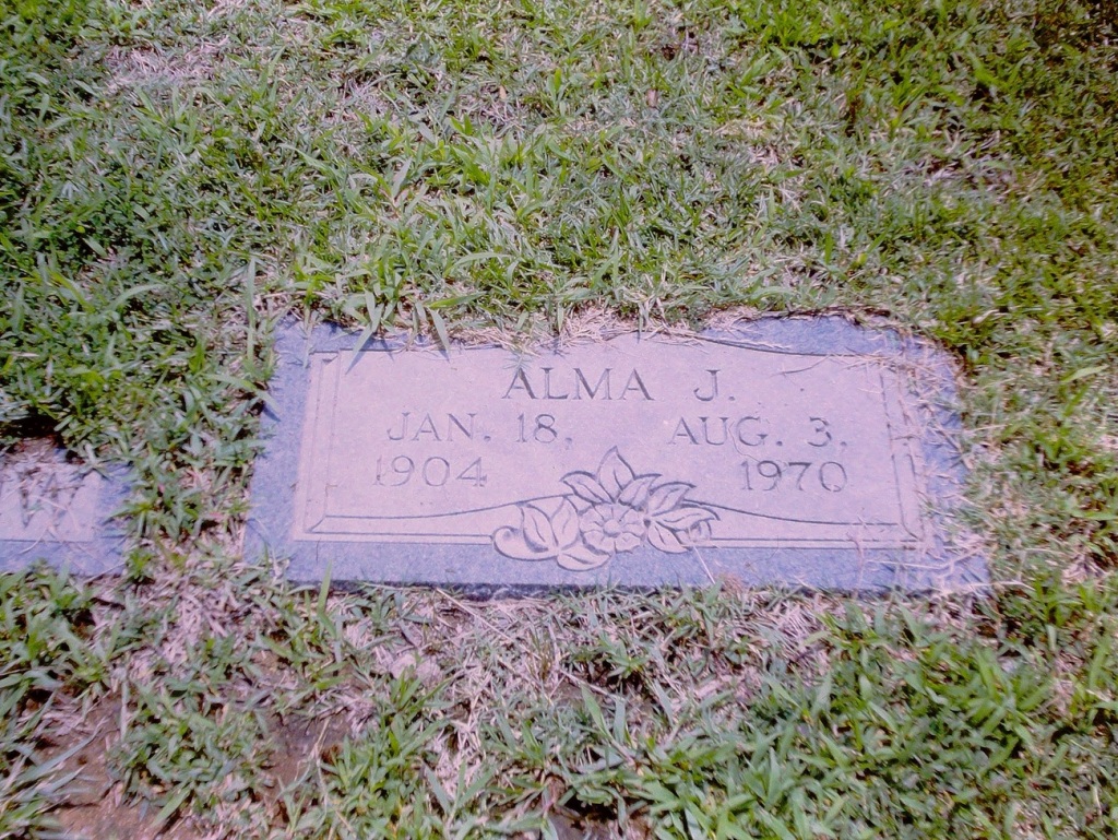
Alma J. Jan. 18, 1904 – Aug. 3, 1970 My paternal grandmother
This was the first time we (my immediate family) had been to the cemetery since my paternal grandmother’s passing in 1970. When she passed, my dad was the only one of us that could fly back for her funeral service.
This view allows us to see both the Headstone and my paternal grandmother’s Foot Marker in the Greenlawn Cemetery.
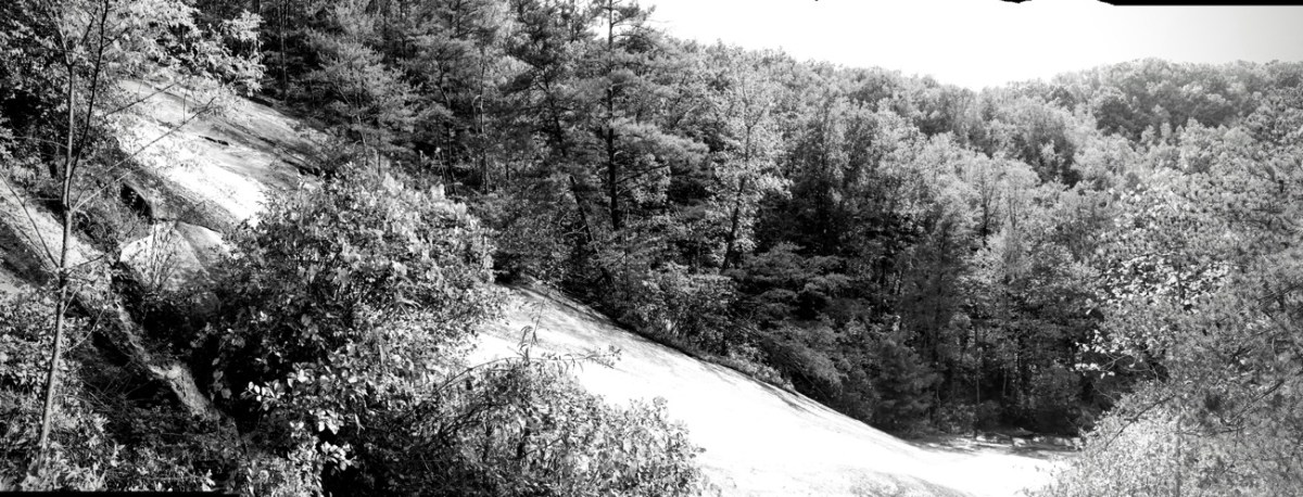
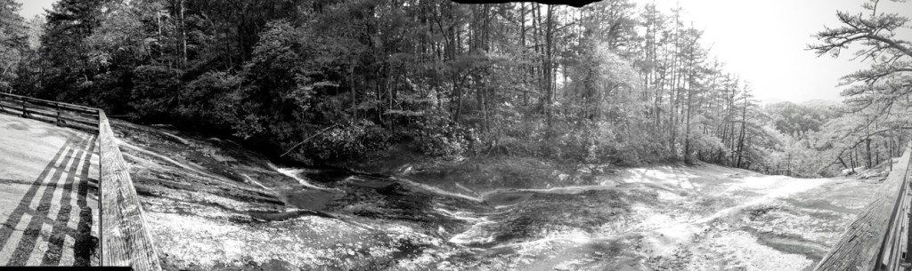
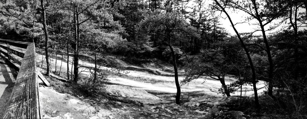
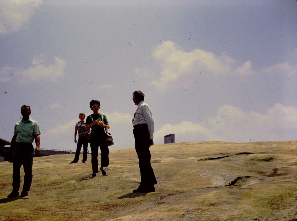
My eldest son and I took a drive along the Blue Ridge Parkway back in the Fall of 2017 as a way to celebrate his birthday. During our drive we stopped at several overlooks prior to stopping at Stone Mountain State Park in North Carolina. At Stone Mountain State Park there is the Upper and Lower Waterfalls you may hike towards.
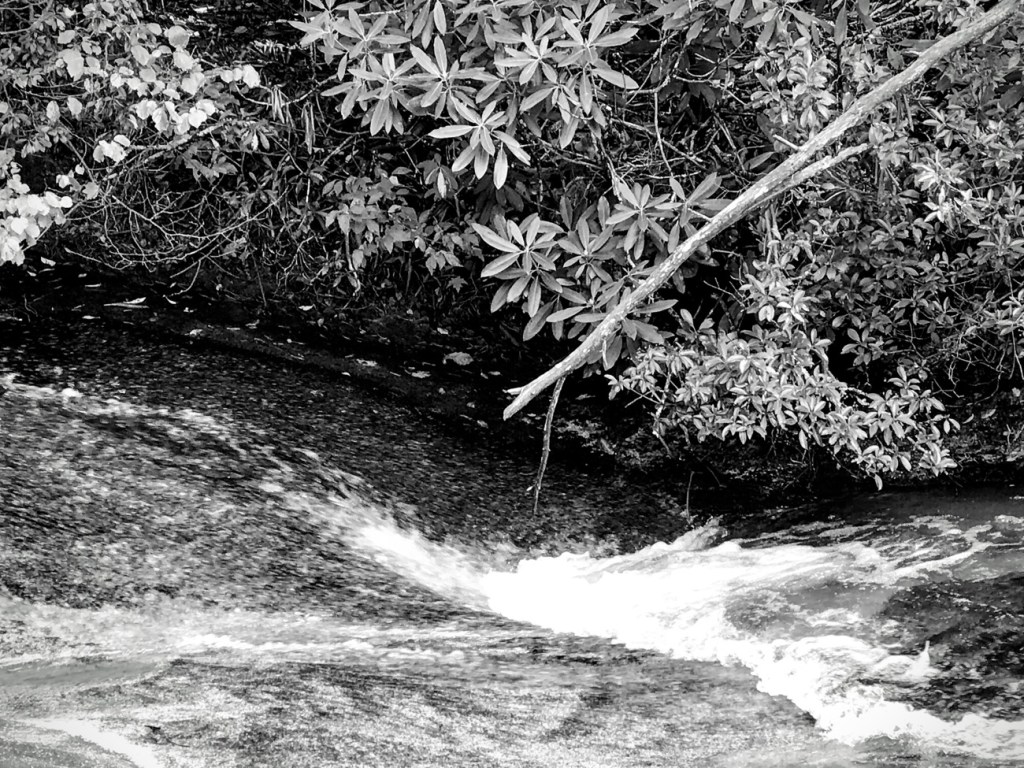
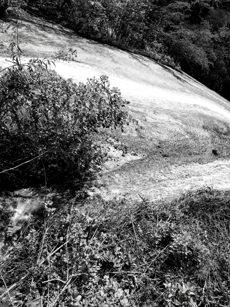
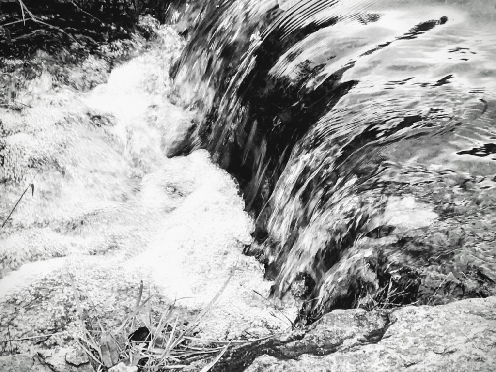
We hiked along Stone Mountain Loop Trail to view the Upper Waterfalls. I took several photos along the route as we watched the Waterfall cascading down over Stone Mountain.
Enjoy the view, however, I would prefer you not to YAWN during the viewing. I would hope it would not bore you but rather enable you to dawn a smile instead.
Can you just visualize the water streaming down over the stones?
The Waterfall slowly increases its strength and speed as it continuously cascades down the Mountain.
Location: Stone Mountain State Park; Roaring Gap, North Carolina, USA
God Bless. Thank you for viewing the Waterfalls at Stone Mountain State Park with us. Thank you for sharing your time and thoughts with me. I appreciate y’all very much.
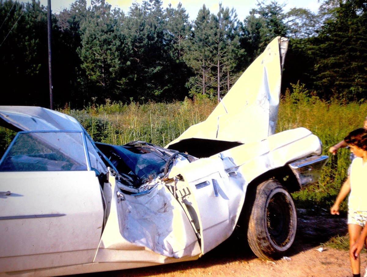
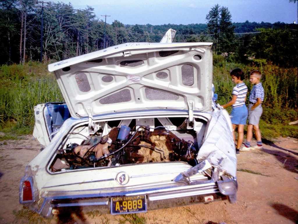
Rummaging through my dad’s old slides I ran across these pictures of a crashed and smashed car where you could clearly see the damage done to the doors, the windows, the hood, and trunk of the car.
Crashed & Smashed Car Doors
I am not sure who the car belonged to, but I know the children who are shown looking at the crashed and smashed vehicle. They are my cousin and my brother. I do not even want to consider what happened to the person or persons who might have been in the car. By looking at those car doors it would have been a miracle if anyone survived without injuries.
Crashed Car Trunk “Door”
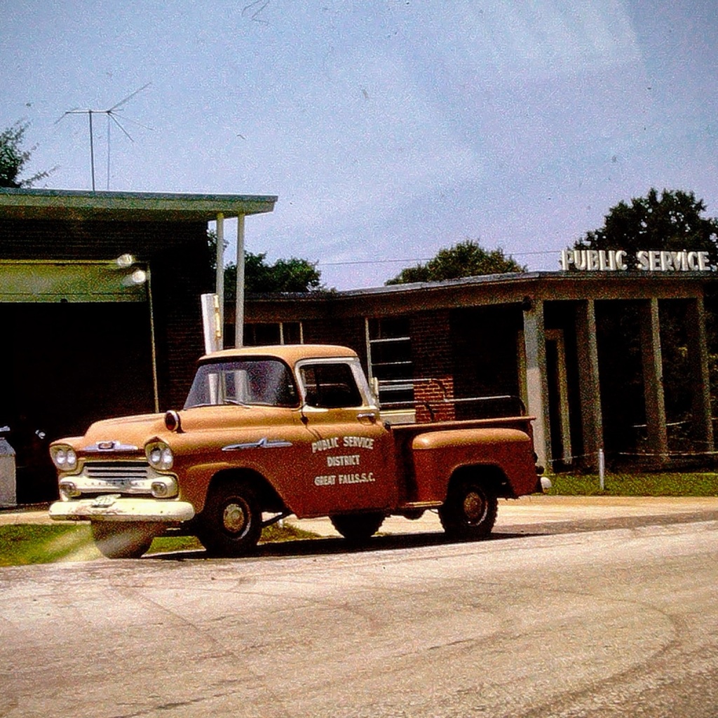
I believe I would prefer the Public Service District truck which drives around Great Falls performing the necessary maintenance and repairs making sure the Town of Great Falls is safe, secure, and it proper working order.
Location: Town of Great Falls, Chester County, South Carolina, USA
God Bless. Thank you for visiting the Town of Great Falls with us. Hope you have a fantastic day filled with joy, laughter, and no wrecks. Thank you for sharing your time and thoughts with me. I appreciate y’all very much.
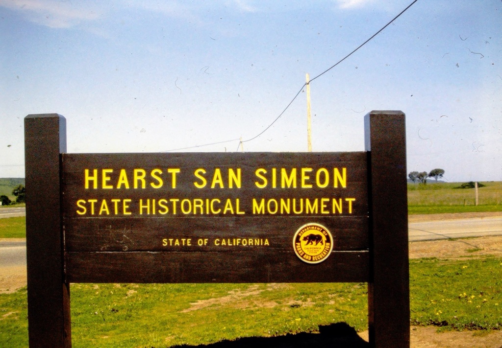
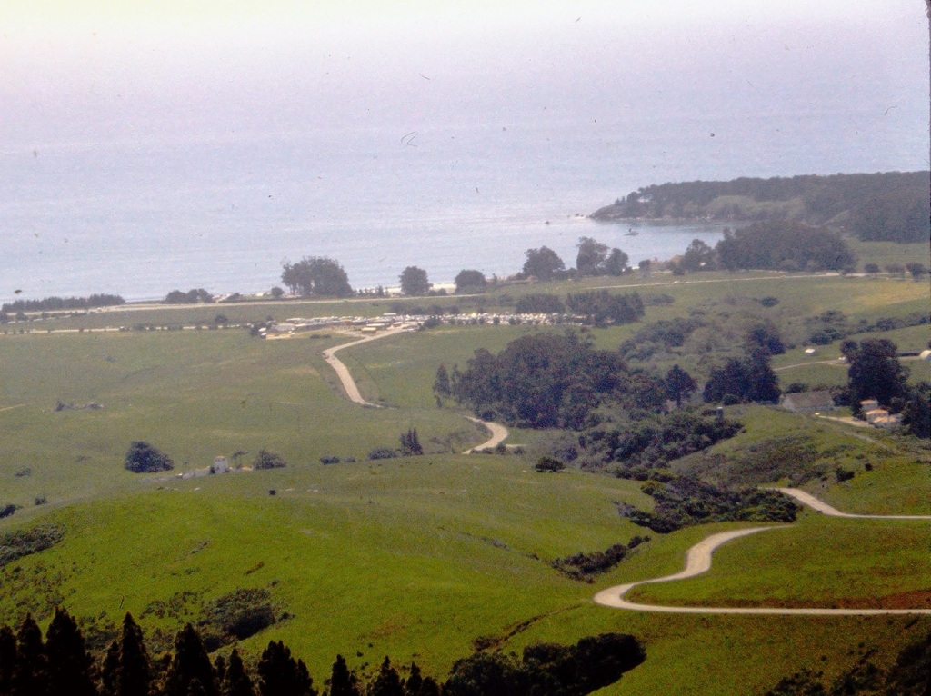
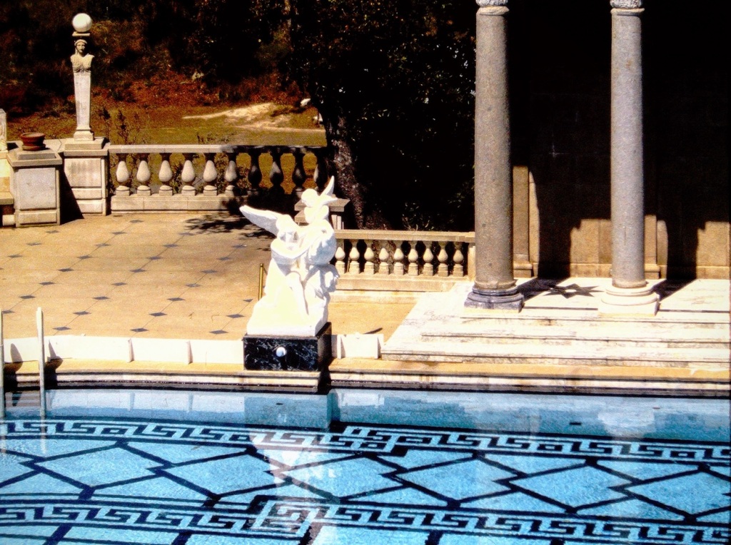
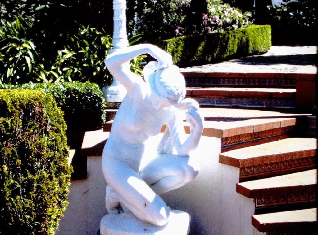
Judy’s Numbers Game can bring about interesting results and insights from those who choose to participate. The challenge is alive, let’s get Blogging. In searching for the #147 and its variations the results that popped up all had the central focus around Hearst. Therefore, I selected a variety of photos around the Word Hearst and Hearst Castle.
As we approach Hearst Castle we see the sign informing us we are arriving at our desired destination.
Hearst San Simeon State Historical Monument
The long and winding road up to the top where Hearst Castle is located.
Touring the outside grounds at Hearst San Simeon we see statues poolside …
And by the stairs leading upward …
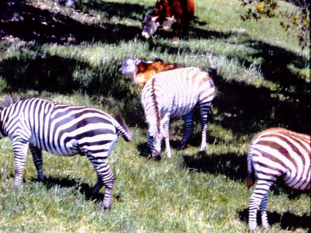
Continuing our tour of the grounds we come upon the Hearst Ranch. William Randolph Hearst kept Fifty (50) species of herbivores on his ranch. They included around 126 Zebras plus bison, fallow deer, antelope, zebras, elk, camels, kangaroos, and giraffes.
We also could see the vastness of the Hearst Ranch where the numerous animals grazed.
At last we come to the end of today’s tour as more about Hearst Castle will come in a later post.
Location: Hearst San Simeon State Historical Monument; San Simeon, California, USA
God Bless. Thank you for tagging along on our tour. Thank you for sharing your time and thoughts with us. Have a wonderful week. I appreciate y’all very much.
Location: Hearst San Simeon State Historical Monument; Hearst Ranch; San Simeon, California, USA
God Bless. Thank you for visiting. Have a wonderful week and enjoy the Outdoors. Thank you for sharing your time and thoughts with me. I appreciate y’all very much.
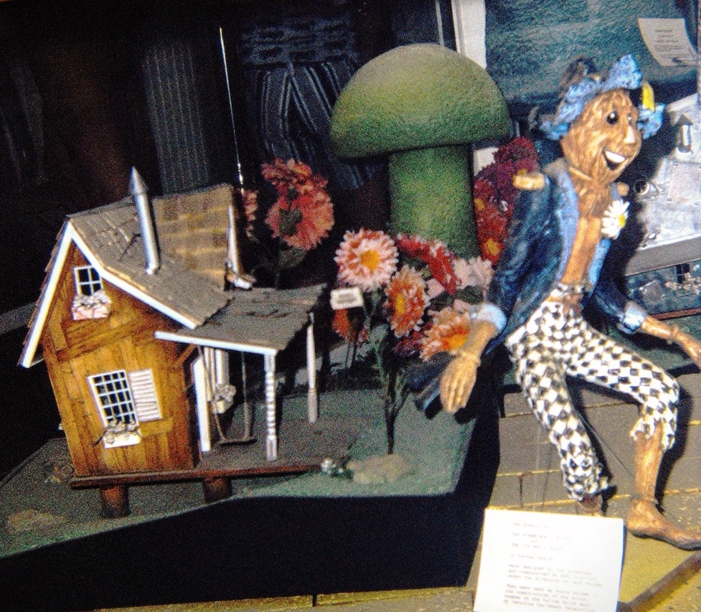
Ritvais this week’s host for the Lens-Artist Photography Challenge; she has chosen the theme of behind. What backgrounds to choose may seem easy, but some thought process may determine just the right background & balance you what to achieve and capture when you are snapping your photos.
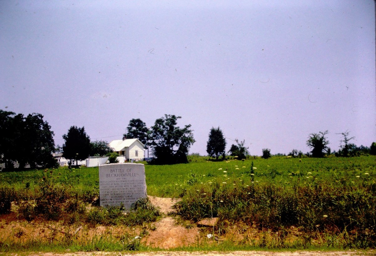
Battle of Beckhamville Marker Beckhamville, Chester, South Carolina, USA
BATTLE OF BECKHAMVILLE
May 1780
Inscription.
British under Houseman surprised and defeated by band of 33 patriots under Capt. John McLure with 9 Gaston brothers and neighbors, who struck first blow for liberty and resisted attempt to subject people to oath of allegiance to king.
Erected.
By Citizens of Chester County
Mary Adair Chapter DAR
May 10, 1942
This Historical Marker was taken by my father in the summer of 1963. It is located at 34° 35.424′ N, 80° 55.194′ W in Beckhamville, South Carolina. Beckhamville is located in Chester County just south of Great Falls where my dad grew up. You can find the Marker at the intersection of State Highway 97 and State Highway 99, on the left when traveling east on State Highway 97.
The Battle of Beckhamville is recorded to have been fought during the Revolutionary War around June 6, 1780. This was following the disasters at Charleston and Waxhaws where Patriot forces struck a blow against the British in South Carolina.
On June 6, 1780, Captain McClure and his small force, wearing hunting shirts, wool hats and deer-skin caps and each armed with a knife and rifle, attacked Houseman and routed about 200 of the gathered loyalists at Alexander’s Old Fields. The Battle of Beckhamville’s victory helped solidify resistance to the Crown in this up country area.
Beckhamville was also known by Beckham’s Old Field and Alexander’s Old Field. Chester County has battlefields, historic markers, monuments, cemeteries, and stories that relate to the important role this area played in our winning our Independence from England.
DAR stands for the Daughters of the American Revolution. The DAR strives to promote the historic preservation, education, and patriotism.
Location: Beckhamville, Chester County, South Carolina, USA
God Bless. Thank you for taking a trip with me to visit an historical marker near my father’s hometown. Thank you for sharing your time and thoughts with me. I appreciate y’all very much.
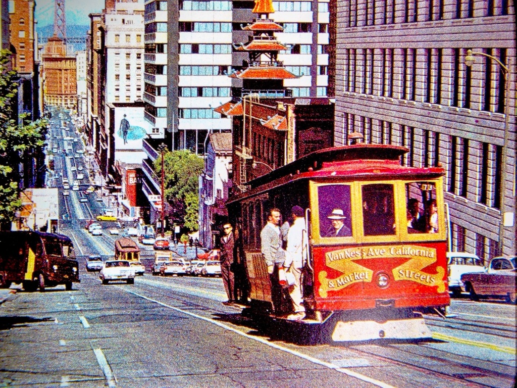
San Francisco Cable Car – Van Ness Ave California Street
Cable Cars have been carrying passengers in San Francisco since 1873. Cable cars were invented by Andrew Smith Hallidie. He based his system on early mining conveyance systems which dominated the city’s transit scene for more than 30 years.
The San Francisco cable car system is the world’s last manually operated cable car system and an icon of the city of San Francisco. Of the 23 cable car lines established between 1873 and 1890, only three remain (one of which combines parts of two earlier lines): two routes from downtown near Union Square to Fisherman’s Wharf, and a third route along California Street.
The vast majority of the millions of passengers who use the system every year are tourists. Due to the high volume of tourists desiring to ride the cable cars, the wait time to get on can be up to or exceeding two (2) hours. The Cable Cars are amongst the most significant tourist attractions in San Francisco, along with Alcatraz Island, the Golden Gate Bridge, and Fisherman’s Wharf.
The San Francisco Cable Cars are one (1) of two (2) street railways named on the National Register of Historic Places as a National Historic Landmark. The other street railway on the National Register of Historic Places is the St. Charles Streetcar Line in New Orleans.
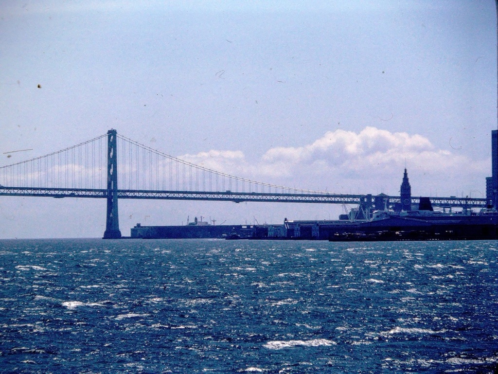
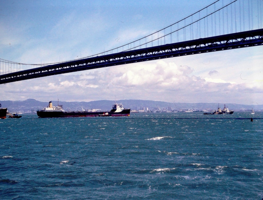
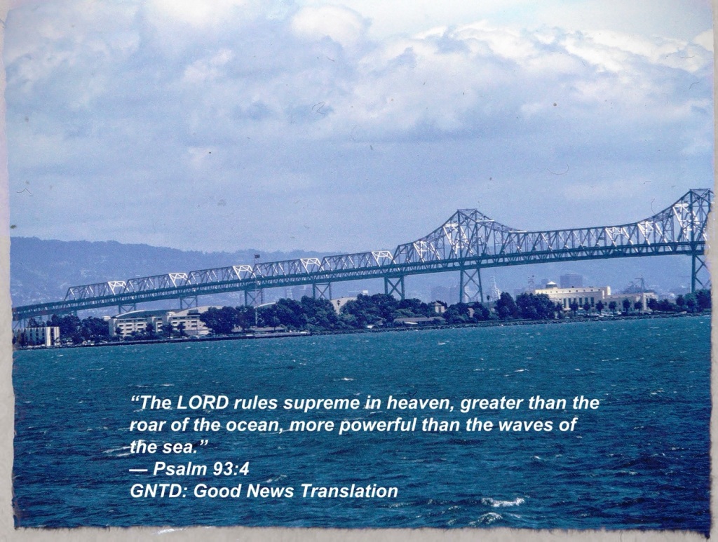
While on our San Francisco Bay Discovery Cruise we were able to see beautiful views surrounding the Bay. We were able to view unique perspectives of the amazing architectural features of the Bay Area Bridges.
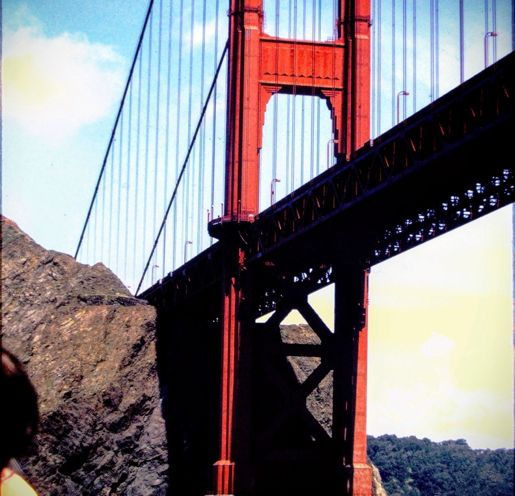
Looking at The Golden Gate Bridge from the waters below …
The Golden Gate Bridge is a suspensionbridge spanning the Golden Gate, the one-mile-wide (1.6 km) strait connectingSan Francisco Bay and the Pacific Ocean.
Golden Gate Bridge
The structure links the U.S. city of San Francisco, California—the northern tip of the San Francisco Peninsula—to Marin County, carrying both U.S. Route 101 and California State Route 1 across the strait.
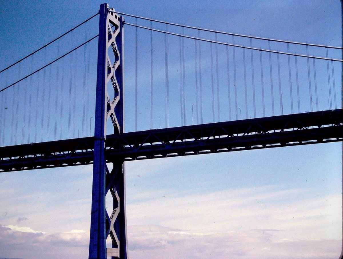
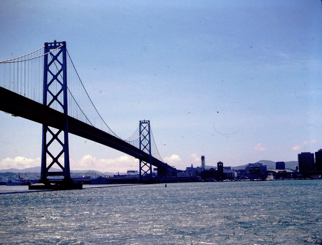
The San Francisco-Oakland Bay Bridge is made up of two (2) bridge segments: a skyway structure/single anchored suspension bridge between Oakland and Yerba Buena Island, and a suspension span from the island to San Francisco. The two (2) are connected by the world’s largest diameter bore tunnel.
The San Francisco-Oakland Bay Bridge is the region’s workhorse bridge, carrying more than a third of the traffic of all of the state-owned bridges combined. It is also a jewel along the San Francisco waterfront.
San Francisco Bay Bridge
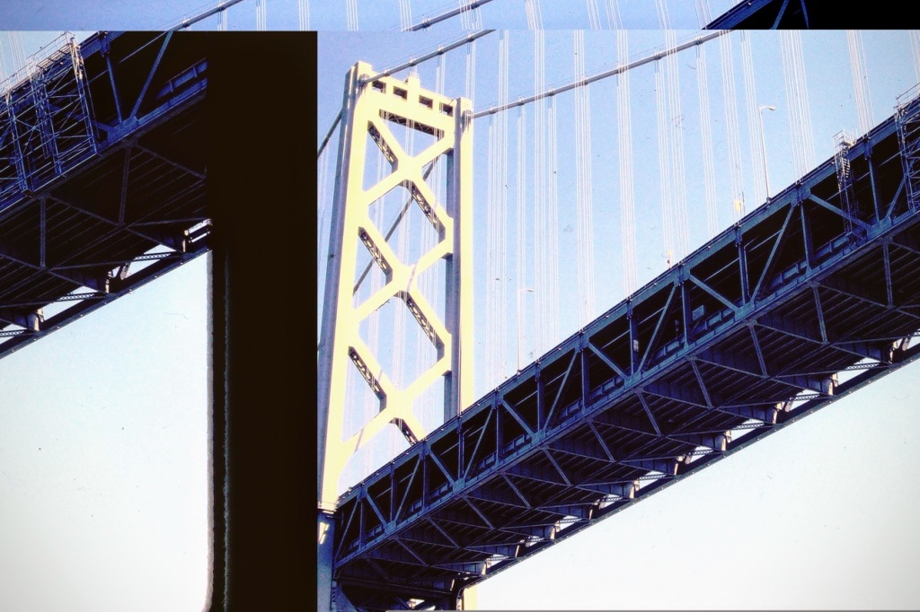
The Eastern Span of the San Francisco-Oakland Bay Bridge underwent an extensive replacement renovation to replace a seismically unsound portion of the Bay Bridge with a new self-anchoredsuspension bridge (SAS) and a pair of viaducts. The span replacement took place between 2002 and 2013, and is the most expensive public works project in California history. The Eastern Span replacement upgrade was part of a plan to make the bridge more seismically sound. The replacement was necessary due to an earthquake of unanticipated magnitude of the horizontal motion caused by the Loma Prieta Earthquakecausing significant damage to the Bay Bridge. It also caused section of a major highway along the bay (a portion of it double-decked) to collapse; repairs on these were completed by the late 1990s.
Oakland Bay Bridge
The San Francisco-Oakland Bay Bridge was listed in the National Register of Historic Places in 2001. The Bay Bridge is significant for its influence in the California Bay Area.
Bay Bridge Architectural Design
The San Francisco-Oakland Bay Bridge’s multi-modal design is a direct example of the mindset of commuters during the 1930s. Constructed in 1936, the bridge was used to support the increase of automobiles and public transit lines in the early half of the 20th century.
San Francisco-Oakland Bay Bridge
Today the Bridge continues to pay a vital role in transportation as it serves as a major freeway connector for many who travel to and from the Bay Area.
Looking through the my dad’s old slides the photos of these Bridges reminds me of a 70’s song by Simon and Garfunkel called “Bridge Over Troubled Water.”
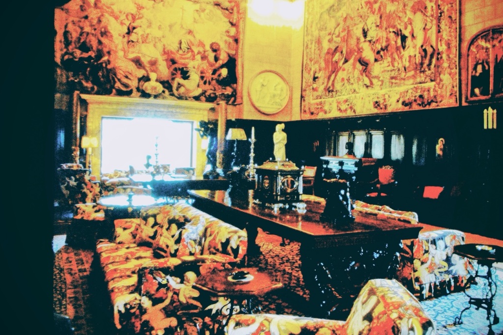
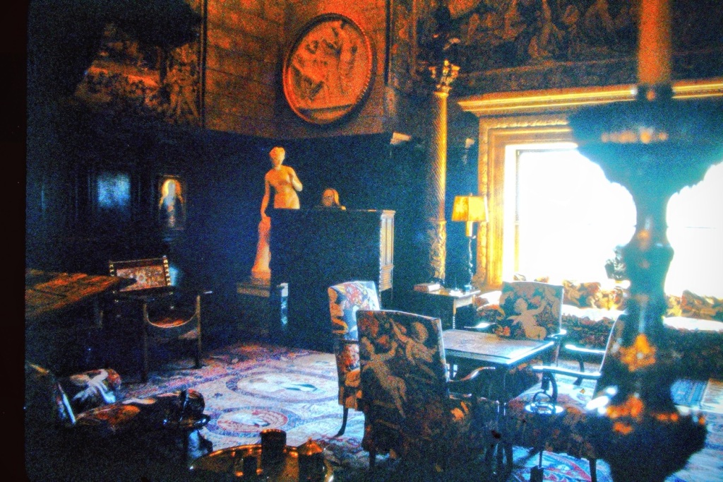
Hearst Castle is located up on a hill in San Simeon, the land was originally purchased by George Hearst. After his & his wife’s passing, the ownership of the property was transferred to William Randolph Hearst, their son.
William Randolph Hearst expanded on the property growing it to encompass approximately 250,00 acres. In 1919, Hearst collaborated with San Francisco architect Julia Morgan to build what would later become one of the world’s greatest showplaces and later an accredited museum.
The site originally known as “Camp Hill” was renamed “La Cuesta Encantada” which is Spanish for The Enchanted Hill.
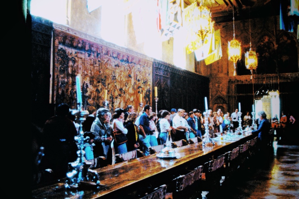
After the passing of William Randolph Hearst, the estate opened its doors to the public in 1958. Hearst Castle comprising 90,000 square feet and Hearst’s world-class art collection. The property includes its own theater, billiard room, beauty salon and pair of dazzling swimming pools.
Among the rooms you can view while touring the Castle are:
Grand Social Rooms of Casa Grande —the largest house at Hearst Castle.
Assembly Room — located on the ground floor.
Refectory — where Hearst hosted lavish dinner parties and social occasions.
Billiard Room — where guests could relax and play billiards and pool.
Theatre — Hearst joined his guests here to watch movies and newsreels.
Doge’s Suite — here guests can admire the magnificent painted antique ceiling, marble balcony and Mountain View’s.
Main Library — It has an impressive collection containing more than 4,000 books.
Gothic Suite — located on the third floor it contains Hearst’s most treasured collections and sacred objects.
There are many more areas and rooms you may tour at Hearst Castle. The sculptures and architecture are amazing to see. As you can see, the various rooms have a variety of seating selections; each selection was once used by the vast number of guests visiting the property.
When touring the Castle ( depending on your choice of tour) you may learn about the paintings, sculptures, antiquities, tapestries and other works that comprise Hearst’s collection.
The Enchanted Hill doubled as a museum, bringing together centuries-old masterpieces in one stunning setting. These historic objects can still be viewed today among Hearst’s gardens, guest houses and Casa Grande.
Even though you can view and admire the numerous spacious rooms and seating arrangements around Hearst Castle, they are only for admiration and not for tourists to currently use.
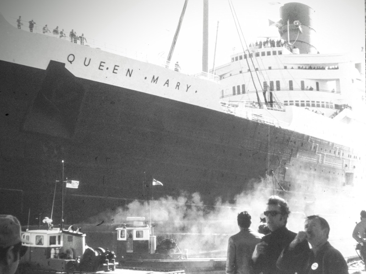
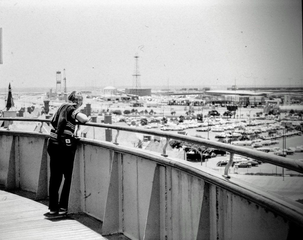
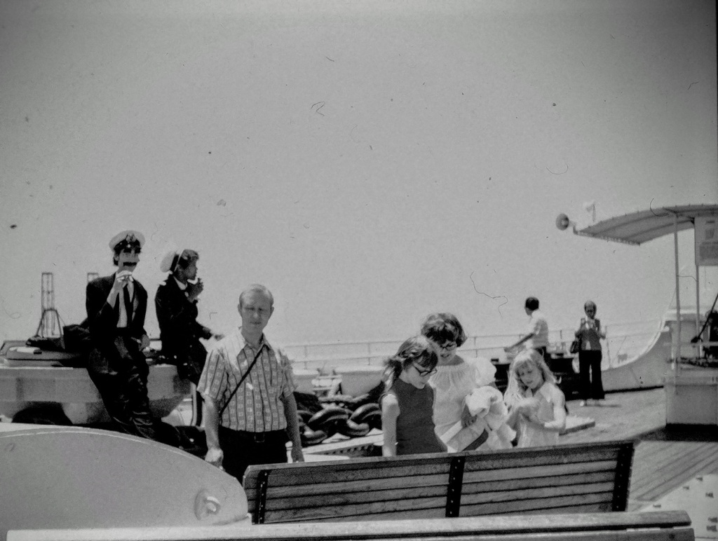
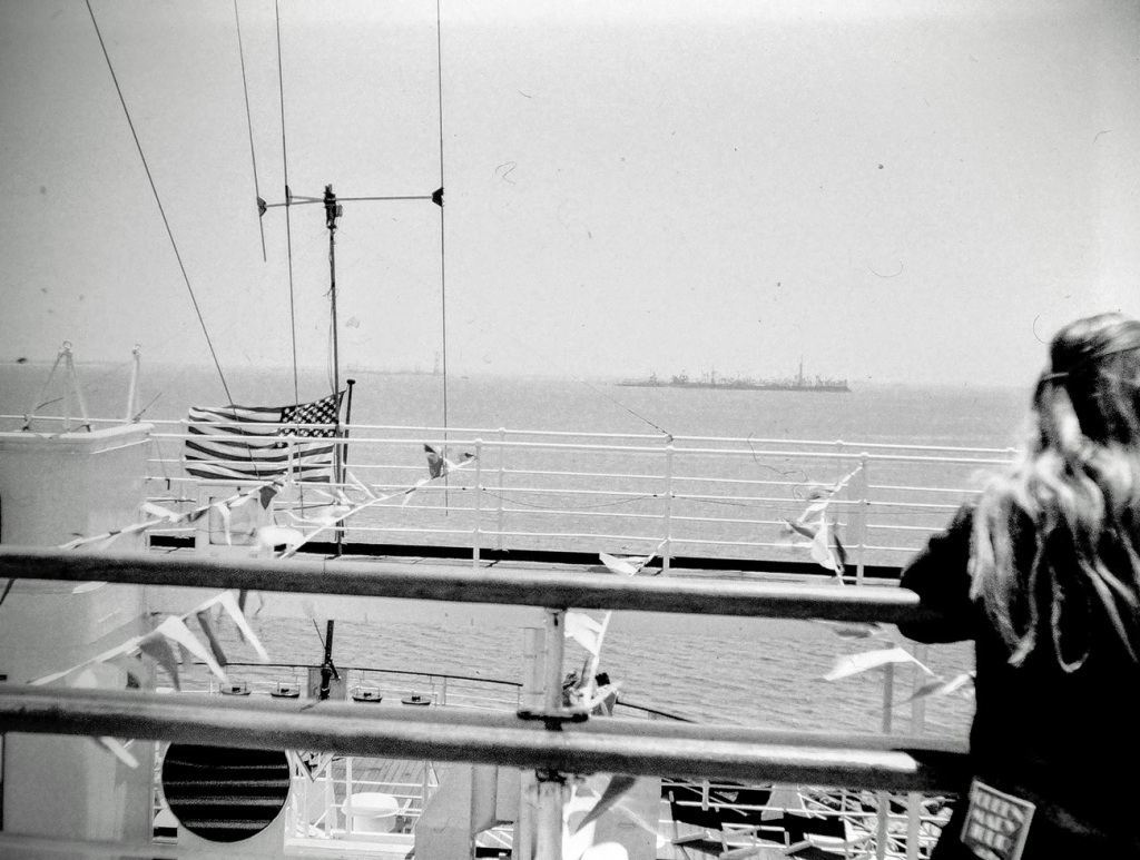
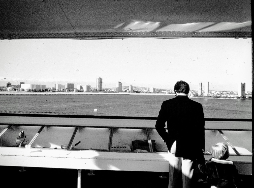
I have been reminiscing about the good old days as I go thru processing my dad’s old slides into a digital format. These are from 1974 and 1975 when we toured the Queen Mary in Long Beach, California.
Here I am looking out over the ships railing into the parking lot waiting for everyone to climb aboard.
Other people are milling about conversing with one another as they wait for the tour to proceed.
Let’s take a gander over yonder at the Pacific Ocean . Isn’t it amazing how vast and beautiful the views are watching the ripples in the ocean waters.
Hey look, there’s a father and son looking out over towards Long Beach.
What do you know? Seems somebody took a photo of my mom and dad.
Mom & DadColor Pop
Are you ready? The tour is over and people are waiting for us to disembark.
Queen Mary
Thank you for joining us on our tour of the Queen Mary.
Janet from sustainabilitea.wordpress.com is offering us all to participate in her“One Word Sunday”word Abandoned. I am choosing to participate, how about you?
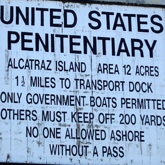
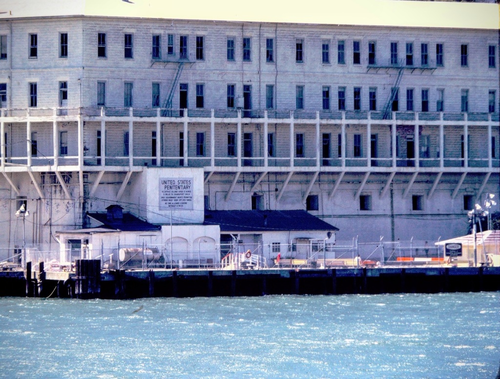
Alcatraz
Have you ever thought about visiting or touring a federal prison? How about touring an Abandoned maximum security prison like Alcatraz? It is possible, you know.
Alcatraz was not always a maximum security prison. It was first used by Native Americans long before Europeans arrived in the area. The Island has been used for camping, hunting, and at one point it became an isolated and remote place where law violators were held during its history. Based on oral history of Indigenous people, it appears that Alcatraz was used as a place of isolation or ostracization for tribal members who had violated a tribal law or taboo, and was utilized also as a hiding place for many Indians attempting to escape from the California Mission system.
Alcatraz Barracks Building 64 United States Penitentiary Alcatraz Island
Building 64 was the first building constructed on the island of Alcatraz off the coast of San Francisco, California. The purpose of Building 64 was for the accommodation of the military officers and their families living on the island. It is located next to the dock on the southeastern side of the island below the Warden’s House. It’s a three-story apartment block that was built in 1905 on the site of a U.S. Army barracks which had been there from the 1860s. It functioned as the Military Guard Barracks from 1906 until 1933.
United States Penitentiary Alcatraz Island
Nowadays, it is possible to tour Alcatraz. You may select from an Alcatraz Day Tour or an Alcatraz Night Tour, or the Bay Discovery Cruise, or Alcatraz Behind the Scenes Tour. All Tours except the Bay Discovery Cruise allows access via ferry onto Alcatraz Island. Each tour has its own unique itinerary and the opportunities are expanded with the Night and Behind the Scenes tours.
The Bay Discovery Cruise does not dock at Alcatraz, but does (weather permitting) encircle Alcatraz Island and provides breathtaking views of the San Francisco Bay Area.
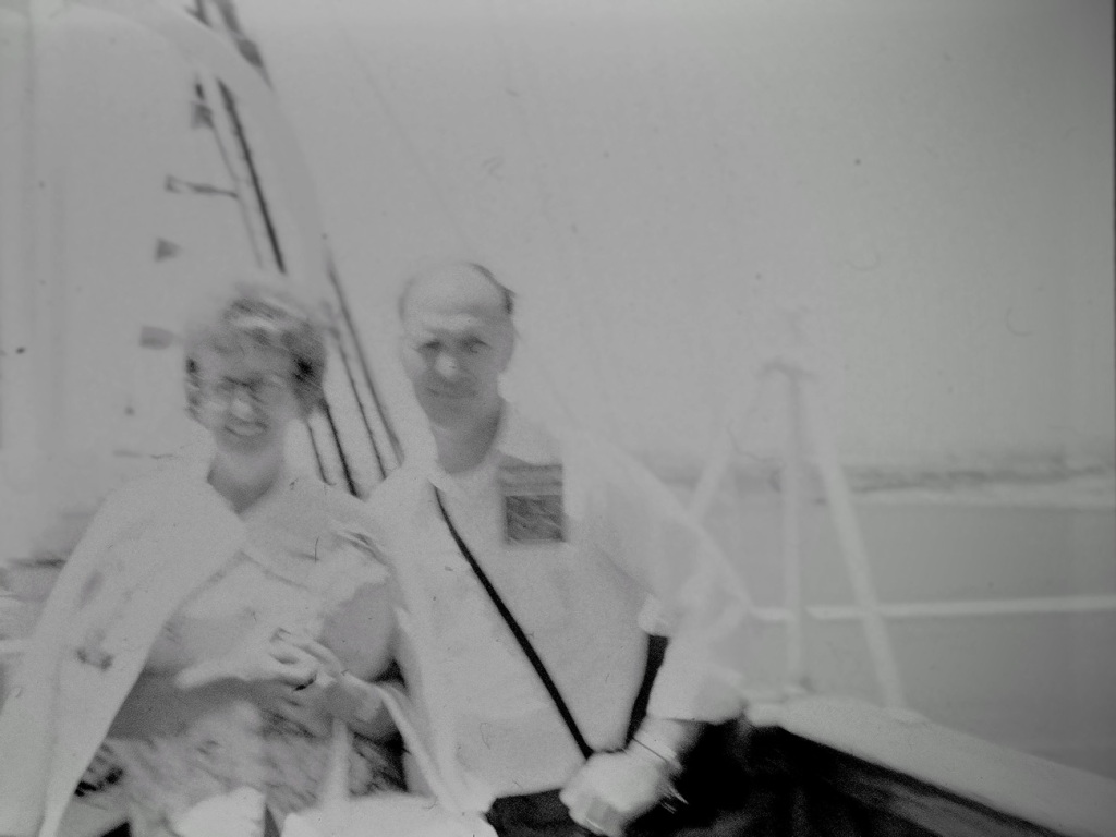
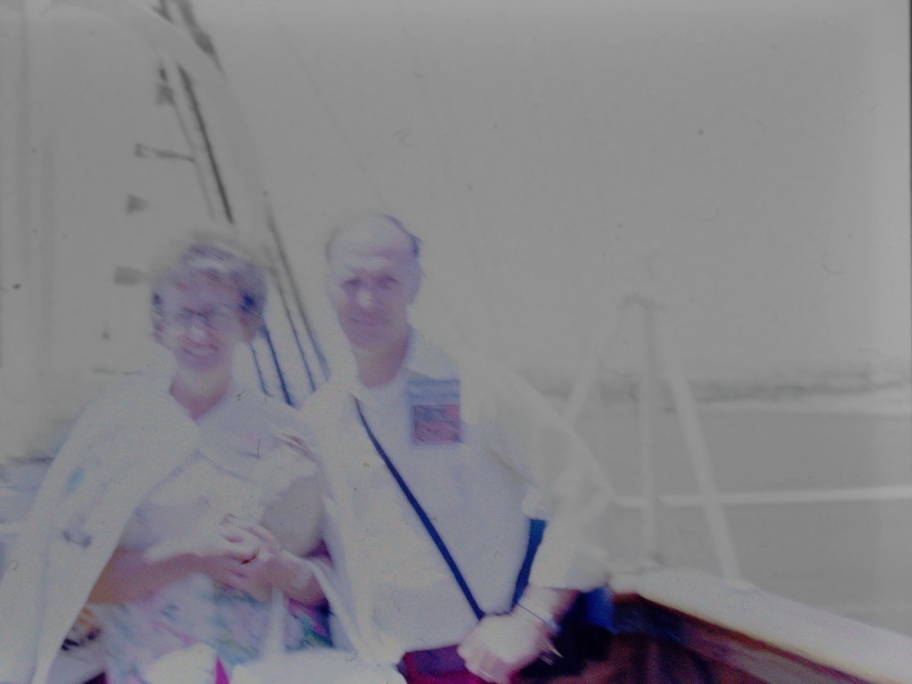
These photos were taken by my dad back in 1979 when we took a Bay Discovery Cruise. The San Francisco Bay Cruise lasts for Ninety (90) minutes sailing under the Golden Gate Bridge, encircling Alcatraz Island and allows for sensational views of the San Francisco Waterfront, the Presidio, Sausalito, Fort Baker, Angel Island and a lot more. [More scenes from the Bay Area Cruise coming in later posts.]
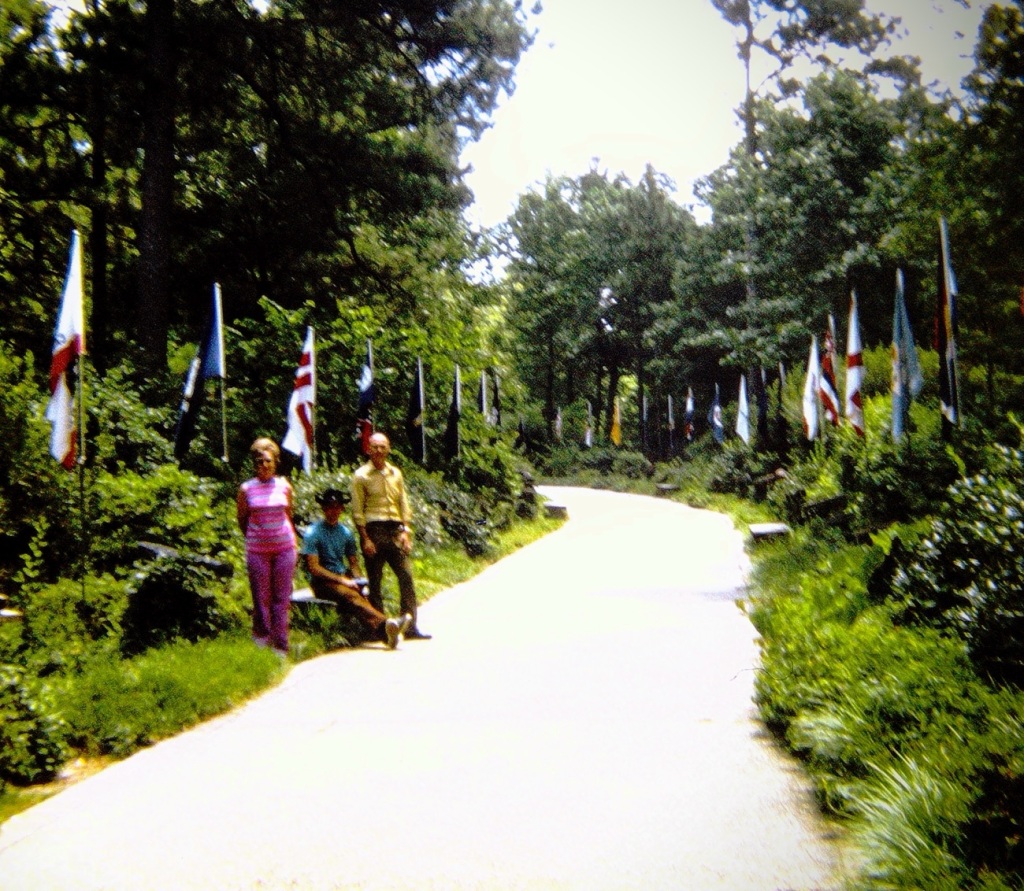
Growing up we made several vacation trips to the Carolinas from San Diego. On one of our trips to the Carolinas we made a stopover in Georgia to visit Franklin Delano Roosevelt’s (FDR) The Little White House in Warm Springs.
When you arrive at The Little White House Historic Site you walk along the Avenue of Flags ( also called the Walk of Flags and Stones.)
My parents and brother on the Walk of Flags and Stones
The Walk of Flags and Stones at the Little White House serves as a tribute to President Franklin Delano Roosevelt, the 32nd President of the United States. Each of the 50 states and Washington D.C. brought a native stone to be put on display at the site.
Moving Forward along through the Walk of Flags and Stones you may notice several stone benches in case you need to Pull Up a Seat and rest a spell. Another option, if you choose, would be to Sit on the bench just outside the front door of The Little White House.
Franklin Delano Roosevelt’s (FDR’s) The Little White House
FDR’s The Little White House was his personal retreat and is located in the Historic District of Warm Springs, Georgia. It is a single-story, plain Colonial Revival constructed of Georgia pine.
Architect Toombs expanded the residence in 1932 with a detached garage/servants’ quarters, a guesthouse in 1933 and the Georgia Wilkins Cottage in 1934. The Cottage was later converted into a museum by Toombs in 1959.
The Little White House was originally approached from the cottage area of the rehabilitation center via an unpaved road; it was more secluded than it is today.
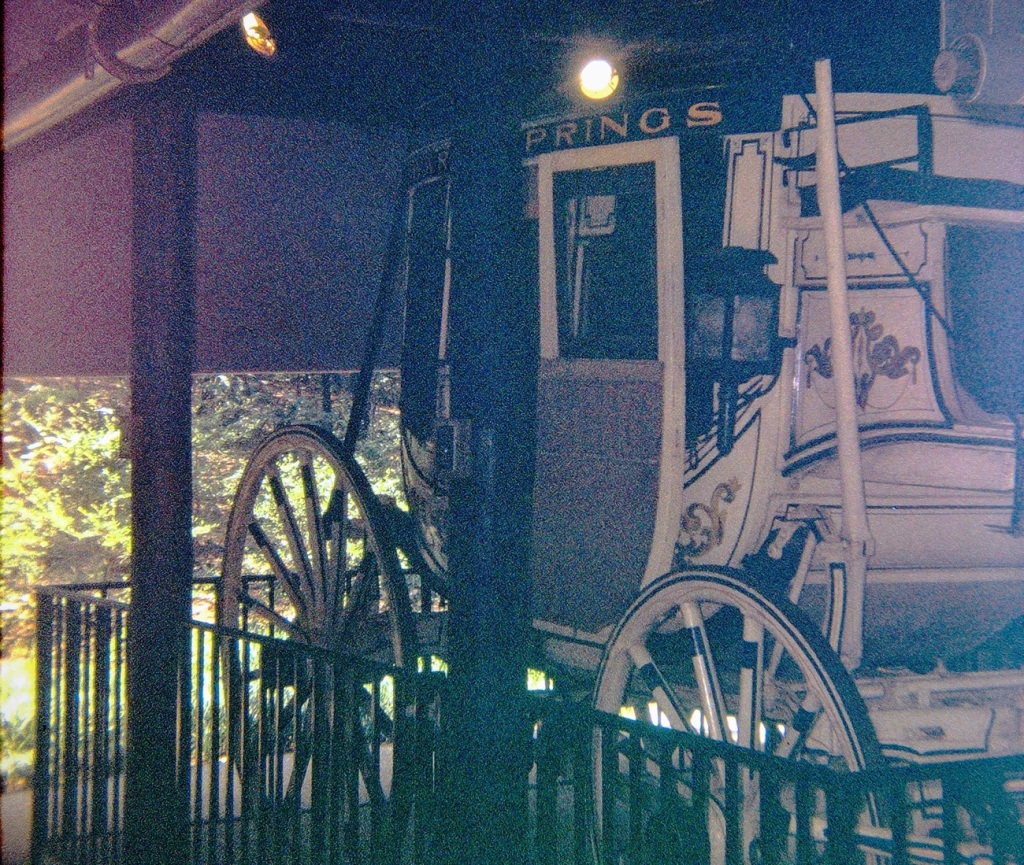
“Tally Ho” stage coach
While you’re touring The Little White House, you might as well took a look at some of FDR’s vehicles. One of those “vehicles” is the “Tally Ho” stage coach.
The “Tally Ho” stage coach came with the Warm Springs property. FDR and Eleanor dressed up as George and Martha Washington and rode in it for the parade to celebrate his election as NY Governor.
The weather has been hot and Sunny 🌞 during the day and stormy at night. Decided to switch out the sand in my grandson’s “Turtle” for Water 💧 to allow him to enjoy 😊 water playtime in the Warm Sunshine.
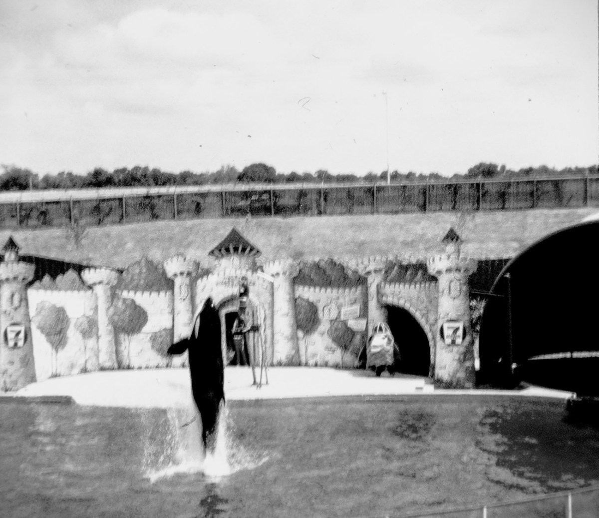
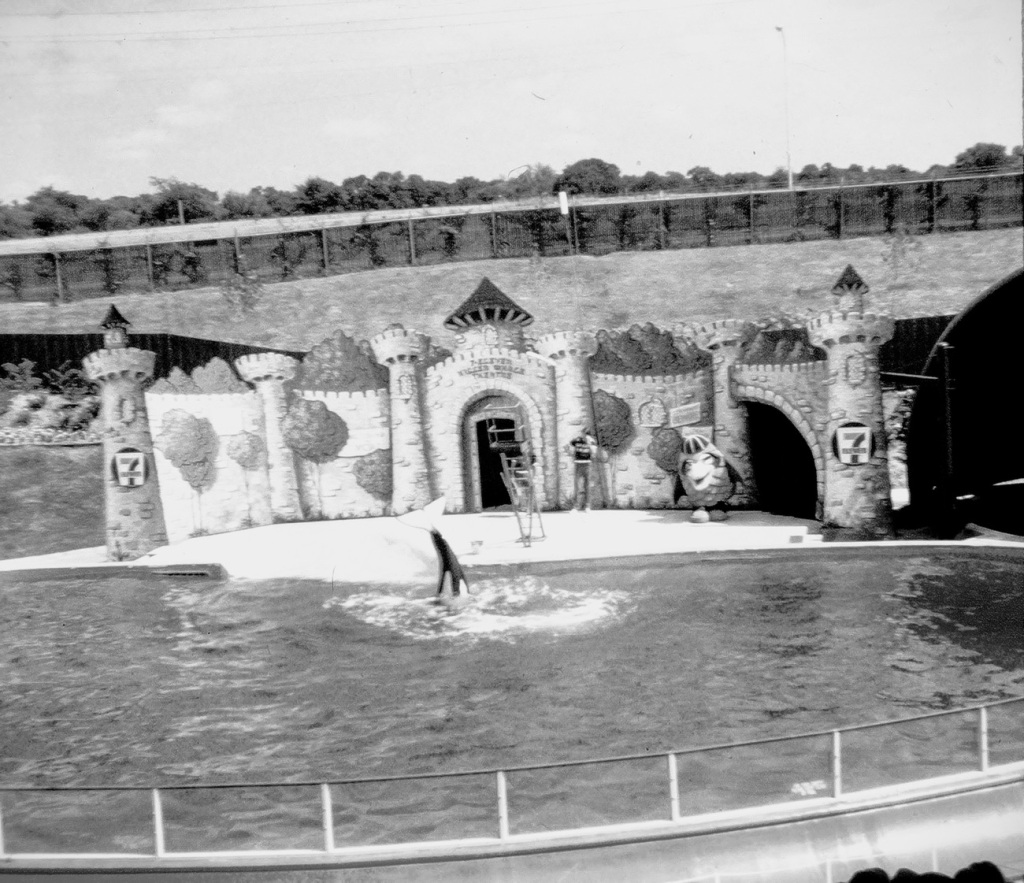
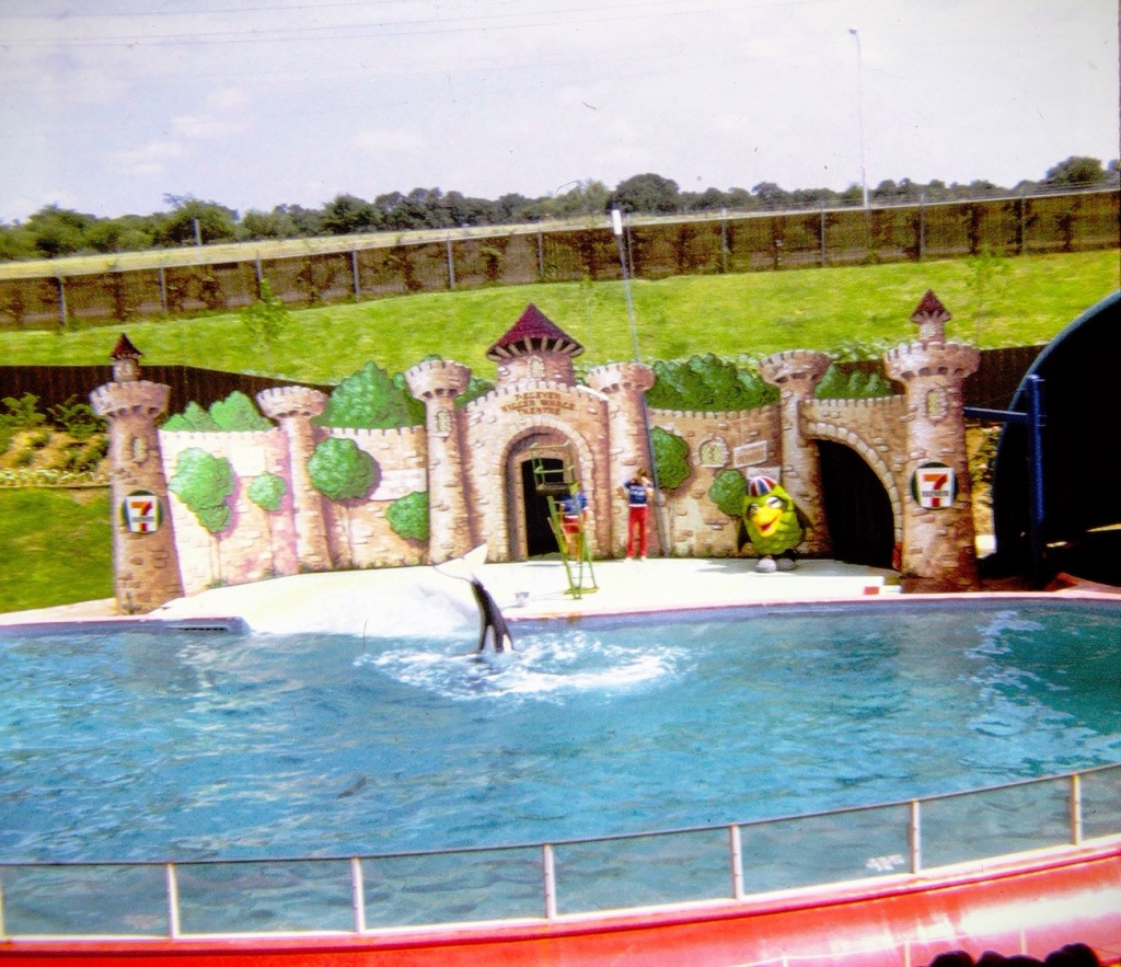
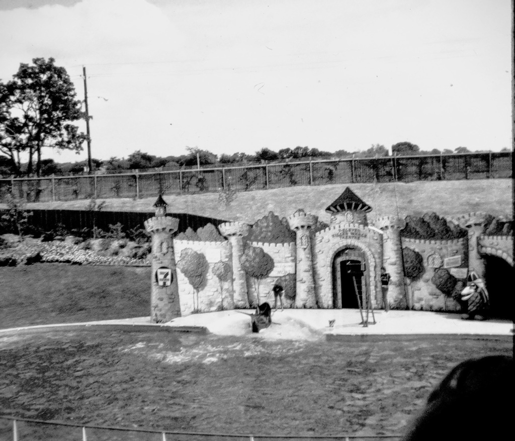
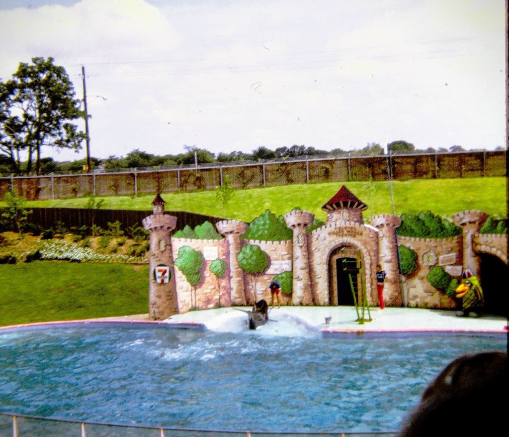
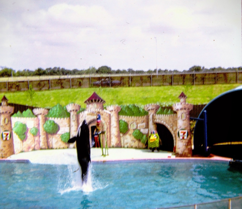
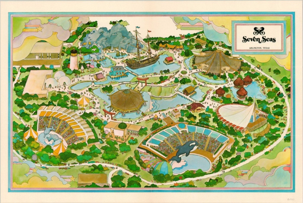
Breaching the Waters of Time, we drift back to 1972 when my family stopped for some time of relaxing entertainment at the Seven Seas Marine Life Park in Arlington, Texas.
Newtka, a Killer Whale
Seven Seas Marine Life Park was a marine mammal park, and animal themepark built and owned by the city of Arlington, Texas, United States. It opened in 1972, and closed in 1976. The 35-acre (14 ha) site was located in north Arlington off Interstate 30 near Six Flags Over Texas and adjacent to Arlington Stadium. The facility housed killer whale Nootka from 1972 to 1975.
Pictured here is the Killer Whale Stadium at Seven Seas Marine Life Park. If you look closely you might can see the two trainers and Orchin, the Seven Seas Mascot standing on the platform stage area within the stadium. The castle themed backdrop is visible behind the platform.
The theme park had seven (7) sections:
Arctic Ocean
Caribbean Sea
Indian Ocean
Mediterranean Sea
Sea of Cortez
Sea of Japan
South Seas
Newtka (also spelled Nootka) the killer whale: A 6,000-pound (2,700 kg) and 18-foot (5.5 m) female orca that resided in the park’s largest animal performance stadium. Other animals that were housed and performed at the park were: Jannie, Rodney, Debbie are three of the twelve bottle-nosed dolphins which performed in the Dolphin Show; Pancho the Elephant Seal; Over fourteen (14) California sea lions for the Sea-lion circus; and Several Rockhopper Penguins and one Magellanic Penguin for the Penguin Troop Performance. Seven Seas Marine Life Park also had a few rides and Pearl Diving.
The city council of Arlington voted to close the park in 1976 because it did not generate enough revenue to both pay its operating expenses and pay off the bonded indebtedness.
The property is now the site of the Arlington Sheraton Hotel and has several buildings on the property that date back to the park.
Location: Seven Seas Marine Life Park; Arlington, Texas, USA
God Bless. Thank you for visiting the Seven Seas Marine Life Park with us. Thank you for sharing your time and thoughts with me. I appreciate y’all very much.
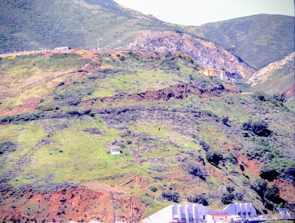
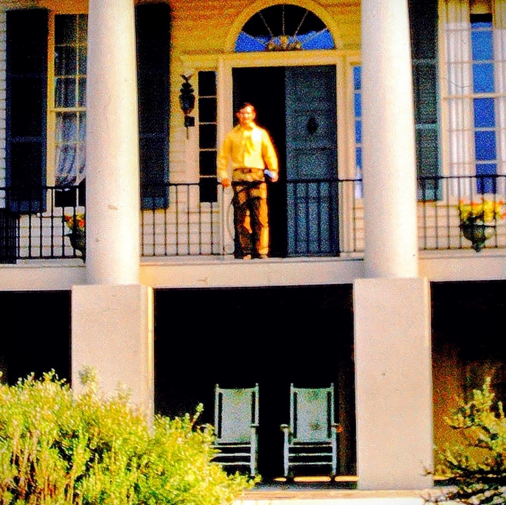
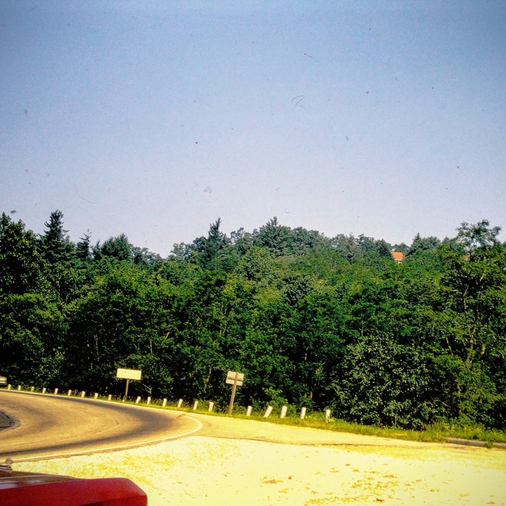
This long straight hilly 15-mile stretch of US 21 is the road that leads us to Great Falls, South Carolina coming out of Georgia. We would travel this road every three (3) to five (5) years to visit my dad’s parents and his brother and sister’s families. My dad grew up in Great Falls, but left when he joined the US Navy. It was only on these long summer trips that I was able to spend time with my dad’s family. Often when we came back to visit we would all go visit an attraction together on one of the days we were here.
Cee, I pray you’re better and home soon. In the meanwhile I’m continuing with the CWWC – Any Which Way in my Way until you are back well and able choose a theme. Anyone care to join me, let’s let Cee know we’re thinking and caring about her.
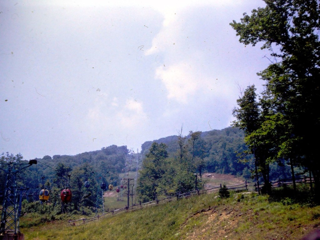
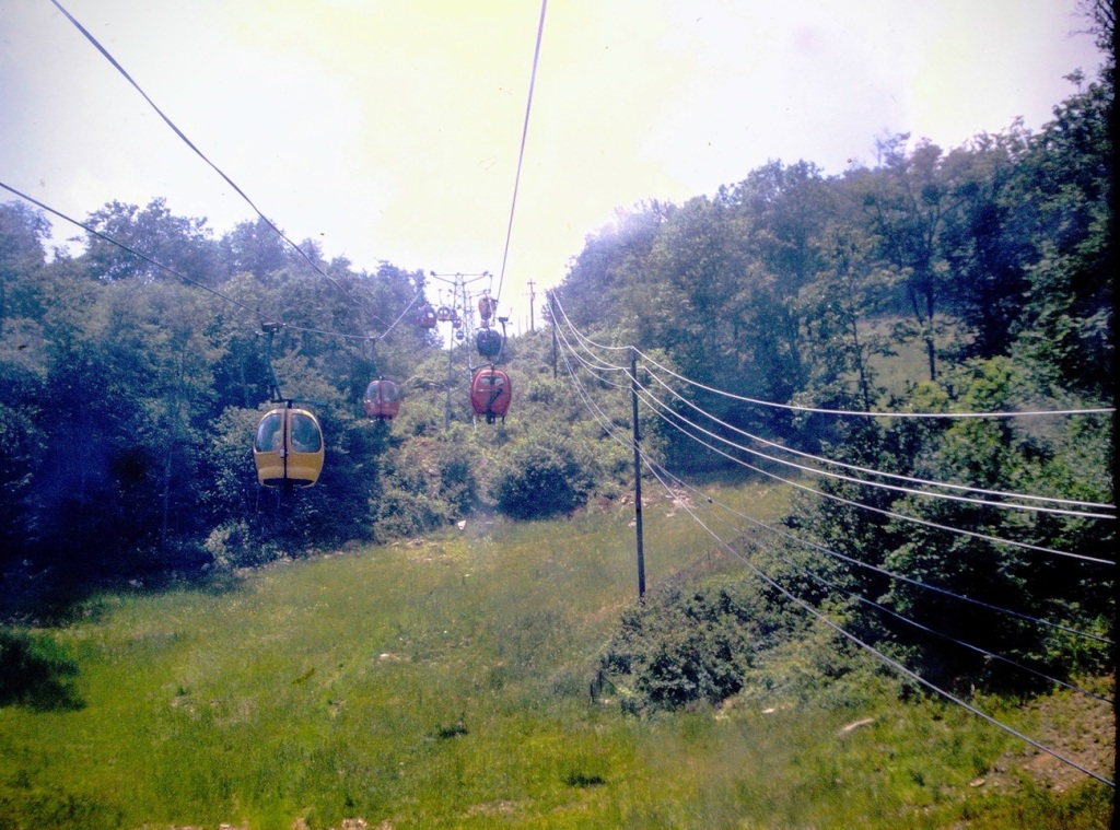
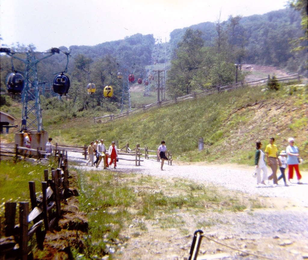
Back in the day there were three (3) ways you could choose from to get to Land of Oz. One could choose the Hot Air Balloon ride, the Gondola Lift, or a shuttle bus to reach the Land of Oz location in Beech Mountain.
People milling about deciding which option they want to take to reach the Land of Oz.
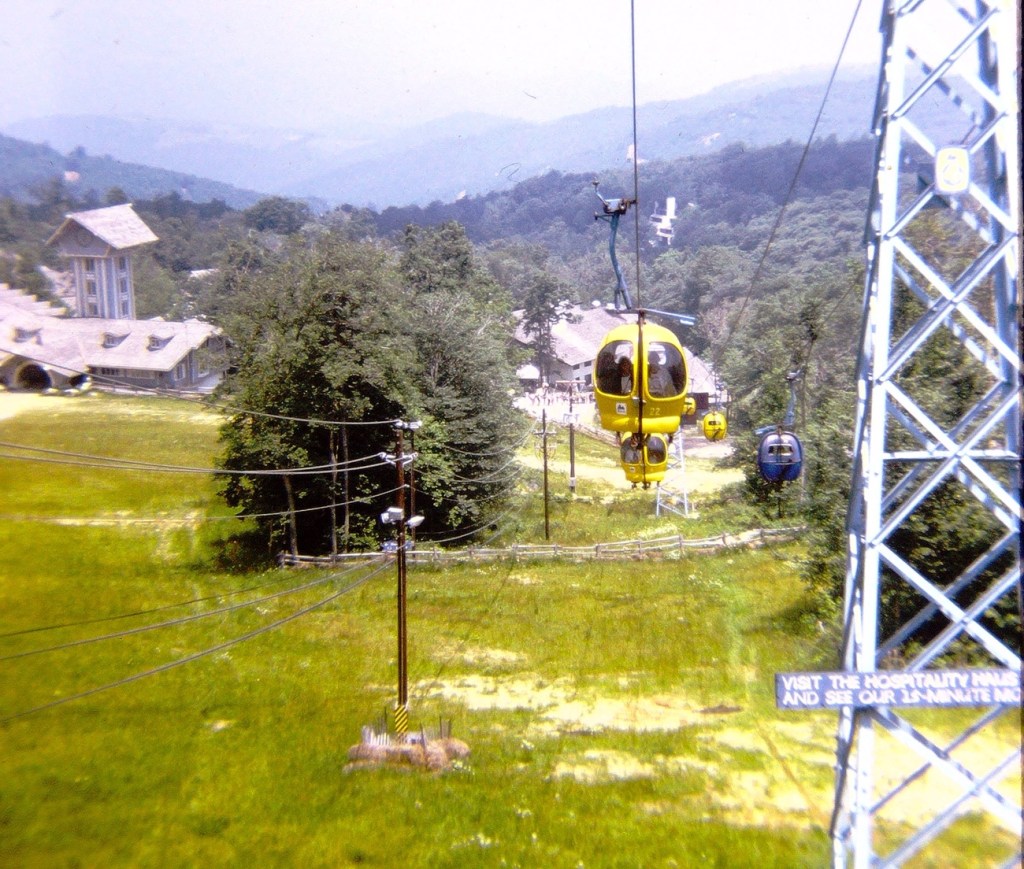
The Hot Air Balloon ride up to the Land of Oz offers a different perspective, a different and unique experience and yet similar in approach to the Gondola Lift. Both the Hot Air Balloons and the Gondola Lift operate similar to a ski resorts ski lift would operate.
They are both aerial lifts that uses a continuous cable loop to transport passengers up a mountain. The cable is driven by a bullwheel at each end of the lift, which is usually connected to an electric motor or engine. The cable runs through sheaves at towers that support the cabins, or carriers, as they travel up the mountain. The cabins are attached to the cable by detachable grips that allow for secure boarding and exiting at slow speeds.
Having chosen our method of reaching the top of Beech Mountain for our Land of Oz adventure, we are delighted we are on our way up.
Up, up, up we go … look at our amazing climb through the air. It seems as if I chose to ride in a Hot Air Balloon while others in the family chose to ride in one of the Gondolas.
Visitors to the Land of Oz walking along the trail after exiting their chosen path.
The Gondolas continue throughout the day to carry visitors to the Land of Oz.
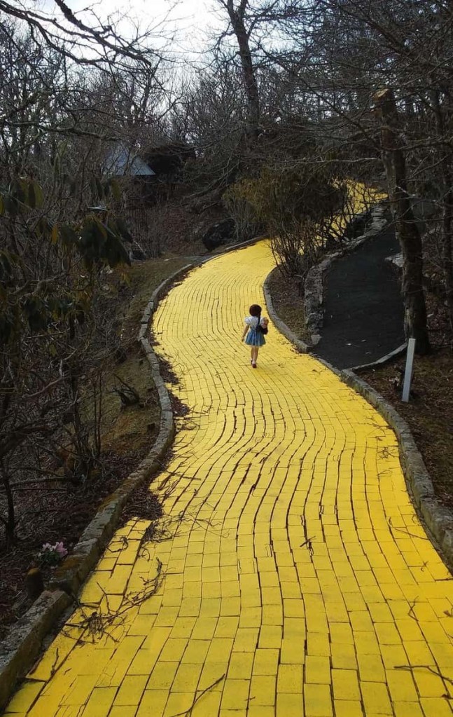
Once you’ve completed your ride, follow the Yellow Brick Road to the Emerald City and your adventure begins.
When your tiredness overwhelms you, take a breather from following the Yellow Brick Road and sit a spell and enjoy the show.
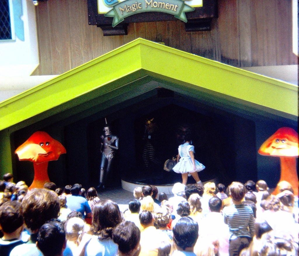
Amphitheater hosting the Magic Moment Show
The Magic Moment Show was staged every half hour. During the show Dorothy appeared with her friends to meet the Wizard and entertain the park’s guests.
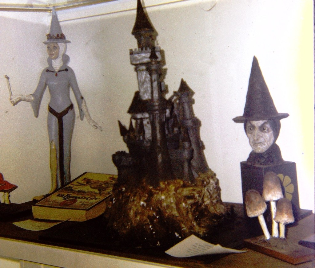
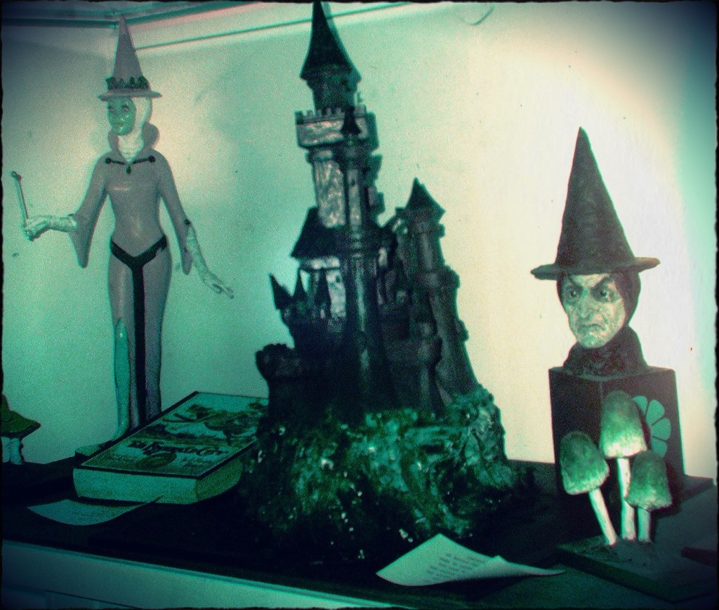
The photo of these Wizard of Oz Sculptures were taken in the Summer of 1972 at The Land of Oz Museum at the Land of Oz Attraction in Beech Mountain, North Carolina.
Original Slight Colour PopBlack and White Monochrome A Bit of Colour Splash, a bit of Dean effect, a bit of brightening, a little of this – a little of that …
Welcome Friends, Guests, and Visitors! This is June 2024, I am realizing that the Older I get the harder it is for me to Rise. It is harder for me to Rise in the mornings, and harder for me to Rise from the floor. Let’s face it the Older I get the harder it is for me to do a lot of things. But, do I let that stop me? No. The Older I get the more determined I am to Rise above any and all obstacles that may arise.
Now that all that has been said, how about we take a ride down memory lane (or in this instance – tracks.) As I have been looking back through my dad’s Old old slides, I realise how much I do not remember about the family trips we took. I remember taking them, but the details are obscure. In the process of digitizing his old slides, the memories are Rising to the forefront of my mind.
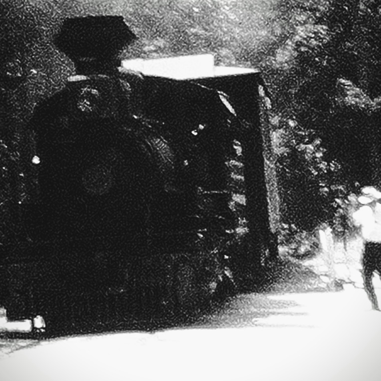
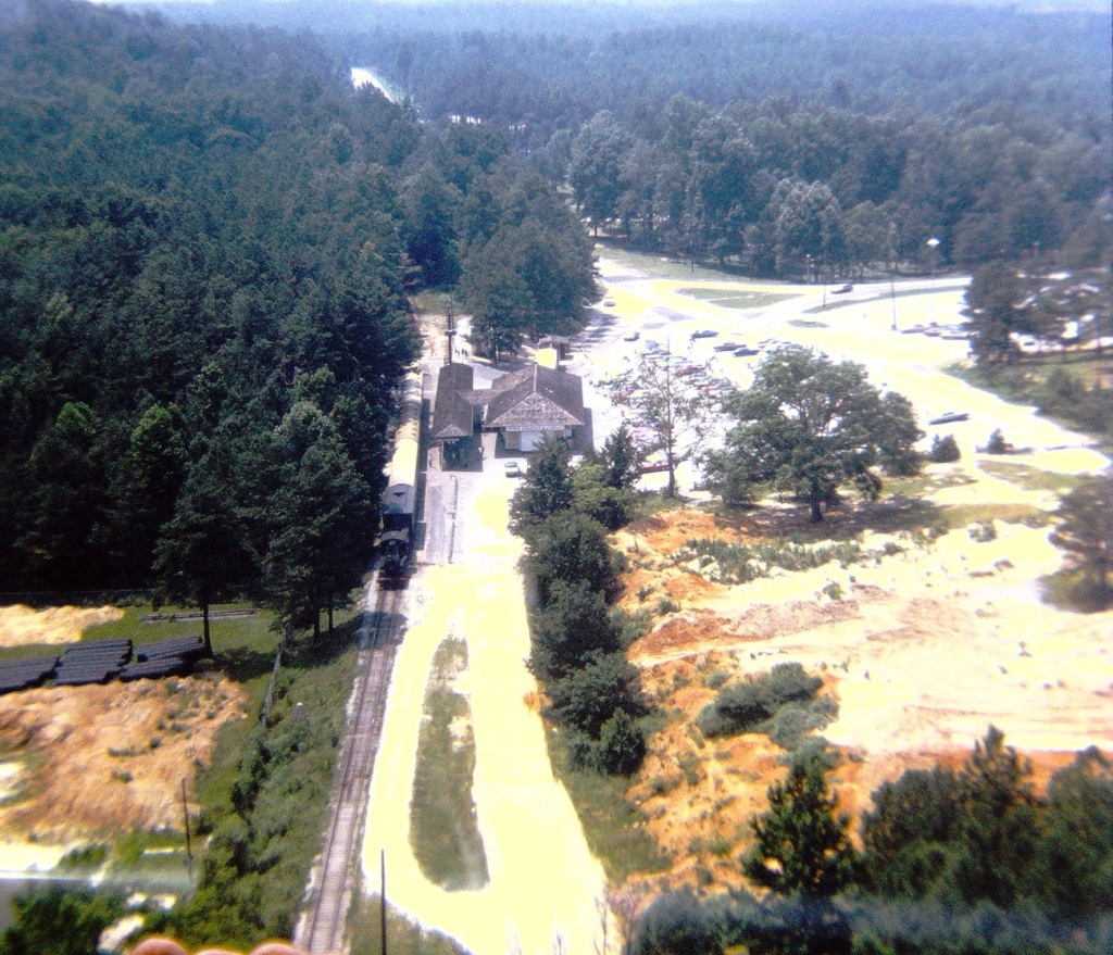
On this trip down memory lane, I can see the photos and recall our ride on a vintage Railroad at Stone Mountain Park in Georgia.
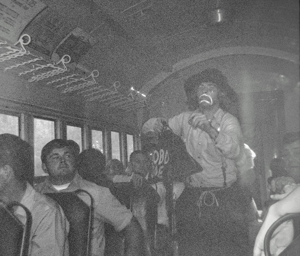
The Stone Mountain Scenic Railroad is an open-air train that chugs around the 5-mile base of Stone Mountain. The ride takes 40 minutes and includes a live “train robbery” skit. Trains depart from Railroad Depot, an old-fashioned train station, where there’s a restaurant with all the fixings for a fried-chicken picnic, just in case you forgot to bring your own.
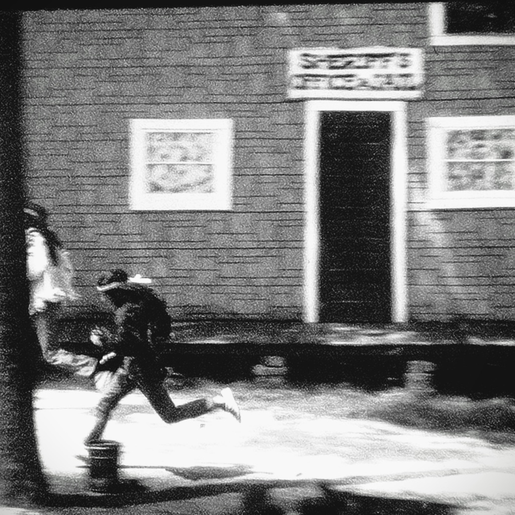
Train Robbers escaping from the Sheriff
The Stone Mountain Scenic Railroad, Inc. was formed in 1960 to construct a tourist railroad encircling the mountain. Three secondhand steam locomotives and several rebuilt passenger cars were purchased for hauling mountain visitors. Attempts were made to backdate two of the steamers to appear more like Civil War era engines, as the railroad’s theme was based on the “Great Locomotive Chase” involving the General and the Texas.
A single locomotive pulls a consistent of open-air cars and often a caboose around the 3.88 mile loop track. Two or more trains are run during busy park hours. Passengers board at the Train Station near the Memorial Lawn. On the far side of the mountain, trains often stop for skit entertainment in the small yard area that includes mock up building fronts, a maintenance shed, and several spurs that store previous rolling stock.
Don’t let the clown face fool you, this is no good guy. He is attempting to “rob” the train.
The Stone Mountain Scenic Railroad ride is just one of several activities one may choose to take part in while visiting the Park. Regardless of whether you’re into history, hiking, or want to enjoy some relaxing entertainment Stone Mountain Park can accommodate your interests. For more information about what to do and see at the Park click here.
This week’s number for Judy’s Number Game is 145. Come play along with us. You’ll never know what fun you’ll be missing if you don’t join in the game.
Rummaging through my photos I came up with a mixture of old and more recent photos for your viewing pleasure for this week’s challenge.
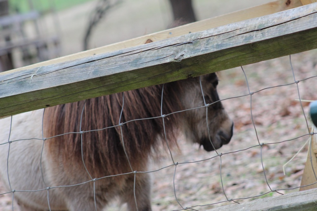
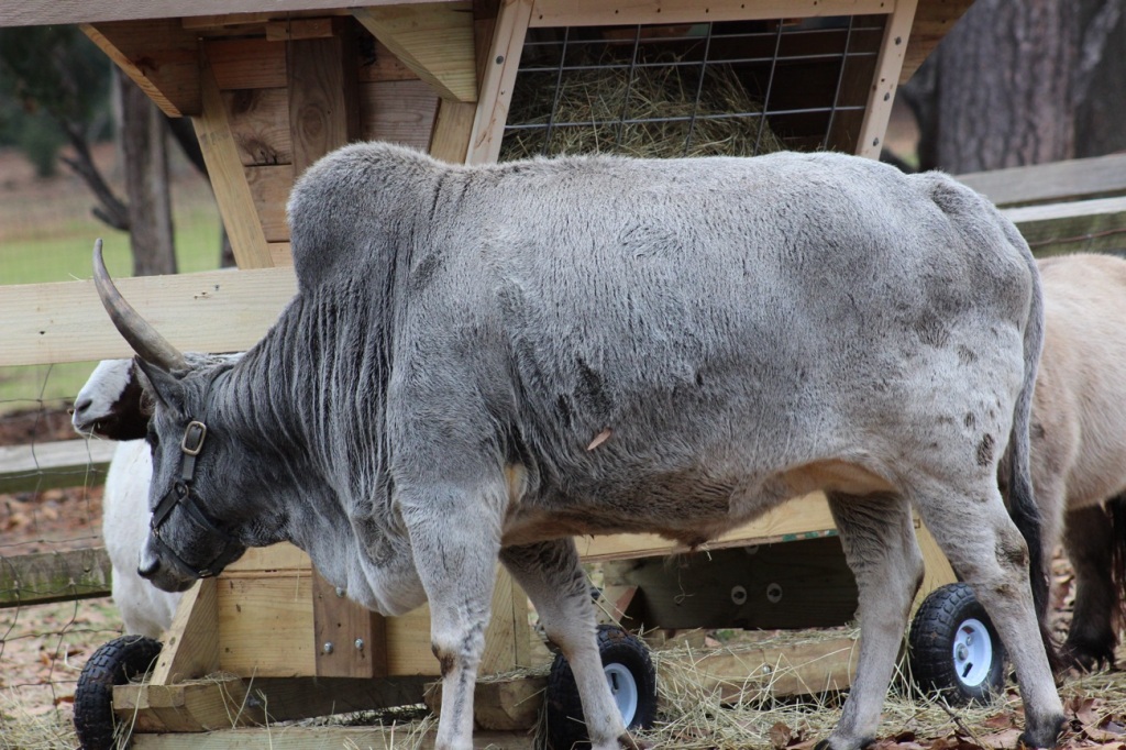
First up we have Farm Animals …
Donkey
At Anne Springs Close Greenway’s Stables Entrance in Fort Mill, South Carolina.
Zebu Cattle Bos taurus indicus
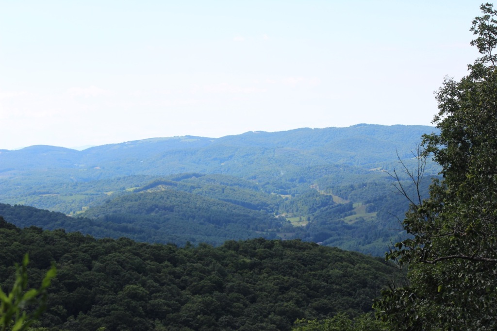
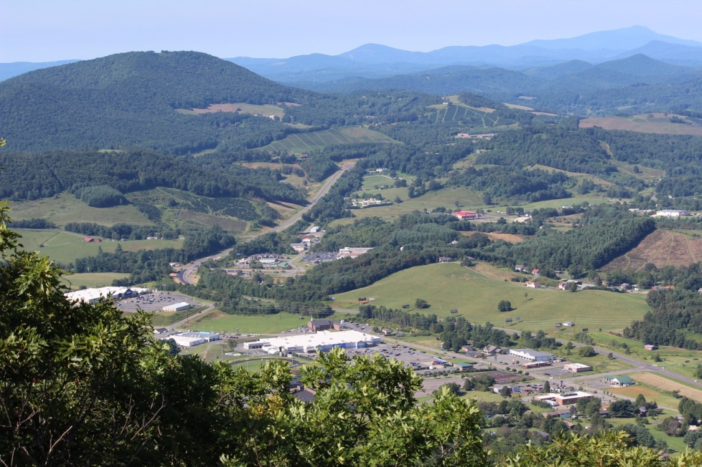
Next, We Head Up to the Mountains of North Carolina …
View from Sunrise Overlook Blue Ridge Parkway, North Carolina View from Mount Jefferson Mount Jefferson State Natural Area Ashe County, North Carolina
And Lastly for this Week we have a Couple of Miscellaneous Throwbacks …
At Franklin D. Roosevelt’s Little White House Historic Site Museum Warm Springs, Meriwether County, Georgia, USAThe Sophia Loren diorama Movieland Wax Museum Buena Park, California
The Davis House Formerly Known as the Dickey House
The Dickey House is a historic home in Stone Mountain Park, Georgia. It was built in the 1840’s on a 1,000 acre plantation in Dickey, Georgia. The house was the manor house of the property. The descendants of the original owners lived in the home until it was moved 200 miles away to Stone Mountain’s Historic Square in 1961.
The roof, porches, and chimneys were removed and the house was quartered for transport, then reassembled by master carpenters. The house was filled with antiques from the 1800s and was considered a historic representation of the 1860s.
Pull Up a Seat was once possible beneath the second story. Sadly, that is no longer possible as the house was destroyed by fire in 2023.
The Dickey House was the focus of the Stone Mountain “antebellum plantation” and the state’s effort to develop a tourist attraction at the site of the Confederate Memorial, a high-relief sculpture of Jefferson Davis, Robert E. Lee, and Thomas J. “Stonewall” Jackson that is carved into Stone Mountain.
The Dickey House opened to the public in 1963. More sophisticated than a Georgia “plain style plantation” such as the Tullie Smith House in Atlanta, and less grand than the Gone With the Wind image of Tara as the assumed typical antebellum plantation of the South, the Dickey Plantation, with its collection of period furnishings, collected outbuildings of the era, and gardens, provides a unique illustration of pre–Civil War architecture.
In November of 2023, Nearly 200 years of history went up in flames on a Tuesday morning when a fire broke out consuming the Dickey House in Stone Mountain Park’s Historic Square that predate the Civil War. The fire completely destroyed the home making it irreparable.
As I continue to look back on time through the digitization process of my dad’s old slides I am reminded and am amazed by the wonderful world we live in and the freedom we have to create/recreate and share our experiences, our memories with others.
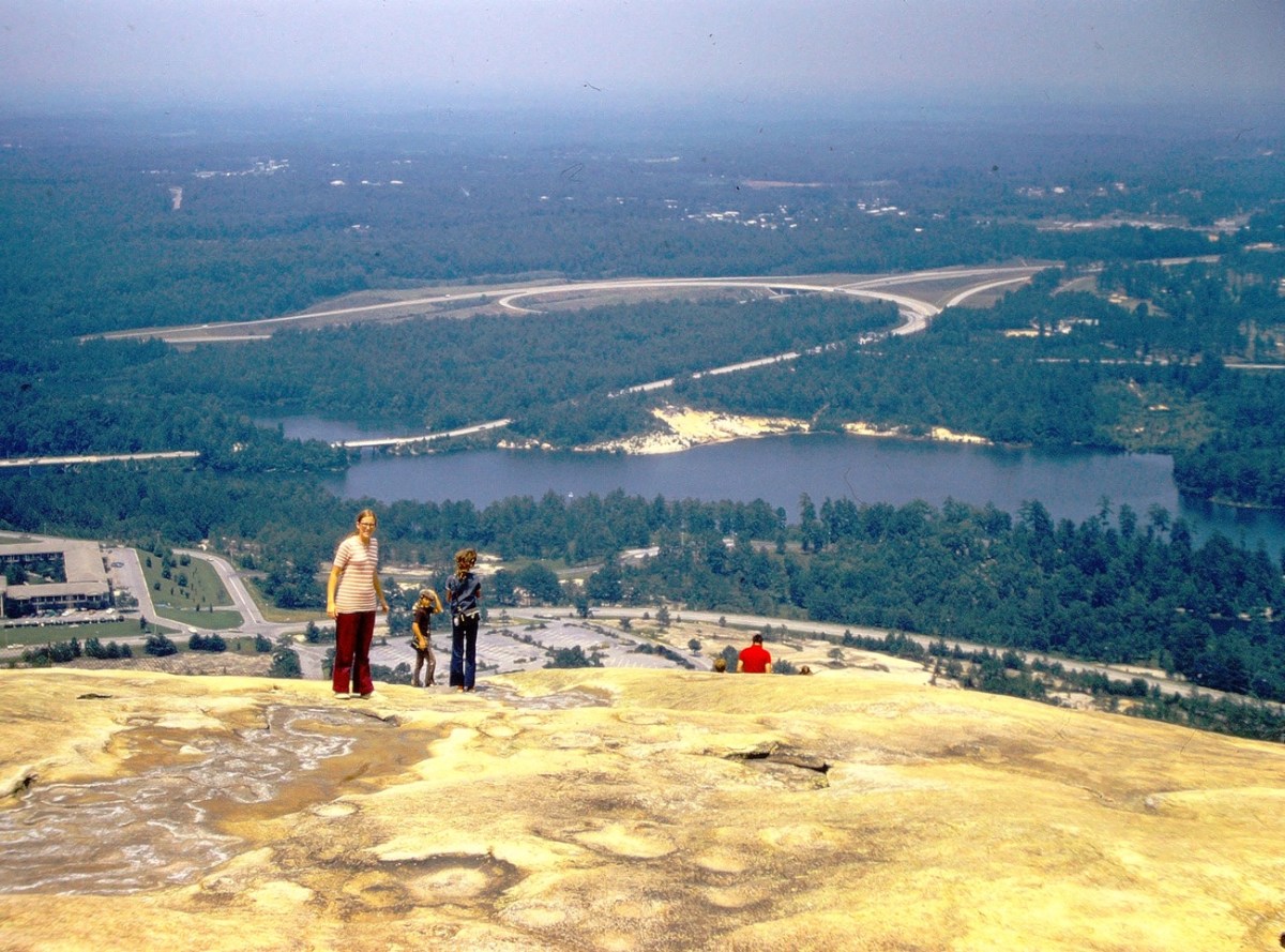
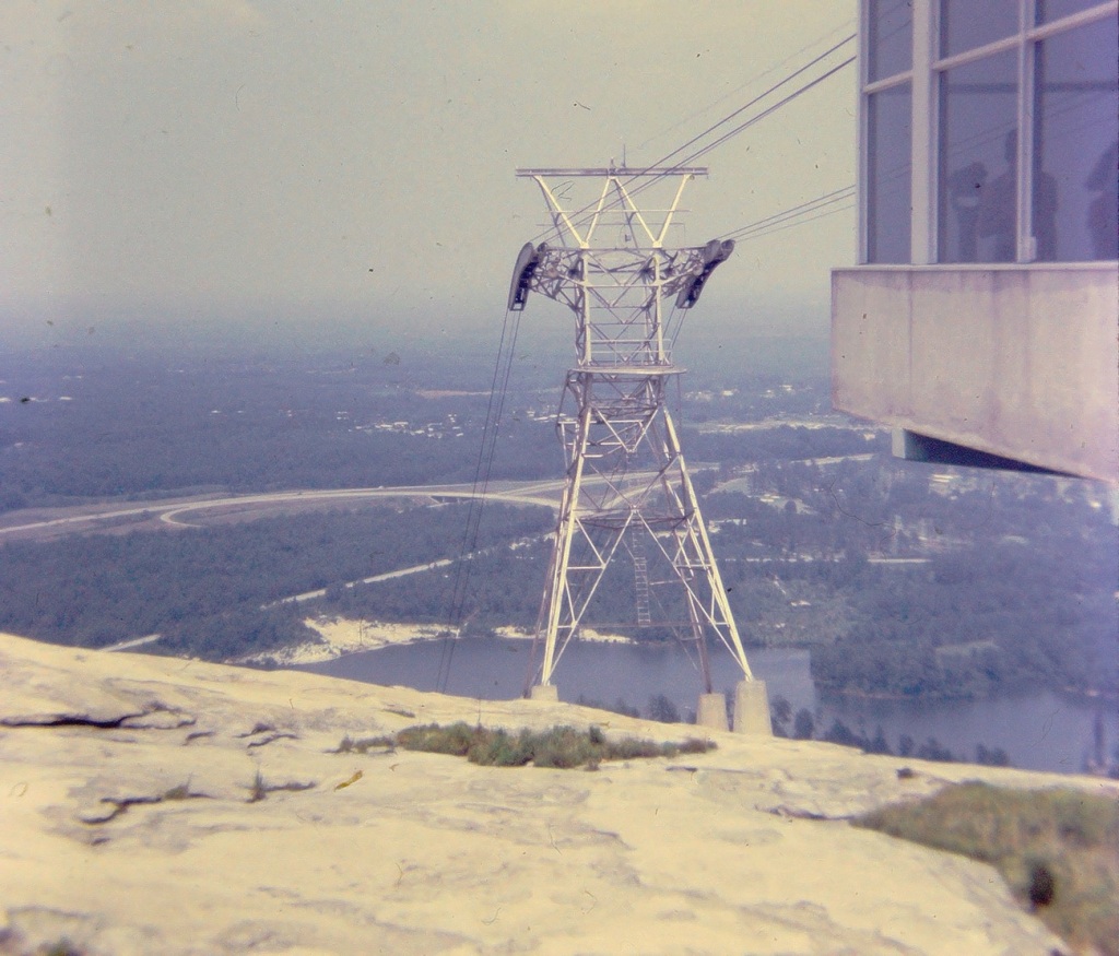
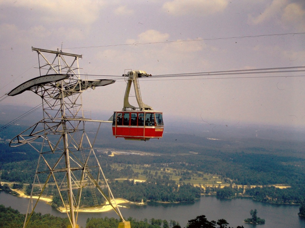
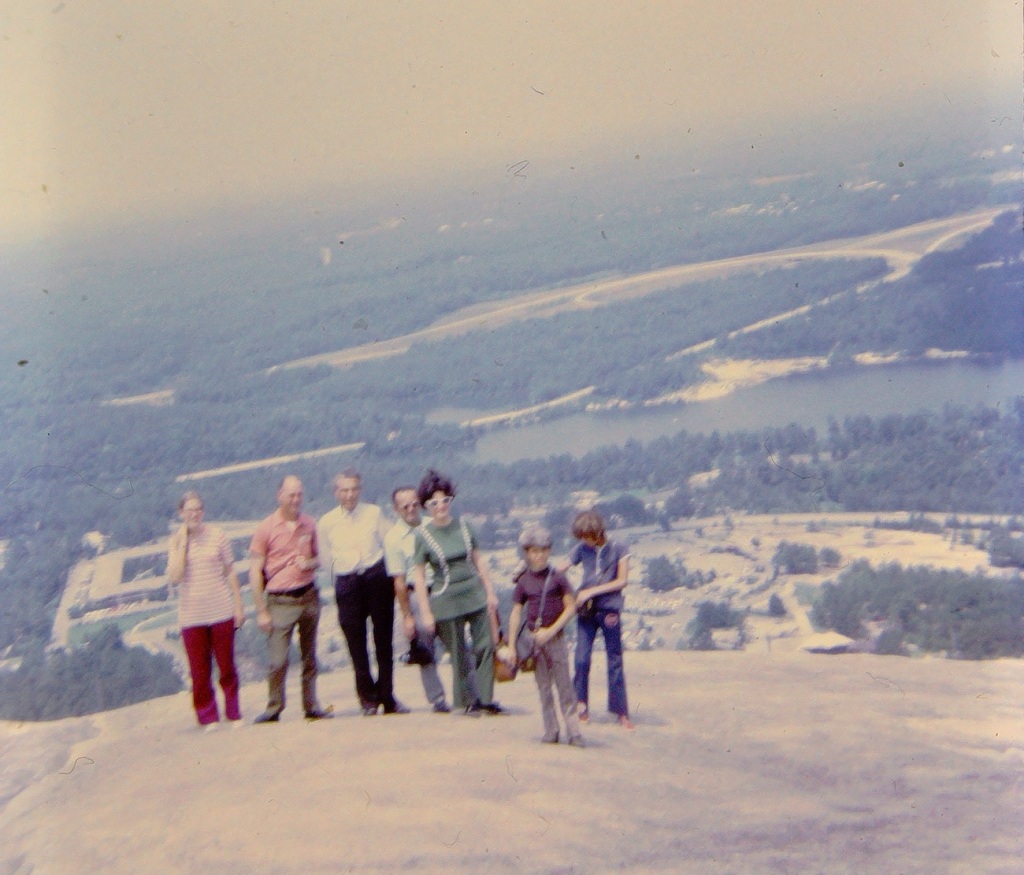
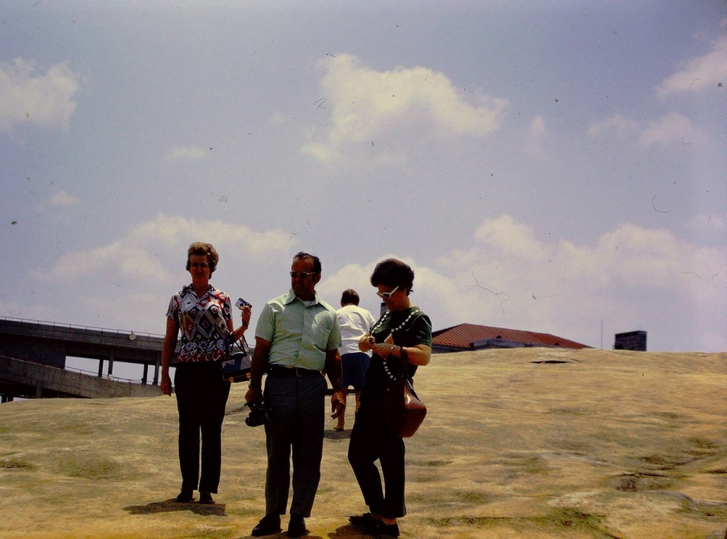
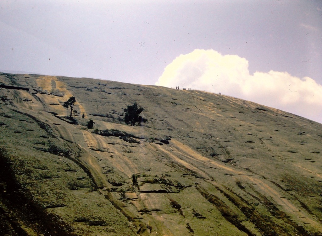
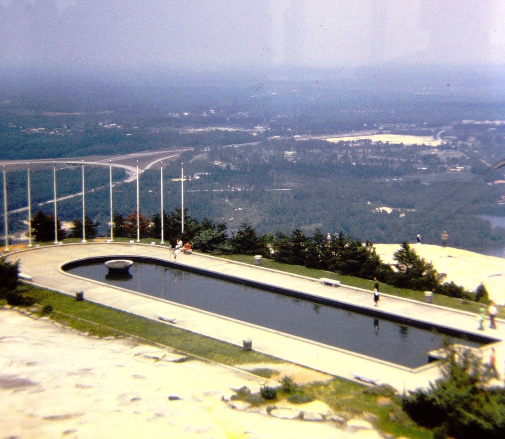
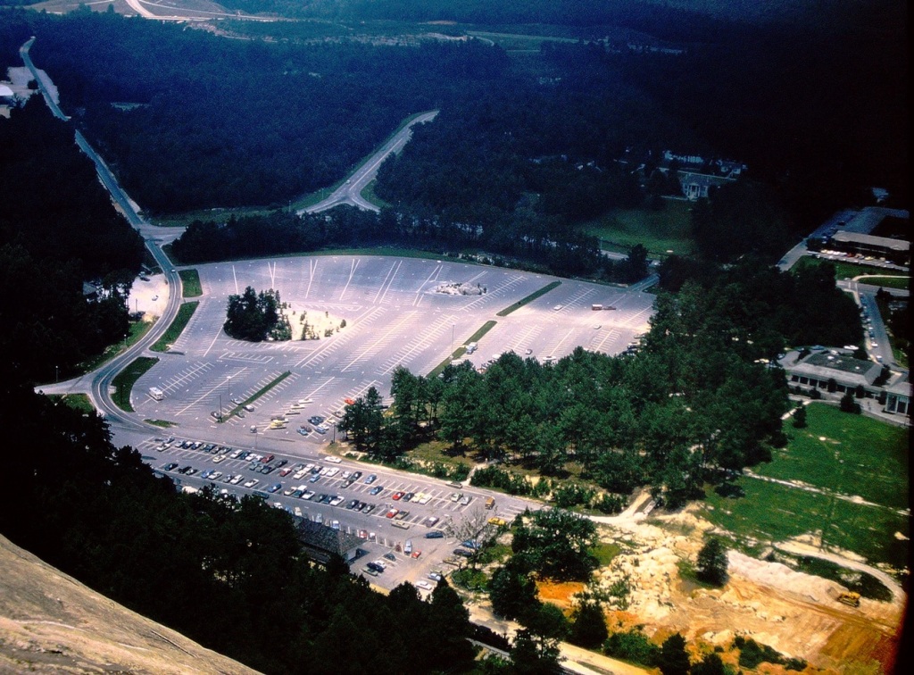
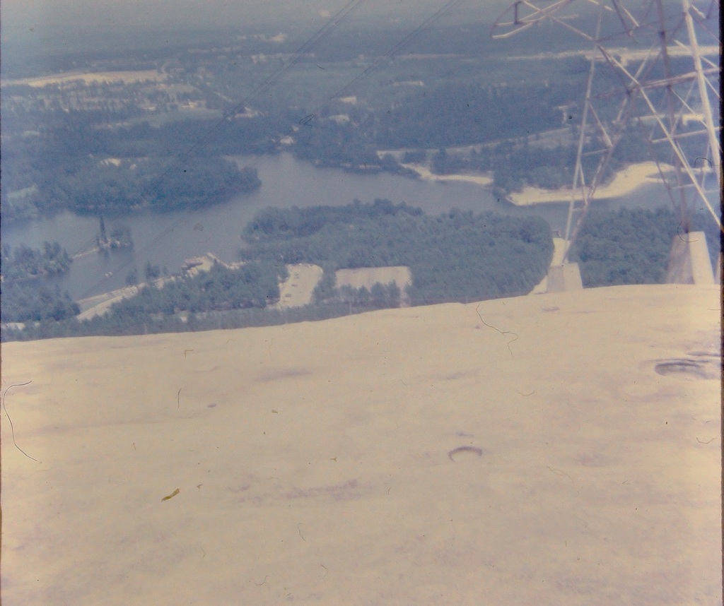
The slideshow is a digital representation of our adventures visiting Stone Mountain Park in Georgia. We, my family and extended family all came together to share togetherness while enjoying ourselves at Stone Mountain. My immediate family drove out from California, my paternal grandfather, from South Carolina, joined my dad’s sister and her family from North Carolina to visit the most popular attraction in Georgia, Stone Mountain Park.
We rode the Skyride to the top of Stone Mountain and the views were amazing. We could see the surrounding landscape, the parking lot, the other attractions in the park, blue waters of the lake & the pond, and the blue skies above. The most amazing part is that we were able to see the wondrous views together as a family.
Scarecrow Land of Oz Museum Display Beech Mountain, North Carolina, USA
The Land of Oz theme park based on Frank Baum’s Land of Oz books originally opened in 1970. In 1975 the Carolina Caribbean Corporation, the company who developed Beech Mountain into a tourist destination and built Oz goes bankrupt due to failed investments. The park had closed and after construction of the Emerald City it reopened in 1976 and later closed once again in 1980. The theme park was closed afterwards for many years. Oz then laid abandoned, succumbing to the harsh weather conditions and vandals.
The Land of Oz is a park in North Carolina dedicated to the iconic film Wizard of Oz. It’s a walk-through attraction that was once closed and now opens for the special Autumn of Oz event in the fall each year. The Autumn of Oz festival is currently held in September and the Land of Oz is only open for three weekends a year.
Location: Land of Oz theme park; Beech Mountain, North Carolina, USA
God Bless. Thank you for visiting the Land of Oz with us. Thank you for sharing your time and thoughts with me. Have a wonderful weekend. I appreciate y’all very much.
We begin our journey in n July of 1972, having made it from California to Georgia we stop for a bit of fun. We were glad to pull into the park and finally be able to get out of the car and stretch our legs. After traveling cross country for days we were more than ready to enjoy some fun and excitement.
Driving into Stone Mountain Park in Stone Mountain, Georgia
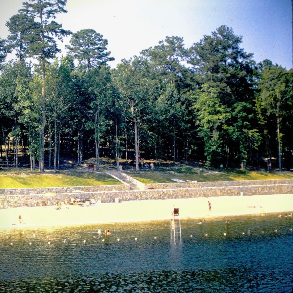
We enjoyed a time of Sun, Sand. and Water Fun relaxing on the beach.
Sun, Sand. and Water Fun
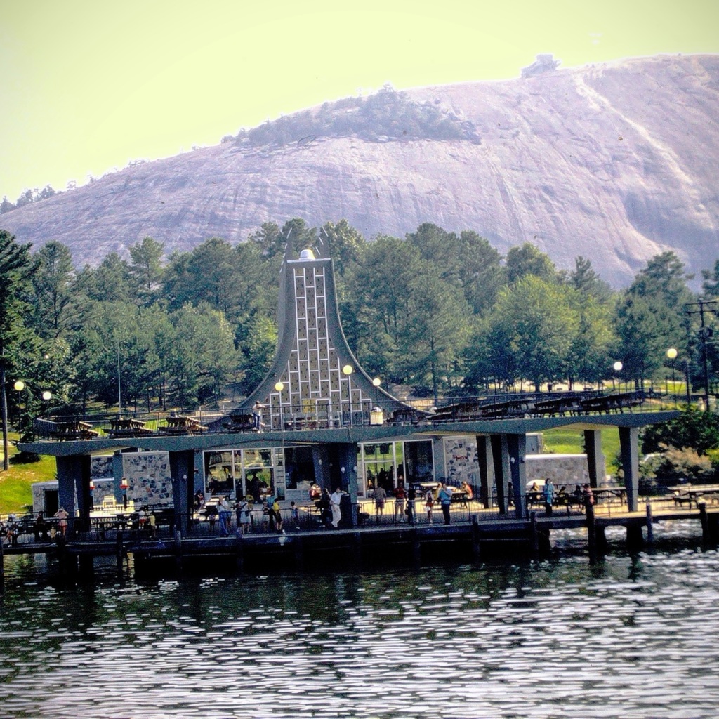
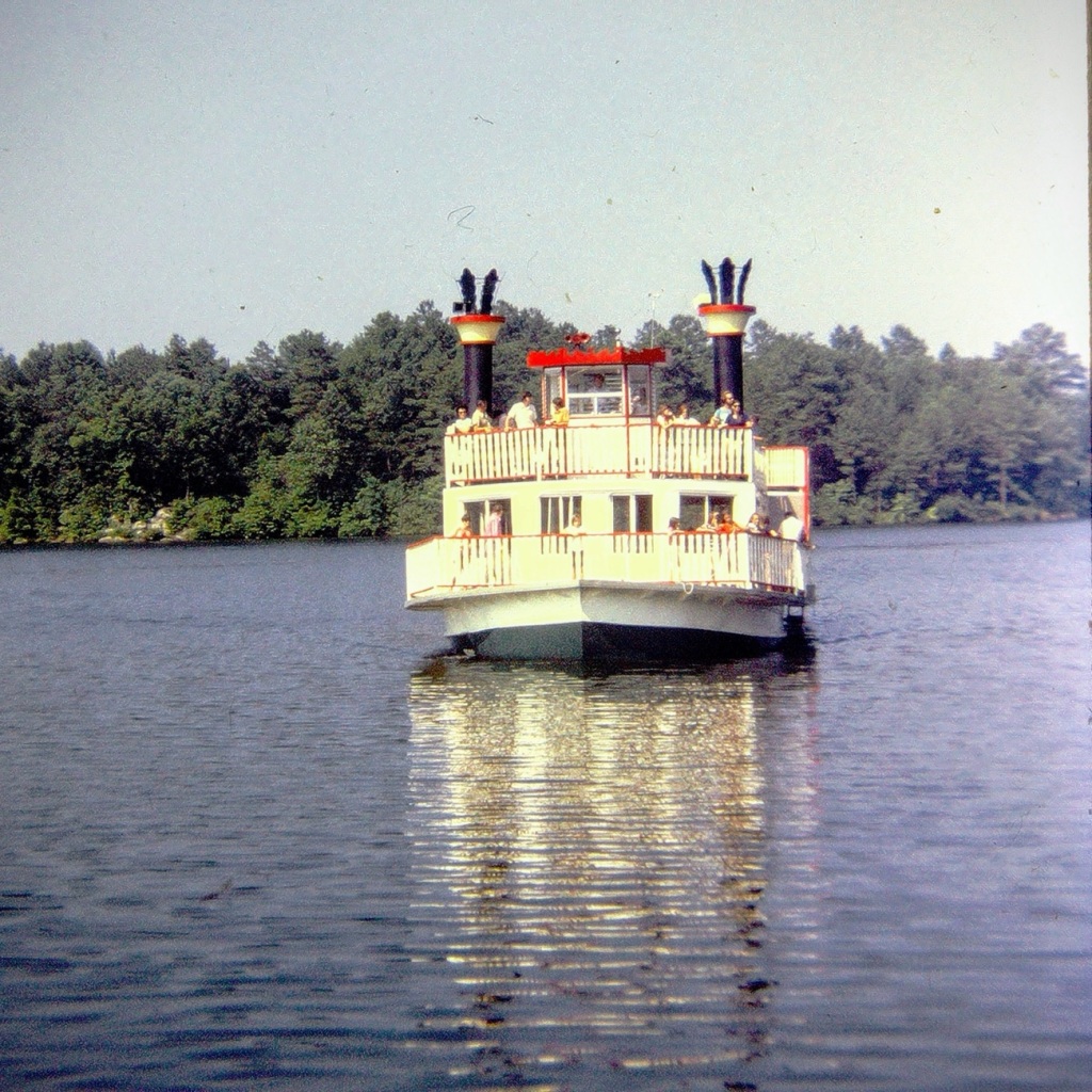
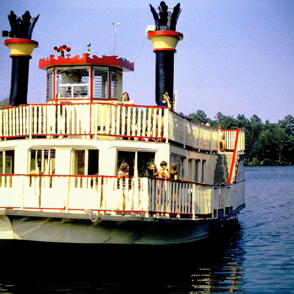
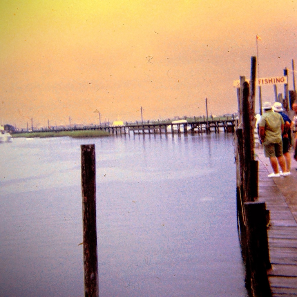
Next, we moved forward to wait our turn for a ride on one of the Paddle-boats. The paddle-boats are large Riverboats which give tourists and guests a thirty minute ride out on Stone Mountain Park Lake. [From what I have discovered, the Riverboats no longer operate on Stone Mountain Park Lake.]
Riverboat Marina Complex Area to wait for a Riverboat Cruise 🚢 ride.
Moving forward out into the lake aboard the Scarlet O’Hara, we had an opportunity to see a uniquely captivating side of the park. The Scarlet O’Hara was one of two (2) paddle boats in the Stone Mountain Fleet that once cruised the lake delighting guests with the beautiful scenic views. It was a side wheeler which could carry up to One Hundred Fifty (150) passengers on board.
Scarlet O’Hara
The Henry W. Grady was the name of the other Stone Mountain paddle boat. It was designed to carry approximately three hundred (300) passengers. Its sole purpose was to be used for private party charters.
The Riverboats departed the Riverboat Marina Complex approximately every half hour moving forward into the lake giving guests a chance to enjoy the waterways, and the beauty surrounding Stone Mountain. The short cruise lasted about twenty (20) to thirty (30) minutes. While out on the lake on one of the paddle-boats you might have noticed the sunken remains of the very first riverboat, the Robert E. Lee, seen at the bottom of the lake.
Location: Stone Mountain Park Lake; Stone Mountain Park, Stone Mountain, Georgia, USA
God Bless. Thank you for visiting and sharing in our memories of cruising on a Riverboat. Thank you for sharing your time and thoughts with me. I appreciate y’all very much.
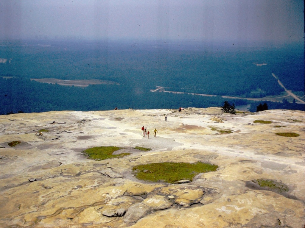
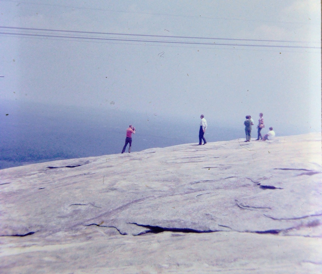
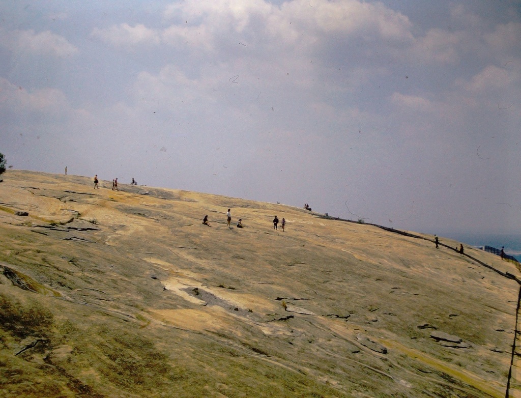
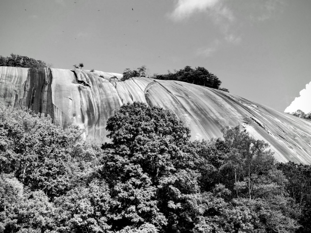
Stone Mountain Stone Mountain State Park Roaring Gap, North Carolina
Stone Mountain State Park is located in Alleghany and Wilkes counties 60 miles northwest of Winston-Salem. Within the Park lies a 600-foot granite dome which has been designated as a National Natural Landmark, and the historic Hutchinson Homestead, a restored mid-19th-century farm situated at the mountain base.
Lower Falls Stone Mountain State Park Roaring Gap, North Carolina
Stone Mountain State Park offers nearly all types of outdoor activity to experience a high country landscape adorned with beautiful waterfalls, winding creeks, and bountiful trout streams. A portion of the Mountains-to-Sea State Trail runs through the park near the backcountry campsites.
Stone Mountain Park (GA)
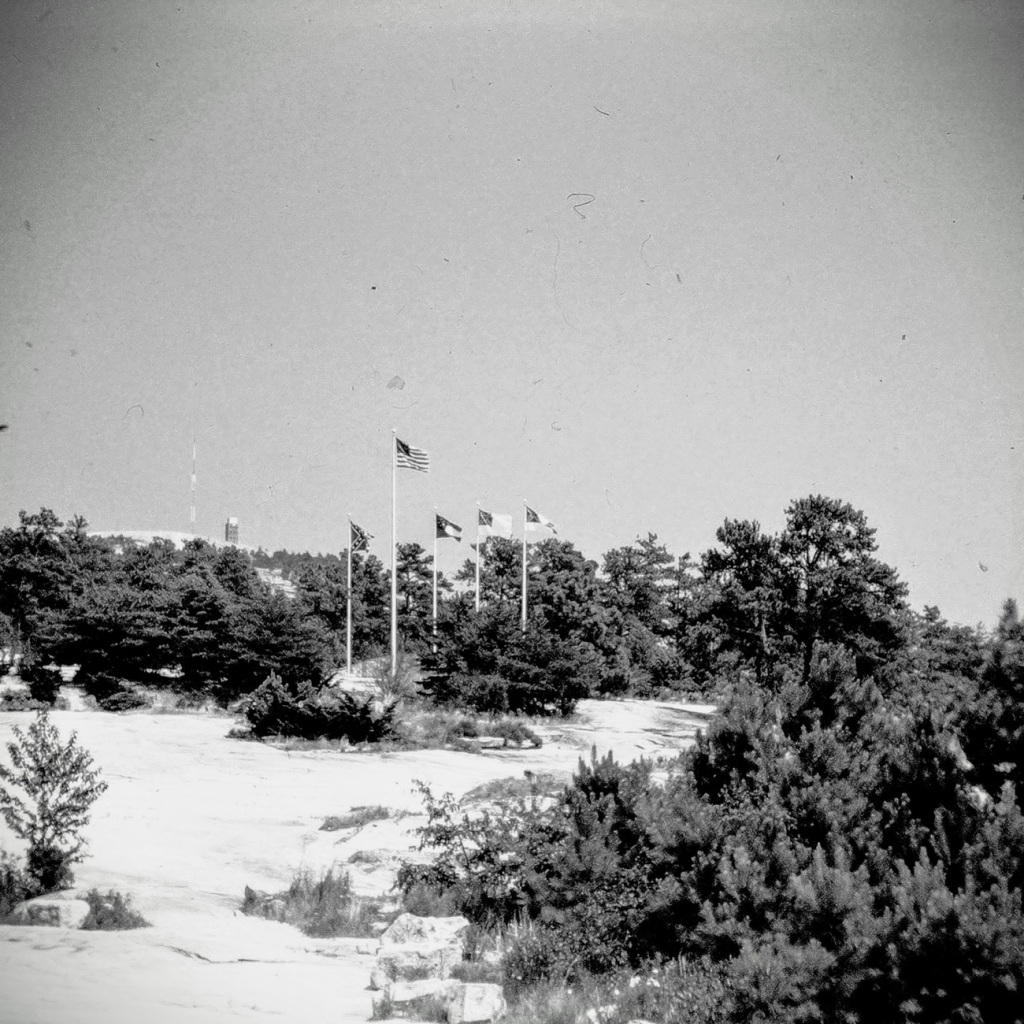
At the bottom of the trail leading up to the mountain is an American flag and four Confederate flags for all to see.
Stone Mountain Park is Georgia’s most visited attraction. Its more than three thousand two hundred (3,200) makes the park a unique destination for guests and families to experience and enjoy an exciting variety of attractions, entertainment, and recreational activities.
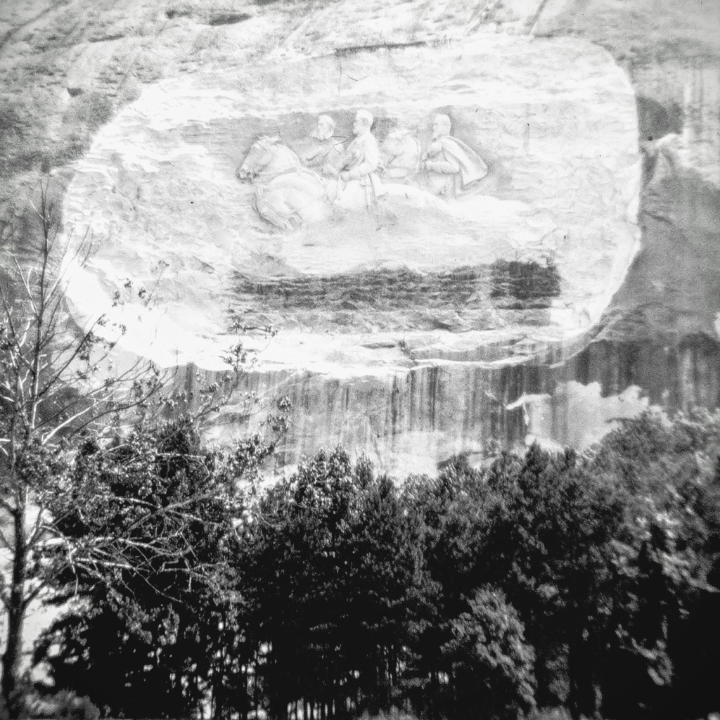
At the center of the park is the largest confederate symbol in the country: a nine story etched carving of Jefferson Davis, Stonewall Jackson, and Robert E. Lee.
Stone Mountain in Georgia is a quartz monzonite dome monadnock ( an isolated rock hill, knob, ridge, or small mountain) and is the location of Stone Mountain Park. It is located approximately sixteen (16) miles east of Atlanta, Georgia. The Park is owned by the state of Georgia. It is most famous for its artwork on the north face. An enormous relief sculpture carved on the stone itself depicting Jefferson Davis, Robert E. Lee, and Stonewall Jackson, three (3) of the Confederate Leaders.
In comparing the two Stone Mountains one can realize that Stone Mountain, Georgia is larger and is not engaged in a series of ridges like its cousin in North Carolina. The one in Georgia is bordered by an actual city named Stone Mountain. It is also a fully developed park with a wide range of attractions to enjoy. The North Carolina Stone Mountain is a more traditional state park, with limited hours and access. Both Stone Mountains have a variety of hiking trails. The Georgia one has a Summit Skyride for easier access to the top. In North Carolina one would hike the Stone Mountain Loop Trail to access an area with breathtaking views of the Blue Ridge Mountains.
I visited Stone Mountain Park in Georgia with my family and extended family during the summer of 1972. I do not recall everything we did at the park, however, viewing & reconstructing my dad’s old slides does help to enable some of those memories. In October of 2017, my eldest son & I visited Stone Mountain State Park in Roaring Gap, North Carolina. One of his wishes that year was to drive the majority of the Blue Ridge Parkway. Stone Mountain State Park was just one of many places we visited on that trip.
Please I encourage everyone to be polite and I desire no controversy over this post or regarding Stone Mountain Park itself.
God Bless. Thank you for visiting the two (2) Stone Mountains with me. Thank you for joining me in viewing my memories of my dad’s reconstructed slides of our visit to Georgia. Thank you for sharing your time and thoughts with me. I appreciate y’all very much.
God Bless. Embrace joy, Seek out Light, and always Seek out the Sunlight in your life. Thank you for sharing your time and thoughts with me. I appreciate y’all.
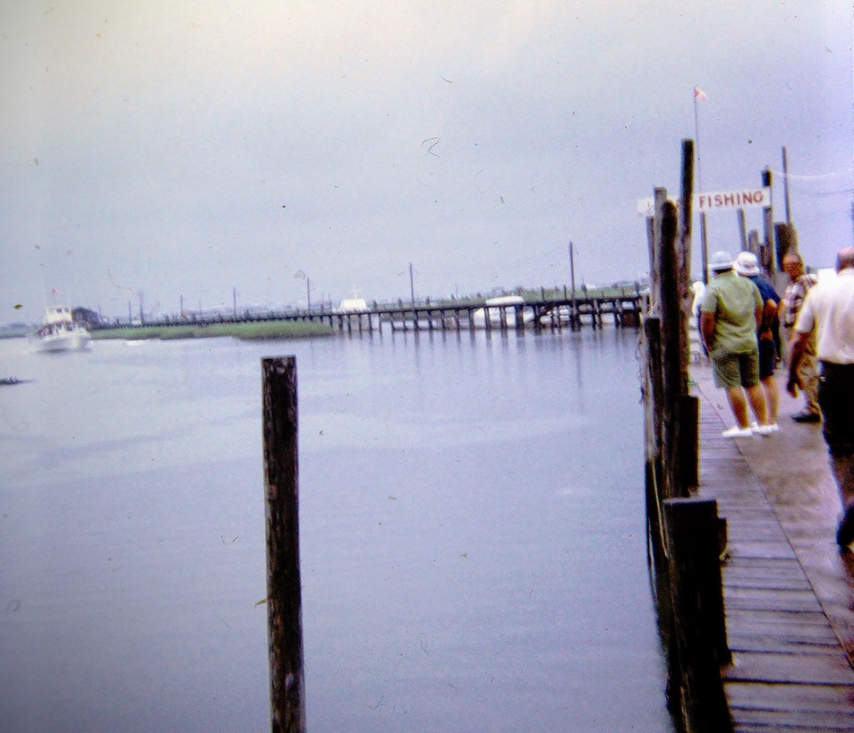
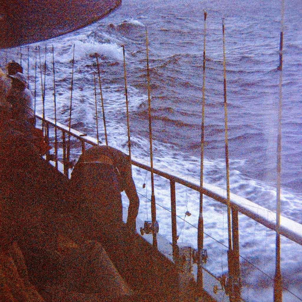
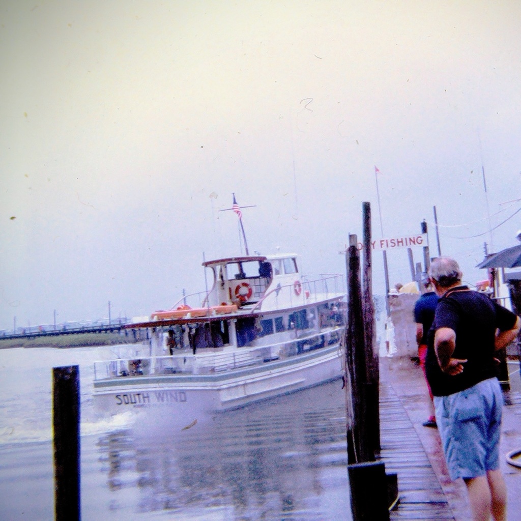
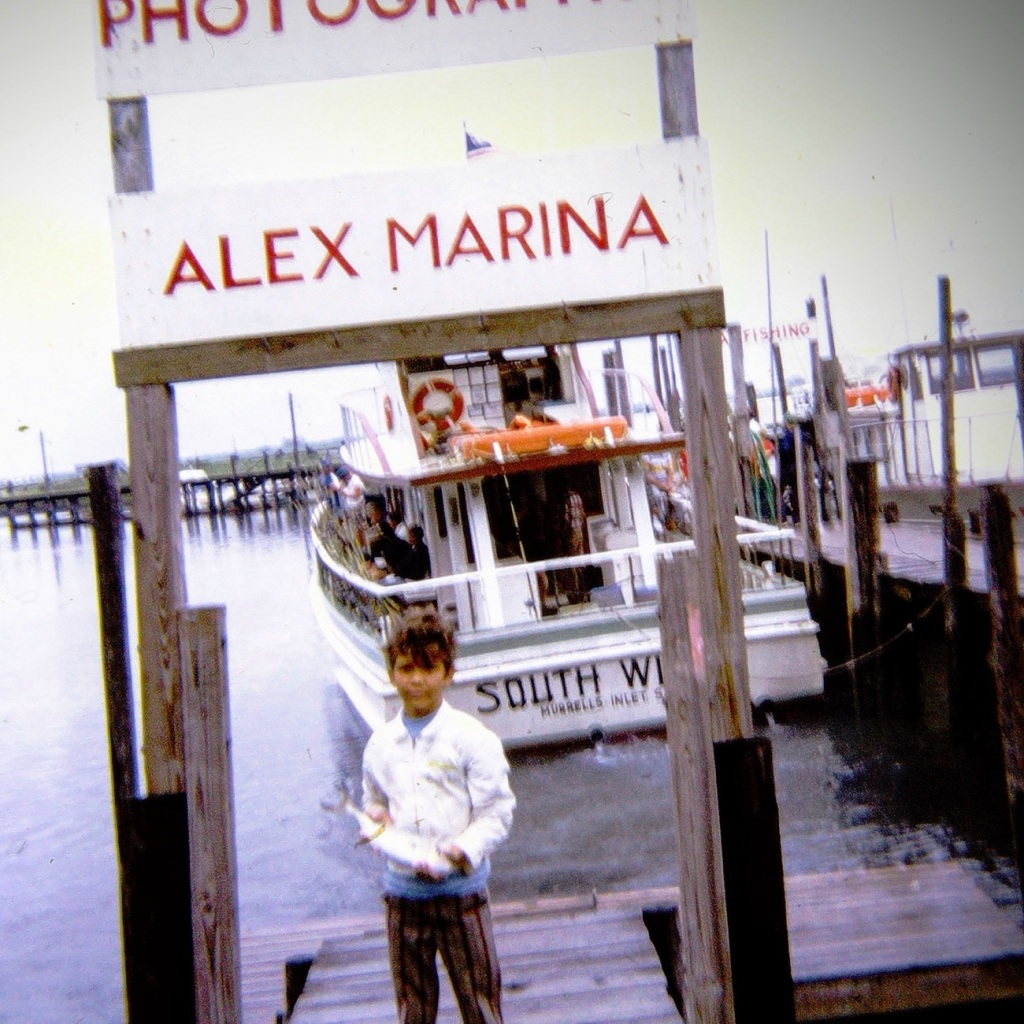
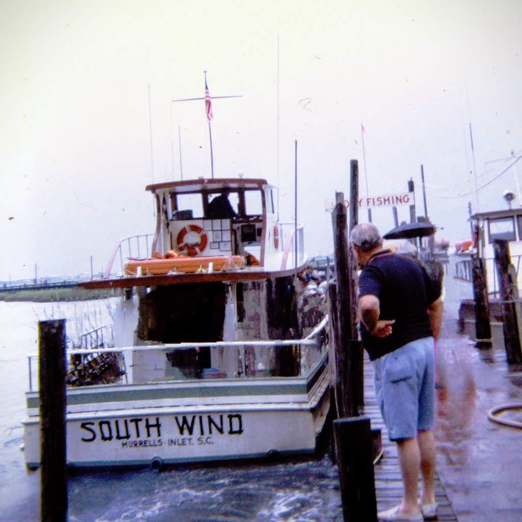
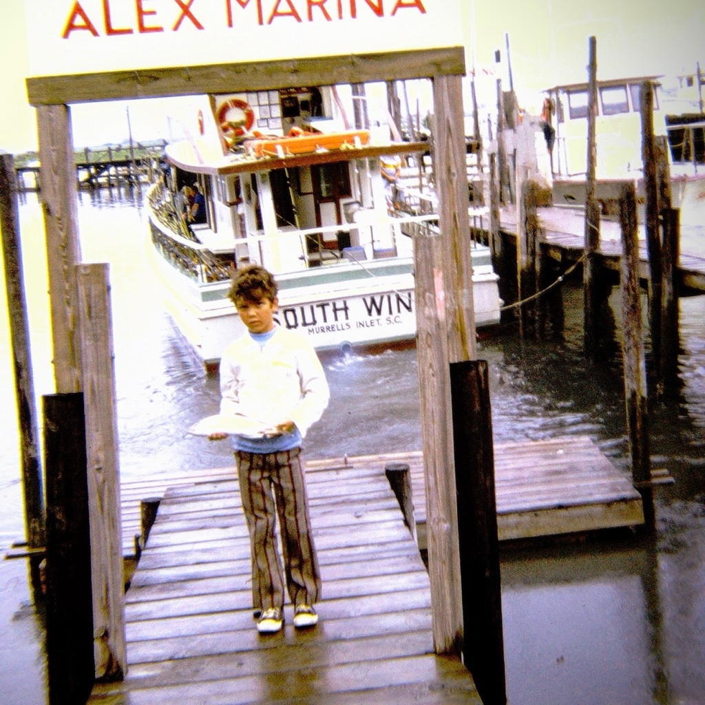
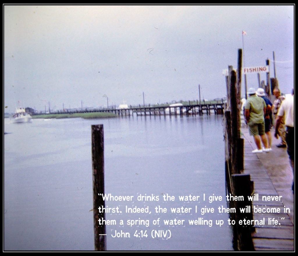
Moving Forward into the Gulf Stream for some Deep Sea Fishing…
The South Wind pulls alongside the pier … excited fishermen watching “patiently” for their turn to go out on the boat.
Young Fisherman with his catch
This was a trip my dad made with my paternal uncle (my dad’s sister’s husband.) Not sure if anyone else went along or not, I do not recall. My dad & Shorty ( my uncle) decided to go deep sea fishing 🎣 and drove the three (3) hours to Murrells Inlet to go out on a charter fishing boat for the day.
Captain Alex’s Marina once stood along the creek front of Murrells Inlet and was first established in the early 1950’s. Murrells Inlet is a fantastic destination just thirty (30) short miles south of Myrtle Beach, South Carolina. It is considered to be the “seafood capital of South Carolina.”
The land around Murrells Inlet has an historical record of human settlement that goes back thousands of years, before written history. The history includes English colonial settlements and plantations which raised various crops from indigo to rice. An interesting note is that the fishing village of Murrells Inlet was once the lair of the infamous pirate Blackbeard. Today, it’s an outdoorsman’s dream.
A tribute to Captain Alex who ran The Alex Marina and took many on tours or fishing excursions in Murrells Inlet and other areas can be read by clicking here.
Location: Alex Marina; Murrells Inlet, South Carolina, USA
God Bless. Thank you for Moving Forward with us as I continue to Reconstruct my dad’s slides and the memories of his adventures. Thank you for sharing your time and thoughts with me. I appreciate y’all very much.
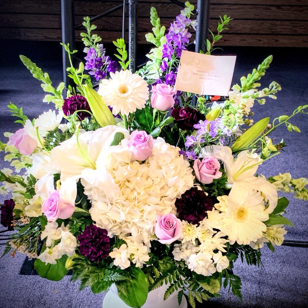
Flowers are given or sent to funeral homes, services, and placed on graves as a sign of sympathy and respect. Have you ever considered why flowers are given? Who are the flowers are meant for? They are not for the deceased, but in a way they are.
So why do we send them? Why do we bring them to the graves of those we love and care deeply about?
Flowers given to me after my mom’s passing. The Flowers my Brother & I got for my mom’s Funeral Service. Funeral Flowers at my Paternal Uncle’s Service Gravesites of my Paternal Grandparents & Paternal Uncle Grave of my Maternal Grandmother Grave of my Paternal Great Grandfather, John Thomas Waters.
Funeral Flowers are intended as a way to show our respect to the deceased. Sympathy Flowers go home with the family of the deceased. Flowers are for the survivors/surviving family members to know their deceased was loved and cared for as well as a sign of respect for the deceased.
[I remember the flowers in the upper right came back to my brother’s home after my mom’s service. He turned around and sent them home with my mom’s sister. I do not recall what happened to the rest of the flowers.]
Sending Flowers to a funeral is a means towards an expression of love, comfort, sympathy, and respect. The purpose of floral arrangements at a funeral are intended to honor the deceased, and show sympathy to the family. The flowers enable the mourners to feel like the deceased was cared for by many people close to them.
The placing of Cemetery Flowers or other objects on a grave marker or headstone is a way of paying your respects to the deceased. The flowers on a grave can show recognition of sacrifice of a deceased Veteran or admiration for a lost friend or family member. People have been leaving flowers on gravesites for thousands of years. In Ancient Rome they were used to create a comforting environment for the deceased spirit to wander around the grave.
I often bring flowers with me when I visit the graves of my family members and even place them on my grandparents & great grandparents graves when I visit the cemeteries. I try to honor the fallen soldiers by contributing to Wreaths Across America; an organization which places wreaths on the graves of fallen soldiers and deceased veterans.
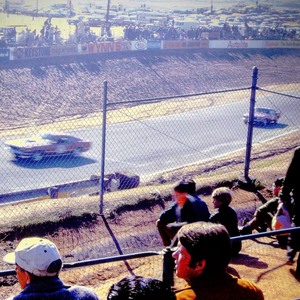
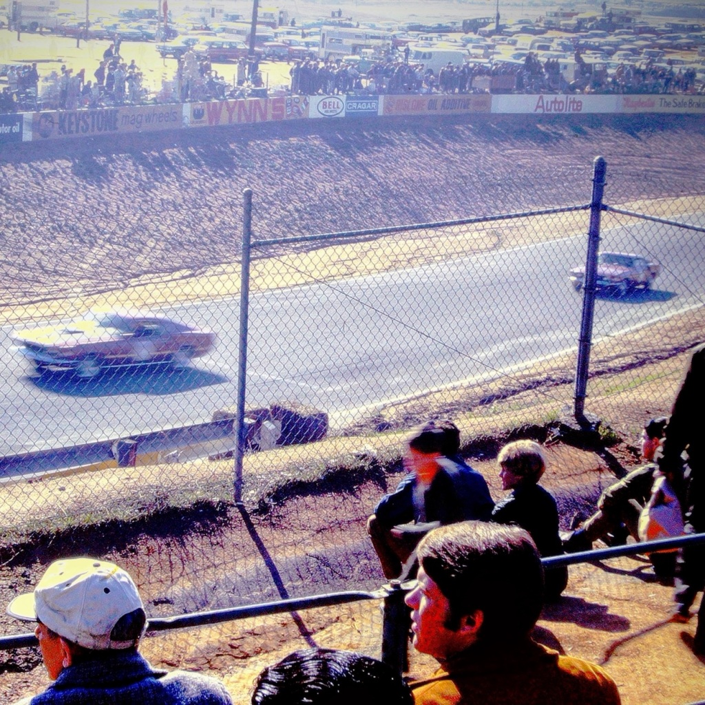
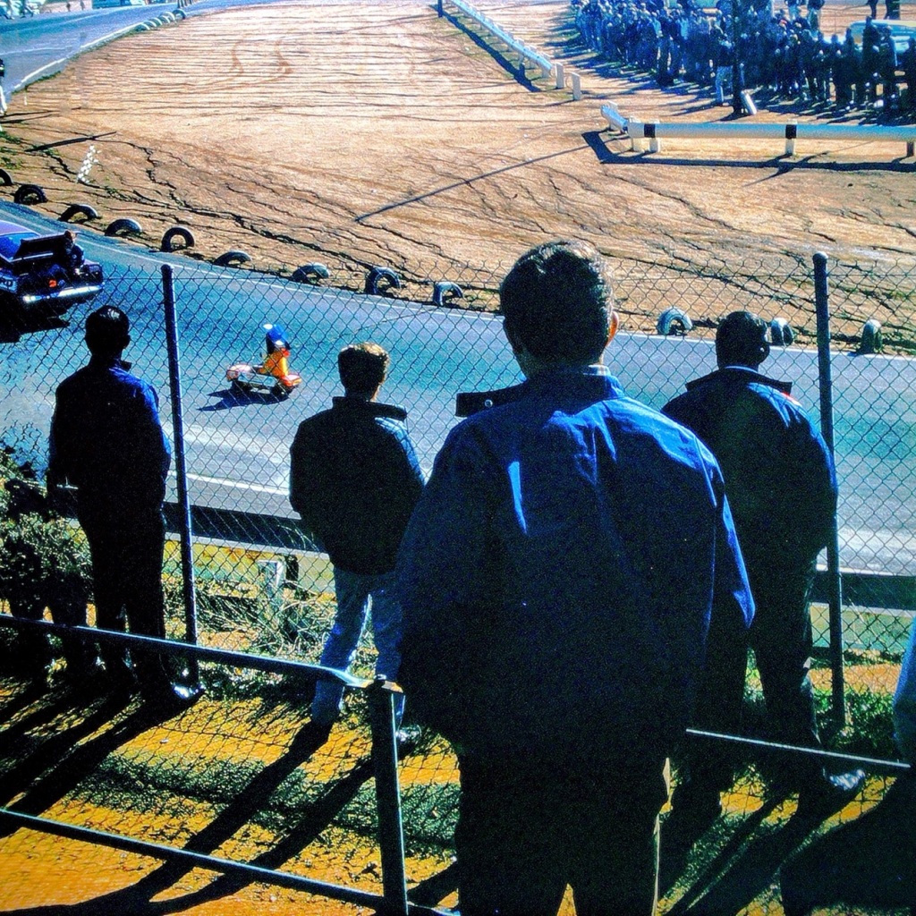
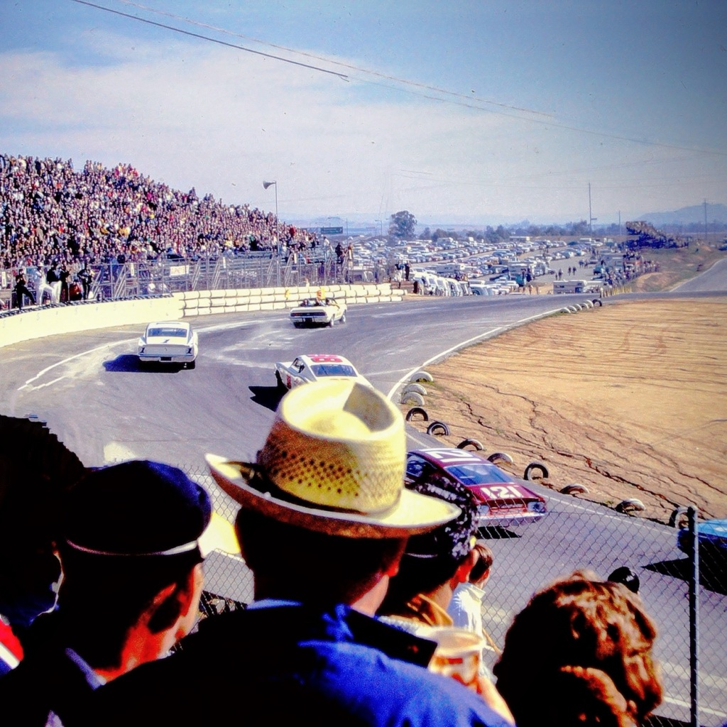
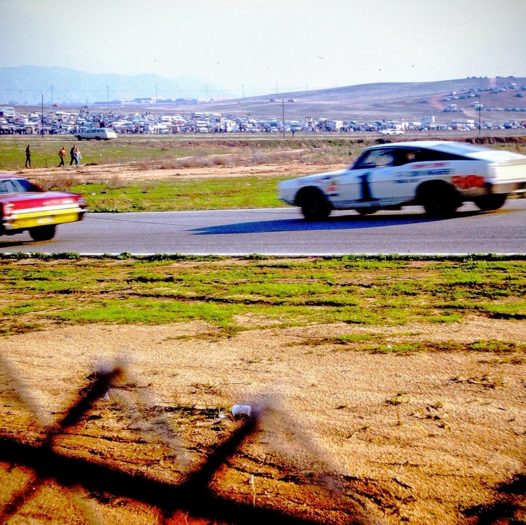
Watching Races at the Cajon Speedway was one of my dad’s favourite things to do on a weekend. It is not something he was able to enjoy that often, but he was thrilled whenever the possibility occurred. When he wasn’t able to go to the Speedway, he would watch NASCAR or the Indy 500 when he could get control of the TV away from my mom. My dad would have been 95 this week. He’s been gone now for 28 years, however, I still miss him.
Location: Cajon Speedway; El Cajon, California, USA September 1970
God Bless. Thank you for watching the races with us. The Cajon Speedway races don’t compare to the Coca Cola 600 which many people watched this weekend, but for El Cajon and San Diego County it was an amazing pastime. Thank you for sharing your time and thoughts with me. I appreciate y’all very much.
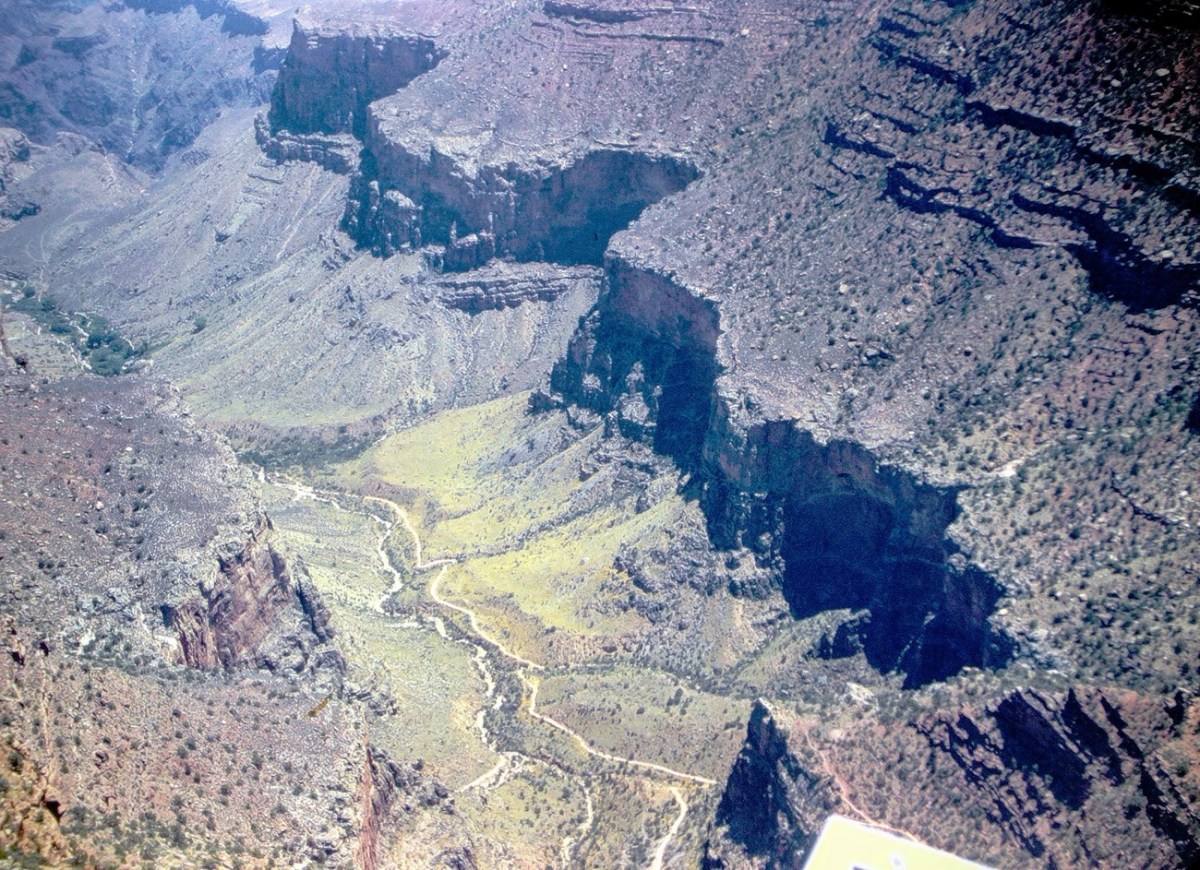
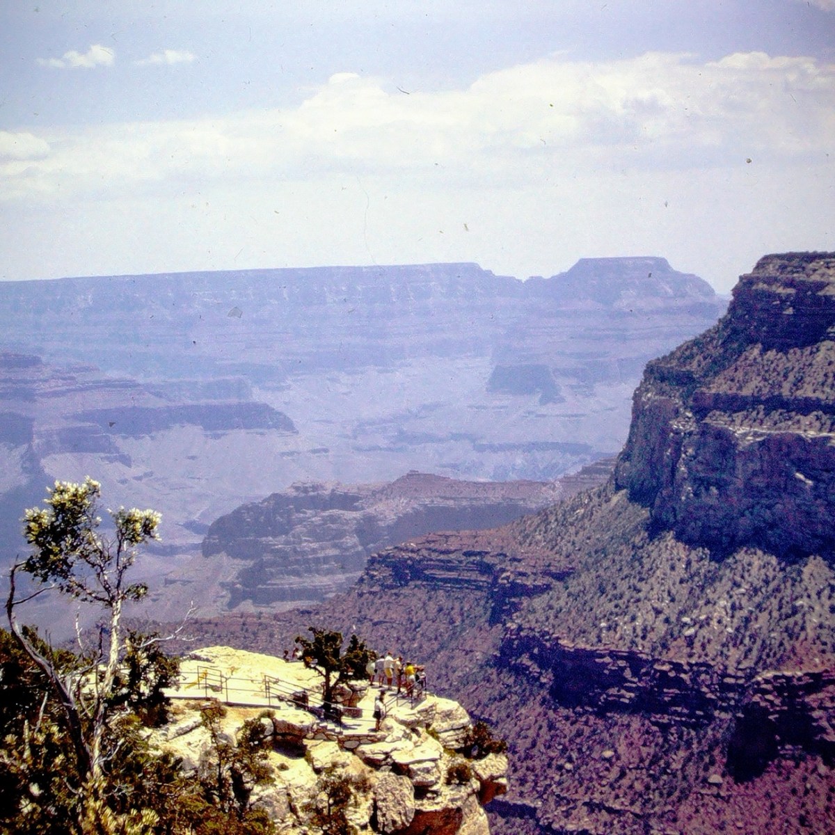
For Cee’s Which Way Challenge this week I’m taking y’all on a hiking adventure back in time to Nineteen Seventy-One (1971). This adventure was a part of a church youth group outing to the Grand Canyon in Arizona. It started off as approximately an 8 hour and 35-minute drive traveling by bus for five hundred sixty-nine miles (569) east northeast loaded with enthusiastic teenagers. [Bus ride not pictured.]
Our first stop at the Grand Canyon was the South Rim where we happened upon the Trans-Canyon Waterline. The South Rim water is pumped up 3200 feet from springs at Indian Gardens, but flow is inadequate for today’s needs (the thoughts in 1971.) Thus the Trans-Canyon Waterline was constructed beginning in 1965 and took until 1970 to complete.
This waterline stretches from the current water intake at Roaring Springs on the north side of the canyon, down to Phantom Ranch, and back up to Indian Garden through extremely rugged terrain accessible only by trail or helicopter. It carries about 190 million gallons of drinking water to over 5,000,000 visitors and 2,500 residents at the Inner Canyon Corridor and South Rim developed area.
Besides the view of the signage, we could see the pipeline which transports the water up to the South Rim and have a terrific view of the Bright Angel Trail. The Bright Angel Trail is the trail which led us to the bottom of the Canyon and the Silver Bridge.
Before we started hiking on the trail we stopped at Hermits Rest to enjoy some spectacular views. Hermits Rest is an iconic and historic stop, at the conclusion of Hermit Road, and the Canyon Rim Trail. It also serves as the gateway to magnificent backcountry hiking trails that originate from the Hermit Trail, a steeply winding path into the canyon that begins 0.25 miles (0.4 km) west of this distinctive building.
Now that we’ve had an overlook of where we are going to be hiking, let’s Move Onward and Forward along the trail. We have a long way to go ahead of us before we’ll reach the bottom of the Grand Canyon and Phantom Ranch.
Once we reach the bottom we had to cross the Silver Bridge to reach our destination. The Silver Bridge is a 500 feet long steel suspension bridge spanning a green river with canyon slopes and cliffs on the opposite side. The Silver Bridge, is located a short distance downstream from the Black Bridge. Both the Silver Bridge and the Black Bridge serve as critical transportation links between the South and North rims at Grand Canyon National Park.
When you visit the South Rim of the Grand Canyon don’t forget to stop at Yavapai Point to see some fabulous views. Make sure you have your camera (or at least your smartphone) with you to capture the beautiful scenic views.
Location: South Rim; Hermits Rest; Silver Bridge; Grand Canyon, Arizona, USA
God Bless. Thank you for visiting and sharing in our memories of hiking the Grand Canyon. Thank you for sharing your time and thoughts with me. I appreciate y’all very much.
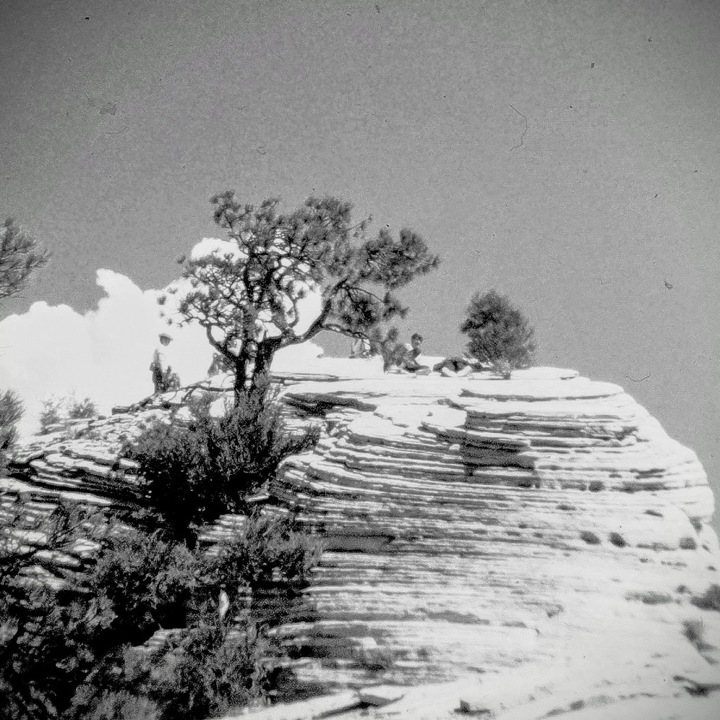
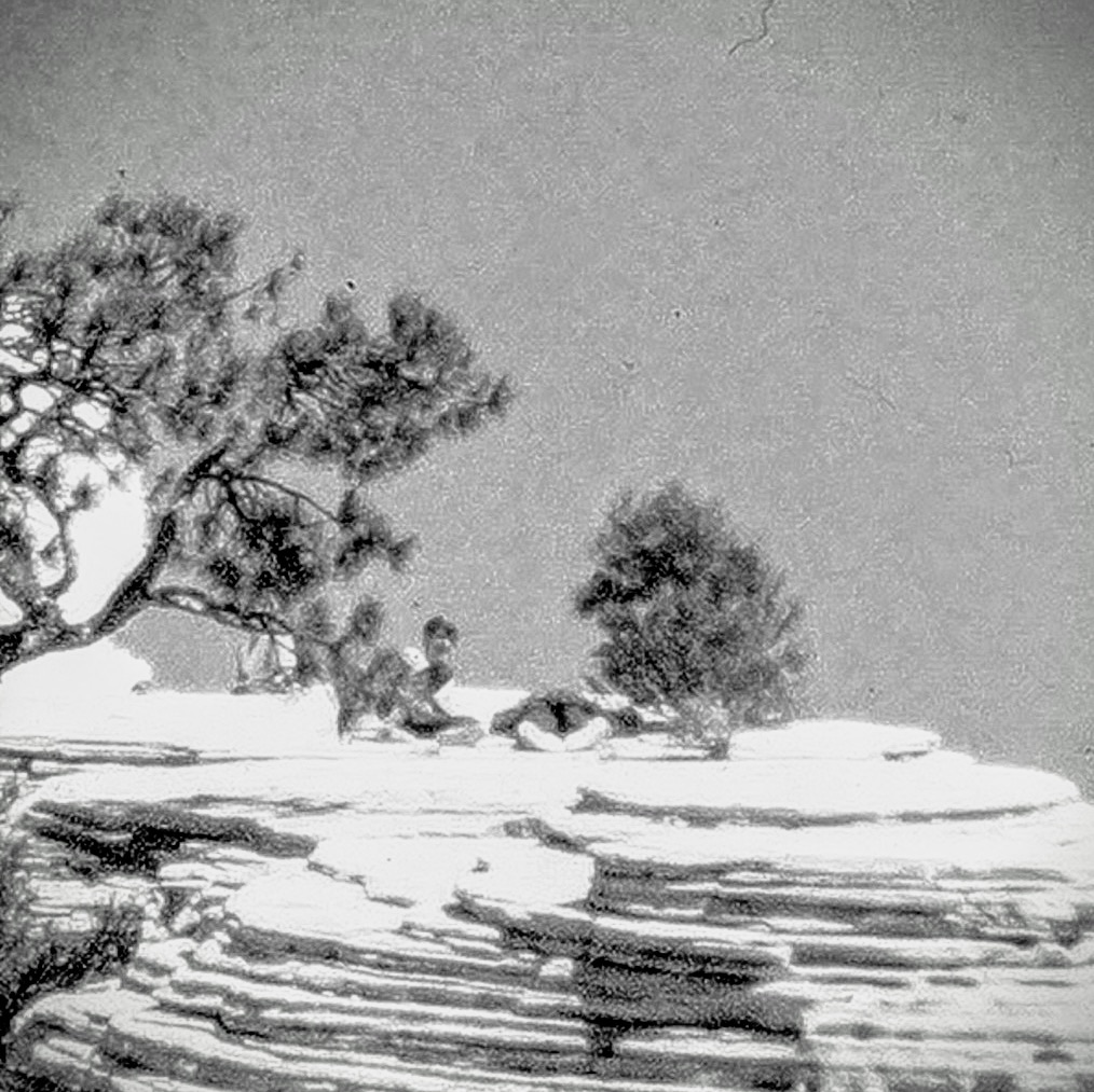
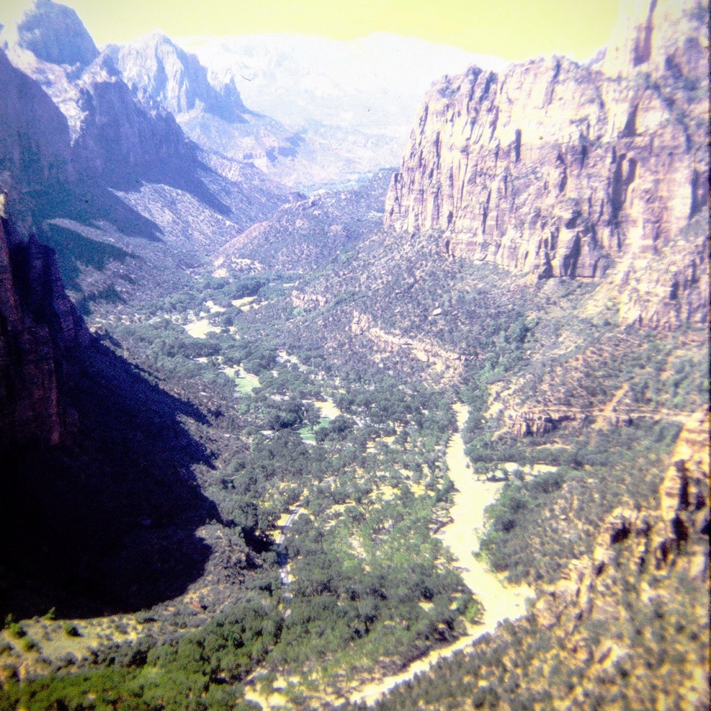
Wow, we made it the Summit. It took all our energy and determination, but we did it. Look at the views, they are so amazingly beautiful. It was worth the strenuous hike to see the spectacular view.
Location: Zion National Park; near Springdale, Utah, USA
God Bless. Thank you for Moving Forward hiking up to the Summit of Lost Peak with us. Thank you for sharing your time and thoughts with me. I appreciate y’all very much.
Remembering my dad through the years (in no particular order), the closeness we had, the good times we enjoyed, the one on one time we spent together, and wishing he good have watched my children grow into adulthood and met my grandchildren. I miss him still to this day. Happy Birthday in Heaven Dad!
God Bless. Have a terrific day. Thinking of y’all. Speedy recovery Cee!Thank you for sharing your time and thoughts with me. I appreciate y’all very much.
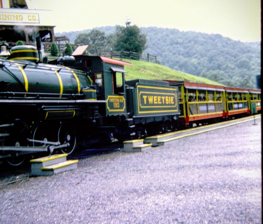
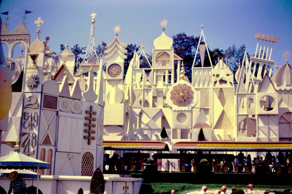
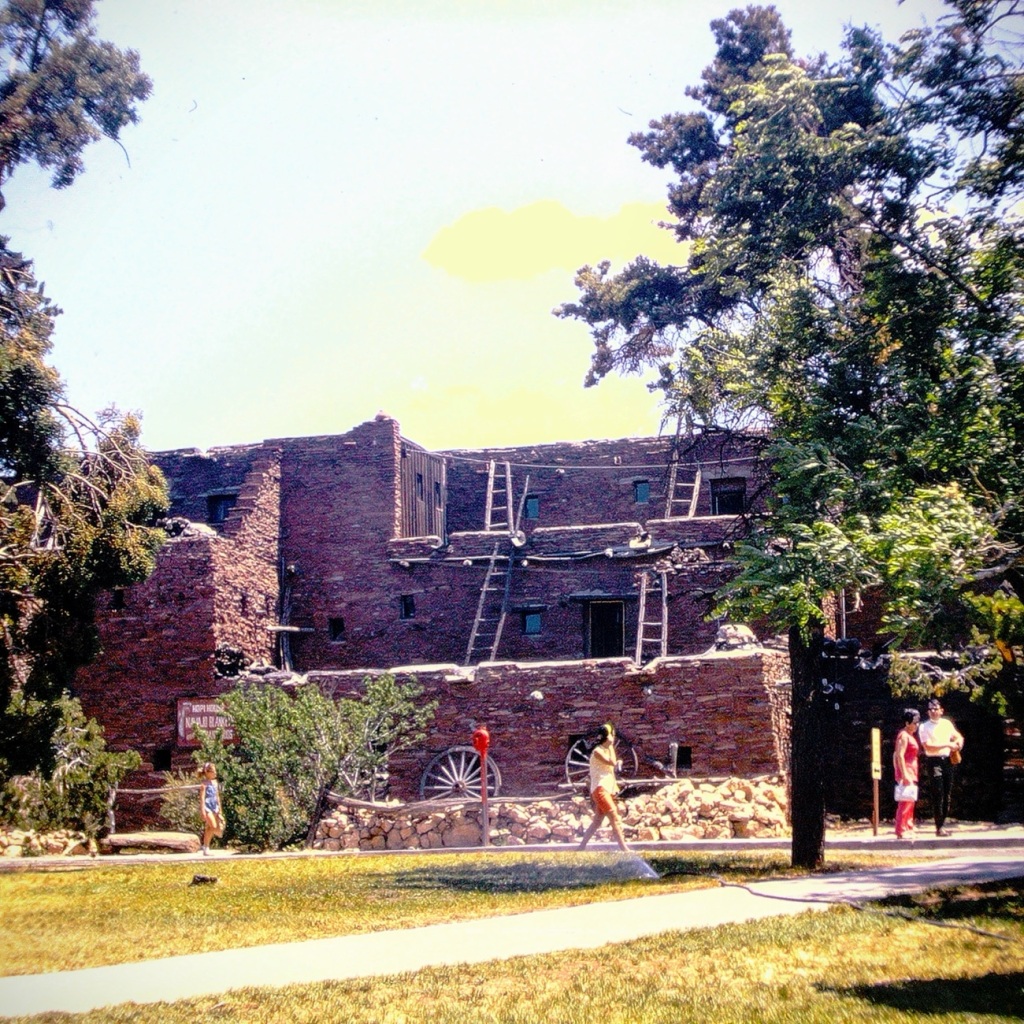
Movieland Doors Movieland Wax Museum Buena Park, California in May 1966Moving Forward on TWEETSIE RAILROAD Boone, North Carolina in July 1969It’s a Small World Disneyland Anaheim, California in June 1970Hopi House Pueblo Indian Dwelling Grand Canyon, Arizona in January 1971View from Angels Landing Angels Landing Trail Zion National Park, Utah in August 1971
Digital Conversion of my dad’s slides were done using Wolverine’s Digital Converter.
God Bless. Thank you for traveling back in time across America with us. We had fun moving forward with memories reconstructing my dad’s old slides to share and preserve. Thank you for sharing your time and thoughts with me. I appreciate y’all very much.
For Cee’s CFFC this week I have dug Theo my archives and chose what I hope y’all will enjoy. Sorry, I don’t have any alleys, but I do have Driveways, Parking Lots, and as always Dirt Roads.
Driveways
Driveway of Gastonia Fire Station #4 Gastonia, North Carolina Driveway of Waters home S. Meadowbrook Drive San Diego, California
Parking Lots
Parking Lot Rankin Lake Park Gastonia, North CarolinaParking Lot Charlotte Douglas International Airport Charlotte, North CarolinaParking Lot Consolidated Aircraft Corporation San Diego, California
Dirt Roads
Persimmon Trail Carolina Thread Trail Daniel Stowe Botanical Garden Belmont, North Carolina Dirt “Road” Persimmon Trail Carolina Thread Trail Daniel Stowe Botanical Garden Belmont, North Carolina
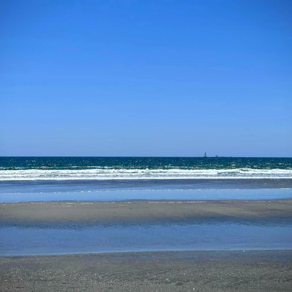
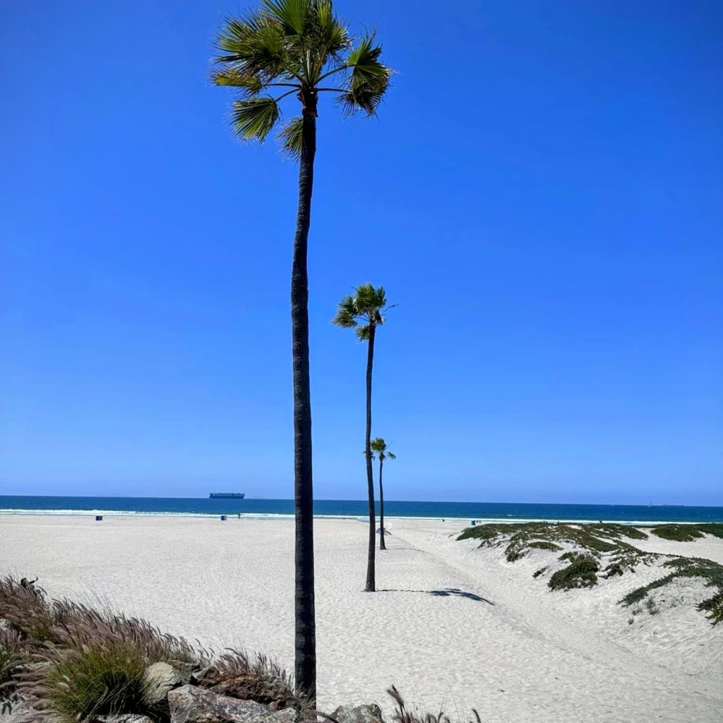
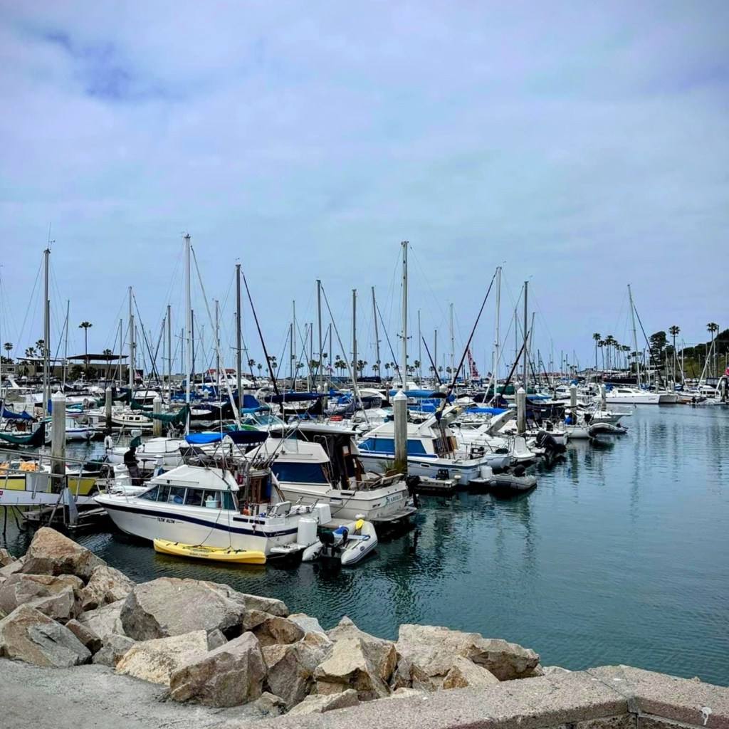
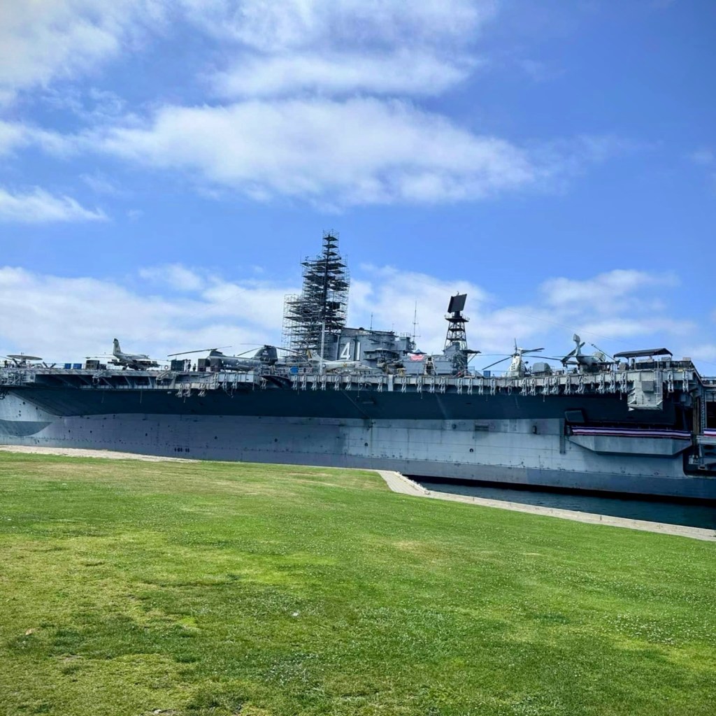
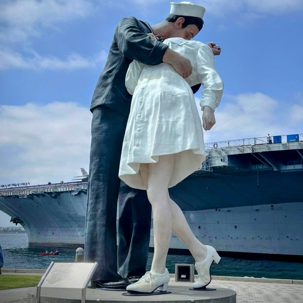
Walking along the Coronado Beach is a fun, relaxing afternoon pleasure filled with delight and beautiful scenery. The slideshow shows the walkways leading up to the Pacific Ocean, the Pacific Ocean itself, and various interesting sights near and in the water. The USS Midway Museum and, the “Unconditional Surrender” a 25-foot sculpture on San Diego’s embarcadero in downtown are just two of the interesting and impressive examples of the amazing sights that can be seen in beautiful Sunny San Diego.
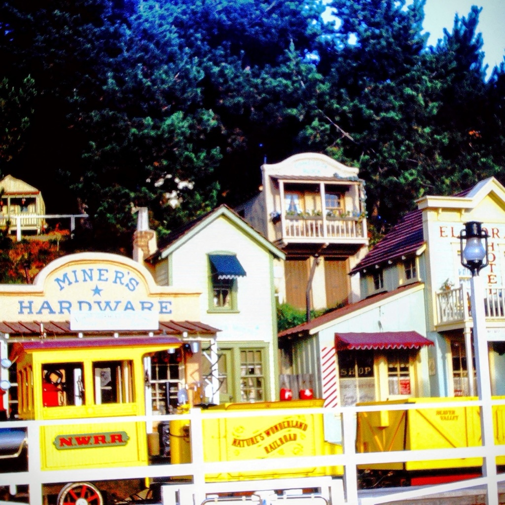
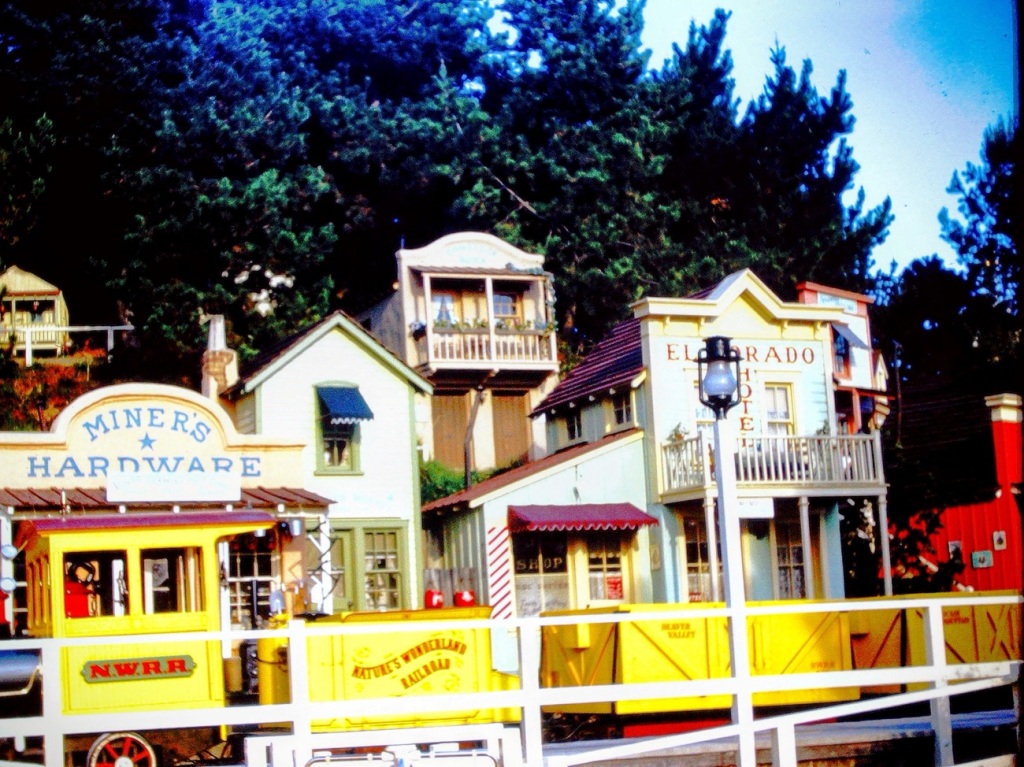
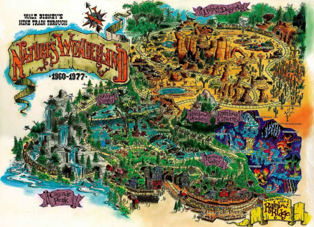
Going back to our Disneyland adventure let’s take. Look at another attraction we rode. We are taking a look at our ride on Disneyland’s Mine Train through Nature’s Wonderland.
The Disneyland Mine Train was an attraction through Nature’s Wonderland in Frontierland that ran from May 28, 1960 until January 2, 1977. It was previously called Rainbow Caverns Mine Train and later became Big Thunder Mountain Railroad.
Nature’s Wonderland Railroad
The Mine Train rode past the mining town of Rainbow Ridge where you could observe what a mining town would have looked like with a hardware store, the El Dorado Hotel. It allowed you to feel like you were in the old west. The train would take you through a tunnel and into Beaver Valley, where you could witness beavers at work chomping their wood, squirrels, raccoons, rabbits, foxes and other forest animals.
After Beaver Valley the train moved forward going across a bridge by Cascade Peak, where you could feel the mist coming from the waterfall on your skin. At this point you could see jumping fish, mountain goats, and swimming bears.
The narrator would announce where you were coming to and what you would see at each destination. From Beaver Valley the train moved forward into Bear Country where you could see 2 large elk with their antlers intertwined, fighting each other.
From there the Mine Train would continue moving forward taking you in a circular shape around the Living Desert, with the other half being a forest filled with desert cottontails, rattlesnakes, waterholes, tortoises, badgers, and armadillos. The displays made everything seem so realistic and lifelike.
The last portion of the ride took you through Rainbow Caverns. In the Caverns you could see giant stalagmites, stalactites, and colorful falls on every side.And if you looked real carefully, you’d see geyser grotto, and the witch’s cauldron.
Thanks for climbing aboard and joining us for our ride on Disneyland’s Mine Train through Nature’s Wonderland adventure.
Traveling back in time to December 1965, to a family day trip. Packed and loaded in our 1962 Ford Galaxie 500 with a cooler of drinks, snacks, and sandwiches; we began our approximately hour and fifty-one (1hr 51min) drive north moving forward through the city streets until turning onto CA-94 and eventually onto the recently constructed I-5.
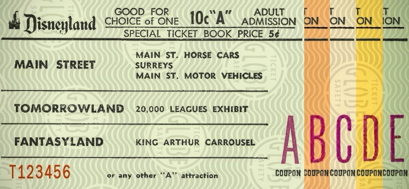
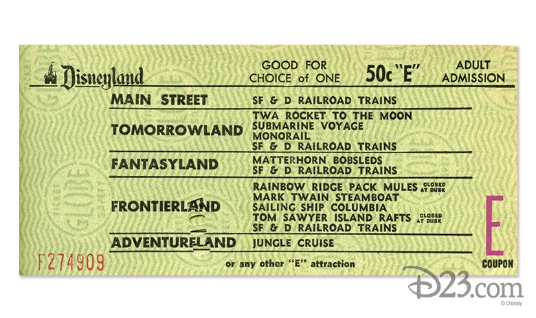
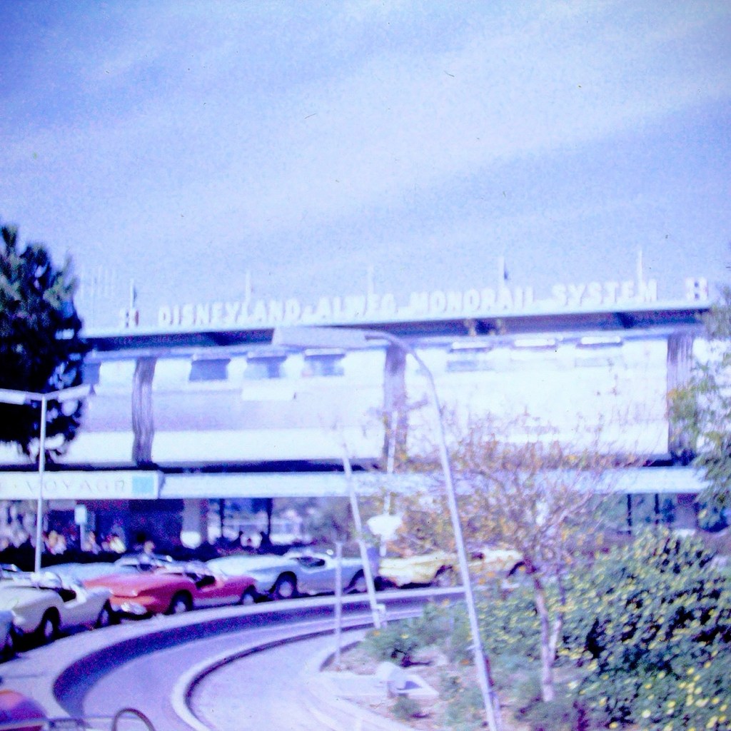
Upon arriving at the Disneyland entrance, my parents purchased our admission and ride tickets. General Admission prices for adults at that time was $2.60 per adult and included a ticket for the Monorail. Junior prices were $1.80 and Children’s admission prices were $1.10. Tickets for the rides cost extra. A book of 10 tickets ranged from $3.00 to $5.00.
1965 Disneyland Ride Tickets A-ESelection of E Ticket Rides
In 1965, the cost of admission was considered a lot of money. However, people considered visiting Disneyland was a worthwhile family adventure.
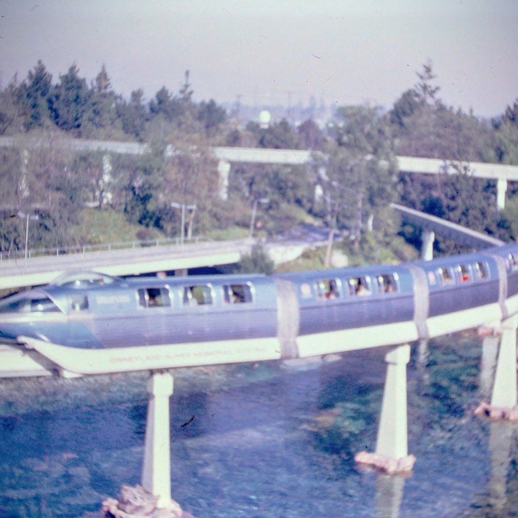
After our tickets were purchased and we entered the park, we selected what rides we wanted to ride. We went to each ride or attraction as a family unit, not venturing off individually. Our first ride of choice was the Monorail.
Disneyland Monorail
The Monorail was considered as a mid-century marvel and captured the hearts and imaginations of the theme park and Disney fans. The Monorail was a Highway in the Sky which allowed for a unique experience viewing the park from above.
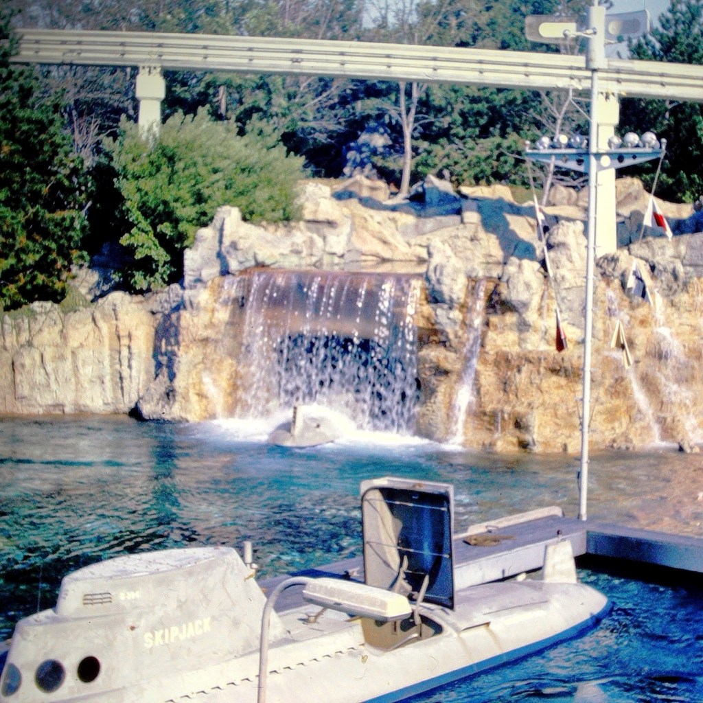
Our next selection was to ride the submarine adventure. The attraction features vehicles that were designed to look like submarines. It required the E ticket was in the Tomorrowland area of the park.
Early Disneyland Submarine
The submarines took us on an adventure under the sea simulating fish and other sea creatures allowing us to imagine we were really being submerged and viewing the undersea life of a tropical lagoon.
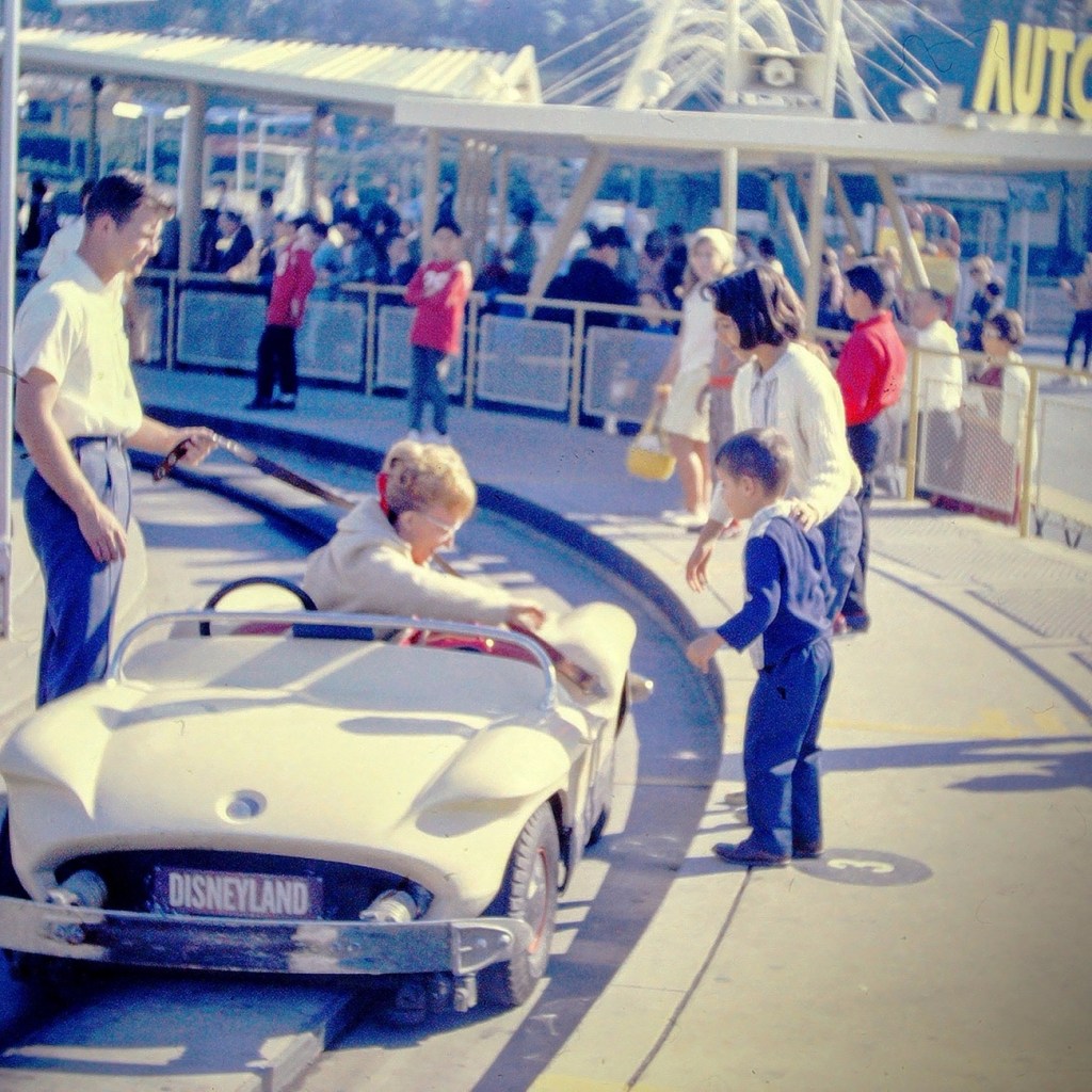
Next up was the Autopia adventure. This was where we could get in cars and race around an enclosed track. We could imagine we were actually racing the other drivers.
My mom getting out of the Race Car.
After a full day of adventures Moving Forward around the park, we selected a spot on the side of Disneyland’s Main Street to watch the Parade. The waiting was a time of excitement as we looked forward to the parade starting.
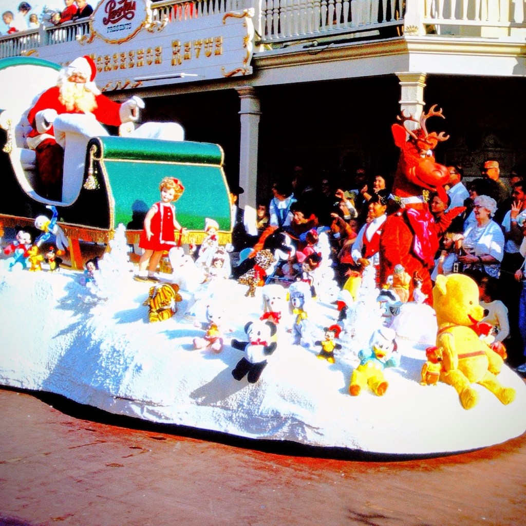
Mickey Mouse riding in a Vintage Car with Goofy1965 Disneyland Santa Claus Float
Well folks, that’s all for today. We had fun, but now it’s time to head home.
Growing up almost three thousand miles (actually 2,512 by today’s calculations) away from my dad’s family in South Carolina; we only traveled the long distance every three (3) to five (5) years. My parents always drove straight through switching off driving every several hours and/or miles as deemed necessary.
On every family vacation to visit my dad’s family, my parents would plan places for us to visit during our trip. One place would always represent a place of historical significance. The other place would always be some fun attraction. Sometimes it’d just be our immediate family visiting the chosen places and at other times my dad’s sister’s family would join us.
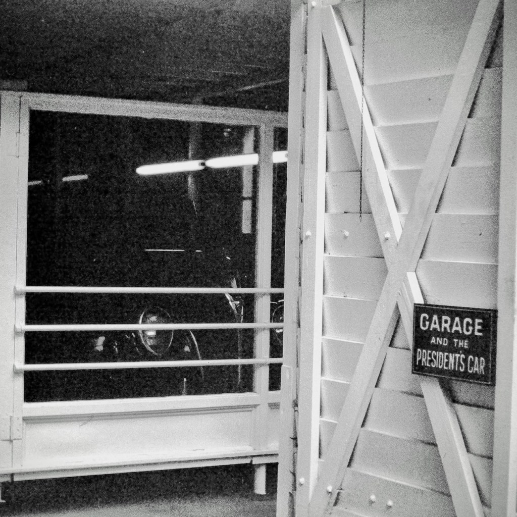
On our trip in July of 1967, my dad selected The Little White House in Warm Springs, Georgia for us to visit. The Little White House was the personal retreat for Franklin Delano Roosevelt, the 32nd president of the United States of America. It is located in the historic district of Warm Springs, Georgia.
When Roosevelt first started coming to Warm Springs (previously known as Bullochville) in 1924 it was to receive treatment for Polio. He loved the area tremendously, so he had a home built on Pine Mountain located close to Warm Springs. On April 12, 1945, President Franklin Delano Roosevelt died in this home shortly after he began his fourth term in office.
In 1948, Roosevelt’s Little White Housewas opened to the public as a museum. Part of the Museum displays include his 1938 Ford V-8 convertible coupe and his custom built 1940 Willys roadster. Many of his cars were equipped with special controls that allowed the partially paralyzed Roosevelt to operate the foot pedals with his hands.
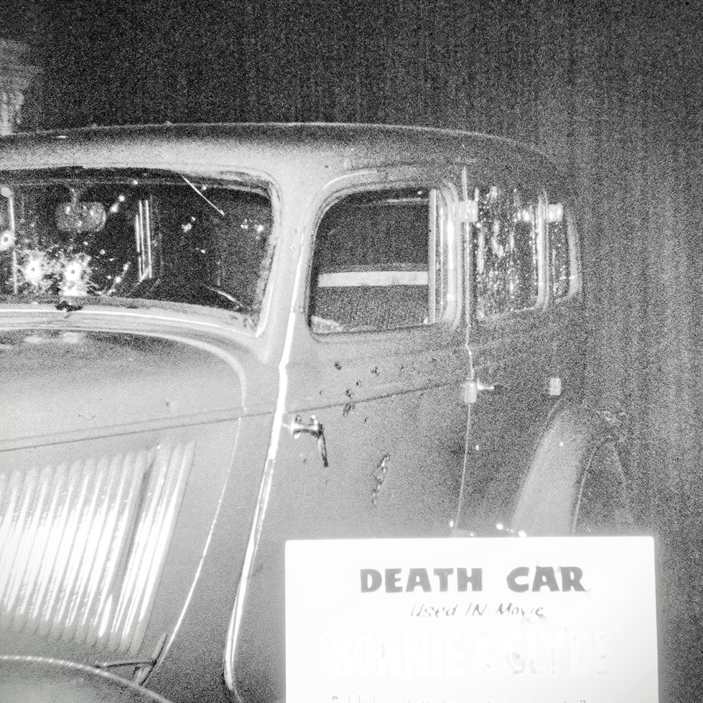
Death Car used in movie Similar to Car FDR was riding in when an Assassination Attempt Occurred
There was a movie made in 1933 that depicted the attempted assassination on Franklin D. Roosevelt. It references the assassination of Chicago Mayor Anton Joseph Cermak and hiswho was mistakenly killed during the attempt on FDR. The Death Car shown here and in the museum is the car that was used during that filming.
To learn more about the assassination attempt on Franklin D. Roosevelt click on Death Caror to learn more about FDR click on his name.
Pictures were Reconstructed from slide format to digital format via a Wolverine Digital Converter Renewing them for preservation and future generations.
Location: Roosevelt’s The Little White House; Warm Springs, Georgia, USA
God Bless. Thank you for visiting and reminiscing with me. Thank you for sharing your time and thoughts with me. I appreciate y’all very much.
For this journey of discovery we are beginning in Southern California at Knott’s Berry Farm. We are Renewing a remembrance by exploring a time of a family outing my dad captured with his camera and had developed onto slides which I Reconstructed into digital formatting for better visibility and preservation.
Stage Coach Ride at Knotts Berry Farm Buena Park, California Circa May 1966
The Stage Coach ride allowed people to seat inside the coach or on the Outside up top of the coach. Being up top allowed for a unique experience and perspective of the exciting surroundings.
Moving Forward we venture out towards the California desert for a weekend of camping and the freedom of the great outdoors for a time of refreshing recreation and a time for renewing the closeness of family togetherness.
Anza-Borrego Desert State Park Borrego Springs, California
We join friends from our church family at Anza-Borrego Desert StatePark for a time of food, fellowship, and tons of fun.
Whether we choose a seat at a table near the chuck wagon or close to an outdoor cook stove/oven is our choice. We may sit together or apart, however the point of the weekend is renewing and strengthening family bonds and friendships.
Anza-Borrego Desert State Park Borrego Springs, California
Moving Forward remembering the past by Reconstructing old slides renewing the photos for future generations.
Good Day! Be sure to click on each photo for larger viewing.
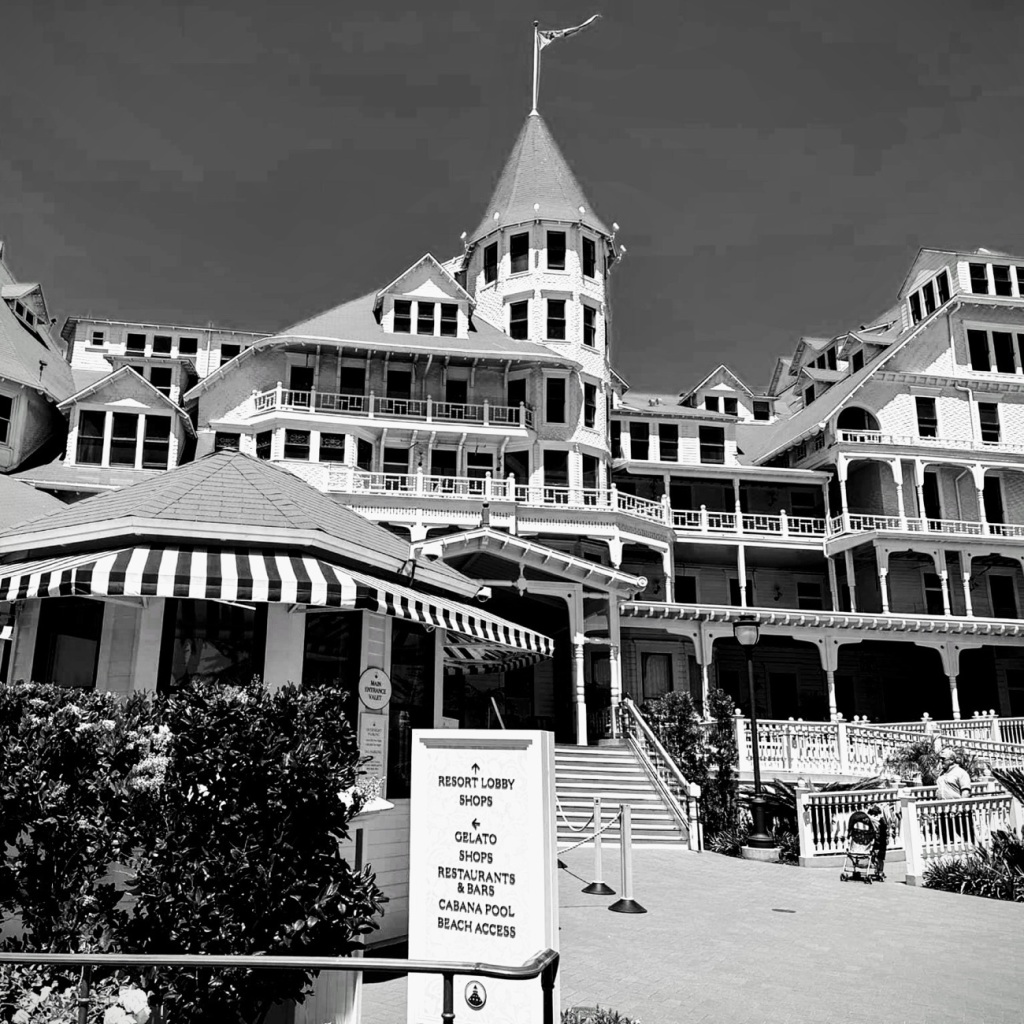
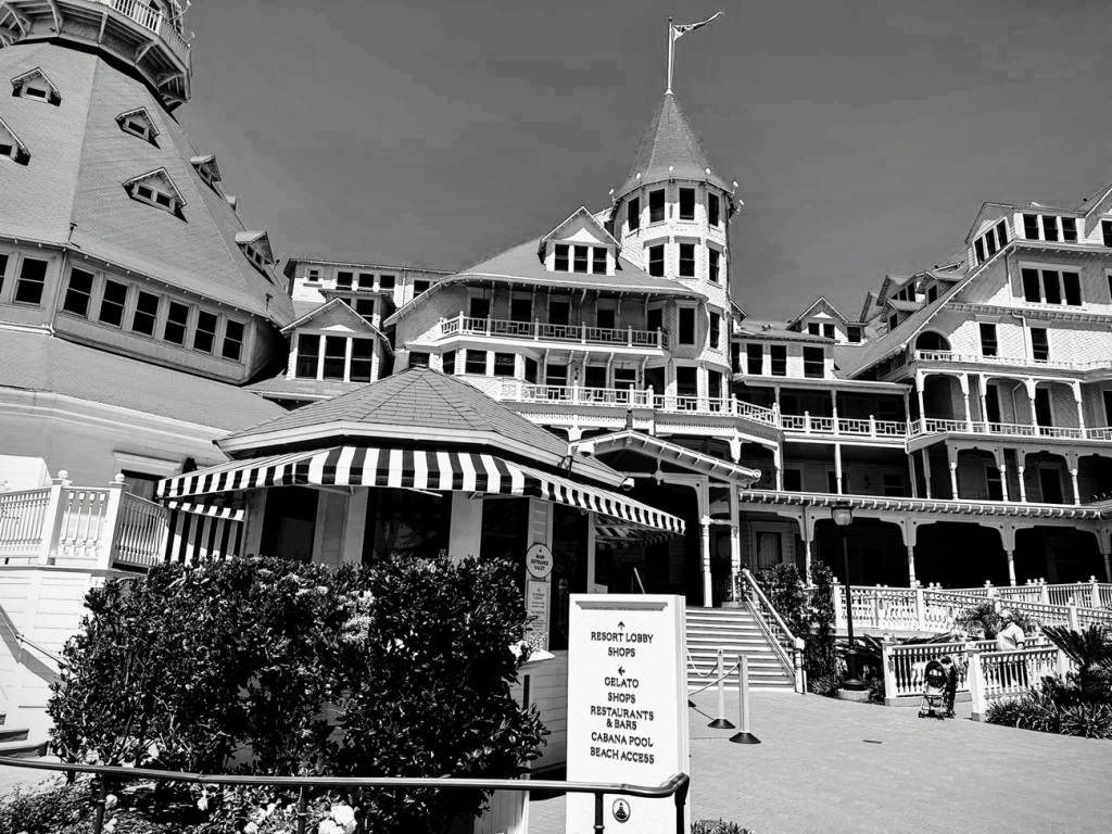
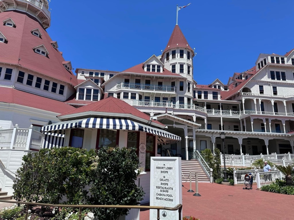
The Hotel Del Coronado has been a living legend for more than One Hundred Thirty (130) years. It has proudly hosted U.S. Presidents, movie stars, celebrities, and royalty as well as many beach loving guests (tourists and locals) for many many decades of generations throughout history.
With Non-Squared
B/W & Color Windows
The Hotel del Coronado was built in 1888 after much dreaming, planning, and inspiration of its founders Elisha Babcock and Hampton Story. Babcock and Story enlisted a local San Diego developer, Alonzo Horton to help them survey Coronado beach in 1886. The natural beauty of Coronado inspired the founders to buy the island and build the magnificent hotel.
Babcock and Story created the Coronado Beach Company and then proceeded to establish several enterprises to support and develop the Coronado Community. Those enterprises included a ferry company, a water company, a railroad company, and an electrical power plant.
Construction began on the hotel in 1887 with approximately 250 men working the construction crew. It was built entirely wood using many different types from across the United States. The lumber used included Douglas Fir for framing, California Redwood for its exterior siding; hemlock and cedar was also made available for use. The Hotel’s lobby featured Illinois White Oak while the Crown Room ceiling was done with Oregon’s Sugar Pine. Each type of lumber was selected for their unique qualities to enhance the hotel’s beauty and ensure its longevity.
Coronado Island and The Hotel del Coronado are wonderful places to visit. The beautiful landscape, the beautiful ocean views, the stunning elegance of the hotel are sites to behold and experience. I have to admit I have never stayed in the hotel (too rich for my blood), however I have visited and walked along the beach with friends. A truly wonderful experience for sure and for certain.
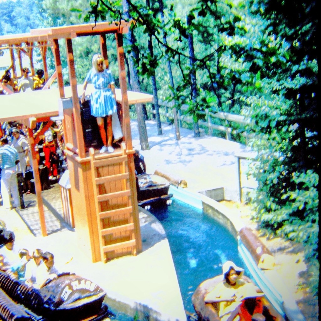
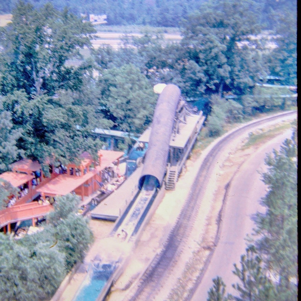
Come on and climb in the “boat” with us. We can make room for one or two more. It’s gonna be a fun ride, just you wait and see.
We’re moving forward, our turns coming up.
The ride lets boats go first from one side and then the other side. Our turn is next. Get ready. It’s our turn.
Moving forward along the ride we are going up, up, up …
And Splash … we zoom down almost to the end of our log ride. Did you feel the water 💦 splashing us? Oh right, you were in the back so you didn’t get oat all.
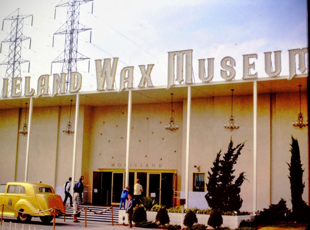
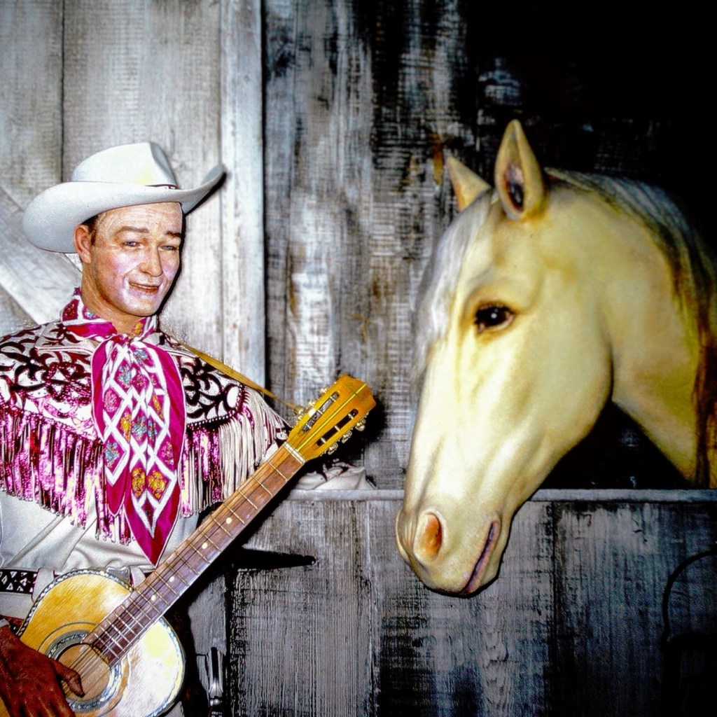
The photo was taken at the Movieland Wax Museum in Buena Park, California back in 1966 by my dad when we visited. These are wax figures of Roy Rogers and Trigger. The sign in front of the display (not pictured here) states CO. REPUBLIC 1945; “DON’T FENCE ME IN”; ROY ROGERS; DIR. ENGLISH; PROD. DONALD H. BROWN; SCENE N. 20; TAKE NO; EXT: STABLE.
The photos have been reconstructed by digitizing them via Wolverine digital converter to create a renewed version for save keeping for future generations.
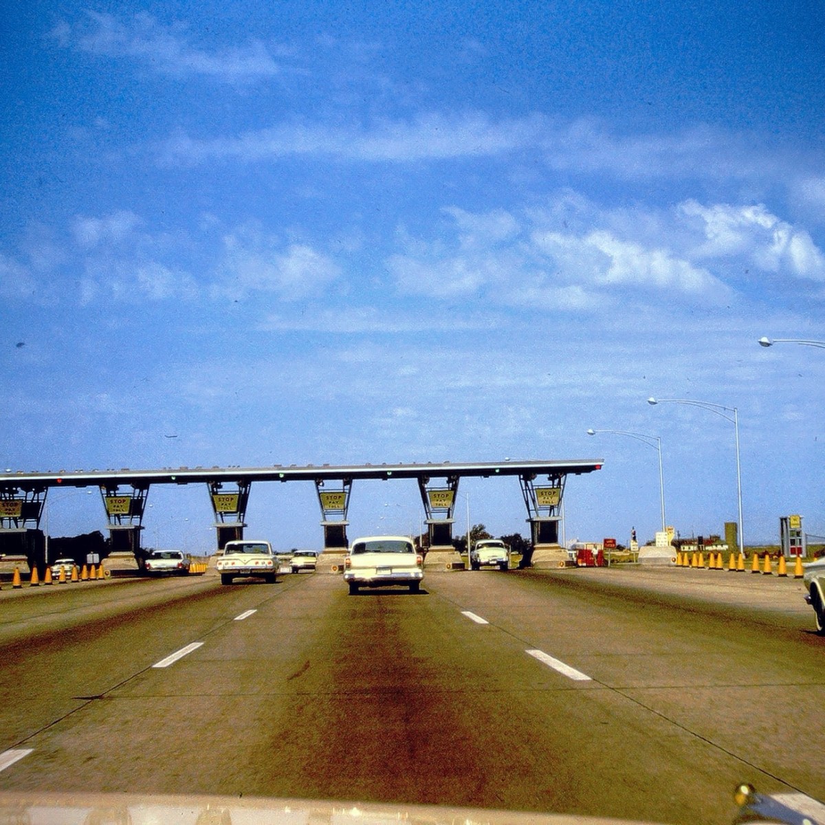
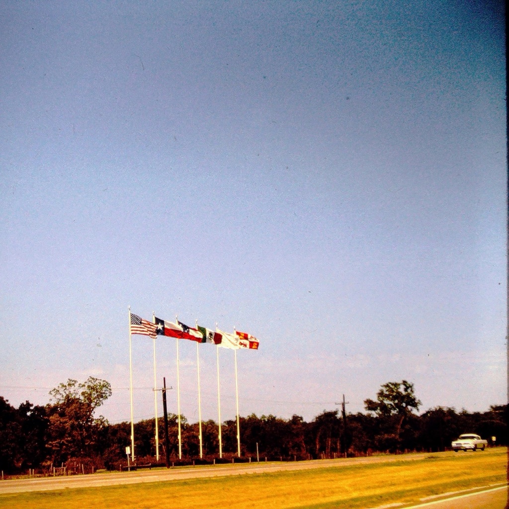
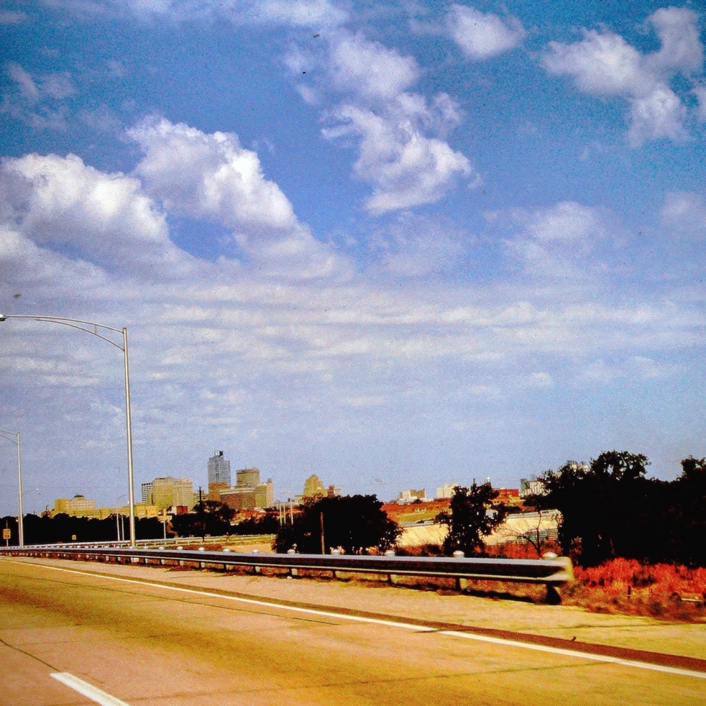
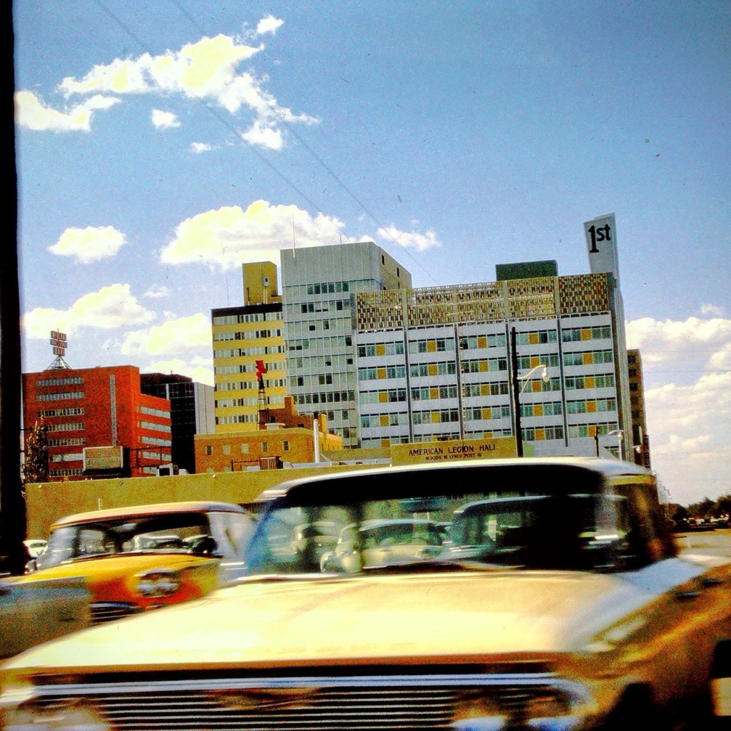
Today we are going backwards in time Reconstructing my dad’s slides to reminisce family journeys from 1963. These are from one of our vacations traveling from San Diego, California to Great Falls, South Carolina and back home again.We progressed along the interstate Moving Forward Eastbound and Down loaded up and truckin’ heading to see my paternal grandparents for the first time in five years.
Coming or Going Somewhere in Texas
The Six Flags can be seen from Interstate 20 nearing the Arlington, Texas. They signify being close to the Six Flags over Texas amusement theme park.
Which way are we going? From the photo I’m not sure if we were headed east or going back west at this point in time as I can barely remember the trip.
Stop 🛑 and Pay 💰 Toll Texas Toll Booths
Nowadays, there are over 50 toll roads in Texas. All drivers are required to pay the toll (fee) regardless of where you live. The first major toll road in Texas, which opened in 1957, was a 30-mile, six-lane stretch of highway between Dallas and Fort Worth. A drive from one end to the other cost 50 cents.
Passing through El Paso, Texas
After a long tiring vacation visiting family in the Carolinas, we are passing forward through El Paso heading home to San Diego. At this point of our trip we are excited to be almost home (over half way back across country.
I’ve been working on preserving and digitizing my dad’s old slides and thought these might fit the theme for Debbie’s OWS-Red Challenge.
3-speed GM Turbo Hydra-Matic automatic transmission in 1969Pirate Ship at Disneyland in 1965The Little Train by Lois LenskiLarry Dean Waters (my brother) and Debbie Lynn Waters (myself) in 1963