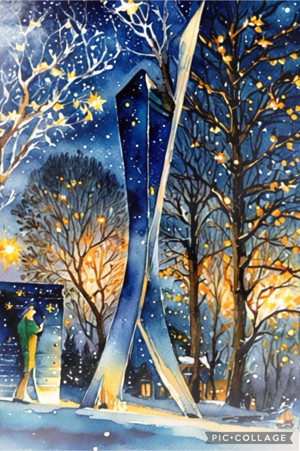
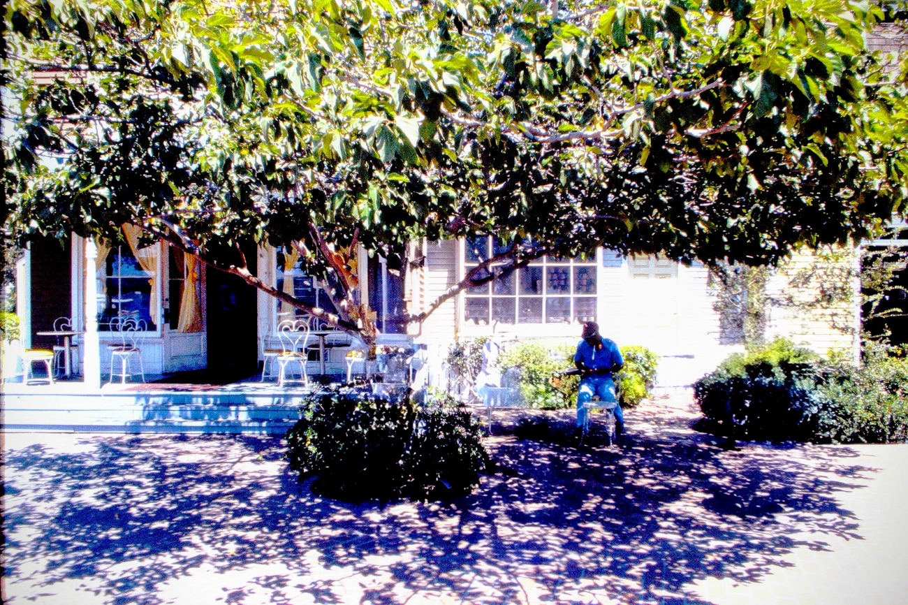
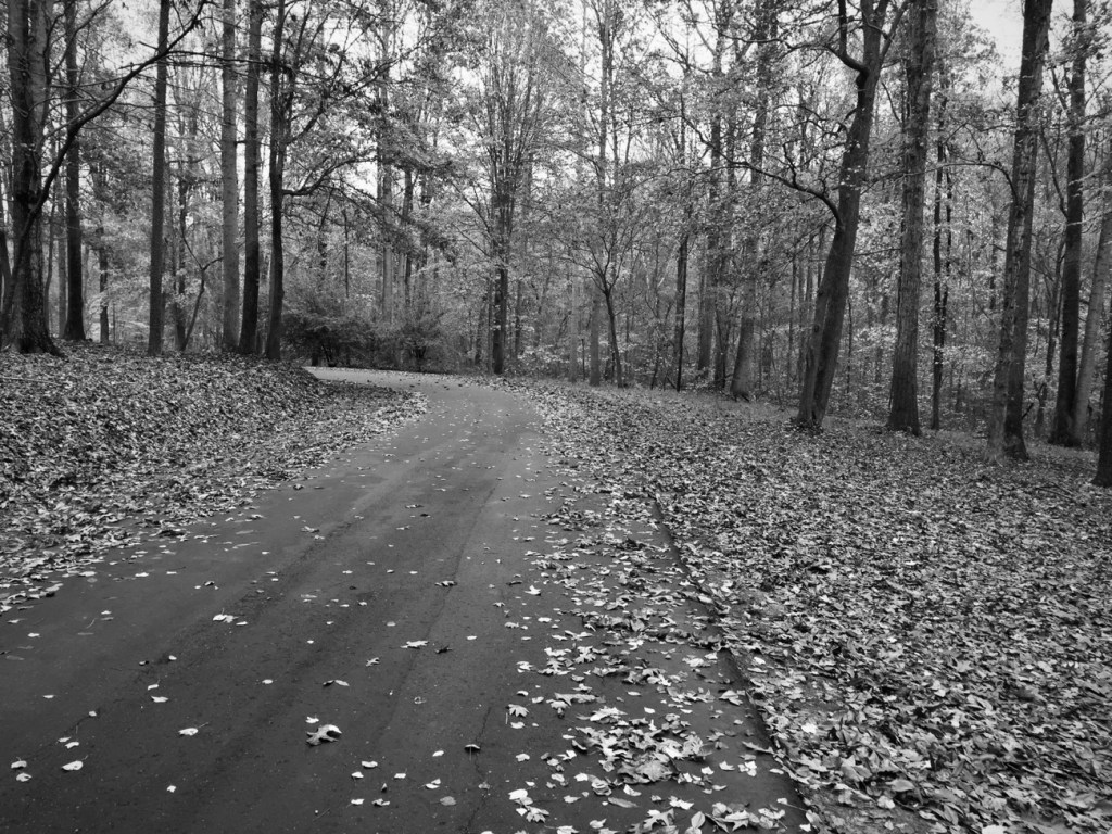
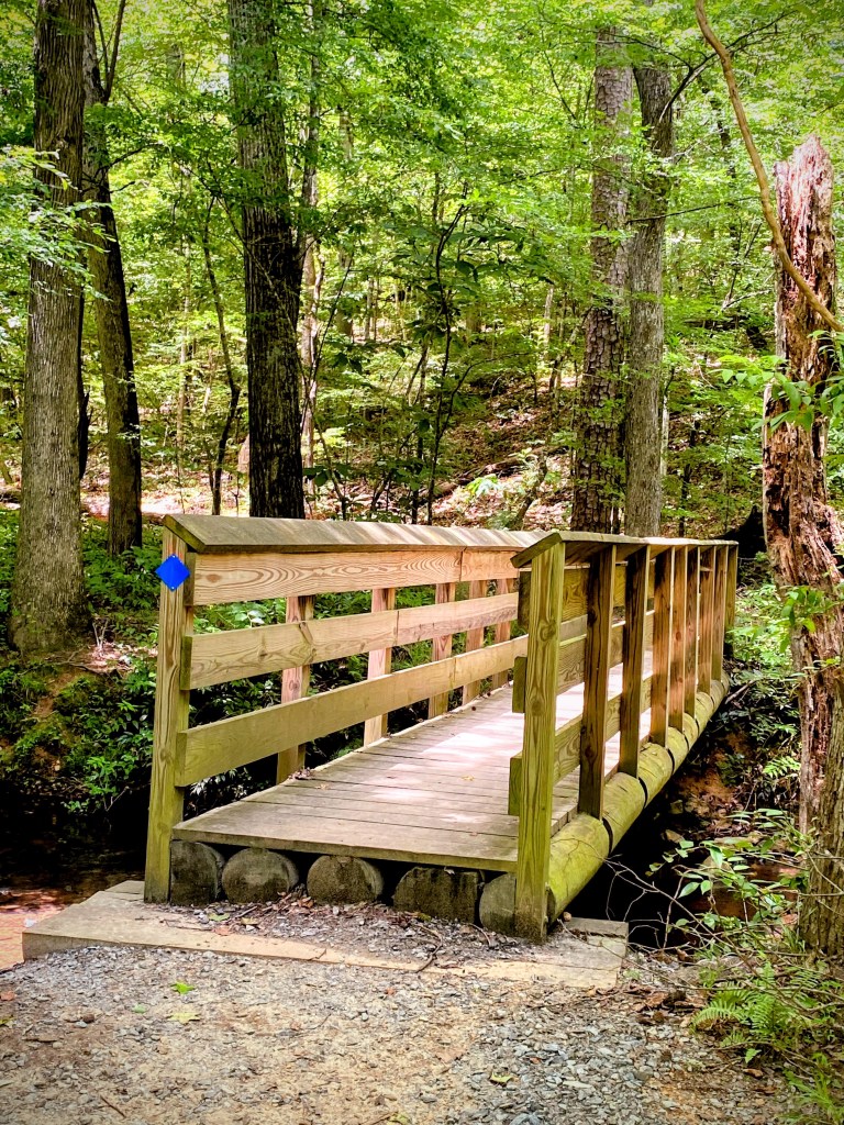
My entries here are from The Lindsay Pettus Greenway’s Lighting of the Greenway. Whenever Coleman and I are hiking in a Greenway, State or National Park, we do not Rush; instead we take our time strolling through the paths and trails in taking everything there is to see. Nature is amazingly beautiful and peaceful, there is never a need to Rush. Take your time, relax and enjoy your journey.
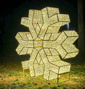
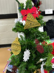
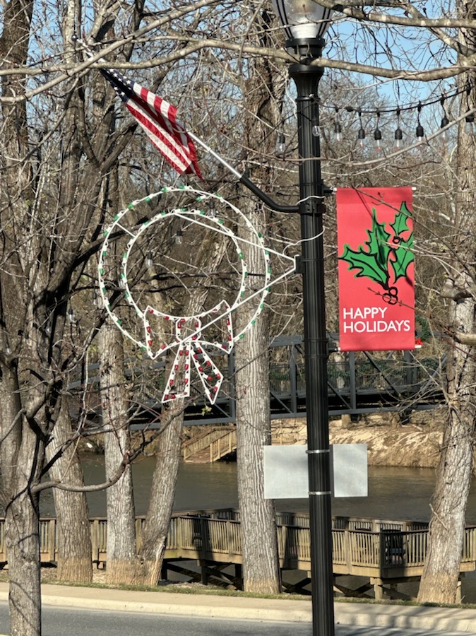
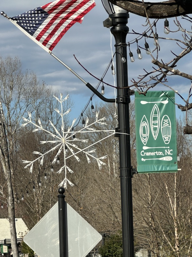
Golden Snowflake
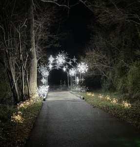
Silver and Gold Lined Pathway
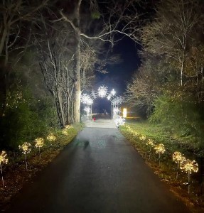
Shining Brightly
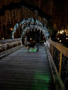
Sparkling Snow Droplets Covering a Bridge
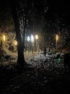
Can you sense the Snow ❄️?
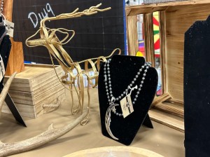
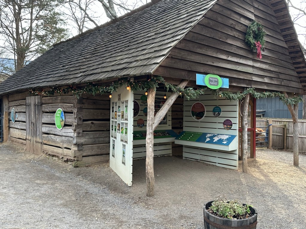
Bonus: Gold at the Christmas Market
Please make sure your which way is the main object of your photo. Thanks.
Cameras: Apple iPhone 14 Pro Max and Canon EOS Rebel T3i
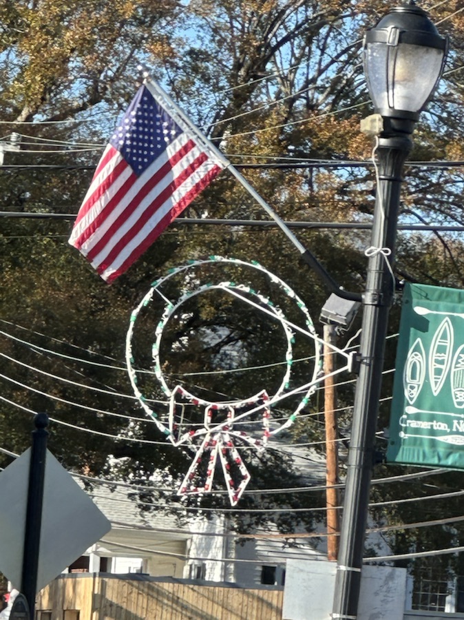
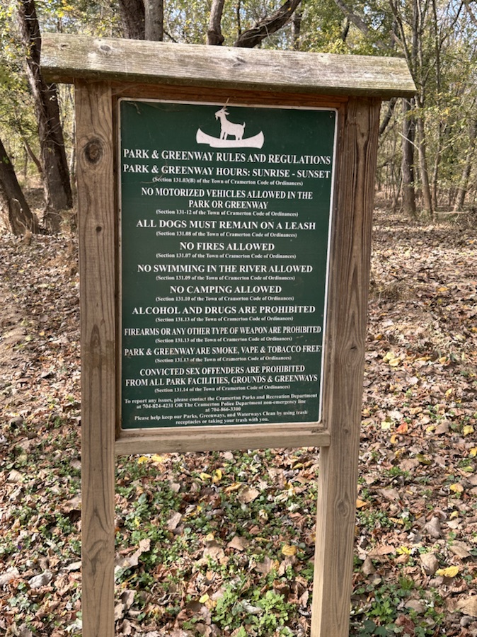
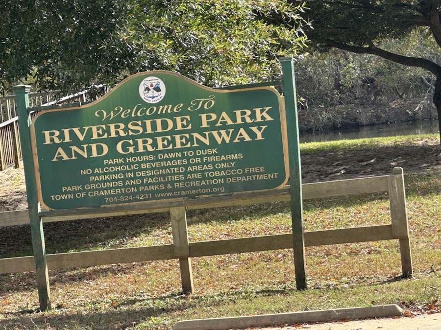
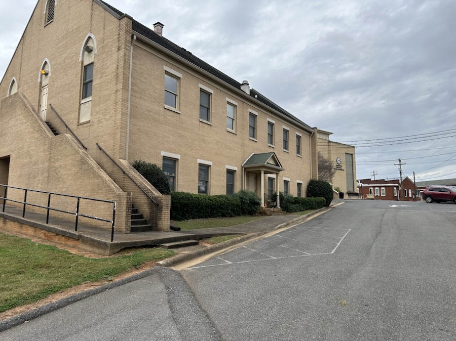
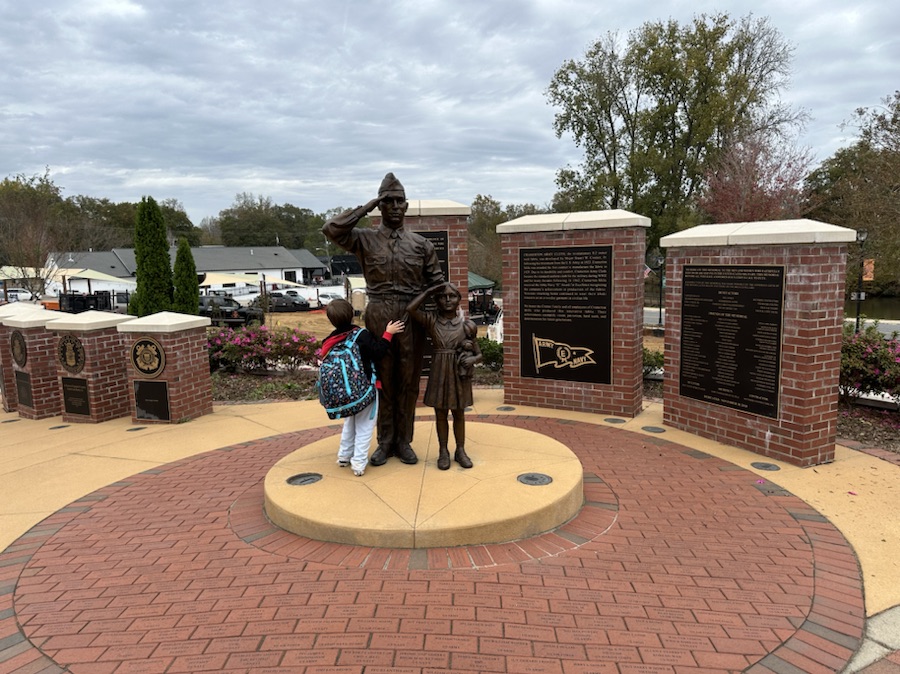
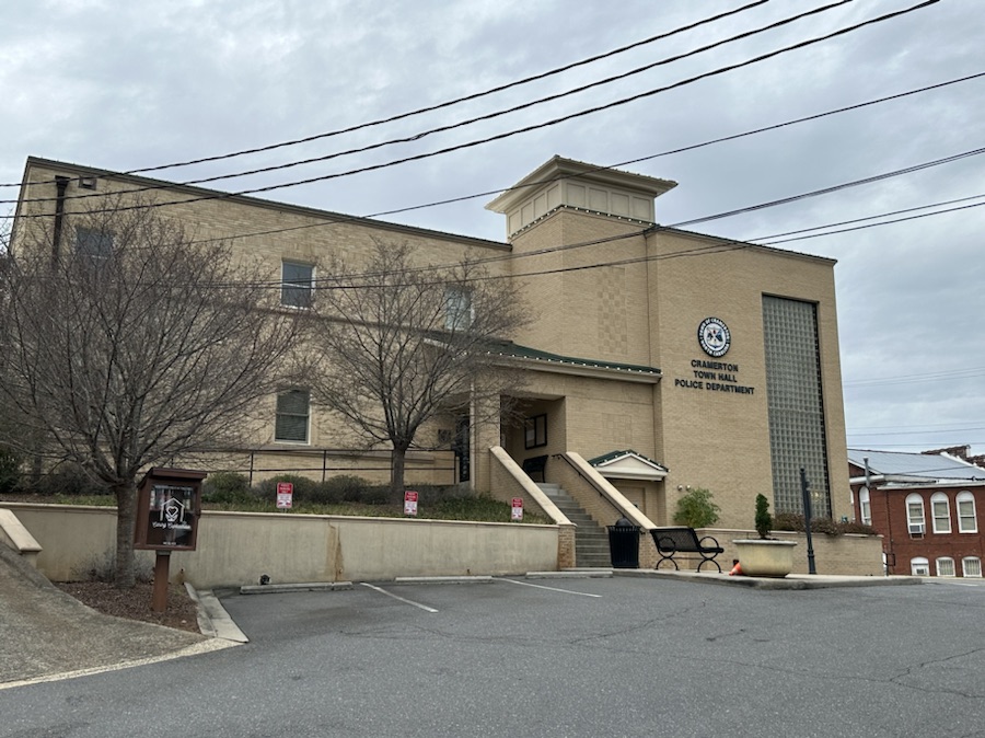
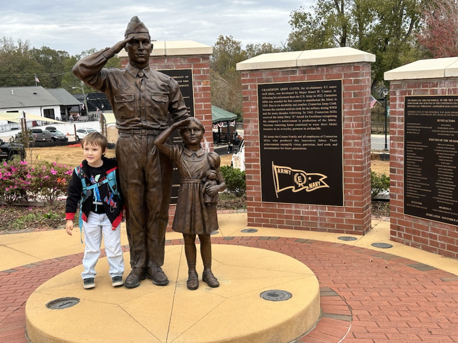
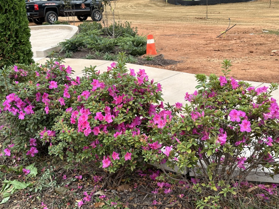
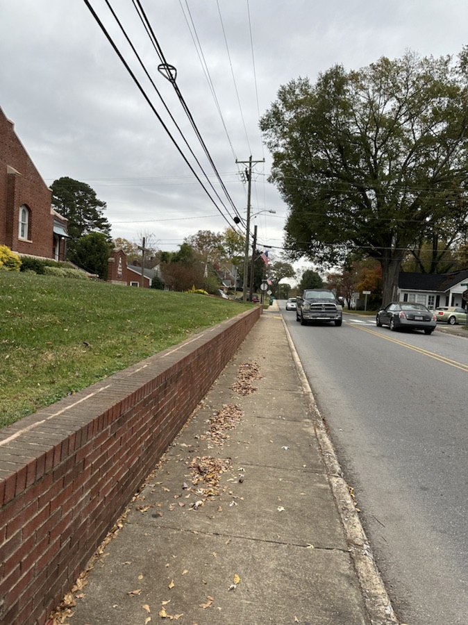
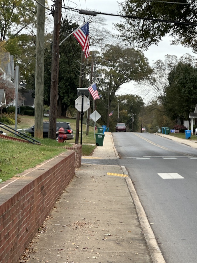
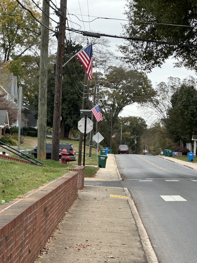
Location: Town of Cramerton; Cramerton, North Carolina, USA
God Bless. Season Greetings. Enjoy your holidays. Remember the Reason for the Season. Thank you for visiting and sharing your time and thoughts with us. I appreciate y’all very much.
The Which Way Challenge (CWWC)is all about capturing the means we travel from place to place such as roads, walkways, trails, and rails. The roads could be paved or unpaved, gravel, or dirt. Walkways could cover sidewalks, hallways, or pathways. Trails are paths we travel through Greenways, Local, State, or National Parks. Also permissible are any kinds of signs and any bridge angle. Remember to ensure your “Way” is visible and the main focus of your photo.
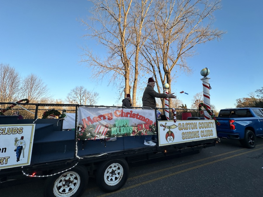
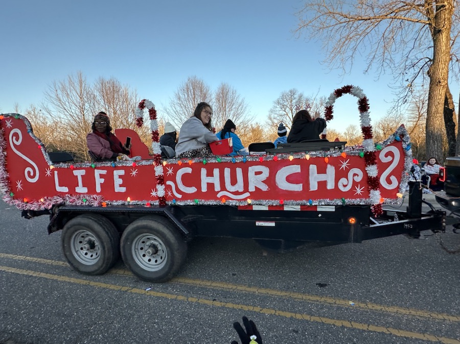
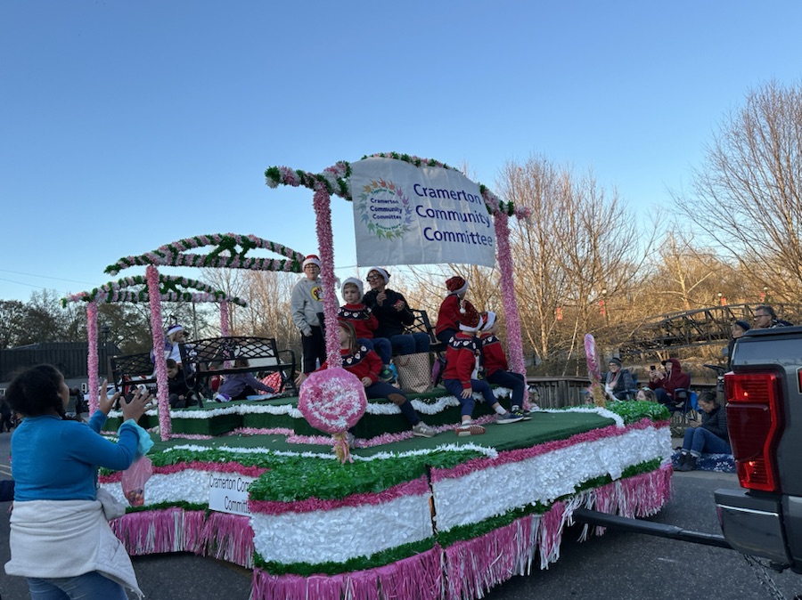
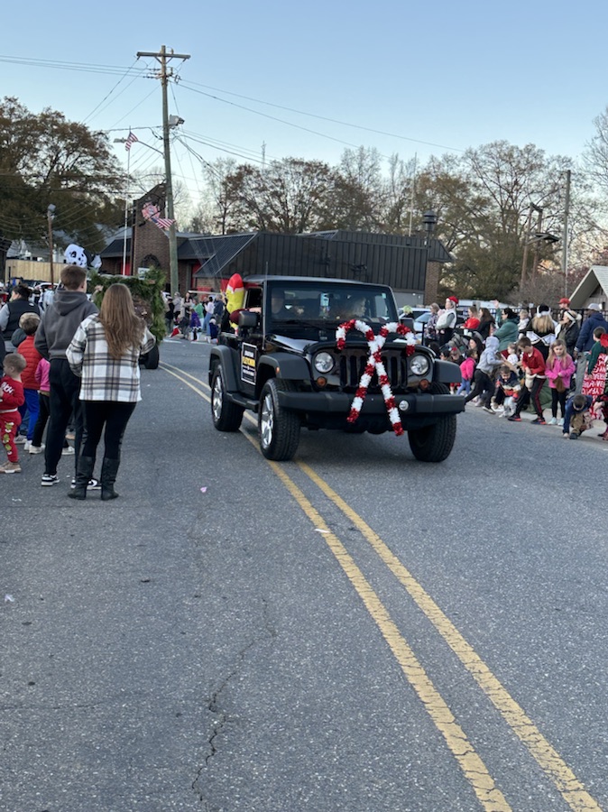
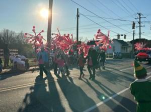
This week’s Theme for the Which Way Challenge (CWWC) is Any Which way with the colors of Red and Green.
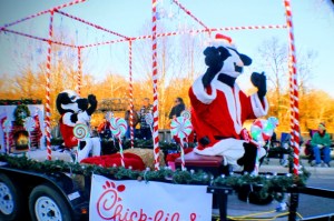
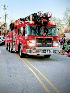
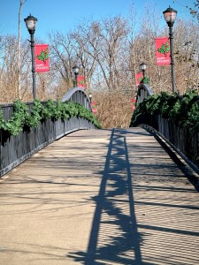
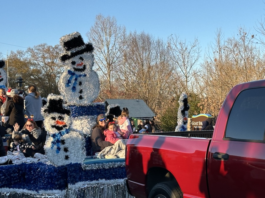
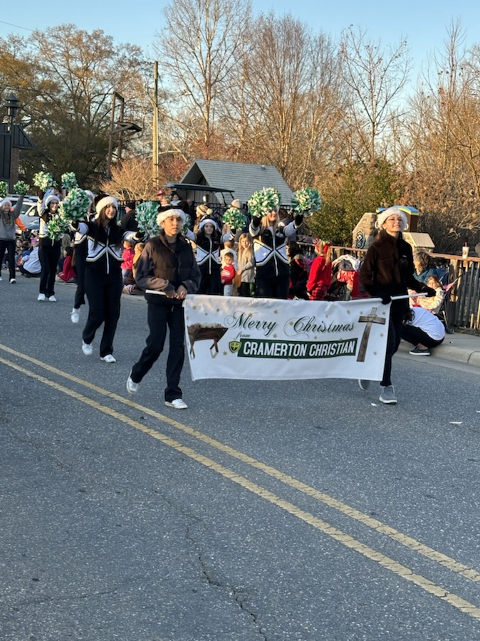
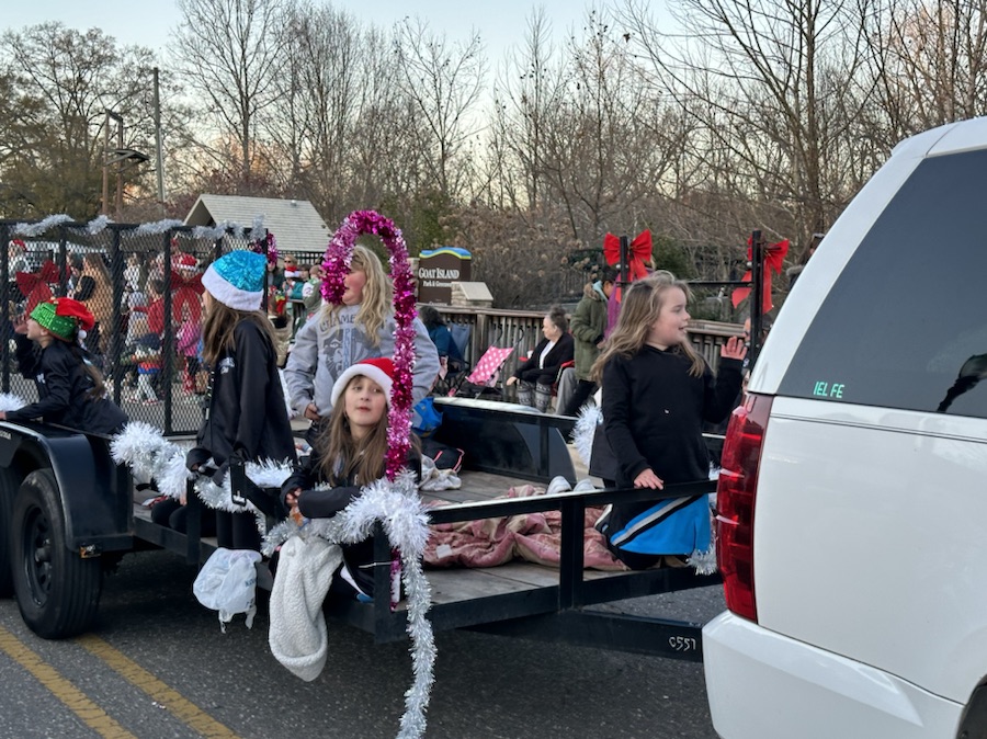
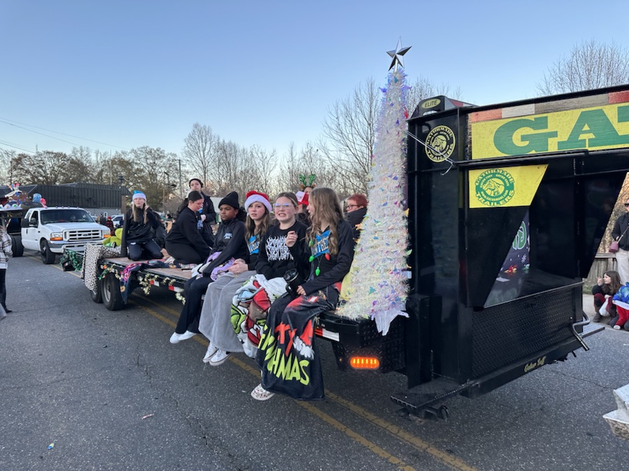
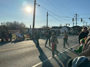
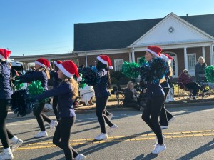
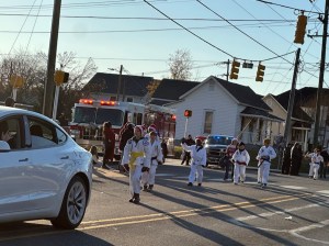
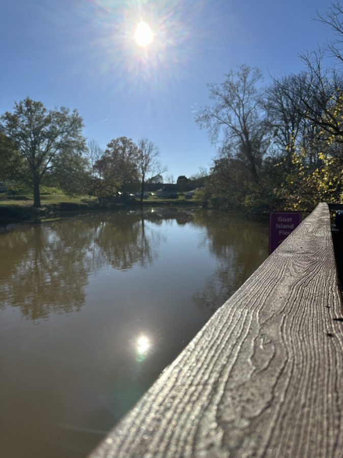
My Which Ways this week are from the Cramerton Christmas Parade and Goat Island Park and Greenway. Remember signs are always welcome in the Which Way Challenge.
Letters to Santa North Pole
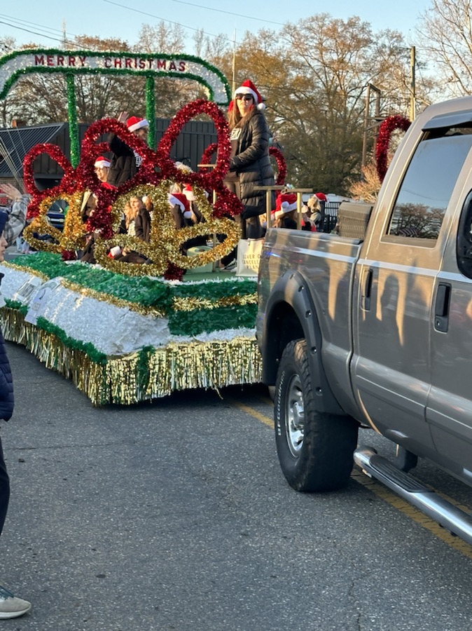
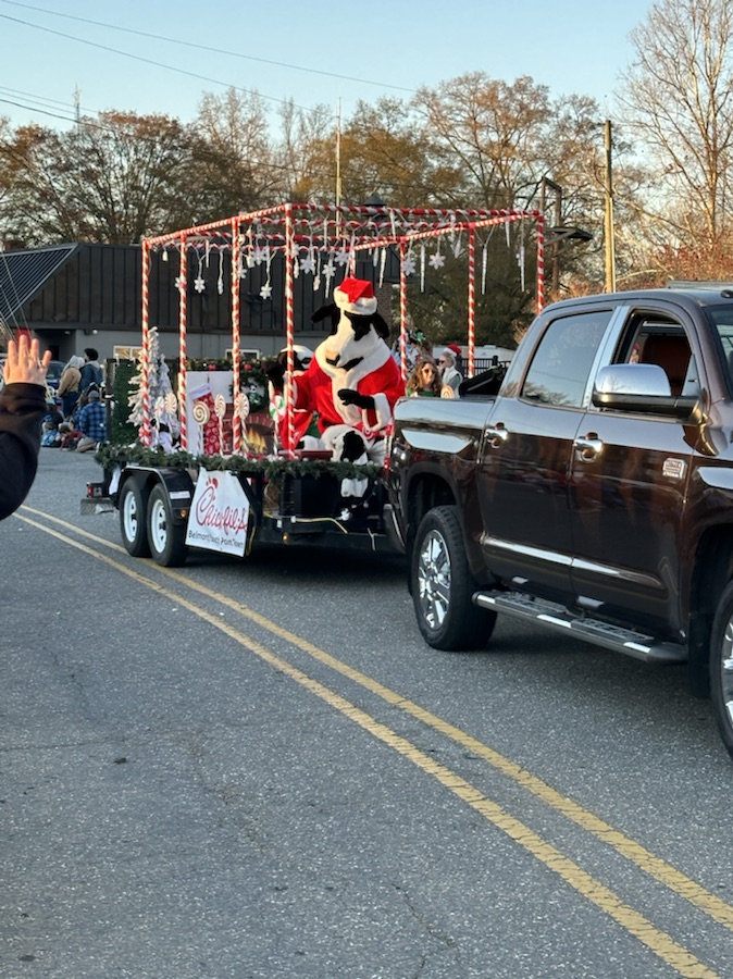
Chick-Fil-A Parade Float
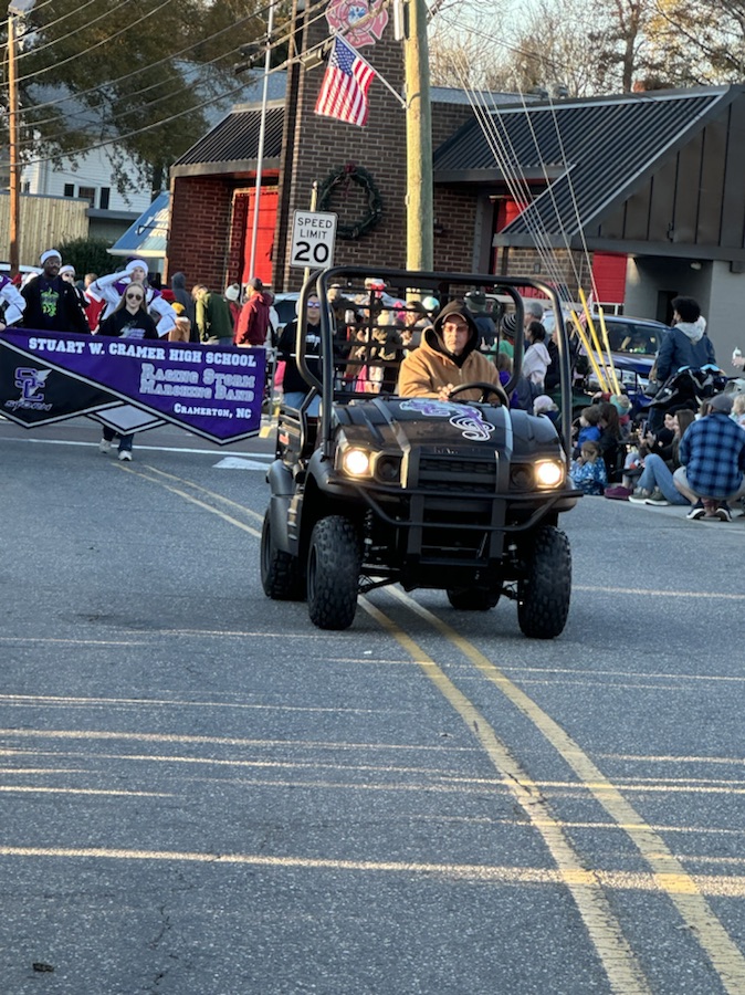
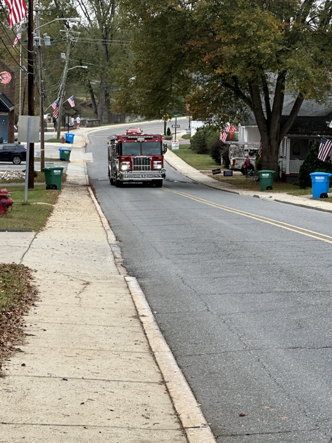
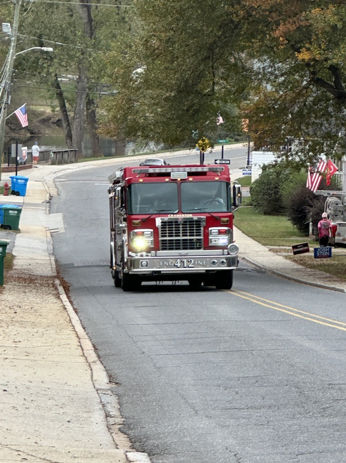
Cramerton Fire Engine Ladder 41
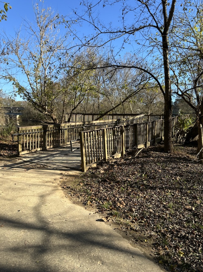
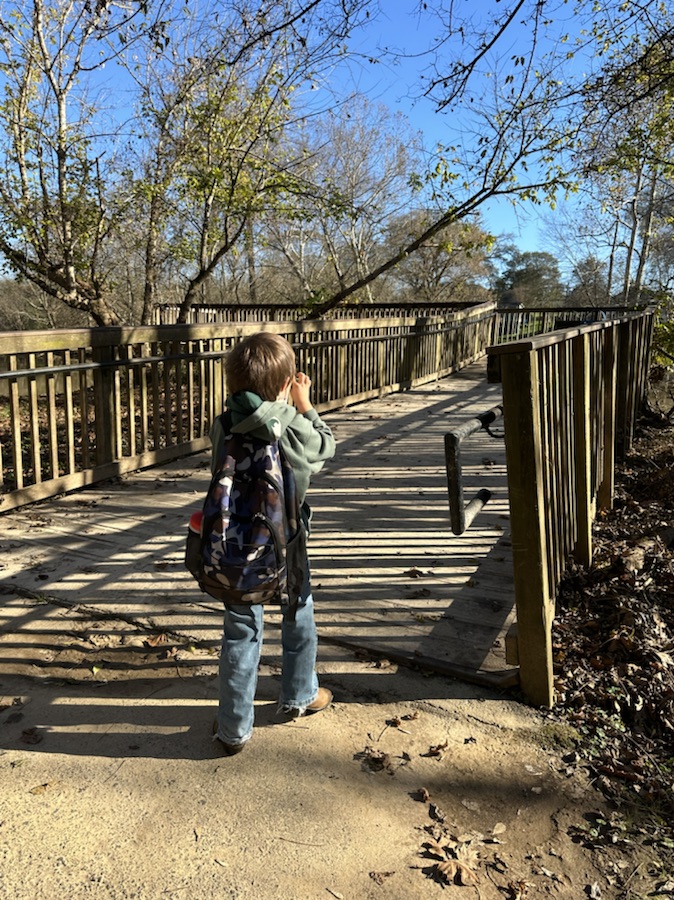
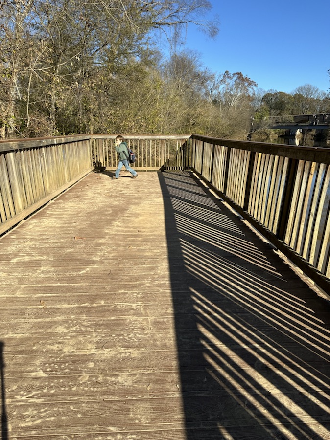
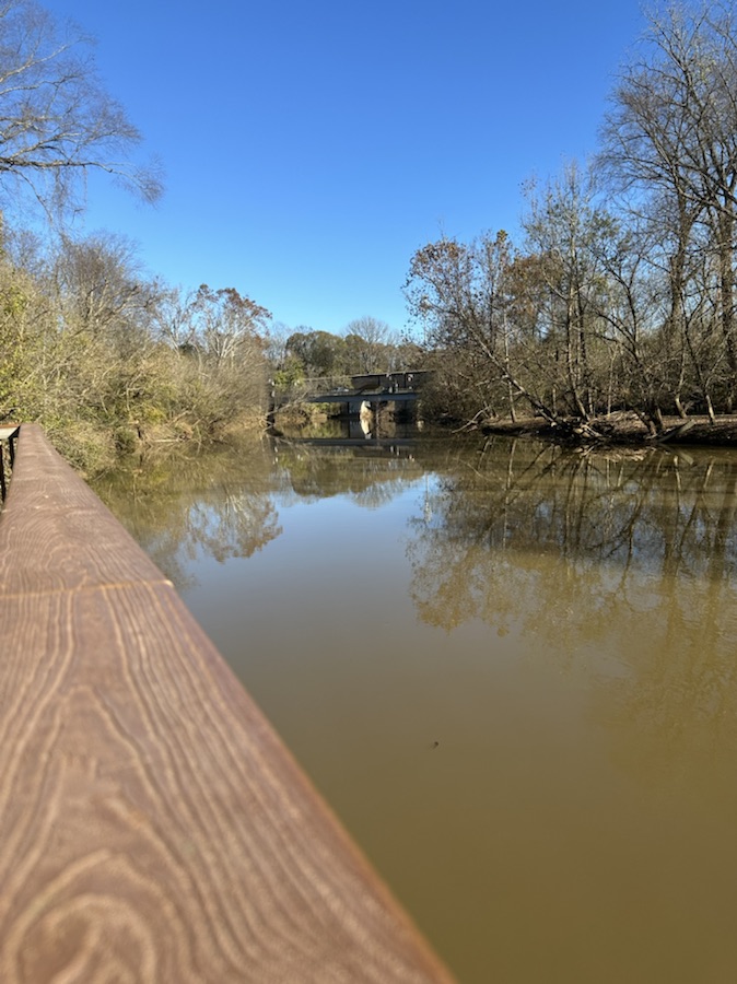
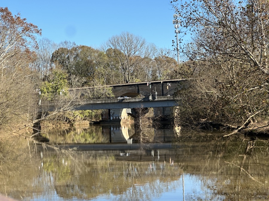
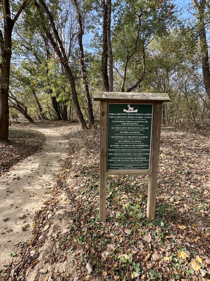
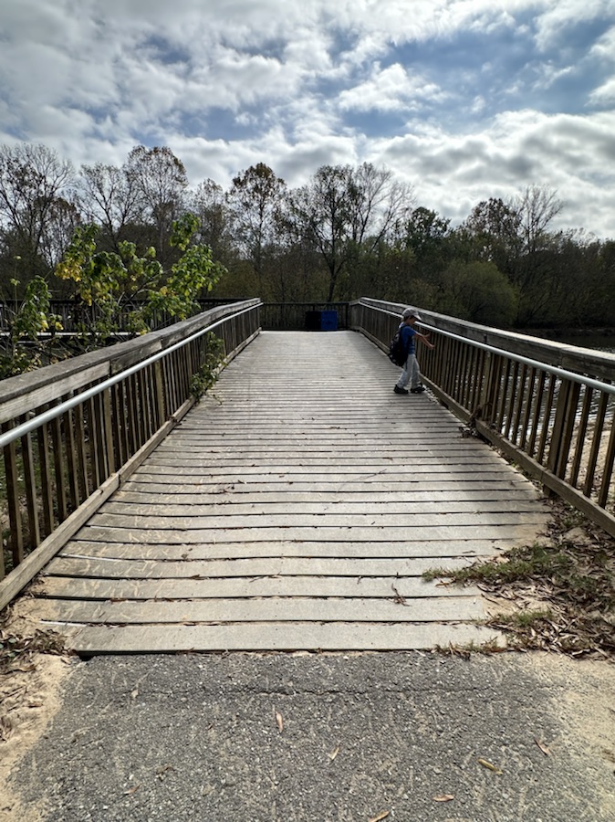
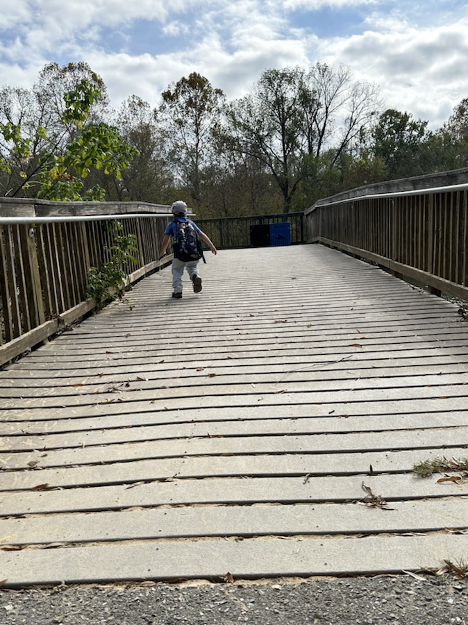
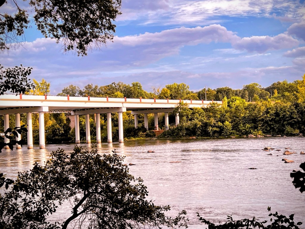
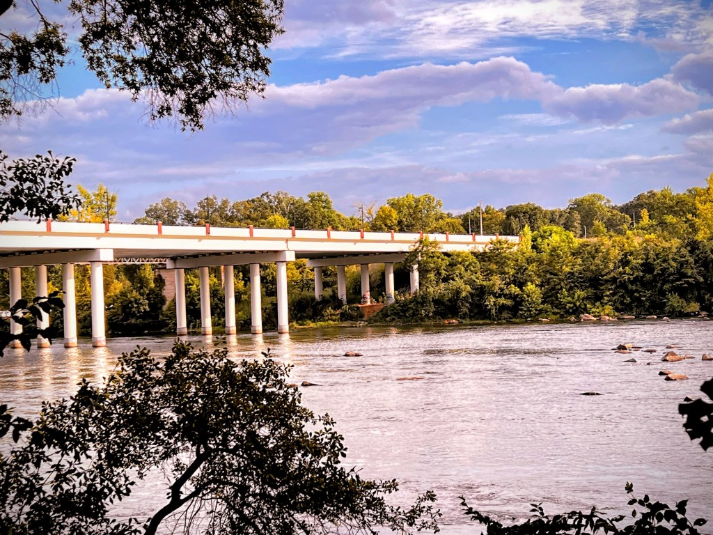
Goat Island Bridge Cramerton, North Carolina
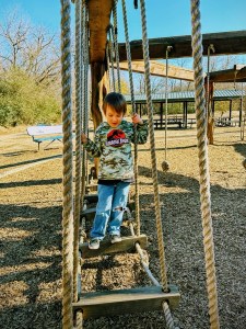
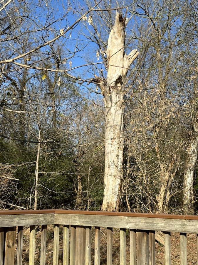
Coleman’s Which Way Goat Island Playground
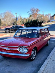
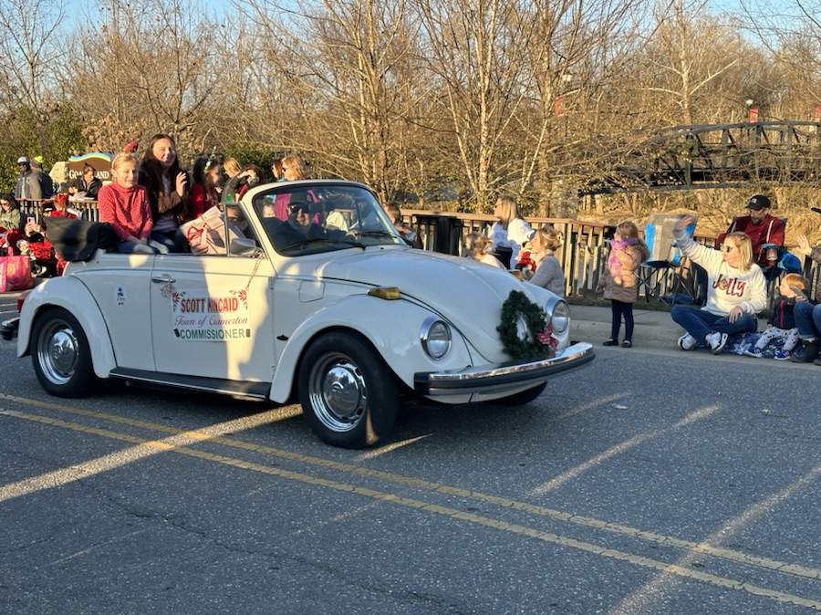
1962 Chevrolet Corvair 700 Wagon with Christmas Tree on Rooftop
Please make sure your which way is the main object of your photo. Thanks.
Next week’s Which Way theme will be CWWC: Which way with the colors of Silver and Gold.
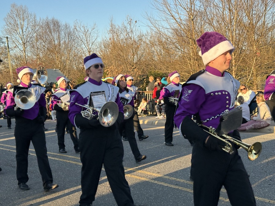
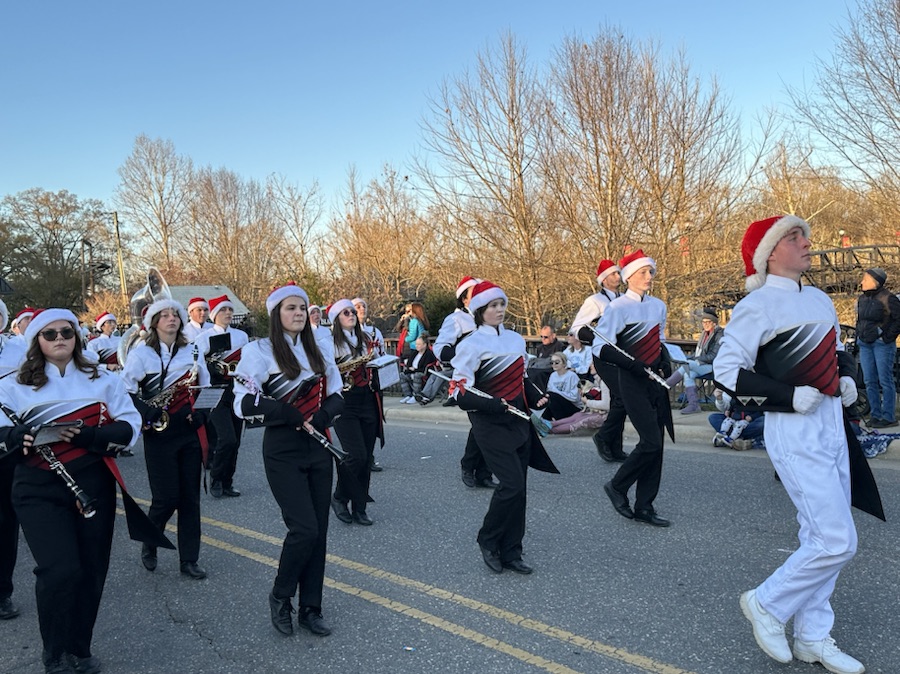
Location: Downtown Parade Route; Town of Cramerton; Cramerton, North Carolina, USA
God Bless. Season Greetings. Enjoy your holidays. Remember the Reason for the Season. Thank you for visiting and sharing your time and thoughts with us. I appreciate y’all very much.
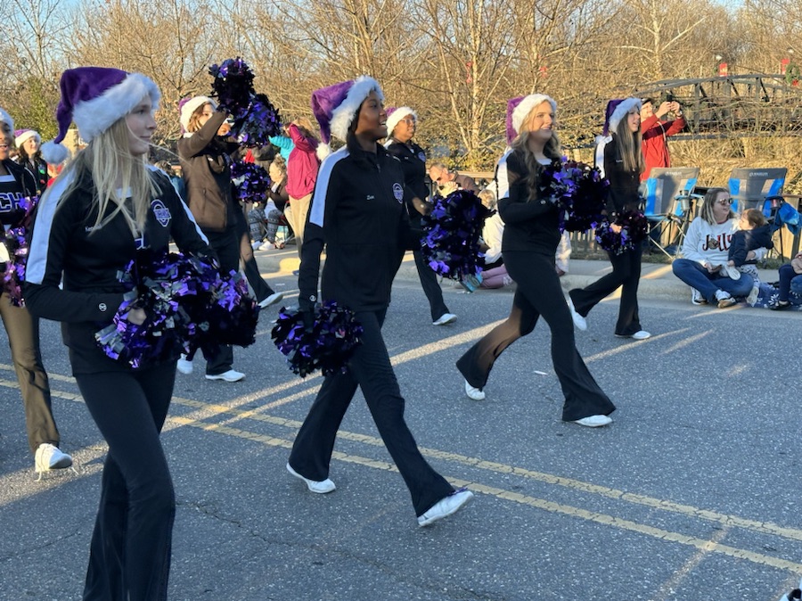
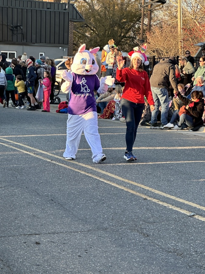
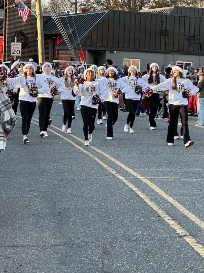
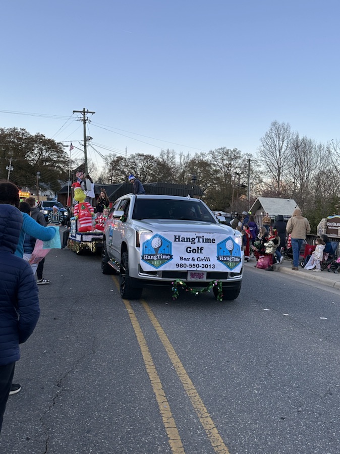
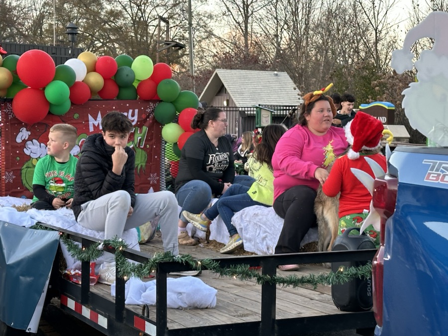
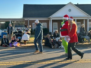
My Which Ways this week are from the Cramerton Christmas Parade. Remember signs are always welcome in the Which Way Challenge.
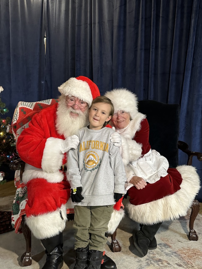
You may have noticed the last photo doesn’t exactly show a Which Way, however, I decided to include Coleman with Santa and Mrs. Claus anyway. They rode on the Cramerton Fire Engine to end the Parade, but I couldn’t capture a good shot of them. Santa’s arrival signaled the end of the Parade. Santa and Mrs. Claus then made their way down to Confluence for picture taking time with the children.
If I’ve missed anyone please let me know. I do appreciate all who joined in the challenges so far and hope y’all will have fun participating in the Which Way Challenges in the future.
Location: Downtown Parade Route; Town of Cramerton; Cramerton, North Carolina, USA
God Bless. Season Greetings. Enjoy your holidays. Remember the Reason for the Season. Thank you for visiting and sharing your time and thoughts with us. I appreciate y’all very much.
Please make sure your which way is the main object of your photo. Thanks.
The Which Way Challenge (CWWC) is all about capturing the means we travel from place to place such as roads, walkways, trails, and rails. The roads could be paved or unpaved, gravel, or dirt. Walkways could cover sidewalks, hallways, or pathways. Trails are paths we travel through Greenways, Local, State, or National Parks. Also permissible are any kinds of signs and any bridge angle. Remember to ensure your “Way” is visible and the main focus of your photo.
My entry for this week:
Belmont Middle School Cheerleaders cheering the crowd.
Hi! Let me introduce myself to y’all. My name is Debbie, however, I go by Deb. I post several times a week on my blog, Gfpacificbee’s Insights & photography.
Many of you may not know that while Cee has been under the weather, I have been continuing the Which Way Challenge. I have recently officially taken over Cee’s Which Way Challenge. I will continue the Which Way Challenge with a theme each week. For now, I will be leaving it as CWWC, but may change it later if I feel it to be for the betterment. I will try to begin posting the upcoming themes in the coming weeks.
Here are a general list of upcoming themes for December:
CWWC: Any which way with people
CWWC: Which way with a Christmas holiday theme
CWWC: Which way with the colors of Red and Green
CWWC: Which way with the colors of Silver and Gold
Possible Upcoming Topics:
CWWC: Dirt roads or dirt pathways or trails
CWWC: Roads with any signs
CWWC: Which way with the colors of brown or black
CWWC: Any which way with people in it
CWWC: Roads with vehicles and or traffic
CWWC: Any which way with in black and white
CWWC: Any which way with lines
CWWC: Any animal in your which way
I plan on posting my Which Ways on Fridays, however, sometimes life interferes with the best laid plans. It might be late but it will be posted by late Friday evening/Early (Around Midnight) Saturday morning at the latest.
This week’s theme will be CWWC: Any which way with people. I will be looking for y’all to join me as I lead the Which Way Challenge.
God Bless. Thank you for welcoming me as I lead the Which Way Challenge. Thank you for sharing your time and thoughts with me. I appreciate each and every one of y’all very much.
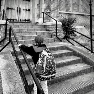
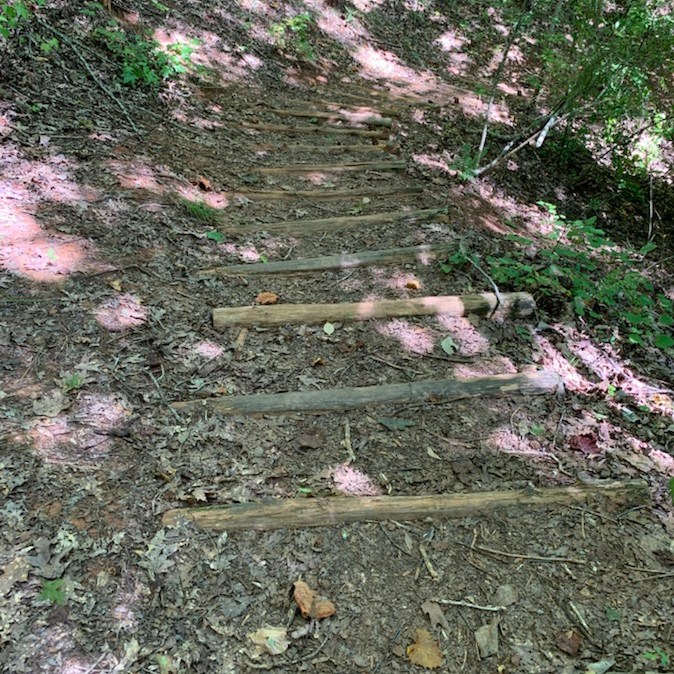
I’ve missed Cee so much and know this is a difficult time for her and Chris. Praying for strength and comfort for them both. I’ve been trying to keep up with the Which Way Challenge even though Cee is unable to do so. I encourage everyone who wishes to show Cee our Which Ways by posting your Stairs, Steps, and/or Ramps this week. . Just post any Which Way you desire and link up to Cee’s Which Way Challenge.
This week I am again posting a Which Way My Wayshowing Which Ways one might use by venturing up or down Stairs, Steps, and or Ramps. This week I chose to post my Stairs, Steps, and Ramp in Monochrome. You may use Monochrome, but not necessary. You may choose any format you desire if you choose to participate.
We begin our Which Way by walking down our front Steps …
Our Front Steps
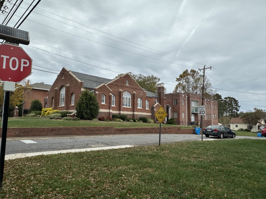
Journeying on our way Coleman decides to climb the Steps at Cramer United Methodist Church …
Steps at Cramer United Methodist Church
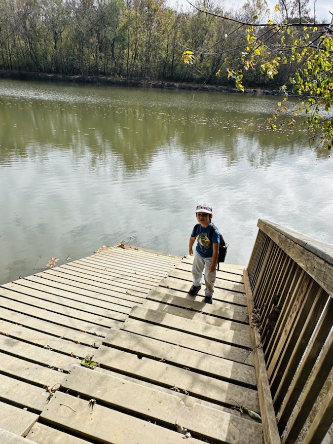
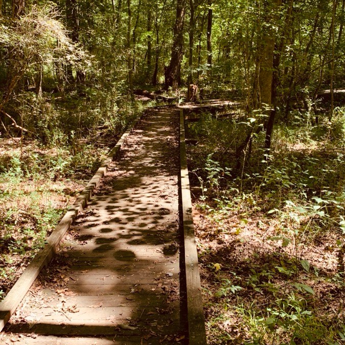
Next, we explore the KayakRamp and Stairs at Goat Island Park and Greenway …
Kayak Ramp & Stairs Goat Island Park and Greenway
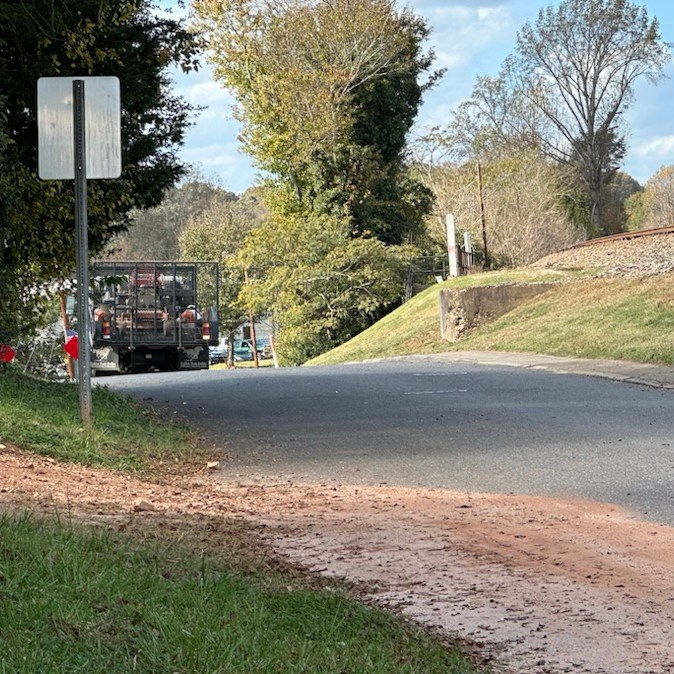
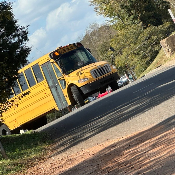
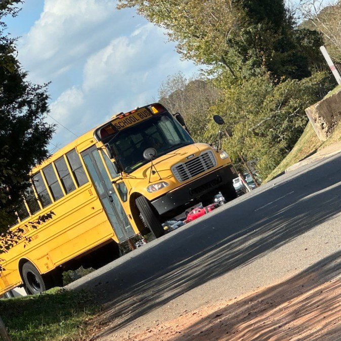
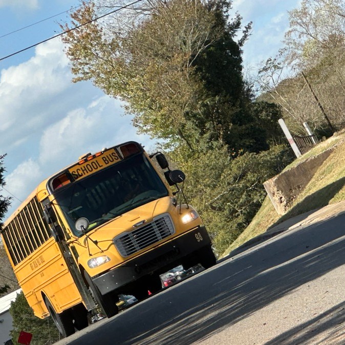
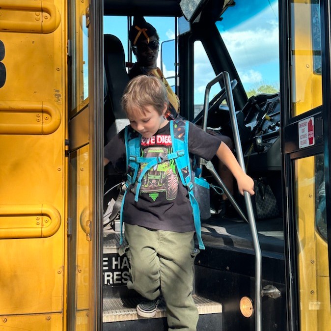
Coleman and I continue our wandering around Cramerton, the next day, after he walks down the School Bus 98 Steps …
School Bus 98 Steps
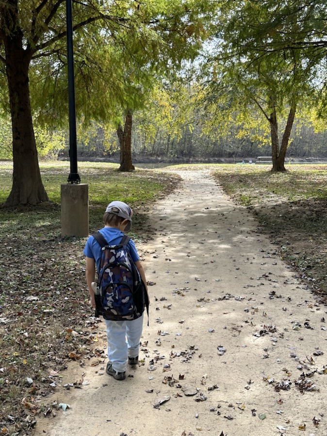
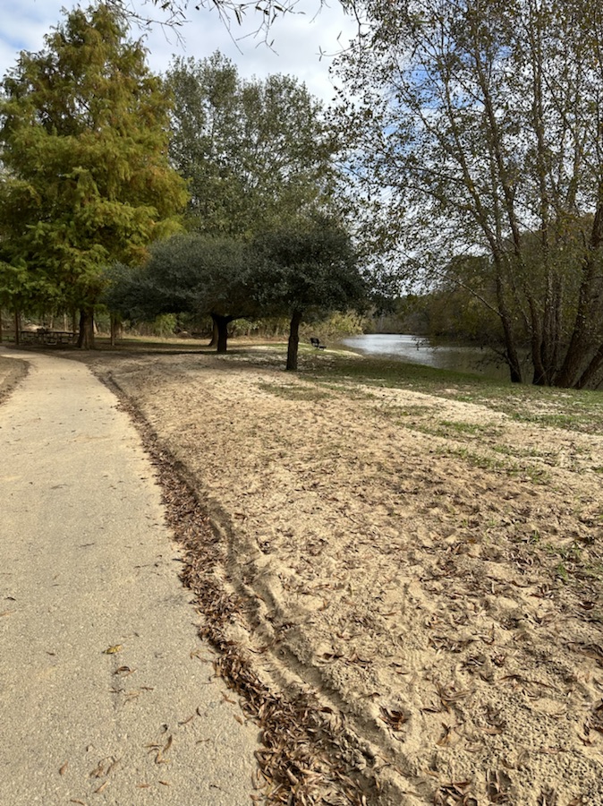
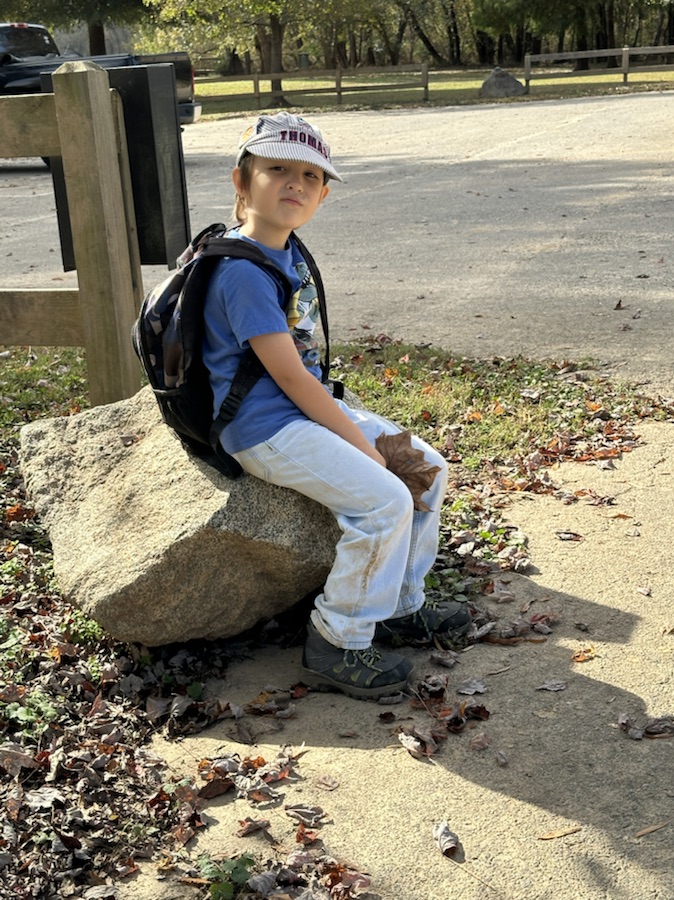
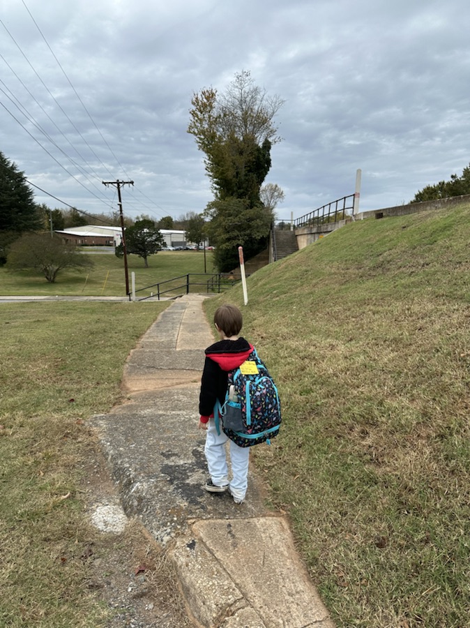
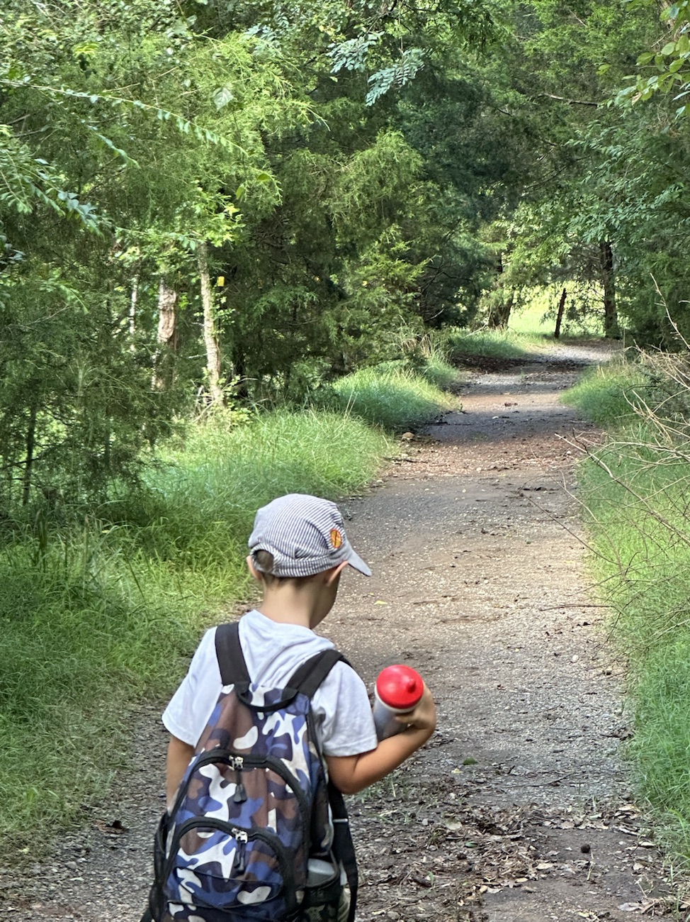
After Coleman exits the school bus, we drop off his school backpack and grab his hiking backpack with snacks and drinks. Then, we head on down to Riverside Park and Greenway for a relaxing afternoon noon of hiking and exploring.
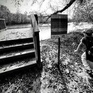
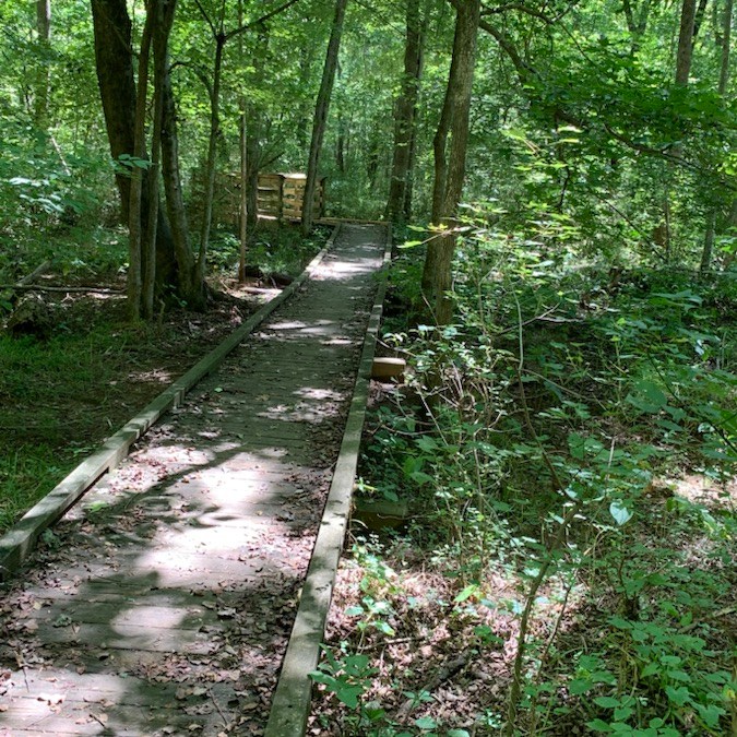
While hiking the trail, we come upon the Stairs to one of several Fishing Piers at the Greenway …
Catawba Riverkeepers Water Recommended Flow Sign by the Fishing Pier Staircase
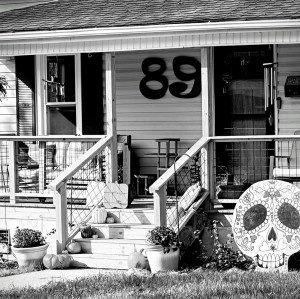
Lastly, we see interesting Halloween Decorations on each side of a neighbouring house Front Porch Steps …
House #89 Decorations and Front Porch Steps
Hope you enjoyed visiting our Which Ways this Week. I would love to see y’all’s Which Ways. Remember to click on each photo for larger enhanced viewing.
Location: Goat Island Park and Greenway; Plus Riverside Park and Greenway; Cramerton, North Carolina, USA
God Bless. Enjoy the Outdoors. Take a Hike. Relax in a Park. Thank you for visiting and sharing your time and thoughts with us. I appreciate y’all very much.
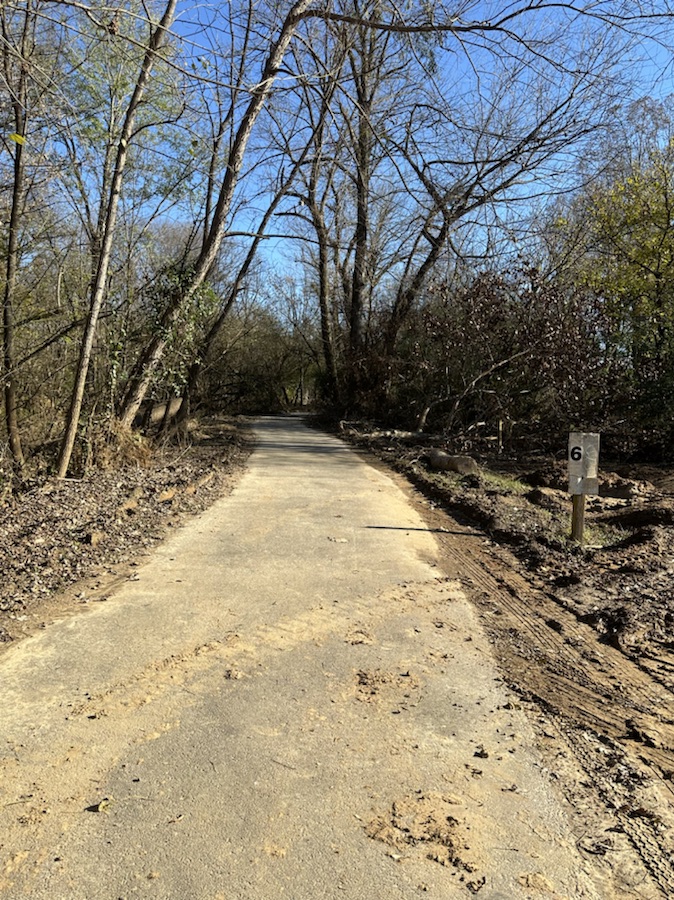
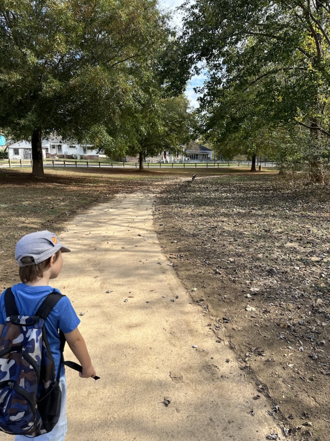
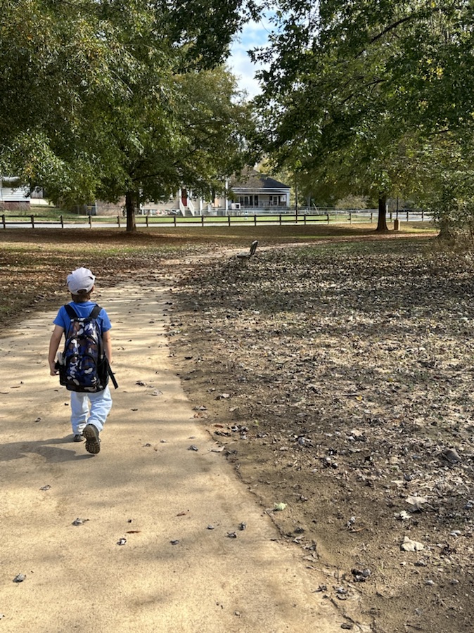
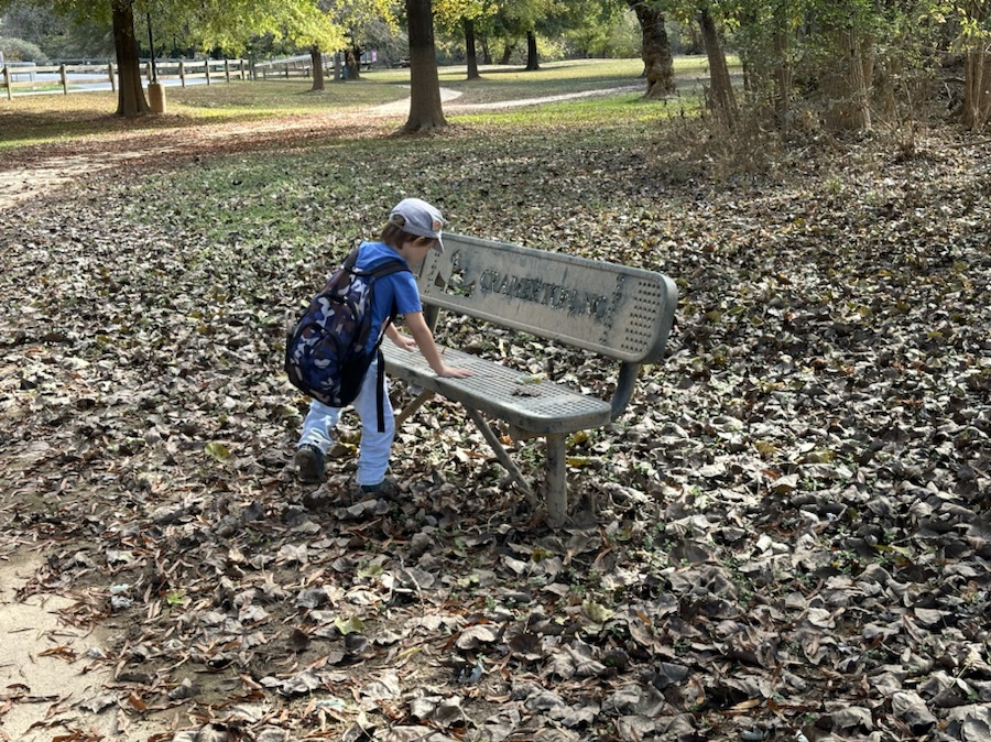
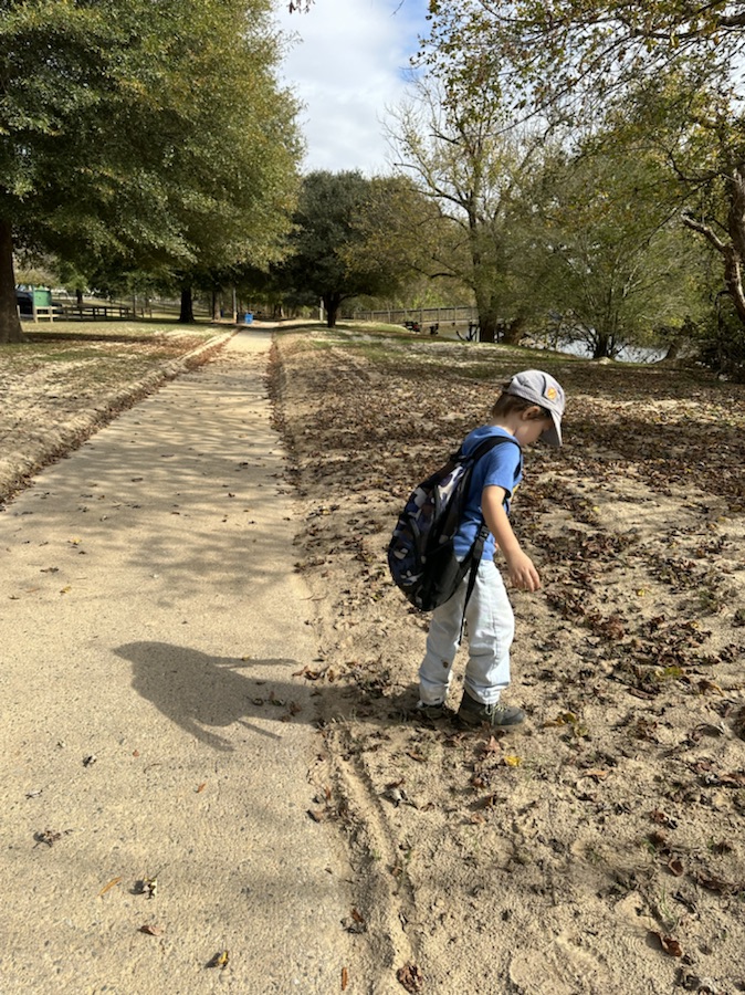
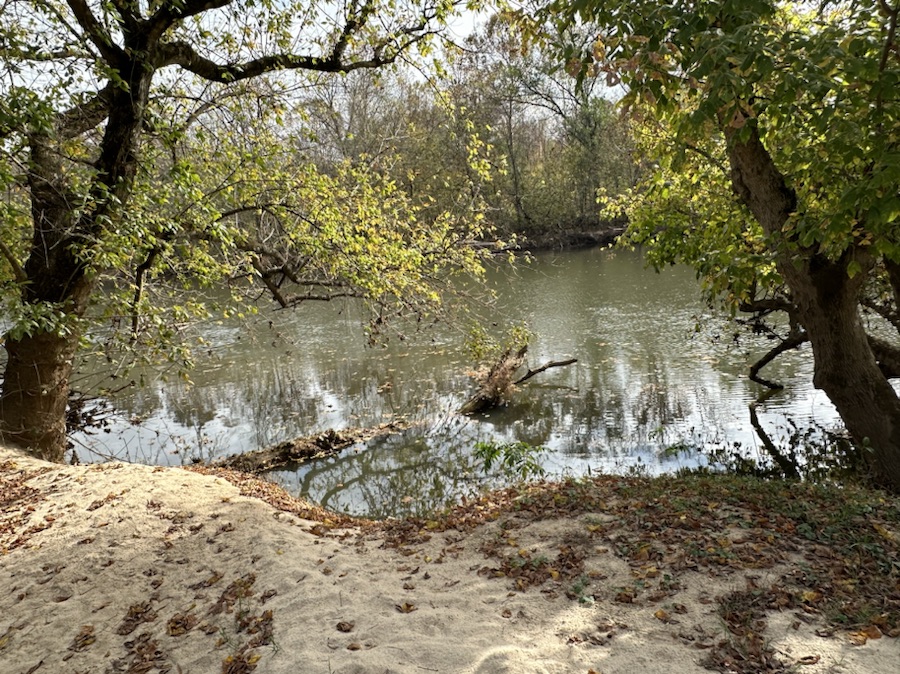
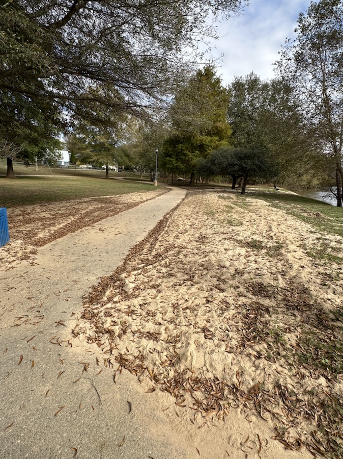
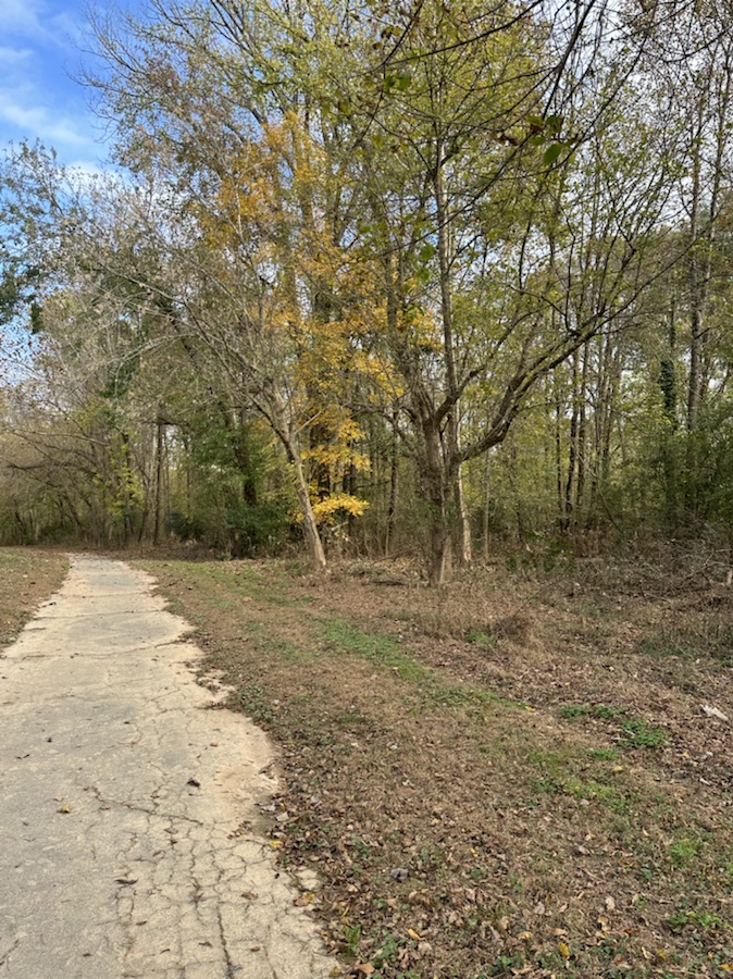
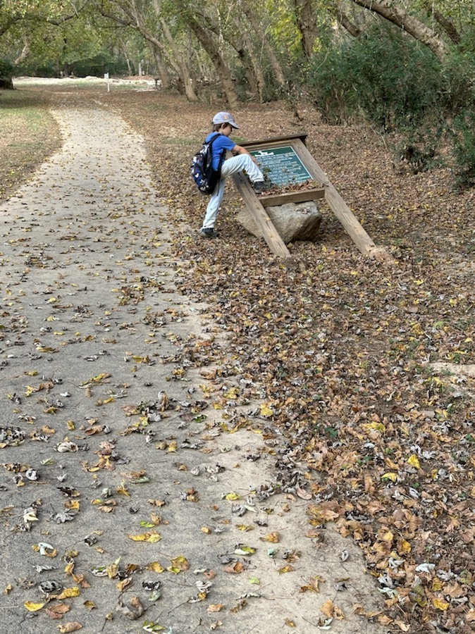
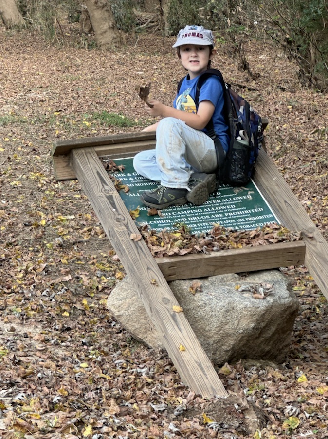
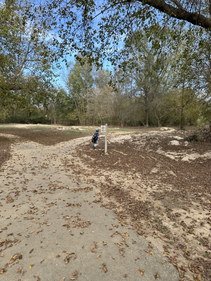
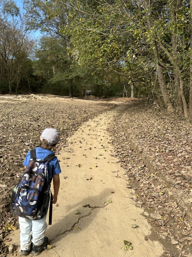
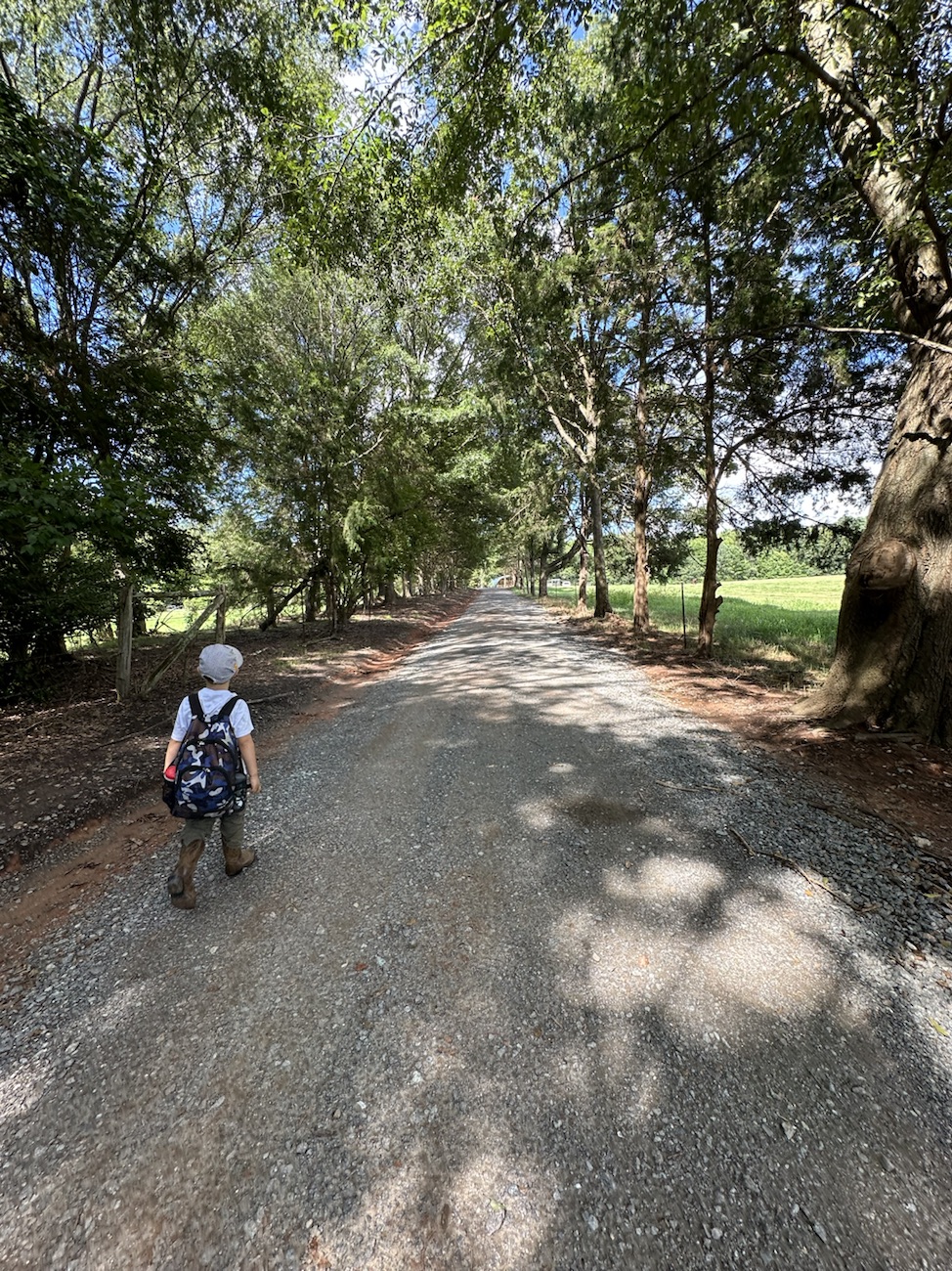
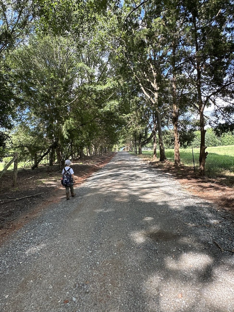
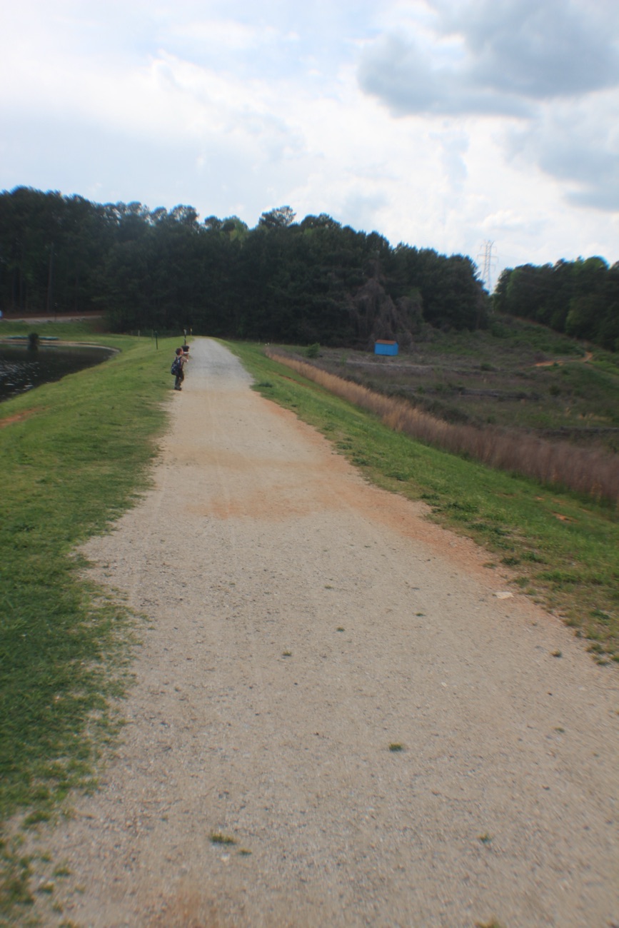
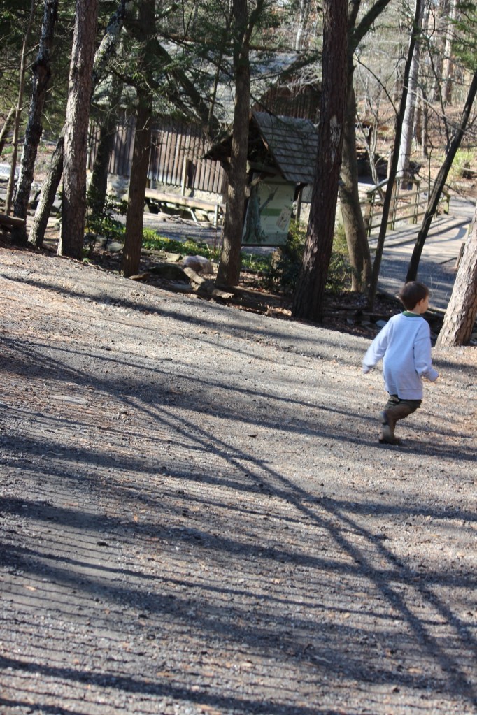
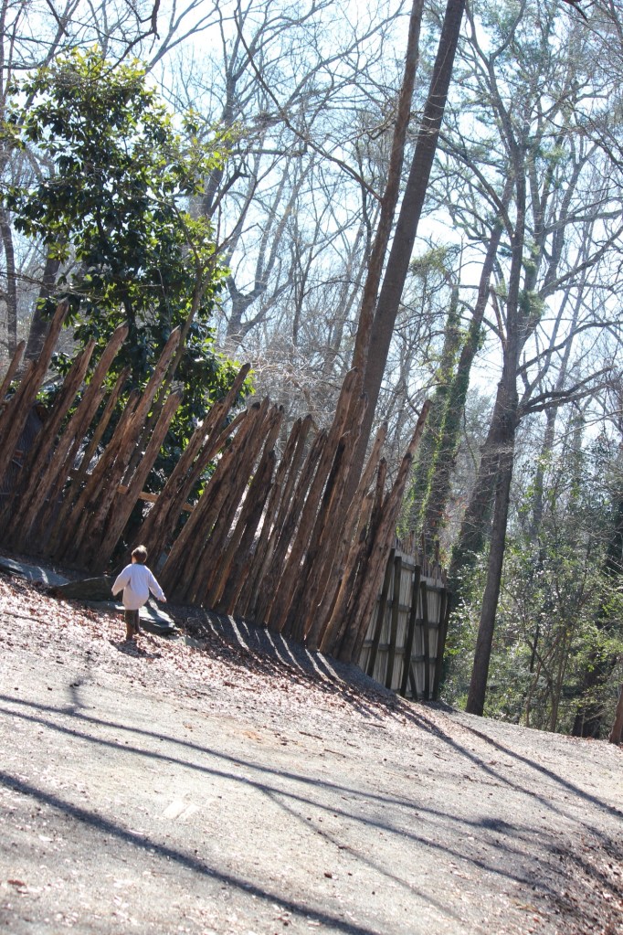
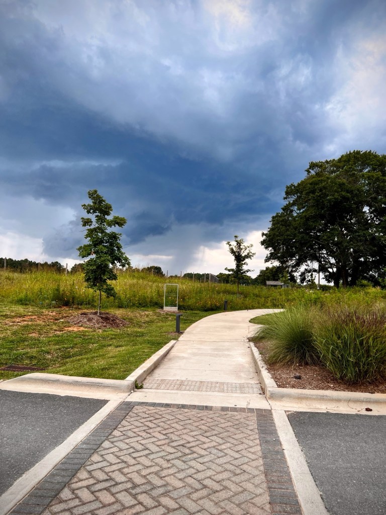
Since we moved to Cramerton at the end of October; Coleman’s new favourite place to go visit is the Goat Island Park and Greenway. The following are a few shots from our latest visit on Saturday.
Location: Goat Island Park and Greenway; Cramerton, North Carolina, USA
God Bless. Enjoy the Outdoors. Take a Hike. Relax in a Park. Thank you for visiting and sharing your time and thoughts with us. I appreciate y’all very much.
I’ve missed Cee so much and know this is a difficult time for her and Chris. Praying for strength and comfort for them both. I’ve been trying to keep up with the Which Way Challenge even though Cee is unable to do so. I encourage everyone who wishes to show Cee our Which Ways. Just post any Which Way you desire and link up to Cee’s Which Way Challenge.
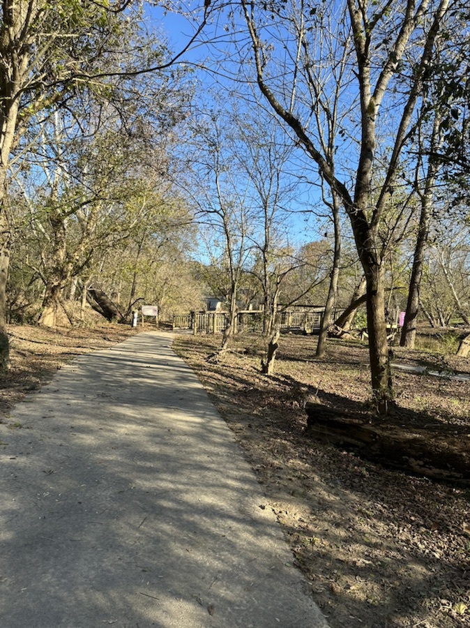
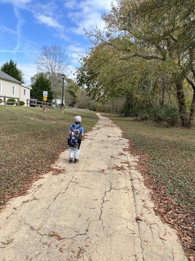
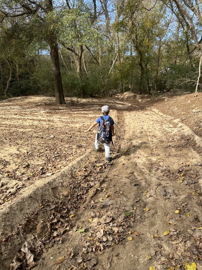
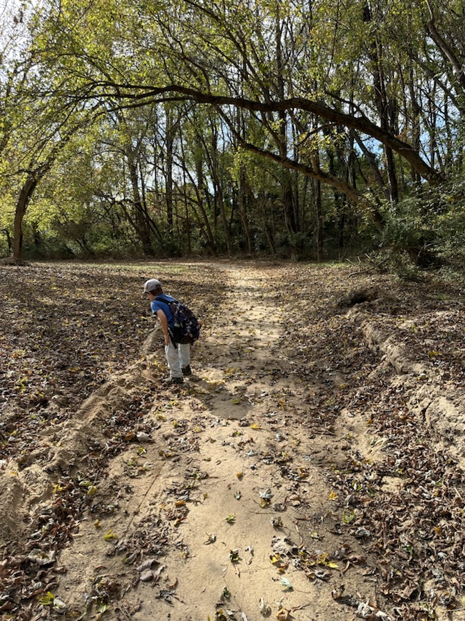
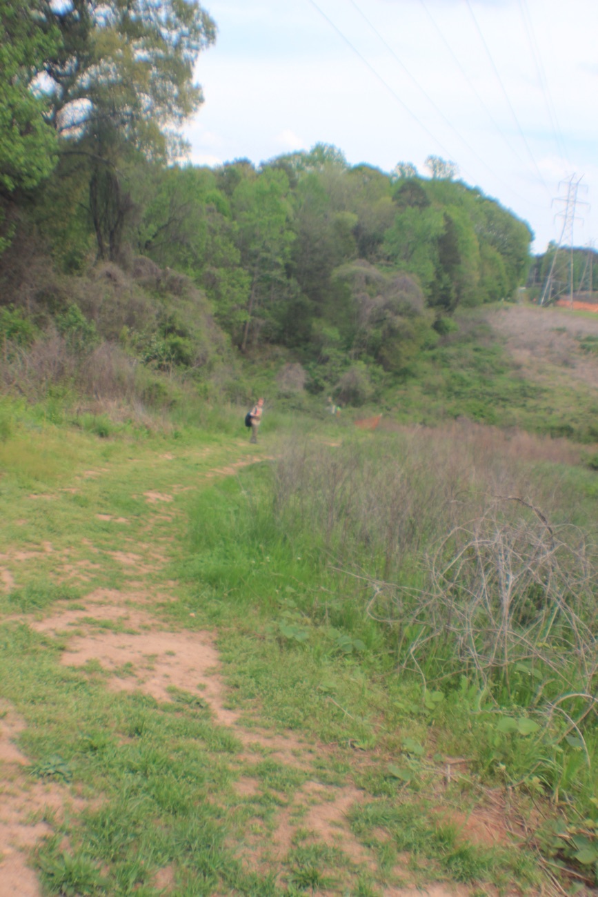
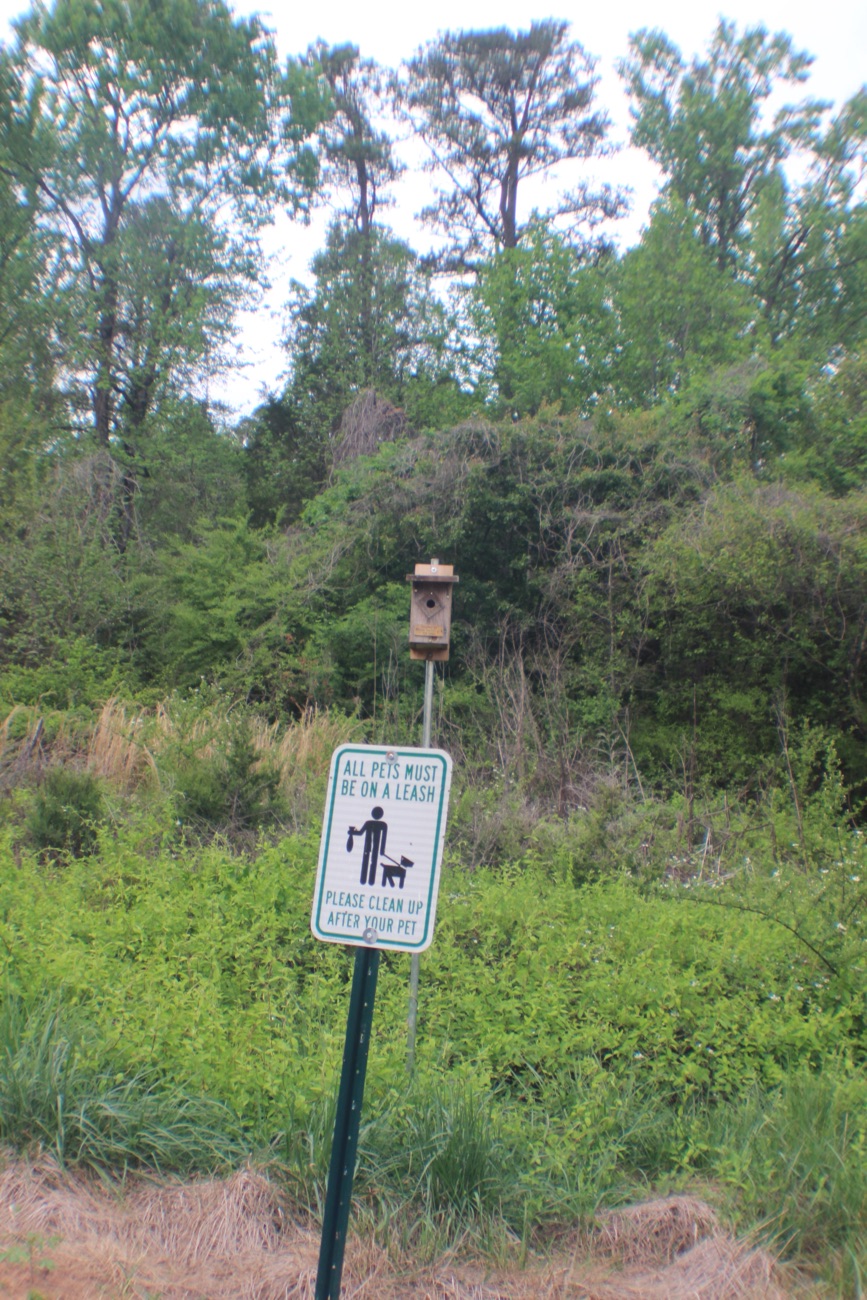
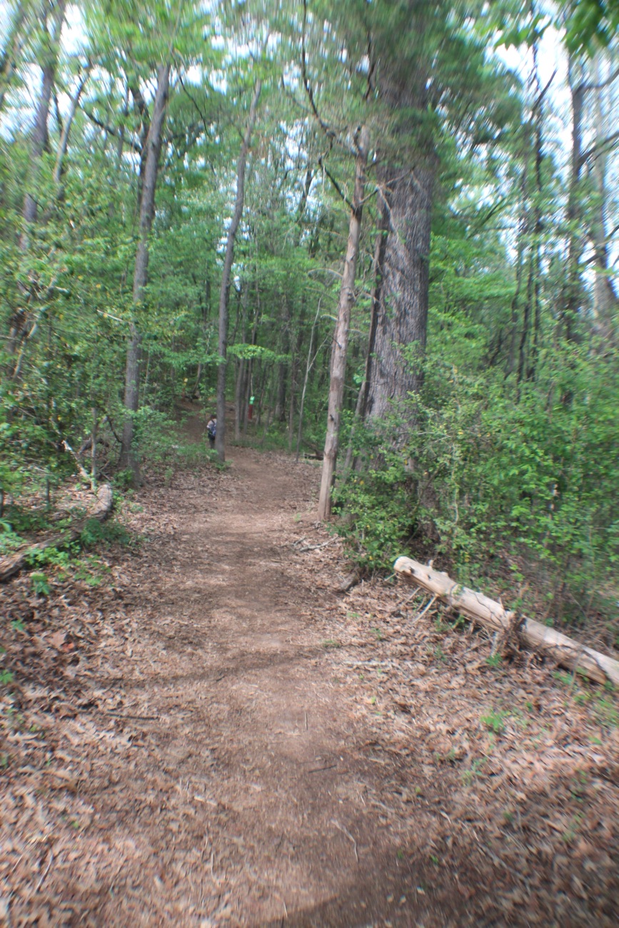
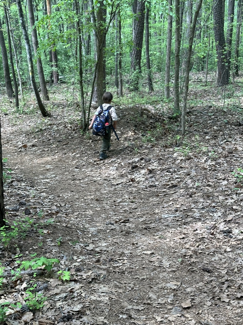
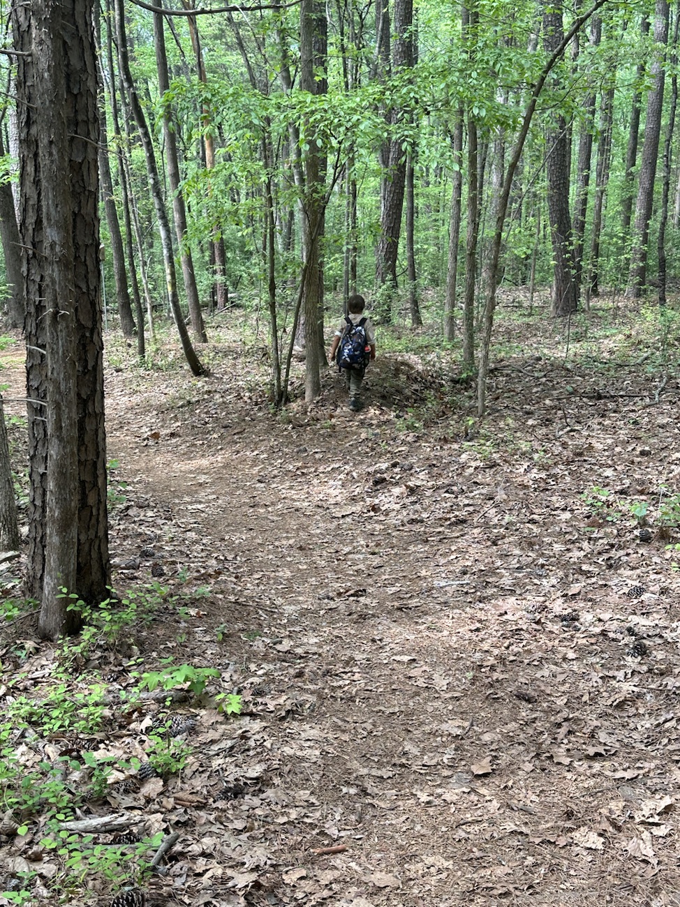
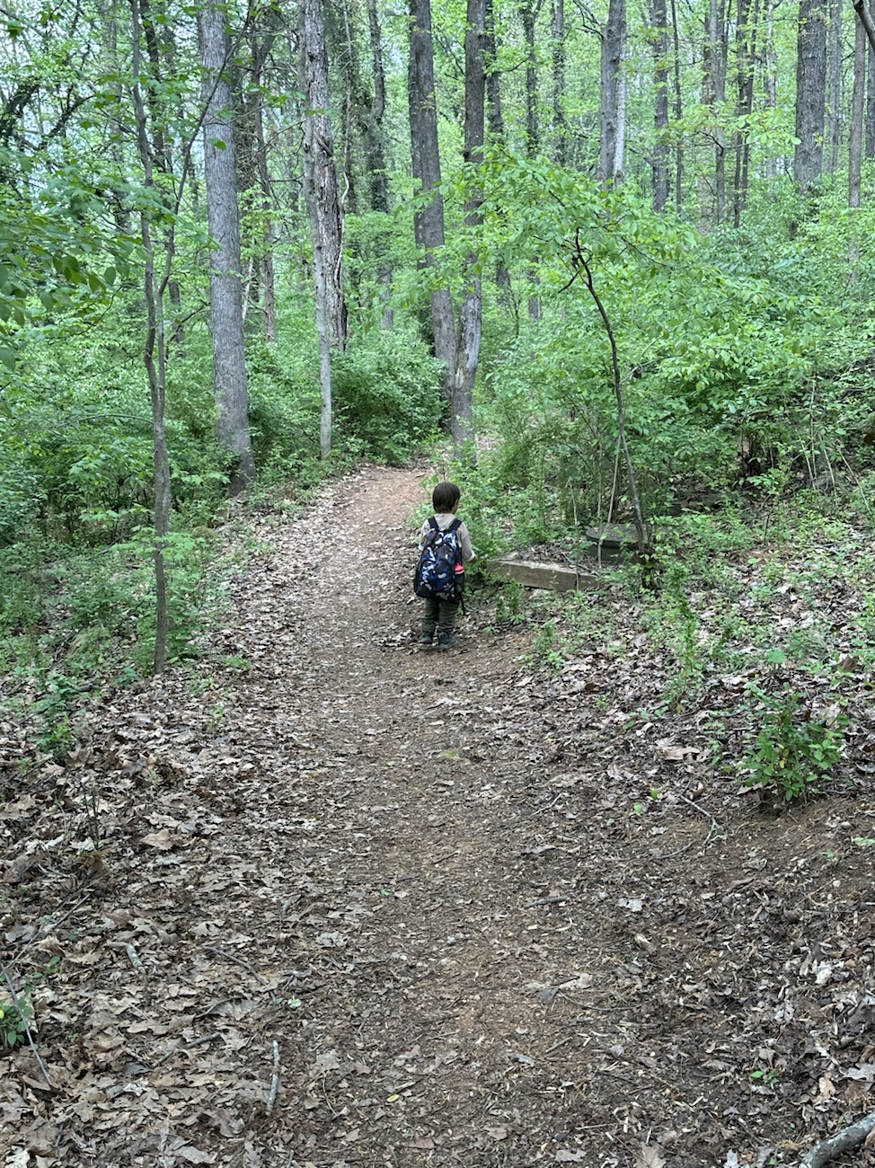
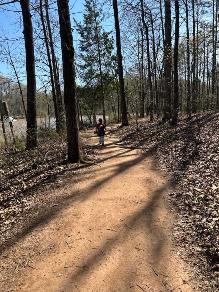
This week I am again posting a Which Way My Wayshowing Which Ways Coleman and I discovered in Riverside Park and Greenway. My grandson, Coleman and I are beginning to roam around our new neighborhood and town investigating what interesting things and places we can find in the area. Riverside Park and Greenway is just a short walking distance away from our new home. Here are a few shots from our walk through Riverside Park and Greenway.
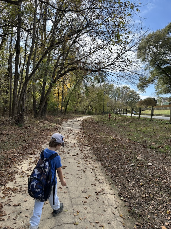
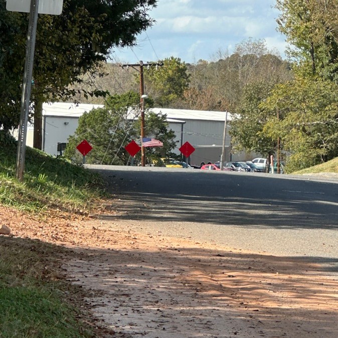
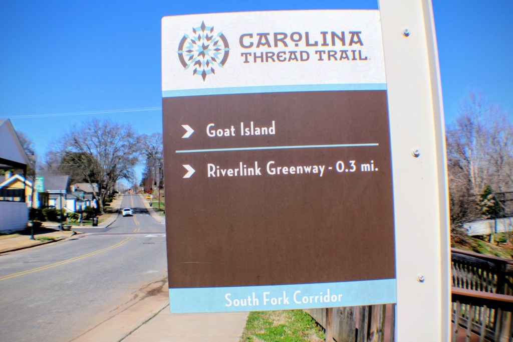
Coleman and I left our home and turned right out of the driveway; walked to the end of our street (which is curved downhill) and then proceeded to walk across the street onto the Carolina Thread Trail.
On the way to Riverside Greenway
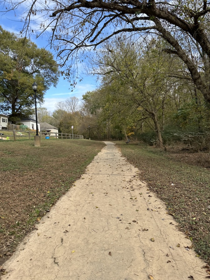
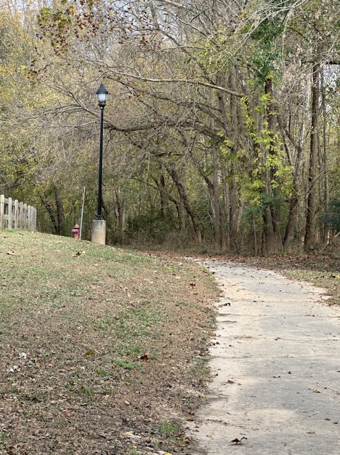
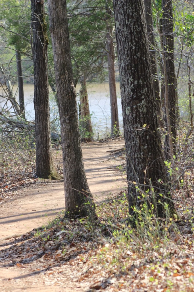
The Carolina Thread Trail leads into the Riverside Greenway Trail. We walked the entire length of the Riverside Greenway Trail and even a little bit of off trail hiking. During parts of the hike we were walking parallel to the South Fork Catawba River.
It was a fun enjoyable relaxing day out discovering a (new to us) local trail. Hope y’all have a wonderfully funtastic weekend.
I’ve been missing Cee’s posts. I pray she is doing alright. This week I am again posting a Which Way My Wayshowing Which Ways in My New Neighbourhoodand Town. My grandson, Coleman and I are beginning to roam around our new neighborhood and town investigating what interesting things and places we can find in the area. Here are a few shots from our walk through our new town.
I’ve been missing Cee’s posts. I pray she is doing alright. This week I am again posting a Which Way My Wayshowing Which Ways in My New Neighbourhood. My grandson, Coleman and I are beginning to roam around our new neighborhood investigating what interesting things and places we can find in the area. Here are a few shots from yesterday’s walk through the neighbourhood.
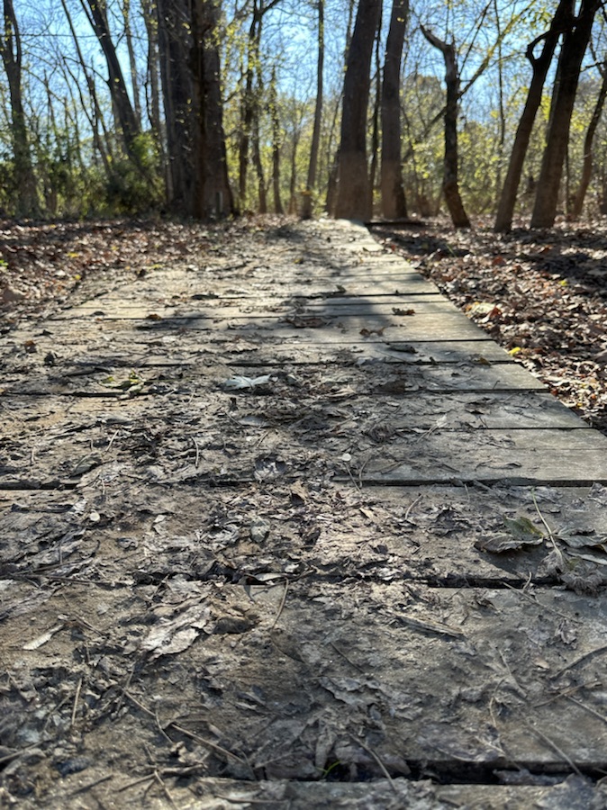
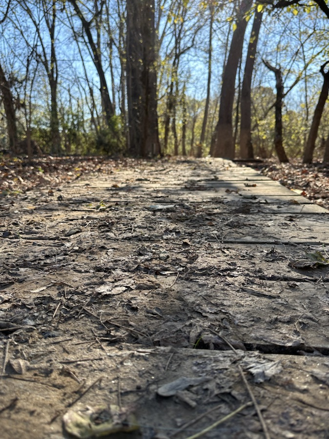
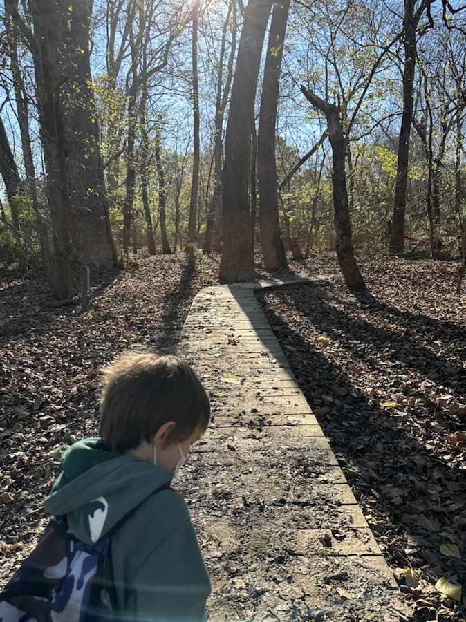
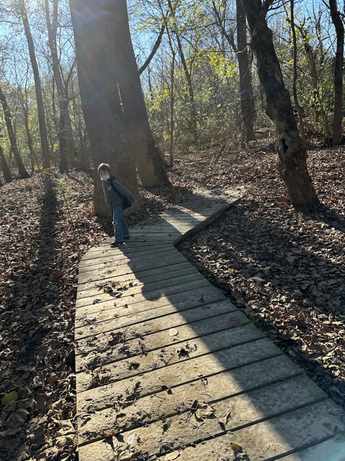
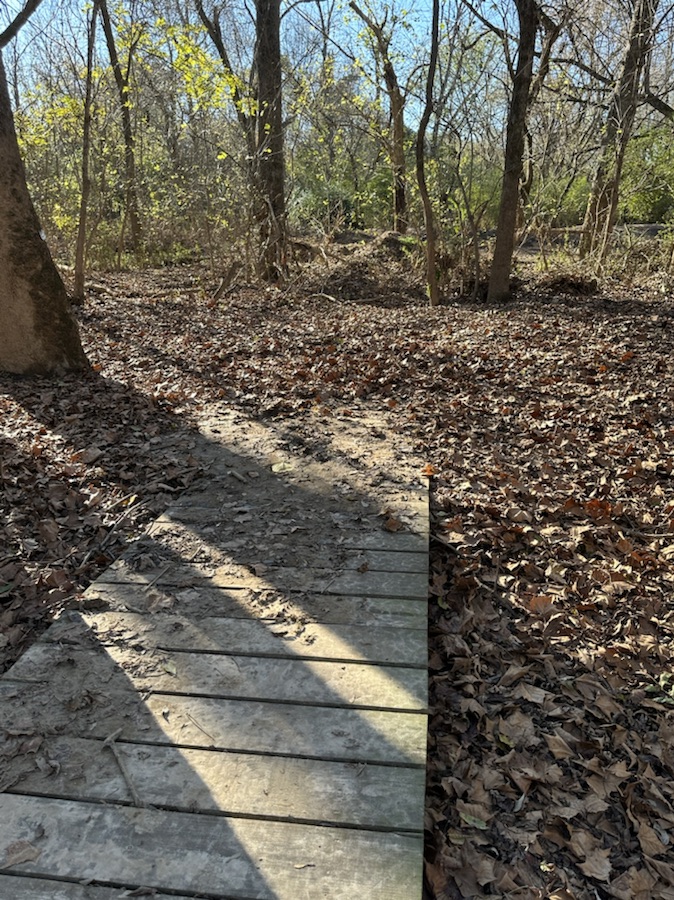
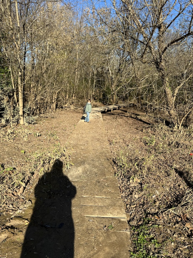
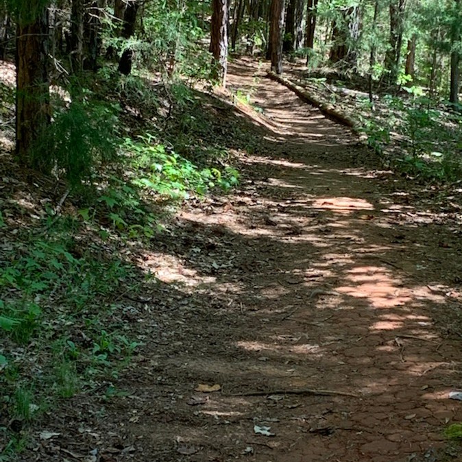
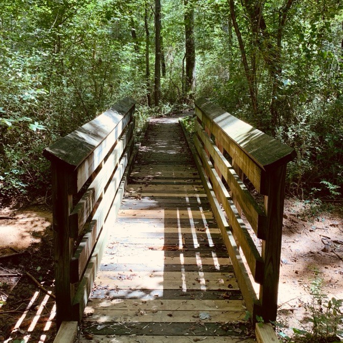
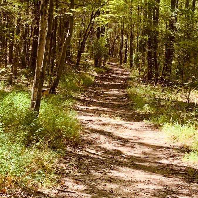
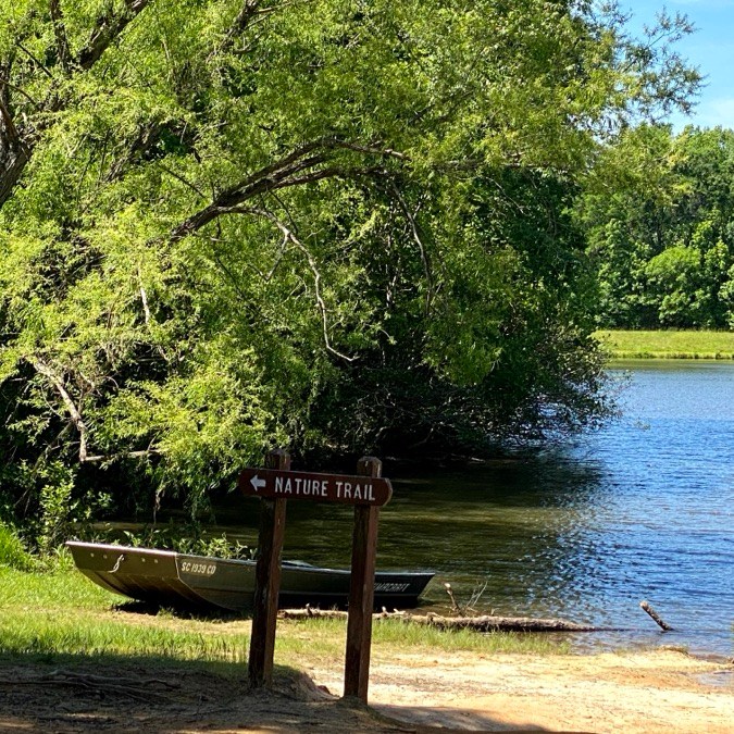
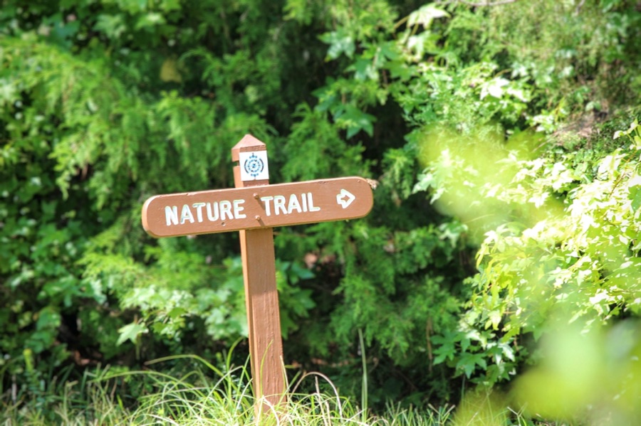
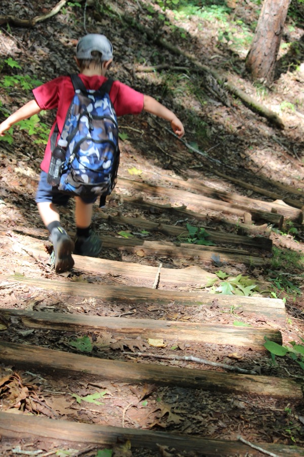
This week Cee is allowing us to post any type of road, path, step, bridge or sign. I have chosen to post some paths, steps, dirt trails, and wooden paths and bridges along the Lake Nature Trail at Andrew Jackson State Park. I took these photos when was camping there the summer after my mom passed. It was a relaxing, peaceful, meditative experience of communing with nature.
Cee is back and allowing us to post any type of road, path, step, bridge or sign this week for her Which Way Challenge. This week I have mixed it up with a little new with a little from my favourite place from my archives. Hope you enjoy!
Path to a small prayer garden Highway 200 leading from Lancaster to Great Falls, South Carolina closed due to Hurricane Helene.
Nature Trail Andrew Jackson State Park Coleman on the Trail at AJSP
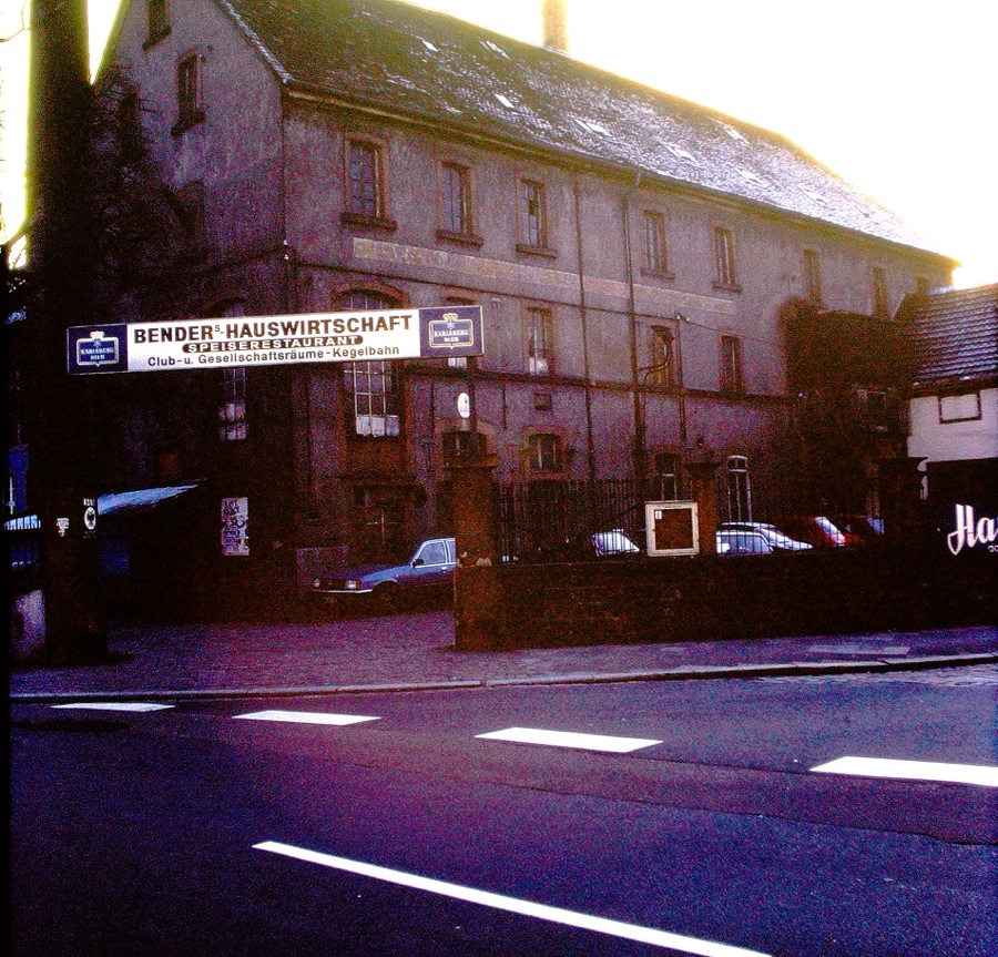
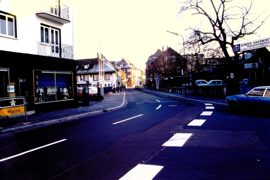
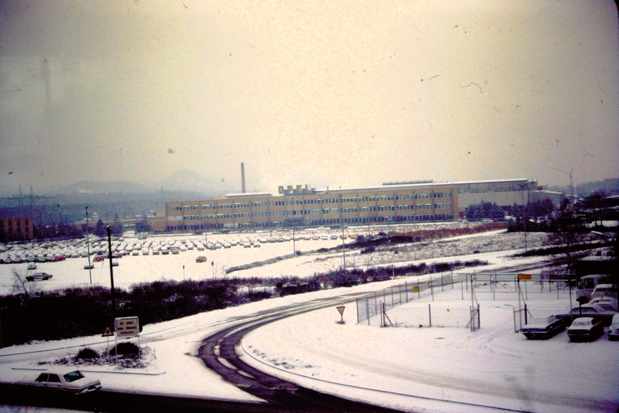
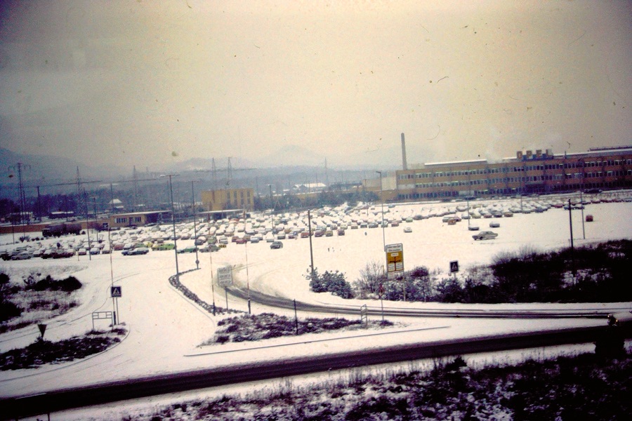
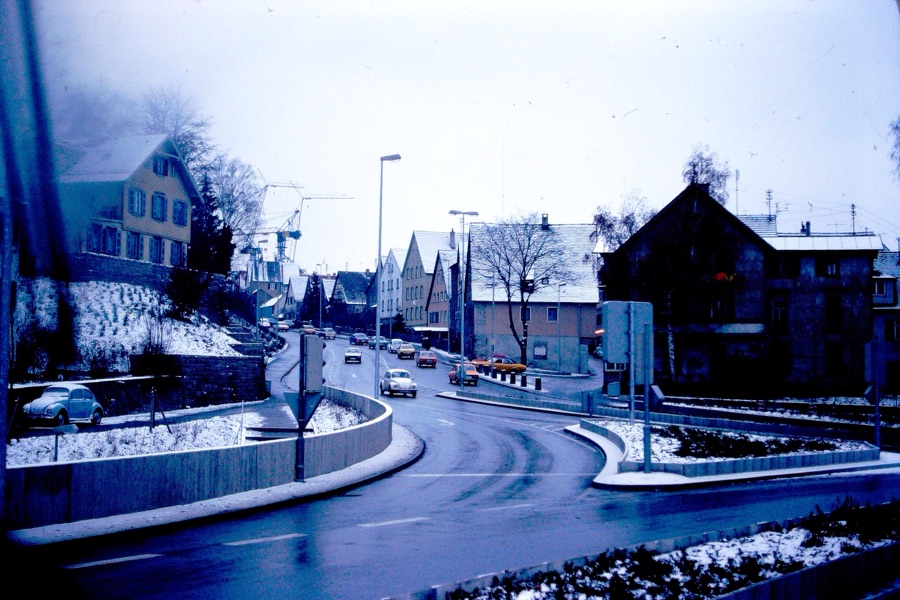
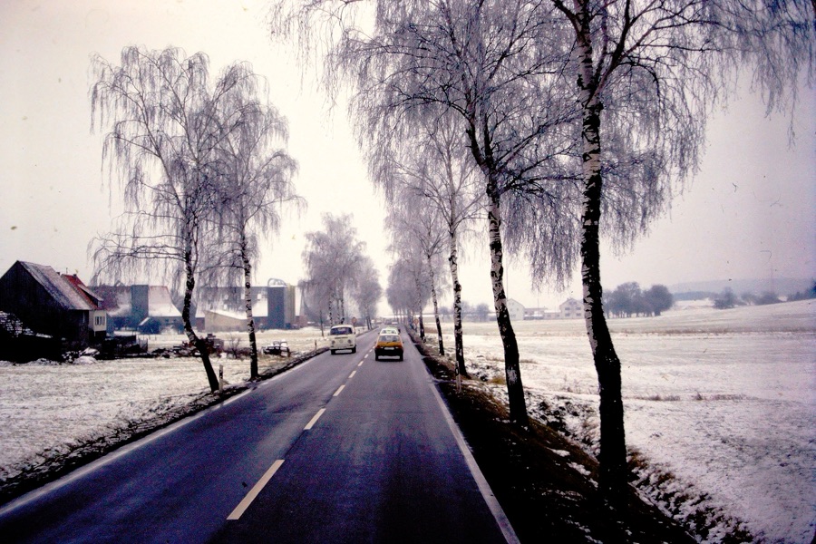
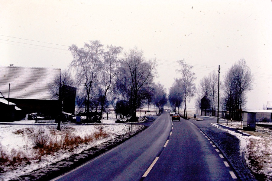
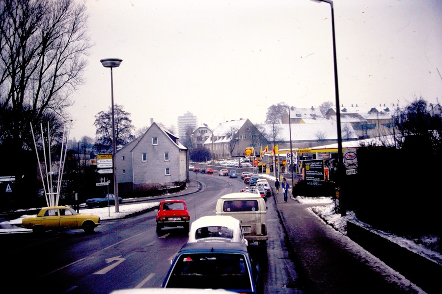
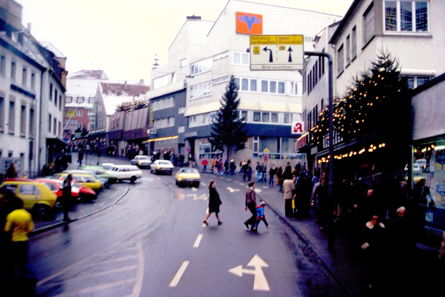
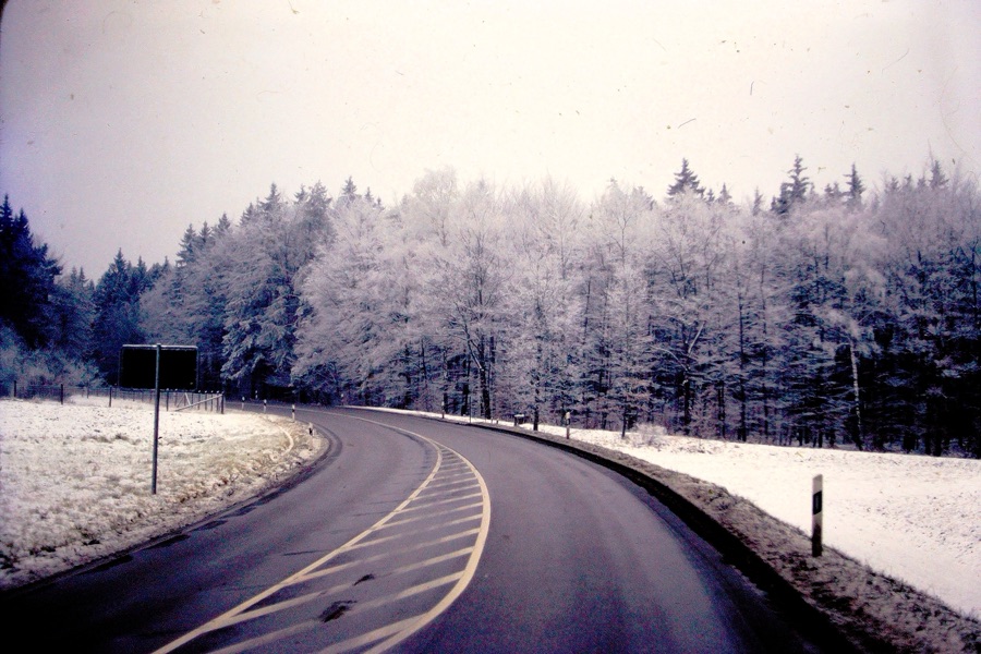
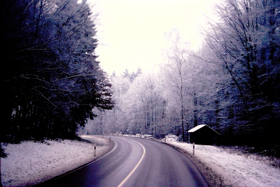
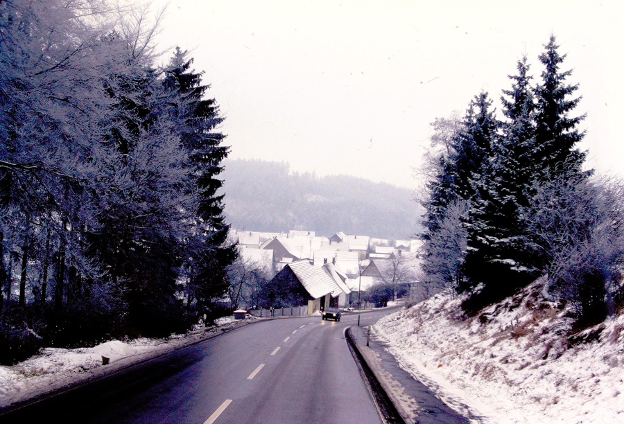
For this the last week of September and I light of the Effects of Hurricane Helene, I have chosen to choose a theme of Any Paved Roads where I am focusing on Paved Roads in Germany. I am challenging everyone to participate in this week’s Which Way Challenge by sharing your Paved Roads.
In the Winter of December 1978/January 1979 my parents flew over to Germany to visit my brother & his family. [My brother was stationed there for a few years while serving in the United States Air Force.]
Shown above are just a few of the Paved Roads my parents rode on while visiting with my brother in Germany. What kind of Paved Roads will you find to share with us? I hope y’all will share your Which Ways with us. Looking forward to Cee taking the Which Way Challenge back on in October.
Thank you for visiting and sharing my parents memories with me. They enjoyed their time in Germany, however, I do not recall seeing their slide photos before I began digitizing my Dad’s slides.
For this week in doing Cee’s Which Way My Way I’m choosing a theme of Any Which Way. Basically Any Which Way you choose; be sure we can see your Which Ways Clearly. And as always, signs are welcome anytime. I’d love for y’all to join me in posting your Which Ways you have Chosen to Share. Remember to link your Which Way posts to Cee’s Which Way hereor if you wish you can link to My Which Way here.
Road Trippin’ USA #5
Which Ways
St. Louis, Missouri
And Westward
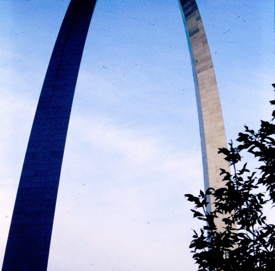
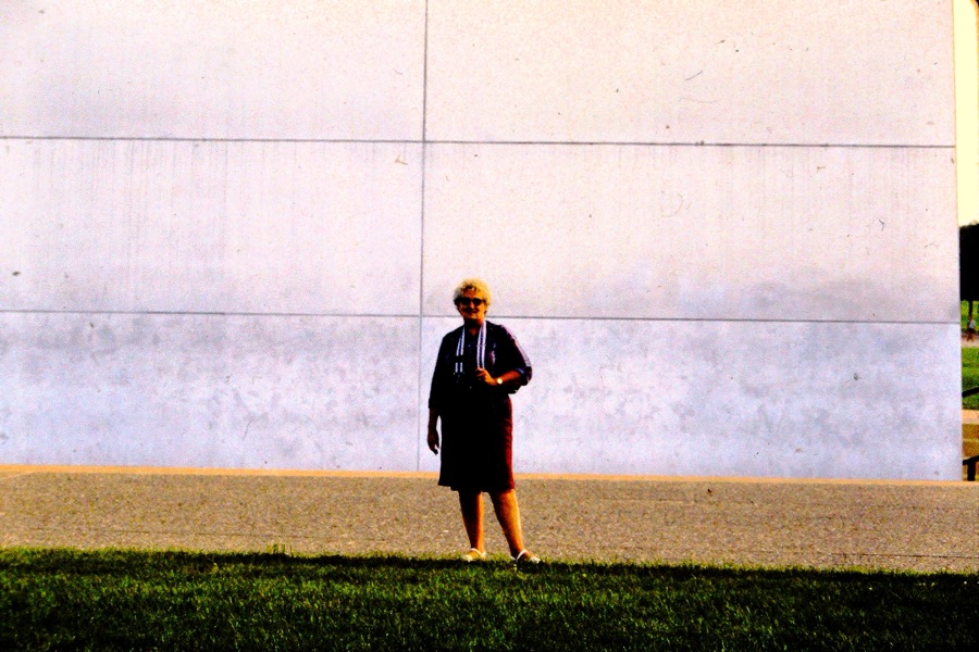
In the Summer of 1985 my parents went Road Trippin’ across the United States of America. They began their Road Trip leaving from their home in San Diego, California. They always planned what or whom they wanted to visit ahead of time.
Last week we saw my parents driving southbound from Indianapolis, Indiana after they completed their tour of the Indianapolis Motor Speedway. Today, we are taking a look first around St. Louis, Missouri and then we’ll continue on their westward journey.
St. Louis, Missouri:
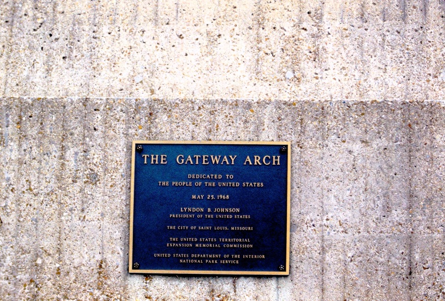
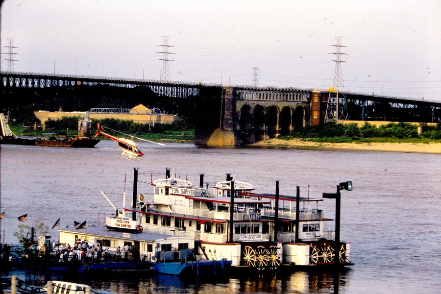
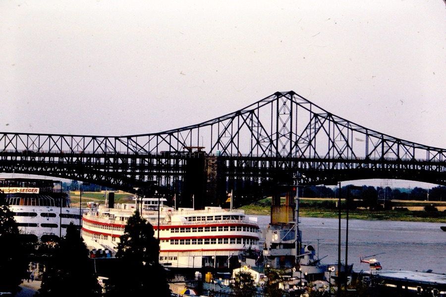
The first stop they made was in St. Louis was at the Gateway Arch National Park. At the Gateway Arch they were able to take a tram ride to the top. The tram lifts you up 630 feet up to the top of the tallest monument in the United States.
While there they also visited the Gateway Arch Museum and later took a Riverboat Dinner Cruise on a 19-century paddle-wheel riverboat. They rode on the Tom Sawyer Riverboat along the Mississippi River seeing stunning views of the skyline. It was a unique and relaxing way for them to experience seeing the Gateway Arch and downtown St. Louis.
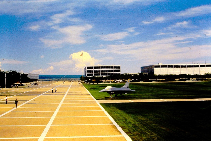
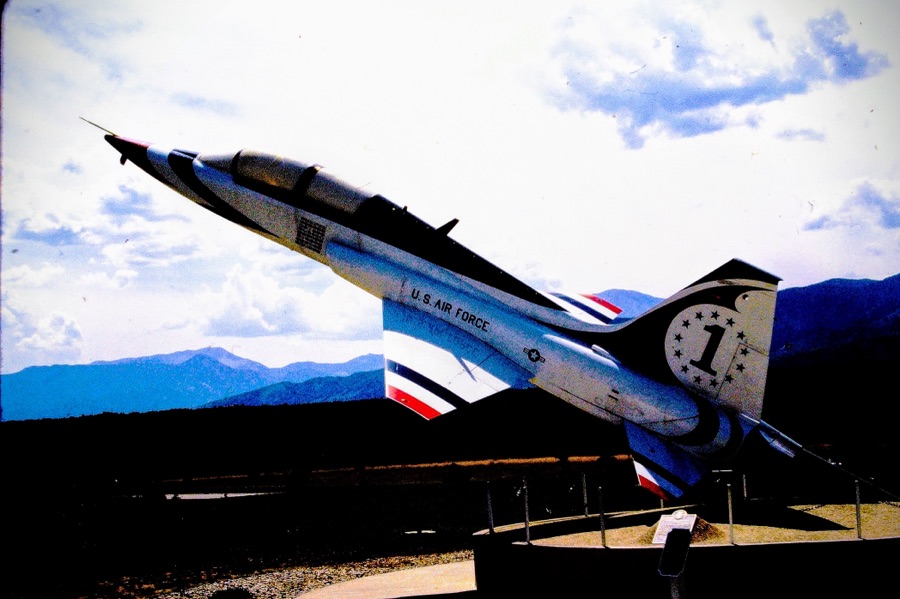
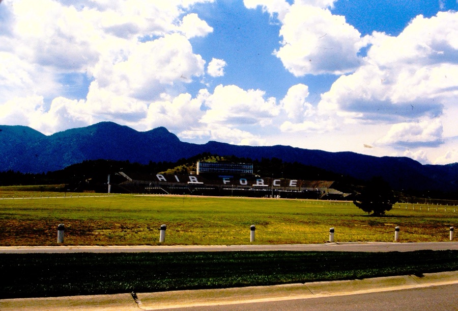
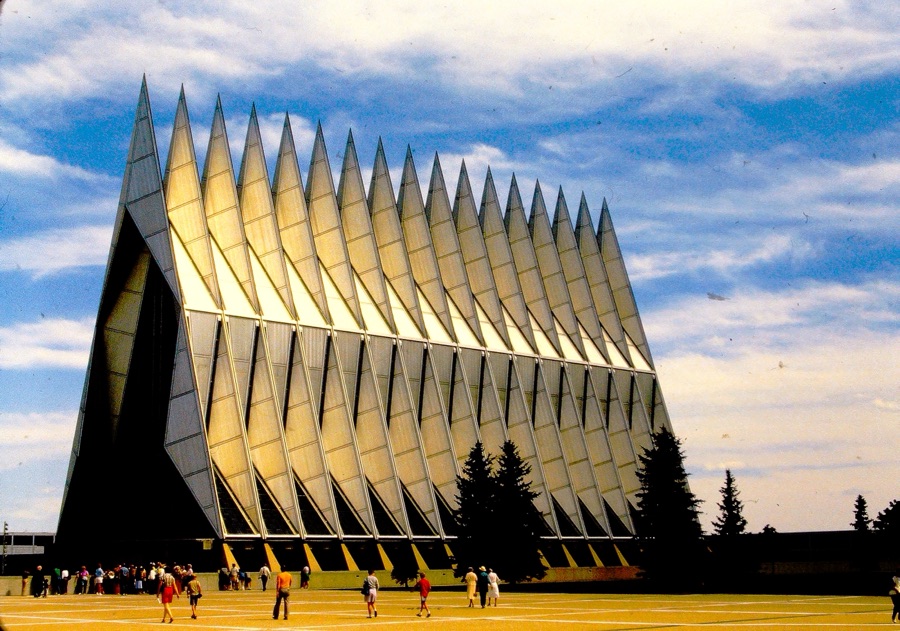
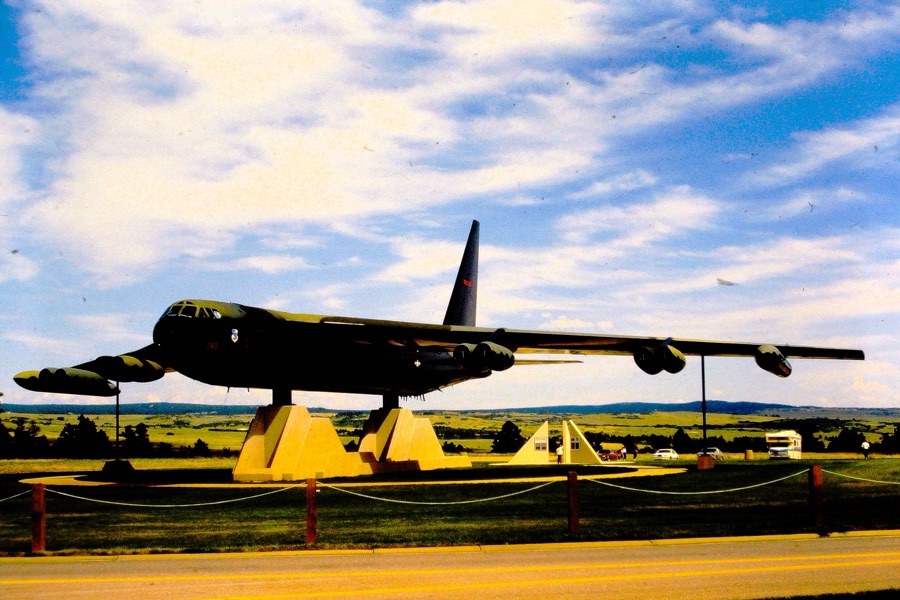
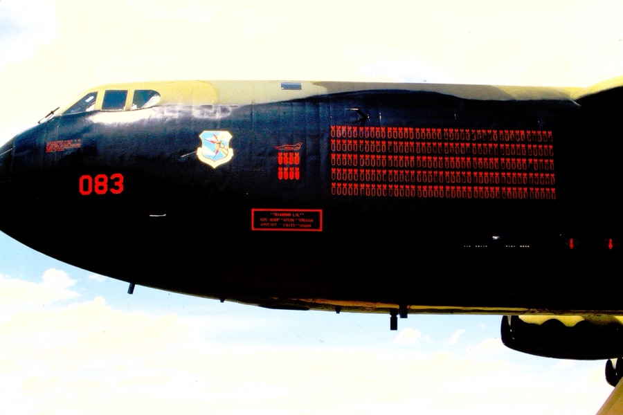
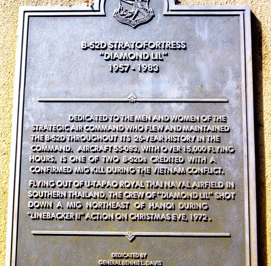
Next up on their Road Trippin’ USA Adventure was to drive westward to the U.S. AIR FORCE ACADEMY in Colorado Springs, Colorado.
TheU.S. AIR FORCE ACADEMY has many sites and facilities available for visitors to see on a self-guided tour. Their visit stop at the Academy was the Barry Goldwater Visitor Center, here they explored the resources available to help them with their tour.
Among the many various facilities they were able to visit were the Planetarium, the Cadet Chapel, Honor Court, Polaris Hall, Arnold Hall, Dolittle Hall, Falcon Stadium, and Thunderbird Overlook. The Cadet Chapel is located at the base of the Chapel Trail. From the Chapel Trail, they were able to view the historical statues and sculptures on displayed at the Honor Court. The U.S. AIR FORCE ACADEMY’s Gift Shop is located on the second floor of Doolittle Hall, which I’m sure they bought souvenirs to bring home.
Next week I’ll continue with their Road Trippin’ adventures for My Which Way of Cee’s Which Way Challenge. We’ll begin in New Mexico and venture onto visiting the Pima Air & Space Museum in Tucson, Arizona.
In the Summer of 1985 my parents went Road Trippin’ across the United States of America. They began their Road Trip leaving from their home in San Diego, California. They always planned what or whom they wanted to visit ahead of time.
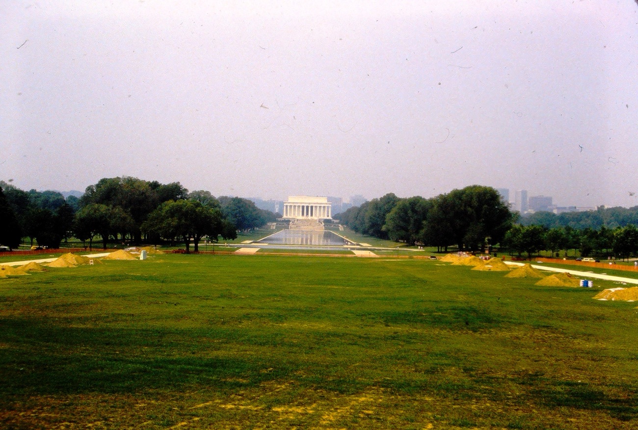
On the road again, their next planned stop was in Washington D.C. after a side visit to my brother near Manassas, Virginia. My parents toured many of the historical sites and monuments around the area. Some of the sites were seen via a tour bus while others were seen via self-guided walking tour routes. They toured the Bureau of Engraving and Printing Building, the National Museum of American History, The Washington Monument, The Lincoln Memorial, The Smithsonian Castle, Capitol Hill and the Ulysses S. Grant Memorial Statue. What would be your interests if you toured Washington D.C. or your country’s Capitol?
Here you may see some of the Roads, Routes, or Pathways they took on their tour of D.C.:
The last photo isn’t exactly a pathway unless you consider going round and round on a merry-go-round one you’d also enjoy taking on occasion.,
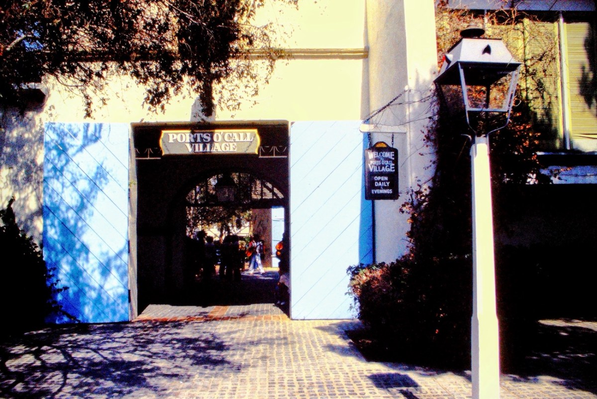
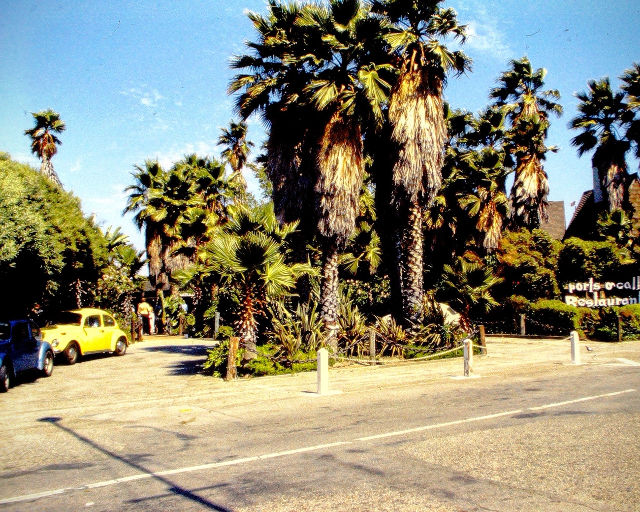
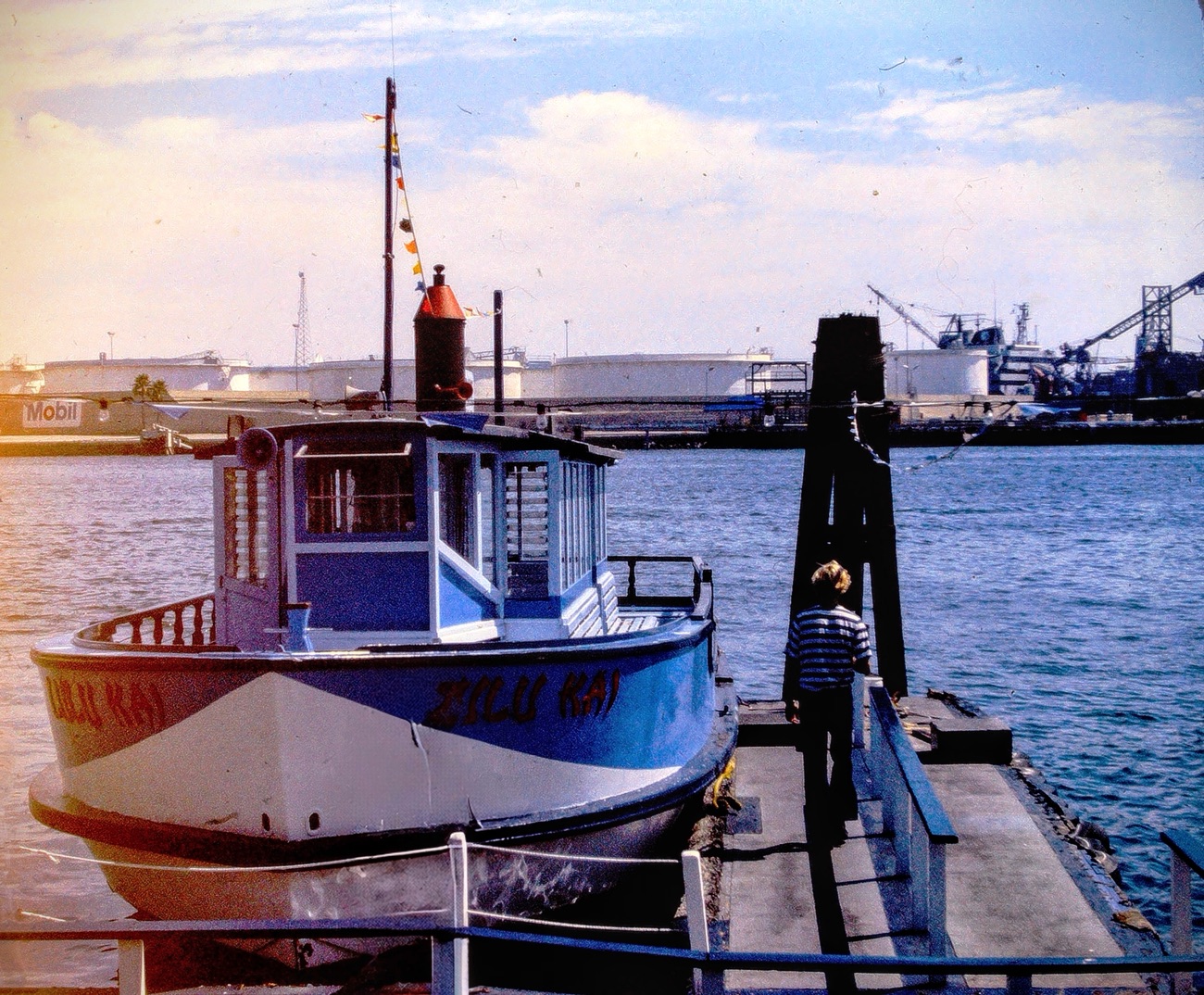
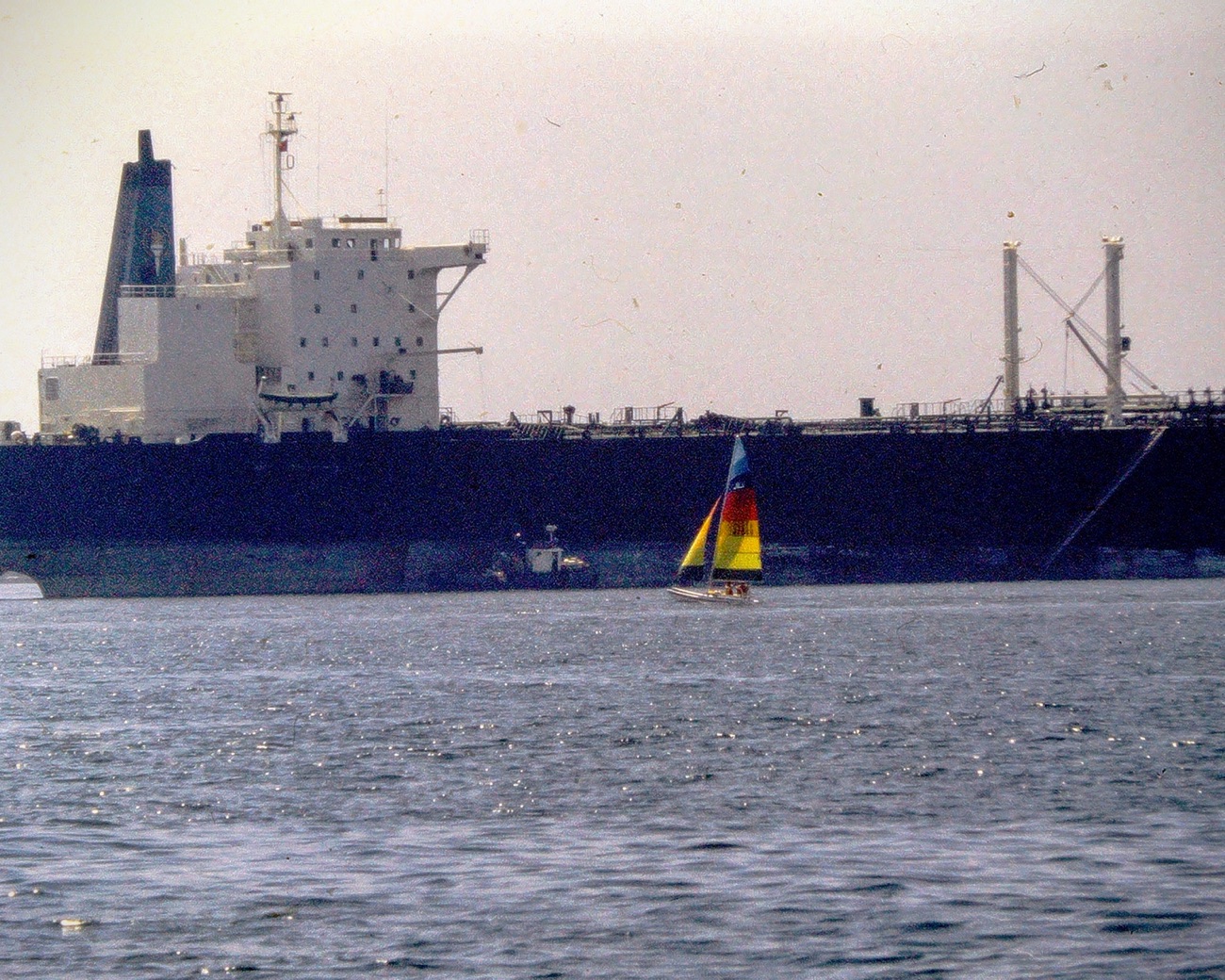
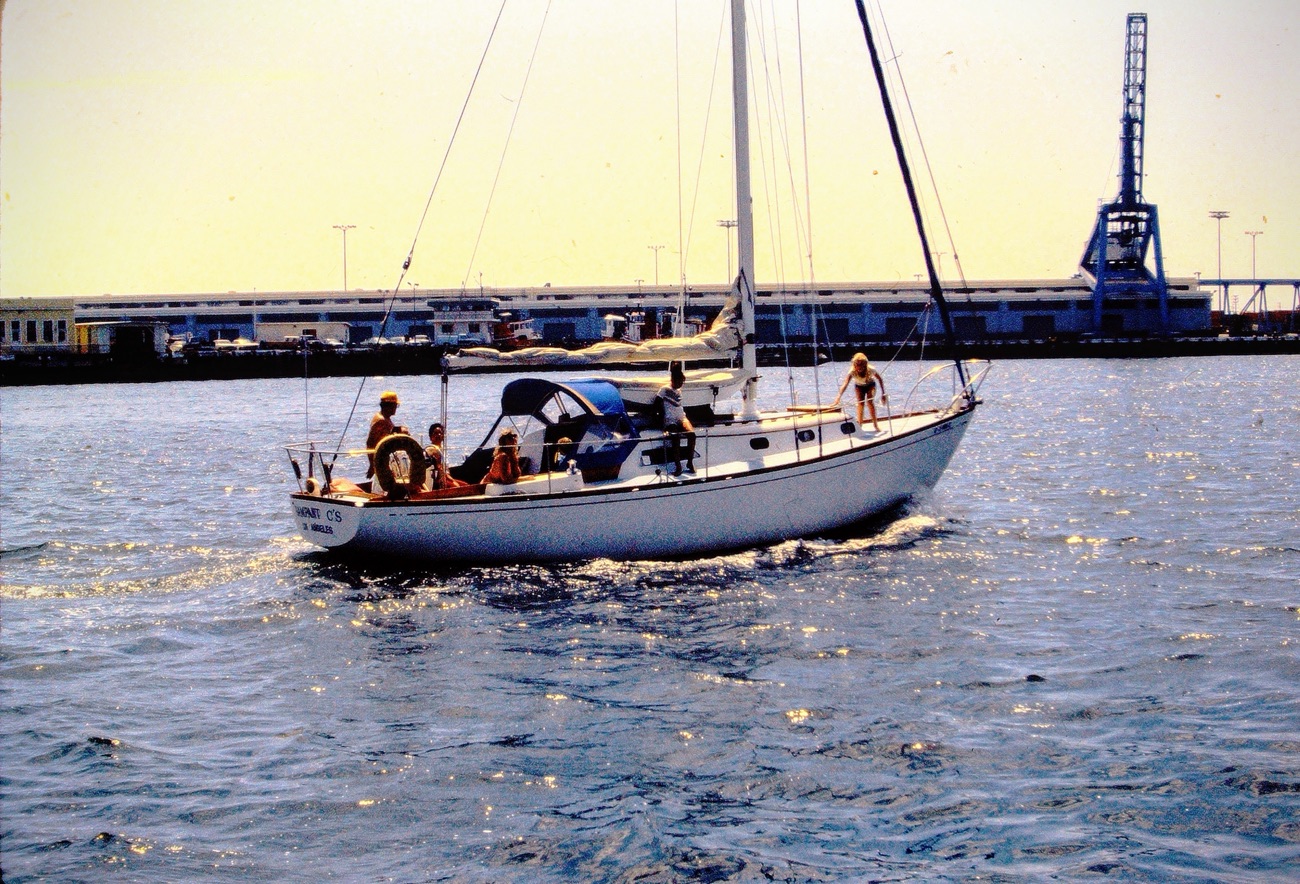
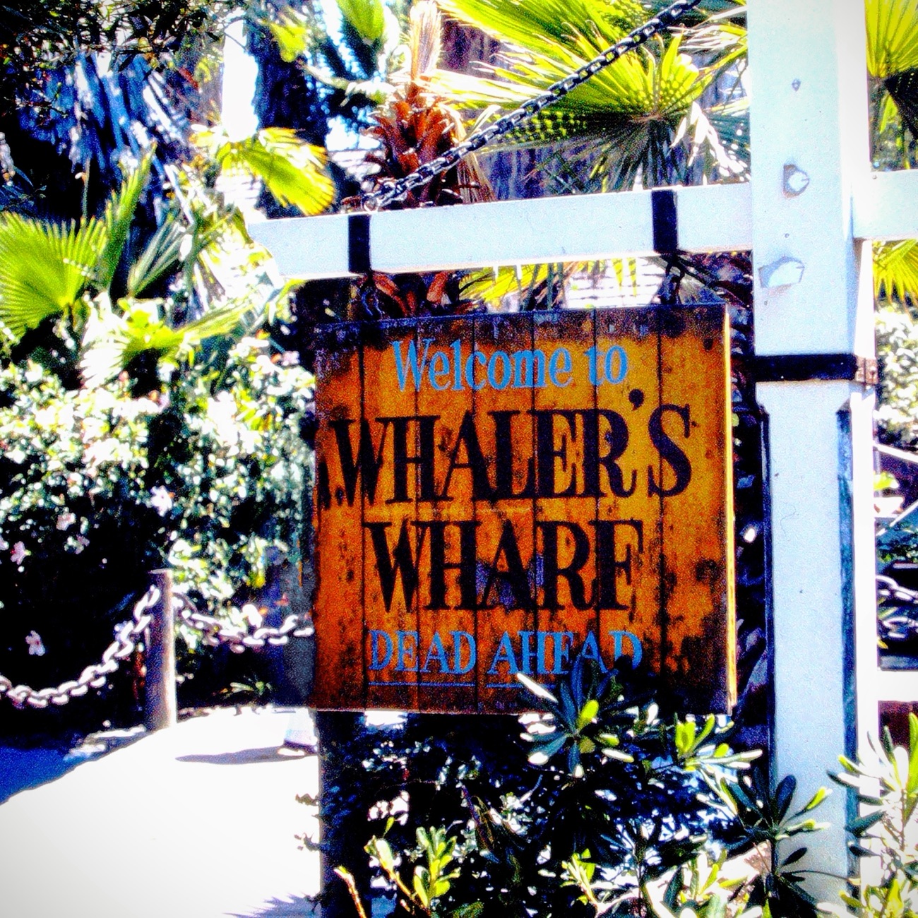
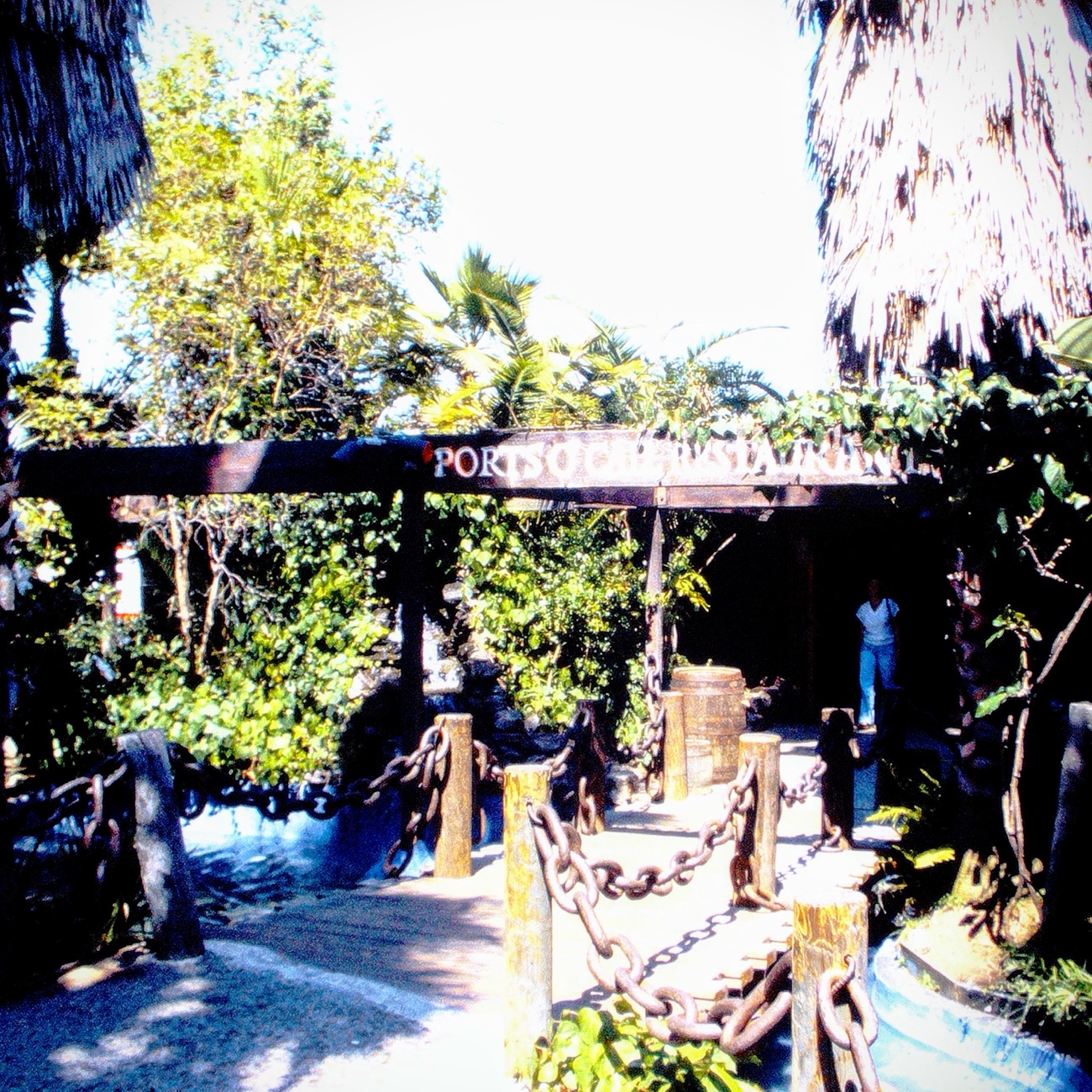
For my own Which Way this week I have combined it with Sunday Stills Challenge from Terriwith her theme of#Float, #Afloat. In other words, my Which Ways are on both Land and Sea. These are from a visit my parents took to The Ports O’ Call in San Pedro, California. They toured the Ports O’ Call Village walking the pathways and took a tour cruise around the Bay. My dad loved to take pictures when they went places (thus my love of photography).
Location: Ports O’ Call, San Pedro, California, USA
God Bless. Thank you for visiting the Ports O’ Call Village with us. Thank you for sharing your time and thoughts with us. I appreciate y’all very much.
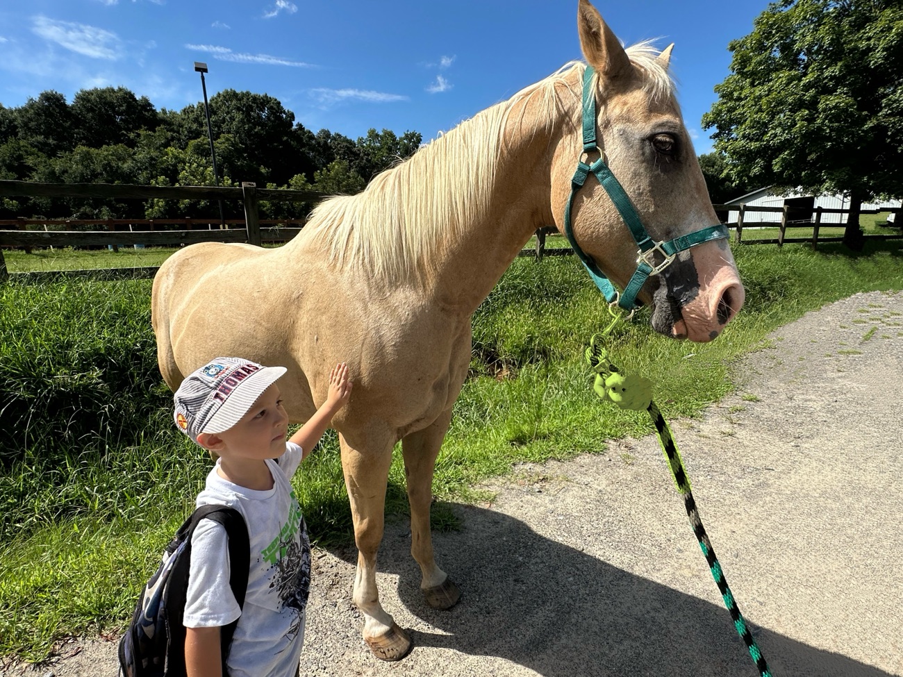
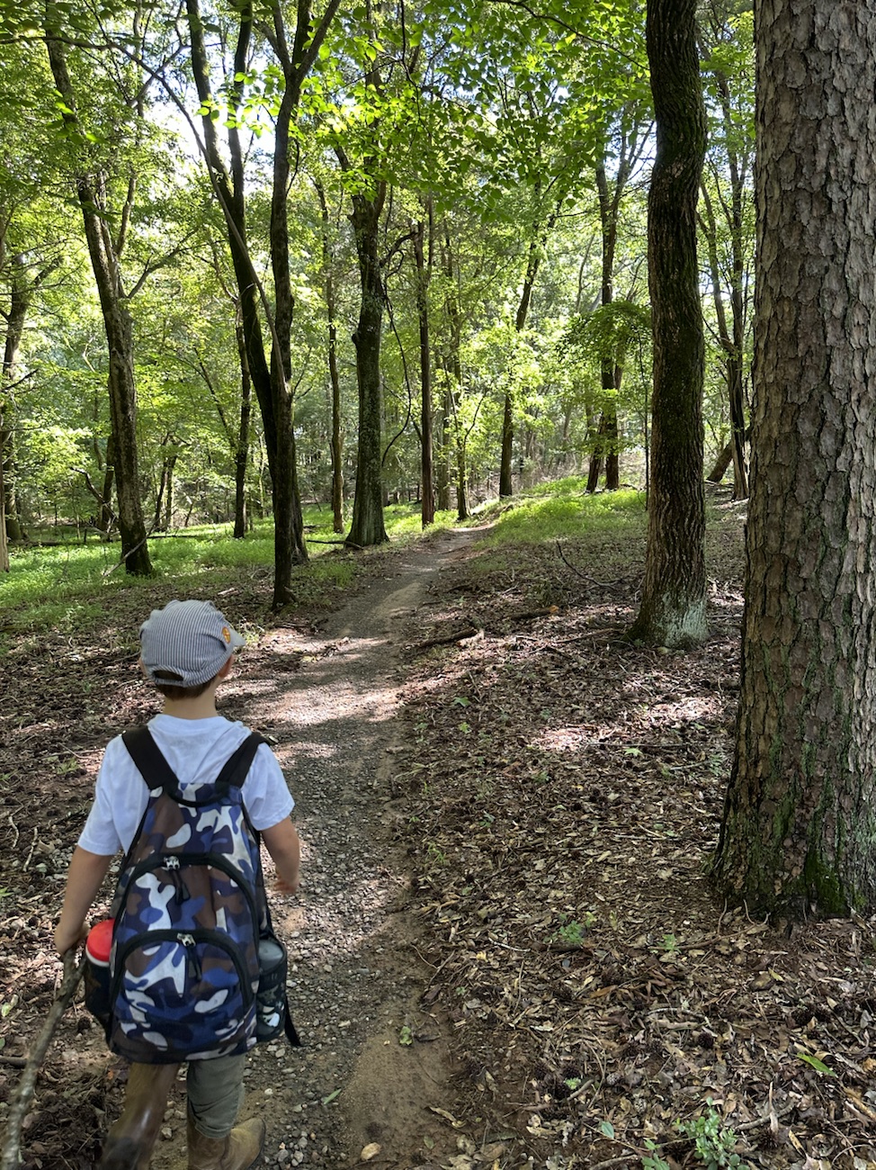
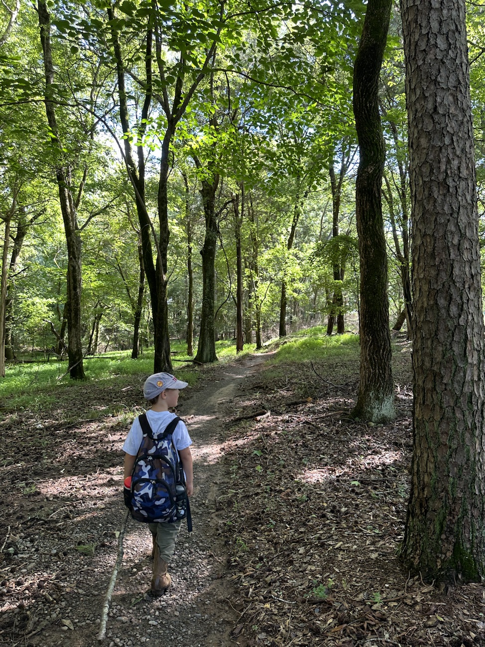
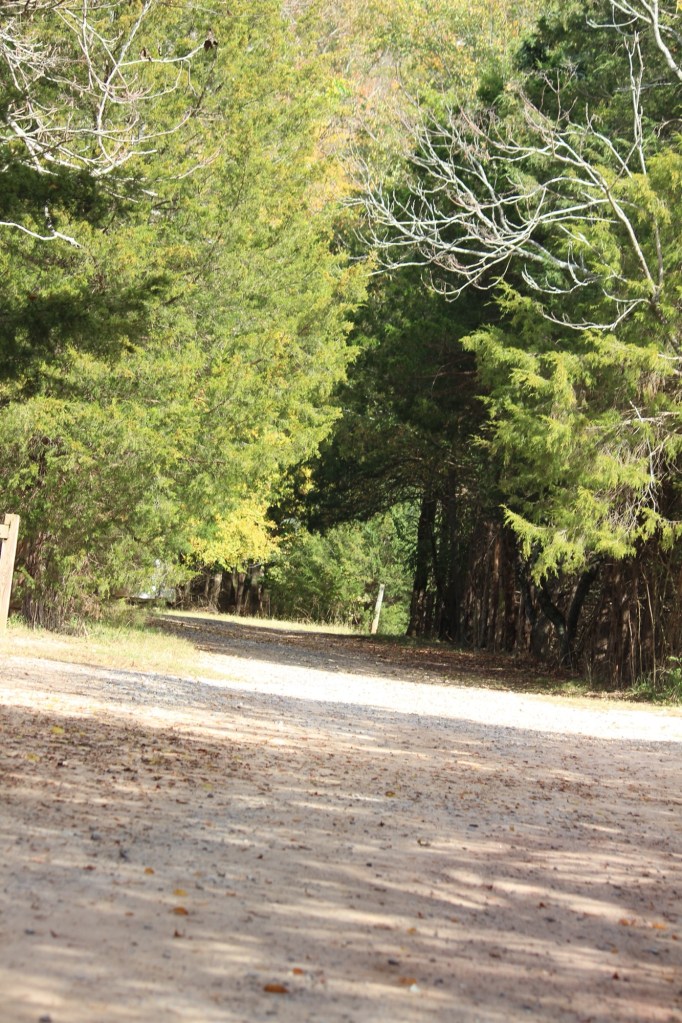
For Cee’s Which Way doing it My Way I have chosen to select Dirt Trails from our favourite Greenway with Coleman. If desired, you can click on each photo for enlarged viewing.
Location: Dogwood Trail; Horse Stables Entrance; Anne Springs Close Greenway; Fort Mill, South Carolina, USA
God Bless. Thank you for visiting and sharing your Dirt Roads, Pathways, and or Trails with us. Thank you for sharing your time and thoughts with us. I appreciate y’all very much.
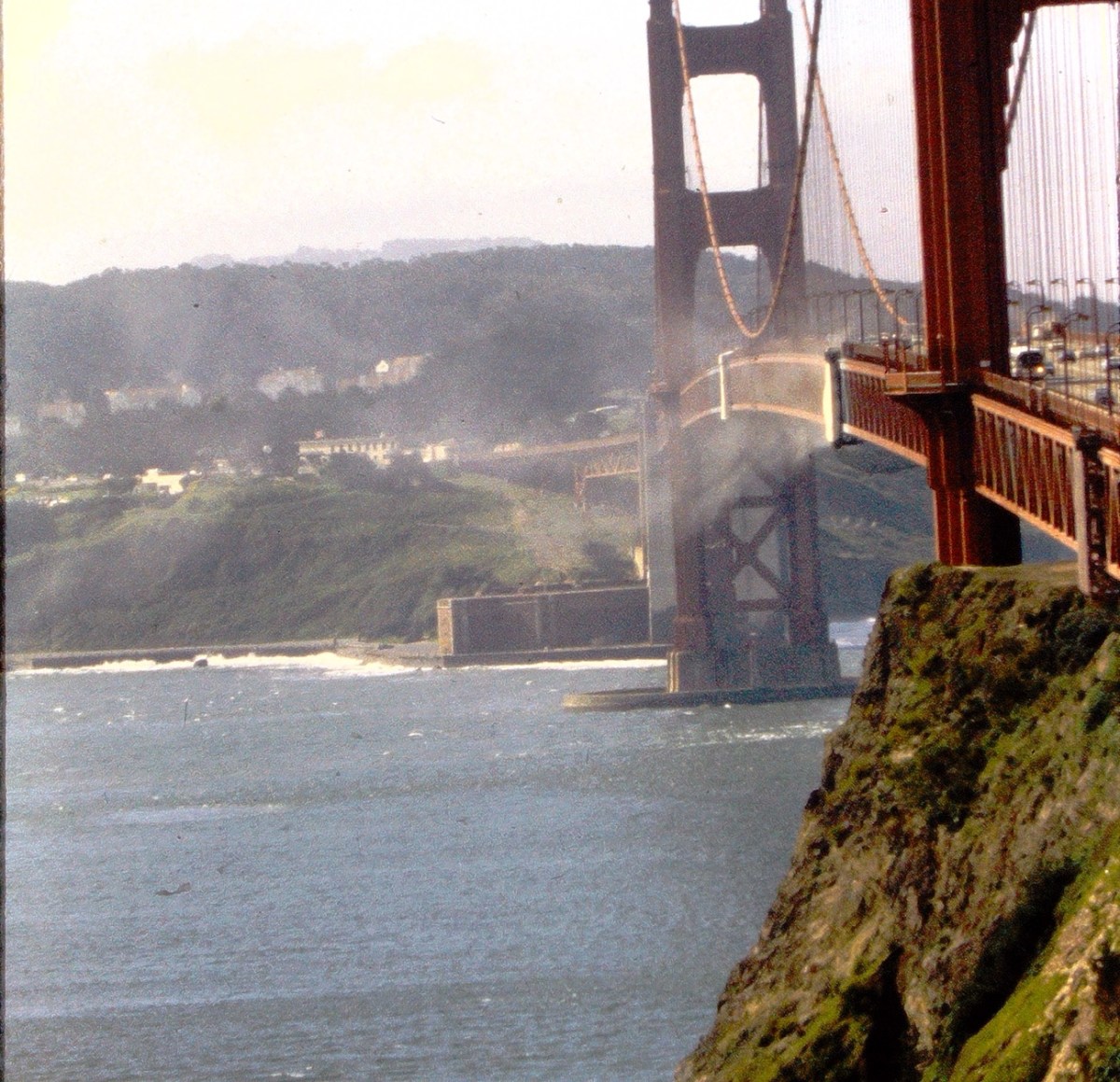
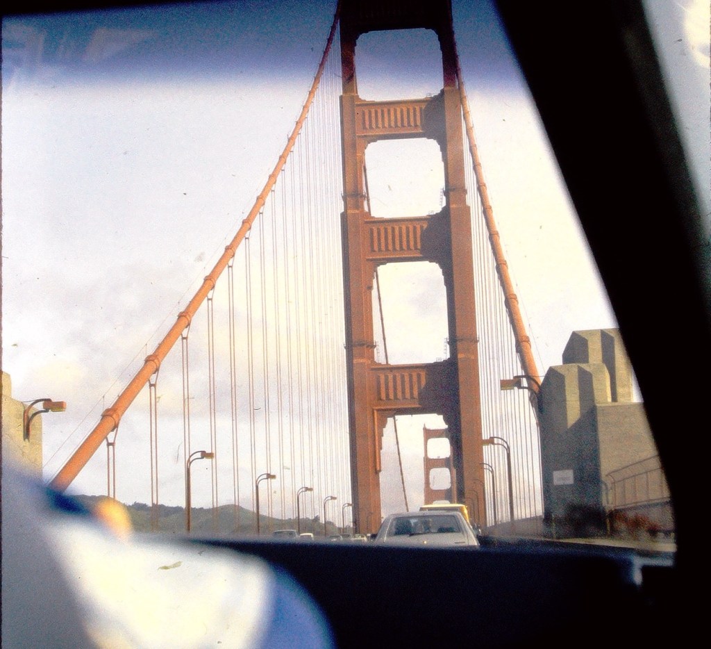
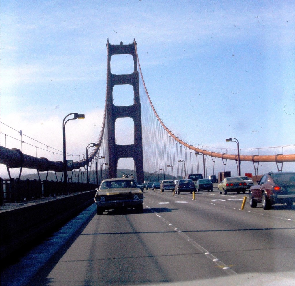
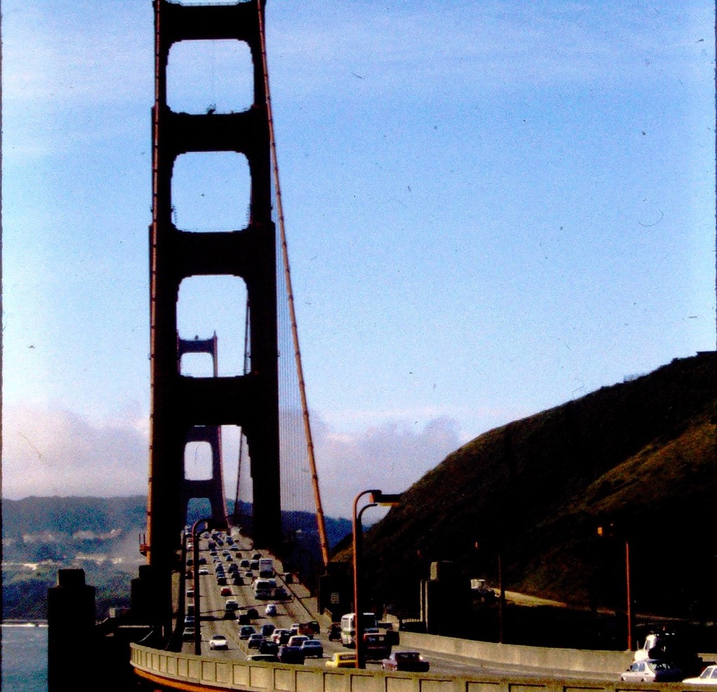
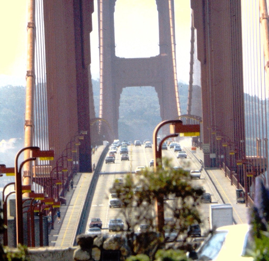
Golden Gate Bridge taken from the passenger seat while crossing the Bridge. Vehicles seen while Driving on the Golden Gate Bridge Golden Gate Bridge with Vehicles (cars, trucks, & buses)San Francisco’s Golden Gate Bridge loaded with Vehicles
My selections of Bridges with Vehicles were all taken during a family trip to San Francisco, California back in the Spring of 1979. Hope y’all enjoy the views and join in on the fun. Click here to link to My Which Way or here to link to Cee.
According the Oxford Dictionary, a Pathway is a path which you can walk along or a route you can take and a Passage is a way of exit or entrance; the act or process of moving through, under, over, or past something on the way from one place to another.
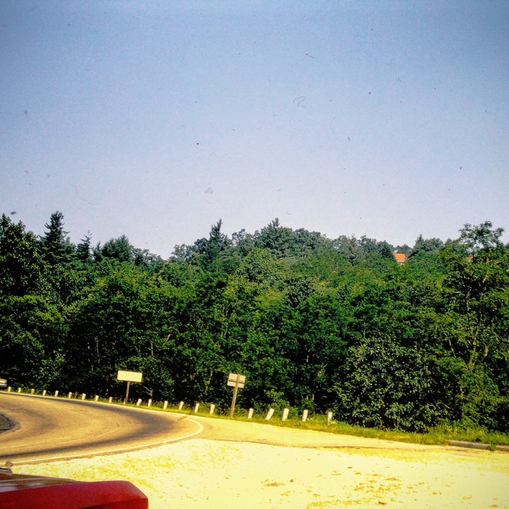
This week I’m continuing Cee’s Which Way Challenge doing it My Way. Therefore for this the third week of June I have chosen a theme of Roads/Dirt Roads. I welcome anyone who desires to join me on this week’s Which Way Challenge.
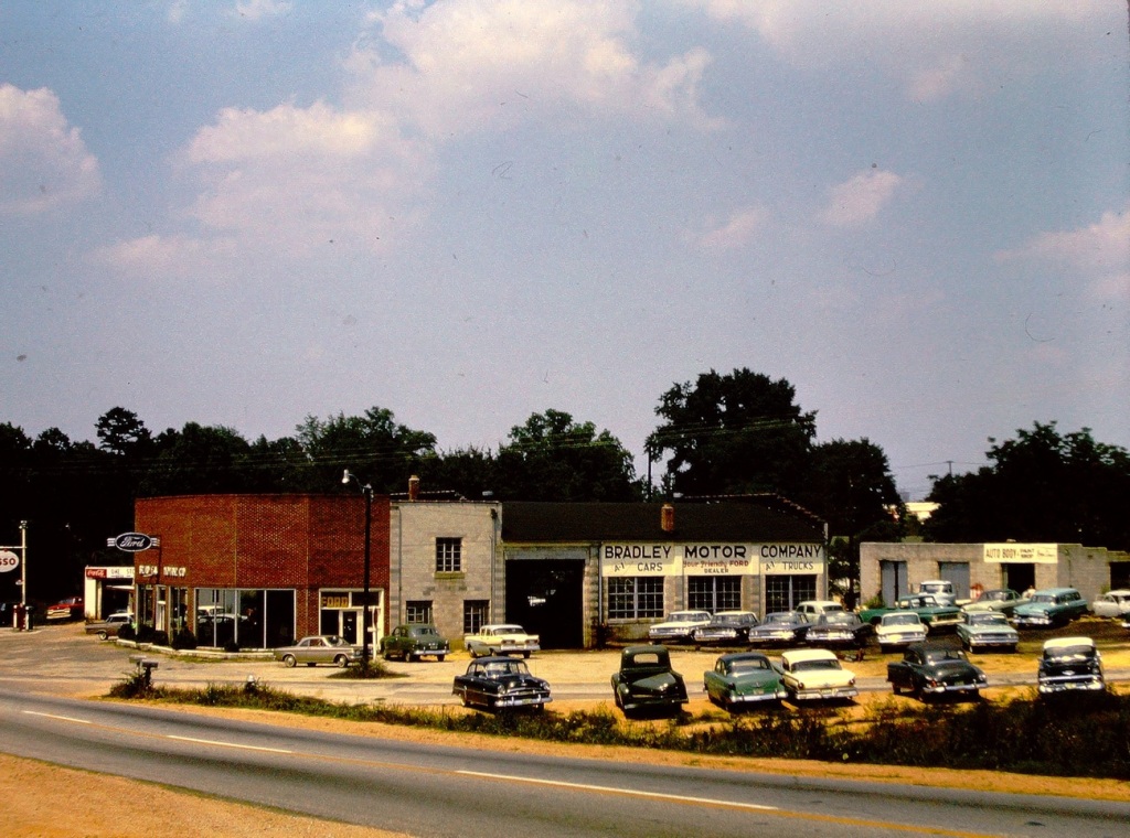
As I have been working to digitize my dad’s old slides I have come across several photos my dad took of Roads in Great Falls, South Carolina back in 1963.
We are starting our (my) Which Way with the Road in front of my Paternal Grandparents home. Their home was originally a Mill Duplex Home and converted into a single family residence.
Walnut Street Home of John & Alma Waters My Paternal Grandparents
Next, we come to the corner of Walnut Street and Argonne Avenue. This is the location of the J P Stevens & Company Mill where my paternal grandfather worked. The Mills in Great Falls were formerly known as Republic Cotton Mills. [Closed in the early 1980’s.]
Cottom Mill #3
1923 Republic Cotton Mill #3 – a silk mill production. The building had a unique saw-tooth roof. There was Village housing and a neighborhood grocery store.
Continuing on our journey, we drive along Chester Avenue. On this Road we can see the Bradley Motor Company ( a FORD Dealership) where my dad worked when he finished high school and again when he first was discharged from the U S Navy.
Bradley Motor Company
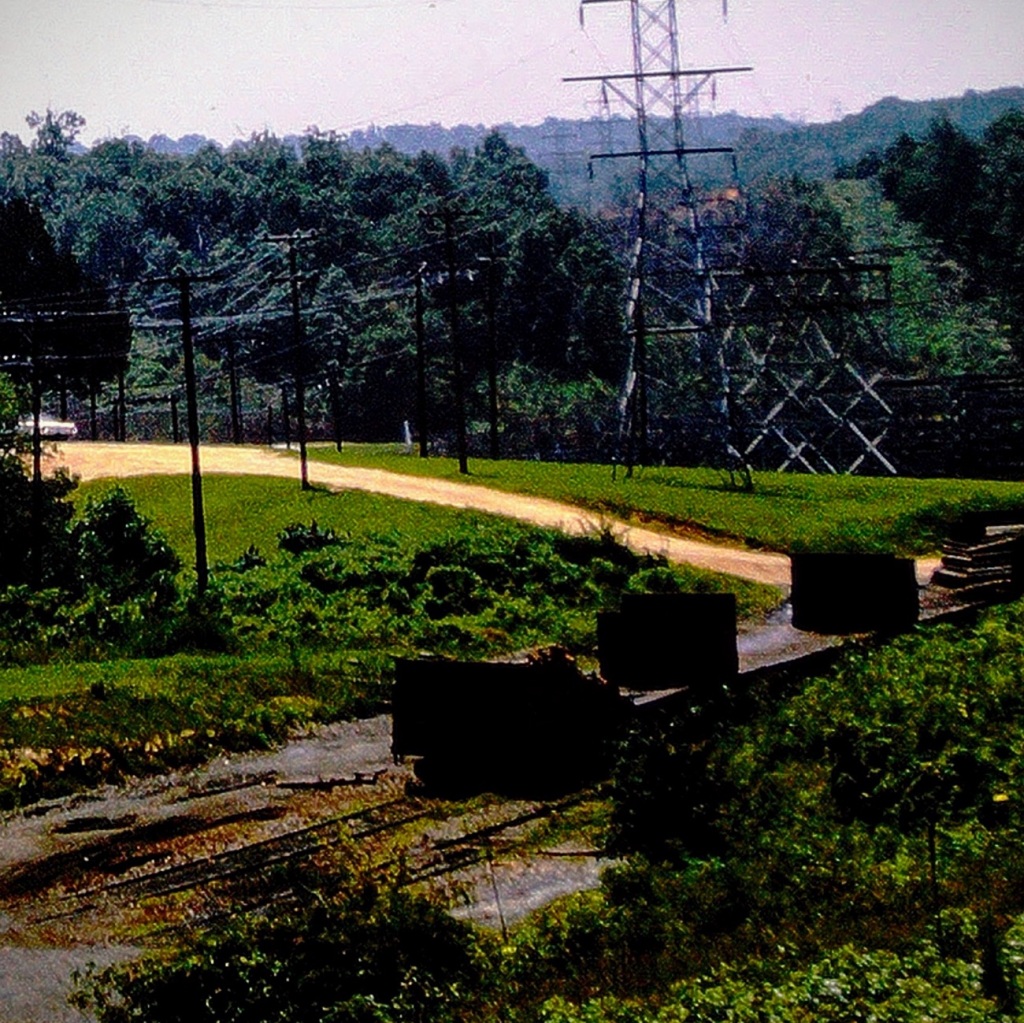
As we continue cruising through the Town of Great Falls, we see a Dirt Road behind the Power plant. Here we notice old Railroad tracks no longer in use. They would have kept extremely busy in the heyday of the town.
The Town of Great Falls is located in Chester County, South Carolina. The name of the Great Falls came from the nearby waterfalls on the Catawba River. The Town was founded by the power company owned by Mr. J.B. Duke. J.B. Duke built hydro electric plants on the Catawba and was the founder of the three Republic Cotton Mills.
Location: Town of Great Falls, Chester County, South Carolina, USA
God Bless. Thank you for visiting in my reminiscing of the Town of Great Falls, SC. Thank you for sharing your time and thoughts with me. I appreciate y’all very much.
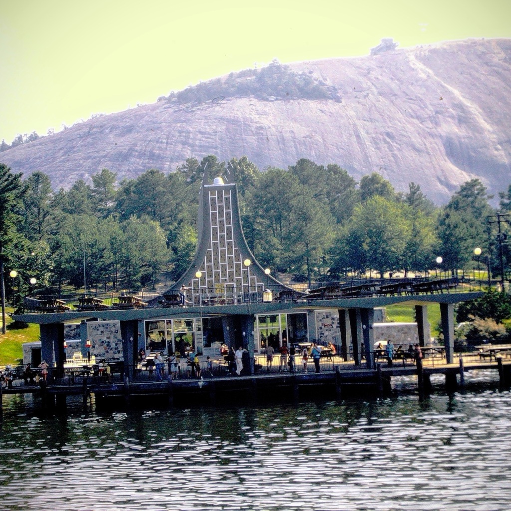
We begin our journey in n July of 1972, having made it from California to Georgia we stop for a bit of fun. We were glad to pull into the park and finally be able to get out of the car and stretch our legs. After traveling cross country for days we were more than ready to enjoy some fun and excitement.
Driving into Stone Mountain Park in Stone Mountain, Georgia
We enjoyed a time of Sun, Sand. and Water Fun relaxing on the beach.
Sun, Sand. and Water Fun
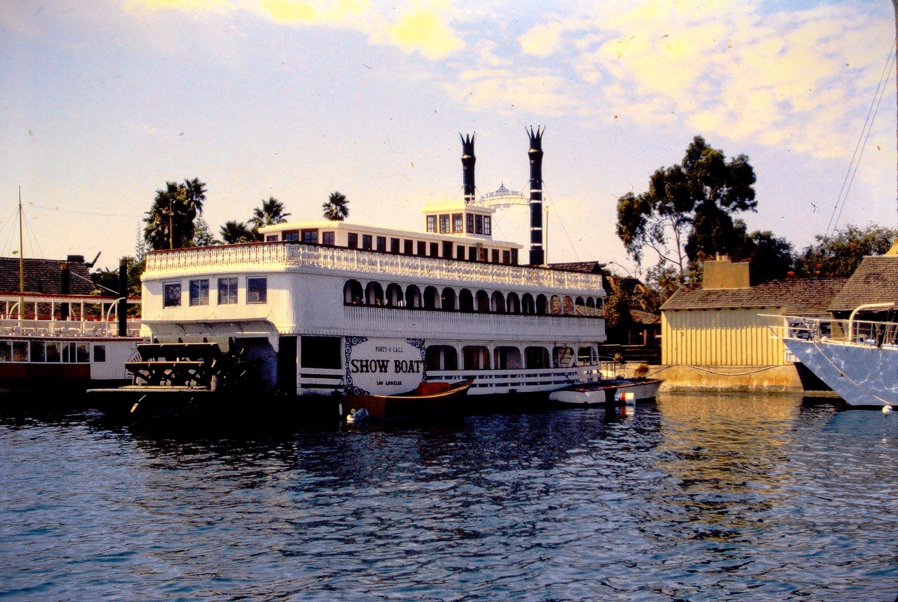
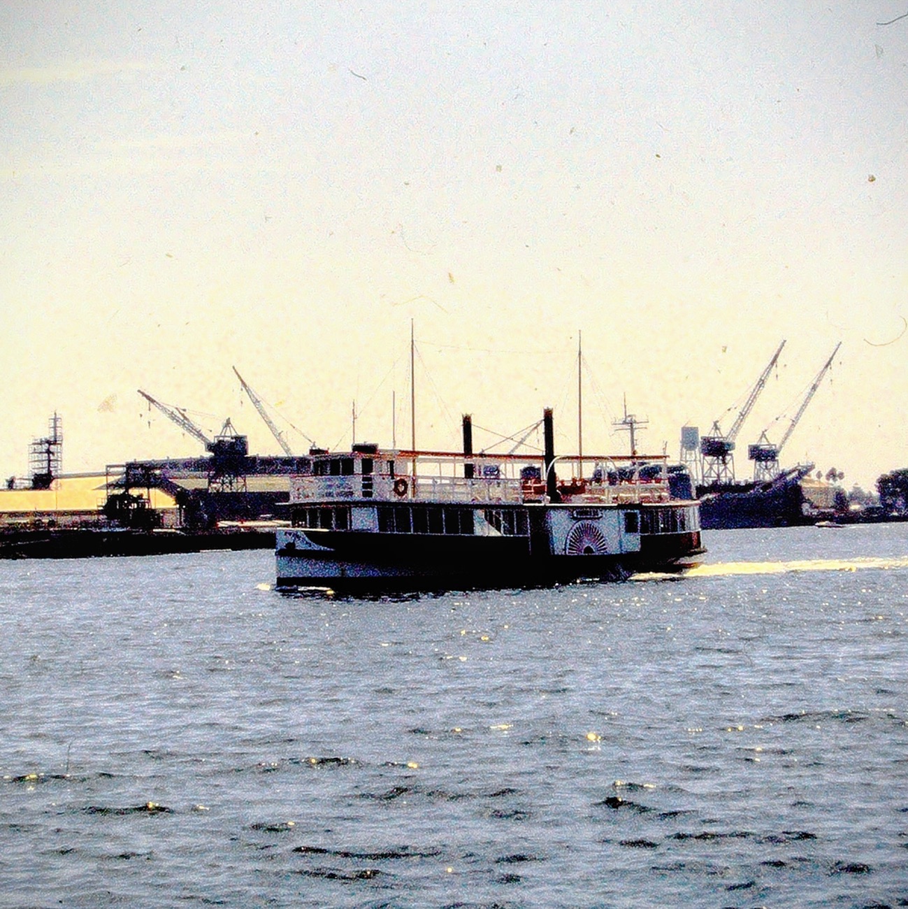
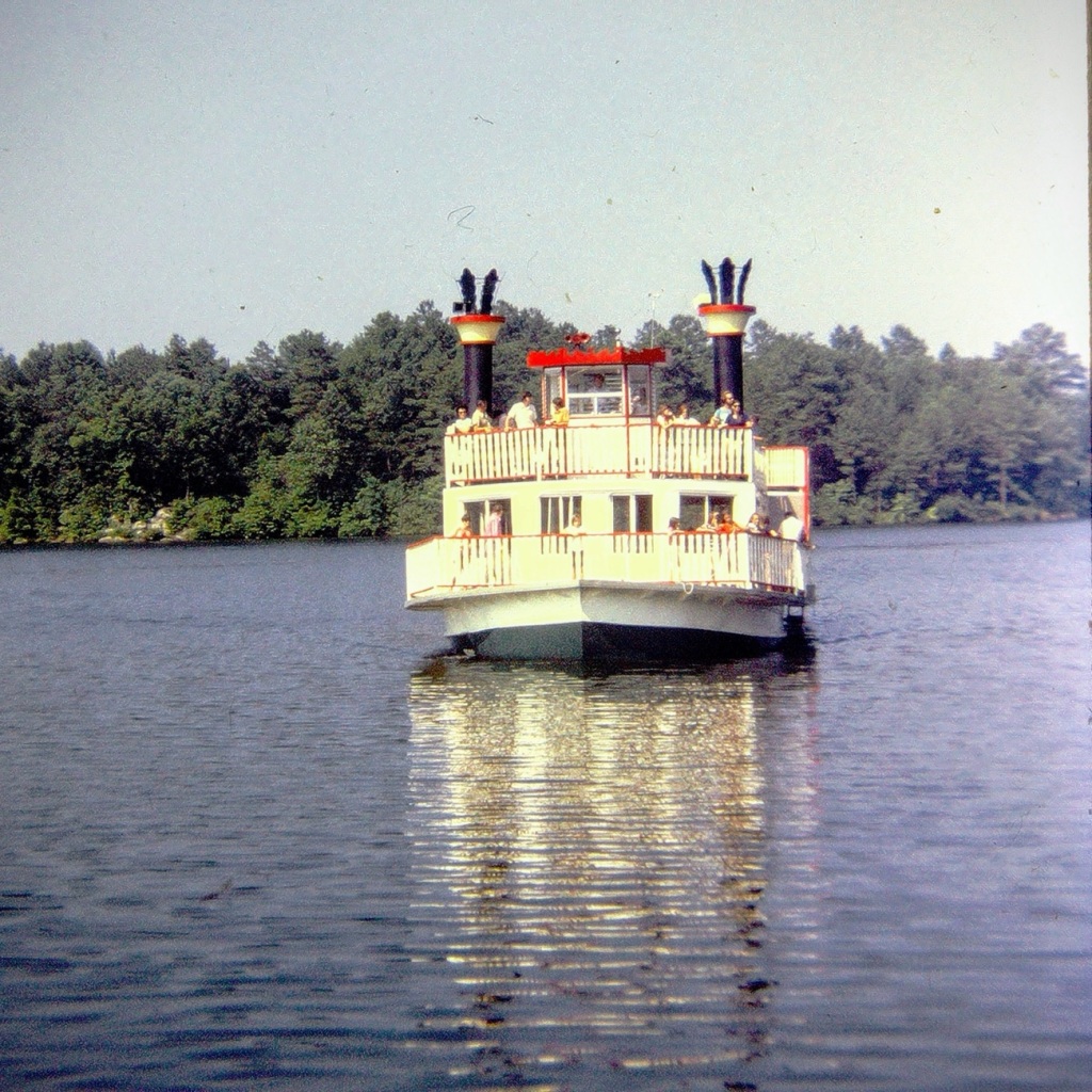
Next, we moved forward to wait our turn for a ride on one of the Paddle-boats. The paddle-boats are large Riverboats which give tourists and guests a thirty minute ride out on Stone Mountain Park Lake. [From what I have discovered, the Riverboats no longer operate on Stone Mountain Park Lake.]
Riverboat Marina Complex Area to wait for a Riverboat Cruise 🚢 ride.
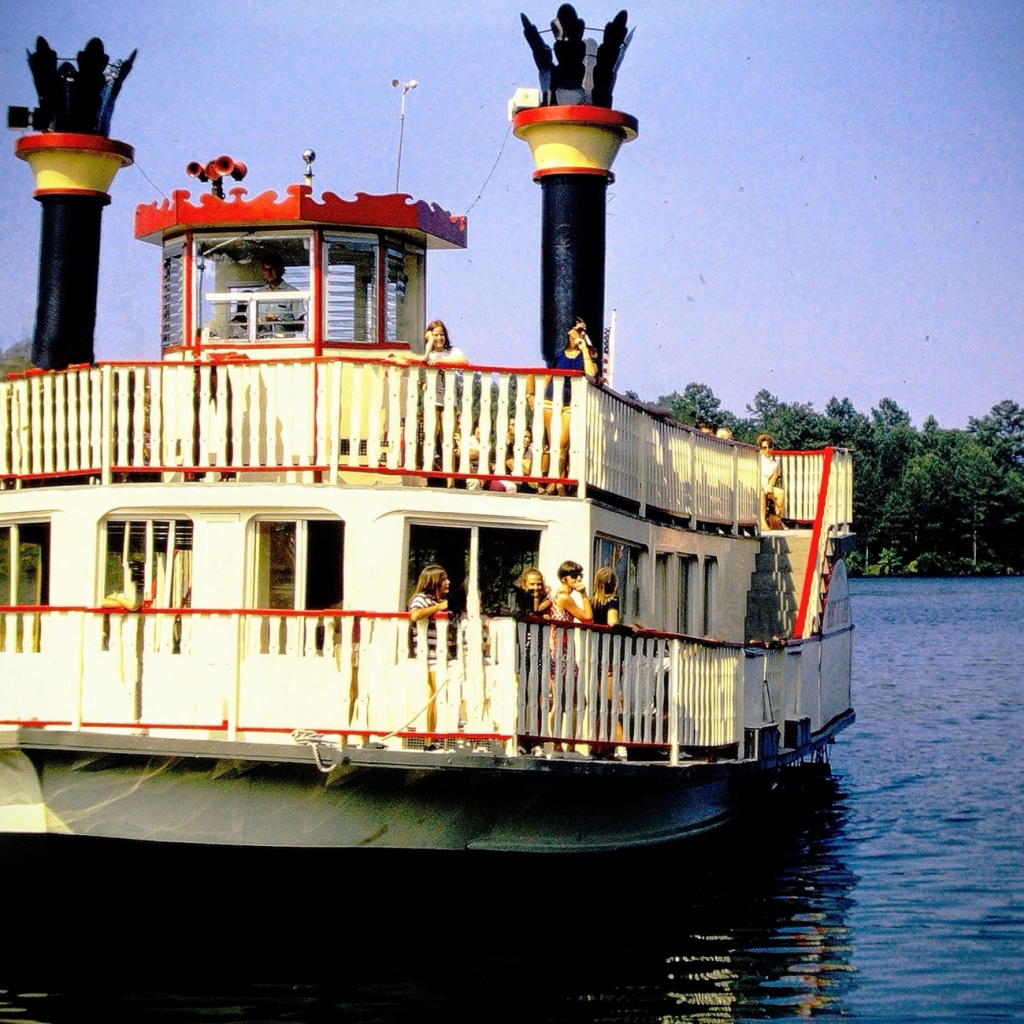
Moving forward out into the lake aboard the Scarlet O’Hara, we had an opportunity to see a uniquely captivating side of the park. The Scarlet O’Hara was one of two (2) paddle boats in the Stone Mountain Fleet that once cruised the lake delighting guests with the beautiful scenic views. It was a side wheeler which could carry up to One Hundred Fifty (150) passengers on board.
Scarlet O’Hara
The Henry W. Grady was the name of the other Stone Mountain paddle boat. It was designed to carry approximately three hundred (300) passengers. Its sole purpose was to be used for private party charters.
The Riverboats departed the Riverboat Marina Complex approximately every half hour moving forward into the lake giving guests a chance to enjoy the waterways, and the beauty surrounding Stone Mountain. The short cruise lasted about twenty (20) to thirty (30) minutes. While out on the lake on one of the paddle-boats you might have noticed the sunken remains of the very first riverboat, the Robert E. Lee, seen at the bottom of the lake.
Location: Stone Mountain Park Lake; Stone Mountain Park, Stone Mountain, Georgia, USA
God Bless. Thank you for visiting and sharing in our memories of cruising on a Riverboat. Thank you for sharing your time and thoughts with me. I appreciate y’all very much.
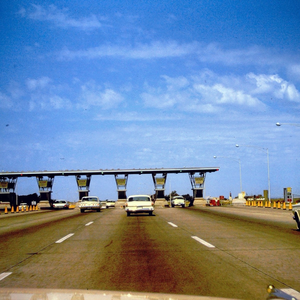
Today we are going backwards in time Reconstructing my dad’s slides to reminisce family journeys from 1963. These are from one of our vacations traveling from San Diego, California to Great Falls, South Carolina and back home again.We progressed along the interstate Moving Forward Eastbound and Down loaded up and truckin’ heading to see my paternal grandparents for the first time in five years.
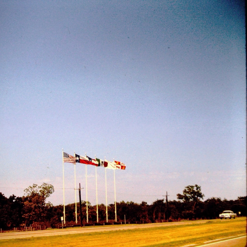
Coming or Going Somewhere in Texas
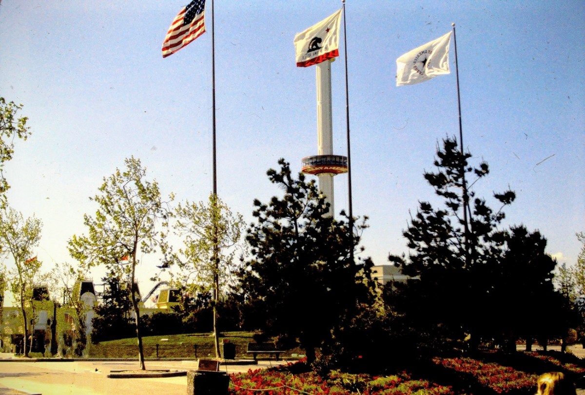
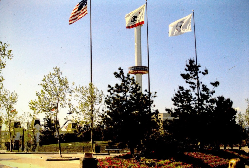
The Six Flags can be seen from Interstate 20 nearing the Arlington, Texas. They signify being close to the Six Flags over Texas amusement theme park.
Which way are we going? From the photo I’m not sure if we were headed east or going back west at this point in time as I can barely remember the trip.
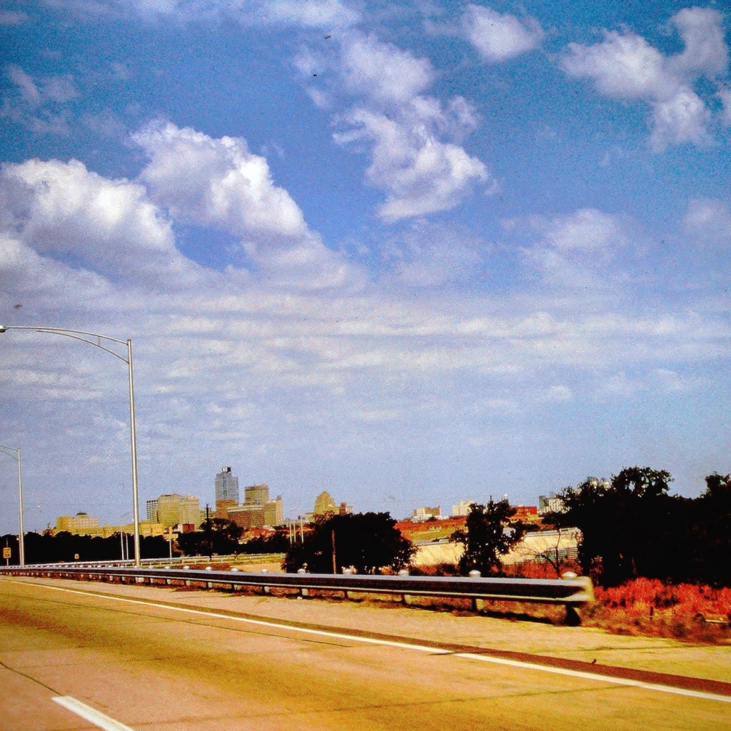
Stop 🛑 and Pay 💰 Toll Texas Toll Booths
Nowadays, there are over 50 toll roads in Texas. All drivers are required to pay the toll (fee) regardless of where you live. The first major toll road in Texas, which opened in 1957, was a 30-mile, six-lane stretch of highway between Dallas and Fort Worth. A drive from one end to the other cost 50 cents.
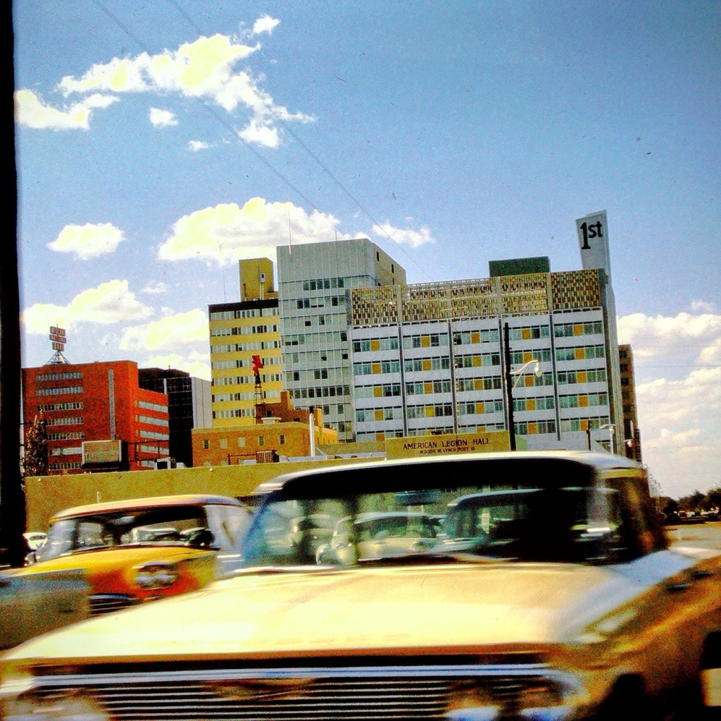
Passing through El Paso, Texas
After a long tiring vacation visiting family in the Carolinas, we are passing forward through El Paso heading home to San Diego. At this point of our trip we are excited to be almost home (over half way back across country.
We managed to have a beautiful clear day yesterday (almost), so Coleman and I rode the bus to the Y for some fresh air and a bit of hiking.
All aboard, we’re on our way.
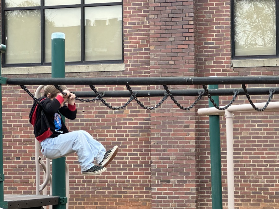
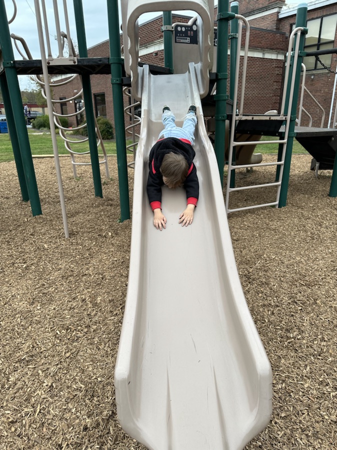
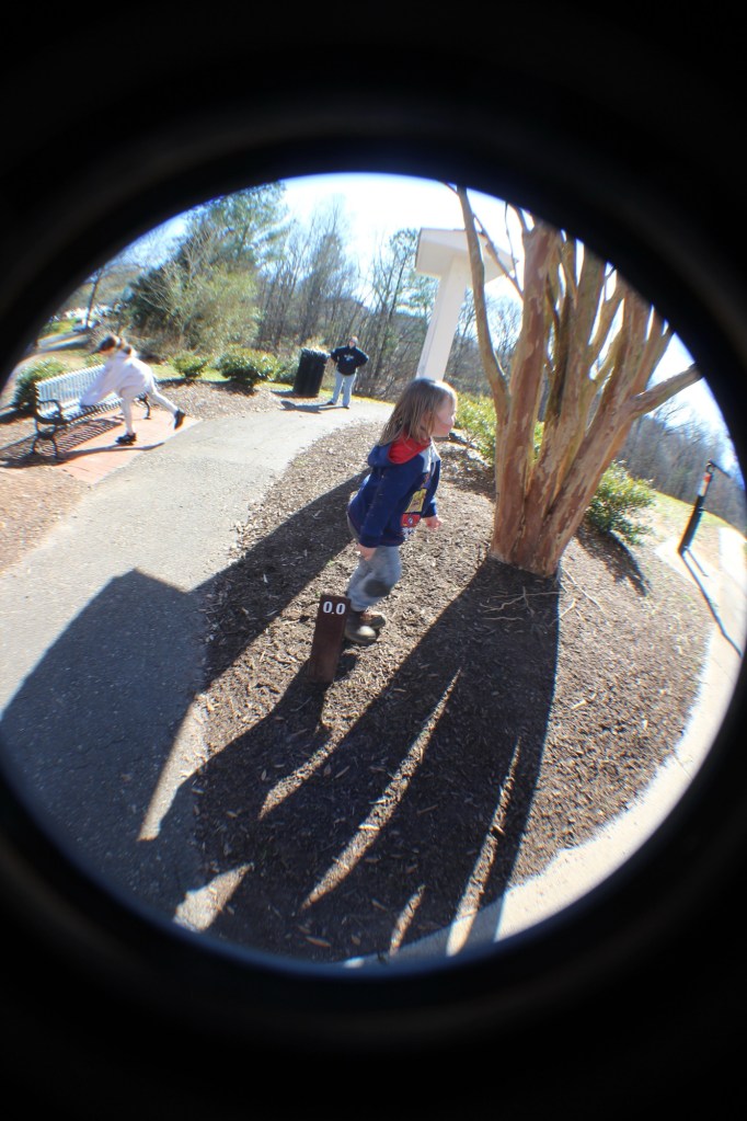
Before we begin our hike, it’s Coleman swing time. If we waited till later the school kids would have taken over and he couldn’t have been able to play.
Cameras: iPhone 14 Pro Max and Canon EOS Rebel T3i with Canon EF-S18-55mm lens with Altura UV & NP filter and also Altura Wide-Angle Fisheye attachments.
Location: Gaston County Warlick Family YMCA; Gastonia, North Carolina, USA
God Bless. Get Outdoors and Enjoy Our Beautiful Earth. Thank you for traversing the trail with us. Thank you for sharing your time and thoughts with us. I appreciate y’all very much.
Before we head out on the road I suggest we stop and fill up the car with some good old fashioned gasoline ⛽️. I doubt you’ll find these prices nowadays though.
I Spy Something Red
I Spy Red on the Gas Station Sign
Now that we’ve filled up the car 🚘 and made sure we have everything we need, let’s get going on our adventure.
I Spy Red Street Lights
Where are we going you might ask? It doesn’t really matter as long as we have a bit of fun along the way.
I Spy Red Trail Signs
How about we pull over for a while and go on a hike. These signs might direct us on our way.
I Spy Coleman Wearing a Red Shirt
Oh Look, Stairs. Shall we go down them? What might we see when we reach the bottom? Who knows, but let’s go on down and discover what we can find.
I Spy Coleman Looking Out Over the Water at a Dam
Wasn’t that fun? Did you enjoy our little game of I Spy? I know Coleman and I had a great time together on our adventures.
Cee’s Which Way Challenge is fun to join and exciting to see everyone’s take on the challenges. No two people have the exact same perspective and I look forward to seeing y’all’s perspectives. Click Hereto link to Cee’s blog.
God Bless. Thank you for traveling with us. I truly hope you enjoyed the adventure. Thank you for sharing your time and thoughts with me. I appreciate y’all very much.
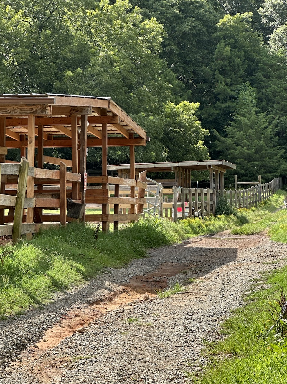
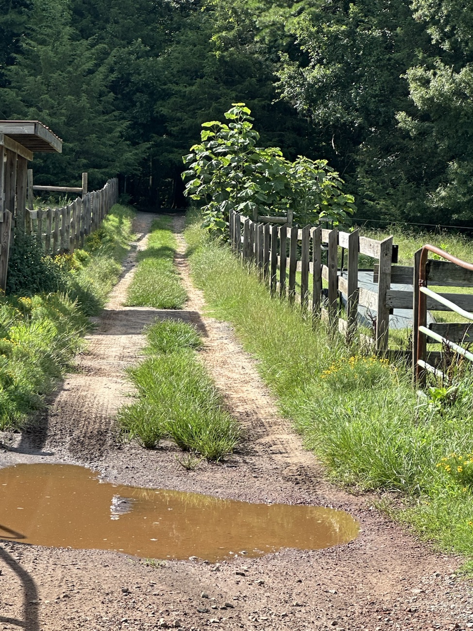
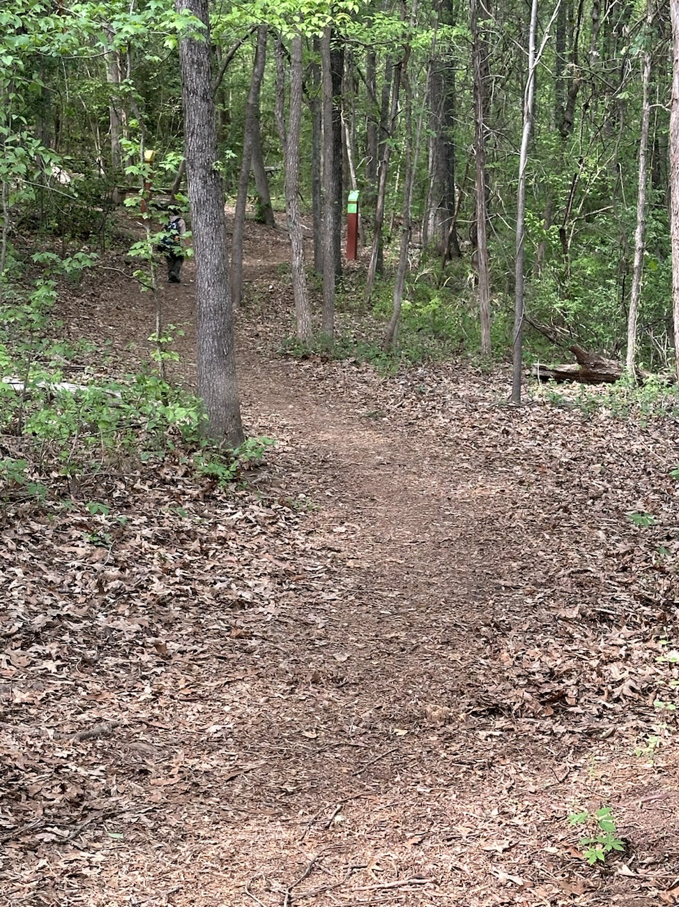
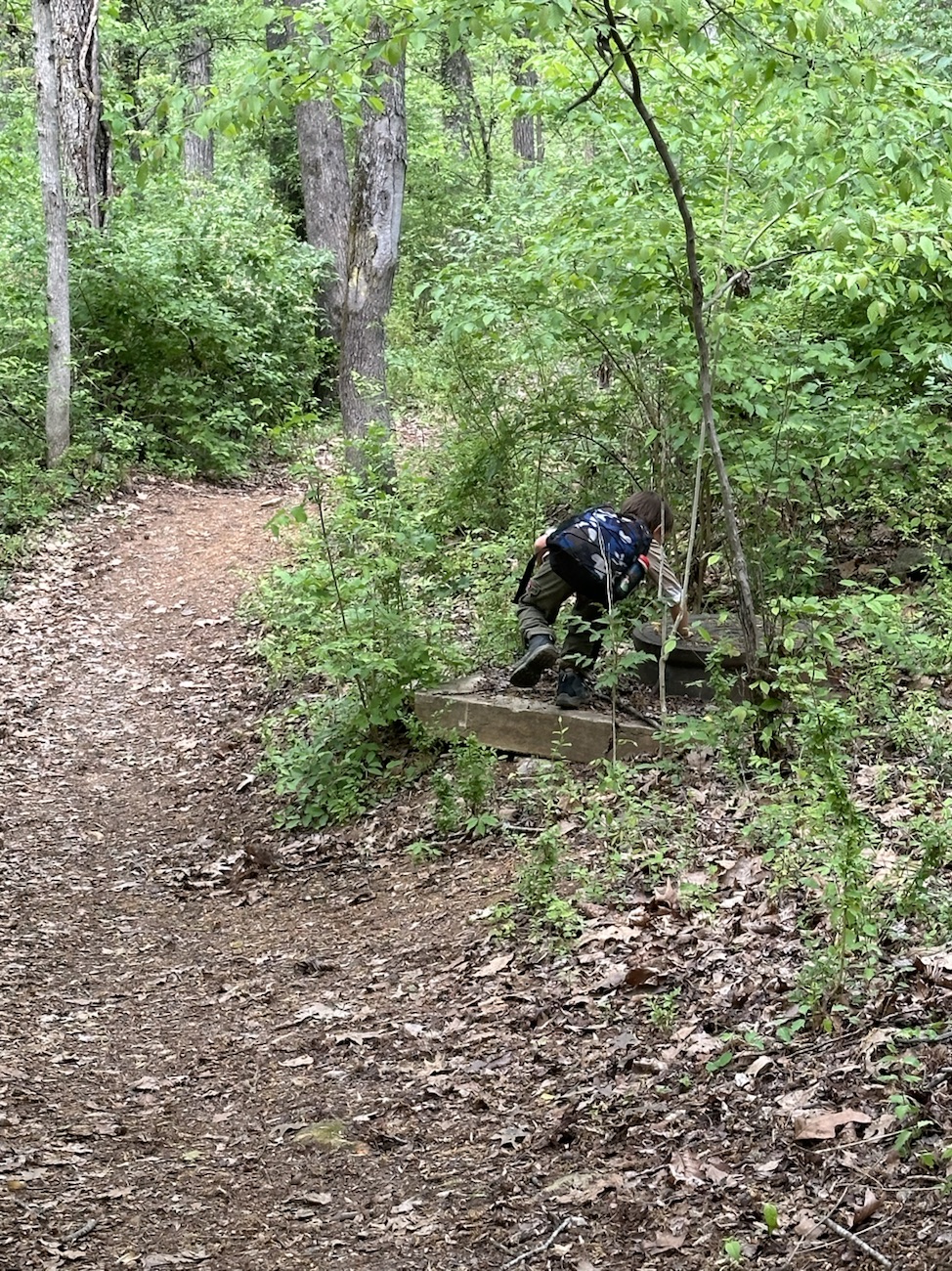
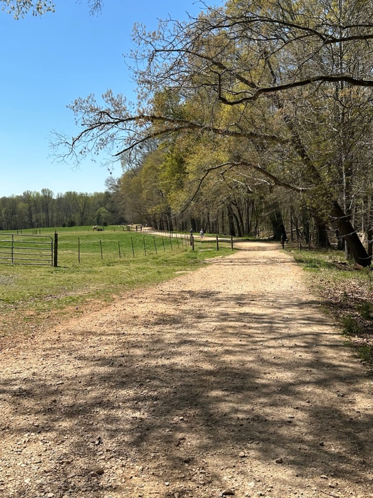
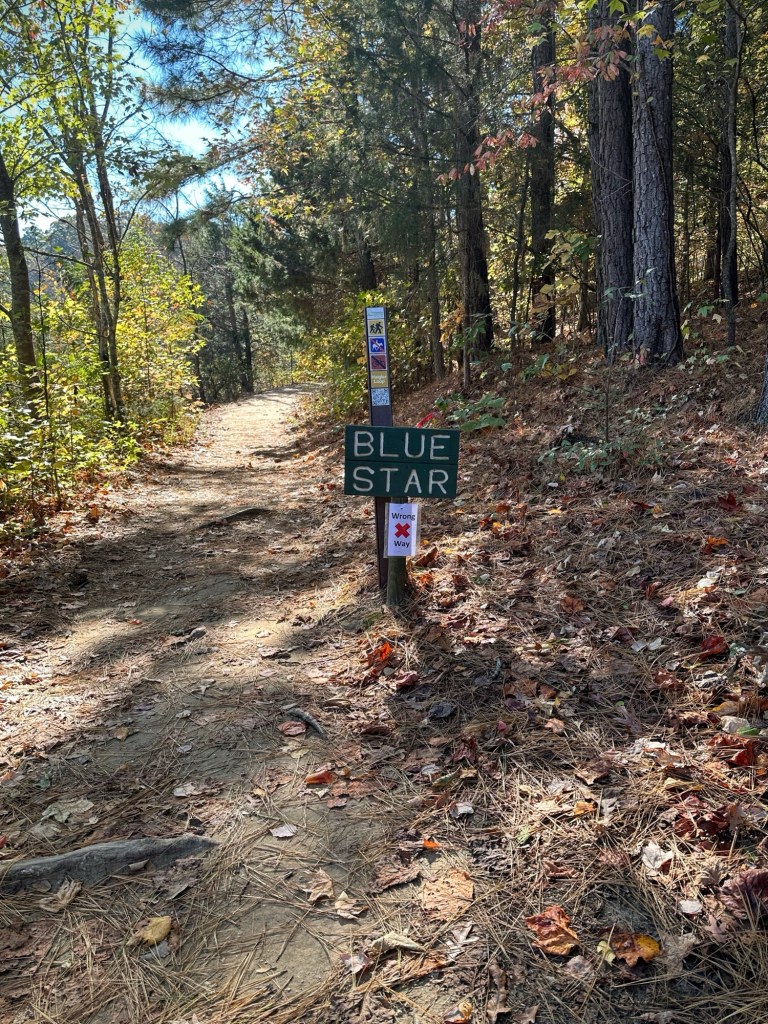
On this hiking adventure I parked at the Dairy Barn Entrance to the Anne Springs Close Greenway. After exiting the car we proceeded to hike along the fencing before hitting the trails. Following the fence line we were able to view the horses, some of which trotted over to our location. [More on horses later].
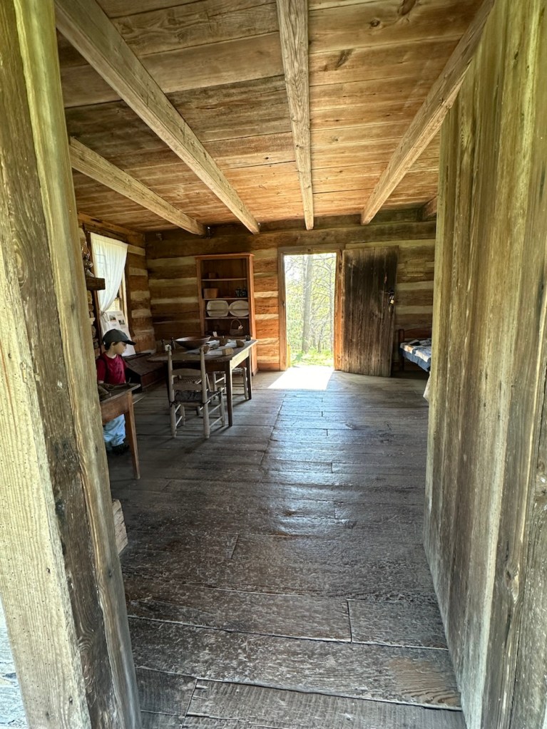
Our first stop along the Blue Star Trail was to take a look at the Faires/Coltharp Cabin. To our surprise and delight it was open to the public (first time we’d seen it open). So naturally, Coleman with me following went inside to see what was inside.
A Look inside the Faires/Coltharp Cabin
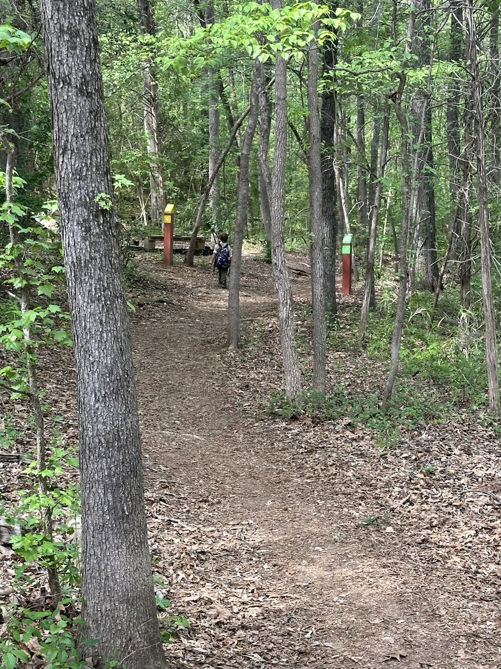
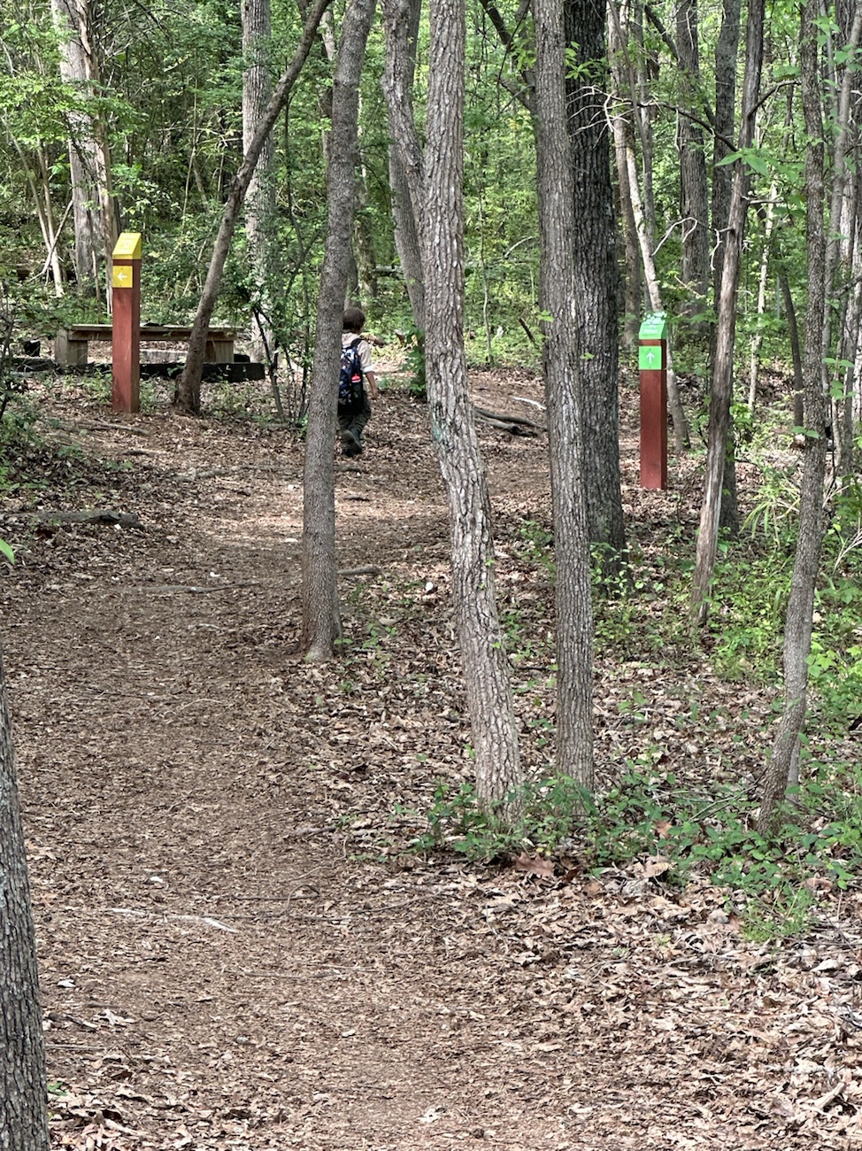
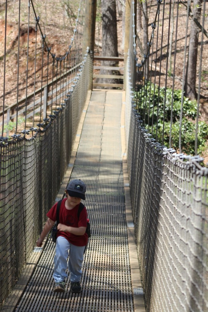
After leaving the cabin, we hiked further along the Blue Star Trail towards the Swinging Bridge and the Schroering Forest Playground located on the other side of the Spillway.
Blue Star Trail
When the Spillway is up and streaming with a steady flow of water, the only way to cross it is to walk across the Greenway’s Swinging Bridge. Since our destination was on the far side of the Swinging Bridge we/I slowly walked across. Coleman used to walk across it when he was younger, but now if no one else is on it he’ll run across.
Coleman crossing the Swinging Bridge
We made it safely across the Swinging Bridge, walked around the Artisan Market, ordered lunch from the Greenway’s Canteen and rested a bit before heading to the Schroering Forest Playground. We had a clear view of the Playground from where we chose to sit. This was the first official day the Playground was open. They had been working on it all fall and winter. Being its opening day, the playground was crowded with children from all age groups.
Coleman hiking the Blue Star Trail
Upon completion of our lunch we noticed there were still a lot of children on the playground. I decided to have Coleman wait to play in it until it wasn’t nearly so crowded. Therefore, we continued on with our hiking and headed down to Lake Haigler.
Blue Star Trail Almost down to Lake Haigler
We hiked along the narrow side pathway towards the lake. The straight pathway is wider and more widely traveled by the majority of visitors to the Greenway.
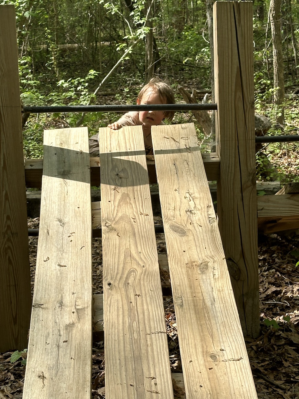
We hiked a short loop with great views of Lake Haigler and then hiked back up to the Playground. Coleman climbed up on the Climbing structure and wasn’t sure about what to do after climbing up a short ways and just sat down for a few minutes. [The all natural wood climbing structure seemed to puzzle Coleman. He’ll probably climb more next time we visit.]
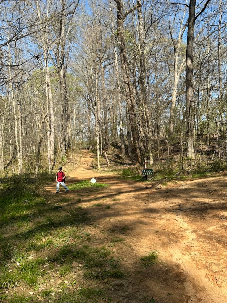
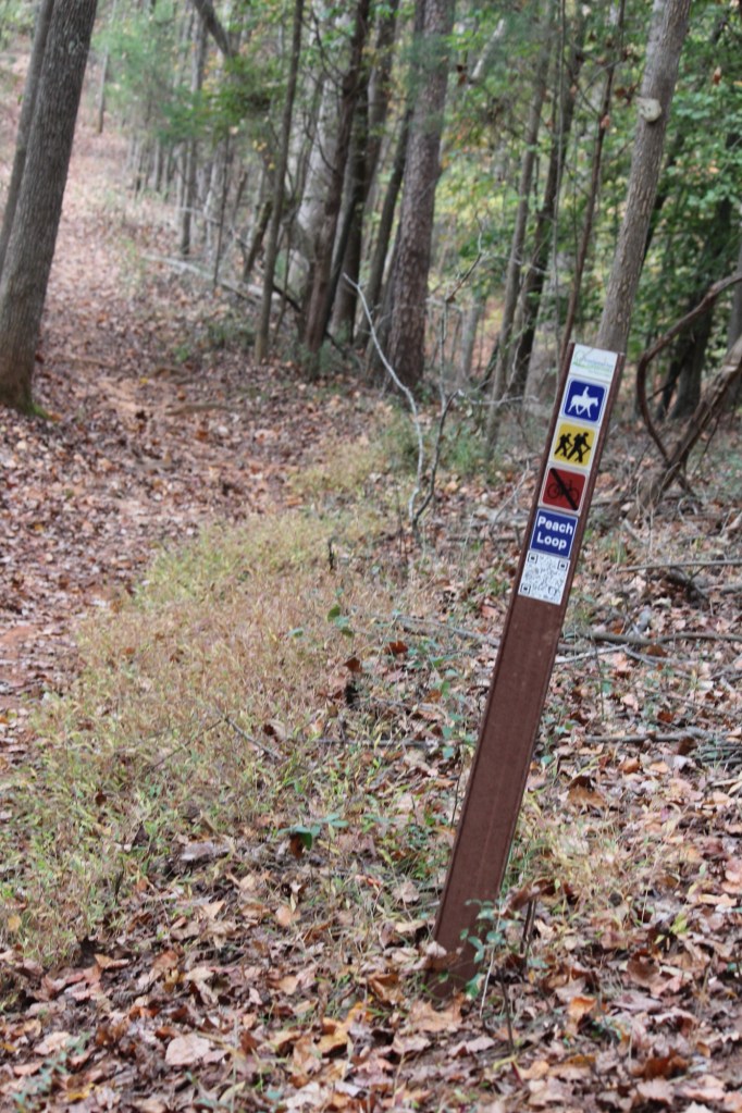
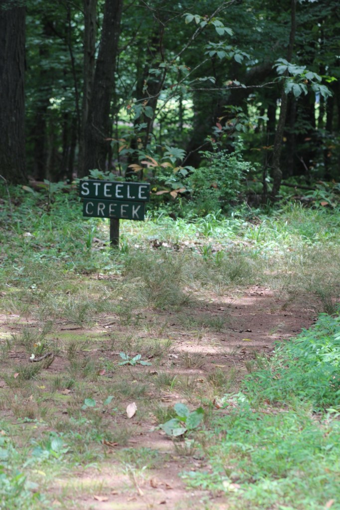
Steele Creek Trail
After a full afternoon of hiking and Coleman playing I decided it was time to head home. Hence, we proceeded to hike back up to the car. Instead of hiking the exact same trail we hiked down, we started out hiking on the Steele Creek Trail. The Steele Creek Trail is a narrow trail that leads up towards the Graham Historical Cabin.
From the cabin we traverse back onto the Blue Star Trail. After short distance from the cabin, Coleman starts searching for the cows. Sometimes they are up close to the fence line, but on this day we really had to look for them. Searching the pasture as we hiked up the trail, two of the cows came walking towards our direction from the far end of the pasture. That made a Coleman’s day. He was then ready to go home.
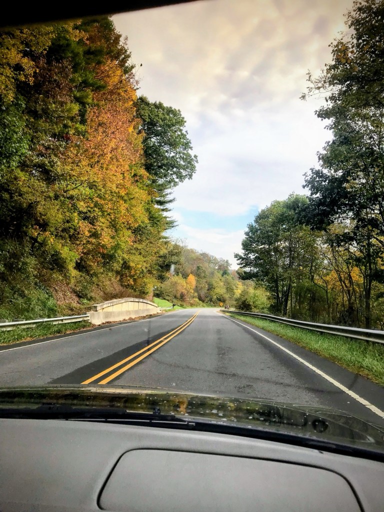
For this week I’ve dug into my archives for various selections of which way to travel.
First, let’s make a stop in Raleigh, North Carolina where I attended Ancestry Day hosted by The Friends of the Archives in conjunction with the State Archives of North Carolina, the Government and Heritage Library, and the North Carolina Genealogical Society.
McKimmon Center and nearby trail Raleigh, North Carolina, USA November 2015
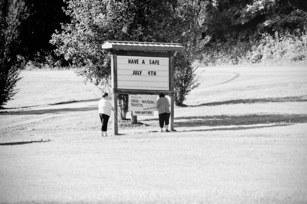
Next, we’ll head over to Lenoir, North Carolina for a Watson/Greer/Trivette family reunion at the Yadkin Valley Community Park.
Greer/Watson/Trivette Family Reunion Yadkin Valley Community Park Lenoir, North Carolina, USA June 2016
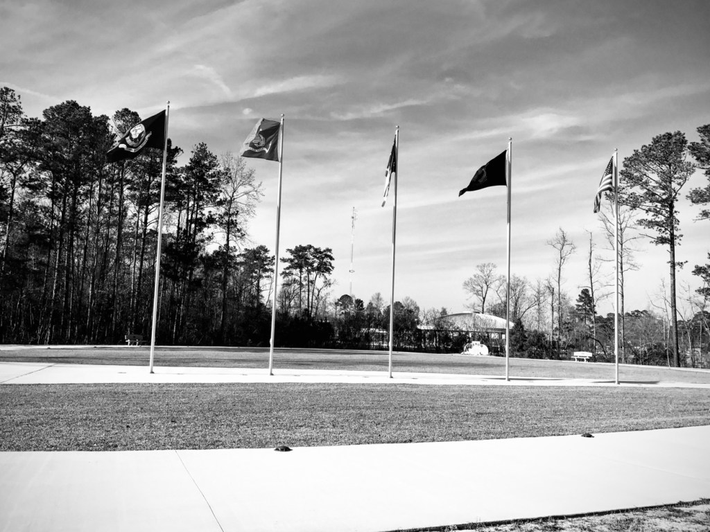
Then we’ll spend some time in Jacksonville, North Carolina where one of my sons ( my 2nd born, David) was stationed while serving in the United States Marines. While there for the weekend my eldest son, John and I visited the Lejeune Memorial Gardens.
Lejeune Memorial Gardens Jacksonville, North Carolina, USA February 2017
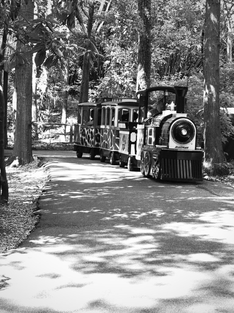
Finally, let’s take another drive. This time let’s drive to Columbia, South Carolina before returning home for some quiet time of rest and relaxation. In Columbia I am joined by my daughter, Trisha and her daughter, Alona. We decided to visit the Riverbanks Zoo to see the animals. We enjoyed the short train ride around a small portion of the Zoo.
Riverbanks Zoo & Garden Columbia, South Carolina, USA August 2017
Cee’s allowing us to post any road, path, step, bridge, or sign this week for her CWWC. For my selections I chose some from Coleman & my adventures this past week.
Car Driving on Bridge Shot from the Avon Catawba Creeks Greenway Gastonia, North Carolina
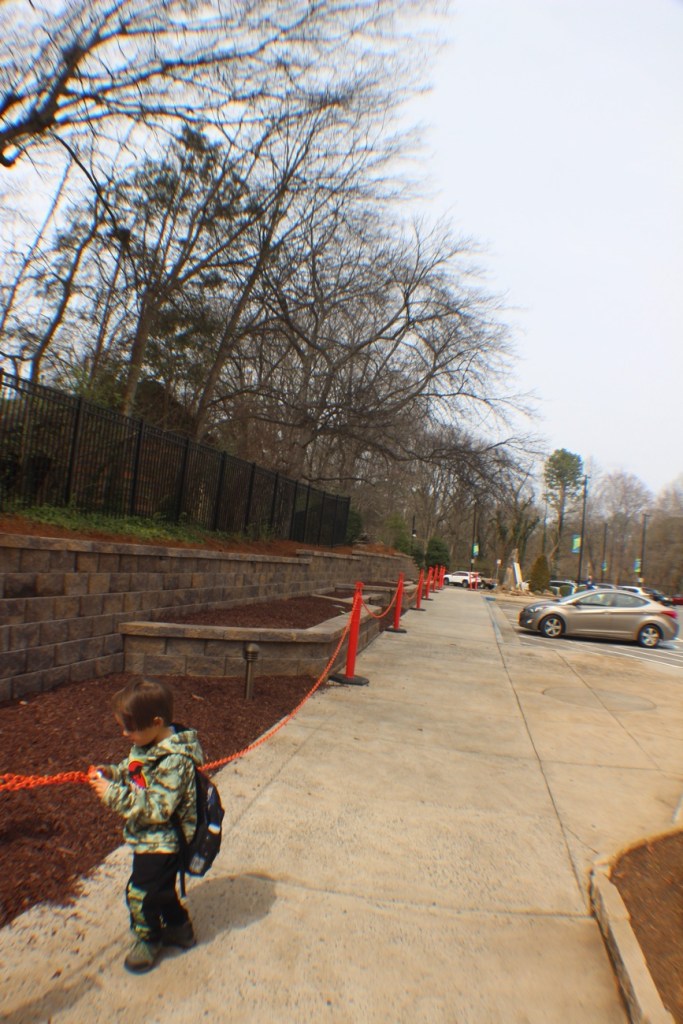
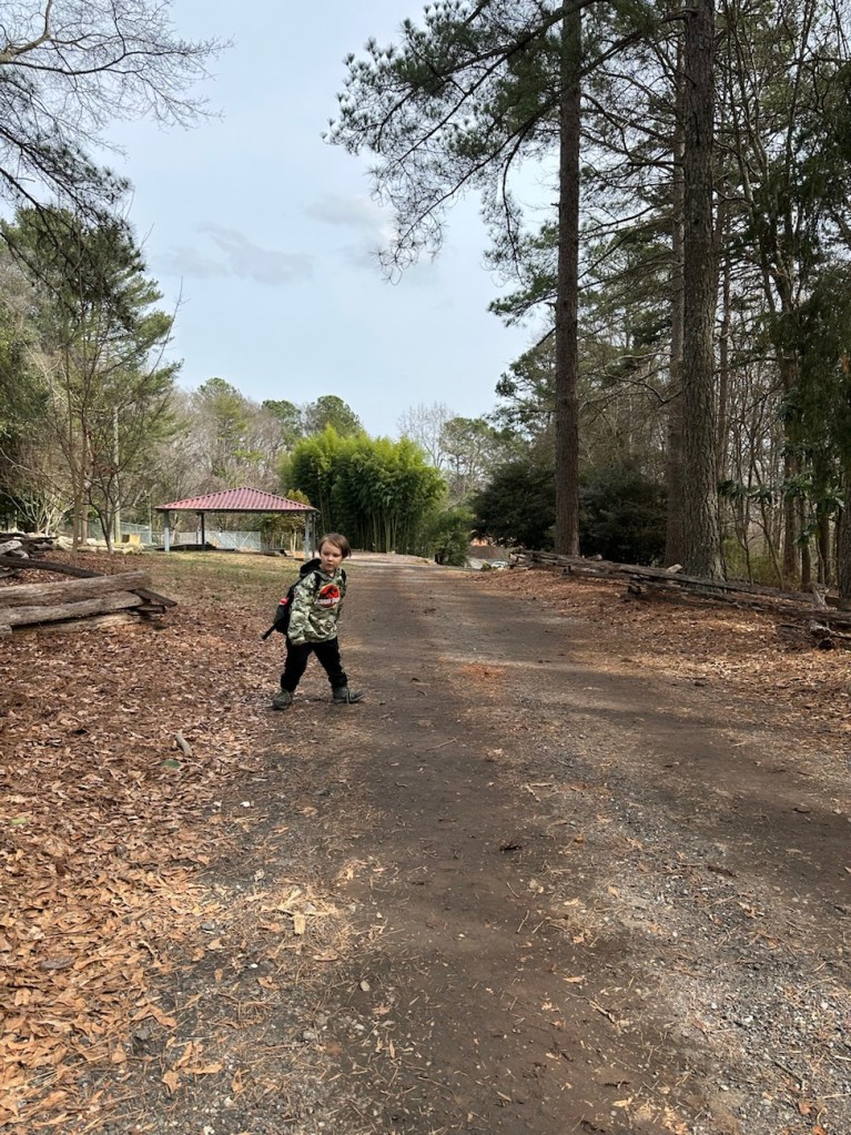
Coleman Walking on Sidewalk New Hope Road; Gastonia, North Carolina
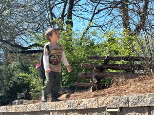
Coleman Walking on Brick Ledge The Schiele Museum of Natural History Gastonia, North Carolina
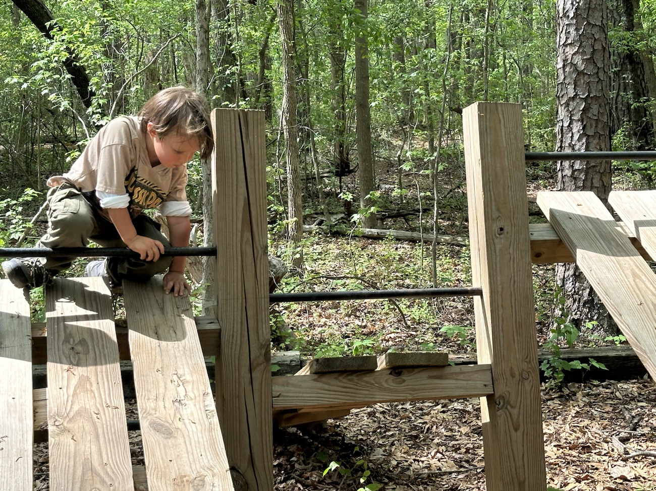
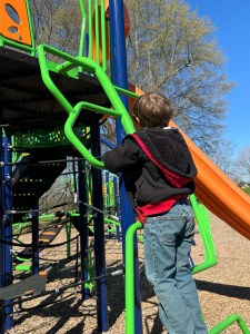
Coleman Climbing on Playground Equipment Ladder Steps Erwin Center Recreation and Park Gastonia, North Carolina
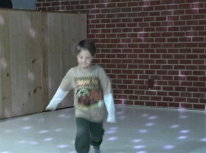
Coleman Sock Skating The Schiele Museum of Natural History Gastonia, North Carolina
Coleman Hiking & Playing Along the Avon and Catawba Creeks Greenway
The hiking adventures with Coleman are always fun and interesting. He doesn’t always stick to actual pathways or trails, however, he always gets to where he wants to go and has a fantastic time along the way.
My entries for this week show pathways and signs in and around The Schiele Museum. Enjoy the walk with Coleman and I as we show you some scenes of our recent visit.
I have not seen any snow recently or in the past year, so I am going to let y’all see some of the WHITE which I have seen along the various trails that Coleman and I have hiked in 2023.
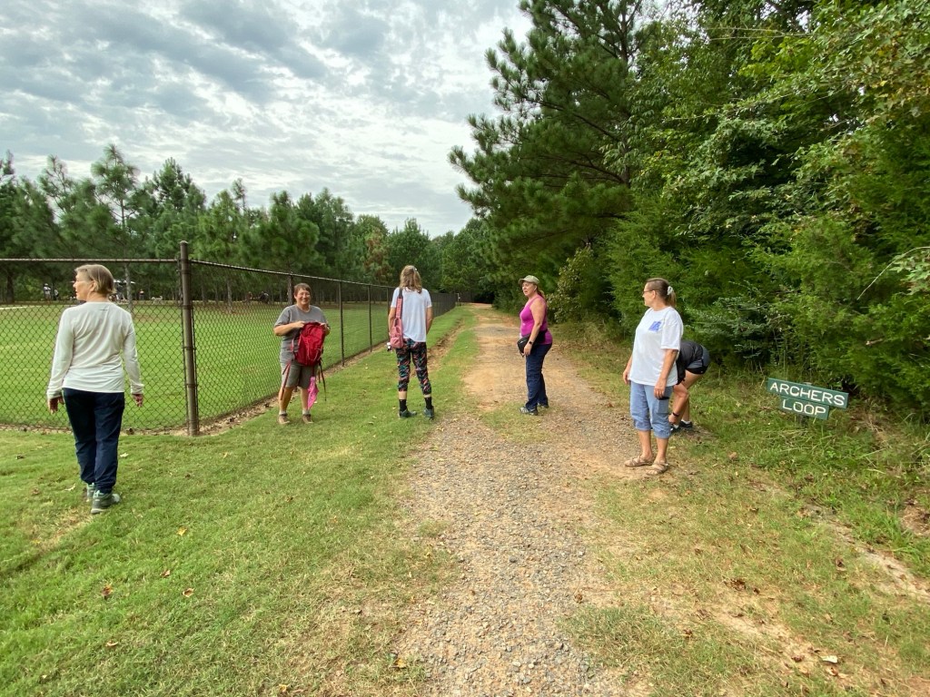
First up is a hike with the Anne Springs Close Greenway Hiking Club where some of the hikers are wearing white. Everybody was not ready for the photo; I like to catch people unaware when I can. you may also notice the white in the Archers Loop sign and the white clouds in the sky. It was a beautiful, picturesque day.
Archers Loop Adventure Road Anne Springs Close Greenway Hiking Club Anne Springs Close Greenway Fort Mill, South Carolina, USA
Next up is the white Riverwalk Bridge as seen from the Piedmont Medical Center Trail that we have hiked with the hiking club and on our own. Coleman loves to hike along the Catawba River whenever we get the opportunity.
Riverwalk Bridge over the Catawba River Riverwalk Trailhead Rock Hill, South Carolina, USA
Below is capturing a hike we were able to do with Coleman’s mom and sister. It is near one of the locations his mom works at sometimes. Here we are on the Baxter Village Trail, a part of the Carolina Thread Trail System.
Baxter Village Trail Carolina Thread Trail Fort Mill, South Carolina, USA Baxter Village Trail Carolina Thread Trail Fort Mill, South Carolina, USA
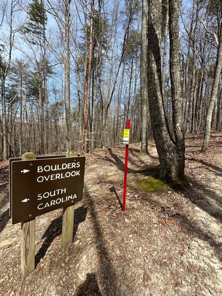
This next trail is one Coleman and I hiked on our own. I parked at the Boulder Access Parking lot, and we found the entrance to the trail. We hiked approximately two and a half miles before we turned around and headed back to the car. The trail goes on for miles crossing from North Carolina into South Carolina. We were not prepared to go that distance on this hike.
Boulders Overlook Boulder Access Area Crowders Mountain State Park Kings Mountain, North Carolina, USA
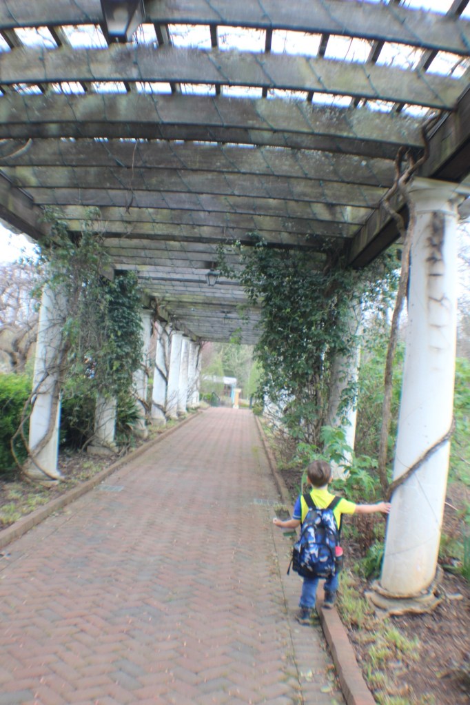
For another hike we stopped at the Daniel Stowe Botanical Garden to hike and enjoy the many marvelous flowers grown there. This is the covered walkway leading into the gardens. Notice the vines growing around the white pillars and Coleman trying to balance on the brick edging along the walkway.
Coleman at Daniel Stowe Botanical Garden Belmont, North Carolina, USA
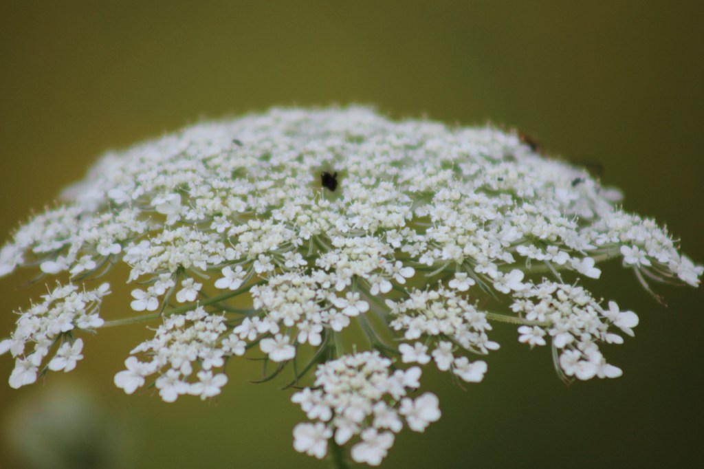
Lastly, I know you cannot see the trail, but I wanted to leave you with a beautiful white flower of Queen Anne’s Lace to enjoy.
Queen Anne’s Lace (Daucas carota) Lake Haigler Entrance Anne Springs Close Greenway Fort Mill, South Carolina, USA
God Bless. Thank you for tagging along with us as we remembered our amazing hikes. Thank you for sharing your time and thoughts with us. I appreciate y’all very much.
Not sure if wintery frigid cold days count or not, however, I couldn’t resist adding a couple anyway-
Aftermath of Wintry Storms: Cloudy skies over Anne Springs Close GreenwayDoes Foggy Weather count as Cloudy? Historic Hutchinson Homestead; Stone Mountain State Park; Roaring Gap, North Carolina, USACloudy Skies while Driving the BlueRidge Parkway Near Boone, North Carolina, USA
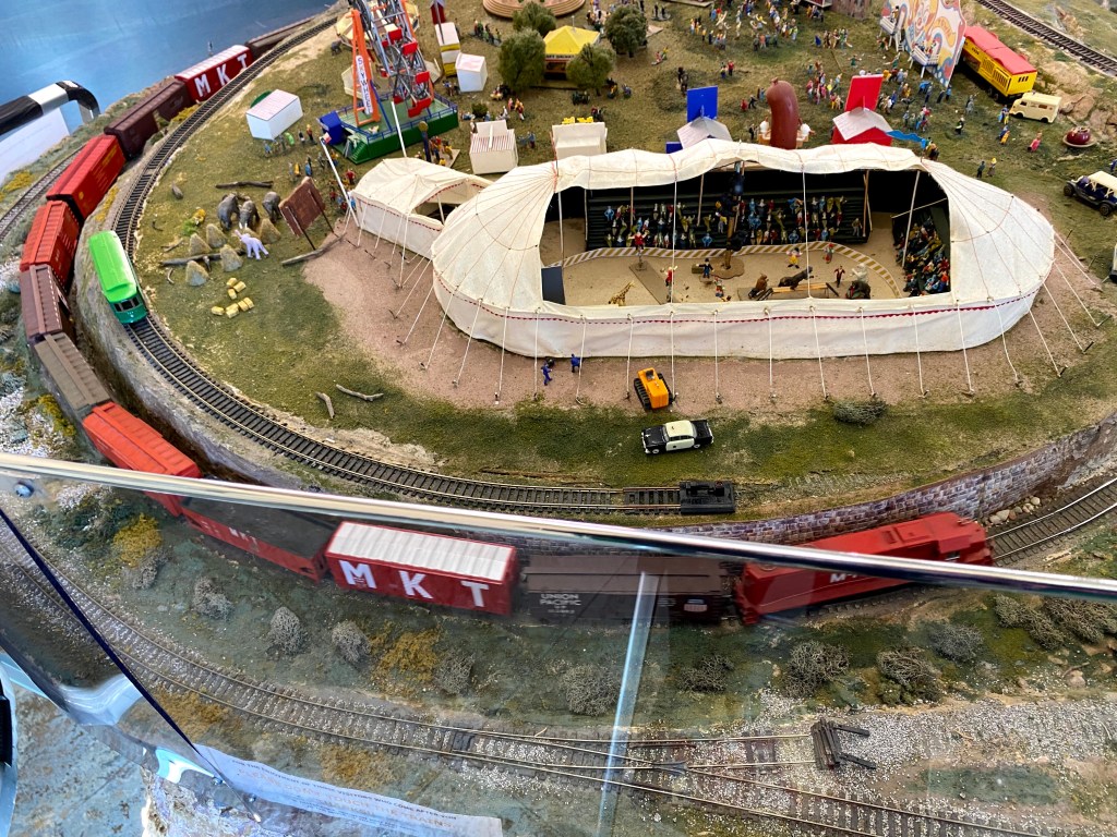
Model Railroad chugging along New Braunfels Railroad Museum New Braunfels, Texas
I was able to visit the New Braunfels Railroad Museum back in January in 2020 when I had the opportunity to visit a relative prior to taking a cruise aboard the Royal Caribbean’s Enchantment of the Seas.
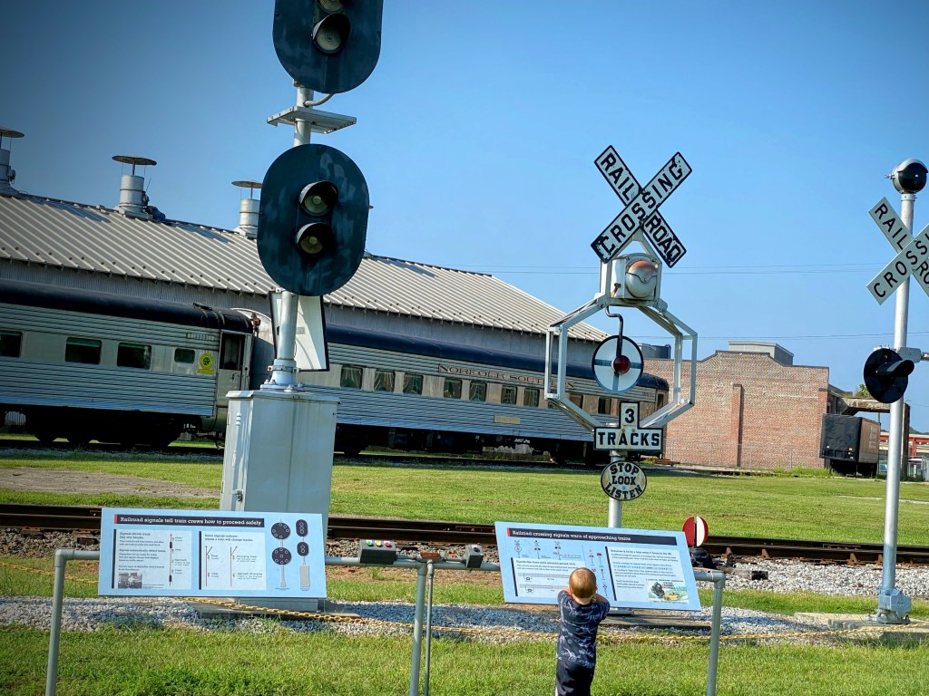
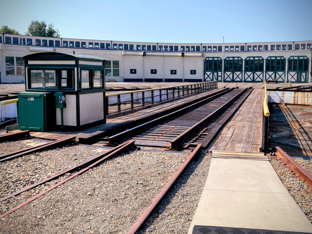
Coleman checking out the signs, the tracks, & the Norfolk Southern Railway Car North Carolina Transportation Museum Spencer, North Carolina, USASouthern Railway, Turntable Bridge and Roundhouse North Carolina Transportation Museum Spencer, North Carolina, USA
The 100-foot long turntable bridge on the ring rail — the outer circular rail. The roundhouse and turntable were apart of the Southern Railway Spencer’s Shops Complex. They are part of the North Carolina Transportation Museum.
The Roundhouse is the largest one of its kind remaining in the U.S. It was built in 1924 and served as a repair shop for locomotives and rail cars. In the old days, a turntable operator was on duty to spin the table to line up with the oncoming train car so it could be maneuvered into the Roundhouse for repairs.
My grandson, Coleman and I toured the North Carolina Transportation Museum back in August of 2021. We did not ride on the turntable bridge, however, for an additional cost visitors are able to do so if they so desire.
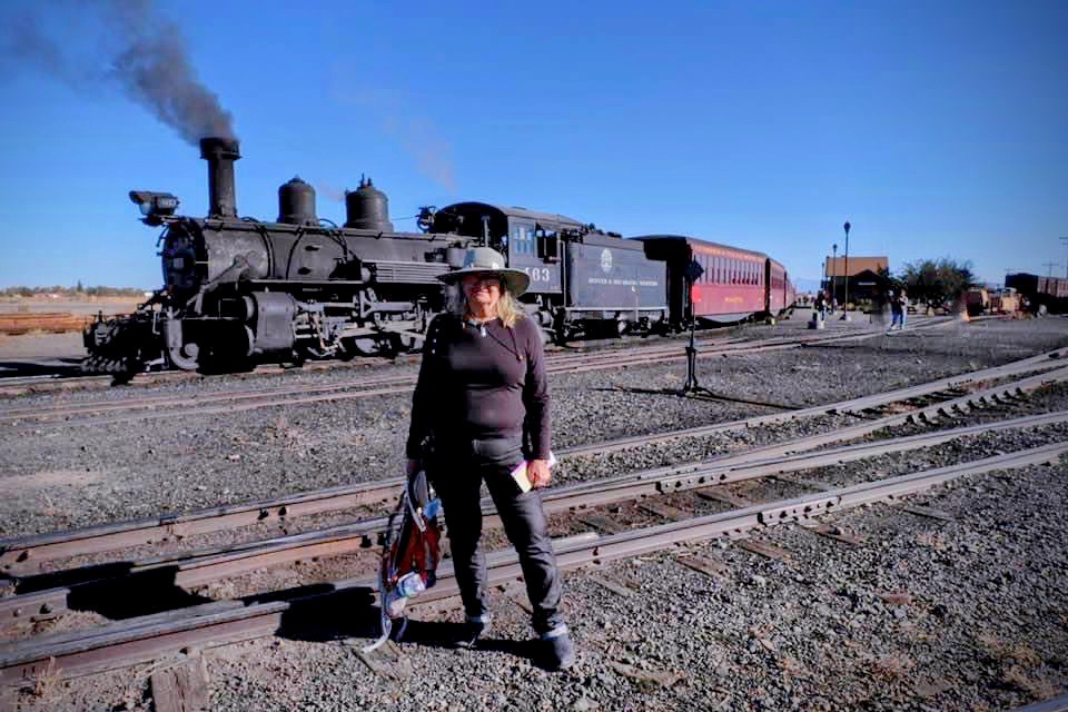
My cousin Marsha Hayes standing by railroad tracks in front of Railway cars The Cumbres & Toltec Scenic Railroad Chama, New Mexico, USA
The Cumbres and Toltec Scenic Railroad is a 3 ft ( 914 mm) narrow-gauge heritage railroad that operates on 64 miles (103 km) of track between Antonito, Colorado, and Chama, New Mexico, in the United States. The railroad is named for 2 geographical features along the route; the Cumbres Pass and the Toltec Gorge. It was originally part of the Denver and Rio Grande Western Railroad’s narrow-gauge network. It is jointly owned by the states of Colorado and New Mexico and has been since 1970. The very first rails for this line began to be laid down on February 20, 1980.
Railway crossing the Railroad Trestle Tracks as seen from the Blue Star Trail Anne Springs Close Greenway Fort Mill, South Carolina, USA
We are not always lucky enough to actually see a train traveling along the Railroad Trestle. I captured this particular video back on November 28, 2020 on one of the many trails Coleman & I hiked at the Anne Springs Close Greenway. Hope you enjoy as much as we did when we watched it chugging down along the tracks.
Bridge @ Lineberger Park Gastonia, North Carolina Kings Mountain State Park Blacksburg, South Carolina GARDEN OF THE WAXHAWS TRAIL Andrew Jackson State Park Lancaster, South Carolina The Founders Trail is a beautiful natural surface trail along the Catawba River with a sidewalk connection to the Riverwalk: Piedmont Medical Center Trail and River Park. Located in the Fort Mill/Rock Hill area of South Carolina. These bridges are at various locations along the Blue Star Trail within Anne Springs Close Greenway which crossover the many creeks, streams, and other waterways connecting many trails for individuals to enjoy hiking and exploring the Greenway. Fort Mill, South Carolina