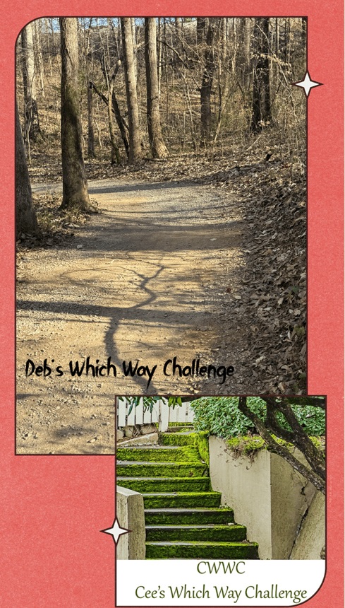
Welcome back to another Which Way Challenge (CWWC). This week I have chosen for the Which Way Challenge (CWWC) 2026: Any Which Way on a Nature Trail (Dirt or Paved) for this week’s theme. The Which Way can be any dirt or paved path, sidewalk, trail, or road as long as the Which Way is clearly discernible. As always signs are always welcome. For further information regarding the Which Way Challenge (CWWC) feel free to check out the home page here.
Coleman and I haven’t journeyed very far like some of y’all have, however, we do enjoy our adventurous journeys to Greenways, State Parks, and nearby National Parks. This past weekend we journeyed to Kings Mountain National Military Park for the sole purpose of hiking the Battlefield Trail.
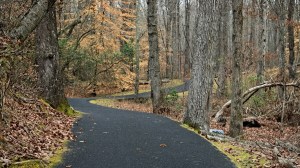
The Battlefield Trail is a mere 1.5 miles long, but it seems a lot further when you’re hiking up hill on the trail, winding around the mountain, back and forth twisting this way and that way through the woods, hiking up and down continuously seems like you’re hiking forever.
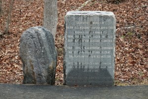
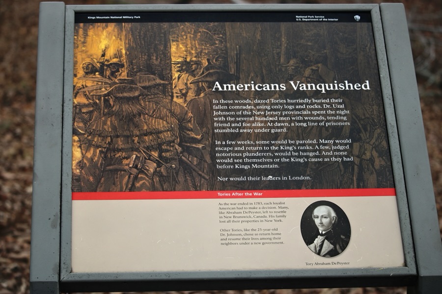
The Battlefield Trail contains several story boards telling about the impact the Revolutionary War had on the Kings Mountain area and the Carolinas. It has monuments in various locations along the trail which have significant historical relevance to the Revolutionary War and the Soldiers who fought against the British. It is a semi-paved trail in natural surroundings.
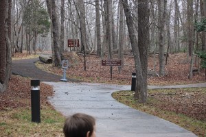
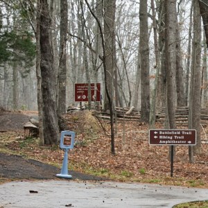
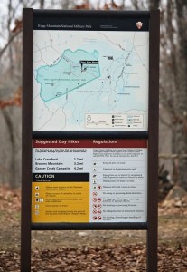
After arriving at Kings Mountain National Military Park, Coleman and I checked out the museum prior to hitting the trail for our adventurous journey. Once we left the Museum/Visitor Center, we had to decide which way we wanted to go to begin our hike.
Do we go to the left or right?
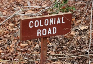
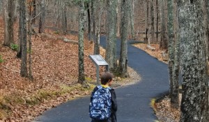
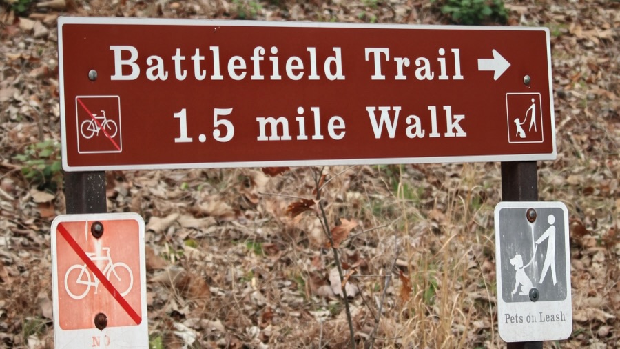
We read the sign which indicated which way the Battlefield Trail was located. Therefore, we followed the signs directions and began hiking to the left. We ran across various signs along the way … some that instructed us on what not to do, some that told about a specific area, and a few that informed about park regulations or gave us hiking suggestions.
Battlefield Trail
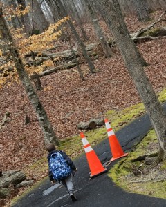
Hiking along we see stone monuments dedicated to fallen soldiers, orange cones alerting us to dangerous areas, and Coleman discovers interesting places to Pull Up a Seat.
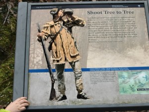
Sacred to the memoryof … Coleman Pulls Up a Seat on a logShoot Tree to TreeColeman Pulls Up a Seat on a Bench One of many Story BoardsBattlefield Trail
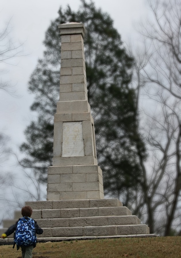
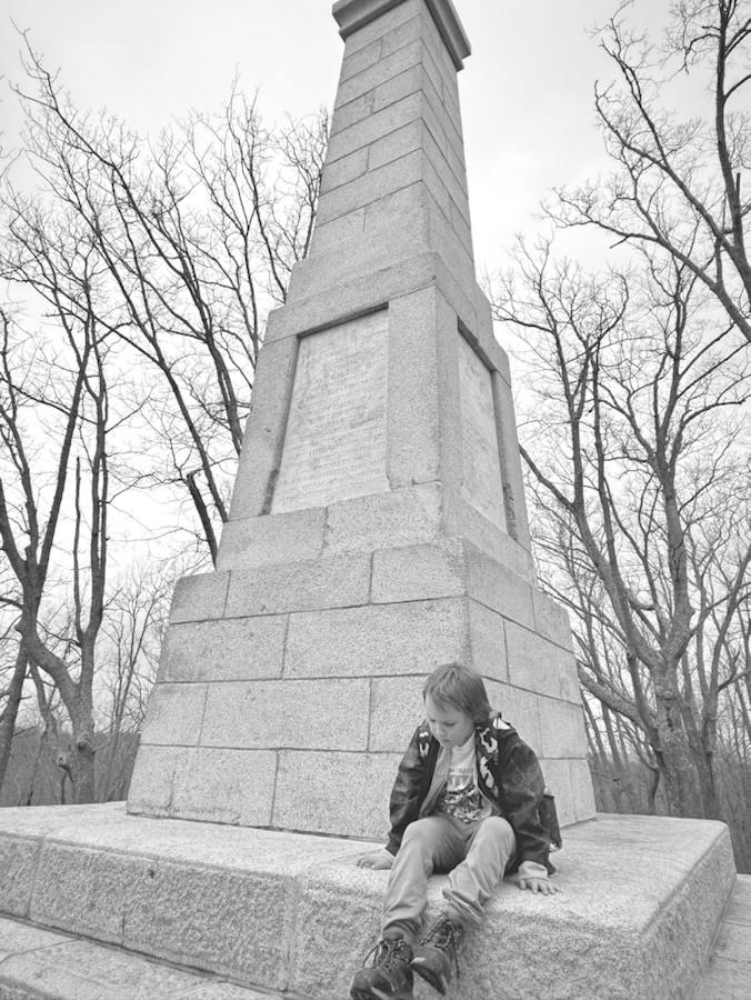
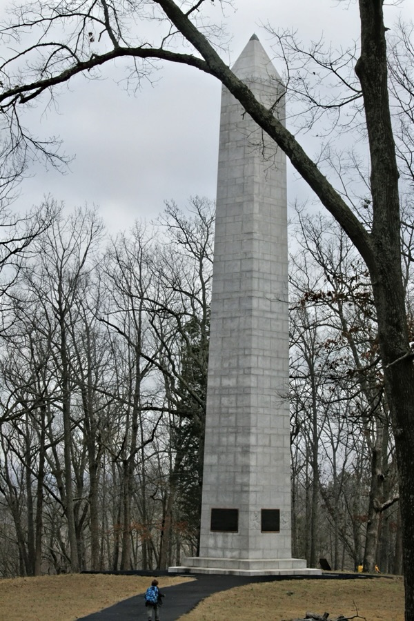
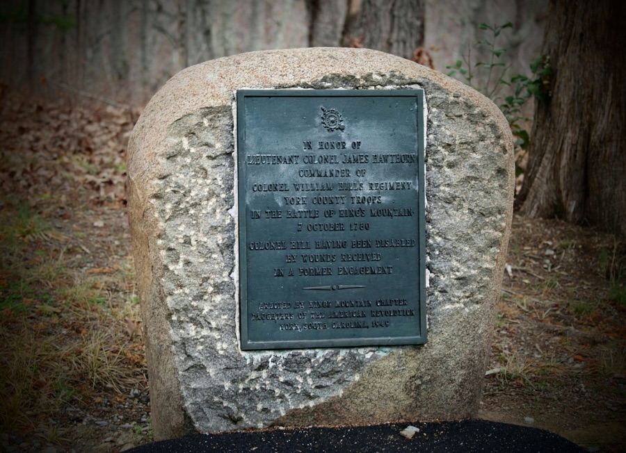
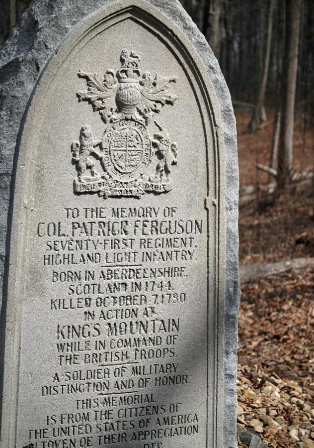
Hiking further up (and I mean uphill)along the trail we spot more monuments with information indicating their significance in history.
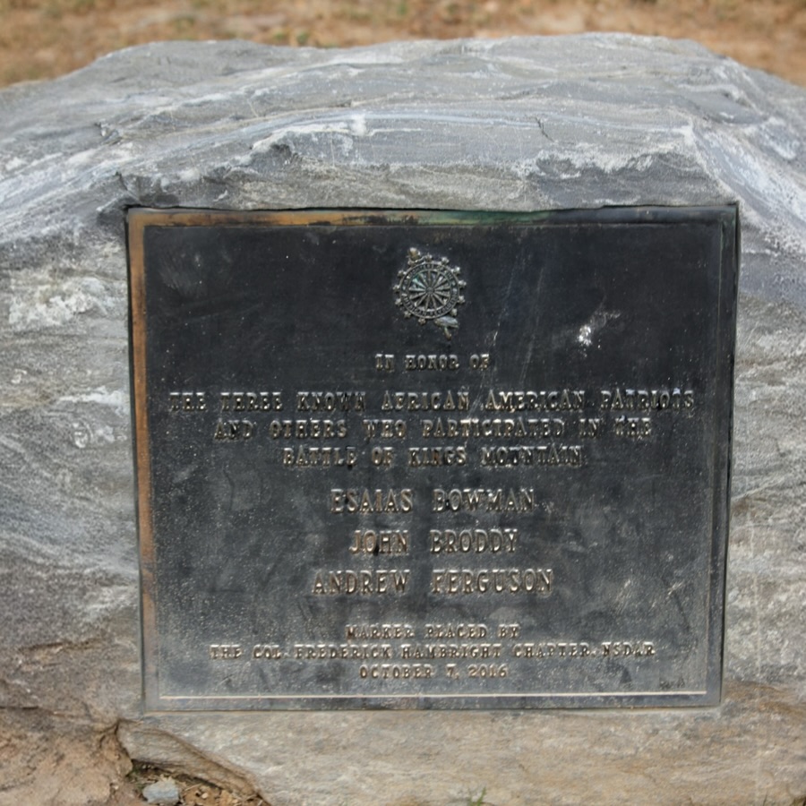
In Honor of the Three Known African-American Patriots…Coleman approaches the largest and tallest monument Coleman Pulls Up a Seat on a Monument This is a different monument Coleman is investigating In Honor of Lieutenant Colonel James Hawthorne …Coleman takes a break Pulling up a Seat on the TrailTo the Memory of Col. Patrick Ferguson …American Vanquished Battlefield Trail Directional SignThe end
Thank you to those who have participated and supported the Which Ways Challenge. I appreciate y’all sharing your Which Ways with us.
For an idea of other’s Which Ways from this past week’s challenge, be sure to click on the following links below.
Dan Antion hosts theThursday Doorschallenge every Thursday. All you need to do to participate is post a picture(s) of a door(s) and leave a link to your post on his current post.
For this week I am posting images of Doors in and around the Kings Mountain National Military Park Visitor Center & Museum.
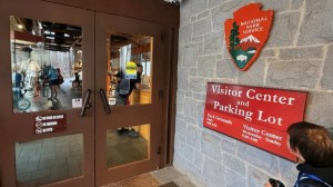
First, we begin at the entrance to the Visitor Center …
Entrance Doors to the Visitor Center and Museum
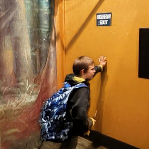
Now let’s look at a couple of doors inside the Museum.
Not sure what this door, that Coleman found, was used for. However, He opened it up to check it out anyway.
Emergency Exit Only
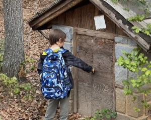
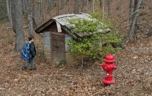
And lastly, let’s check out to see what door(s) Coleman found outside near a trail.
Location: Kings Mountain National Military Park; Blacksburg, South Carolina, USA
God Bless. Have a great rest of your week and a funtastic weekend. Thank you for visiting and sharing your time and thoughts with us. I appreciate y’all very much.
Coleman and I had the opportunity to hike Battlefield Trail (more on that later) on Saturday, March 7th. The day started out gloomy and overcast with the possibility of rain. Luckily the rain held off until we were back home. It ended up being around 76°F and humid. Not too bad for hiking weather except my glasses kept fogging up making it hard to see.
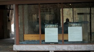
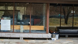
Below are the windows we saw as we were approaching the backside of the VisitorCenter upon completing the 1.5 mile Battlefield Trail.
Windows on the Backside of the Visitor Center
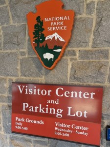
Kings Mountain National Military Park Visitor Center and Museum
National Park Service Visitor Center Kings Mountain National Military Park & Museum
Camera: 1-2) Canon EOS Rebel T7 (2000D) with Canon EF-S55-250mm lens and Altura UV Filter attachment; 3) Apple iPhone 16 Pro Max
Location: Kings Mountain National Military Park; Blacksburg, South Carolina, USA
God Bless. Have a fantastic week. Get Outdoors. Enjoy Nature’s Beauty. Thank you for visiting and sharing your time and thoughts with us. I appreciate y’all very much.
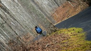
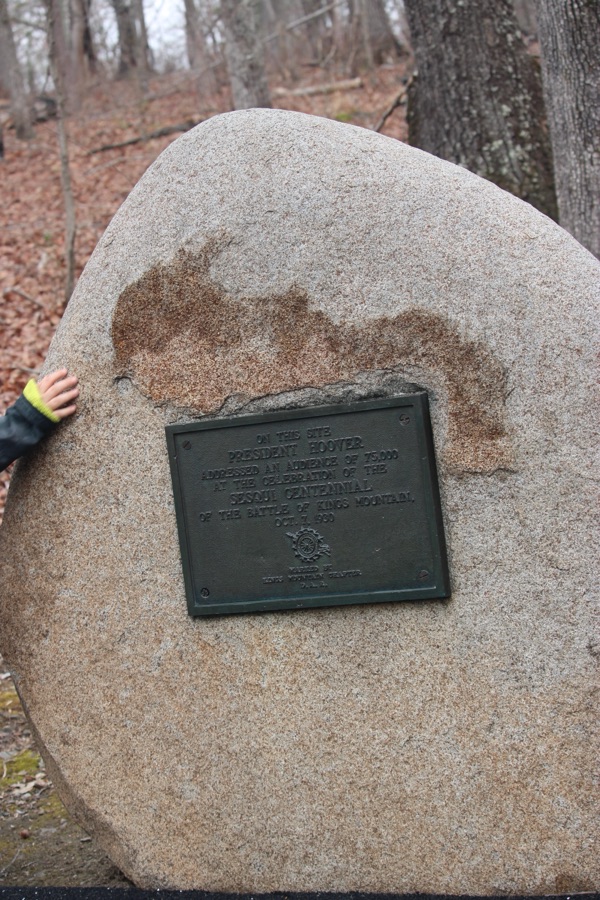
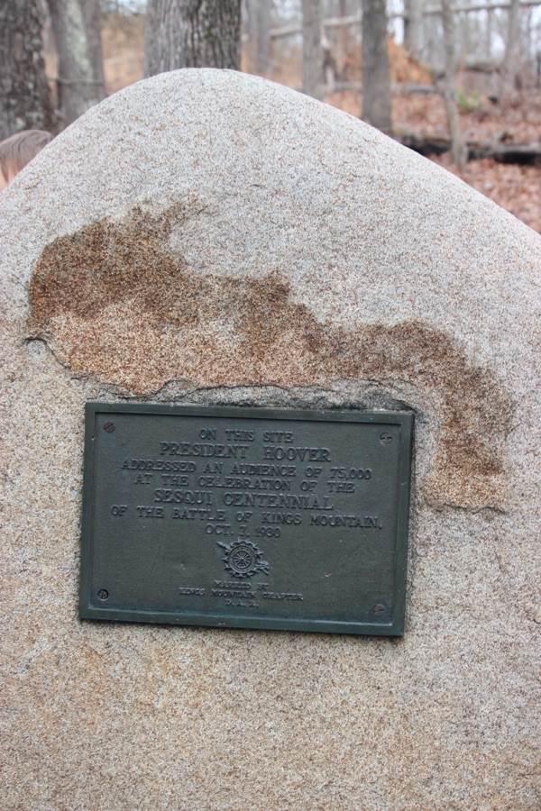
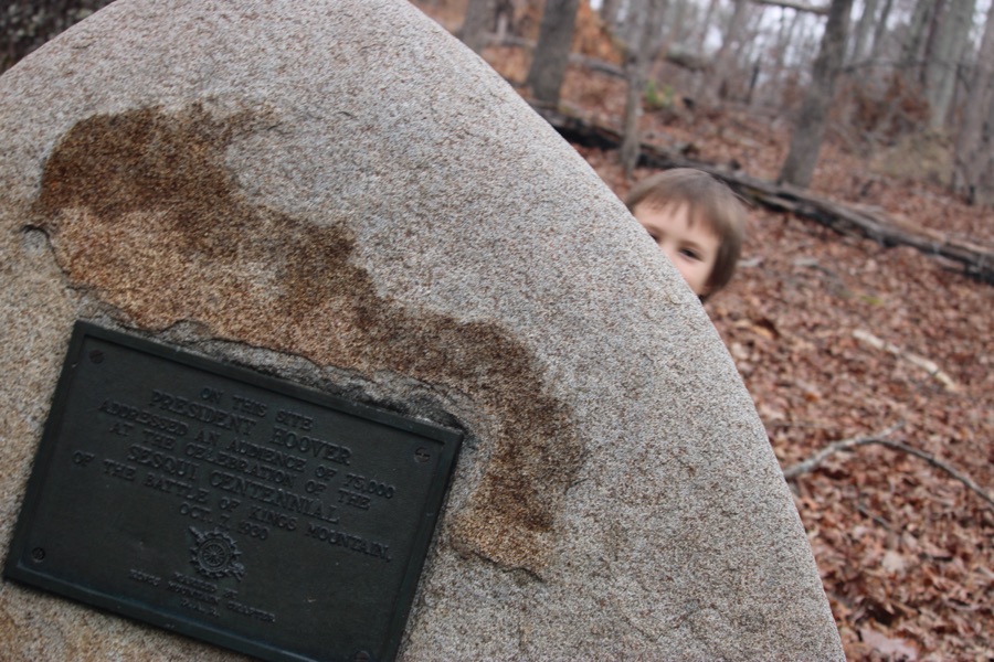
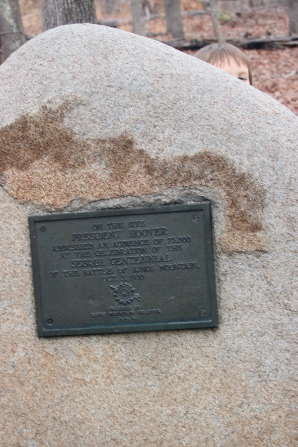
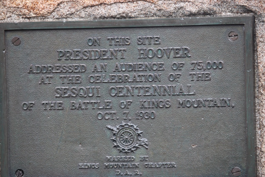
Coleman playing Hide-N-Seek … Behind the Monument Peek-a-Boo Coleman On This Site President Hoover Addressed An Audience of 75,000 At The Celebration Of The Sesqui Centennial Of The Battle Of Kings Mountain October 7, 1930
Camera: Canon EOS Rebel T7 (2000D) with Canon EF-S55-250mm lens and Altura UV Filter attachment.
Location: The Battlefield Trail; Kings Mountain National Military Park; Blacksburg, South Carolina, USA
God Bless. Have a funtastic week. Take a hike and enjoy nature. Thank you for visiting and sharing your time and thoughts with us. I appreciate y’all very much.